
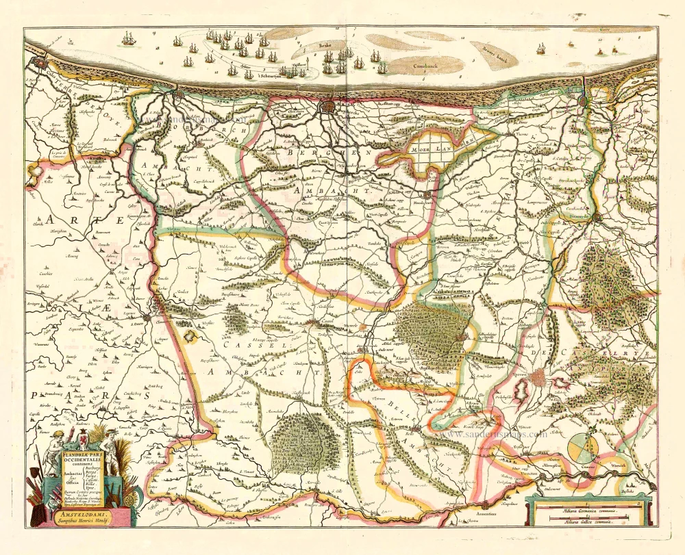
Ieper - Kortrijk - Oudenaarde - Tielt by Nicolaas Visscher II 1683-1696
The Visscher Family
For nearly a century, the members of the Visscher family were essential art dealers and map publishers in Amsterdam.
Claes Jansz. Visscher, or N.J. Piscator (1587-1652)
Claes Jansz. Vischer bought a house in Amsterdam, 'de gulden Bors', on the crucial Kalverstraat and changed the name into "In de Visscher"; under this title, the shop was to flourish for many years.
He was famous for his engravings and etchings of Dutch landscapes and 'historical scenes', such as sieges, battles, etc. These 'historical scenes' were considered contemporary illustrated news items, especially e.g. that of 'the Eighty Years' War'.
For the publication of his first atlas, he bought copperplates of the atlas Germania Inferior by Pieter van den Keere (1623).
In 1649, he published an atlas entitled Tabularum Geographicarum Contractarum, containing the same maps as Langenes' Caert Thresoor, for which Visscher had only new title pages engraved.
Claes Jansz. Visscher died in 1652. His wife, Neeltjen Florisdr., had already died in 1640. They had seven children, four of whom were still alive at Claes Jansz.'s death. One was Nicolaes Visscher I, who was to continue his father's business.
Nicolaes Visscher I (1618-1679)
Nicolaes Visscher I partnered with his father, continued the business, and stayed on the Kalverstraat 'in de Visscher' till his death.
In about 1657, the first edition of his Atlas Contractus Orbis Terrarum appeared.
Between 1664 and 1677, several editions of his Atlas Contractus appeared without a printed index, for these atlases had no fixed contents but were composed according to the buyer's financial leaping pole.
In May 1664, Nicolaes Visscher was admitted as a member of the Booksellers' Guild of his town. In July 1677, he was granted a patent of the States of Holland and West-Friesland for printing and publishing maps and atlases for 15 years.
After this, he again published an Atlas Contractus with a printed index. At about the same time, he also brought out an Atlas Minor.
Nicolaes Visscher II (1649-1702)
Nicolaes Visscher II inherited the 'shop' from his father. To obtain a new privilege, he applied to the States of Holland and West-Friesland in 1682 for a patent for printing and publishing maps. This patent was granted to him the same year. He moved the firm to the Dam, but it kept the same signboard: "In de Visscher".
Around 1683, he published his first Atlas Minor with a printed index of 91 maps. In 1684, an atlas Germania Inferior appeared. Till 1697, he published another number of atlases. He used his grandfather's (Claes Jansz.) maps less often now and relied more and more on his own.
The wars waged at this time initiated the compilation of maps of the countries where the armies operated. Many war maps were included in the various editions of his Atlas Minor.
After Nicolaes's death, his wife, Elizabeth Verseyl, published all the war maps as an atlas under the title De Stoel des Oorlogs in de Wereld (The seat of war in the world).
The widow of Nicolaes Visscher II (?-1726)
His widow continued the business energetically, and by her hand, under the name of her deceased husband, numerous atlases appeared, e.g., several editions of the Atlas Minor, an Atlas Maior and De Stoel des Oorlogs. The shop enjoyed a high reputation due to the assortment's incredible variety. Not only 'Visscher' maps but also maps of other publishers were obtainable. With the death of Elizabeth Verseyl in 1726, the last descendant died of a great map- and atlas-publishing firm in Amsterdam.
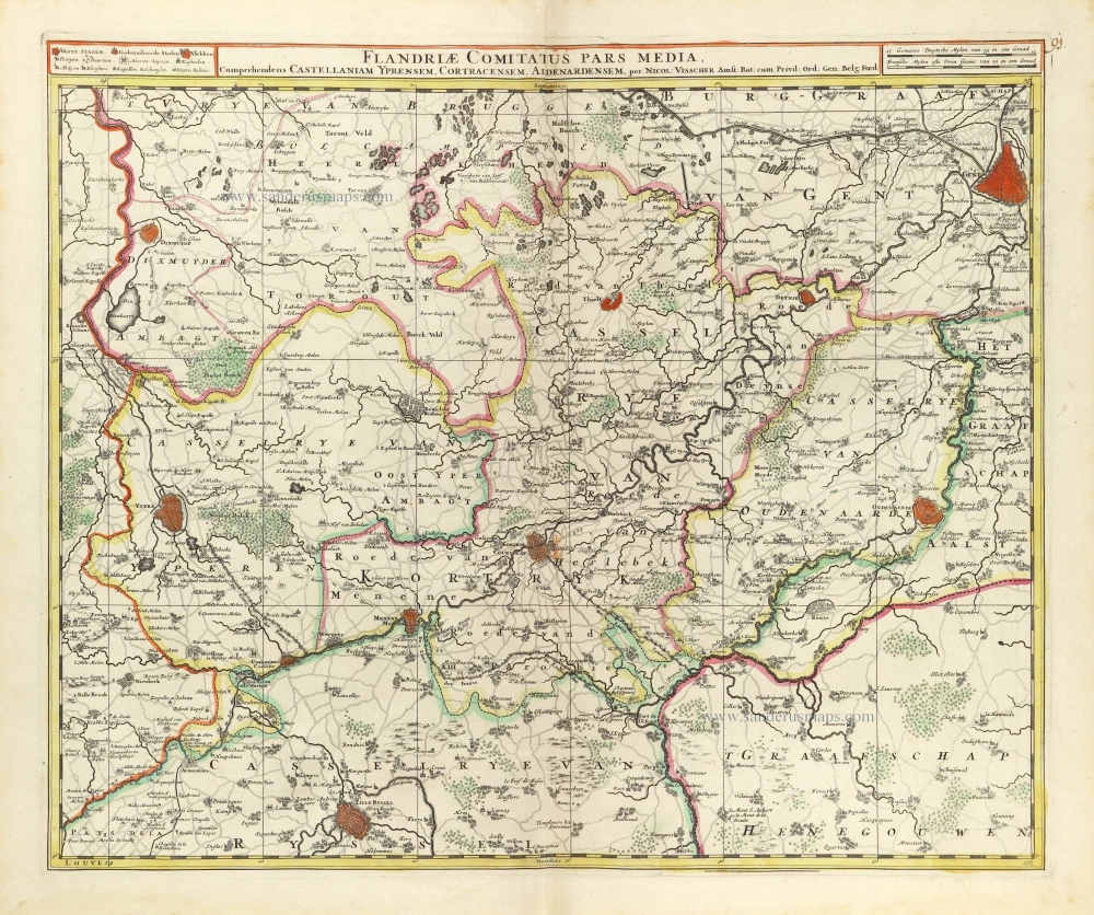
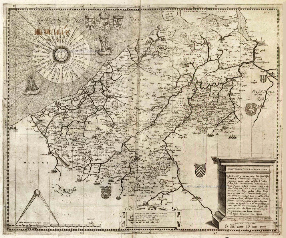
Flandriae Comitatus Pars Media, comprehendens Castellaniam Yprensem, Cortracensem, Aldenardensem.
Item Number: 24421 Authenticity Guarantee
Category: Antique maps > Europe > Belgium
Old, antique map of Ieper - Kortrijk - Oudenaarde - Tielt by Nicolaas Visscher II.
Title: Flandriae Comitatus Pars Media, comprehendens Castellaniam Yprensem, Cortracensem, Aldenardensem.
per Nicol: Visscher Amst: Bat: cum Privil: Ord:Gen: Belg: Foed:
Date: 1683-1696.
Copper engraving, printed on paper.
Map size: 475 x 570mm (18.7 x 22.44 inches).
Sheet size: 530 x 630mm (20.87 x 24.8 inches).
Verso: Blank.
Condition: Original coloured, excellent.
Condition Rating: A+.
From: Atlas Minor Sive Geographia Compendosia, ... Amsterdam, 1683-1696.
The Visscher Family
For nearly a century, the members of the Visscher family were essential art dealers and map publishers in Amsterdam.
Claes Jansz. Visscher, or N.J. Piscator (1587-1652)
Claes Jansz. Vischer bought a house in Amsterdam, 'de gulden Bors', on the crucial Kalverstraat and changed the name into "In de Visscher"; under this title, the shop was to flourish for many years.
He was famous for his engravings and etchings of Dutch landscapes and 'historical scenes', such as sieges, battles, etc. These 'historical scenes' were considered contemporary illustrated news items, especially e.g. that of 'the Eighty Years' War'.
For the publication of his first atlas, he bought copperplates of the atlas Germania Inferior by Pieter van den Keere (1623).
In 1649, he published an atlas entitled Tabularum Geographicarum Contractarum, containing the same maps as Langenes' Caert Thresoor, for which Visscher had only new title pages engraved.
Claes Jansz. Visscher died in 1652. His wife, Neeltjen Florisdr., had already died in 1640. They had seven children, four of whom were still alive at Claes Jansz.'s death. One was Nicolaes Visscher I, who was to continue his father's business.
Nicolaes Visscher I (1618-1679)
Nicolaes Visscher I partnered with his father, continued the business, and stayed on the Kalverstraat 'in de Visscher' till his death.
In about 1657, the first edition of his Atlas Contractus Orbis Terrarum appeared.
Between 1664 and 1677, several editions of his Atlas Contractus appeared without a printed index, for these atlases had no fixed contents but were composed according to the buyer's financial leaping pole.
In May 1664, Nicolaes Visscher was admitted as a member of the Booksellers' Guild of his town. In July 1677, he was granted a patent of the States of Holland and West-Friesland for printing and publishing maps and atlases for 15 years.
After this, he again published an Atlas Contractus with a printed index. At about the same time, he also brought out an Atlas Minor.
Nicolaes Visscher II (1649-1702)
Nicolaes Visscher II inherited the 'shop' from his father. To obtain a new privilege, he applied to the States of Holland and West-Friesland in 1682 for a patent for printing and publishing maps. This patent was granted to him the same year. He moved the firm to the Dam, but it kept the same signboard: "In de Visscher".
Around 1683, he published his first Atlas Minor with a printed index of 91 maps. In 1684, an atlas Germania Inferior appeared. Till 1697, he published another number of atlases. He used his grandfather's (Claes Jansz.) maps less often now and relied more and more on his own.
The wars waged at this time initiated the compilation of maps of the countries where the armies operated. Many war maps were included in the various editions of his Atlas Minor.
After Nicolaes's death, his wife, Elizabeth Verseyl, published all the war maps as an atlas under the title De Stoel des Oorlogs in de Wereld (The seat of war in the world).
The widow of Nicolaes Visscher II (?-1726)
His widow continued the business energetically, and by her hand, under the name of her deceased husband, numerous atlases appeared, e.g., several editions of the Atlas Minor, an Atlas Maior and De Stoel des Oorlogs. The shop enjoyed a high reputation due to the assortment's incredible variety. Not only 'Visscher' maps but also maps of other publishers were obtainable. With the death of Elizabeth Verseyl in 1726, the last descendant died of a great map- and atlas-publishing firm in Amsterdam.
Related items
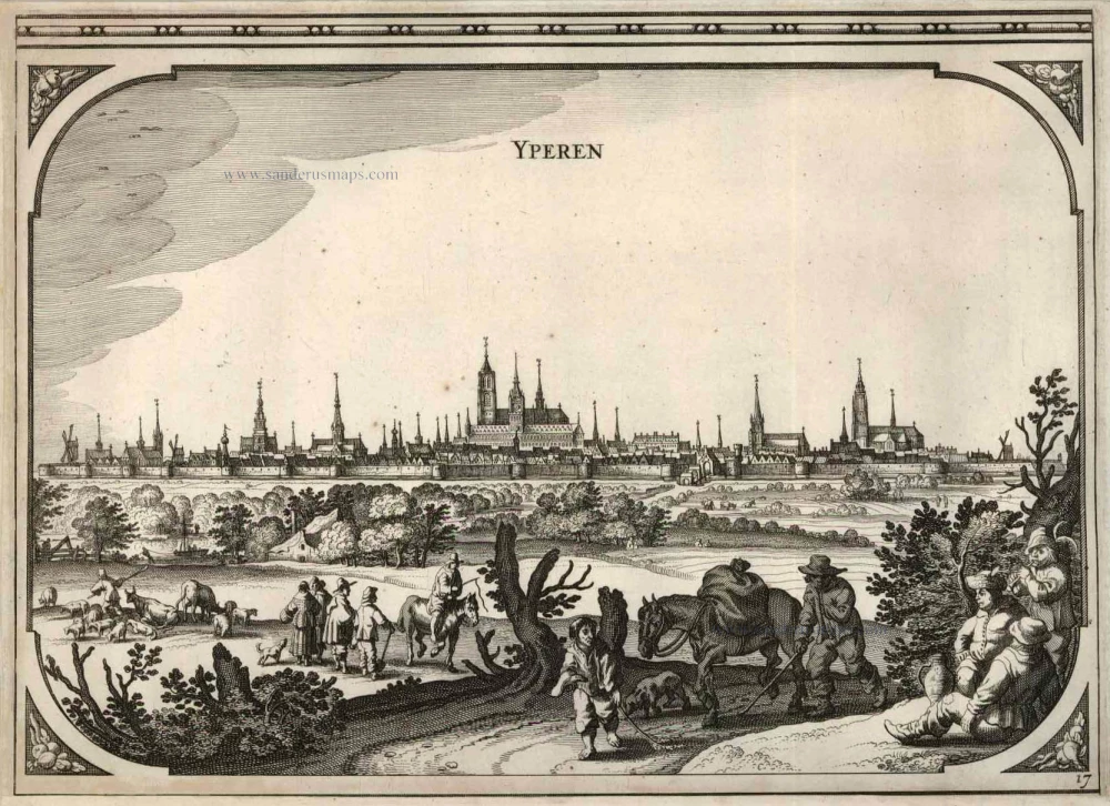
Yperen. 1656
Ieper, by N. Visscher & P.H. Schut.
[Item number: 2774]
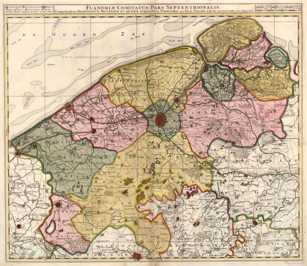
Flandriae Comitatus Pars Septentrionalis, comprehendens Franconatum Brugensem et ejusdem subjacentia Territoria. 1683-1696
Western Flanders (West Vlaanderen) by N. Visscher II.
[Item number: 13092]
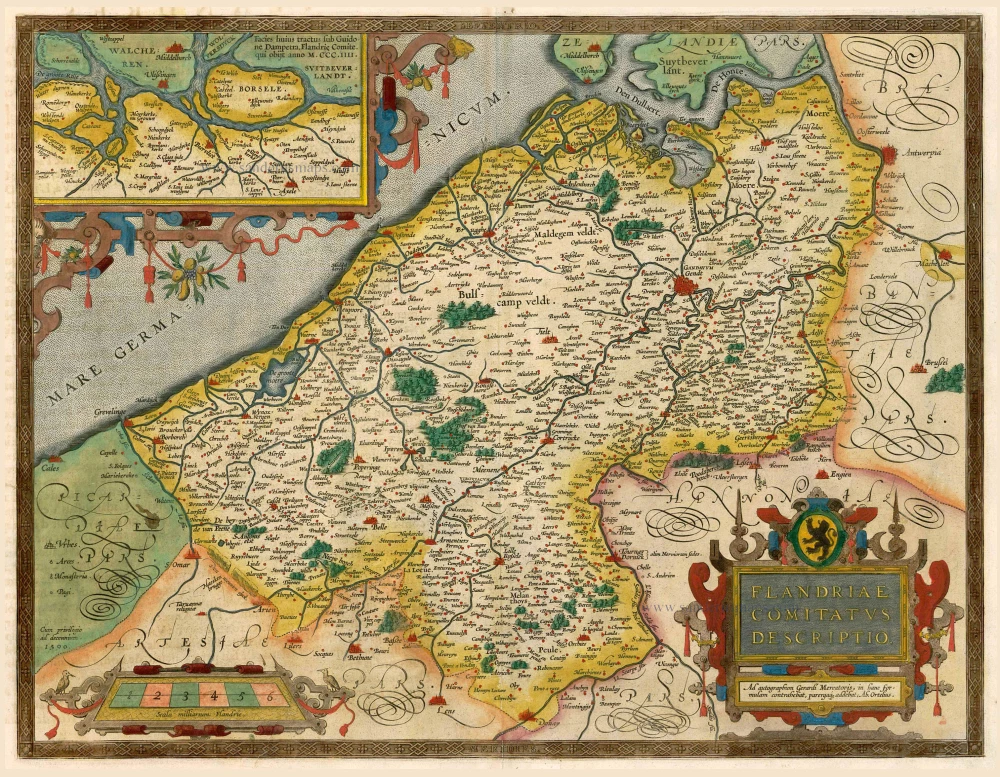
Flandriae Comitatus Descriptio. 1598
Flanders (Vlaanderen), by A. Ortelius.
[Item number: 22821]
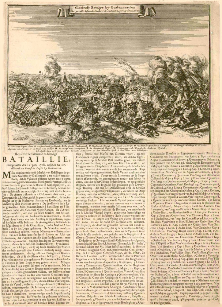
Glorieuse Batalye by Oudenaarden voorgevalletussen de Geallieerde en Franse Legers op den 11 Juli 1708. 1708
Military plan of Oudenaarde
[Item number: 25304]
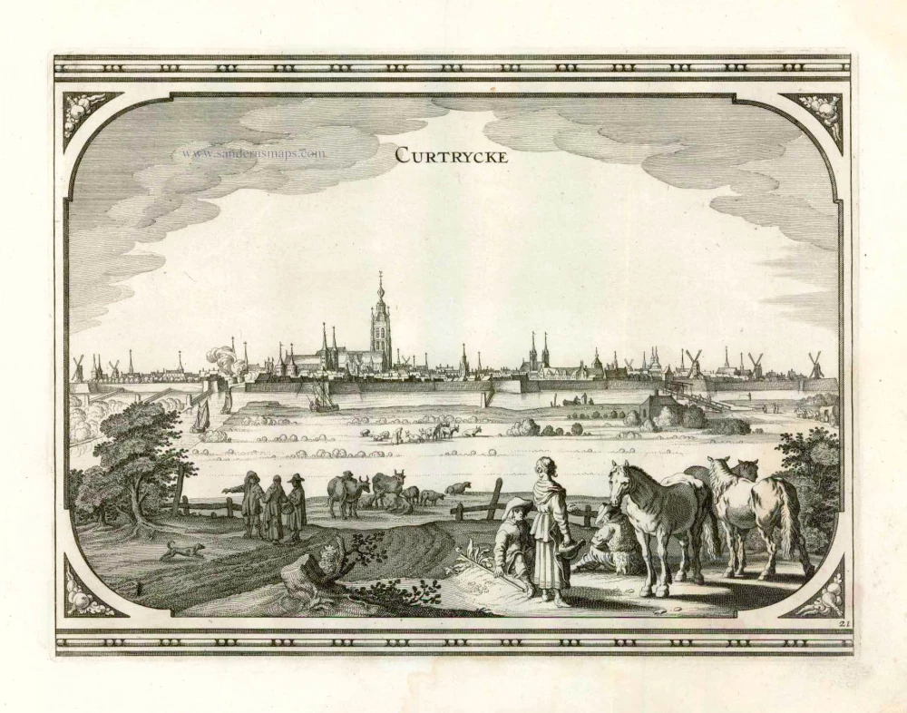
Curtrycke. 1656
Kortrijk by Visscher N. - Schut P.H.
[Item number: 25406]
Exactissima Flandriae descriptio. Flandria, Caroli V. Aug. Imp. max. natione illustrissima, Belgice provinciae est . . . . Ad signum Bibliothecae Diui Marci. Dominicus Zenoi Venetus excidebat. Venetijs M.D.M.VIIII. 1559
Flanders (Vlaanderen) by Domenico Zenoi.
[Item number: 25774]
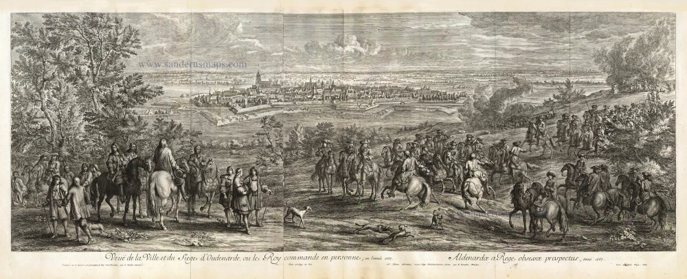
Spectacular view of the Siege.
Veuë de la Ville et du Siege d'Oudenarde, ou le Roy commande en personne, en lannée 1667. - Aldenardae a Rege obsessae prospectus, anno 1667. 1685
Oudenaarde by Frans Vander Meulen
[Item number: 25797]
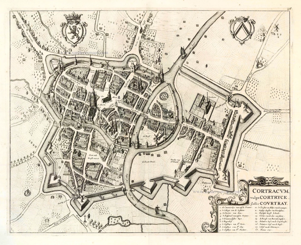
Cortracum vulgo Cortryck, Gallice Courtray ... 1657
Kortrijk, by Joannes Janssonius.
[Item number: 25988]
Flandriae Pars Occidentalis continens ... 1641
Western Flanders (West Vlaanderen), by Henricus Hondius.
[Item number: 26319]
Ypra. 1652
Ieper by Joan Blaeu.
[Item number: 26682]
Rare.
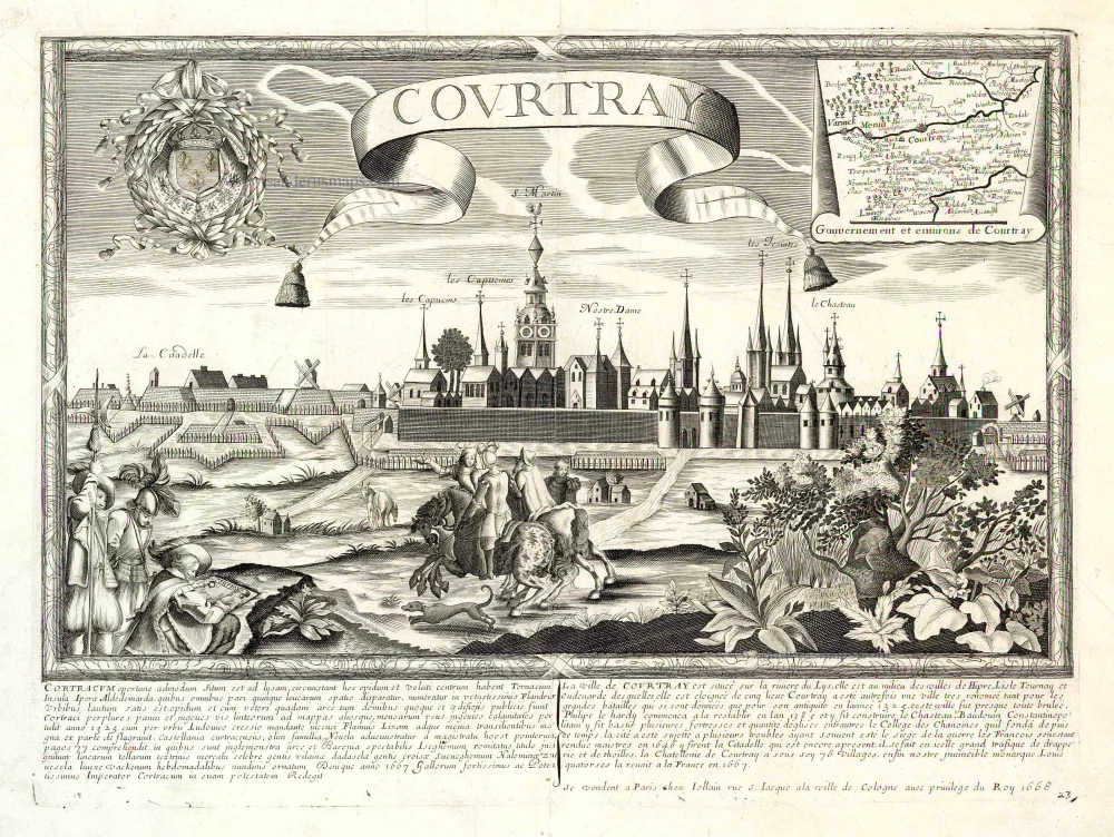
Courtray. c. 1678
Kortrijk, by Gerard Jollain.
[Item number: 26704]
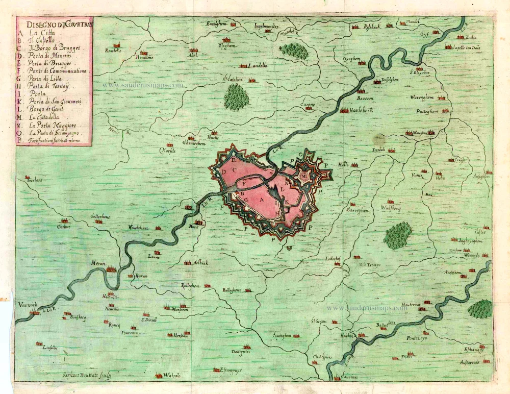
Disegno di Coutray. 1670
Kortrijk and surrounding, by Gualdo Priorato.
[Item number: 26788]
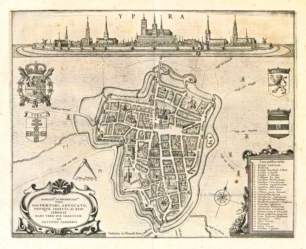
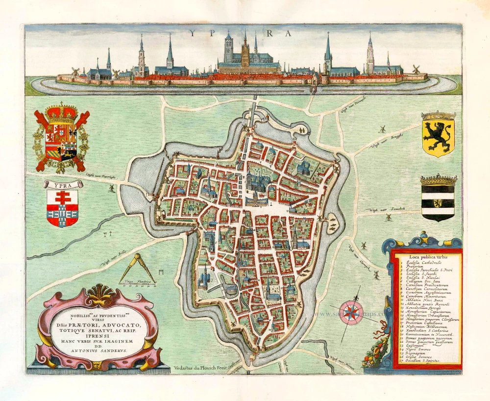
Ypra. 1641-1644
Ypres (Ieper), by Antonius Sanderus.
[Item number: 27019]
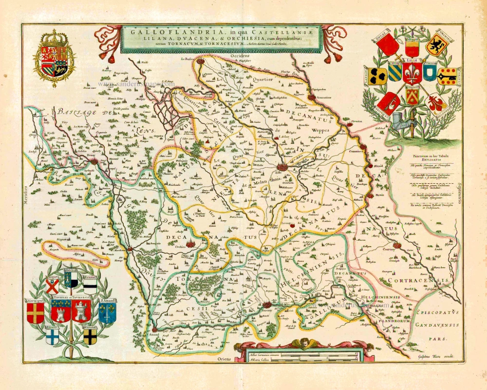
Galloflandria in qua Castellaniae Lilana, Duacena, &Orchiesa, cum dependentibus; necnon Tornacum, , & Tornacesium. 1643
Gallo-Flandria, by Willem Blaeu.
[Item number: 27125]
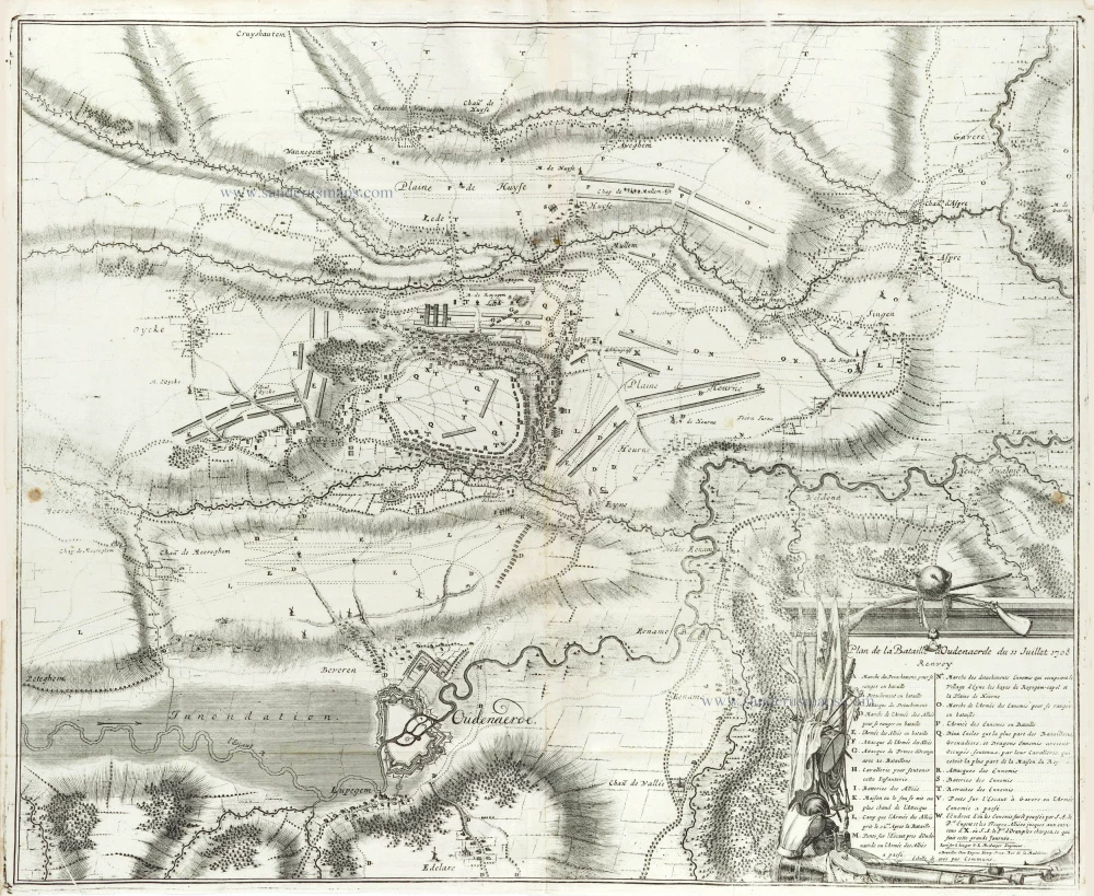
Plan de la Bataille d'Oudenaerde du 11 Juillet 1708. 1712
Oudenaarde by Eugène Fricx.
[Item number: 29585]
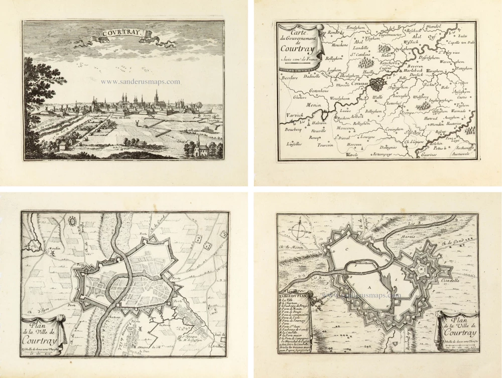
Courtray. - Carte du Gouvernemant de Courtray. - Plan de la ville de Courtray. ca. 1668
Kortrijk by Sr. S. de Beaulieu - four plates.
[Item number: 30301]