
Diocese of Antwerp by Petrus Verbiest. Before 1678

Pieter Verbiest (Petrus Verbist) and Isaak Verbiest (Isack Verbist)
Pieter Verbiest (Antwerpen, 1607-1674) was an Antwerp cartographer and engraver. Little is known about his life.
One of his most important works is the Novus Tabularum Geographicorum Belgicae (Antwerp, 1636), a pocket atlas of which two more editions were published later (1644 and 1652). Isaak Verbiest, probably a brother of Pieter, drew and engraved certain maps. Their collaboration also led to the production of two rare world maps.
Pieter Verbiest also published folio maps as separate publications. Koeman describes three editions of a Verbiest atlas of the Netherlands, published between 1636 and 1652. Only one copy of each of these atlases is known.
Verbiest-maps, some with beautiful decorative borders with city views, costumed figures and coats of arms, were sometimes bound in composite atlases. Occasionally, copies of these scarce maps come onto the market.
Dioecesis Episcopatus Anverpiensis.
Item Number: 30172 Authenticity Guarantee
Category: Antique maps > Europe > Belgium
Diocese of Antwerp by Petrus Verbiest.
Title: Dioecesis Episcopatus Anverpiensis.
With a dedication to Johannes Malderus by Petrus Verbiest (in cartouche in upper left corner).
Oriented to the east.
Date: Before 1678.
Copper engraving, printed on paper.
Image size: 340 x 403mm (13.39 x 15.87 inches).
Sheet size: 465 x 540mm (18.31 x 21.26 inches).
Verso: Blank.
Condition: Excellent.
Condition Rating: A+.
Separate publication.
Pieter Verbiest (Petrus Verbist) and Isaak Verbiest (Isack Verbist)
Pieter Verbiest (Antwerpen, 1607-1674) was an Antwerp cartographer and engraver. Little is known about his life.
One of his most important works is the Novus Tabularum Geographicorum Belgicae (Antwerp, 1636), a pocket atlas of which two more editions were published later (1644 and 1652). Isaak Verbiest, probably a brother of Pieter, drew and engraved certain maps. Their collaboration also led to the production of two rare world maps.
Pieter Verbiest also published folio maps as separate publications. Koeman describes three editions of a Verbiest atlas of the Netherlands, published between 1636 and 1652. Only one copy of each of these atlases is known.
Verbiest-maps, some with beautiful decorative borders with city views, costumed figures and coats of arms, were sometimes bound in composite atlases. Occasionally, copies of these scarce maps come onto the market.
Related items
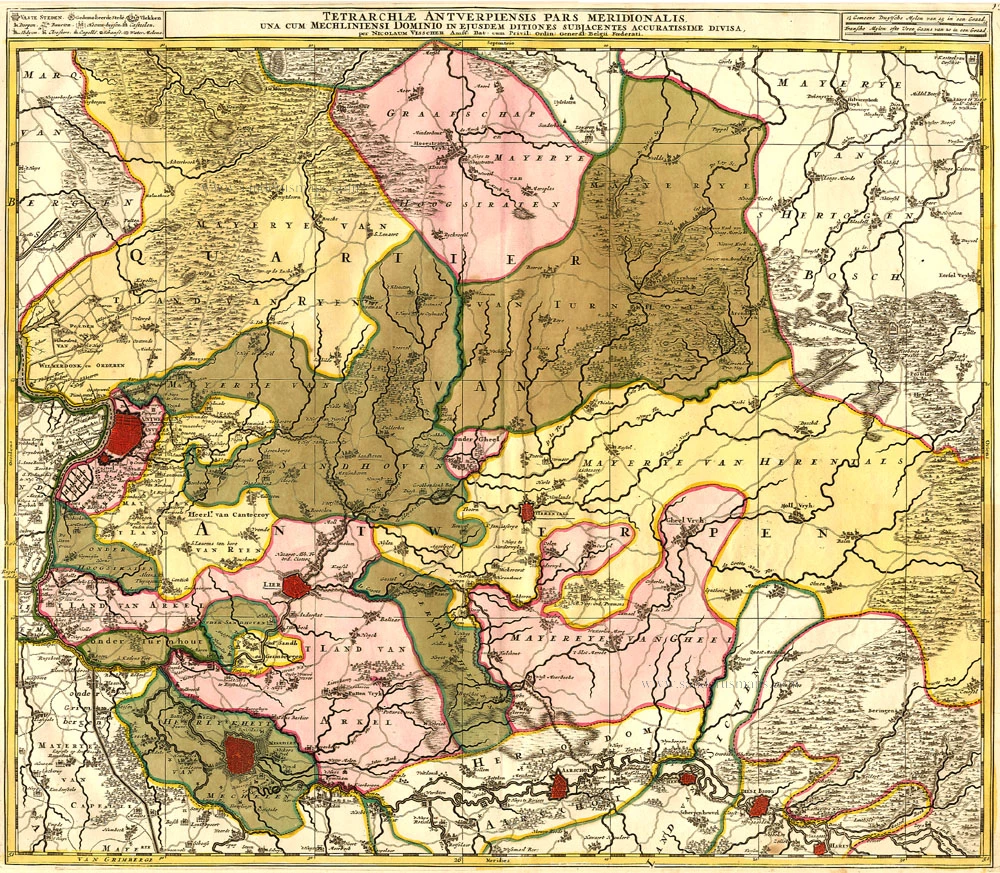
Tetrarchiae Antverpiensis Pars Meridionalis 1683-1696
Antwerpen - Mechelen by Visscher N. II.
[Item number: 14777]

Tertia Pars Brabantiae qua continetur Marchionat S.R.I. horum urbs primaria Antverpia. 1641-42
The Marquisate of Antwerp, by Willem Blaeu.
[Item number: 17537]
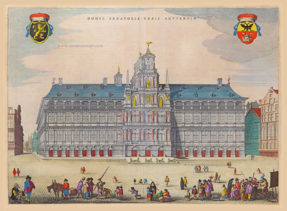
Domus Senatoria Urbis Antverpiae 1652
City Hall by Joan Blaeu. (Antwerp)
[Item number: 17590]
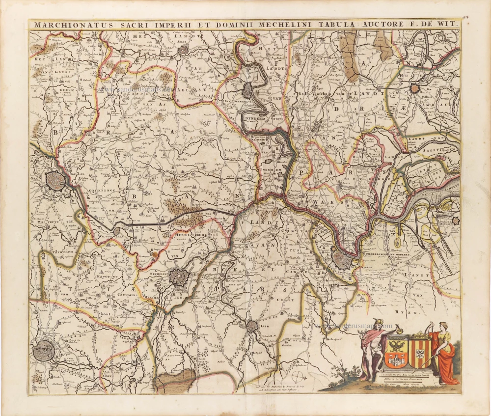
Marchionatus Sacri Imperiit Dominii Mechelini Tabula. c. 1705
The marquisate of Antwerp and the manor of Mechelen, by Frederick de Wit.
[Item number: 28997]

One of Antwerp's most beautiful maps
Marchionatus Sacri Romani Imperii. c. 1760
Antwerp, by Nicolaes Visscher I, published by Petrus Schenk Jr.
[Item number: 31137]

Antwerpen. 1686
Antwerpen by Christoph Riegel.
[Item number: 31503]

Le Pourtraict de la tres noble ville d'Anvers, ainsi qu'elle se comporte a present. 1575
Antwerp (Antwerpen), by François de Belleforest.
[Item number: 31871]

Marchionatus Sacri Romani Imperii. 1617
Antwerp (Antwerpen), by Petrus Kaerius.
[Item number: 32003]

Spectacular view by Hoefnagel
Antverpia. 1596
Antwerp, by Georg Braun and Frans Hogenberg, after G. Hoefnagel.
[Item number: 32468]

Port d'Anvers 1823
Antwerpen, lithograph by Dewasme, after Prosper de la Barrière.
[Item number: 33108]
new

Marché aux Poissons, à Anvers. 1823
Antwerpen - Vismarkt, lithograph by Dewasme, after Prosper de la Barrière.
[Item number: 33109]