
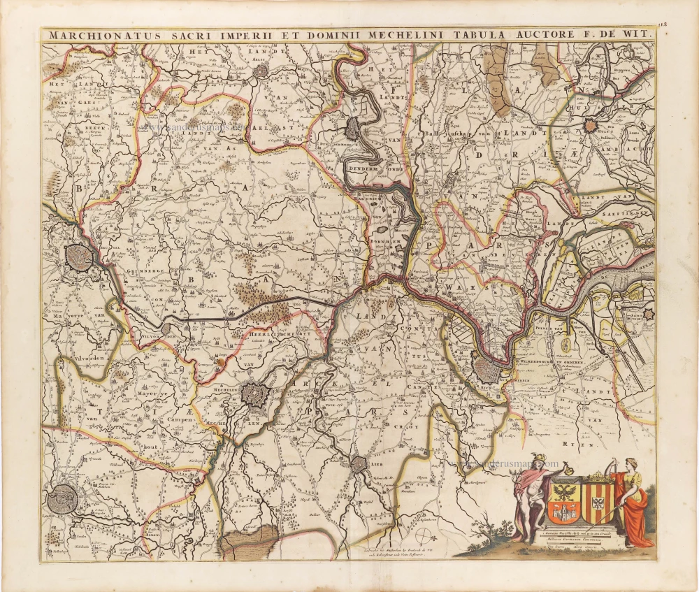
Antwerpen - Mechelen by Visscher N. II. 1683-1696
The Visscher Family
For nearly a century, the members of the Visscher family were essential art dealers and map publishers in Amsterdam.
Claes Jansz. Visscher, or N.J. Piscator (1587-1652)
Claes Jansz. Vischer bought a house in Amsterdam, 'de gulden Bors', on the crucial Kalverstraat and changed the name into "In de Visscher"; under this title, the shop was to flourish for many years.
He was famous for his engravings and etchings of Dutch landscapes and 'historical scenes', such as sieges, battles, etc. These 'historical scenes' were considered contemporary illustrated news items, especially e.g. that of 'the Eighty Years' War'.
For the publication of his first atlas, he bought copperplates of the atlas Germania Inferior by Pieter van den Keere (1623).
In 1649, he published an atlas entitled Tabularum Geographicarum Contractarum, containing the same maps as Langenes' Caert Thresoor, for which Visscher had only new title pages engraved.
Claes Jansz. Visscher died in 1652. His wife, Neeltjen Florisdr., had already died in 1640. They had seven children, four of whom were still alive at Claes Jansz.'s death. One was Nicolaes Visscher I, who was to continue his father's business.
Nicolaes Visscher I (1618-1679)
Nicolaes Visscher I partnered with his father, continued the business, and stayed on the Kalverstraat 'in de Visscher' till his death.
In about 1657, the first edition of his Atlas Contractus Orbis Terrarum appeared.
Between 1664 and 1677, several editions of his Atlas Contractus appeared without a printed index, for these atlases had no fixed contents but were composed according to the buyer's financial leaping pole.
In May 1664, Nicolaes Visscher was admitted as a member of the Booksellers' Guild of his town. In July 1677, he was granted a patent of the States of Holland and West-Friesland for printing and publishing maps and atlases for 15 years.
After this, he again published an Atlas Contractus with a printed index. At about the same time, he also brought out an Atlas Minor.
Nicolaes Visscher II (1649-1702)
Nicolaes Visscher II inherited the 'shop' from his father. To obtain a new privilege, he applied to the States of Holland and West-Friesland in 1682 for a patent for printing and publishing maps. This patent was granted to him the same year. He moved the firm to the Dam, but it kept the same signboard: "In de Visscher".
Around 1683, he published his first Atlas Minor with a printed index of 91 maps. In 1684, an atlas Germania Inferior appeared. Till 1697, he published another number of atlases. He used his grandfather's (Claes Jansz.) maps less often now and relied more and more on his own.
The wars waged at this time initiated the compilation of maps of the countries where the armies operated. Many war maps were included in the various editions of his Atlas Minor.
After Nicolaes's death, his wife, Elizabeth Verseyl, published all the war maps as an atlas under the title De Stoel des Oorlogs in de Wereld (The seat of war in the world).
The widow of Nicolaes Visscher II (?-1726)
His widow continued the business energetically, and by her hand, under the name of her deceased husband, numerous atlases appeared, e.g., several editions of the Atlas Minor, an Atlas Maior and De Stoel des Oorlogs. The shop enjoyed a high reputation due to the assortment's incredible variety. Not only 'Visscher' maps but also maps of other publishers were obtainable. With the death of Elizabeth Verseyl in 1726, the last descendant died of a great map- and atlas-publishing firm in Amsterdam.
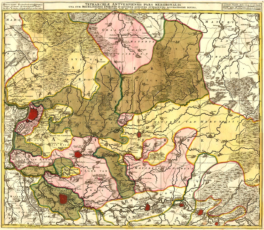
Tetrarchiae Antverpiensis Pars Meridionalis
Item Number: 14777 Authenticity Guarantee
Category: Antique maps > Europe > Belgium
Old, antique map of Antwerpen - Kempen, by Visscher N. II.
Title: Tetrarchiae Antverpiensis Pars Meridionalis.
Date: 1683-1696.
Copper engraving, printed on paper.
Size (not including margins): 502 x 585mm (19.76 x 23.03 inches).
Verso: Blank.
Condition: Original coloured, excellent.
Condition Rating: A+
From: Atlas Minor Sive Geographia Compendosia, ... Amsterdam, 1683-1696.
The Visscher Family
For nearly a century, the members of the Visscher family were essential art dealers and map publishers in Amsterdam.
Claes Jansz. Visscher, or N.J. Piscator (1587-1652)
Claes Jansz. Vischer bought a house in Amsterdam, 'de gulden Bors', on the crucial Kalverstraat and changed the name into "In de Visscher"; under this title, the shop was to flourish for many years.
He was famous for his engravings and etchings of Dutch landscapes and 'historical scenes', such as sieges, battles, etc. These 'historical scenes' were considered contemporary illustrated news items, especially e.g. that of 'the Eighty Years' War'.
For the publication of his first atlas, he bought copperplates of the atlas Germania Inferior by Pieter van den Keere (1623).
In 1649, he published an atlas entitled Tabularum Geographicarum Contractarum, containing the same maps as Langenes' Caert Thresoor, for which Visscher had only new title pages engraved.
Claes Jansz. Visscher died in 1652. His wife, Neeltjen Florisdr., had already died in 1640. They had seven children, four of whom were still alive at Claes Jansz.'s death. One was Nicolaes Visscher I, who was to continue his father's business.
Nicolaes Visscher I (1618-1679)
Nicolaes Visscher I partnered with his father, continued the business, and stayed on the Kalverstraat 'in de Visscher' till his death.
In about 1657, the first edition of his Atlas Contractus Orbis Terrarum appeared.
Between 1664 and 1677, several editions of his Atlas Contractus appeared without a printed index, for these atlases had no fixed contents but were composed according to the buyer's financial leaping pole.
In May 1664, Nicolaes Visscher was admitted as a member of the Booksellers' Guild of his town. In July 1677, he was granted a patent of the States of Holland and West-Friesland for printing and publishing maps and atlases for 15 years.
After this, he again published an Atlas Contractus with a printed index. At about the same time, he also brought out an Atlas Minor.
Nicolaes Visscher II (1649-1702)
Nicolaes Visscher II inherited the 'shop' from his father. To obtain a new privilege, he applied to the States of Holland and West-Friesland in 1682 for a patent for printing and publishing maps. This patent was granted to him the same year. He moved the firm to the Dam, but it kept the same signboard: "In de Visscher".
Around 1683, he published his first Atlas Minor with a printed index of 91 maps. In 1684, an atlas Germania Inferior appeared. Till 1697, he published another number of atlases. He used his grandfather's (Claes Jansz.) maps less often now and relied more and more on his own.
The wars waged at this time initiated the compilation of maps of the countries where the armies operated. Many war maps were included in the various editions of his Atlas Minor.
After Nicolaes's death, his wife, Elizabeth Verseyl, published all the war maps as an atlas under the title De Stoel des Oorlogs in de Wereld (The seat of war in the world).
The widow of Nicolaes Visscher II (?-1726)
His widow continued the business energetically, and by her hand, under the name of her deceased husband, numerous atlases appeared, e.g., several editions of the Atlas Minor, an Atlas Maior and De Stoel des Oorlogs. The shop enjoyed a high reputation due to the assortment's incredible variety. Not only 'Visscher' maps but also maps of other publishers were obtainable. With the death of Elizabeth Verseyl in 1726, the last descendant died of a great map- and atlas-publishing firm in Amsterdam.
Related items
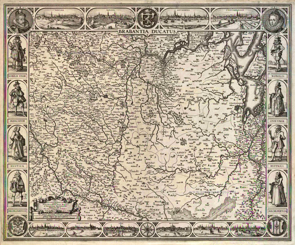
Brabantia Ducatus / Tabula Ducatus Brabantiae Continens Marchionatum Sacri Imperij et Dominium Mechliniense Magna cura edita à Nicolao Iohannis Visscher. Anno 1622. 1622
Brabant by C.J. Visscher.
[Item number: 2640]

Rare.
Andorff c. 1650
Antwerp (Antwerpen), by Lucas Schnitzer.
[Item number: 7025]

Brabantiae Descriptio 1601
Brabant, with an inset map of the district of Mechelen, by Abraham Ortelius.
[Item number: 12909]
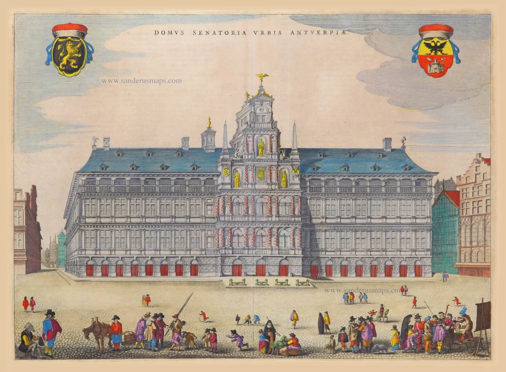
Domus Senatoria Urbis Antverpiae 1652
City Hall by Joan Blaeu. (Antwerp)
[Item number: 17590]
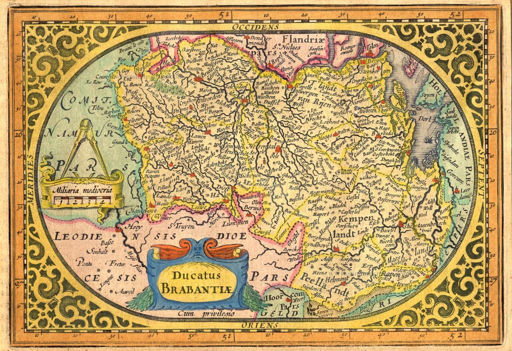
Ducatus Brabantiae. 1631
Brabant by Abraham Goos,published by Joannes Janssonius.
[Item number: 17723]

Quarta Pars Brabantiae cujus caput Sylvaducis. 1635
Northern Brabant, by Blaeu W. & J.
[Item number: 20384]

Brabantiae, pars Septentrionalis c. 1680
Northern Brabant, by Frederick de Wit.
[Item number: 24653]

Brabantiae Belgarum provinciae recens exactaque descriptio. 1602
Brabant by M. Quad - J. Bussemacher.
[Item number: 25235]
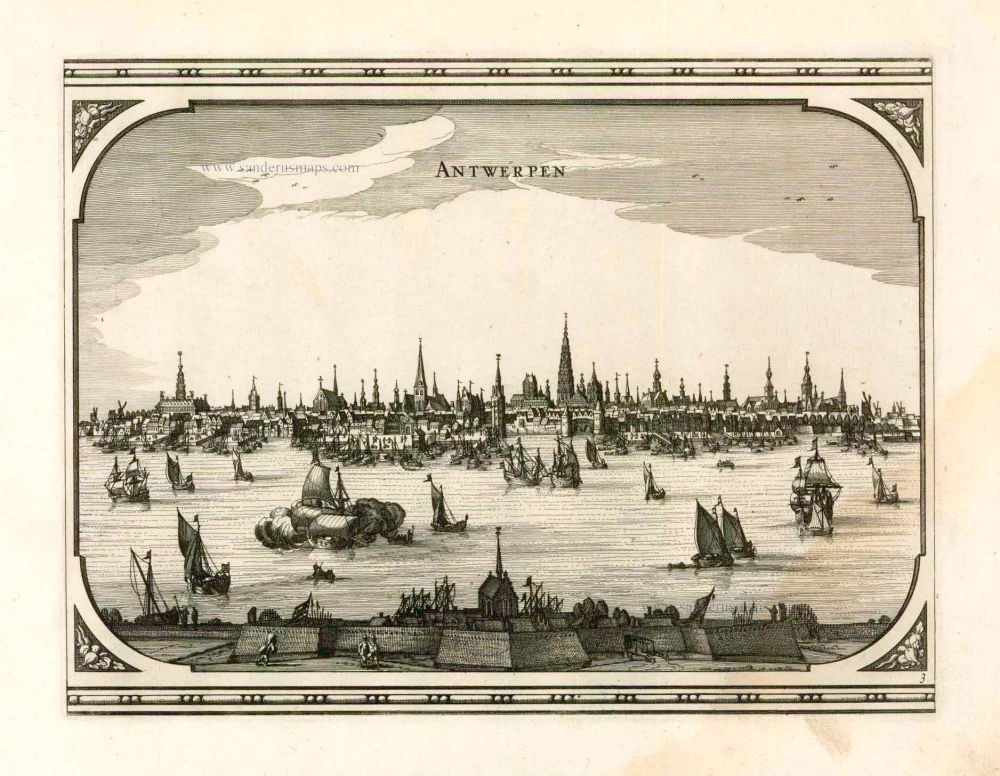
Antwerpen. 1656
Antwerpen by Visscher N. - Schut P.H.
[Item number: 25371]

Mechelen. 1656
Mechelen by Visscher N. - Schut P.H.
[Item number: 25372]

Brabantiae Descriptio. 1595
Brabant, by A. Ortelius.
[Item number: 25573]
Marchionatus Sacri Imperiit Dominii Mechelini Tabula. c. 1705
The marquisate of Antwerp and the manor of Mechelen, by Frederick de Wit.
[Item number: 28997]

Dioecesis Episcopatus Anverpiensis. Before 1678
Diocese of Antwerp by Petrus Verbiest.
[Item number: 30172]

One of Antwerp's most beautiful maps
Marchionatus Sacri Romani Imperii. c. 1760
Antwerp, by Nicolaes Visscher I, published by Petrus Schenk Jr.
[Item number: 31137]
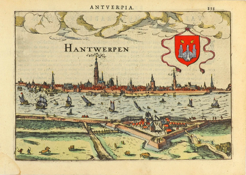
Hantwerpen. 1616
Antwerp (Antwerpen), by Lodovico Guicciardini.
[Item number: 31167]

Machlinia. 1649
Mechelen, by Joan Blaeu.
[Item number: 31178]
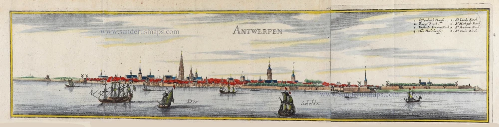
Antwerpen 1659
Antwerp by C. Merian.
[Item number: 31845]

Le Pourtraict de la tres noble ville d'Anvers, ainsi qu'elle se comporte a present. 1575
Antwerp (Antwerpen), by François de Belleforest.
[Item number: 31871]

Carte de la Seigneyrie de Malines. 1633
Mechelen by Christophe Tassin.
[Item number: 31931]

Marchionatus Sacri Romani Imperii. 1617
Antwerp (Antwerpen), by Petrus Kaerius.
[Item number: 32003]

With train station
Panorama von Mecheln - Panorama de Malines. c. 1840
Mechelen, by F.C. Eisen.
[Item number: 32122]
Mechelen. 1659
Mechelen, door Matthäus Merian & Martin Zeiller.
[Item number: 33201]
new