
Navigation chart of utmost importance. Third known copy.
Zeeland and Flanders, Willem den Dooven, 1617.
Dr. Ruud Paesie, a maritime historian, highlights Willem den Dooven's involvement in the preparations for the arrival of Elector Palatine Frederick V and Elizabeth Stuart in Vlissingen in 1613. An accurate and up-to-date chart, significantly more precise than Waghenaer's map, was essential for the safe crossing of the fleet commanded by Charles Howard, the upper commander of the English Navy (Resolutions of the Admiralty of Zeeland on 13/02/1613 and 18/02/1613). The Prince Royal, the flagship of the English Navy, was one of the largest ships of its time, and it was crucial to avoid grounding at all costs.
Upon completing the chart and deciding to have it printed, Willem den Dooven would have recognised the chart's importance for the Dutch Republic's rapidly expanding maritime activities (during the 17th century, 350 Zeeland VOC ships departed via De Wielingen). For many years, this was the best chart for use in the hazardous waters of Zeeland and Flanders.
References:
Paesie, R. Nieuw licht op de aankomst, in: Tijdschrift Zeeland, Koninklijk Zeeuwsch Genootschap der Wetenschappen, 2023/4, Middelburg, 2023.
Vlam A.W., De veranderingen in den mond van de Westerschelde van het begin der 16e eeuw tot omstreeks 1800, Middelburg, 1941.
Van den Bergh R.J., Miscellanea Archivistica VII Samuel de Swaef, Bergen-op-Zoom, 1994.
De Keyser A., Wegwijs varen langs onze kusten rond 1600, Knokke-Heist, 1985.
[No title]
Item Number: 25614 Authenticity Guarantee
Category: Antique maps > Europe > Belgium
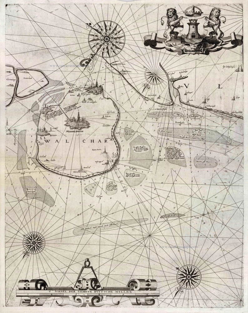
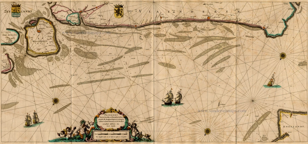
Highly detailed chart of Southwest Zeeland and Northern Flanders, by Willem den Dooven.
Left sheet of a two-sheet chart.
Oriented to the Southeast.
Date: 1617
Printer: Samuel De Swaef, Middelburg, 1619
Copper engraving
Size (not including margins): 59.5 x 47cm (23.2 x 18.3 inches)
Verso: Blank
Condition: Excellent.
Condition Rating: A+
Separate publication. Only two other copies recorded: Nat. Archief Den Haag; Zeeuws Archief Middelburg.
Dr. Ruud Paesie, a maritime historian, highlights Willem den Dooven's involvement in the preparations for the arrival of Elector Palatine Frederick V and Elizabeth Stuart in Vlissingen in 1613. An accurate and up-to-date chart, significantly more precise than Waghenaer's map, was essential for the safe crossing of the fleet commanded by Charles Howard, the upper commander of the English Navy (Resolutions of the Admiralty of Zeeland on 13/02/1613 and 18/02/1613). The Prince Royal, the flagship of the English Navy, was one of the largest ships of its time, and it was crucial to avoid grounding at all costs.
Upon completing the chart and deciding to have it printed, Willem den Dooven would have recognised the chart's importance for the Dutch Republic's rapidly expanding maritime activities (during the 17th century, 350 Zeeland VOC ships departed via De Wielingen). For many years, this was the best chart for use in the hazardous waters of Zeeland and Flanders.
References:
Paesie, R. Nieuw licht op de aankomst, in: Tijdschrift Zeeland, Koninklijk Zeeuwsch Genootschap der Wetenschappen, 2023/4, Middelburg, 2023.
Vlam A.W., De veranderingen in den mond van de Westerschelde van het begin der 16e eeuw tot omstreeks 1800, Middelburg, 1941.
Van den Bergh R.J., Miscellanea Archivistica VII Samuel de Swaef, Bergen-op-Zoom, 1994.
De Keyser A., Wegwijs varen langs onze kusten rond 1600, Knokke-Heist, 1985.
Related items
Paskaert van de Zeeusche en Vlaemsche Kusten, tonende Alle Drooghten, Diepten, en Ondiepten, tusschen t'Eylandt Schouwen en de Hoofden, Curieuselyck Beschreven door Dirck Davidsz 1667
Sea chart of Flanders (Vlaanderen) & Zeeland, by Pieter Goos.
[Item number: 19054]
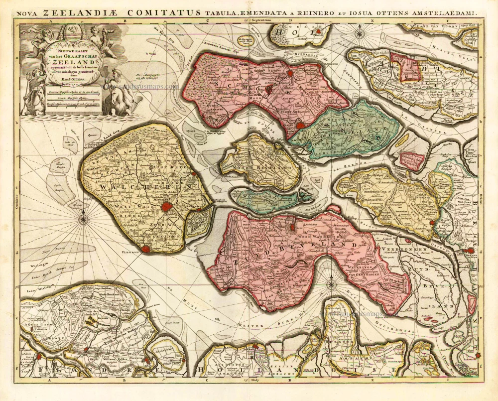
Nieuwe Kaart van het Graafschap Zeeland. 1730-45
Zeeland, by Ottens R. & I.
[Item number: 25736]
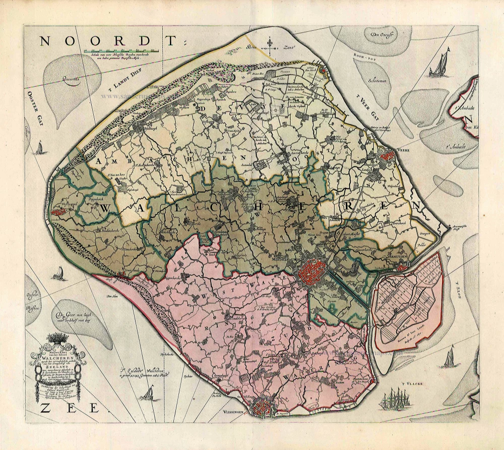
Nieuwe Kaart van het Eiland Walcheren zynde het vermakelykste gedeelte van het Graafschap van Zeeland ... 1765-70
Walcheren, by Widow J. Ottens & Son.
[Item number: 25773]
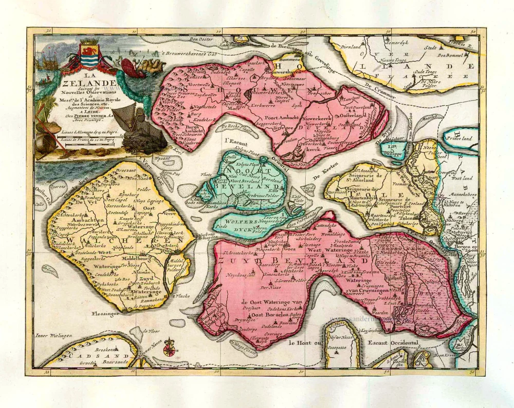
La Zelande. 1713
Zeeland, by Pieter Van der Aa.
[Item number: 26058]
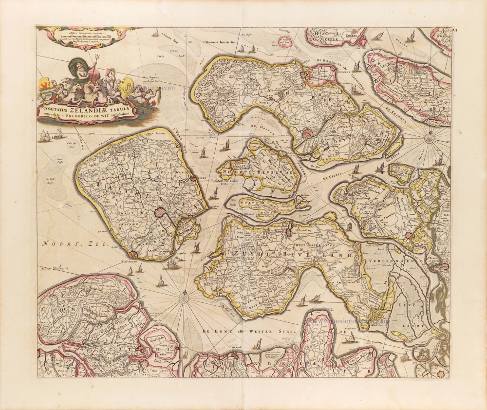
Comitatus Zelandiae Tabula. ca. 1705
Zeeland by Frederick de Wit.
[Item number: 29008]
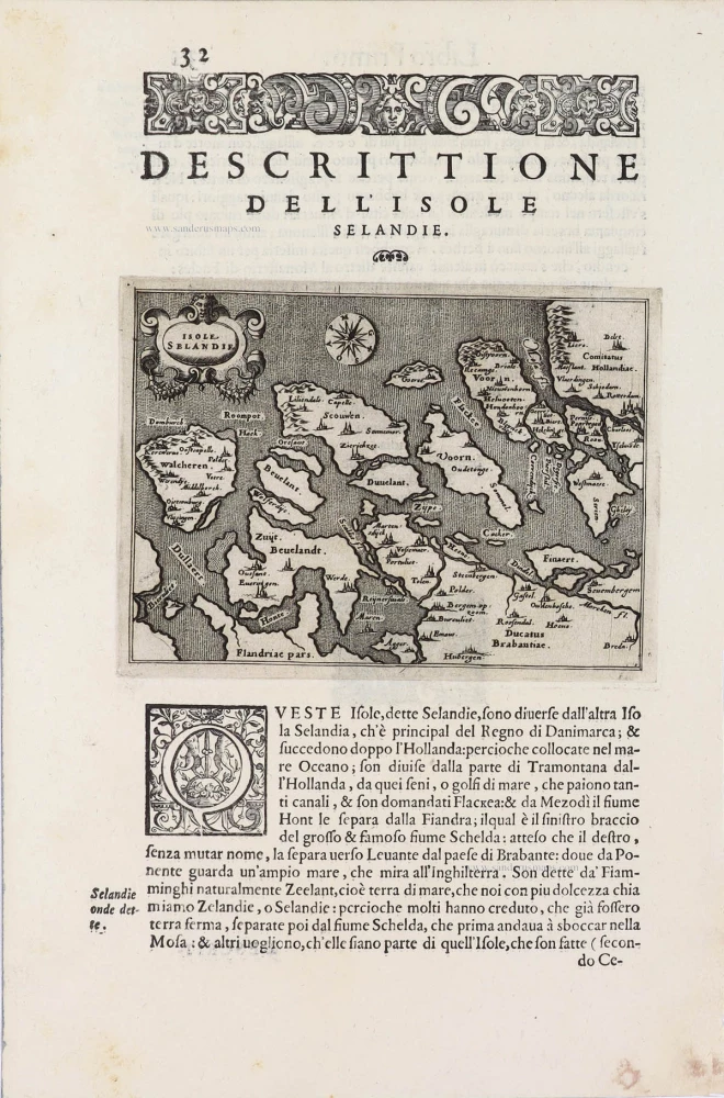
Isole Selandia - [Above map :] Descrittione dell'Isole Selandie. 1590
Zeeland, by Thomaso Porcacchi.
[Item number: 29759]
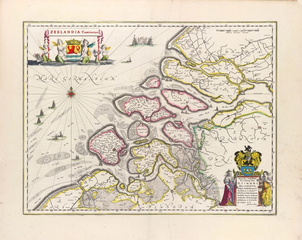
Zeelandia Comitatus. 1643
Zeeland, by W. Blaeu.
[Item number: 29937]
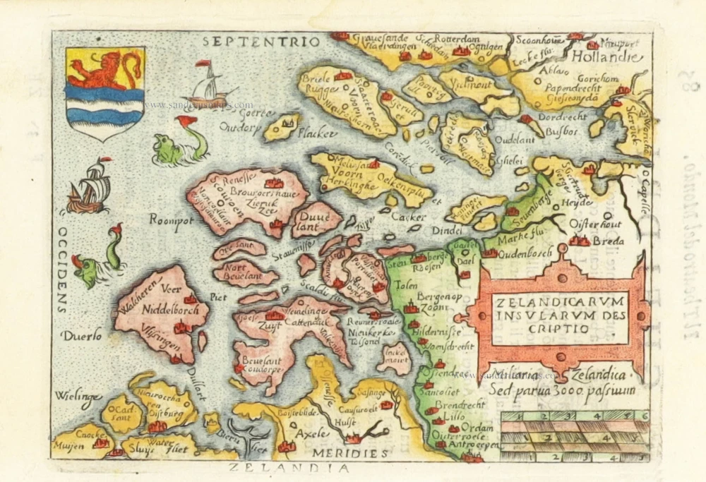
Zelandicarum Insularum Descriptio. 1598
Zeeland by Abraham Ortelius.
[Item number: 30236]