
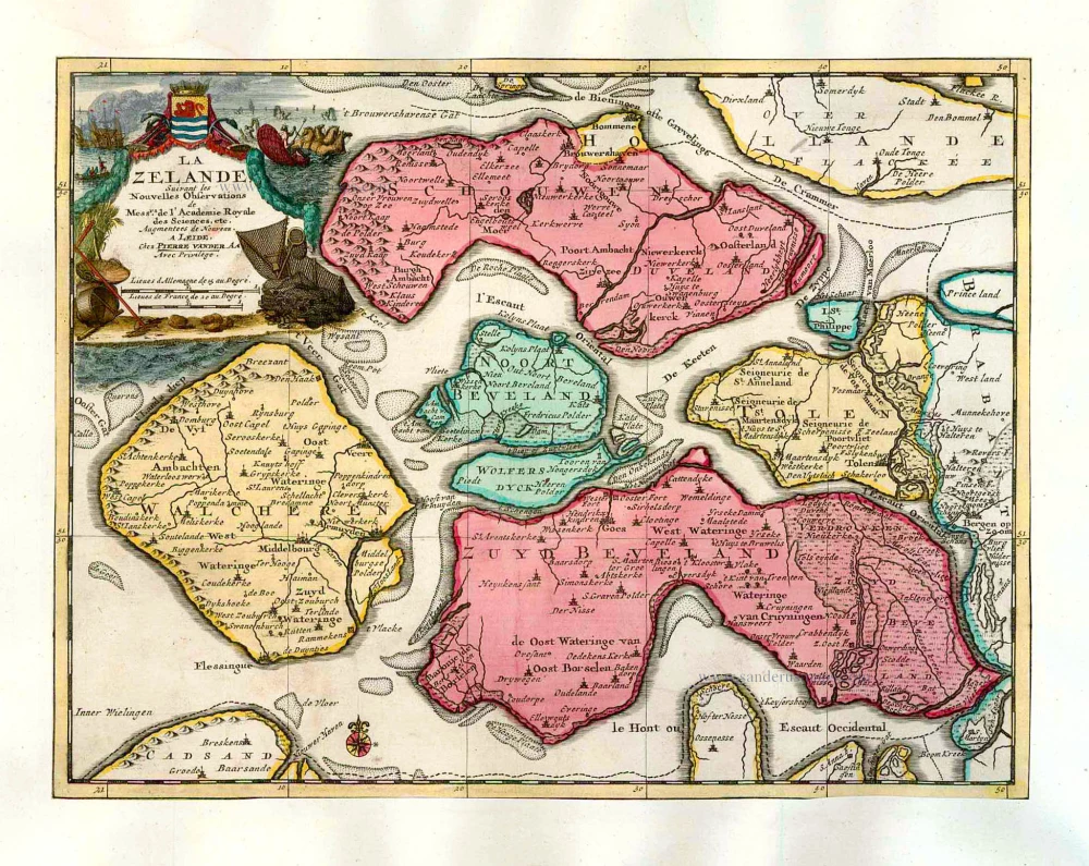
Zeeland, by Pieter Van der Aa. 1713
Pieter van der Aa (Leiden, 1659-1733)
Pieter van der Aa was already in 1682 owner of a bookshop and auction house. During his life, he has published an enormous amount of printed material.
After 1700, van der Aa increasingly specialised in books on geography and travel.
He published composite atlases, a series of geographical descriptions of European countries, and some very spectacular works. Between 1706 and 1708 he published the Naauweurige versameling der gedenkwaardigste zee- en land-reysen, in 28 volumes.
Many of Van der Aa’s publications are richly illustrated with maps and plates. He took over many copperplates and prints from other publishers such as Carel Allard and Frederik De Wit. The composite atlases that appeared from his workshop contain a curious mixture of his own material, copies of maps from other publishers, and reprints made from old copper plates, now with his own imprint.
The Galérie agréable du monde, was completed in 1729, and comprised 66 parts, bound in 27 volumes. Van der Aa presented it as a good investment; after publication, the antiquarian value of the work would double, the more so since it was printed in a limited edition of only one hundred copies.
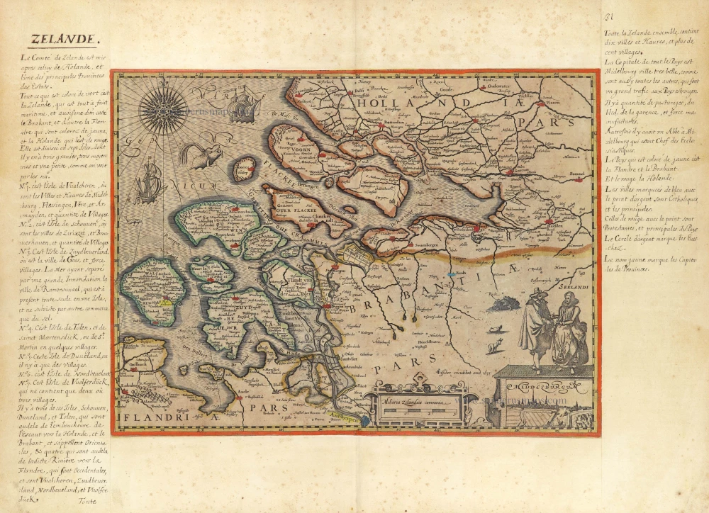
La Zelande.
Item Number: 26058 Authenticity Guarantee
Category: Antique maps > Europe > The Netherlands
Zeeland, by Pieter Van der Aa.
Title: La Zelande.
Date of the first edition: 1713.
Date of this map: 1713.
Copper engraving, printed on paper.
Size (not including margins): 225 x 296mm (8.86 x 11.65 inches).
Verso: Blank.
Condition: Original coloured, trimmed to neatline and mounted on heavy paper at an early time.
Condition Rating: A.
From: Nouvel Atlas, très exact et fort commode pour toutes sortes de personnes, Contenant Les Principales cartes géographiques. Leiden, P. Van der Aa, n.d. (1713) (Koeman, Aa7).
Van der Aa maps are rarely found in original colouring.
Pieter van der Aa (Leiden, 1659-1733)
Pieter van der Aa was already in 1682 owner of a bookshop and auction house. During his life, he has published an enormous amount of printed material.
After 1700, van der Aa increasingly specialised in books on geography and travel.
He published composite atlases, a series of geographical descriptions of European countries, and some very spectacular works. Between 1706 and 1708 he published the Naauweurige versameling der gedenkwaardigste zee- en land-reysen, in 28 volumes.
Many of Van der Aa’s publications are richly illustrated with maps and plates. He took over many copperplates and prints from other publishers such as Carel Allard and Frederik De Wit. The composite atlases that appeared from his workshop contain a curious mixture of his own material, copies of maps from other publishers, and reprints made from old copper plates, now with his own imprint.
The Galérie agréable du monde, was completed in 1729, and comprised 66 parts, bound in 27 volumes. Van der Aa presented it as a good investment; after publication, the antiquarian value of the work would double, the more so since it was printed in a limited edition of only one hundred copies.
Related items
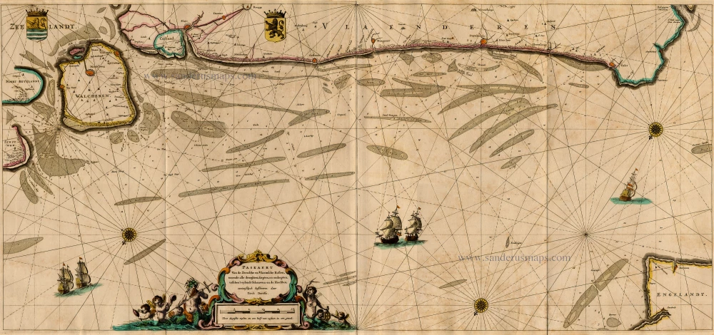
Paskaert van de Zeeusche en Vlaemsche Kusten, tonende Alle Drooghten, Diepten, en Ondiepten, tusschen t'Eylandt Schouwen en de Hoofden, Curieuselyck Beschreven door Dirck Davidsz 1667
Sea chart of Flanders (Vlaanderen) & Zeeland, by Pieter Goos.
[Item number: 19054]
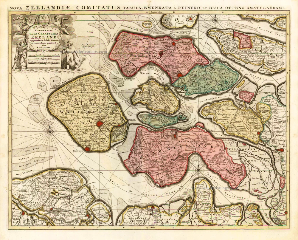
Nieuwe Kaart van het Graafschap Zeeland. 1730-45
Zeeland, by Ottens R. & I.
[Item number: 25736]
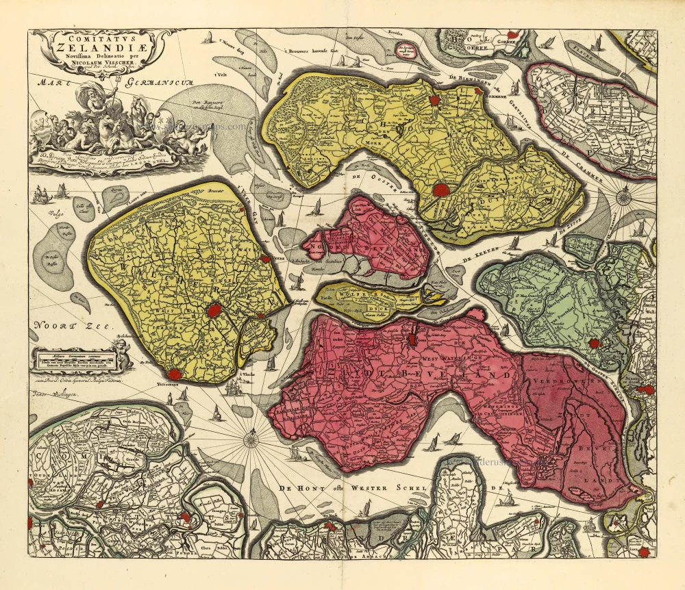
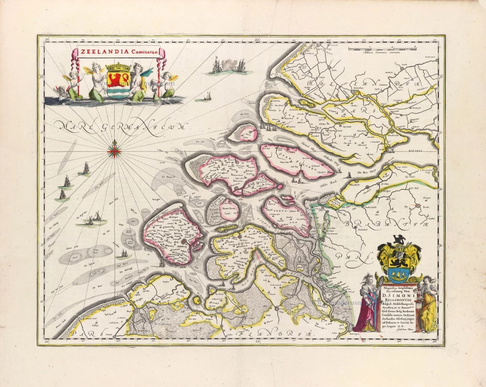
Comitatus Zelandiae. c. 1715
Zeeland by Nicolaas Visscher I, published by Petrus Schenk II.
[Item number: 28275]
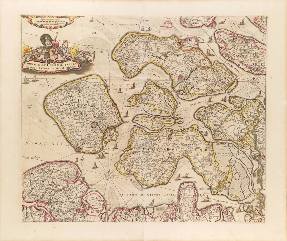
Comitatus Zelandiae Tabula. ca. 1705
Zeeland by Frederick de Wit.
[Item number: 29008]
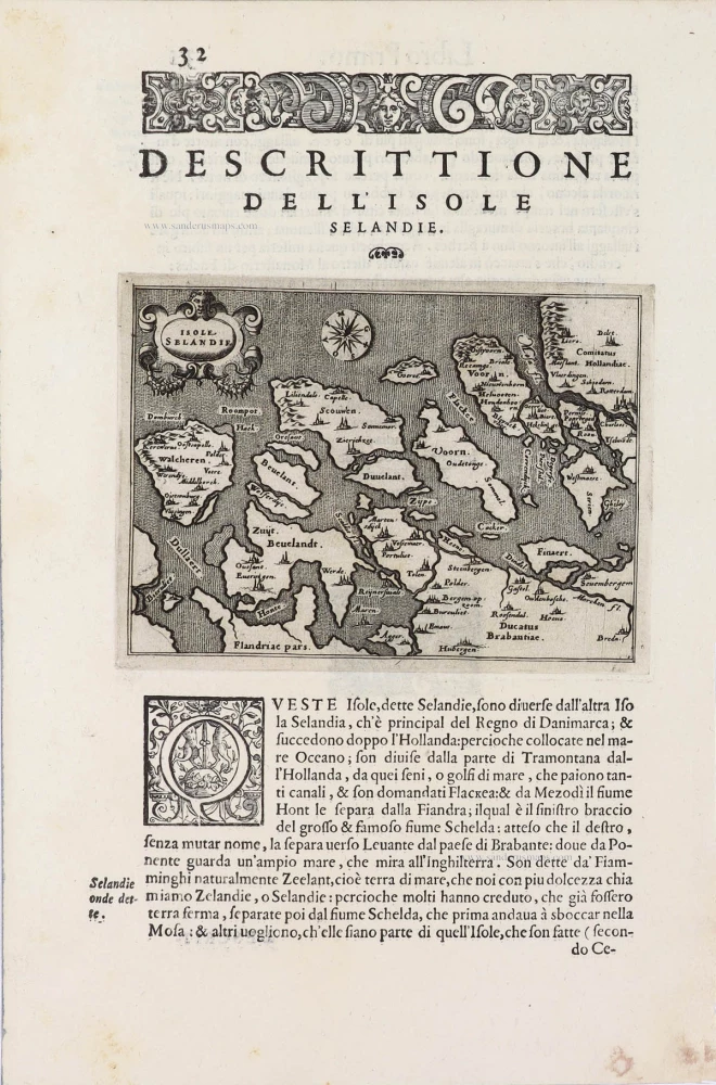
Isole Selandia - [Above map :] Descrittione dell'Isole Selandie. 1590
Zeeland, by Thomaso Porcacchi.
[Item number: 29759]
Zeelandia Comitatus. 1643
Zeeland, by W. Blaeu.
[Item number: 29937]
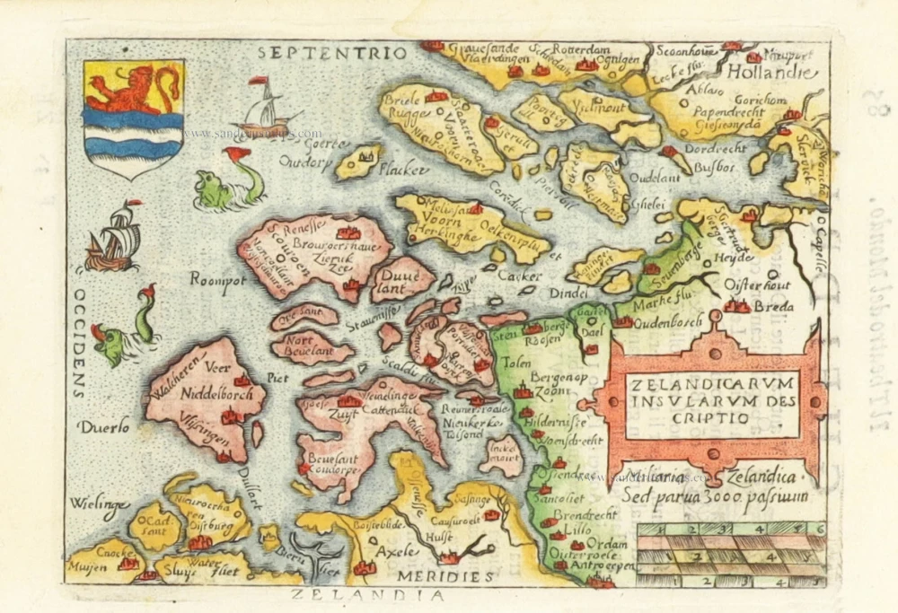
Zelandicarum Insularum Descriptio. 1598
Zeeland by Abraham Ortelius.
[Item number: 30236]
[No title - With inset view of the town of Middelburg:] Middelburgum. [Costumed figures:] Seelandi c. 1630-1650
Zeeland by Petrus Kaerius, published by C.J. Visscher.
[Item number: 30935]
Early edition
Zelandicarum Insularum exactissima et nova descriptio, 1573
Zeeland by Abraham Ortelius.
[Item number: 30967]

Zelandia - Zelandicarum insularum exactissima et nova descriptio, 1592
Zeeland by Matthias Quad, published by J. Bussemacher.
[Item number: 31258]
Le Comté de Zeelande. 1692
Zeeland by N. Sanson, so-called published by Hubert Jaillot. (Pirated edition by Pierre Mortier).
[Item number: 31343]
Zeelandia. 1618
Zeeland by Petrus Bertius, published by Jodocus Hondius II.
[Item number: 31590]

Carte de Zeland. 1633
Zeeland by Christophe Tassin.
[Item number: 31929]