
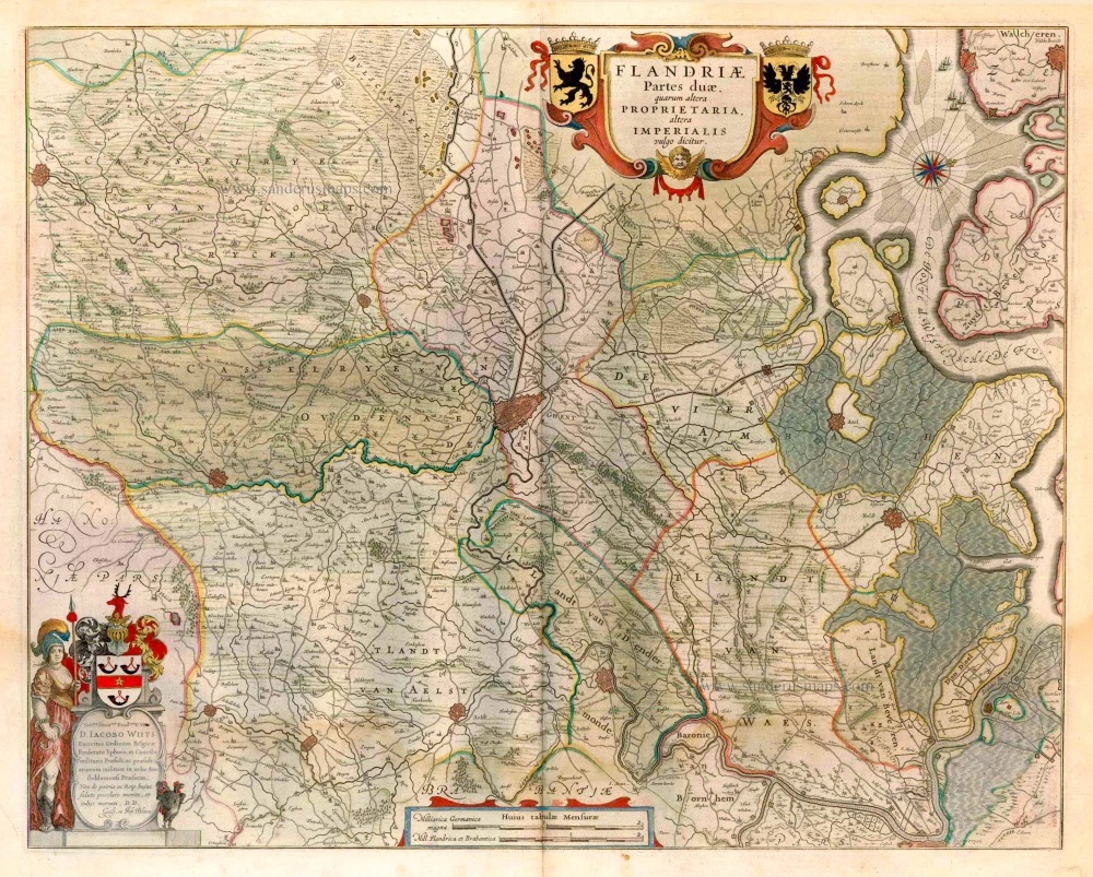
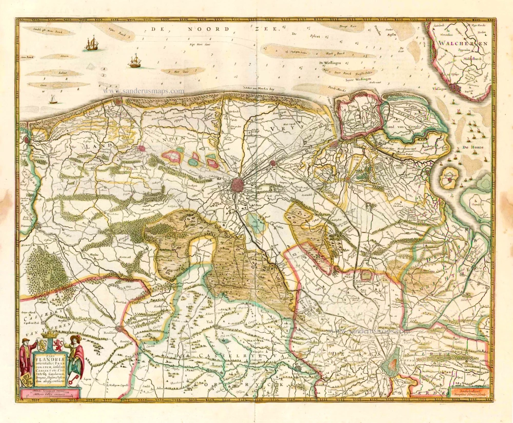
Oost Vlaanderen by J. Blaeu. 1658-59
The Blaeus: Willem Janszoon, Cornelis & Joan
Willem Jansz. Blaeu and his son Joan Blaeu are the most widely known cartographic publishers of the seventeenth century.
Willem Jansz. (also written Guilielmus Janssonius) = Willem Janszoon Blaeu, was born in Uitgeest (Netherlands), near Alkmaar in 1571. He studied mathematics under Tycho Brahe and learned the theory and practice of astronomical observations and the art of instrument- and globe making.
In 1596 he came to Amsterdam where he settled down as a globe-, instrument- and map-maker. He published his first cartographic work (a globe) in 1599 and probably published his first printed map (a map of the Netherlands) in 1604. He specialized in maritime cartography and published the first edition of the pilot guide Het Licht der Zeevaert in 1608, and was appointed Hydrographer of the V.O.C. (United East India Company) in 1633. After thirty years of publishing books, wall maps, globes, charts and pilot guides, he brought out his first atlas, Atlas Appendix (1630). This was the beginning of the great tradition of atlas-making by the Blaeus.
In 1618 another mapmaker, bookseller and publisher, Johannes Janssonius established himself in Amsterdam next door to Blaeu's shop. It is no wonder that these two neighbours, who began accusing each other of copying and stealing their information, became fierce competitors who did not have a good word to say about each other. In about 1621 Willem Jansz. decided to put an end to the confusion between his name and his competitor's, and assumed his grandfather's sobriquet, 'blauwe Willem' ('blue Willem'), as the family name; thereafter he called himself Willem Jansz. Blaeu.
Willem Janszoon Blaeu died in 1638, leaving his prospering business to his sons, Cornelis and Joan. Of Cornelis we only know that his name occurs in the prefaces of books and atlases until c. 1645.
Joan Blaeu, born in Amsterdam, 1596, became partner in his father’s book trade and printing business. In 1638 he was appointed his father’s successor in the Hydrographic office of the V.O.C. His efforts culminated in the magnificent Atlas Major and the town-books of the Netherlands and of Italy – works unsurpassed in history and in modern times, which gave eternal fame to the name of the Blaeus.
On February 23, 1672, a fire ruined the business. One year later, Dr. Joan Blaeu died. The fire of 1672 and the passing away of the director gave rise to a complete sale of the stock of the Blaeu House. Five public auctions dispersed the remaining books, atlases, copperplates, globes, etc., among many other map dealers and publishers in Amsterdam. The majority was acquired by a number of booksellers acting in partnership.
In the succeeding years, the remaining printing department was left in the hands of the Blaeu family until 1695 when also the inventory of the printing house was sold at a public auction. That meant the end of the Blaeus as a printing house of world renown.
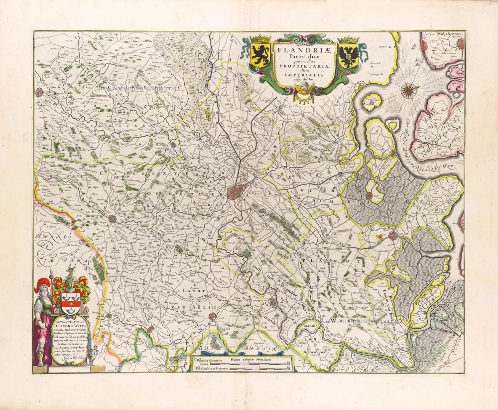
Flandriae Partes duae, quarum altera Proprietata altera Imperialis vulgo dicitur.
Currently not available
Item Number: 12603 Authenticity Guarantee
Category: Antique maps > Europe > Belgium
Old, antique map of Oost-Vlaanderen by Joan Blaeu.
Title: Flandriae Partes duae, quarum altera Proprietata altera Imperialis vulgo dicitur.
Oriented to the west.
Date of the first edition: 1634.
Date of this map: 1658-59.
Copper engraving, printed on paper.
Size (not including margins): 415 x 523mm (16.34 x 20.59 inches).
Verso: Spanish text.
Condition: Original coloured, heightened in gold, light waterstained at bottom.
Condition Rating: A.
References: Van der Krogt 2, 3215:2
References: Van der Krogt 2 - 3215:2
From: Atlas Nuevo de la Extrema Asia. 1658-59 (Van der Krogt 2, 641)
The Blaeus: Willem Janszoon, Cornelis & Joan
Willem Jansz. Blaeu and his son Joan Blaeu are the most widely known cartographic publishers of the seventeenth century.
Willem Jansz. (also written Guilielmus Janssonius) = Willem Janszoon Blaeu, was born in Uitgeest (Netherlands), near Alkmaar in 1571. He studied mathematics under Tycho Brahe and learned the theory and practice of astronomical observations and the art of instrument- and globe making.
In 1596 he came to Amsterdam where he settled down as a globe-, instrument- and map-maker. He published his first cartographic work (a globe) in 1599 and probably published his first printed map (a map of the Netherlands) in 1604. He specialized in maritime cartography and published the first edition of the pilot guide Het Licht der Zeevaert in 1608, and was appointed Hydrographer of the V.O.C. (United East India Company) in 1633. After thirty years of publishing books, wall maps, globes, charts and pilot guides, he brought out his first atlas, Atlas Appendix (1630). This was the beginning of the great tradition of atlas-making by the Blaeus.
In 1618 another mapmaker, bookseller and publisher, Johannes Janssonius established himself in Amsterdam next door to Blaeu's shop. It is no wonder that these two neighbours, who began accusing each other of copying and stealing their information, became fierce competitors who did not have a good word to say about each other. In about 1621 Willem Jansz. decided to put an end to the confusion between his name and his competitor's, and assumed his grandfather's sobriquet, 'blauwe Willem' ('blue Willem'), as the family name; thereafter he called himself Willem Jansz. Blaeu.
Willem Janszoon Blaeu died in 1638, leaving his prospering business to his sons, Cornelis and Joan. Of Cornelis we only know that his name occurs in the prefaces of books and atlases until c. 1645.
Joan Blaeu, born in Amsterdam, 1596, became partner in his father’s book trade and printing business. In 1638 he was appointed his father’s successor in the Hydrographic office of the V.O.C. His efforts culminated in the magnificent Atlas Major and the town-books of the Netherlands and of Italy – works unsurpassed in history and in modern times, which gave eternal fame to the name of the Blaeus.
On February 23, 1672, a fire ruined the business. One year later, Dr. Joan Blaeu died. The fire of 1672 and the passing away of the director gave rise to a complete sale of the stock of the Blaeu House. Five public auctions dispersed the remaining books, atlases, copperplates, globes, etc., among many other map dealers and publishers in Amsterdam. The majority was acquired by a number of booksellers acting in partnership.
In the succeeding years, the remaining printing department was left in the hands of the Blaeu family until 1695 when also the inventory of the printing house was sold at a public auction. That meant the end of the Blaeus as a printing house of world renown.
Related items
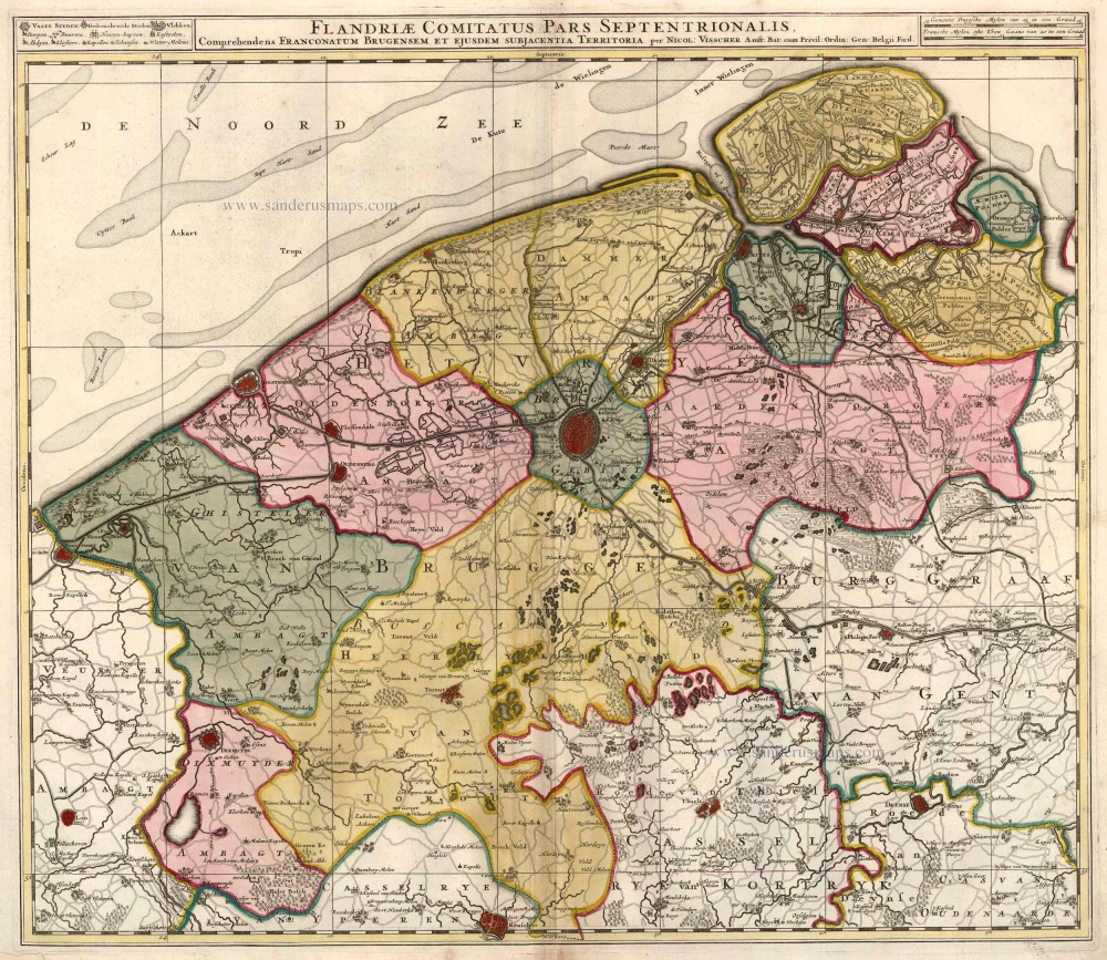
Flandriae Comitatus Pars Septentrionalis, comprehendens Franconatum Brugensem et ejusdem subjacentia Territoria. 1683-1696
Western Flanders (West Vlaanderen) by N. Visscher II.
[Item number: 13092]
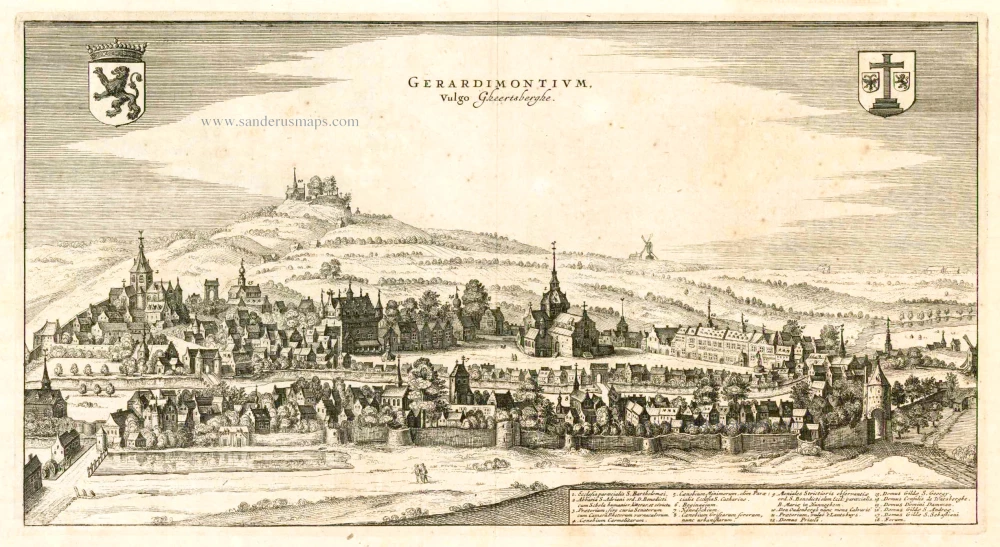
Gerardimontium Vulgo Gheertsberghe. 1641-1644
Geraardsbergen, by Antonius Sanderus.
[Item number: 25278]
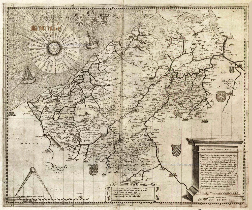
Exactissima Flandriae descriptio. Flandria, Caroli V. Aug. Imp. max. natione illustrissima, Belgice provinciae est . . . . Ad signum Bibliothecae Diui Marci. Dominicus Zenoi Venetus excidebat. Venetijs M.D.M.VIIII. 1559
Flanders (Vlaanderen) by Domenico Zenoi.
[Item number: 25774]
Pars Flandriae Orientalis; Franconatum, insulam Cadsant etc. Civitatesq. Gandavum, Brugas, Slusam, Oostendam aliasq. continens. 1641
West-Vlaanderen (East), by Henricus Hondius.
[Item number: 26320]

[No title] 1633
Vlaanderen - Brabant, by J. Janssonius - J. Hondius.
[Item number: 26355]
With 'Gravensteen'.
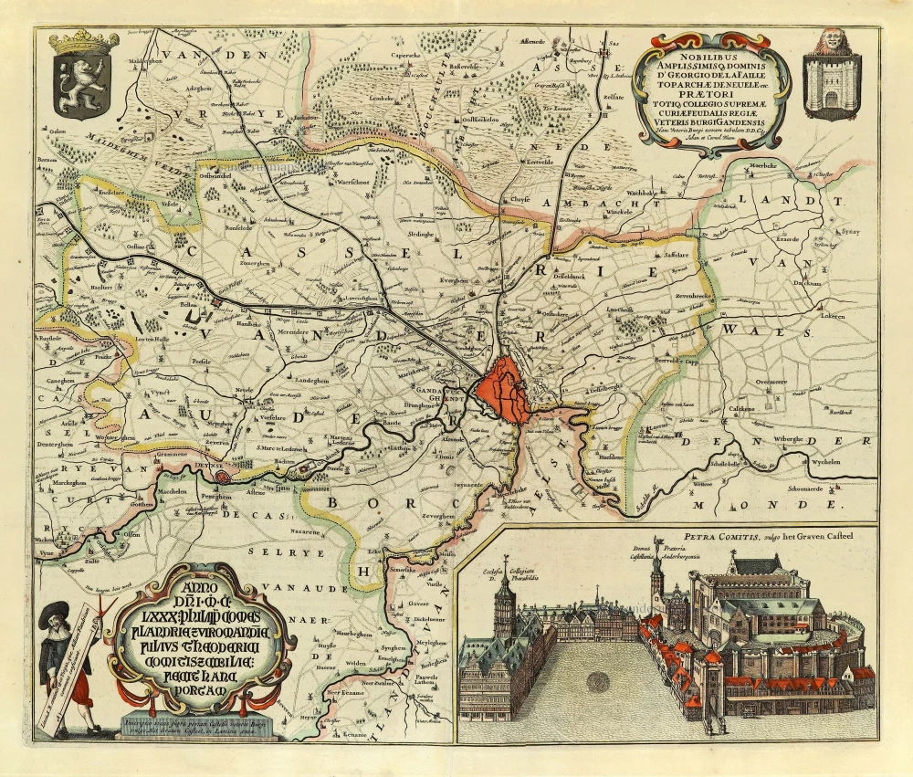
... Hanc Veteris Burgis novam tabulam ... 1662
Gent (Castellania) by Antonius Sanderus, published by Joan Blaeu.
[Item number: 28138]
First state.
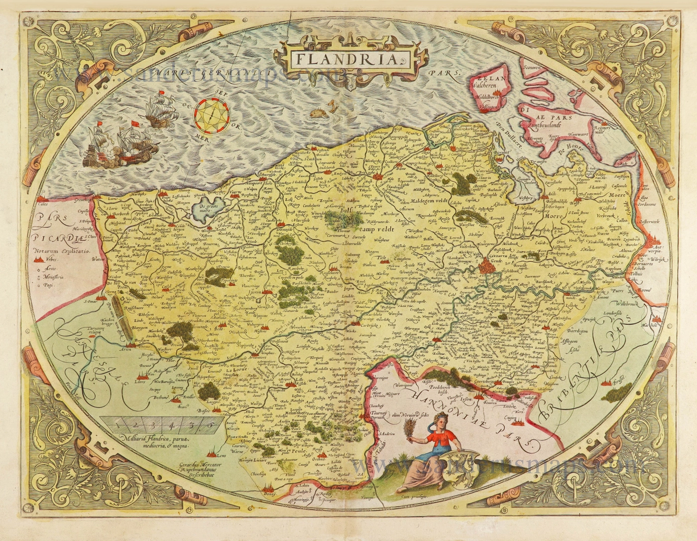
Flandria. 1575.
Flanders (Vlaanderen) by Abraham Ortelius.
[Item number: 28673]
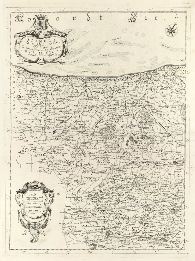
Fiandra Parte Occidentale, 1696
West Flanders, by Vincenzo Coronelli.
[Item number: 29223]
Flandriae Partes duae, quarum altera Proprietata altera Imperialis vulgo dicitur. 1643
Keizerlijk Vlaanderen of Oost Vlaanderen (Imperial Flanders or Eastern Flanders), by Willem Blaeu.
[Item number: 29935]