
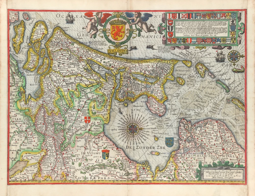
Holland by Petrus Kaerius (Pieter Van den Keere). 1617


Pieter Van den Keere (Petrus Kaerius) (1571-c.1650)
Pieter van den Keere was born in Ghent in 1571 as the son of the type-founder, Hendrik van den Keere. In 1584, he moved with his family to London for religious reasons. There, Van den Keere received training as an engraver from Jodocus Hondius, his brother-in-law. Not only the companionship with Jodocus Hondius but also the acquaintanceship with Pieter van den Berghe (Petrus Montanus), author of the text of the Germania Inferior, originates from the years of refuge in London.
Upon their settlement in Amsterdam in 1593, both Keere and Hondius embarked on a monumental project. Their collaboration resulted in the creation of a large wall map of Europe, a masterpiece that still stands as a testament to their skill and vision, dated 1595: Nova totius Europae descriptio.
In 1610, he set up a workshop in the Kalverstraat that he called ‘In den onseeckeren tijd’ (In the uncertain time). During this period, he made numerous copperplates, including maps for his Atlas of the Netherlands and the Atlas Minor published by Jodocus Hondius.
The Germania Inferior (1617) is the first original atlas of the Netherlands published in folio size. The text for the atlas, both in Dutch and in French, was written by Petrus Montanus. After 1623, Claes Jansz. Visscher bought the plates and substituted his name for Kaerius’s. In 1634, Visscher included many of these maps in his Germana Inferior.
Kaerius's fame is not only based on his atlas of the Netherlands. He is even better known as an engraver of many loose-leaf maps and as a collaborator of book publishers. His maps are found, i.e., in the Caert thresoor (Barent Langenes, 1598), Licht der Zeevaert (Blaeu, 1608), Atlas Minor (Hondius, 1628), and Caertboeck vande Midellandsche Zee (Barents, 1595).
Hollandia.
Item Number: 30257 Authenticity Guarantee
Category: Antique maps > Europe > The Netherlands
Holland by Petrus Kaerius (Pieter Van den Keere).
Title: Holland.
Hollandiae Comitatus nova et exacta delineatio ... =
Het Graefschap van Hollandt, nieuwe en[de] grundtlycke beschryvinghe ...
Amstelodami Petrus Kaerius - excudebat Anno 1617.
Oriented to the west.
Date of the first edition: 1617.
Date of this map: 1617.
Date on map: 1617.
Copper engraving, printed on paper.
Image size: 380 x 515mm (14.96 x 20.28 inches).
Sheet size: 430 x 550mm (16.93 x 21.65 inches).
Verso: Latin text.
Condition: Original coloured, side margins extended.
Condition Rating: A.
From: Petri Kaerii Germania Inferior id est, XVII provinciarum ejus novae et exactae Tabulae Geographicae, cum Luculentis Singularum descriptionibus additis. À Petro Montano. Amsterdam, 1617. (Koeman, Kee1; Van der Krogt 3, 64:01)
Pieter Van den Keere (Petrus Kaerius) (1571-c.1650)
Pieter van den Keere was born in Ghent in 1571 as the son of the type-founder, Hendrik van den Keere. In 1584, he moved with his family to London for religious reasons. There, Van den Keere received training as an engraver from Jodocus Hondius, his brother-in-law. Not only the companionship with Jodocus Hondius but also the acquaintanceship with Pieter van den Berghe (Petrus Montanus), author of the text of the Germania Inferior, originates from the years of refuge in London.
Upon their settlement in Amsterdam in 1593, both Keere and Hondius embarked on a monumental project. Their collaboration resulted in the creation of a large wall map of Europe, a masterpiece that still stands as a testament to their skill and vision, dated 1595: Nova totius Europae descriptio.
In 1610, he set up a workshop in the Kalverstraat that he called ‘In den onseeckeren tijd’ (In the uncertain time). During this period, he made numerous copperplates, including maps for his Atlas of the Netherlands and the Atlas Minor published by Jodocus Hondius.
The Germania Inferior (1617) is the first original atlas of the Netherlands published in folio size. The text for the atlas, both in Dutch and in French, was written by Petrus Montanus. After 1623, Claes Jansz. Visscher bought the plates and substituted his name for Kaerius’s. In 1634, Visscher included many of these maps in his Germana Inferior.
Kaerius's fame is not only based on his atlas of the Netherlands. He is even better known as an engraver of many loose-leaf maps and as a collaborator of book publishers. His maps are found, i.e., in the Caert thresoor (Barent Langenes, 1598), Licht der Zeevaert (Blaeu, 1608), Atlas Minor (Hondius, 1628), and Caertboeck vande Midellandsche Zee (Barents, 1595).
Related items

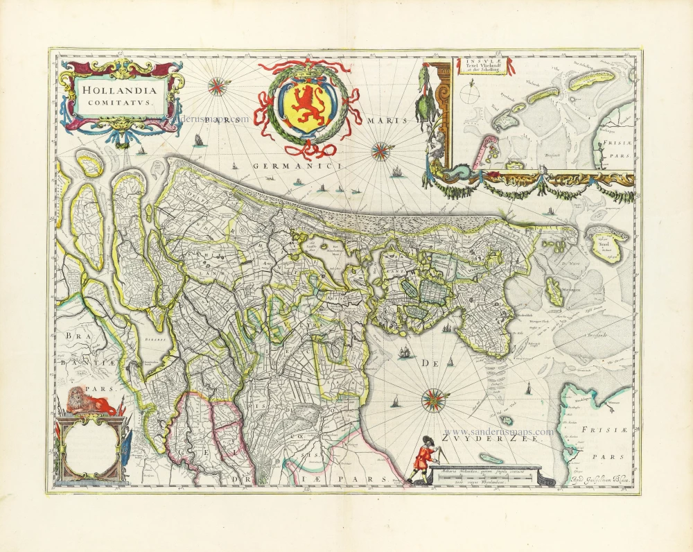
Novissima Delflandiae, Schielandiae et circumiacentium insularum ... 1644-58
Southwest Holland, by J. Janssonius
[Item number: 2848]

Rare and important map!
Hollandiae Batavor Veteris Insulae Locorum Adiacentium Exacta Descriptio. 1563
Holland, by Camocio G.F. - Forlani P.
[Item number: 9232]

De Cust van Hollandt Tusschen de Maes en Texel. 1686
Holland by Hendrick Doncker.
[Item number: 15677]

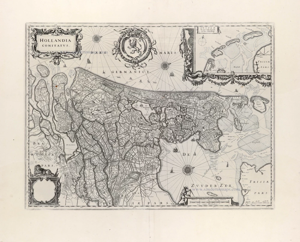
Comitatus Hollandiae novissima descriptio. 1638
Holland, by Janssonius J.
[Item number: 19020]

Cust van Hollant tusschen de Maes ende Texel 1667
Sea chart of Holland, by Pieter Goos.
[Item number: 19040]

Delflandia, Schielandia et circumjacentes Insulae ... 1680-1710
Holland, by N. Visscher
[Item number: 24417]

Kaart van 't Graafschap Holland Naauwkeurig Afgedeelt in zyne Heemraadschappen, Baljuwschappen en Waarden, 1730-45
Holland by C. Specht, published by R. & J. Ottens.
[Item number: 25706]

La Hollande. 1713
Holland by Pieter Van der Aa.
[Item number: 26059]

Hollandiae Cattorum Regionis Typus. 1588
Holland, by Lodovico Guicciardini.
[Item number: 26656]

Second printed Holland map.
Hola(n)d. 1552
Holland by Sebastian Münster.
[Item number: 27467]

Big and spectacular map
Le Comté de Hollande. c. 1705
Holland, by Pieter Mortier.
[Item number: 27807]

Comitatus Hollandiae Tabula Pluribus Locis Recens Emendata A Frederico De Wit. c. 1705
Holland, by Frederick de Wit.
[Item number: 29011]

Hollandiae Antiquorum Catthorum Sedis Nova Descriptio. 1584
Holland, by Abraham Ortelius.
[Item number: 29547]
Hollandia Comitatus. 1643
Holland by Willem Blaeu
[Item number: 30182]

Hollandiae Antiquorum Catthorum Sedis Nova Descriptio. 1603
Holland, by Abraham Ortelius.
[Item number: 31103]
Hollandia Comitatus. 1647
Holland by Willem Blaeu
[Item number: 31104]

Hollandia Septentr 1618
Holland (North) by Petrus Bertius, published by Jodocus Hondius II.
[Item number: 31587]

Hollandia Meridonal. 1618
Holland (South) by Petrus Bertius, published by Jodocus Hondius II.
[Item number: 31588]

Hollandia. 1618
Holland by Petrus Bertius, published by Jodocus Hondius II.
[Item number: 31589]

Carte de Hollande. 1633
Holland by C. Tassin.
[Item number: 31762]

Novißima Tabula Insular. Dordracensis, Alblasser, Crimper, Clundert etc: Comprehens item Territoria Vianae, Goricomii, Leerdami, Altenae, Heusdenae, ac Civitates ... 1638
Holland (Southeast), by Henricus Hondius.
[Item number: 32446]

Comitatus Hollandiae novissima descriptio. 1638
Holland by Henricus Hondius
[Item number: 32448]