
West Friesland, by Abraham Ortelius. 1598

A peacock is drawn next to the inset map, which is why this map is often called the 'Peacock map'.
The author of this map is Leo Sibrandus (c.1530-1583), born in Leeuwarden. He received his education at the Mariëndal monastery school in Lidlum and was then a monk of the abbey in Lidlum. In 1550 he was appointed as a priest at Menaldum and, from 1562, at Berlikum.
Abraham Ortelius (1527-1598)
The maker of the 'first atlas', the Theatrum Orbis Terrarum (1570), was born on 4 April 1527 into an old Antwerp family. He learned Latin and studied Greek and mathematics.
Abraham and his sisters, Anne and Elizabeth, took up map colouring. Ortelius was admitted to the Guild of St. Luke as an "illuminator of maps." In addition to colouring maps, Ortelius was a dealer in antiques, coins, maps, and books, and the book and map trade gradually became his primary occupation.
Business went well because his means allowed him to amass an extensive collection of medals, coins, and antiques, as well as a library of many volumes. In addition, he travelled extensively, visited Italy and France, made contacts with scholars and editors everywhere, and maintained extensive correspondence with them.
In 1564, he published his first map, a large and ambitious world wall map. The inspiration for this map may well have been Gastaldi's large world map. In 1565, he published a map of Egypt and a map of the Holy Land; a large map of Asia followed.
In 1568, the production of individual maps for his atlas Theatrum Orbis Terrarum was already in full swing. He completed the atlas in 1569, and in May 1570, it was available for sale. It was one of the most expensive books ever published.
This first edition contained seventy maps on fifty-three sheets. Franciscus Hogenberg engraved the maps.
Later editions included Additamenta (additions), resulting in Ortelius' historical atlas, the Parergon, which is mainly bound together with the atlas. The Parergon can be considered a truly original work by Ortelius, who drew the maps based on his research.
The importance of the Theatrum Orbis Terrarum for geographical knowledge in the last quarter of the sixteenth century is difficult to overemphasise. Nothing was like it until Mercator's atlas appeared twenty-five years later. Demand for the Theatrum was remarkable. Some 24 editions appeared during Ortelius's lifetime, and another 10 after he died in 1598. Editions were published in Dutch, German, French, Spanish, English, and Italian. The number of map sheets grew from 53 in 1570 to 167 in the last edition in 1612.
In 1577, engraver Philip Galle and poet-translator Pieter Heyns published the first pocket-sized edition of the Theatrum, the Epitome. The work was trendy. Over thirty editions of this Epitome were published in different languages.
Ortelius is also remembered for an early idea resembling continental drift: he suggested that the Americas, Europe, and Africa may once have been joined together before separating over time. His work helped shape the development of modern geography and mapmaking.
Frisia Occidentalis
Item Number: 22913 Authenticity Guarantee
Category: Antique maps > Europe > The Netherlands
Old, antique map of West Friesland, by Abraham Ortelius.
Title: Frisia Occidentalis.
Date of the first edition: 1579.
Date of this map: 1598.
Copper engraving, printed on paper.
Size (not including margins): 366 x 498mm (14.41 x 19.61 inches).
Verso: French text.
Condition: Uncoloured, excellent.
Condition Rating: A+.
From: Ortelius A. Théâtre de l'Univers. Antwerp, Plantin Press, 1598. (Van der Krogt 3, 31:351)
A peacock is drawn next to the inset map, which is why this map is often called the 'Peacock map'.
The author of this map is Leo Sibrandus (c.1530-1583), born in Leeuwarden. He received his education at the Mariëndal monastery school in Lidlum and was then a monk of the abbey in Lidlum. In 1550 he was appointed as a priest at Menaldum and, from 1562, at Berlikum.
Abraham Ortelius (1527-1598)
The maker of the 'first atlas', the Theatrum Orbis Terrarum (1570), was born on 4 April 1527 into an old Antwerp family. He learned Latin and studied Greek and mathematics.
Abraham and his sisters, Anne and Elizabeth, took up map colouring. Ortelius was admitted to the Guild of St. Luke as an "illuminator of maps." In addition to colouring maps, Ortelius was a dealer in antiques, coins, maps, and books, and the book and map trade gradually became his primary occupation.
Business went well because his means allowed him to amass an extensive collection of medals, coins, and antiques, as well as a library of many volumes. In addition, he travelled extensively, visited Italy and France, made contacts with scholars and editors everywhere, and maintained extensive correspondence with them.
In 1564, he published his first map, a large and ambitious world wall map. The inspiration for this map may well have been Gastaldi's large world map. In 1565, he published a map of Egypt and a map of the Holy Land; a large map of Asia followed.
In 1568, the production of individual maps for his atlas Theatrum Orbis Terrarum was already in full swing. He completed the atlas in 1569, and in May 1570, it was available for sale. It was one of the most expensive books ever published.
This first edition contained seventy maps on fifty-three sheets. Franciscus Hogenberg engraved the maps.
Later editions included Additamenta (additions), resulting in Ortelius' historical atlas, the Parergon, which is mainly bound together with the atlas. The Parergon can be considered a truly original work by Ortelius, who drew the maps based on his research.
The importance of the Theatrum Orbis Terrarum for geographical knowledge in the last quarter of the sixteenth century is difficult to overemphasise. Nothing was like it until Mercator's atlas appeared twenty-five years later. Demand for the Theatrum was remarkable. Some 24 editions appeared during Ortelius's lifetime, and another 10 after he died in 1598. Editions were published in Dutch, German, French, Spanish, English, and Italian. The number of map sheets grew from 53 in 1570 to 167 in the last edition in 1612.
In 1577, engraver Philip Galle and poet-translator Pieter Heyns published the first pocket-sized edition of the Theatrum, the Epitome. The work was trendy. Over thirty editions of this Epitome were published in different languages.
Ortelius is also remembered for an early idea resembling continental drift: he suggested that the Americas, Europe, and Africa may once have been joined together before separating over time. His work helped shape the development of modern geography and mapmaking.
Related items

Belgii Veteris Typus. 1624
Ancient Netherlands by Abraham Ortelius.
[Item number: 2025]

Tabula Comitatus Frisiae. Auctore B: Schotano à Sterringa. c. 1680
Friesland, by Frederik De Wit.
[Item number: 2635]

Charte von Friesland 1759-1784
Friesland by Homann Heirs.
[Item number: 13868]
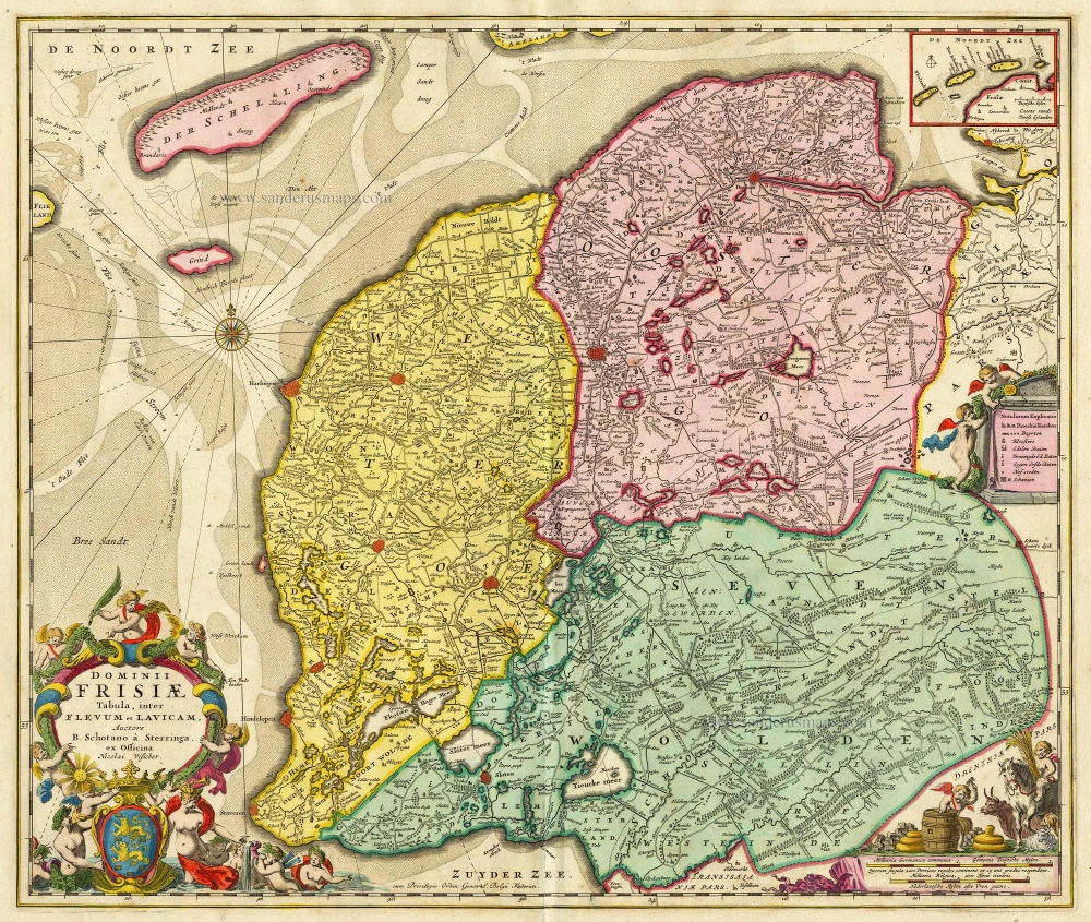
Dominii Frisiae Tabula, inter Flevum et Lavicam. c. 1678
Friesland by Nicolaas Visscher II.
[Item number: 18688]

First Christoffel Pantin edition
Descriptio Germaniae Inferioris. 1579
XVII Provinces by Abraham Ortelius.
[Item number: 21663]

Scarce map by Vrients
Limburgensis Ducatus Tabula Nova. 1612
Limburg, by Ortelius A.
[Item number: 22979]

Frisiae Dominium vernacule Friesland, Ca. 1730
Friesland, by Ottens R. & I.
[Item number: 25746]

Frisia Occidentalis. 1629-30
West-Friesland, by Henricus Hondius.
[Item number: 26357]

Nieuwe Caerte waerinne vertoont wordt de gantsche Vaert van Amsterdam over de Watten tot de stadt Hamborch toe. 1653
The Wadden Sea, by Henricus Hondius.
[Item number: 30375]

Frisia Occidentalis. c. 1630-1650
West-Friesland, by Henricus Hondius.
[Item number: 31219]

La Seigneurie d'Ouest-Frise ou Frise Occidentale, divisée en ses Trois Parties, subdivisées en leurs Iuridictions. 1692
West-Friesland by N. Sanson, so-called published by Hubert Jaillot. (Pirated edition by Pierre Mortier).
[Item number: 31376]

Carte de la Frise Occidentale. 1633
Friesland by C. Tassin.
[Item number: 31755]