
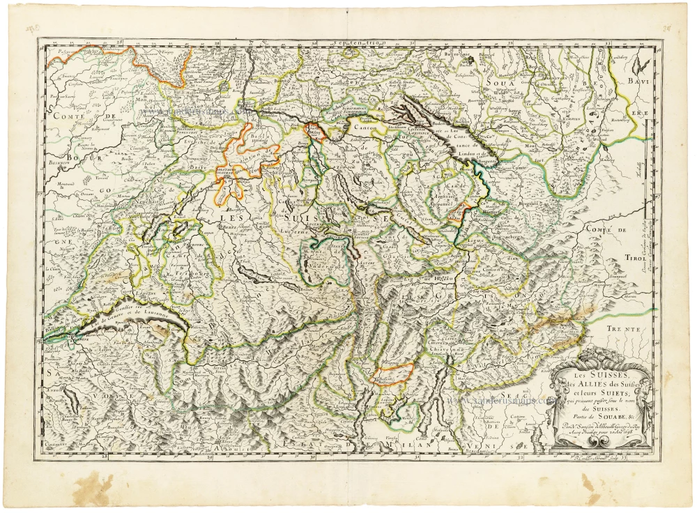
Switzerland by Nicolas Sanson. 1659
Nicolas Sanson (1600-1667) - Guillaume Sanson (1633-1703)
Originally from Abbeville, Nicolas I Sanson showed a keen interest in historical geography. Still very young, he published a map of ancient Gaul and two treatises, Britannia and Portus Itius on Abbeville and Boulogne's origins. His meeting with Melchior Tavernier was decisive: it prompted him to give up his duties as a military engineer in Picardy and devote himself to engraved cartography.
At the same time, Sanson had drawn up the outline of modern France. He got the help of Tavernier who encouraged him to compete with the Dutch map publishers. Tavernier contacted other French cartographers whose works he published.
From 1643, N. Sanson obtained a privilege to publish a work personally, the Princes souverains de l'Italie. Then, in 1644 and 1645, he had his famous geographical tables printed, which significantly contributed to his fame. He also published a series of atlases in quarto of the four continents.
In 1648, N. Sanson associated himself with Mariette for the publishing of atlases. From then on, certain maps bore his name, and others Mariette's. N. Sanson and Mariette worked together for more than 20 years. After the death of N. Sanson, Mariette acquired the entire fund. Since Mariette only wanted to publish complete atlases, individual maps were no longer sold, and some army generals complained to the king.
The disagreement between the Sanson family and Pierre II Mariette culminated in 1671 when Guillaume Sanson took the case to court. From then on, there was no longer any question of collaboration: Guillaume Sanson started working for another publisher, Alexis-Hubert Jaillot.
The Sanson family faced financial difficulties, and in 1692, their cousin, Pierre Moullart-Sanson, bought the entire geographic fund from his uncles and aunt. Moullart-Sanson restarted the publishing of Sanson's world atlas, and in 1704 he acquired a privilege for publishing all the works of Nicolas and Guillaume Sanson, which continued to be published until 1730.
Les Suisses, les Alliés des Suißes et leurs Suiets; qui peuvent paßer sous le nom des Suisses. Partie Souabe, &c.
Item Number: 33247 new Authenticity Guarantee
Category: Antique maps > Europe > The Netherlands
Switzerland by Nicolas Sanson.
Title: Les Suisses, les Alliés des Suißes et leurs Suiets; qui peuvent paßer sous le nom des Suisses. Partie Souabe, &c.
Par N. Sanson d'Abbeville Geogr. du Roy
Aveq Privilege pour 20 Ans. 1648
R Cordier Abbavil sculp.
Engraver: Robert Cordier.
Date of the first edition: 1648.
Date of this map: 1659.
Date on map: 1648.
Copper engraving, printed on paper.
Image size: 370 x 550mm (14½ x 21¾ inches).
Sheet size: 435 x 595mm (17¼ x 23½ inches).
Verso: Blank.
Condition: Original coloured in outline, excellent.
Condition Rating: A+.
From: Cartes generales de toutes les parties du monde, ou les empires, monarchies, republiques, estats, peuples,&c. le l'Asie, de l'Afrique, de l'Europe, & de l'Amerique, ... Par le Sieur d'Abbeville, A Paris, chez l'auteur, ... Et chez Pierre Mariette, M.DC.LVIII [1658]. (Pastoureau, Sanson V A 1658). (Qui doit être de 1659 car la table indique la Westphalie. - Pastoureau)
Nicolas Sanson (1600-1667) - Guillaume Sanson (1633-1703)
Originally from Abbeville, Nicolas I Sanson showed a keen interest in historical geography. Still very young, he published a map of ancient Gaul and two treatises, Britannia and Portus Itius on Abbeville and Boulogne's origins. His meeting with Melchior Tavernier was decisive: it prompted him to give up his duties as a military engineer in Picardy and devote himself to engraved cartography.
At the same time, Sanson had drawn up the outline of modern France. He got the help of Tavernier who encouraged him to compete with the Dutch map publishers. Tavernier contacted other French cartographers whose works he published.
From 1643, N. Sanson obtained a privilege to publish a work personally, the Princes souverains de l'Italie. Then, in 1644 and 1645, he had his famous geographical tables printed, which significantly contributed to his fame. He also published a series of atlases in quarto of the four continents.
In 1648, N. Sanson associated himself with Mariette for the publishing of atlases. From then on, certain maps bore his name, and others Mariette's. N. Sanson and Mariette worked together for more than 20 years. After the death of N. Sanson, Mariette acquired the entire fund. Since Mariette only wanted to publish complete atlases, individual maps were no longer sold, and some army generals complained to the king.
The disagreement between the Sanson family and Pierre II Mariette culminated in 1671 when Guillaume Sanson took the case to court. From then on, there was no longer any question of collaboration: Guillaume Sanson started working for another publisher, Alexis-Hubert Jaillot.
The Sanson family faced financial difficulties, and in 1692, their cousin, Pierre Moullart-Sanson, bought the entire geographic fund from his uncles and aunt. Moullart-Sanson restarted the publishing of Sanson's world atlas, and in 1704 he acquired a privilege for publishing all the works of Nicolas and Guillaume Sanson, which continued to be published until 1730.
Related items

Helvetiae Descriptio Aegidio Tschudo Auct. 1598
Switzerland, by Abraham Ortelius.
[Item number: 3868]
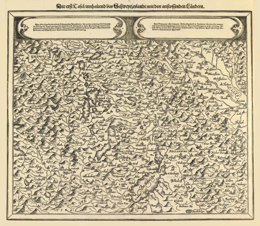
Die erst Tafel innhaltend das Schweytzerlandt mit den anstossenden Ländern. 1588
Switzerland by Sebastian Münster.
[Item number: 14631]

Helvetia Prima Rheni et V Nova Tabula. 1542
Switzerland by Sebastian Munster.
[Item number: 14925]

Helvetia Tredecim Statibus Liberis quos Cantones vocant Composita ... c. 1757.
Switzerland, by Homann Heirs.
[Item number: 22480]

Helvetiae Descriptio Aegidio Tschudo Auct. 1612
Switzerland, by Ortelius A.
[Item number: 22945]

Helvetiae Descriptio Aegidio Tschudo Auct. 1579
SWITZERLAND by Abraham Ortelius
[Item number: 23164]

Novissima et Acuratissima Helvetiae, Rhaetiae, Valesiae et Partis Sabaudiae Tabula 1756
Antique map of Switzerland by Ottens R. & J.
[Item number: 23506]

Carte de la Souverainete de Neuchatel et Vallangin ... 1721-41
Switzerland - Lake of Neuchâtel by Guillaume Delisle, published by Covens & Mortier.
[Item number: 23877]

Exactissima Helvetiae Rhaetiae, Valesiae C. terorumq Confoederatorum ut et finitimorum Populorum Regionum Tabula. c. 1695
Switzerland by Nicolaas Visscher.
[Item number: 24384]

Nova Helvetiae, Foederatarumque cum ea, nec non Subditarum Regionum Tabula ... 1730
Switzerland by Guillaume Delisle, published by Covens & Mortier.
[Item number: 25699]

La Suisse. 1713
Switzerland, by Pieter Van der Aa.
[Item number: 26174]

Helvetia cum finitimis regionibus confoederatis. 1641
Switzerland, by Henricus Hondius
[Item number: 26292]

La Suisse Divisee en ses Treize Cantons et ses Allies. 1776-79
Switzerland, by Francesco Santini.
[Item number: 26957]

Zurichgow. [Lettering in lower right quadrant.] 1628.
Northern Switzerland, by Gerard Mercator.
[Item number: 27450]

Helvetia cum finitimis regionibus confoederatis. 1623
Switzerland, by Gerard Mercator.
[Item number: 27884]

Nova Helvetiae Tabula. c. 1634
Switzerland, by Jodocus Hondius.
[Item number: 28003]

Ta . Here . Helve. [From verso] 1525
Switzerland by Lorenz Fries.
[Item number: 28199]

Helvetia Divisa in Tredicem Cantones sive Regiones, Bernam nempe Fruburgum, Solodurum, Basileam, Schafhusiam; Tigurum et Lucernam, cum foederatis Regionibus, numirum Comitatu Neoburgensi, urbe Biela, Resp. Genevensi Abbatia S. Galleni et Vallesia. c. 1702
Switzerland by Gerard & Leonard Valck.
[Item number: 28270]

Helvetiae Rhetiae & Valesiae cum omnibus finitimis regionibus Tabula Vulgo Schweitzerland. c. 1678
Switzerland by Johannes Janssonius.
[Item number: 28538]

Carte Générale des treize Cantons Suisse, et des différents Etats de leur Dépendance; ainsi que la pluspart des Etats qui leur sont voisins et aliez; avec des tables pour l'intelligence de l'Histoire. 1708
Switzerlandx, by Zacharias Châtelain.
[Item number: 29444]

La Suisse divisée en ses Treze Cantons, Ses Alliez & Ses Sujets, c. 1709
Switzerland by Hubert Jaillot, published by Pierre Mortier.
[Item number: 29566]

Helvetia cum finitimis Regionibus confoederatis. 1643
Switzerland by Willem Blaeu.
[Item number: 29928]

Very rare.
Raetiae veteris et exterae pars Orientalis, qua Comitatus Tyrolis cum Regionibus finitimis, continetur. 1616
Switzerland - Eastern Rhaetia by Matthias Hirtzgarter.
[Item number: 31190]

Zurichou. 1607
Switzerland (North) by Gerard Mercator, published by Jodocus Hondius.
[Item number: 31470]

Das Wiflispurgergou. 1607
Avenches (Switzerland) by Gerard Mercator, published by Jodocus Hondius.
[Item number: 31471]

Zurichgow. 1618
Switzerland (North) by Petrus Bertius, published by Jodocus Hondius II.
[Item number: 31581]

Helvetia. 1618
Switzerland by Petrus Bertius, published by Jodocus Hondius II.
[Item number: 31585]

L'Elvezia divisa ne suoi tredici cantoni e suoi Alleati 1779-1785
Switzerland, by Antonio Zatta.
[Item number: 31893]

Parte Occidentale dell' Elvezia Divisa ne' suoi Cantoni [and] Parte Orientale dell' Elvezia 1779-1785
Switzerland in two maps, by Antonio Zatta.
[Item number: 31894]

La Suisse. 1633
Switzerland by Christophe Tassin.
[Item number: 32007]

La Suisse divisée en ses Treze Cantons, Ses Alliez & Ses Sujets, 1692
Switzerland by Nicolas Sanson, published by Hubert Jaillot.
[Item number: 32294]

Helvetiorum Reipublicae Cantones XIII; ut et Faederata Rhaetia; Quique Iis Cocii, ac Subditi: Adkunctis una Comitatibus Vallesiae, et Neocomi/ c. 1696-1700
Switzerland, by Gerard Valk.
[Item number: 32503]

Tabula Geographica qua pars Meridionalis sive Superior Rheni, Mosae, et Mosellae, ac minores influentes Fluvii nec non mediae partes Archiepiscopatus et Electoratus Moguntini et Palatinatus Rheni, Lotharingia Helvetia Alsatia Suevia Ducatus et Comitatus Burgindiae, aliaque Galliae et Italiae c. 1695
Switzerland, Eastern France, and south-western Germany, by N. Visscher
[Item number: 32630]

Potentissimae Helvetiorum Reipublicae Cantones Tredecim cum Foederatis et Subjectis Provinciis 1712
Switzerland, by J.B. Homann.
[Item number: 33169]