
Norway, by J. Blaeu. 1662
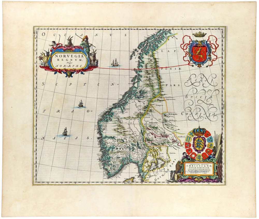
A magnificent and highly decorative map of Norway, published by Joan Blaeu in the first edition of his celebrated Atlas Maior in 1662. One of the most attractive seventeenth-century maps of the country, it combines a detailed geographical representation with exceptionally elaborate heraldic and allegorical ornamentation.
The map depicts the Kingdom of Norway, extending from its southernmost regions to the northern territories bordering Lapland. The extraordinarily intricate western coastline is carefully delineated, with its numerous fjords, islands, and coastal settlements. The mountainous interior is represented by extensive chains of pictorial mountains, while rivers, lakes, towns, and regional boundaries are shown throughout the country. The neighbouring Swedish territories are indicated to the east.
The map is particularly notable for its elaborate decorative elements. In the upper left corner, a magnificent title cartouche is surrounded by figures in traditional northern dress, wild animals, and hunting attributes, evoking Scandinavia's rugged landscape and natural environment. Among the animals depicted are a reindeer and other creatures associated with the northern regions.
In the upper right corner appears the crowned Norwegian royal coat of arms, displaying the golden lion holding an axe against a red background, surrounded by elaborate ribbons and ornamental scrollwork.
The lower right corner contains an exceptionally rich heraldic composition incorporating the royal arms of Denmark and Norway and the arms of associated territories. Beneath this arrangement is a dedication to King Christian IV of Denmark and Norway, who had died in 1648, before the publication of the map. The dedication therefore reflects an earlier stage in the map's preparation or the cartographic material on which it was based.
The surrounding seas are embellished with finely engraved sailing vessels, while the large, elegantly intertwined lettering identifying the Swedish territories adds to the map's decorative character.
Although published in 1662, the geographical representation reflects the cartographic knowledge accumulated during the first half of the seventeenth century. The complex Norwegian coastline, particularly its innumerable fjords and islands, presented considerable challenges to early modern cartographers. Blaeu's map represents an important stage in the development of the printed cartography of Norway, combining contemporary geographical information with the artistic refinement characteristic of the great Dutch atlas publishers.
An exceptionally attractive example of Dutch Golden Age cartography, distinguished by its impressive heraldic ornamentation, finely engraved Norwegian coastline, and beautiful hand-colouring. The map is an outstanding example of the combination of geographical scholarship, political symbolism, and artistic craftsmanship that characterises Joan Blaeu's celebrated Atlas Maior.
The Blaeus: Willem Janszoon, Cornelis & Joan
Willem Jansz. Blaeu and his son Joan Blaeu are the most widely known cartographic publishers of the seventeenth century.
Willem Jansz. (also written Guilielmus Janssonius) = Willem Janszoon Blaeu, was born in Uitgeest (Netherlands), near Alkmaar in 1571. He studied mathematics under Tycho Brahe and learned the theory and practice of astronomical observations and the art of instrument- and globe making.
In 1596 he came to Amsterdam where he settled down as a globe-, instrument- and map-maker. He published his first cartographic work (a globe) in 1599 and probably published his first printed map (a map of the Netherlands) in 1604. He specialized in maritime cartography and published the first edition of the pilot guide Het Licht der Zeevaert in 1608, and was appointed Hydrographer of the V.O.C. (United East India Company) in 1633. After thirty years of publishing books, wall maps, globes, charts and pilot guides, he brought out his first atlas, Atlas Appendix (1630). This was the beginning of the great tradition of atlas-making by the Blaeus.
In 1618 another mapmaker, bookseller and publisher, Johannes Janssonius established himself in Amsterdam next door to Blaeu's shop. It is no wonder that these two neighbours, who began accusing each other of copying and stealing their information, became fierce competitors who did not have a good word to say about each other. In about 1621 Willem Jansz. decided to put an end to the confusion between his name and his competitor's, and assumed his grandfather's sobriquet, 'blauwe Willem' ('blue Willem'), as the family name; thereafter he called himself Willem Jansz. Blaeu.
Willem Janszoon Blaeu died in 1638, leaving his prospering business to his sons, Cornelis and Joan. Of Cornelis we only know that his name occurs in the prefaces of books and atlases until c. 1645.
Joan Blaeu, born in Amsterdam, 1596, became partner in his father’s book trade and printing business. In 1638 he was appointed his father’s successor in the Hydrographic office of the V.O.C. His efforts culminated in the magnificent Atlas Major and the town-books of the Netherlands and of Italy – works unsurpassed in history and in modern times, which gave eternal fame to the name of the Blaeus.
On February 23, 1672, a fire ruined the business. One year later, Dr. Joan Blaeu died. The fire of 1672 and the passing away of the director gave rise to a complete sale of the stock of the Blaeu House. Five public auctions dispersed the remaining books, atlases, copperplates, globes, etc., among many other map dealers and publishers in Amsterdam. The majority was acquired by a number of booksellers acting in partnership.
In the succeeding years, the remaining printing department was left in the hands of the Blaeu family until 1695 when also the inventory of the printing house was sold at a public auction. That meant the end of the Blaeus as a printing house of world renown.
Norvegia Regnum, Vulgo Nor-Ryke.
Item Number: 33416 new Authenticity Guarantee
Category: Antique maps > Europe > Northern Europe
Norway, by J. Blaeu.
Title: Norvegia Regnum, Vulgo Nor-Ryke.
Dedicated to Christian King of Denmark, Norway etc. by Joan Blaeu.
Date of the first edition: 1662.
Date of this map: 1662.
Copper engraving, printed on paper.
Image size: 410 x 495mm (16¼ x 19½ inches).
Sheet size: 560 x 655mm (22 x 25¾ inches).
Verso: Latin text.
Condition: Hand-coloured, excellent.
Condition Rating: A+.
From: Atlas Maior, Sive Cosmographia Blaviana, Qua Solum, Salum, Coelum, Accuratissime Describuntur. Amsterdam, J. Blaeu, 1662-65. (Van der Krogt 2, 601-3)
A magnificent and highly decorative map of Norway, published by Joan Blaeu in the first edition of his celebrated Atlas Maior in 1662. One of the most attractive seventeenth-century maps of the country, it combines a detailed geographical representation with exceptionally elaborate heraldic and allegorical ornamentation.
The map depicts the Kingdom of Norway, extending from its southernmost regions to the northern territories bordering Lapland. The extraordinarily intricate western coastline is carefully delineated, with its numerous fjords, islands, and coastal settlements. The mountainous interior is represented by extensive chains of pictorial mountains, while rivers, lakes, towns, and regional boundaries are shown throughout the country. The neighbouring Swedish territories are indicated to the east.
The map is particularly notable for its elaborate decorative elements. In the upper left corner, a magnificent title cartouche is surrounded by figures in traditional northern dress, wild animals, and hunting attributes, evoking Scandinavia's rugged landscape and natural environment. Among the animals depicted are a reindeer and other creatures associated with the northern regions.
In the upper right corner appears the crowned Norwegian royal coat of arms, displaying the golden lion holding an axe against a red background, surrounded by elaborate ribbons and ornamental scrollwork.
The lower right corner contains an exceptionally rich heraldic composition incorporating the royal arms of Denmark and Norway and the arms of associated territories. Beneath this arrangement is a dedication to King Christian IV of Denmark and Norway, who had died in 1648, before the publication of the map. The dedication therefore reflects an earlier stage in the map's preparation or the cartographic material on which it was based.
The surrounding seas are embellished with finely engraved sailing vessels, while the large, elegantly intertwined lettering identifying the Swedish territories adds to the map's decorative character.
Although published in 1662, the geographical representation reflects the cartographic knowledge accumulated during the first half of the seventeenth century. The complex Norwegian coastline, particularly its innumerable fjords and islands, presented considerable challenges to early modern cartographers. Blaeu's map represents an important stage in the development of the printed cartography of Norway, combining contemporary geographical information with the artistic refinement characteristic of the great Dutch atlas publishers.
An exceptionally attractive example of Dutch Golden Age cartography, distinguished by its impressive heraldic ornamentation, finely engraved Norwegian coastline, and beautiful hand-colouring. The map is an outstanding example of the combination of geographical scholarship, political symbolism, and artistic craftsmanship that characterises Joan Blaeu's celebrated Atlas Maior.
The Blaeus: Willem Janszoon, Cornelis & Joan
Willem Jansz. Blaeu and his son Joan Blaeu are the most widely known cartographic publishers of the seventeenth century.
Willem Jansz. (also written Guilielmus Janssonius) = Willem Janszoon Blaeu, was born in Uitgeest (Netherlands), near Alkmaar in 1571. He studied mathematics under Tycho Brahe and learned the theory and practice of astronomical observations and the art of instrument- and globe making.
In 1596 he came to Amsterdam where he settled down as a globe-, instrument- and map-maker. He published his first cartographic work (a globe) in 1599 and probably published his first printed map (a map of the Netherlands) in 1604. He specialized in maritime cartography and published the first edition of the pilot guide Het Licht der Zeevaert in 1608, and was appointed Hydrographer of the V.O.C. (United East India Company) in 1633. After thirty years of publishing books, wall maps, globes, charts and pilot guides, he brought out his first atlas, Atlas Appendix (1630). This was the beginning of the great tradition of atlas-making by the Blaeus.
In 1618 another mapmaker, bookseller and publisher, Johannes Janssonius established himself in Amsterdam next door to Blaeu's shop. It is no wonder that these two neighbours, who began accusing each other of copying and stealing their information, became fierce competitors who did not have a good word to say about each other. In about 1621 Willem Jansz. decided to put an end to the confusion between his name and his competitor's, and assumed his grandfather's sobriquet, 'blauwe Willem' ('blue Willem'), as the family name; thereafter he called himself Willem Jansz. Blaeu.
Willem Janszoon Blaeu died in 1638, leaving his prospering business to his sons, Cornelis and Joan. Of Cornelis we only know that his name occurs in the prefaces of books and atlases until c. 1645.
Joan Blaeu, born in Amsterdam, 1596, became partner in his father’s book trade and printing business. In 1638 he was appointed his father’s successor in the Hydrographic office of the V.O.C. His efforts culminated in the magnificent Atlas Major and the town-books of the Netherlands and of Italy – works unsurpassed in history and in modern times, which gave eternal fame to the name of the Blaeus.
On February 23, 1672, a fire ruined the business. One year later, Dr. Joan Blaeu died. The fire of 1672 and the passing away of the director gave rise to a complete sale of the stock of the Blaeu House. Five public auctions dispersed the remaining books, atlases, copperplates, globes, etc., among many other map dealers and publishers in Amsterdam. The majority was acquired by a number of booksellers acting in partnership.
In the succeeding years, the remaining printing department was left in the hands of the Blaeu family until 1695 when also the inventory of the printing house was sold at a public auction. That meant the end of the Blaeus as a printing house of world renown.
Related items

De Custen van Noorwegen en Laplandt, vande Noord-kyn tot aende Rivier van Kola. 1686
Sea chart of the coast of Norway, by Doncker H.
[Item number: 12920]

De Custen van Noorwegen tusschen Der Neus en Schuitenes. 1686
Sea chart of Norway, by Doncker H.
[Item number: 15775]

De Cust van Noorwegen vertoonende van Bergen tot aen de hoek van Horrel. 1686
Norway, by Doncker H.
[Item number: 17064]

De Zee-kusten van Finmarcken tusschen Dronten en Sanien. 1686
Sea chart of Norway - Finnmark, by Doncker H.
[Item number: 17630]

Caarte van Finmargken van 't Eylandt Sanien tot Noordkyn. 1686
Sea chart of Norway - Finnmark, by Doncker H.
[Item number: 17900]

Norvegia Regnum Divisum in suos Dioeceses Nidrosiensem, Bergensem, Opsloensem, et Stavangriensem et Praefecturam Bahusiae ... c. 1730
Norway by F. de Wit - R. & J. Ottens.
[Item number: 23499]

Episcopatus Bergensis 1680
Norway - Bergen, by J. Janssonius, published by Moses Pitt and J. Janssonius-Waesberge.
[Item number: 25068]

Dioecesis Stavangriensis, & partes aliquot vicinae, opera L. Scavenii, S.S. 1643-50
Norway - Stavanger, by Willem & Joan Blaeu.
[Item number: 27100]

Regni Norvegia Nova Tabula in Quinque Praefecturas Generalis Aggerhusiensem, Bergensem, Nidrosiensem, Warhusiae, et Bahusiae. c. 1715
Norway by Frederik de Wit, published by Covens & Mortier.
[Item number: 28266]
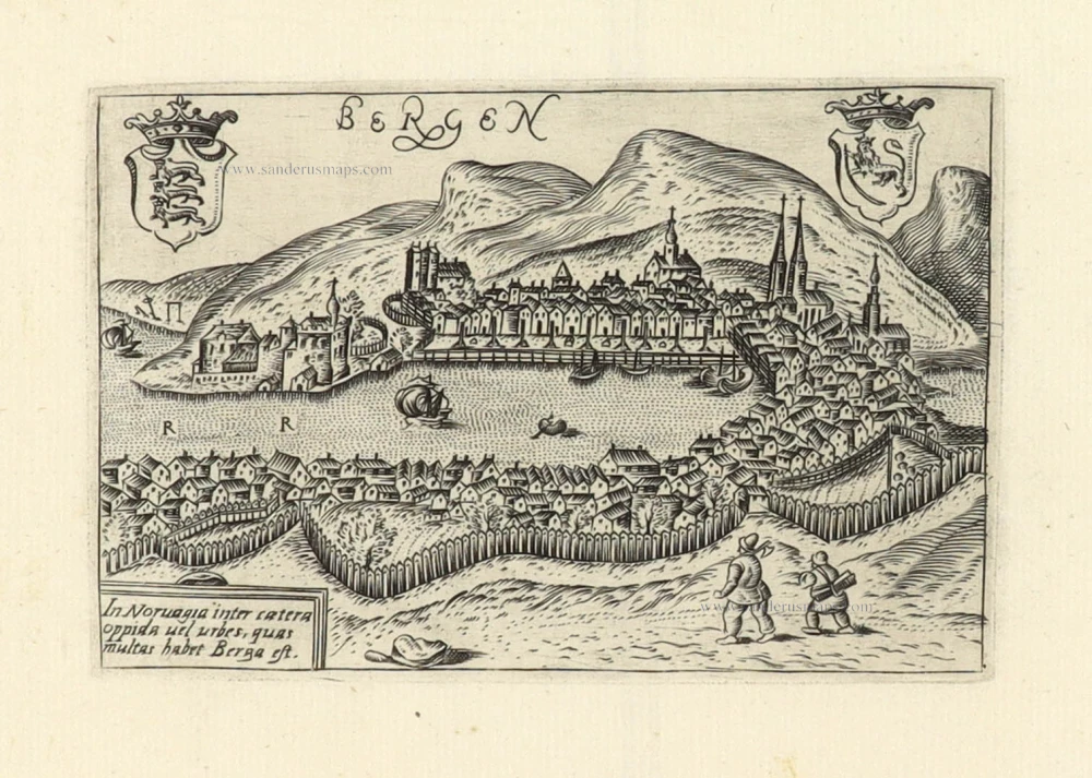
Rare and early view
Bergen. ca. 1580
Bergen (Norway), by Francesco Valegio.
[Item number: 29423]
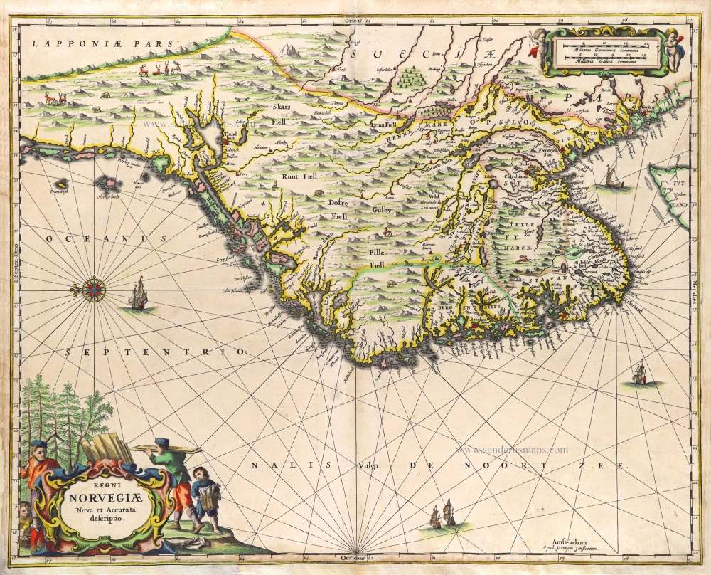
Regni Norvegiae. 1666
Norway by Joannes Janssonius.
[Item number: 29724]

Episcopatus Stavangriae Pars Borealis. 1659
Northern Stavanger (Norway) by Joan Blaeu.
[Item number: 30209]

Dioecesis Bergensis Tabula 1659
Bergen (Norway) by Joan Blaeu.
[Item number: 30211]
Rare
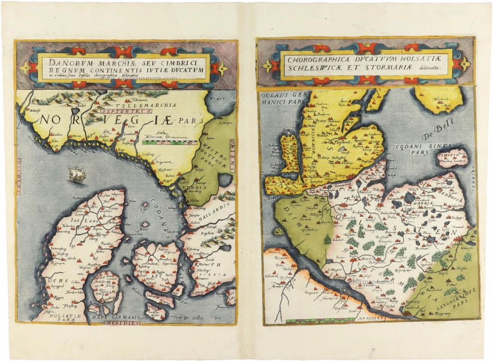
Danorum Marchiae seu Cimbrici Regnum Continentis Iutiae Ducatum [on sheet with] Chorographica Ducatum Holstatiae Schleswicae et Stormariae 1593
Norway - Denmark by Gerard de Jode
[Item number: 30947]
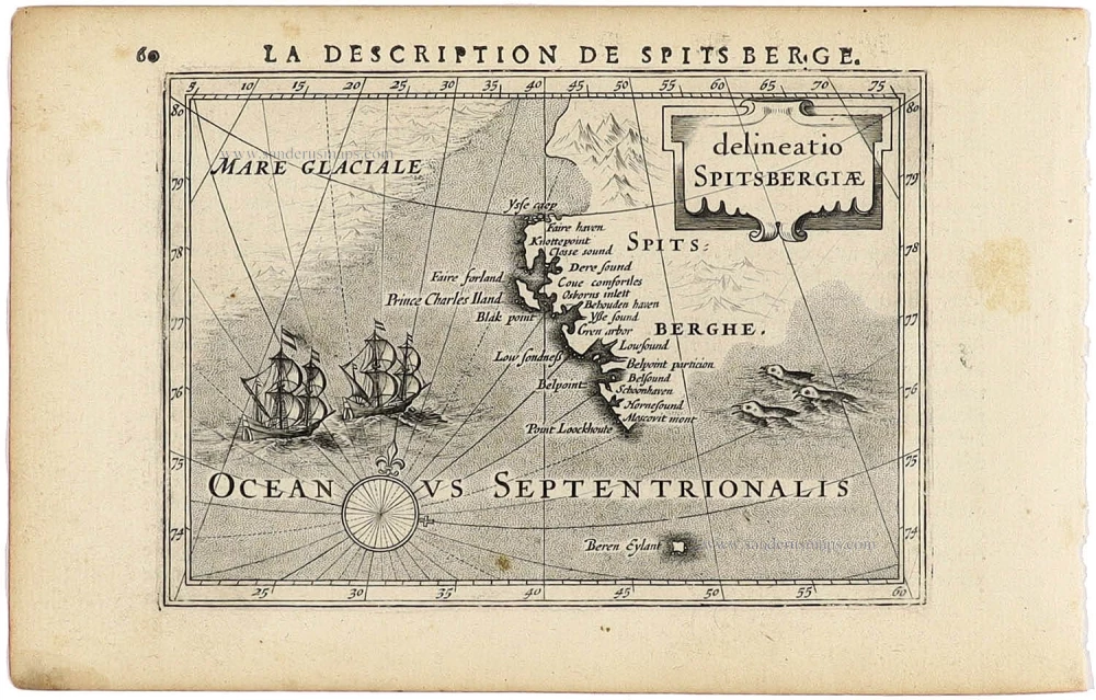
delineatio Spitsbergiae. 1618
Spitsbergen - Norway (Svalbard) by Petrus Bertius, published by Jodocus Hondius II.
[Item number: 31522]

La Norvegia divisa nelle sue Provincie 1779-1785
Norway, by Antonio Zatta.
[Item number: 31892]

Das Konigreich Norwegen. 1789
Norway by F. Reilly.
[Item number: 32186]

Norvegia Regnum Divisum in suos Dioeceses Nidrosiensem, Bergensem, Opsloensem, et Stavangriensem et Praefecturam Bahusiae ... 1689-90
Norway by F. de Wit
[Item number: 33211]