
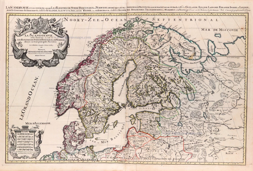
Scandinavia, by Homann J.B. c. 1720
The Homann Family: Masters of German Cartography and Publishing
The Homann family stands as one of the most significant names in the history of German cartography and publishing. Their maps, atlases, and geographic works not only shaped contemporary understanding of the world during the 18th century but also left an enduring legacy in the fields of geography, engraving, and scholarly publishing.
The family's prominence began with Johann Baptist Homann (1664–1724), a native of Oberkammlach in Bavaria. Initially trained in law and theology, Johann Baptist later turned to engraving and cartography — a field that was flourishing amid the Age of Discovery and the growing demand for precise geographic knowledge.
In 1702, he founded his own publishing house in Nürnberg, a city then renowned for its vibrant intellectual, artistic, and scientific community. Nuremberg’s rich tradition of printmaking and map production provided fertile ground for Homann's enterprise.
Johann Baptist Homann quickly rose to prominence as one of Germany’s leading cartographers and publishers. His works combined technical accuracy, artistic merit, and rich ornamentation, often embellished with elaborate cartouches, mythological scenes, and heraldic symbols.
In 1715, Homann was appointed Imperial Geographer to the Holy Roman Emperor Charles VI. He obtained the "Imperial Privilege" (Privilegium Imperialis). This prestigious title solidified his status and bestowed upon his publishing house both credibility and influence. His most famous works include:
- Atlas Novus Terrarum Orbis (1707) — an early and ambitious atlas project.
- Grosser Atlas über die ganze Welt (1716) — one of the most crucial German world atlases of the early 18th century.
Homann’s maps covered both European and global territories, including the Americas, Asia, and Africa, reflecting contemporary geographical knowledge and political boundaries.
The Homann Heirs (Homannische Erben)
After Johann Baptist Homann died in 1724, his son Johann Christoph Homann (1703–1730) briefly took over the business. However, Johann Christoph died at a young age, and the enterprise was then continued under the name Homännische Erben ("Homann Heirs"), a partnership of family members and associates.
Despite the loss of its founder, the firm remained highly productive and influential for several decades. The Homann Heirs continued to publish atlases, wall maps, city views, and geographical treatises well into the late 18th century. Their catalogue included works by noted cartographers such as Johann Matthias Hase, Leonhard Euler, and Tobias Conrad Lotter.
The Homann publishing house played a crucial role in disseminating geographic and scientific knowledge during the Enlightenment. Their maps combined artistry with empirical detail and were sought after by scholars, navigators, governments, and collectors.
Several of their works are now prized as valuable historical artefacts, housed in museums, libraries, and private collections around the world. The Homann Heirs' firm gradually declined by the end of the 18th century, overtaken by newer publishing houses and changing technologies, but their contribution to the cartographic tradition remains significant.
The Homann family’s name is indelibly linked to the golden age of German cartography. Through meticulous craftsmanship and a keen sense of visual storytelling, they charted the known world of their time, leaving a remarkable record of early modern geography. Today, their maps not only inform historians of cartography but also captivate collectors and enthusiasts for their aesthetic beauty and historical value.
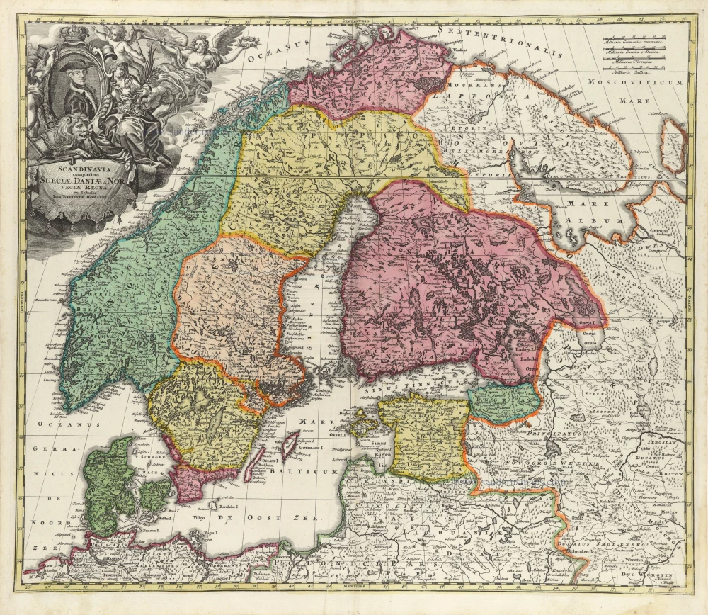
Scandinavia complectens Sueciae, Daniae, & Norvegiae Regna.
Item Number: 32203 Authenticity Guarantee
Category: Antique maps > Europe > Northern Europe
Scandinavia, by Homann J.B.
Title: Scandinavia complectens Sueciae, Daniae, & Norvegiae Regna.
ex Tabulis Ioh. Baptistae Homanni.
Date of the first edition: 1707.
Date of this map: c. 1720.
Copper engraving, printed on paper.
Image size: 485 x 570mm (19 x 22½ inches).
Sheet size: 520 x 590mm (20½ x 23¼ inches).
Verso: Blank.
Condition: Original coloured, sharp impression, excellent.
Condition Rating: A+.
From: Atlas Novus Terrarum Orbis Imperia, regna et status exactis tabulis geographice demonstrans. Nuremberg, J.B. Homann, [c. 1720].
With Portrait of King Charles XII of Sweden.
The Homann Family: Masters of German Cartography and Publishing
The Homann family stands as one of the most significant names in the history of German cartography and publishing. Their maps, atlases, and geographic works not only shaped contemporary understanding of the world during the 18th century but also left an enduring legacy in the fields of geography, engraving, and scholarly publishing.
The family's prominence began with Johann Baptist Homann (1664–1724), a native of Oberkammlach in Bavaria. Initially trained in law and theology, Johann Baptist later turned to engraving and cartography — a field that was flourishing amid the Age of Discovery and the growing demand for precise geographic knowledge.
In 1702, he founded his own publishing house in Nürnberg, a city then renowned for its vibrant intellectual, artistic, and scientific community. Nuremberg’s rich tradition of printmaking and map production provided fertile ground for Homann's enterprise.
Johann Baptist Homann quickly rose to prominence as one of Germany’s leading cartographers and publishers. His works combined technical accuracy, artistic merit, and rich ornamentation, often embellished with elaborate cartouches, mythological scenes, and heraldic symbols.
In 1715, Homann was appointed Imperial Geographer to the Holy Roman Emperor Charles VI. He obtained the "Imperial Privilege" (Privilegium Imperialis). This prestigious title solidified his status and bestowed upon his publishing house both credibility and influence. His most famous works include:
- Atlas Novus Terrarum Orbis (1707) — an early and ambitious atlas project.
- Grosser Atlas über die ganze Welt (1716) — one of the most crucial German world atlases of the early 18th century.
Homann’s maps covered both European and global territories, including the Americas, Asia, and Africa, reflecting contemporary geographical knowledge and political boundaries.
The Homann Heirs (Homannische Erben)
After Johann Baptist Homann died in 1724, his son Johann Christoph Homann (1703–1730) briefly took over the business. However, Johann Christoph died at a young age, and the enterprise was then continued under the name Homännische Erben ("Homann Heirs"), a partnership of family members and associates.
Despite the loss of its founder, the firm remained highly productive and influential for several decades. The Homann Heirs continued to publish atlases, wall maps, city views, and geographical treatises well into the late 18th century. Their catalogue included works by noted cartographers such as Johann Matthias Hase, Leonhard Euler, and Tobias Conrad Lotter.
The Homann publishing house played a crucial role in disseminating geographic and scientific knowledge during the Enlightenment. Their maps combined artistry with empirical detail and were sought after by scholars, navigators, governments, and collectors.
Several of their works are now prized as valuable historical artefacts, housed in museums, libraries, and private collections around the world. The Homann Heirs' firm gradually declined by the end of the 18th century, overtaken by newer publishing houses and changing technologies, but their contribution to the cartographic tradition remains significant.
The Homann family’s name is indelibly linked to the golden age of German cartography. Through meticulous craftsmanship and a keen sense of visual storytelling, they charted the known world of their time, leaving a remarkable record of early modern geography. Today, their maps not only inform historians of cartography but also captivate collectors and enthusiasts for their aesthetic beauty and historical value.
Related items
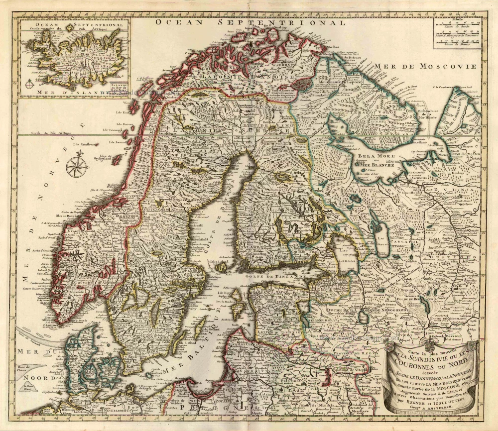
Carte la Plus Nouvelle de la Scandinivie ou les Couronnes du Nord Scavoir La Suede le Dannemarc et La Norvege Ou Lon Trouve La Mer Baltique et une Grande Partie de la Moscovie etc. 1730-45
Scandinavia par R. & I. Ottens.
[Item number: 25858]
Rare and important map.
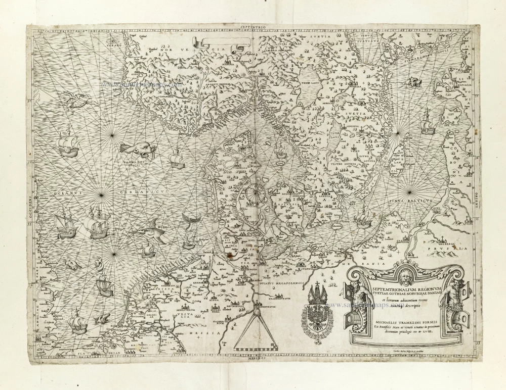
Septemtrionalium Regionum Svetiae Gothiae Norvegiae Daniae et terrarum adiacentium recens exactaq[ue] descriptio. 1558
Scandinavia, by Michele Tramezini.
[Item number: 27045]
Early edition with Durer's woodcut panels on verso.
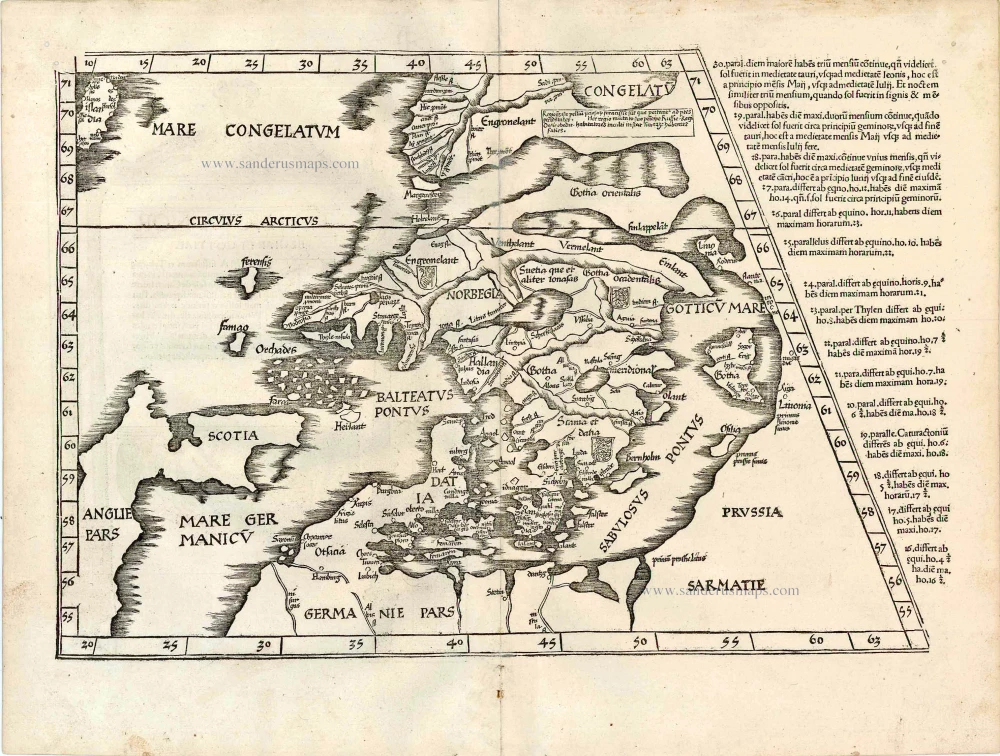
[No title - on verso:] Tab. Nova Norbegiae et Gottiae 1525
Ptolemy map of Scandinavia by Lorenz Fries, after Matin Waldseemüller.
[Item number: 27930]
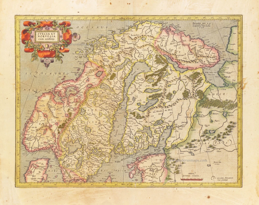
Svecia et Norvegia cum confinijs. 1628
Scandinavia, by Gerard Mercator.
[Item number: 28815]
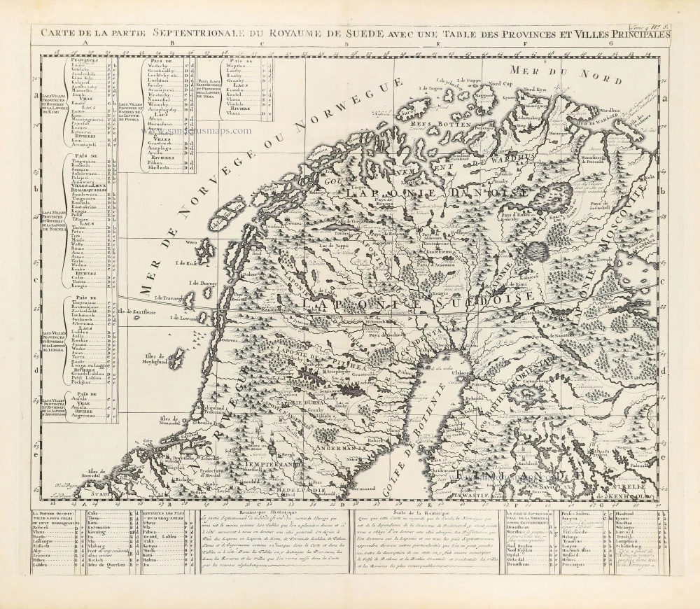
Carte de la Partie Septentrionale du Royaume de Suède avec une Table des Provinces et Villes Principales. 1714
Northern Scandinavia by Zacharias Châtelain.
[Item number: 29412]

Carte de la Partie Meridionale du Royaume de Suède avec une Table des Provinces et Villes Principales. 1714
Southern Scandinavia by Zacharias Châtelain.
[Item number: 29413]

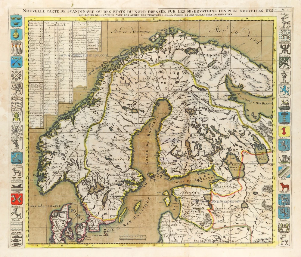
Nouvelle Carte de Scandinavie ou des Etats du Nord Dressée sur les observations les plus nouvelles des meilleurs Géographes avec les Armes des Provinces de la Suède et des Tables tres instructives. 1714
Scandinavia, by Zacharias Châtelain.
[Item number: 29499]
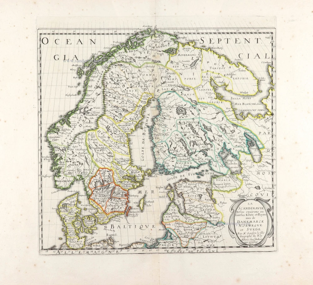
La Scandinavie et les environs ou sont les Estats et Royaumes de Danemarck Norwegue et Suede. 1652
Scandinavia by Nicolas Sanson.
[Item number: 29607]
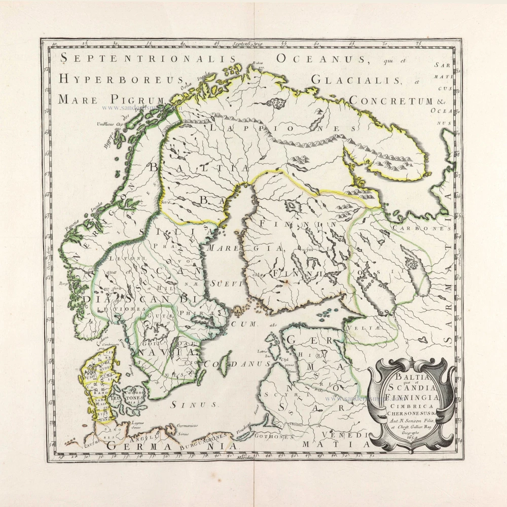
Baltia, quae et Scandia, Cimbrica Chersonesus &c. 1654-58
Scandinavia by Nicolas Sanson.
[Item number: 29608]
First edition.
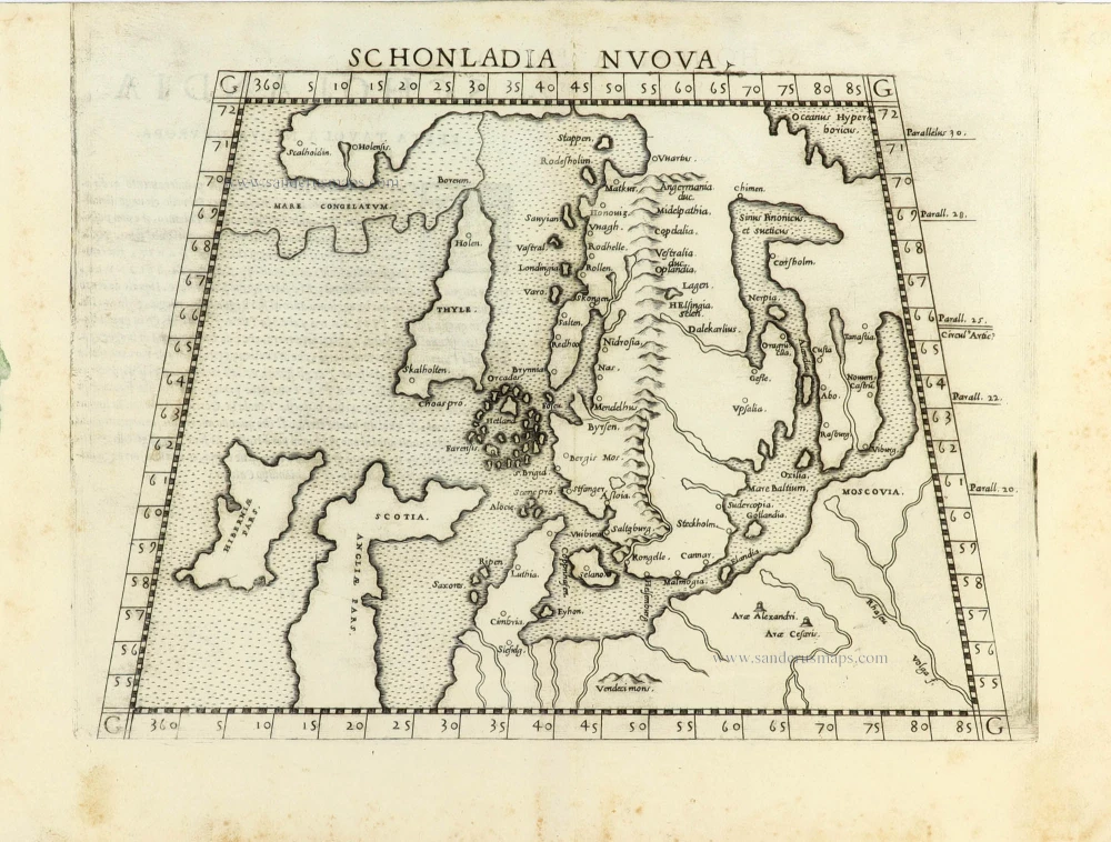
Schonladia Nuova. 1561
Scandinavia by Girolamo Ruscelli.
[Item number: 31087]
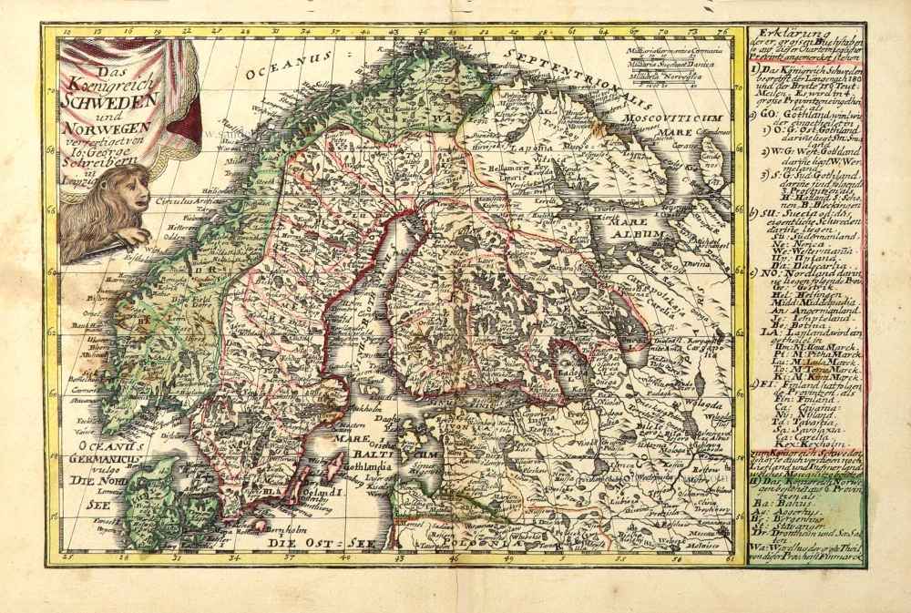
Das Koenigreich Schweden und Norwegen. c. 1745.
Scandinavia by J.G. Schreiber.
[Item number: 31108]
La Scandinavie, et les Environs, ou sont les Royaumes de Suede de Danemarck, et de Norwege. divisés en leurs principales Provinces. 1692
Scandinavia by N. Sanson, so-called published by Hubert Jaillot. (Pirated edition by Pierre Mortier).
[Item number: 31170]
In rare original colour
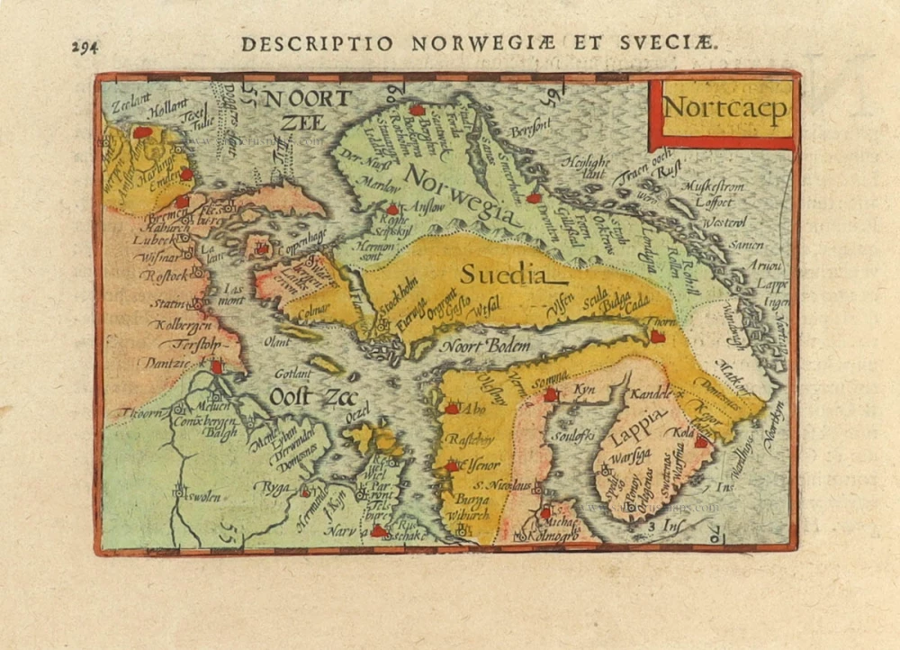
Nortcaep 1602
Scandinavia by Barent Langenes, published by Petrus Bertius.
[Item number: 31204]
In rare original colour
Nouvelle Carte de Scandinavie ou des Etats du Nord Dressée sur les observations les plus nouvelles des meilleurs Géographes avec les Armes des Provinces de la Suède et des Tables tres instructives. 1714
Scandinavia, by Zacharias Châtelain.
[Item number: 31424]

Suecia et Norvegia ect. 1618
Scandinavia by Petrus Bertius, published by Jodocus Hondius II.
[Item number: 31631]
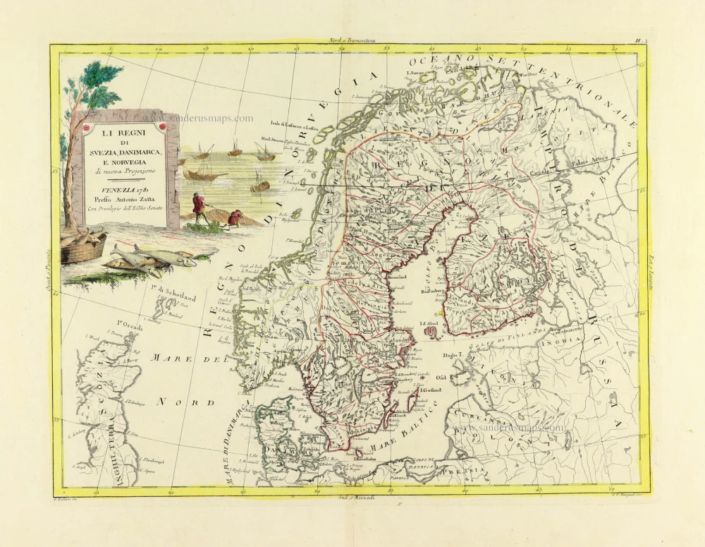
Li Regni di Svezia, Danimarca, e Norvegia. 1779-1785
Scandinavia, by Antonio Zatta.
[Item number: 31812]
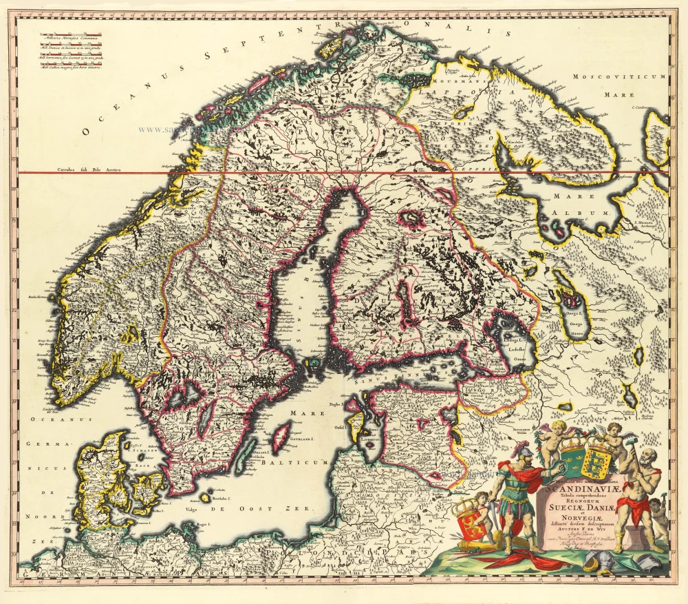
Novissima nec non Perfectissima Scandinaviae Tabula Comprehendens Regnorum Sueciae, Daniae et Novegiae. 1689-1691
Scandinavia by Frederick de Wit.
[Item number: 32208]
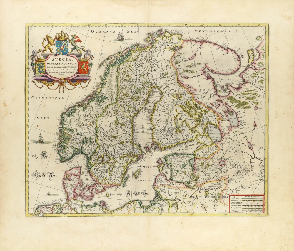
Suecia, Dania et Norvegia, Regna Europae Septentrionalia. 1659
Scandinavia by Joan Blaeu.
[Item number: 32423]

Scarce
Accuratissima Regnorum et Norvegiae, Tabula. c. 1680
Scandinavia by Justus Danckerts
[Item number: 32613]

La Scandinavia Divisa nelli suoi Regni di Suezia, Danimarca, Norvegia, e Paese de Lapponi, 1678
Scandinavia by Nicolas Sanson, published by Giovanni de Rossi.
[Item number: 32900]