
Important map of the Island of Hven
Ven by Braun & Hogenberg 1617


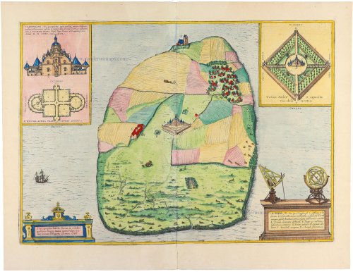
It depicts the Island of Hven, where Tycho Brahe's observatory, Uraniborg, is oriented westward.
TRANSLATION OF CAPTION TOP LEFT: The castle of Urania, equipped with a significant number and variety of accurately made astronomical instruments, was built in honour and for the renewal of that noble science by Tycho Brahe, the famous Dane, lord of Knudsdrup, around 1580.
CARTOUCHE BOTTOM LEFT: Topography of the Island of Hven in the famous strait in the kingdom of Denmark, which in the vernacular is called Øresund and drawn in Cologne in 1586.
COMMENTARY BY BRAUN: "This is the description of the Island of Hven, situated in the famous strait in the Kingdom of Denmark, called the Øresund. There is a castle called Uraniborg, which contains many ingenious astronomical instruments. It was built by Tycho Brahe, a Danish nobleman, to honour and renew the above-mentioned noble art of astronomy. ... Despite its small size, no part is useless or unfruitful, for it produces grain, has a surplus of cattle, chamois, hares, wrens and partridges in great numbers. Above all, it is in a perfect situation for catching fish."
The observer of the map of Denmark and the view of the Øresund has, as it were, approached the Earth from space and has now reached his goal: the Island of Hven, from where the astronomer Tycho Brahe explored the broad expanse of the universe and made pioneering discoveries. The plate shows Uraniborg, the most famous astronomical observatory of its time. It was built by Tycho Brahe, to whom the island was given as a fief by the Danish king in 1576, and who added a second observatory with underground observation rooms in 1584. Among other things, we can see Uraniborg itself (B), the workshop and house of the craftsmen who made the astronomical instruments (C) and the position of the underground observatory (D). When royal support was withdrawn, Brahe left Hven in 1597 with all his tools and moved to the estate of his friend Heinrich Rantzau. Brahe had not been liked by the farmers on the island, who resented him so much that they destroyed the castle of Uraniborg after his departure. Today, the Brahe Museum stands here. The observatory has been excavated and restored. (Taschen)
Braun G. & Hogenberg F. and the Civitates Orbis Terrarum.
The Civitates Orbis Terrarum, also known as the 'Braun & Hogenberg', is a six-volume town atlas and the most excellent book of town views and plans ever published: 363 engravings, sometimes beautifully coloured. It was one of the best-selling works in the last quarter of the 16th century. Georg Braun, a skilled writer, wrote the text accompanying the plans and views on the verso. Many plates were engraved after the original drawings of a professional artist, Joris Hoefnagel (1542-1600). The first volume was published in Latin in 1572 and the sixth in 1617. Frans Hogenberg, a talented engraver, created the tables for volumes I through IV, and Simon van den Neuwel made those for volumes V and VI. Other contributors were cartographers Daniel Freese and Heinrich Rantzau, who provided valuable geographical information. Works by Jacob van Deventer, Sebastian Münster, and Johannes Stumpf were also used as references. Translations appeared in German and French, making the atlas accessible to a broader audience.
Since its original publication of volume 1 in 1572, the Civitates Orbis Terrarum has left an indelible mark on the history of cartography. Seven more editions followed the first volume in 1575, 1577, 1582, 1588, 1593, 1599, and 1612. Vol.2, initially released in 1575, saw subsequent editions in 1597 and 1612. The subsequent volumes, each a treasure trove of historical insights, graced the world in 1581, 1588, 1593, 1599, and 1606. The German translation of the first volume, a testament to its widespread appeal, debuted in 1574, followed by the French edition in 1575.
Several printers were involved: Theodor Graminaeus, Heinrich von Aich, Gottfried von Kempen, Johannis Sinniger, Bertram Buchholtz, and Peter von Brachel, all of whom worked in Cologne.
Georg Braun (1541-1622)
Georg Braun, the author of the text accompanying the plans and views in the Civitates Orbis Terrarum, was born in Cologne in 1541. After his studies in Cologne, he entered the Jesuit Order as a novice, indicating his commitment to learning and intellectual pursuits. In 1561, he obtained his bachelor's degree; in 1562, he received his Magister Artium, further demonstrating his academic achievements. Although he left the Jesuit Order, he continued his studies in theology, gaining a licentiate in theology. His theological background likely influenced the content and tone of the text in the Civitates Orbis Terrarum, adding a unique perspective to the work.
Frans Hogenberg (1535-1590)
Frans Hogenberg was a Flemish and German painter, engraver, and mapmaker. He was born in Mechelen as the son of Nicolaas Hogenberg.
By the end of the 1560s, Frans Hogenberg was employed upon Abraham Ortelius's Theatrum Orbis Terrarum, published in 1570; he is named an engraver of numerous maps. In 1568, he was banned from Antwerp by the Duke of Alva and travelled to London, where he stayed a few years before emigrating to Cologne. He immediately embarked on his two most important works, the Civitates, published in 1572 and the Geschichtsblätter, which appeared in several series from 1569 until about 1587.
Thanks to large-scale projects like the Geschichtsblätter and the Civitates, Hogenberg's social circumstances improved with each passing year. He died as a wealthy man in Cologne in 1590.
Topographia Insulae Huenae in Celebri Porthmo Regni Daniae, quem vulgo Oersunt uocant.
Item Number: 32738 Authenticity Guarantee
Category: Antique maps > Europe > Northern Europe
The Island of Hven (Denmark), by Georg Braun & Frans Hogenberg.
Title: Topographia Insulae Huenae in Celebri Porthmo Regni Daniae, quem vulgo Oersunt uocant.
Effigiata Coloniae 1586.
Oriented to the west.
Date of the first edition: 1588.
Date of this map: 1617.
Date on map: 1586.
Copper engraving, printed on paper.
Image size: 340 x 480mm (13½ x 19 inches).
Sheet size: 410 x 530mm (16¼ x 20¾ inches).
Verso: Latin text.
Condition: Excellent, hand-coloured.
Condition Rating: A+.
From: Liber Quartus Urbium Praecipuarum Totius Mundi. Cologne, Petrus von Brachel, 1617. (Van der Krogt 4, 41:1.4(1617))
It depicts the Island of Hven, where Tycho Brahe's observatory, Uraniborg, is oriented westward.
TRANSLATION OF CAPTION TOP LEFT: The castle of Urania, equipped with a significant number and variety of accurately made astronomical instruments, was built in honour and for the renewal of that noble science by Tycho Brahe, the famous Dane, lord of Knudsdrup, around 1580.
CARTOUCHE BOTTOM LEFT: Topography of the Island of Hven in the famous strait in the kingdom of Denmark, which in the vernacular is called Øresund and drawn in Cologne in 1586.
COMMENTARY BY BRAUN: "This is the description of the Island of Hven, situated in the famous strait in the Kingdom of Denmark, called the Øresund. There is a castle called Uraniborg, which contains many ingenious astronomical instruments. It was built by Tycho Brahe, a Danish nobleman, to honour and renew the above-mentioned noble art of astronomy. ... Despite its small size, no part is useless or unfruitful, for it produces grain, has a surplus of cattle, chamois, hares, wrens and partridges in great numbers. Above all, it is in a perfect situation for catching fish."
The observer of the map of Denmark and the view of the Øresund has, as it were, approached the Earth from space and has now reached his goal: the Island of Hven, from where the astronomer Tycho Brahe explored the broad expanse of the universe and made pioneering discoveries. The plate shows Uraniborg, the most famous astronomical observatory of its time. It was built by Tycho Brahe, to whom the island was given as a fief by the Danish king in 1576, and who added a second observatory with underground observation rooms in 1584. Among other things, we can see Uraniborg itself (B), the workshop and house of the craftsmen who made the astronomical instruments (C) and the position of the underground observatory (D). When royal support was withdrawn, Brahe left Hven in 1597 with all his tools and moved to the estate of his friend Heinrich Rantzau. Brahe had not been liked by the farmers on the island, who resented him so much that they destroyed the castle of Uraniborg after his departure. Today, the Brahe Museum stands here. The observatory has been excavated and restored. (Taschen)
Braun G. & Hogenberg F. and the Civitates Orbis Terrarum.
The Civitates Orbis Terrarum, also known as the 'Braun & Hogenberg', is a six-volume town atlas and the most excellent book of town views and plans ever published: 363 engravings, sometimes beautifully coloured. It was one of the best-selling works in the last quarter of the 16th century. Georg Braun, a skilled writer, wrote the text accompanying the plans and views on the verso. Many plates were engraved after the original drawings of a professional artist, Joris Hoefnagel (1542-1600). The first volume was published in Latin in 1572 and the sixth in 1617. Frans Hogenberg, a talented engraver, created the tables for volumes I through IV, and Simon van den Neuwel made those for volumes V and VI. Other contributors were cartographers Daniel Freese and Heinrich Rantzau, who provided valuable geographical information. Works by Jacob van Deventer, Sebastian Münster, and Johannes Stumpf were also used as references. Translations appeared in German and French, making the atlas accessible to a broader audience.
Since its original publication of volume 1 in 1572, the Civitates Orbis Terrarum has left an indelible mark on the history of cartography. Seven more editions followed the first volume in 1575, 1577, 1582, 1588, 1593, 1599, and 1612. Vol.2, initially released in 1575, saw subsequent editions in 1597 and 1612. The subsequent volumes, each a treasure trove of historical insights, graced the world in 1581, 1588, 1593, 1599, and 1606. The German translation of the first volume, a testament to its widespread appeal, debuted in 1574, followed by the French edition in 1575.
Several printers were involved: Theodor Graminaeus, Heinrich von Aich, Gottfried von Kempen, Johannis Sinniger, Bertram Buchholtz, and Peter von Brachel, all of whom worked in Cologne.
Georg Braun (1541-1622)
Georg Braun, the author of the text accompanying the plans and views in the Civitates Orbis Terrarum, was born in Cologne in 1541. After his studies in Cologne, he entered the Jesuit Order as a novice, indicating his commitment to learning and intellectual pursuits. In 1561, he obtained his bachelor's degree; in 1562, he received his Magister Artium, further demonstrating his academic achievements. Although he left the Jesuit Order, he continued his studies in theology, gaining a licentiate in theology. His theological background likely influenced the content and tone of the text in the Civitates Orbis Terrarum, adding a unique perspective to the work.
Frans Hogenberg (1535-1590)
Frans Hogenberg was a Flemish and German painter, engraver, and mapmaker. He was born in Mechelen as the son of Nicolaas Hogenberg.
By the end of the 1560s, Frans Hogenberg was employed upon Abraham Ortelius's Theatrum Orbis Terrarum, published in 1570; he is named an engraver of numerous maps. In 1568, he was banned from Antwerp by the Duke of Alva and travelled to London, where he stayed a few years before emigrating to Cologne. He immediately embarked on his two most important works, the Civitates, published in 1572 and the Geschichtsblätter, which appeared in several series from 1569 until about 1587.
Thanks to large-scale projects like the Geschichtsblätter and the Civitates, Hogenberg's social circumstances improved with each passing year. He died as a wealthy man in Cologne in 1590.
Related items

Iutiae Tabula in qua sunt Dioecesis Alburgensis, Wiburgensis, Ripensis et Arhusiensis quae et sunt divisae in Omnia Dominia. c. 1680
Denmark - Jutland, by F. De Wit.
[Item number: 2669]

Pascaart om Door de Sond en de Droogen te Seylen Strekkende van Kol tot Meun 1697-1709
Denmark - Sjaelland, by J. Van Keulen Johannes.
[Item number: 4495]

Paskaert van t' Schager-Rak 1697-1709
Denmark - Skagerrak and Kattegat, by Van Keulen Johannes.
[Item number: 5394]

Paskaart vande West Kust van Jutland van Busem tot aen 't Jutsche Riff met Alle syn Eylanden daer onder Begrepen. 1697-1709
Sea chart of Denmark (Westcoast of Jutland), by J. Van Keulen.
[Item number: 13449]

Carte de l'Etat du Royaume de Dannemarck et diverses observations pour conduire à l'Intelligence de l'Histoire et du Gouvernement de ce Royaume. 1714
Denmark - Copenhagen, by Zacharias Châtelain.
[Item number: 21339]
Nouvelle Carte Géographique du Royaume de Dannemarck avec une Table des Villes les plus remarquables. 1714
Denmark, by Zacharias Châtelain.
[Item number: 21341]

Le Royaume de Danemark Subdivisé en ses Principales Provinces. 1710
Denmark by Sanson - Covens & Mortier.
[Item number: 23736]

Iutiae Tabula in qua sunt Dioecesis Alburgensis, Wiburgensis, Ripensis et Arhusiensis quae et sunt divisae in Omnia Dominia. 1721-41
Denmark - Jutland, by Covens & Mortier.
[Item number: 23738]

Dania Regnum. 1649-55
Denmark, by W. & J. Blaeu.
[Item number: 25266]

Carte du Royaume de Danemarc. 1730
Denmark by Guillaume Delisle, published by Covens & Mortier.
[Item number: 25900]
Le Danemarc, Suivant les Nouvelles Observations de Mess.rs de L'Academie Royale des Sciences, etc. 1713
Denmark, by Pieter van der Aa
[Item number: 26044]

Dania Regnum In quo sunt Ducatus Holsatia et Slesvicum Iutia, et Insulae, dictae Danicae, quae Nuncupantur Zelandia, Fionia, Lalandia, Falstria, Langelandia Bornholmia etc. after 1721
Denmark by Frederik de Wit, published by Covens & Mortier.
[Item number: 28268]

Regni Daniae, Novißima at Accuratißima Tabula. c. 1678
Denmark by Nicolaes Visscher I.
[Item number: 28521]

Totius Daniae nova descriptio. 1639-42
Denmark by Henricus Hondius.
[Item number: 28699]
Rare and decorative map from Janssonius' 'Appendix'. Strong impression.
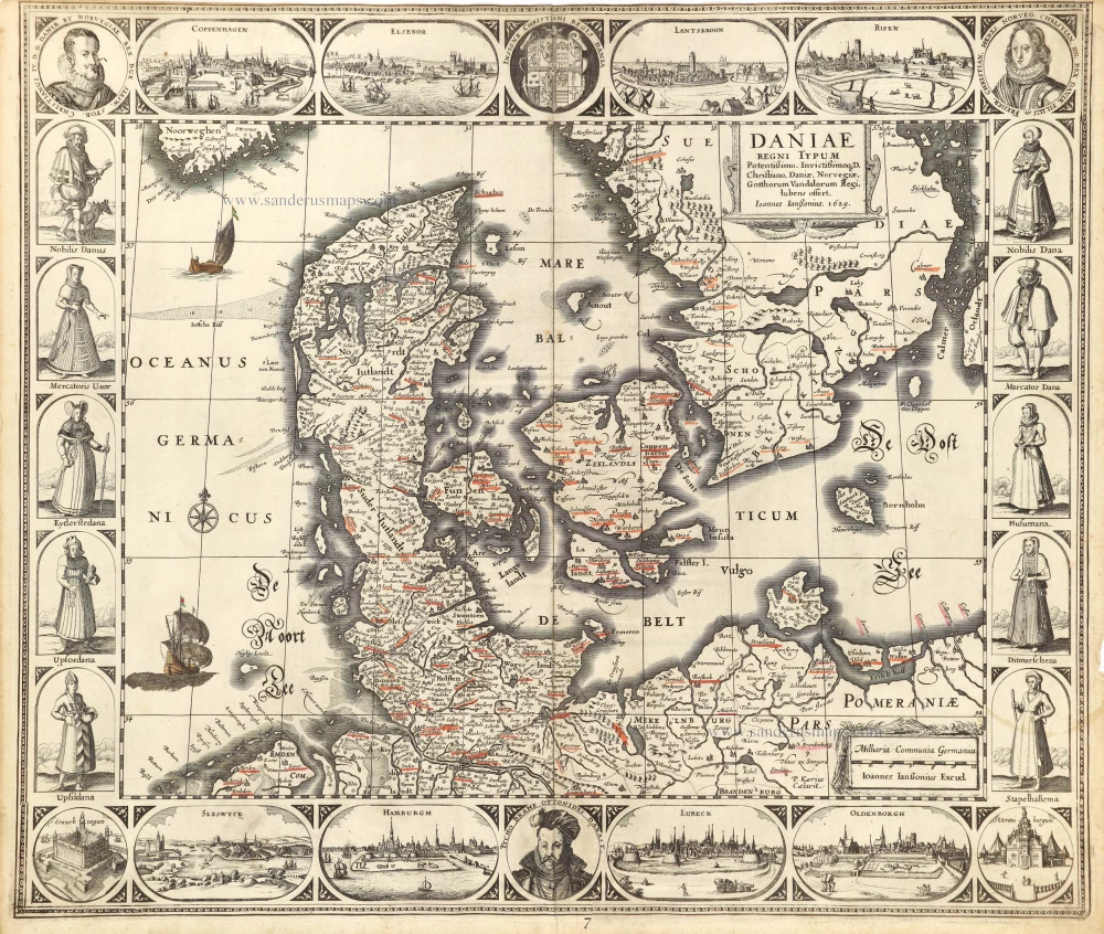
Daniae Regni Typum. 1630
Denmark by Joannes Janssonius.
[Item number: 28950]

Daniae Regni Typus Cornelius Antoniades Descripsit; [On sheet with:] Oldenburg Comit. 1584
Denmark and Jutland by Abraham Ortelius.
[Item number: 29133]

Nouvelle Carte Géographique du Royaume de Dannemarck avec une Table des Villes les plus remarquables. 1714
Denmark by Zacharias Châtelain.
[Item number: 29430]

Le Royaume de Danemark, Divisé en ses Provinces. c. 1709
Denmark by Hubert Jaillot.
[Item number: 29589]

Important map
Daniae Regni Typus. 1574
Denmark by Abraham Ortelius.
[Item number: 29601]

Nova et Accurata descriptio totius Fioniae vulgo Funen. 1653
Denmark - Fyn by Johannes Janssonius.
[Item number: 30344]
Rare
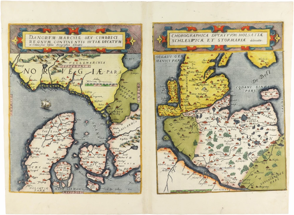
Danorum Marchiae seu Cimbrici Regnum Continentis Iutiae Ducatum [on sheet with] Chorographica Ducatum Holstatiae Schleswicae et Stormariae 1593
Norway - Denmark by Gerard de Jode
[Item number: 30947]

Famous map of Denmark by Marcus Jordan
Danorum Marca, vel Cimbricum, aut Daniae Regnum ... c. 1593
Denmark, by Georg Braun & Frans Hogenberg.
[Item number: 31044]

Le Royaume de Danemark Subdivisé en ses Principales Provinces. 1692
Denmark by N. Sanson, so-called published by Hubert Jaillot. (Pirated edition by Pierre Mortier).
[Item number: 31169]
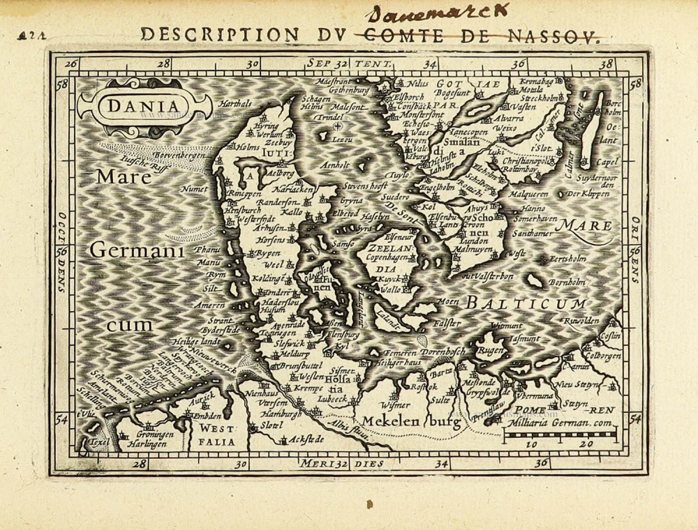
Dania. 1618
Denmark by Petrus Bertius, published by Jodocus Hondius II.
[Item number: 31632]
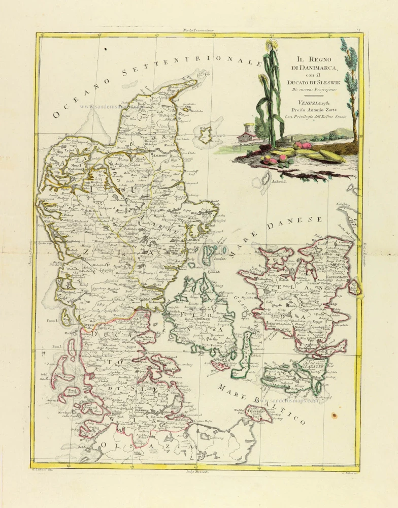
Il Regno di Danimarca, con il Ducato di Sleswik 1779-1785
Denmark, by Antonio Zatta.
[Item number: 31890]

Regni Daniae, in quo sunt Ducatus Holsatia et Slesvicum, Insulae Danicae, Provinciae Iutia Scania Blekingia ec. c. 1720
Denmark, by Homann J.B.
[Item number: 32204]

Scarce
Dania Regnum In quo sunt Ducatus Holsatia et Slesvicum Insulae Danicae et Provinciae Iutia Scania Blekingia et Hallandia. c. 1680
Denmark by Justus Danckerts.
[Item number: 32523]

Regno di Danimarca. 1687
Denmark, by Guillaume Sanson, published by Giovanni de Rossi.
[Item number: 32958]