
Low Countries by Girolamo Ruscelli. 1562
Girolamo Ruscelli (1504 (1518?) -1566)
Girolamo Ruscelli was an Italian mathematician and cartographer who worked in Venice in the early 16th century. He was also an alchemist who wrote pseudonymously as Alessio Piemontese.
He published a translation of the Geografia of Ptolemy, printed in Venice by Vincenzo Valgrisi in 1561. It was a quarto edition with Ptolemaic and modern maps. The engravers may have been the brothers Giulio and Livio Sanuto. Among the 69 copperplate maps were 40 based on maps by Giacomo Gastaldi. The maps were re-issued in 1562, 1564, 1574 and 1598.
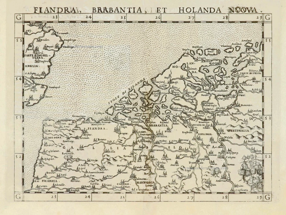
Fiandra, Brabantia, et Holanda Nuova.
Item Number: 28011 Authenticity Guarantee
Category: Antique maps > Europe > The Low Countries
Old, antique map of Flanders (Vlaanderen), Brabant and Holland by G. Ruscelli.
Cartographer: G. Gastaldi - C. Ptolemy
Copper engraving, printed on paper.
Size (not including margins): 19 x 25cm (7.4 x 9.8 inches)
Verso text: Italian
Condition: Excellent.
Condition Rating: A
From: La Geografia di Claudio Tolomeo. Venice, 1561. (Karrow, 30/C.1)
In 1561, Girolamo Ruscelli published a new translation of Ptolemy's Geographia.His maps are almost all enlargements of the 1548 Gastaldi maps.
Girolamo Ruscelli (1504 (1518?) -1566)
Girolamo Ruscelli was an Italian mathematician and cartographer who worked in Venice in the early 16th century. He was also an alchemist who wrote pseudonymously as Alessio Piemontese.
He published a translation of the Geografia of Ptolemy, printed in Venice by Vincenzo Valgrisi in 1561. It was a quarto edition with Ptolemaic and modern maps. The engravers may have been the brothers Giulio and Livio Sanuto. Among the 69 copperplate maps were 40 based on maps by Giacomo Gastaldi. The maps were re-issued in 1562, 1564, 1574 and 1598.
Related items

First Christoffel Pantin edition
Descriptio Germaniae Inferioris. 1579
XVII Provinces by Abraham Ortelius.
[Item number: 21663]

Belgiae Inferioris descriptio emendata cum circu(m)jacentium regionum confinijs. 1610
The 17 Provinces, by Jan Orlers.
[Item number: 25913]

Belgii sive Germania Inferioris - Nider Teutschlandt. 1638
The 17 Provinces, by Matthäus Merian.
[Item number: 26030]

Belgii sive germaniae inferioris accuratissima tabula. auctore henrico hondio 1631. amstelodami, sumptibus henrici hondio 1631. 1641
The 17 Provinces, by Henricus Hondius.
[Item number: 26301]

Rare
Germania Inferior. Gallia Belgica Dicta, continens Hispaniarum Regis Provincias Septentrionales. 1593
XVII Provinces, by Gerard de Jode.
[Item number: 27943]

Belgium sive Inferior Germania. 1630
XVII Provinces, by A. Goos - J. Janssonius.
[Item number: 27988]

Flandriae Comitatus Accuratissima Descriptio. c. 1658
Flanders (Vlaanderen) by Nicolaas Visscher I.
[Item number: 29980]
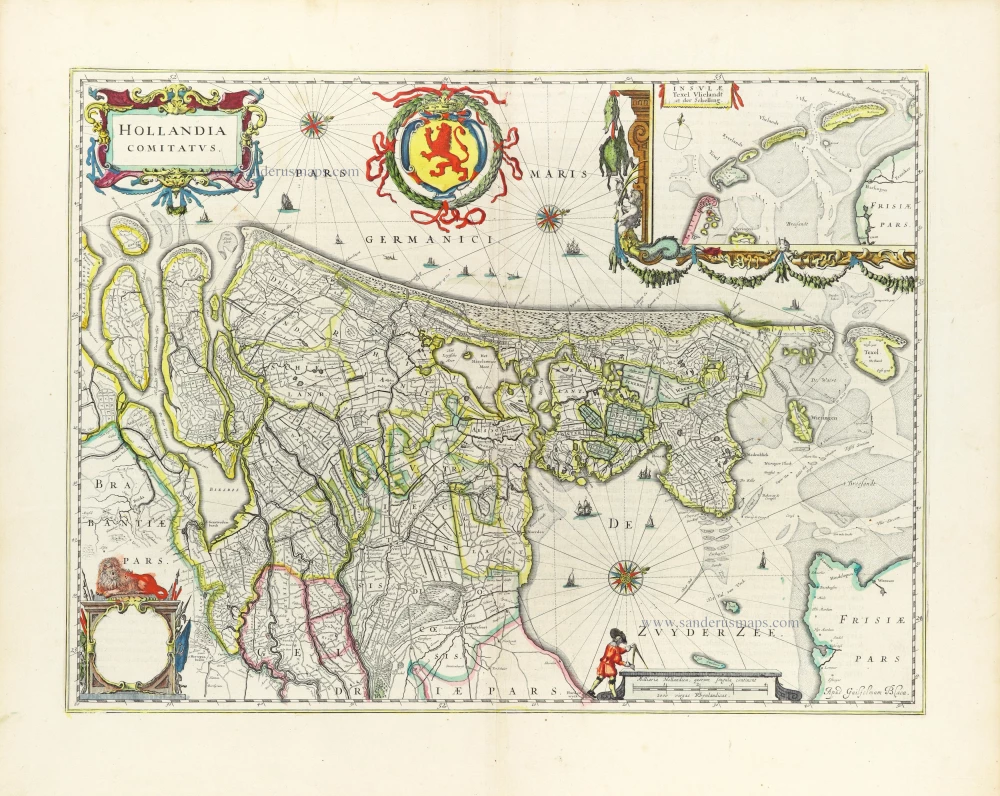
Hollandia Comitatus. 1643
Holland by Willem Blaeu
[Item number: 30182]