
Holland - Leo Hollandicus - by C.J. Visscher. 1648
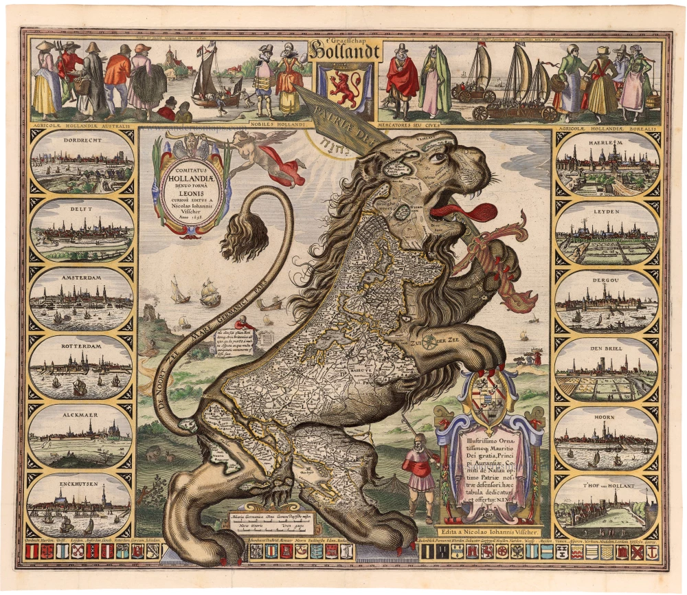
On this map, Holland appears as a rampant lion. Michael von Aitzing (Aitsinger) originally introduced the lion as a symbol for the Seventeen Provinces as a whole. Claes Jansz Visscher, however, composed the Leo Hollandicus in imitation of Von Aitzing's Leo Belgicus, thereby showing the most powerful province of the Northern Netherlands in political, economic, and financial terms. Therefore, the Leo Hollandicus bears the device PATRIAE DEFENSIO on its sword. Visscher published the map one year after the end of the Twelve Year's Truce (1609-21) when the war between the Northern Netherlands and the Spanish king started again.
The first map title is in the centre of the top border above the coat of arms of the province of Holland. The second map title is in an upright oval cartouche, decorated with an angel with a trumpet of fame. In the lower right corner is a decorative cartouche, crowned by a shield with a coat of arms, with a nine-line dedication to Maurice, Prince of Orange. Below this dedication cartouche is the imprint. Between the hind legs of the lion is a cartouche with two bar scales, and a compass rose appears in the lion's right forepaw.
Decorative borders frame the map on all sides. In the top border the coat of arms if the County of Holland is flanked on both sides by costumed figures watching the wind-powered wagons on the beach and the ice-sledge on a frozen canal.
The side borders feature town views in oval frames. Left border: Dordrecht; Delft; Amsterdam; Rotterdam; Alckmaer and Enckhuysen. Right border: Haerlem, Leyden; Dergou; Den Briel; Hoorn and T'Hof van Hollant. Along the bottom border runs a series of coats of arms of 32 Dutch towns, with captions above them.
The Visscher Family
For nearly a century, the members of the Visscher family were essential art dealers and map publishers in Amsterdam.
Claes Jansz. Visscher, or N.J. Piscator (1587-1652)
Claes Jansz. Vischer bought a house in Amsterdam, 'de gulden Bors', on the crucial Kalverstraat and changed the name into "In de Visscher"; under this title, the shop was to flourish for many years.
He was famous for his engravings and etchings of Dutch landscapes and 'historical scenes', such as sieges, battles, etc. These 'historical scenes' were considered contemporary illustrated news items, especially e.g. that of 'the Eighty Years' War'.
For the publication of his first atlas, he bought copperplates of the atlas Germania Inferior by Pieter van den Keere (1623).
In 1649, he published an atlas entitled Tabularum Geographicarum Contractarum, containing the same maps as Langenes' Caert Thresoor, for which Visscher had only new title pages engraved.
Claes Jansz. Visscher died in 1652. His wife, Neeltjen Florisdr., had already died in 1640. They had seven children, four of whom were still alive at Claes Jansz.'s death. One was Nicolaes Visscher I, who was to continue his father's business.
Nicolaes Visscher I (1618-1679)
Nicolaes Visscher I partnered with his father, continued the business, and stayed on the Kalverstraat 'in de Visscher' till his death.
In about 1657, the first edition of his Atlas Contractus Orbis Terrarum appeared.
Between 1664 and 1677, several editions of his Atlas Contractus appeared without a printed index, for these atlases had no fixed contents but were composed according to the buyer's financial leaping pole.
In May 1664, Nicolaes Visscher was admitted as a member of the Booksellers' Guild of his town. In July 1677, he was granted a patent of the States of Holland and West-Friesland for printing and publishing maps and atlases for 15 years.
After this, he again published an Atlas Contractus with a printed index. At about the same time, he also brought out an Atlas Minor.
Nicolaes Visscher II (1649-1702)
Nicolaes Visscher II inherited the 'shop' from his father. To obtain a new privilege, he applied to the States of Holland and West-Friesland in 1682 for a patent for printing and publishing maps. This patent was granted to him the same year. He moved the firm to the Dam, but it kept the same signboard: "In de Visscher".
Around 1683, he published his first Atlas Minor with a printed index of 91 maps. In 1684, an atlas Germania Inferior appeared. Till 1697, he published another number of atlases. He used his grandfather's (Claes Jansz.) maps less often now and relied more and more on his own.
The wars waged at this time initiated the compilation of maps of the countries where the armies operated. Many war maps were included in the various editions of his Atlas Minor.
After Nicolaes's death, his wife, Elizabeth Verseyl, published all the war maps as an atlas under the title De Stoel des Oorlogs in de Wereld (The seat of war in the world).
The widow of Nicolaes Visscher II (?-1726)
His widow continued the business energetically, and by her hand, under the name of her deceased husband, numerous atlases appeared, e.g., several editions of the Atlas Minor, an Atlas Maior and De Stoel des Oorlogs. The shop enjoyed a high reputation due to the assortment's incredible variety. Not only 'Visscher' maps but also maps of other publishers were obtainable. With the death of Elizabeth Verseyl in 1726, the last descendant died of a great map- and atlas-publishing firm in Amsterdam.
t' Graefschap Hollandt / COMITATUS HOLLANDIAE Denuo Formâ Leonis Curiosè editus a Nicolao Iohannis Visscher Anno 1648.
Item Number: 33279 new Authenticity Guarantee
Category: Antique maps > Europe > The Low Countries
Holland - Leo Hollandicus - by C.J. Visscher.
Title: t' Graefschap Hollandt / COMITATUS HOLLANDIAE Denuo Formâ Leonis Curiosè editus a Nicolao Iohannis Visscher Anno 1648.
Edita a Nicolao Iohannis Visscher.
With dedication to Maurice, Prince of Orange.
Oriented to the northwest.
Date of the first edition: 1622.
Date of this map: 1648.
Date on map: 1648.
Copper engraving, printed on paper.
Image size: 465 x 560mm (18¼ x 22 inches).
Sheet size: 500 x 585mm (19¾ x 23 inches).
Verso: Blank.
Condition: Hand-coloured, folds as issued, printed on heavy paper.
Condition Rating: A+.
Separate publication.
On this map, Holland appears as a rampant lion. Michael von Aitzing (Aitsinger) originally introduced the lion as a symbol for the Seventeen Provinces as a whole. Claes Jansz Visscher, however, composed the Leo Hollandicus in imitation of Von Aitzing's Leo Belgicus, thereby showing the most powerful province of the Northern Netherlands in political, economic, and financial terms. Therefore, the Leo Hollandicus bears the device PATRIAE DEFENSIO on its sword. Visscher published the map one year after the end of the Twelve Year's Truce (1609-21) when the war between the Northern Netherlands and the Spanish king started again.
The first map title is in the centre of the top border above the coat of arms of the province of Holland. The second map title is in an upright oval cartouche, decorated with an angel with a trumpet of fame. In the lower right corner is a decorative cartouche, crowned by a shield with a coat of arms, with a nine-line dedication to Maurice, Prince of Orange. Below this dedication cartouche is the imprint. Between the hind legs of the lion is a cartouche with two bar scales, and a compass rose appears in the lion's right forepaw.
Decorative borders frame the map on all sides. In the top border the coat of arms if the County of Holland is flanked on both sides by costumed figures watching the wind-powered wagons on the beach and the ice-sledge on a frozen canal.
The side borders feature town views in oval frames. Left border: Dordrecht; Delft; Amsterdam; Rotterdam; Alckmaer and Enckhuysen. Right border: Haerlem, Leyden; Dergou; Den Briel; Hoorn and T'Hof van Hollant. Along the bottom border runs a series of coats of arms of 32 Dutch towns, with captions above them.
The Visscher Family
For nearly a century, the members of the Visscher family were essential art dealers and map publishers in Amsterdam.
Claes Jansz. Visscher, or N.J. Piscator (1587-1652)
Claes Jansz. Vischer bought a house in Amsterdam, 'de gulden Bors', on the crucial Kalverstraat and changed the name into "In de Visscher"; under this title, the shop was to flourish for many years.
He was famous for his engravings and etchings of Dutch landscapes and 'historical scenes', such as sieges, battles, etc. These 'historical scenes' were considered contemporary illustrated news items, especially e.g. that of 'the Eighty Years' War'.
For the publication of his first atlas, he bought copperplates of the atlas Germania Inferior by Pieter van den Keere (1623).
In 1649, he published an atlas entitled Tabularum Geographicarum Contractarum, containing the same maps as Langenes' Caert Thresoor, for which Visscher had only new title pages engraved.
Claes Jansz. Visscher died in 1652. His wife, Neeltjen Florisdr., had already died in 1640. They had seven children, four of whom were still alive at Claes Jansz.'s death. One was Nicolaes Visscher I, who was to continue his father's business.
Nicolaes Visscher I (1618-1679)
Nicolaes Visscher I partnered with his father, continued the business, and stayed on the Kalverstraat 'in de Visscher' till his death.
In about 1657, the first edition of his Atlas Contractus Orbis Terrarum appeared.
Between 1664 and 1677, several editions of his Atlas Contractus appeared without a printed index, for these atlases had no fixed contents but were composed according to the buyer's financial leaping pole.
In May 1664, Nicolaes Visscher was admitted as a member of the Booksellers' Guild of his town. In July 1677, he was granted a patent of the States of Holland and West-Friesland for printing and publishing maps and atlases for 15 years.
After this, he again published an Atlas Contractus with a printed index. At about the same time, he also brought out an Atlas Minor.
Nicolaes Visscher II (1649-1702)
Nicolaes Visscher II inherited the 'shop' from his father. To obtain a new privilege, he applied to the States of Holland and West-Friesland in 1682 for a patent for printing and publishing maps. This patent was granted to him the same year. He moved the firm to the Dam, but it kept the same signboard: "In de Visscher".
Around 1683, he published his first Atlas Minor with a printed index of 91 maps. In 1684, an atlas Germania Inferior appeared. Till 1697, he published another number of atlases. He used his grandfather's (Claes Jansz.) maps less often now and relied more and more on his own.
The wars waged at this time initiated the compilation of maps of the countries where the armies operated. Many war maps were included in the various editions of his Atlas Minor.
After Nicolaes's death, his wife, Elizabeth Verseyl, published all the war maps as an atlas under the title De Stoel des Oorlogs in de Wereld (The seat of war in the world).
The widow of Nicolaes Visscher II (?-1726)
His widow continued the business energetically, and by her hand, under the name of her deceased husband, numerous atlases appeared, e.g., several editions of the Atlas Minor, an Atlas Maior and De Stoel des Oorlogs. The shop enjoyed a high reputation due to the assortment's incredible variety. Not only 'Visscher' maps but also maps of other publishers were obtainable. With the death of Elizabeth Verseyl in 1726, the last descendant died of a great map- and atlas-publishing firm in Amsterdam.
Related items

Rare and important map!
Hollandiae Batavor Veteris Insulae Locorum Adiacentium Exacta Descriptio. 1563
Holland, by Camocio G.F. - Forlani P.
[Item number: 9232]

De Cust van Hollandt Tusschen de Maes en Texel. 1686
Holland by Hendrick Doncker.
[Item number: 15677]

Comitatus Hollandiae novissima descriptio. 1638
Holland, by Janssonius J.
[Item number: 19020]

Cust van Hollant tusschen de Maes ende Texel 1667
Sea chart of Holland, by Pieter Goos.
[Item number: 19040]

Kaart van 't Graafschap Holland Naauwkeurig Afgedeelt in zyne Heemraadschappen, Baljuwschappen en Waarden, 1730-45
Holland by C. Specht, published by R. & J. Ottens.
[Item number: 25706]

La Hollande. 1713
Holland by Pieter Van der Aa.
[Item number: 26059]

Hollandiae Cattorum Regionis Typus. 1588
Holland, by Lodovico Guicciardini.
[Item number: 26656]

Big and spectacular map
Le Comté de Hollande. c. 1705
Holland, by Pieter Mortier.
[Item number: 27807]

Hollandiae Antiquorum Catthorum Sedis Nova Descriptio. 1584
Holland, by Abraham Ortelius.
[Item number: 29547]
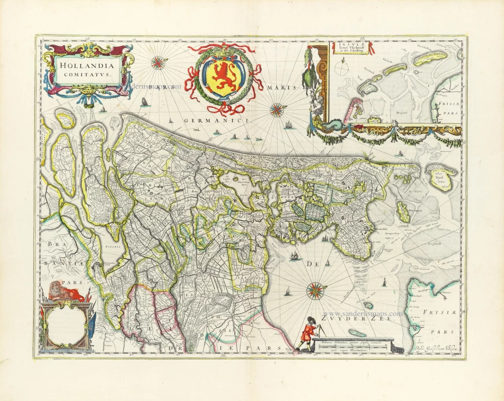
Hollandia Comitatus. 1643
Holland by Willem Blaeu
[Item number: 30182]
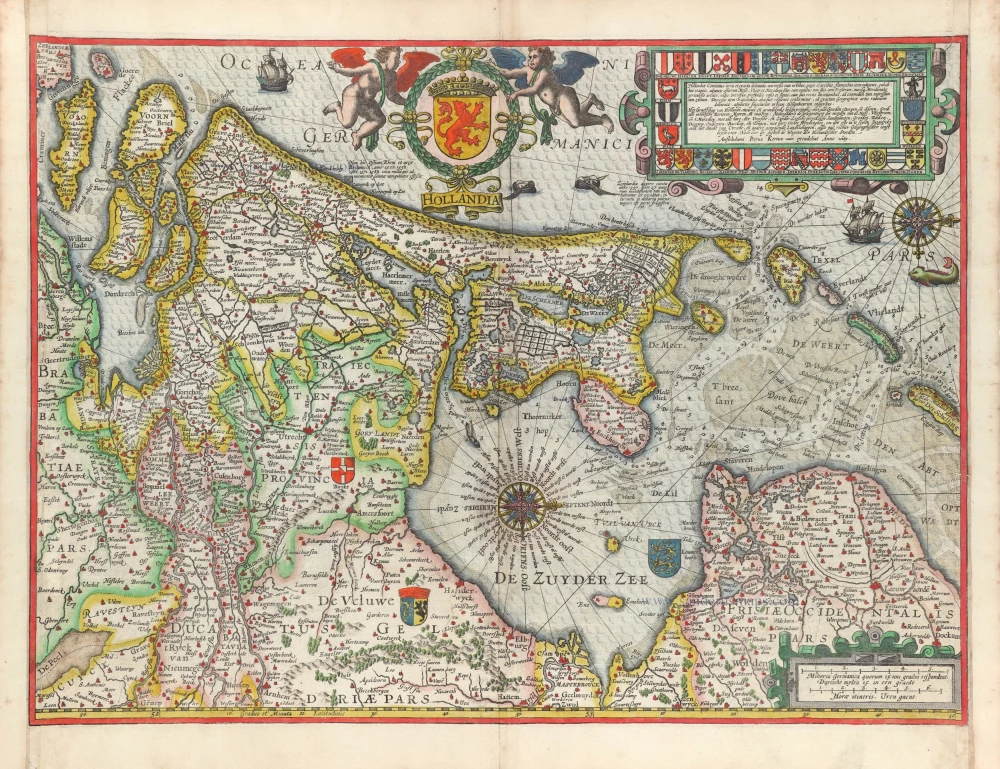
Hollandia. 1617
Holland by Petrus Kaerius (Pieter Van den Keere).
[Item number: 30257]
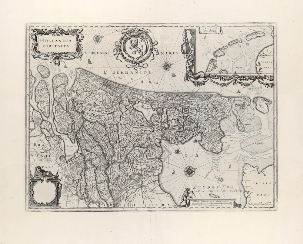
Hollandia Comitatus. 1647
Holland by Willem Blaeu
[Item number: 31104]

Hollandia. 1618
Holland by Petrus Bertius, published by Jodocus Hondius II.
[Item number: 31589]

Le Comté de Hollande Dressé sur les Memoires les plus Nouveaux. 1692
Holland by N. Sanson, so-called published by Hubert Jaillot. (Pirated edition by Pierre Mortier).
[Item number: 31717]

Carte de Hollande. 1633
Holland by C. Tassin.
[Item number: 31762]

Comitatus Hollandiae novissima descriptio. 1638
Holland by Henricus Hondius
[Item number: 32448]