
Old, antique map of the Indian Ocean by Janssonius 1662
The Janssonius Family
Joannes Janssonius (Arnhem, 1588-1664), son of the Arnhem publisher Jan Janssen, married Elisabeth Hondius, daughter of Jodocus Hondius, in Amsterdam in 1612. After his marriage, he settled down in this town as a bookseller and publisher of cartographic material. In 1618, he established himself in Amsterdam next door to Blaeu’s bookshop. He entered into serious competition with Willem Jansz. Blaeu when copying Blaeu’s Licht der Zeevaert after the expiration of the privilege in 1620. His activities concerned the publication of atlases, books, single maps, and an extensive book trade with branches in Frankfurt, Danzig, Stockholm, Copenhagen, Berlin, Koningsbergen, Geneva, and Lyon. In 1631, he began publishing atlases together with Henricus Hondius.
In the early 1640s, Henricus Hondius left the atlas publishing business to Janssonius. Competition with Joan Blaeu, Willem’s son and successor, in atlas production, prompted Janssonius to enlarge his Atlas Novus finally into a work of six volumes, into which a sea atlas and an atlas of the Old World were inserted. Other atlases published by Janssonius are Mercator’s Atlas Minor, Hornius’s historical atlas (1652), the townbooks in eight volumes (1657), Cellarius’s Atlas Coelestis and several sea atlases and pilot guides.
After the death of Joannes Janssonius, the shop and publishing firm were continued by the heirs under the direction of Johannes van Waesbergen (c. 1616-1681), son-in-law of Joannes Janssonius. Van Waesbergen added Janssonius's name to his own.
In 1676, Joannes Janssonius’s heirs sold by auction “all the remaining Atlases in Latin, French, High and Low German, as well as the Stedeboecken in Latin, in 8 volumes, bound and unbound, maps, plates belonging to the Atlas and Stedeboecken.” The copperplates from Janssonius’s atlases were afterwards sold to Schenk and Valck.
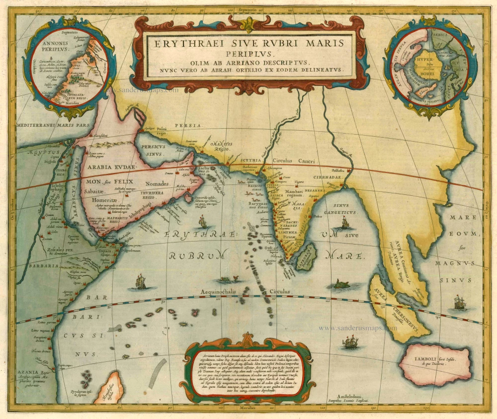
Erythraei sive Rubri Maris Periplus.
Item Number: 3679 Authenticity Guarantee
Category: Antique maps > Oceans
Map showing the northern part of the Indian Ocean. With two circular insets: "Annonis Periplus" at top left which represents the Northwest coast of Africa and the north pole at top right.
Cartographer: A. Ortelius
Copper engraving
Size: 39 x 46.5cm (15.2 x 18.1 inches)
Verso text: Dutch
Condition: Old coloured, centrefold reinforced.
Condition Rating: B+
References: Van der Krogt 1, 0500H:1.
From: Nieuwen Atlas, Ofte Weerelts-Beschrijvinge, Seste Deel: Inhoudende De Oude, Geestelijcke ende Ardsche Weerel-Beschrijving. Amsterdam, J. Janssonius, 1662.
The Janssonius Family
Joannes Janssonius (Arnhem, 1588-1664), son of the Arnhem publisher Jan Janssen, married Elisabeth Hondius, daughter of Jodocus Hondius, in Amsterdam in 1612. After his marriage, he settled down in this town as a bookseller and publisher of cartographic material. In 1618, he established himself in Amsterdam next door to Blaeu’s bookshop. He entered into serious competition with Willem Jansz. Blaeu when copying Blaeu’s Licht der Zeevaert after the expiration of the privilege in 1620. His activities concerned the publication of atlases, books, single maps, and an extensive book trade with branches in Frankfurt, Danzig, Stockholm, Copenhagen, Berlin, Koningsbergen, Geneva, and Lyon. In 1631, he began publishing atlases together with Henricus Hondius.
In the early 1640s, Henricus Hondius left the atlas publishing business to Janssonius. Competition with Joan Blaeu, Willem’s son and successor, in atlas production, prompted Janssonius to enlarge his Atlas Novus finally into a work of six volumes, into which a sea atlas and an atlas of the Old World were inserted. Other atlases published by Janssonius are Mercator’s Atlas Minor, Hornius’s historical atlas (1652), the townbooks in eight volumes (1657), Cellarius’s Atlas Coelestis and several sea atlases and pilot guides.
After the death of Joannes Janssonius, the shop and publishing firm were continued by the heirs under the direction of Johannes van Waesbergen (c. 1616-1681), son-in-law of Joannes Janssonius. Van Waesbergen added Janssonius's name to his own.
In 1676, Joannes Janssonius’s heirs sold by auction “all the remaining Atlases in Latin, French, High and Low German, as well as the Stedeboecken in Latin, in 8 volumes, bound and unbound, maps, plates belonging to the Atlas and Stedeboecken.” The copperplates from Janssonius’s atlases were afterwards sold to Schenk and Valck.
Related items
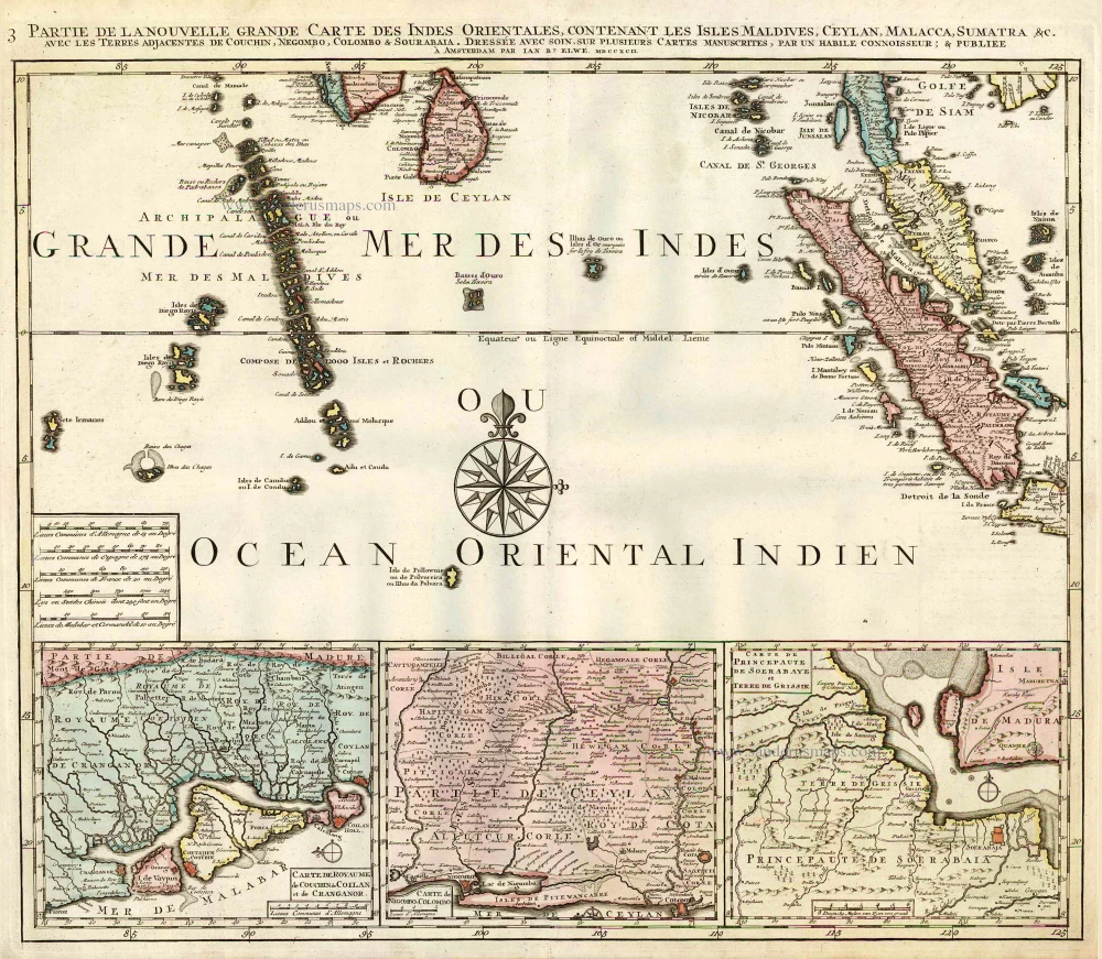
Partie de la Nouvelle Grande Carte des Indes Orientales, Contenant les Isles Maldives, Ceylan, Malacca, Sumatra &c. 1792
Indian Ocean (North), by J.B. Elwe.
[Item number: 2363]
Heightened in gold
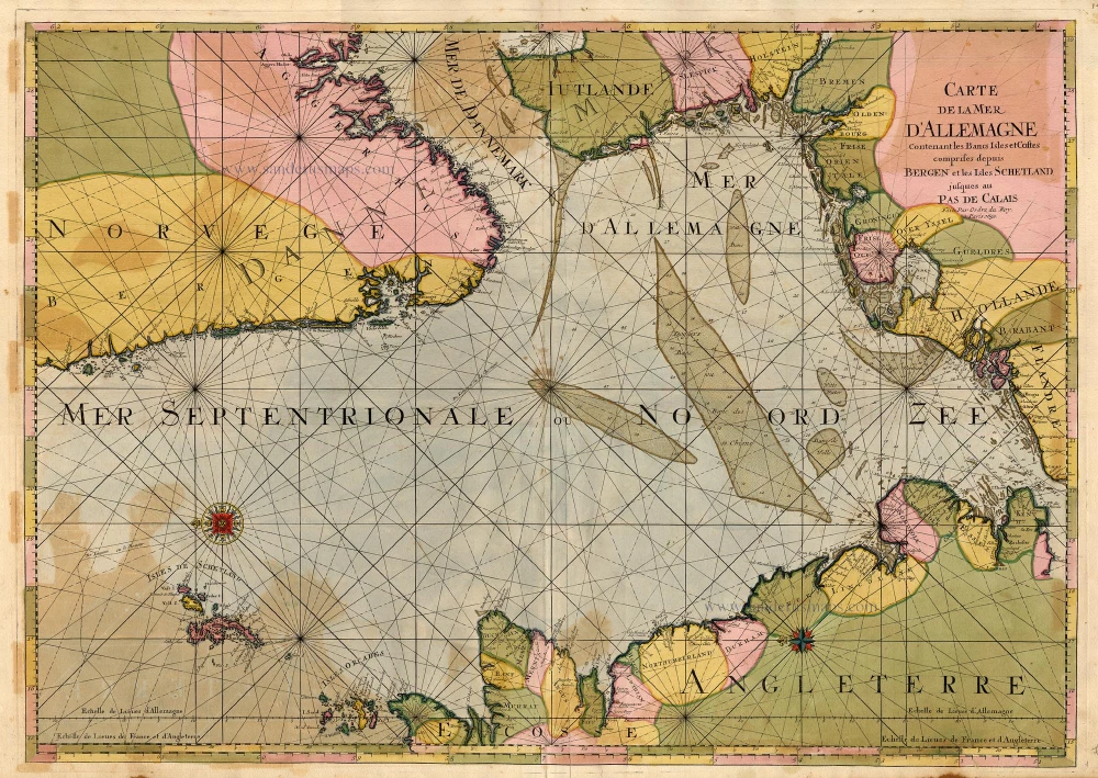
Carte de la Mer d'Allemagne ... 1693
The North Sea by P. Mortier.
[Item number: 15485]
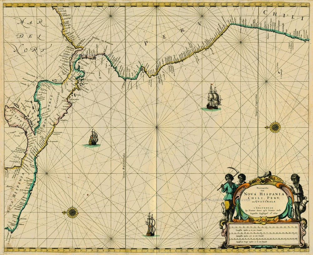
Pascaerte van Nova Hispania Chili, Peru, en Guatimala 1667
Central America, by Pieter Goos.
[Item number: 19031]

Caerte van de zeylage van Jacob le Maire over de Zuydzee, vertonende de Eylanden ende Landen aldaer by hem ghesien ende aenghedaen. / Tabula, ductum navigationis, quem in Mari Australi tenuit Iacobus Le Maire ... 1622
Rare chart showing the route taken by Schouten and le Maire from South America to New Guinea, by Michiel Colijn.
[Item number: 25104]
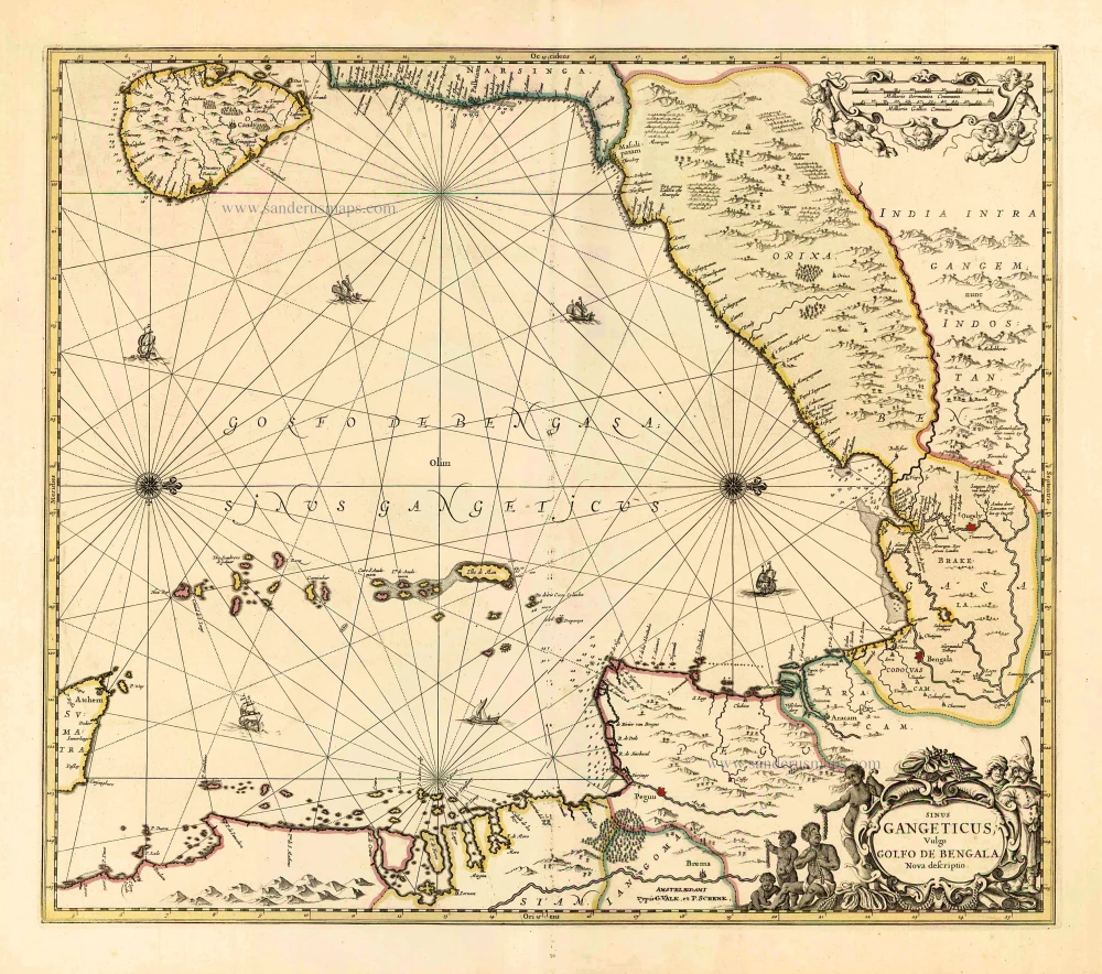
Sinus Gangeticus Vulgo Golfo de Bengala Nova Descriptio. c. 1700
Gulf of Bengal, by G. Valk & P. Schenk.
[Item number: 25835]
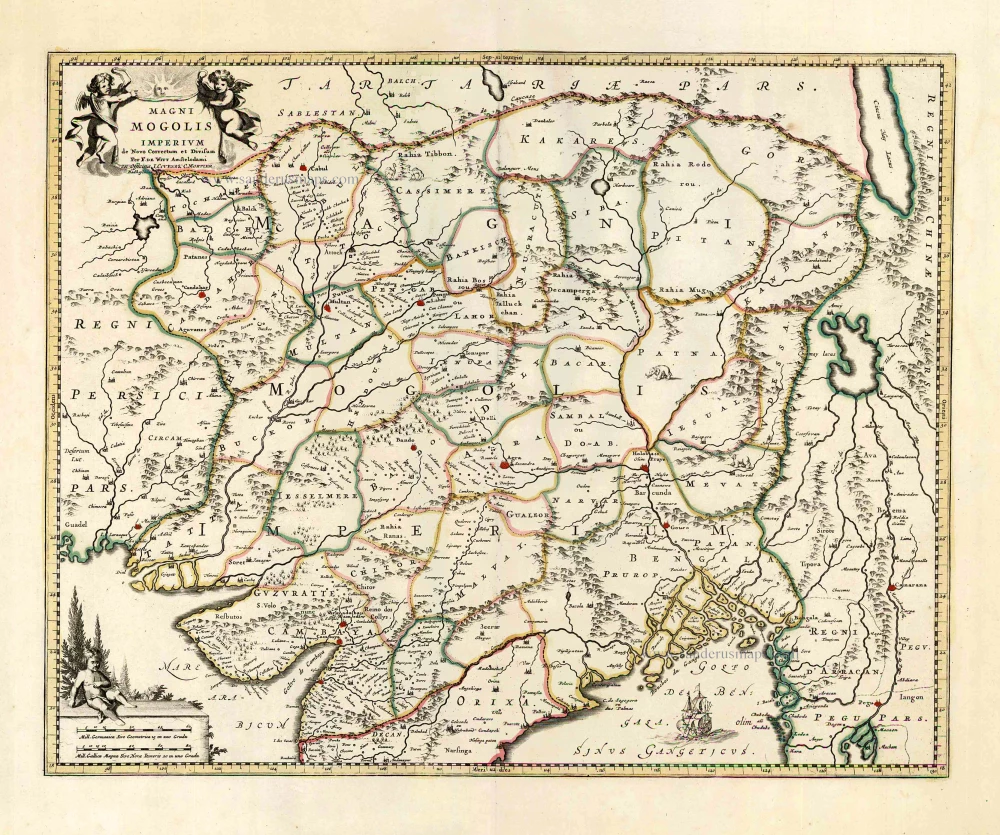
Magni Mogolis Imperium. After 1721
Mongol Empire, by Frederick de Wit - Covens & Mortier.
[Item number: 25838]