
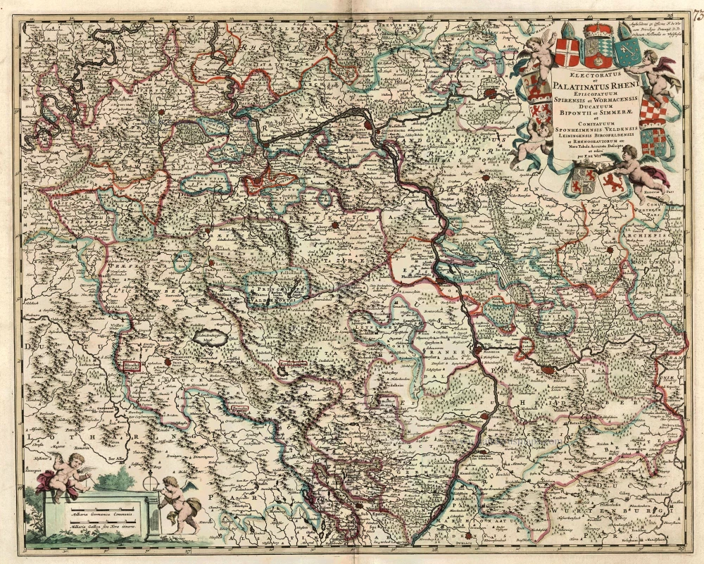
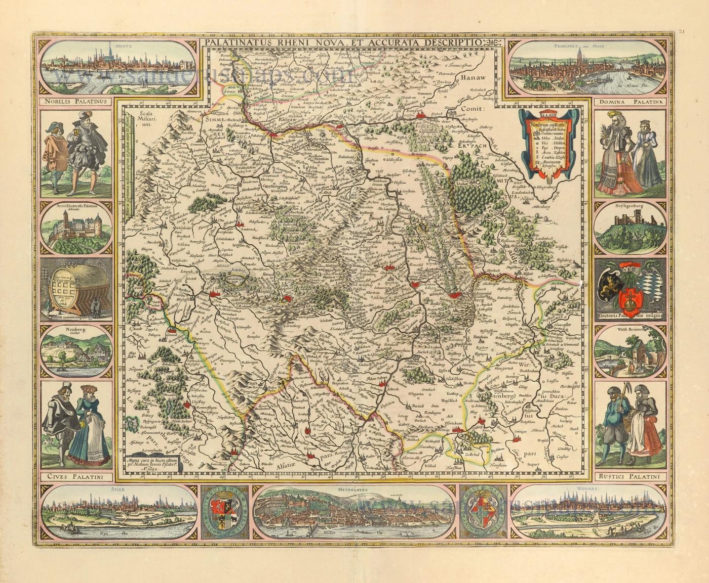
Rheinland-Pfalz by Frederik De Wit. c. 1680
Frederick de Wit (1630-1706)
The engraver and map-seller, Frederick de Wit, was born in Gouda (Netherlands) in 1630 as a son of Hendrick Fredericksz de Wit. Through his marriage with Maria van der Waag of Amsterdam in 1661, he obtained citizenship of the city where he had been working since 1648 and where he became one of the most famous engravers of maps of the second half of the 17th century. Although De Wit was a Catholic, which meant that he was not favoured at the time by the city council, he was awarded the honour of being listed as one of the "excellent citizens" on the roll of the city council in the years 1694-1704. However, his name was not written in the Guild of St. Luke book before 1664. At that time, he lived on the Kalverstraat "in de Witte Pascaert", where he stayed until his death in 1706. His earliest dates on maps engraved are 1659 (Regni Daniae) and 1660 (World map).
Frederick de Wit published several world atlases, a sea atlas, and an atlas of the Netherlands.
The dating of the maps is difficult. However, as a privilege was granted in 1689, the annotation 'cum privilegio' marks an edition after 1688.
Around 1700, Frederick de Wit entered the market with a town atlas. He produced two volumes with a total of 260 plans and views. Most were printed from plates used for Janssonius and Blaeu town atlases.
After he died in 1706, his widow continued the shop until 1709. The plates and stock of De Wit's atlas were sold to Covens & Mortier in 1710, who sold the atlas for an extended period.
Electoratus et Palatinatus Rheni Episcopatuum Spirensis et Wormacensis Ducatuum Bipontii et Simmerae et Comitatuum Sponheimensis Veldensis Leiningensis Bircofeldensis et Rhenograviorum etc.
Item Number: 24426 Authenticity Guarantee
Category: Antique maps > Europe > Germany
Old, antique map of Rheinland-Pfalz, by Frederik de Wit.
Title: Electoratus et Palatinatus Rheni Episcopatuum Spirensis et Wormacensis Ducatuum Bipontii et Simmerae et Comitatuum Sponheimensis Veldensis Leiningensis Bircofeldensis et Rhenograviorum etc.
Nova Tabula Accurate Descripta et edita per F. De Wit.
Amstelodami ex Pfficina F. de Wit
cum Privilegio Potentiß. D.D. Ordinum Hollandiae et Westfrisie.
Date of the first edition: c 1680.
Date of this map: c. 1680.
Copper engraving, printed on paper.
Size (not including margins): 470 x 585mm (18.5 x 23.03 inches).
Verso: Blank.
Condition: Original coloured, excellent.
Condition Rating: A+.
From: Composite Atlas by F. De Wit, c. 1680.
Frederick de Wit (1630-1706)
The engraver and map-seller, Frederick de Wit, was born in Gouda (Netherlands) in 1630 as a son of Hendrick Fredericksz de Wit. Through his marriage with Maria van der Waag of Amsterdam in 1661, he obtained citizenship of the city where he had been working since 1648 and where he became one of the most famous engravers of maps of the second half of the 17th century. Although De Wit was a Catholic, which meant that he was not favoured at the time by the city council, he was awarded the honour of being listed as one of the "excellent citizens" on the roll of the city council in the years 1694-1704. However, his name was not written in the Guild of St. Luke book before 1664. At that time, he lived on the Kalverstraat "in de Witte Pascaert", where he stayed until his death in 1706. His earliest dates on maps engraved are 1659 (Regni Daniae) and 1660 (World map).
Frederick de Wit published several world atlases, a sea atlas, and an atlas of the Netherlands.
The dating of the maps is difficult. However, as a privilege was granted in 1689, the annotation 'cum privilegio' marks an edition after 1688.
Around 1700, Frederick de Wit entered the market with a town atlas. He produced two volumes with a total of 260 plans and views. Most were printed from plates used for Janssonius and Blaeu town atlases.
After he died in 1706, his widow continued the shop until 1709. The plates and stock of De Wit's atlas were sold to Covens & Mortier in 1710, who sold the atlas for an extended period.
Related items
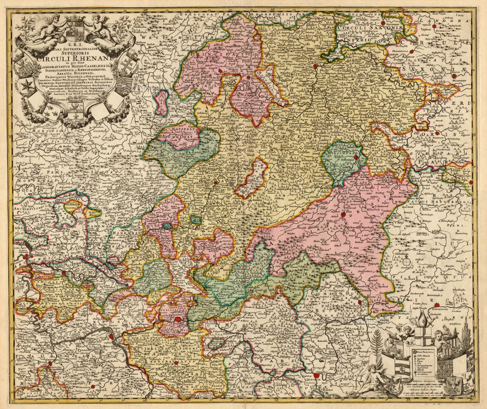
S.R.I. Pars Septentrionalor Superioris Circuli Rhenani, c. 1715
Rheinland-Pfalz, by Frederick de Wit - Covens & Mortier.
[Item number: 1265]
Scarce
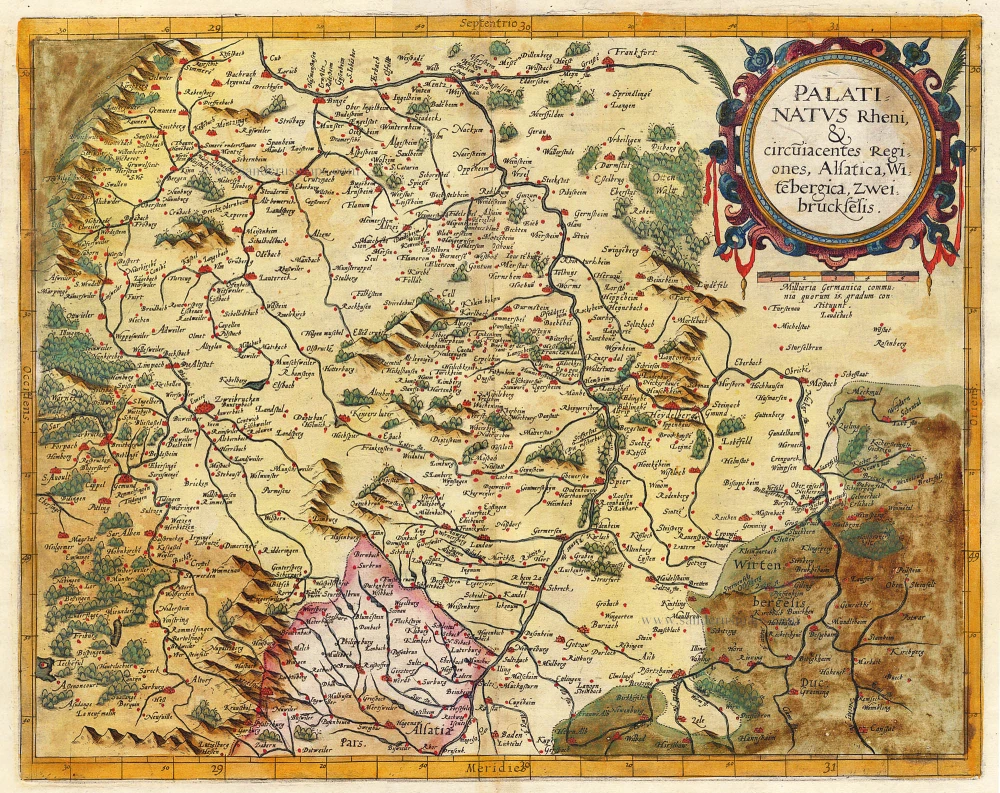
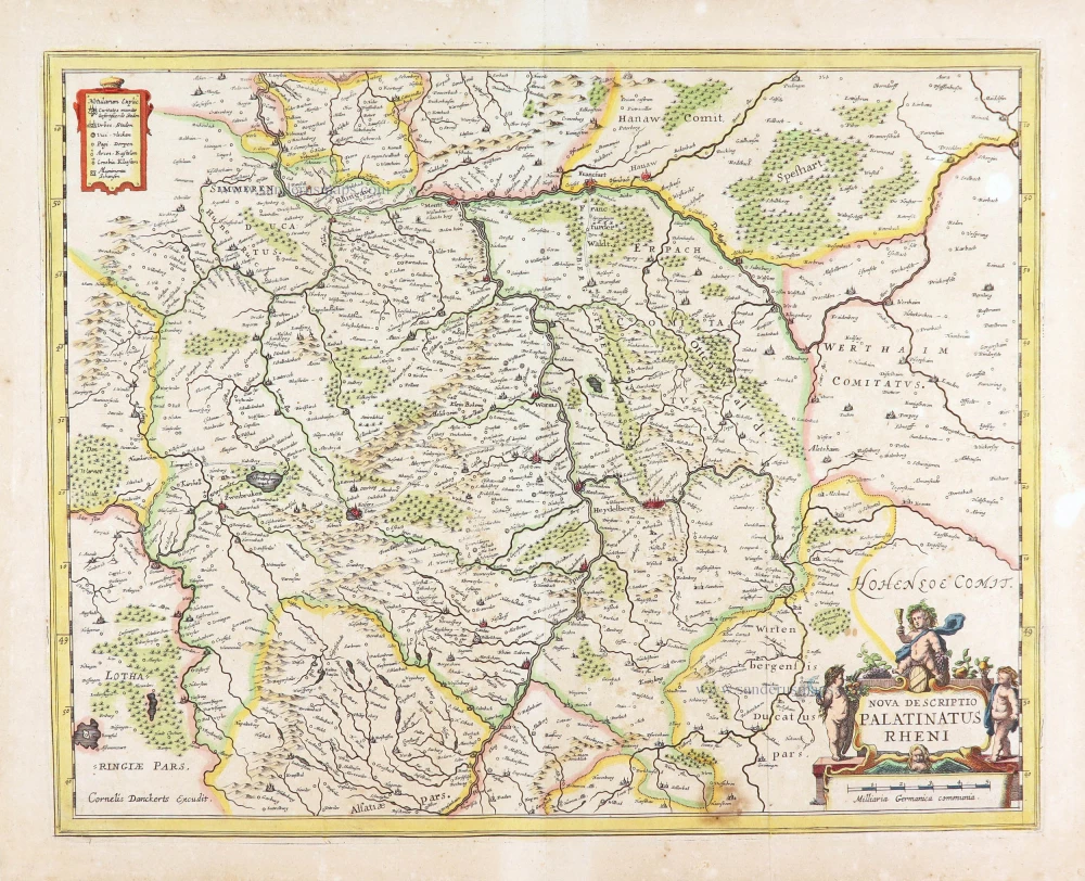
Palatinatus Rheni & Circumiacentes Regiones, Alsatica, Witebergica, Zweibruckselis 1593
Rheinland-Pfalz by Gerard de Jode.
[Item number: 5335]
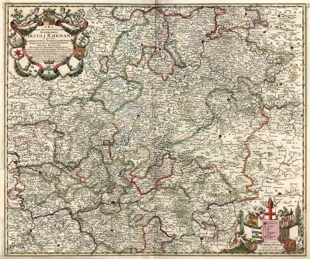
S.R.I. Pars Septentrionalor Superioris Circuli Rhenani, ... c. 1680
Rheinland-Pfalz, by F. De Wit.
[Item number: 10613]
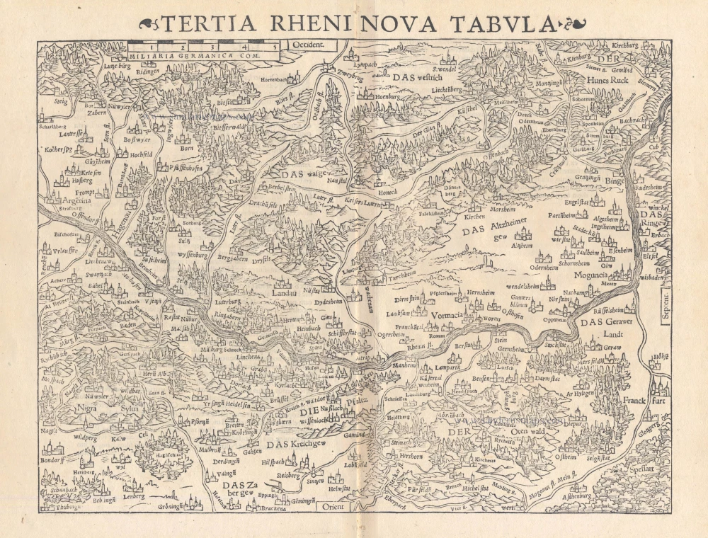
Tertia Rheni Nova Tabula 1542
Rheinland-Pfalz, by Sebastian Münster.
[Item number: 15390]
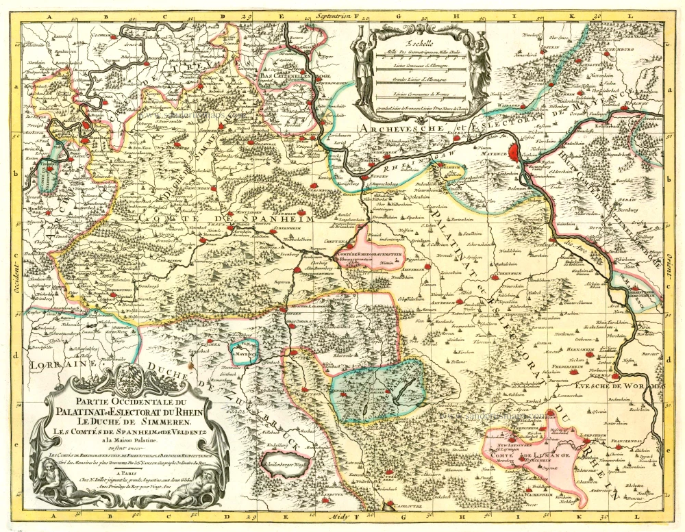
Partie Occidentale du Palatinat et Eslectorat du Rhein Le Duché de Simmeren, Les Comtés de Spanheim et de Veldentz à la Maison Palatine. 1710
Rheinland-Pfalz, by Covens & Mortier.
[Item number: 23829]
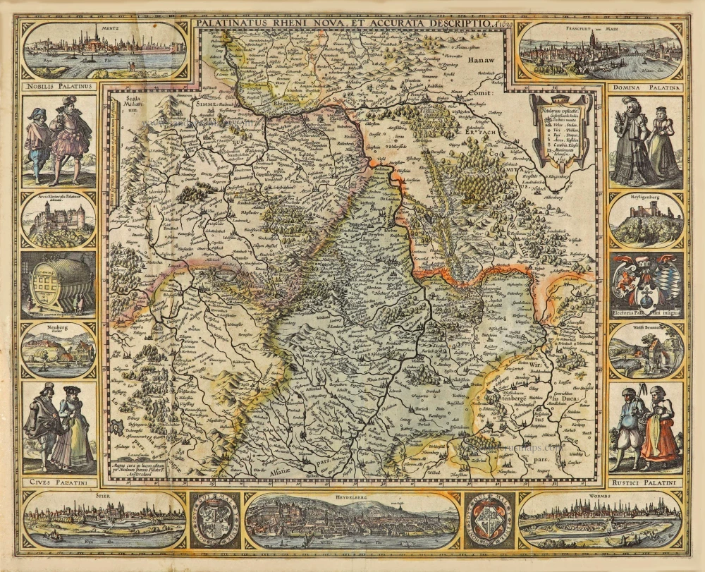
Palatinatus Rheni Nova et Accurata Descriptio. A° 1630. 1630
Rheinland-Pfalz, by Claes Jansz. Visscher.
[Item number: 28024]
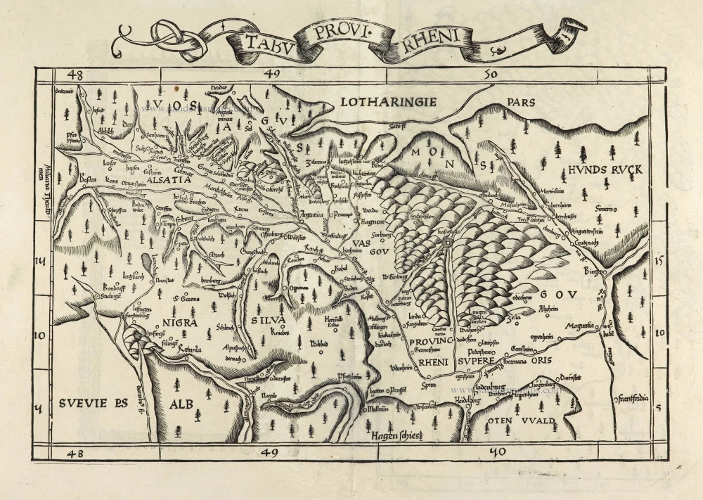
Tabu Provi. Rheni. 1525
Rheinland-Pfalz (Lorraine on verso) by Lorenz Fries.
[Item number: 28200]
Palatinatus Rheni Nova et Accurata Descriptio. 1656-80
Rheinland-Pfalz by Nicolaes Visscher I.
[Item number: 28592]
Nova Descriptio Palatinatus Rheni. c. 1640
The Rhine-Palatinate (Rheinpfalz), by Cornelis Danckerts.
[Item number: 29013]

Exactissima Tabula Sedis Belli Palatinatus ad Rhenum, Vormaciensis et Spirensis Episcopatus, Bipontini Ducatus; sed etiam plurimae Moguntini Archiepiscopatus, et aliae adjacentes et insertae Regiones, distincte ostenduntur. c. 1716.
Rheinland-Pfalz by Nicolas Visscher II.
[Item number: 29657]
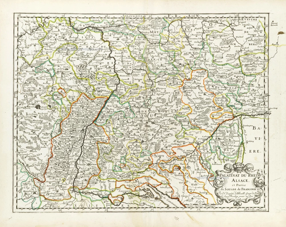
Palatinat du Rhein, Alsace, et Partie de Souabe de Franconie &c. 1652
Rheinland-Pfalz by Nicolas Sanson.
[Item number: 29696]