
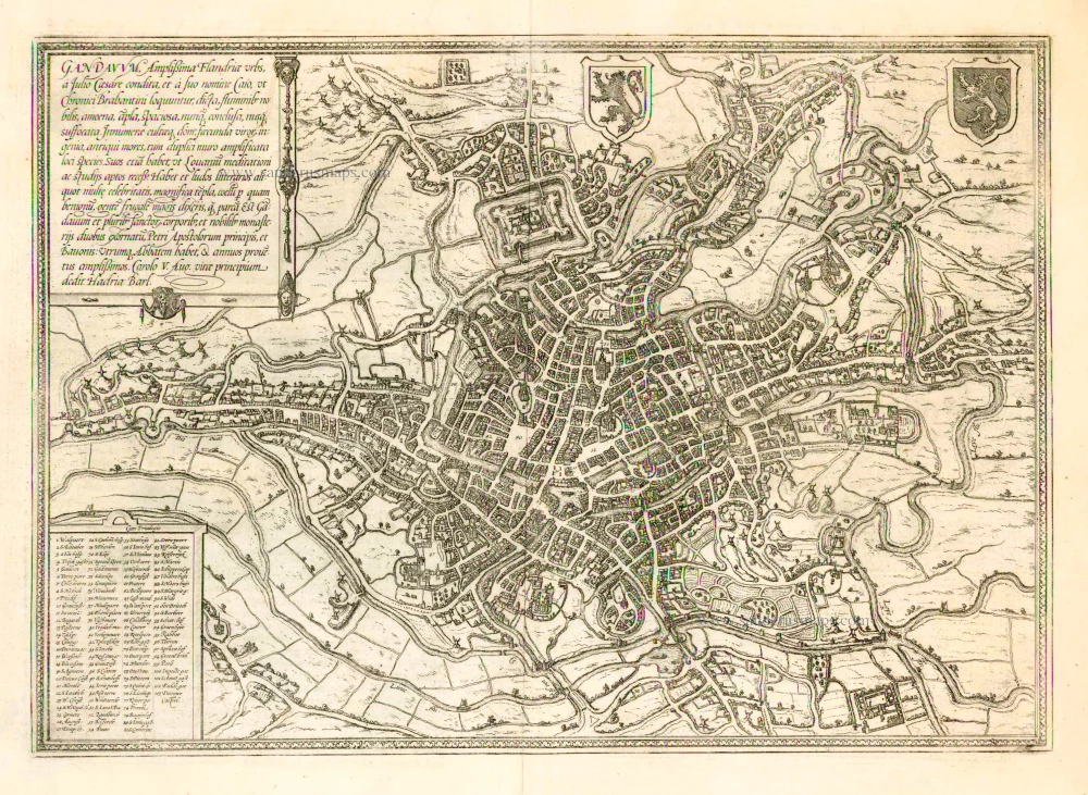
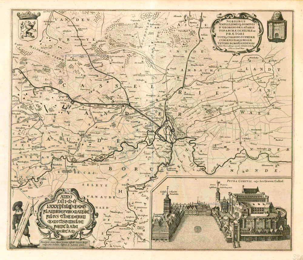
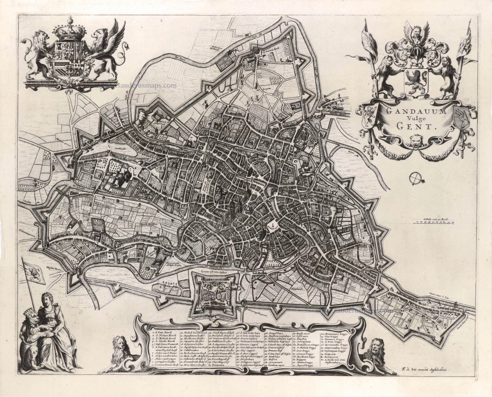
Gent by Georg Braun & Frans Hogenberg. 1612
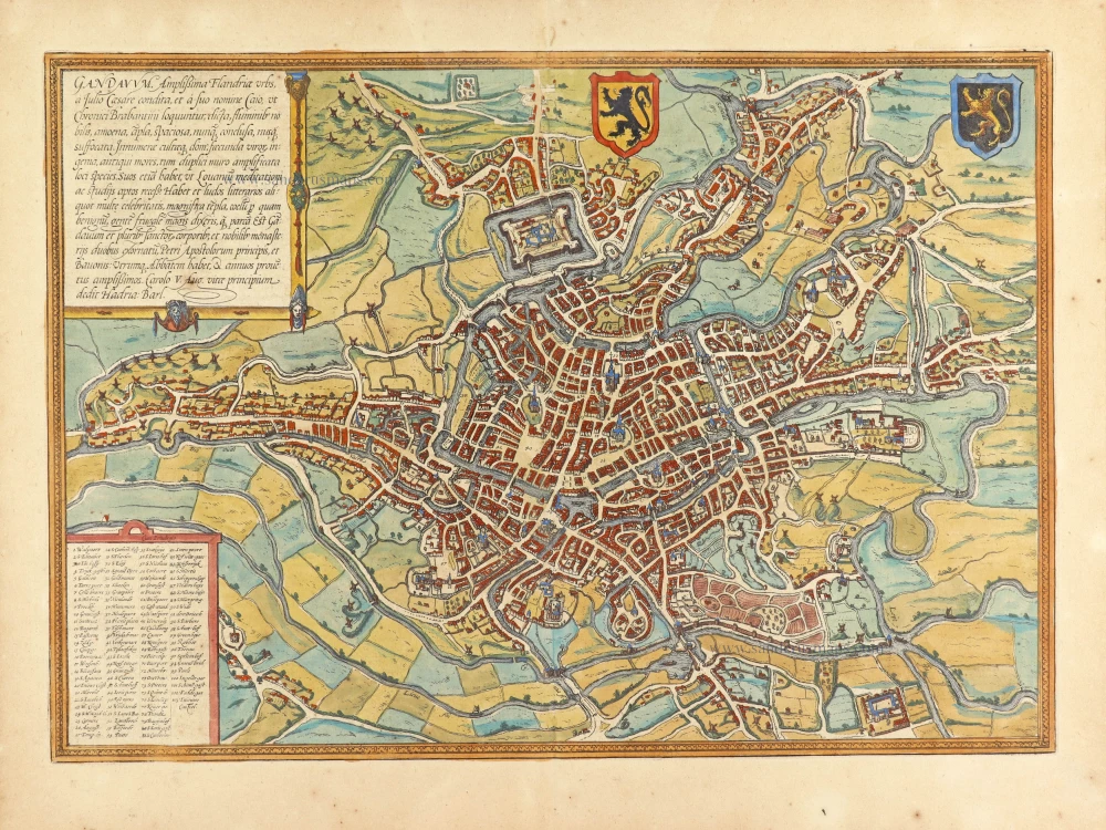


TRANSLATION OF CARTOUCHE TEXT: Ghent, the most splendid city in Flanders, was founded by Julius Caesar and called Gaius after his forename, as the Brabant chroniclers relate. The city is distinguished by its rivers: delightful, magnificent, spacious, never confined, nowhere stifling. The houses are innumerable and well-kept, the men richly talented, the customs venerable. A double wall amplifies the beautiful appearance of the place, which - like Louvain - also has quiet corners for reflection and study. Ghent also possesses famous schools and magnificent churches; the climate is excellent. The people are more frugal than parsimonious. Ghent is embellished by the relics of several saints and two famous monasteries dedicated to St Peter, Prince of the Apostles, and St Bavo; each has an abbot and a sizeable annual rental income.
COMMENTARY BY BRAUN: "Ghent has a circumference of three German miles, possesses 20 islands, which lie in the surrounding lakes and rivers and are also inhabited, 98 bridges, including three that have more than two spans and beneath which even the biggest ships can pass. One hundred windmills can grind even the largest production. This city alone has seven parish churches, five abbeys, two collegiate churches, 25 monasteries and seven general hospices. On the site where the new castle now stands lay in olden times the village of Ganden, from which the city also took its name, and a magnificent Benedictine monastery of St Bavo, which was constructed from an old fortress and which in 1540 was enlarged by Emperor Charles V into an even bigger palace."
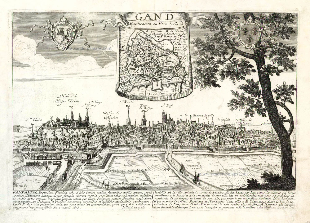
The view of Ghent shows the city from the northwest in a plan view from a great height. The city's historical core occupies the peninsula between the two Rivers, Schelde and Leie. The cathedral of Sint-Baafs (51) is almost at the centre of the map: it houses the famous Ghent Altarpiece painted by Hubert and Jan van Eyck. With the Gothic church of Sint-Niklaas (57) lower down and the nearby Sint-Jacobskerk (43), Sint-Baafs serves as one of the three main orientation points inside the city centre. Within this triangle stands the 14th-century belfry (55), 118 m high, which forms part of the cloth hall. The former Sint-Baafs monastery lies somewhat outside the city centre and is surrounded by fortifications and moats (103). Ghent, situated northwest of Brussels, derives its name from the Celtic Ganda, meaning "confluence". As a leading centre of cloth production in the High Middle Ages, Ghent became a significant power with a flourishing economy and, together with Bruges, was the most important centre of commerce in Flanders. From the 13th to the middle of the 14th century, Ghent was the second-largest city in northern Europe after Paris, with some 60,000 inhabitants, but in the second half of the 14th century, these numbers began to decline. Flemish-speaking Ghent is today the third-largest city in Belgium, with a population of around 230,000. (Taschen)
Braun G. & Hogenberg F. and the Civitates Orbis Terrarum.
The Civitates Orbis Terrarum, also known as the 'Braun & Hogenberg', is a six-volume town atlas and the most excellent book of town views and plans ever published: 363 engravings, sometimes beautifully coloured. It was one of the best-selling works in the last quarter of the 16th century. Georg Braun, a skilled writer, wrote the text accompanying the plans and views on the verso. Many plates were engraved after the original drawings of a professional artist, Joris Hoefnagel (1542-1600). The first volume was published in Latin in 1572 and the sixth in 1617. Frans Hogenberg, a talented engraver, created the tables for volumes I through IV, and Simon van den Neuwel made those for volumes V and VI. Other contributors were cartographers Daniel Freese and Heinrich Rantzau, who provided valuable geographical information. Works by Jacob van Deventer, Sebastian Münster, and Johannes Stumpf were also used as references. Translations appeared in German and French, making the atlas accessible to a wider audience.
Since its original publication of volume 1 in 1572, the Civitates Orbis Terrarum has left an indelible mark on the history of cartography. The first volume was followed by seven more editions in 1575, 1577, 1582, 1588, 1593, 1599, and 1612. Vol.2, initially released in 1575, saw subsequent editions in 1597 and 1612. The subsequent volumes, each a treasure trove of historical insights, graced the world in 1581, 1588, 1593, 1599, and 1606. The German translation of the first volume, a testament to its widespread appeal, debuted in 1574, followed by the French edition in 1575.
Several printers were involved: Theodor Graminaeus, Heinrich von Aich, Gottfried von Kempen, Johannis Sinniger, Bertram Buchholtz, and Peter von Brachel, all of whom worked in Cologne.
Georg Braun (1541-1622)
Georg Braun, the author of the text accompanying the plans and views in the Civitates Orbis Terrarum, was born in Cologne in 1541. After his studies in Cologne, he entered the Jesuit Order as a novice, indicating his commitment to learning and intellectual pursuits. In 1561, he obtained his bachelor's degree; in 1562, he received his Magister Artium, further demonstrating his academic achievements. Although he left the Jesuit Order, he continued his studies in theology, gaining a licentiate in theology. His theological background likely influenced the content and tone of the text in the Civitates Orbis Terrarum, adding a unique perspective to the work.
Frans Hogenberg (1535-1590)
Frans Hogenberg was a Flemish and German painter, engraver, and mapmaker. He was born in Mechelen as the son of Nicolaas Hogenberg.
By the end of the 1560s, Frans Hogenberg was employed upon Abraham Ortelius's Theatrum Orbis Terrarum, published in 1570; he is named an engraver of numerous maps. In 1568, he was banned from Antwerp by the Duke of Alva and travelled to London, where he stayed a few years before emigrating to Cologne. He immediately embarked on his two most important works, the Civitates, published in 1572 and the Geschichtsblätter, which appeared in several series from 1569 until about 1587.
Thanks to large-scale projects like the Geschichtsblätter and the Civitates, Hogenberg's social circumstances improved with each passing year. He died as a wealthy man in Cologne in 1590.
Gandavum, Amplissima Flandriae urbs, ...
Item Number: 30613 Authenticity Guarantee
Category: Antique maps > Europe > Belgium - Cities
Gent by Georg Braun & Frans Hogenberg.
Title: Gandavum, Amplissima Flandriae urbs, ...
Cum privilegio. [top border of the key cartouche = 2nd state]
Date of the first edition: 1572.
Date of this map: 1612.
Copper engraving, printed on paper.
Image size: 340 x 485mm (13.39 x 19.09 inches).
Sheet size: 415 x 530mm (16.34 x 20.87 inches).
Verso: Latin text.
Condition: Hand coloured, excellent.
Condition Rating: A+
From: Civitates Orbis Terrarum, Liber Primus. Cologne, Petrus von Brachel, 1612. (Van der Krogt 4, 41:1.1(1612))
TRANSLATION OF CARTOUCHE TEXT: Ghent, the most splendid city in Flanders, was founded by Julius Caesar and called Gaius after his forename, as the Brabant chroniclers relate. The city is distinguished by its rivers: delightful, magnificent, spacious, never confined, nowhere stifling. The houses are innumerable and well-kept, the men richly talented, the customs venerable. A double wall amplifies the beautiful appearance of the place, which - like Louvain - also has quiet corners for reflection and study. Ghent also possesses famous schools and magnificent churches; the climate is excellent. The people are more frugal than parsimonious. Ghent is embellished by the relics of several saints and two famous monasteries dedicated to St Peter, Prince of the Apostles, and St Bavo; each has an abbot and a sizeable annual rental income.
COMMENTARY BY BRAUN: "Ghent has a circumference of three German miles, possesses 20 islands, which lie in the surrounding lakes and rivers and are also inhabited, 98 bridges, including three that have more than two spans and beneath which even the biggest ships can pass. One hundred windmills can grind even the largest production. This city alone has seven parish churches, five abbeys, two collegiate churches, 25 monasteries and seven general hospices. On the site where the new castle now stands lay in olden times the village of Ganden, from which the city also took its name, and a magnificent Benedictine monastery of St Bavo, which was constructed from an old fortress and which in 1540 was enlarged by Emperor Charles V into an even bigger palace."
The view of Ghent shows the city from the northwest in a plan view from a great height. The city's historical core occupies the peninsula between the two Rivers, Schelde and Leie. The cathedral of Sint-Baafs (51) is almost at the centre of the map: it houses the famous Ghent Altarpiece painted by Hubert and Jan van Eyck. With the Gothic church of Sint-Niklaas (57) lower down and the nearby Sint-Jacobskerk (43), Sint-Baafs serves as one of the three main orientation points inside the city centre. Within this triangle stands the 14th-century belfry (55), 118 m high, which forms part of the cloth hall. The former Sint-Baafs monastery lies somewhat outside the city centre and is surrounded by fortifications and moats (103). Ghent, situated northwest of Brussels, derives its name from the Celtic Ganda, meaning "confluence". As a leading centre of cloth production in the High Middle Ages, Ghent became a significant power with a flourishing economy and, together with Bruges, was the most important centre of commerce in Flanders. From the 13th to the middle of the 14th century, Ghent was the second-largest city in northern Europe after Paris, with some 60,000 inhabitants, but in the second half of the 14th century, these numbers began to decline. Flemish-speaking Ghent is today the third-largest city in Belgium, with a population of around 230,000. (Taschen)
Braun G. & Hogenberg F. and the Civitates Orbis Terrarum.
The Civitates Orbis Terrarum, also known as the 'Braun & Hogenberg', is a six-volume town atlas and the most excellent book of town views and plans ever published: 363 engravings, sometimes beautifully coloured. It was one of the best-selling works in the last quarter of the 16th century. Georg Braun, a skilled writer, wrote the text accompanying the plans and views on the verso. Many plates were engraved after the original drawings of a professional artist, Joris Hoefnagel (1542-1600). The first volume was published in Latin in 1572 and the sixth in 1617. Frans Hogenberg, a talented engraver, created the tables for volumes I through IV, and Simon van den Neuwel made those for volumes V and VI. Other contributors were cartographers Daniel Freese and Heinrich Rantzau, who provided valuable geographical information. Works by Jacob van Deventer, Sebastian Münster, and Johannes Stumpf were also used as references. Translations appeared in German and French, making the atlas accessible to a wider audience.
Since its original publication of volume 1 in 1572, the Civitates Orbis Terrarum has left an indelible mark on the history of cartography. The first volume was followed by seven more editions in 1575, 1577, 1582, 1588, 1593, 1599, and 1612. Vol.2, initially released in 1575, saw subsequent editions in 1597 and 1612. The subsequent volumes, each a treasure trove of historical insights, graced the world in 1581, 1588, 1593, 1599, and 1606. The German translation of the first volume, a testament to its widespread appeal, debuted in 1574, followed by the French edition in 1575.
Several printers were involved: Theodor Graminaeus, Heinrich von Aich, Gottfried von Kempen, Johannis Sinniger, Bertram Buchholtz, and Peter von Brachel, all of whom worked in Cologne.
Georg Braun (1541-1622)
Georg Braun, the author of the text accompanying the plans and views in the Civitates Orbis Terrarum, was born in Cologne in 1541. After his studies in Cologne, he entered the Jesuit Order as a novice, indicating his commitment to learning and intellectual pursuits. In 1561, he obtained his bachelor's degree; in 1562, he received his Magister Artium, further demonstrating his academic achievements. Although he left the Jesuit Order, he continued his studies in theology, gaining a licentiate in theology. His theological background likely influenced the content and tone of the text in the Civitates Orbis Terrarum, adding a unique perspective to the work.
Frans Hogenberg (1535-1590)
Frans Hogenberg was a Flemish and German painter, engraver, and mapmaker. He was born in Mechelen as the son of Nicolaas Hogenberg.
By the end of the 1560s, Frans Hogenberg was employed upon Abraham Ortelius's Theatrum Orbis Terrarum, published in 1570; he is named an engraver of numerous maps. In 1568, he was banned from Antwerp by the Duke of Alva and travelled to London, where he stayed a few years before emigrating to Cologne. He immediately embarked on his two most important works, the Civitates, published in 1572 and the Geschichtsblätter, which appeared in several series from 1569 until about 1587.
Thanks to large-scale projects like the Geschichtsblätter and the Civitates, Hogenberg's social circumstances improved with each passing year. He died as a wealthy man in Cologne in 1590.
Related items
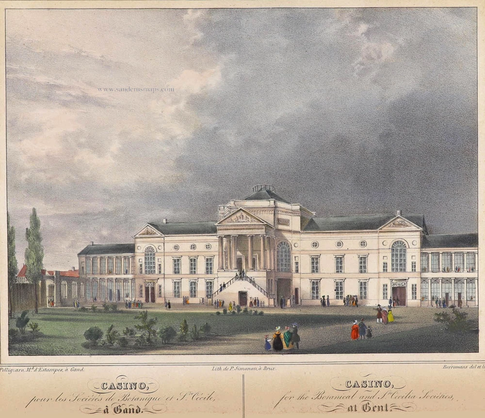
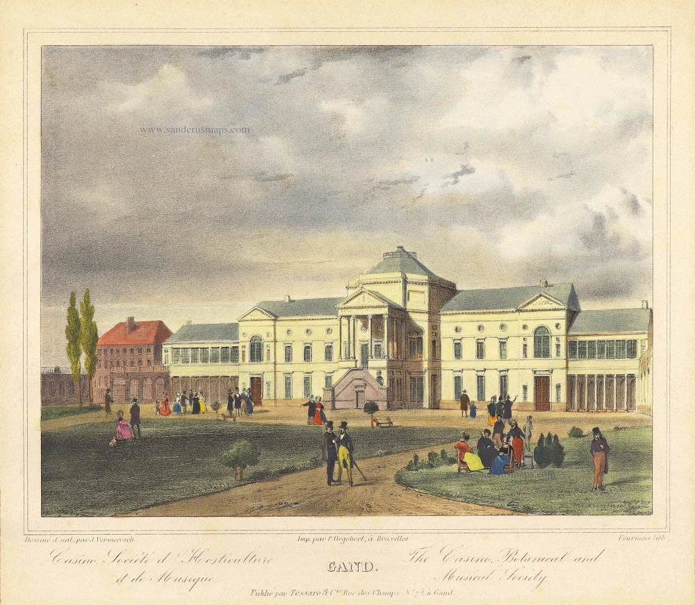
Casino, pour les Sociétés de Botanique et Ste. Cécile, à Gand. - Casono, for the Botanical and Ste Cecilia Sociétes, at Gent. ca. 1840
Gent - Casino by Henri Borremans.
[Item number: 359]
Gandavum, Amplißima Flandria Urbs ... 1657
Ghent (Gent) by Georg Braun & Frans Hogenberg, published by Johannes Janssonius.
[Item number: 2687]
With 'Gravensteen'.
No title. 1641-1644
Ghent (Gent), by A. Sanderus.
[Item number: 5533]
Gand. 19e eeuw
Gent - Casino by P. Degobert after J. Vermeersch, published by Tessaro.
[Item number: 5655]
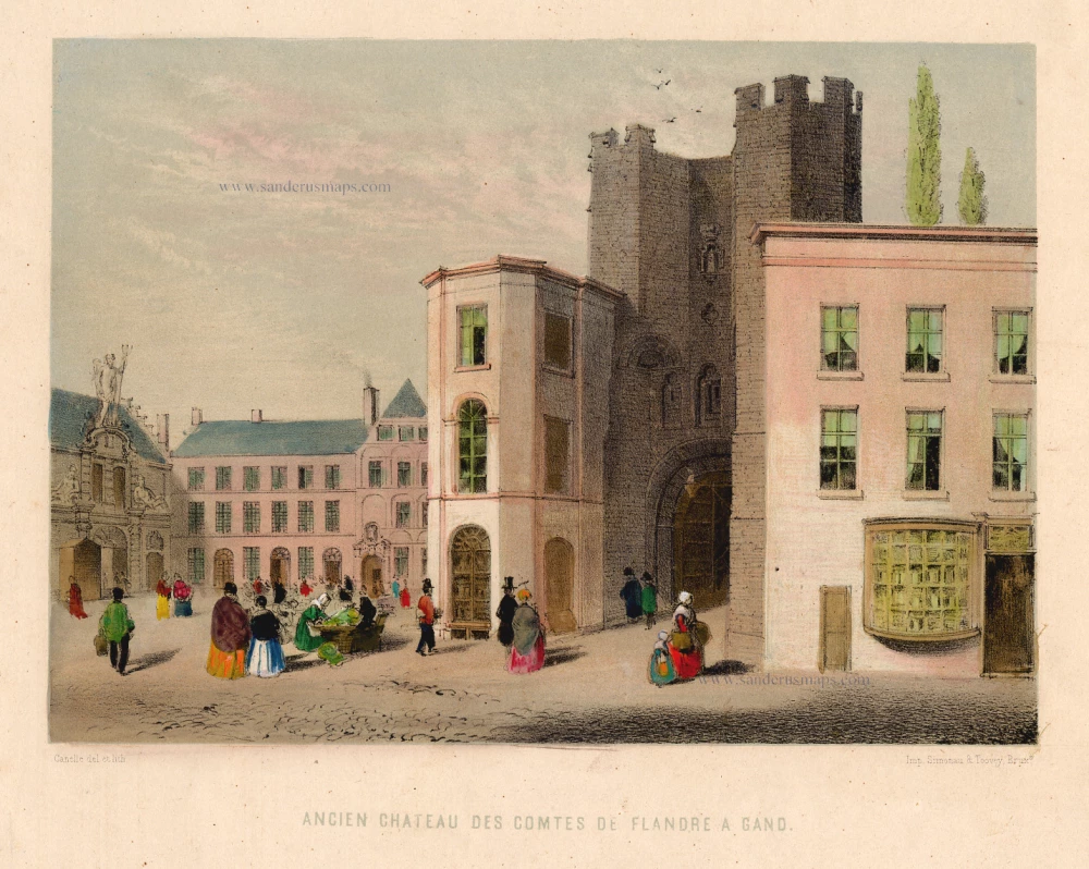
Ancien Château des Comtes de Flandre à Gand. c. 1850
Castle in Ghent (Gravenkasteel) by Canelle.
[Item number: 13180]
Rare.
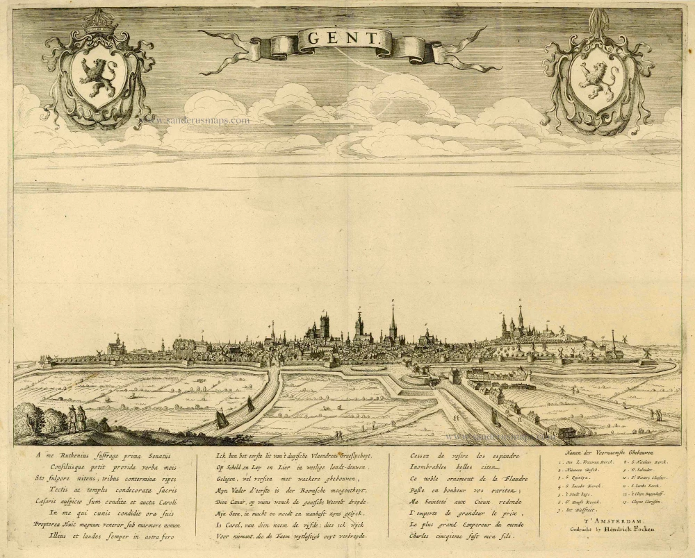
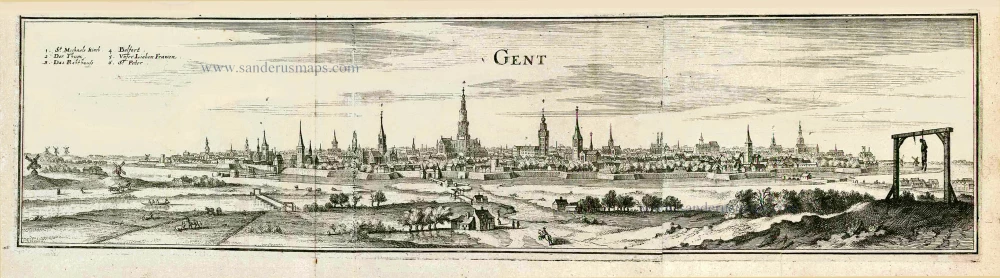
Gent. c. 1660
Gent, by Focken Hendrick
[Item number: 21312]

Rare.
Gent ca. 1650
Gent by Schnitzer Lucas
[Item number: 21998]
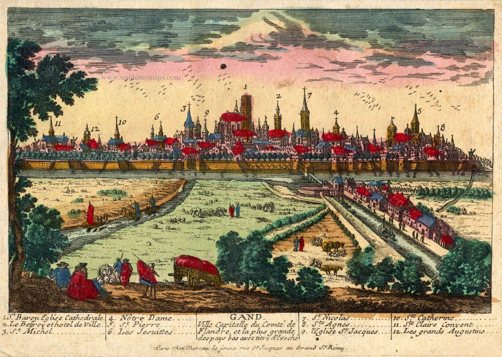
Gand. Ville Capitalle du Comté de Flandre, et la plus grande des pays bas avec titre d'Eveché c. 1720
Gent, by Chéreau.
[Item number: 22537]
Ghendt 1656
Gent, by Visscher N. - Schut P.H.
[Item number: 25397]
Rare!
Gand. c. 1678
Ghent (Gent) by Gerard Jollain.
[Item number: 26705]
Gent. 1659
Gent, by Matthäus Merian.
[Item number: 27411]
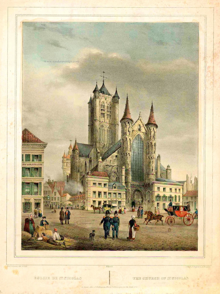
Eglise de St Nicolas à Gand - The church of St Nicolas at Ghent. ca,1830
St.-Niklaaskerk (Gent) by BORREMANS
[Item number: 27418]
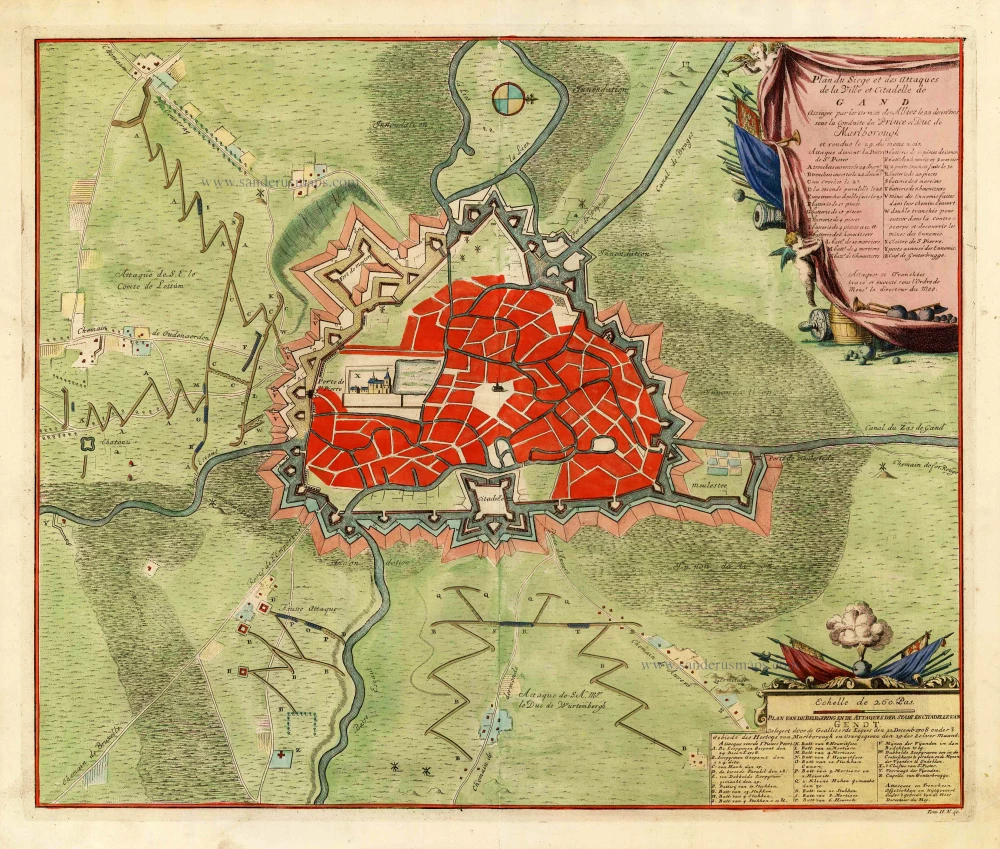
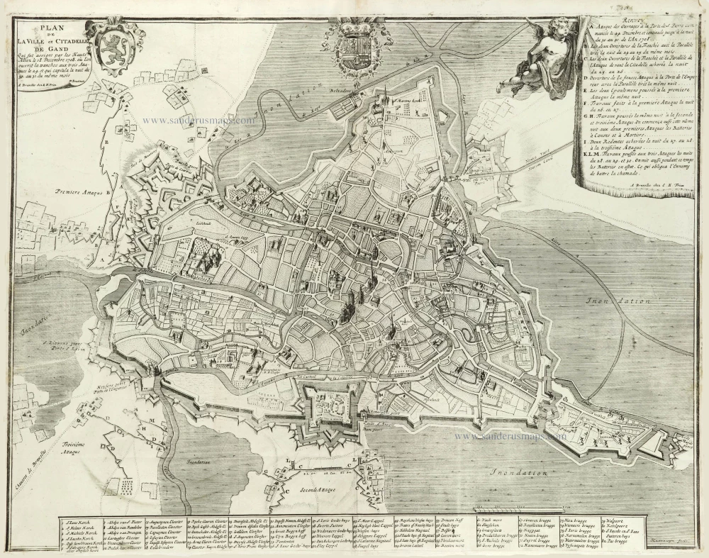
Plan du siège et des attaques de la ville et citadelle de Gand assiégée par les armées des alliez le 22 décembre 1708. ... 1729
Gent, by Jean Dumont.
[Item number: 27430]

Gandavum vulgo Gent. 1652
Gent by Joan Blaeu.
[Item number: 27500]
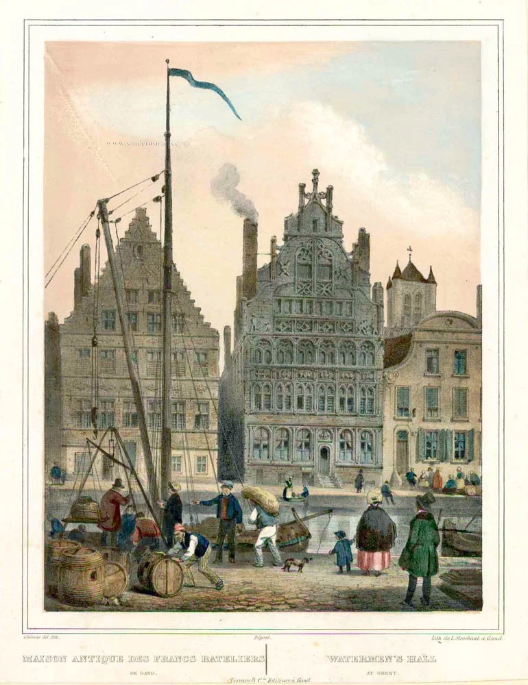
Maison antique des Francs Bateliers de Gand. - Watermen's Hall at Ghent. c. 1840
Graslei - Gent, door Tessaro - L. Stroobant.
[Item number: 27986]
With 'Gravensteen'.
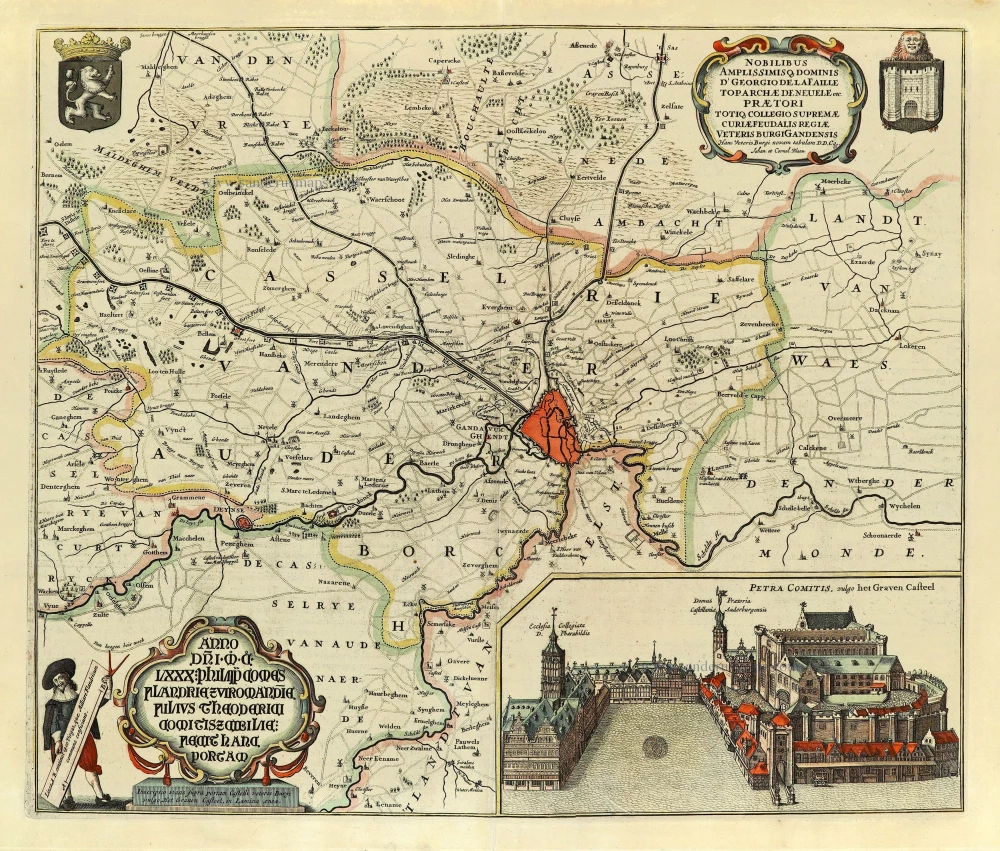
... Hanc Veteris Burgis novam tabulam ... 1662
Gent (Castellania) by Antonius Sanderus, published by Joan Blaeu.
[Item number: 28138]
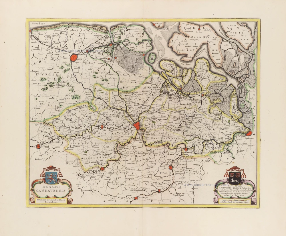
Episcopatus Gandavensis. 1664
Diocese of Ghent (Gent) by Antonius Sanderus, published by Joan Blaeu.
[Item number: 28743]
Gandavum vulgo Gent. c. 1700
Gent by Frederick de Wit.
[Item number: 29517]
Plan de la Ville et Citadelle de Gand . . . 1712
Gent by Eugène Fricx.
[Item number: 29542]
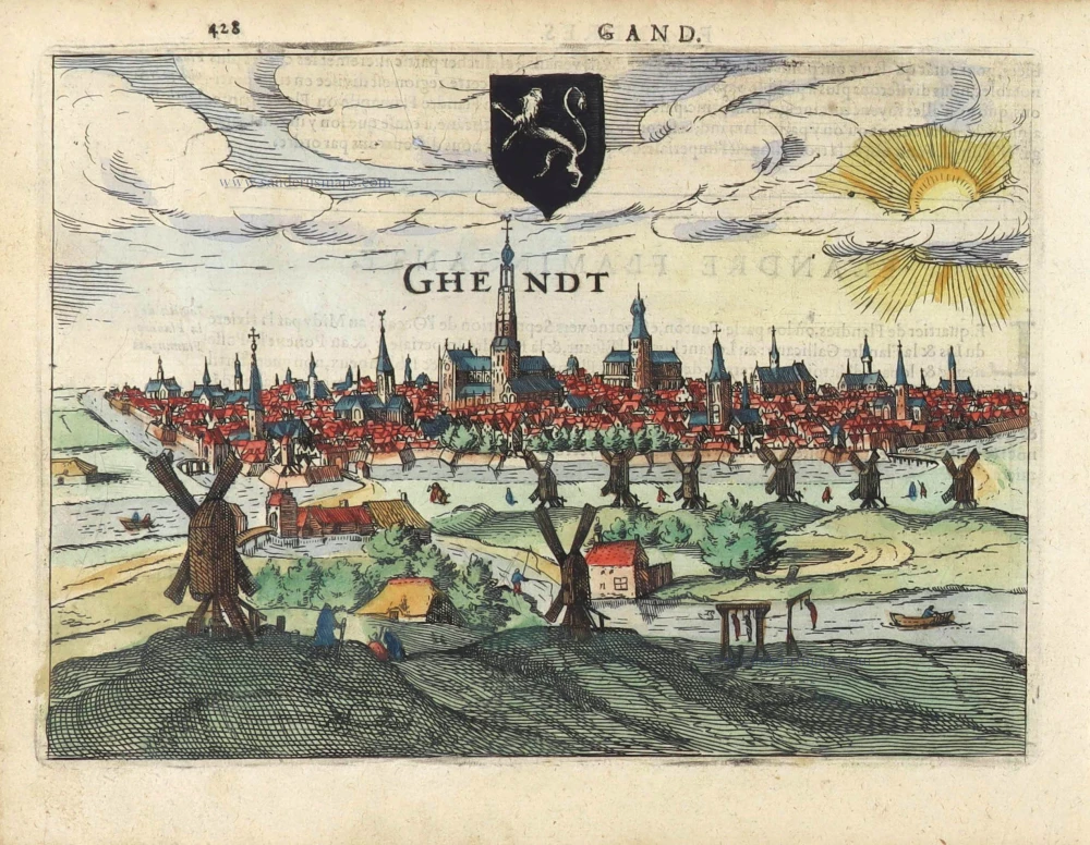
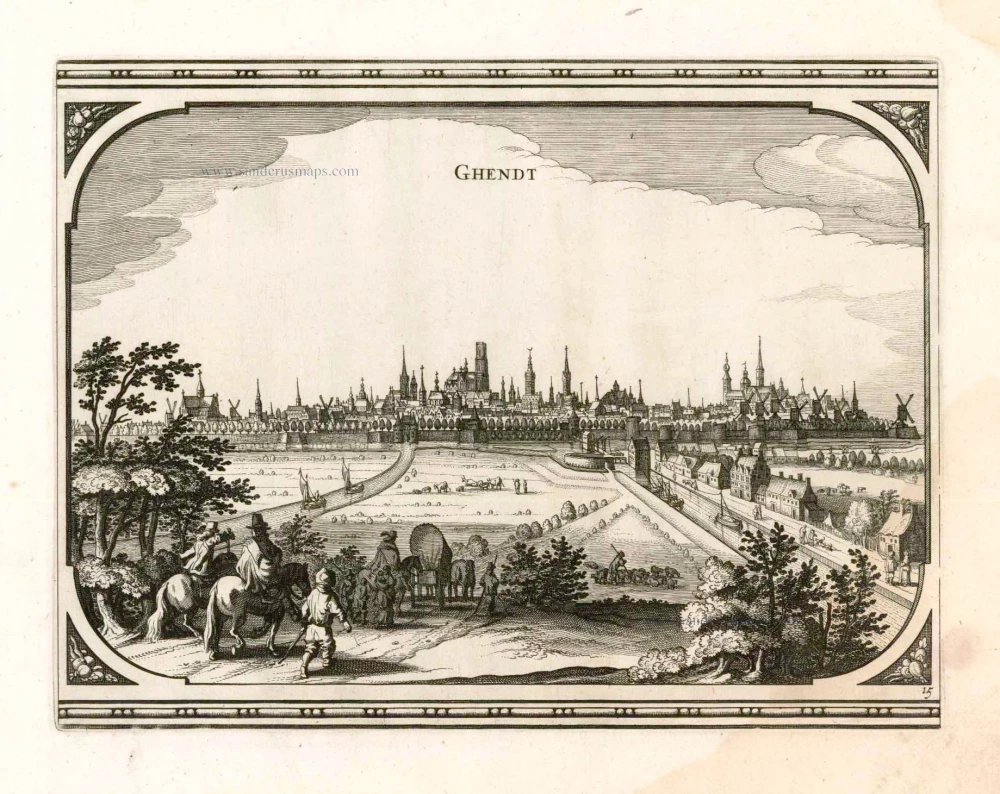
Ghendt. 1613
Gent by Ludovico Guicciardini.
[Item number: 29558]
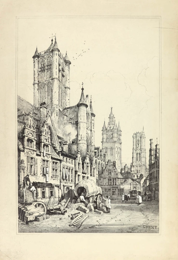
Ghent. 1833
Ghent (Gent) Three towers - Drie torens, by S. Prout.
[Item number: 30027]
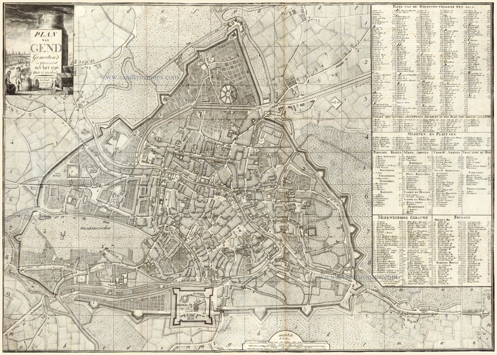
Plan van Gend.
Gent by George Goethals.
[Item number: 30059]
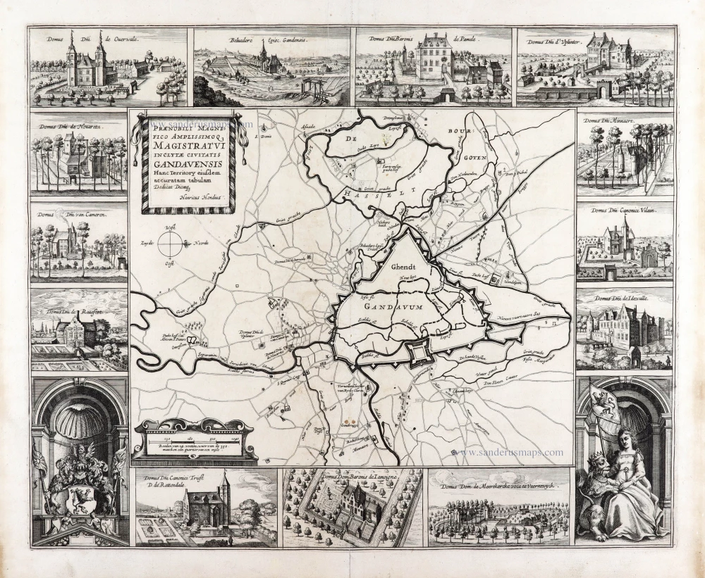
Extremely rare map of Ghent and surroundings.
Praenobili Magnifico Amplissimoq[ue] Magistratui inclytae civitatis Gandavensis
Ghent (Gent), by Henricus Hondius.
[Item number: 30121]
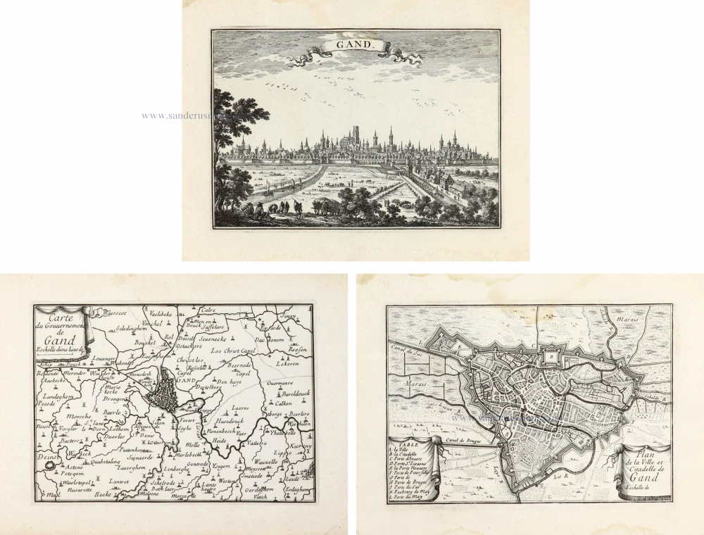
Gand. - Carte du Gouvernement de Gand. - Plan de la Ville et Citadelle de Gand. ca. 1668
Ghent (Gent) by Sr. S. de Beaulieu - three plates.
[Item number: 30298]