
Carolinas by Johannes Janssonius c. 1658
The item displayed on this page has been sold. However, we have a similar map in stock:
Carolina by Johannes Janssonius 1666
Virginiae partis australis et Floridae partis ...
[Item number: 30020]

One of the many cases of duplication by the firms of Blaeu and Hondius of each other's work. Janssonius' plate is so good that it is virtually indistinguishable from Blaeu's.
Cartographically this map forms a marked improvement on the Jodocus Hondius map of 1606, from which this was derived mainly. It also illustrates how engraving styles have moved, being more open and florid. The map depicts the two nations' interests, marked by their coat of arms. The French claim, being largely present-day Georgia, rests on the abortive colonial attempts of the 1560s. Blaeu makes no advance here in geography, following Hondius to the letter.
The most significant improvement occurs in the northern half of the map north of Porto Royal. Whereas on the Hondius, the coastline towards C. de Ste. Romano (present-day Cape Fear) veered directly east, Blaeu more correctly takes it northeast, placing the cape closer to its proper position of 34°. This span of coastline is approximately that of present-day South Carolina. This now presents a more accurately proportioned Outer Banks Region, radically reduced in size but slightly too far north. For these improvements, Blaeu drew upon the extremely rare DE EYLANDEN ..., by Hessel Gerritsz, c. 1631. The Outer Banks combine the placenames of Gerritsz and Hondius, often using two different ones for the same area, such as C. de Trafalgar and C. ost Fear. This last name was often applied to present-day Cape Lookout before it was used for its present site to the southwest.
Chesapeake Bay was depicted as just a tiny bay on Hondius' map of 1606, as John Smith was yet to explore these waters. The Gerritsz terminated at this point, and only two placenames appeared. Blaeu draws mainly on the Smith map for much of the terminology but introduces some English ones from an unknown source. The most important is Newport nesa, Newport News, founded in 1621 and shown here for the first time on a printed map. Also new are Bermouth, Stortingen and Arglas. The two Indian figures from Hondius' map form part of the cartouche on Blaeu's. (Burden)
The Janssonius Family
Joannes Janssonius (Arnhem, 1588-1664), son of the Arnhem publisher Jan Janssen, married Elisabeth Hondius, daughter of Jodocus Hondius, in Amsterdam in 1612. After his marriage, he settled down in this town as a bookseller and publisher of cartographic material. In 1618, he established himself in Amsterdam next door to Blaeu’s bookshop. He entered into serious competition with Willem Jansz. Blaeu when copying Blaeu’s Licht der Zeevaert after the expiration of the privilege in 1620. His activities concerned the publication of atlases, books, single maps, and an extensive book trade with branches in Frankfurt, Danzig, Stockholm, Copenhagen, Berlin, Koningsbergen, Geneva, and Lyon. In 1631, he began publishing atlases together with Henricus Hondius.
In the early 1640s, Henricus Hondius left the atlas publishing business to Janssonius. Competition with Joan Blaeu, Willem’s son and successor, in atlas production, prompted Janssonius to enlarge his Atlas Novus finally into a work of six volumes, into which a sea atlas and an atlas of the Old World were inserted. Other atlases published by Janssonius are Mercator’s Atlas Minor, Hornius’s historical atlas (1652), the townbooks in eight volumes (1657), Cellarius’s Atlas Coelestis and several sea atlases and pilot guides.
After the death of Joannes Janssonius, the shop and publishing firm were continued by the heirs under the direction of Johannes van Waesbergen (c. 1616-1681), son-in-law of Joannes Janssonius. Van Waesbergen added Janssonius's name to his own.
In 1676, Joannes Janssonius’s heirs sold by auction “all the remaining Atlases in Latin, French, High and Low German, as well as the Stedeboecken in Latin, in 8 volumes, bound and unbound, maps, plates belonging to the Atlas and Stedeboecken.” The copperplates from Janssonius’s atlases were afterwards sold to Schenk and Valck.
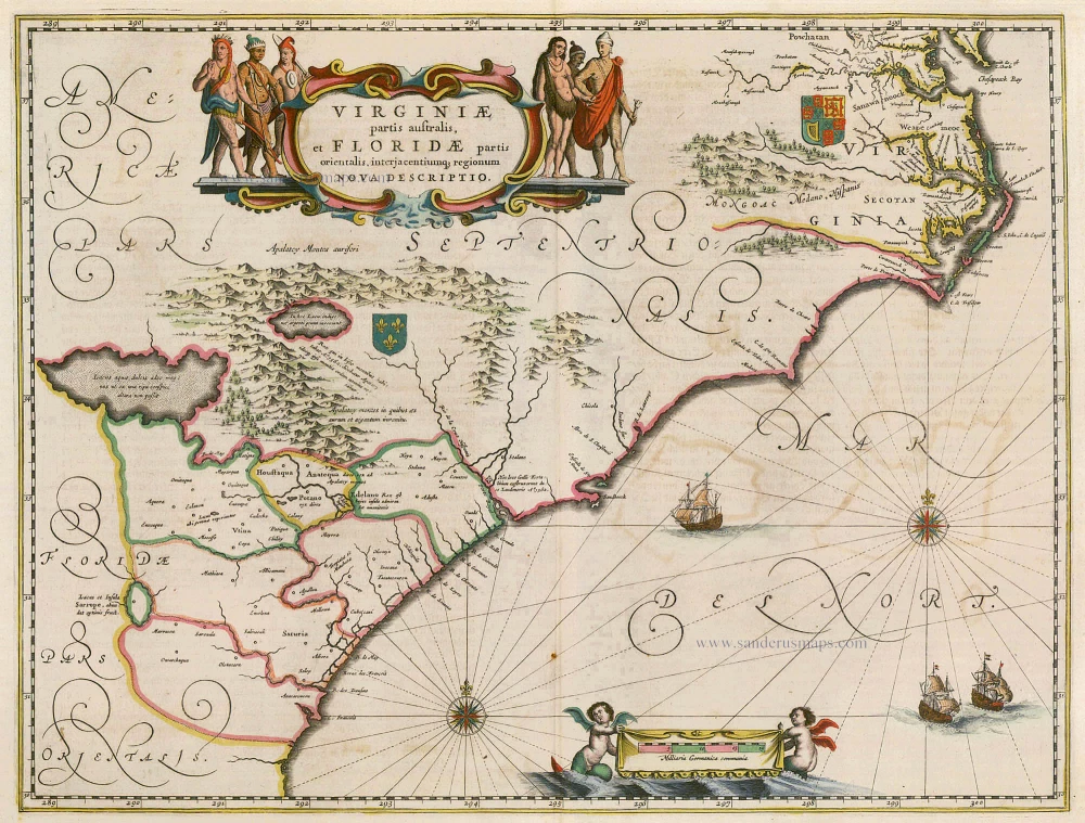
Virginiae partis australis et Floridae partis orientalis, interjacentiumq; regionum Nova Descriptio.
Item Number: 19577 Authenticity Guarantee
Category: Antique maps > America > North America
Old, antique map of Virginia by Janssonius J.
Date of the first edition: 1639
Date of this map: c. 1658
Copper engraving
Size: 38 x 49cm (14.8 x 19.1 inches)
Verso text: German
Condition: Original coloured, some offsetting.
Condition Rating: A
References: Van der Krogt 1, 9400:1B; Burden, 254 State 1.
Atlas Major VI: Novus Atlas Absolutissimus, Das ist, Generale Welt-Beschreibung, mit allerley schönen und Neuen Land-Carten gezieret. Dass Sechste Theil, beschreibet Hispanien, Asia, Africa, und America. Amsterdam, J. Janssonius, 1658. (Van der Krogt 1:428.6)
One of the many cases of duplication by the firms of Blaeu and Hondius of each other's work. Janssonius' plate is so good that it is virtually indistinguishable from Blaeu's.
Cartographically this map forms a marked improvement on the Jodocus Hondius map of 1606, from which this was derived mainly. It also illustrates how engraving styles have moved, being more open and florid. The map depicts the two nations' interests, marked by their coat of arms. The French claim, being largely present-day Georgia, rests on the abortive colonial attempts of the 1560s. Blaeu makes no advance here in geography, following Hondius to the letter.
The most significant improvement occurs in the northern half of the map north of Porto Royal. Whereas on the Hondius, the coastline towards C. de Ste. Romano (present-day Cape Fear) veered directly east, Blaeu more correctly takes it northeast, placing the cape closer to its proper position of 34°. This span of coastline is approximately that of present-day South Carolina. This now presents a more accurately proportioned Outer Banks Region, radically reduced in size but slightly too far north. For these improvements, Blaeu drew upon the extremely rare DE EYLANDEN ..., by Hessel Gerritsz, c. 1631. The Outer Banks combine the placenames of Gerritsz and Hondius, often using two different ones for the same area, such as C. de Trafalgar and C. ost Fear. This last name was often applied to present-day Cape Lookout before it was used for its present site to the southwest.
Chesapeake Bay was depicted as just a tiny bay on Hondius' map of 1606, as John Smith was yet to explore these waters. The Gerritsz terminated at this point, and only two placenames appeared. Blaeu draws mainly on the Smith map for much of the terminology but introduces some English ones from an unknown source. The most important is Newport nesa, Newport News, founded in 1621 and shown here for the first time on a printed map. Also new are Bermouth, Stortingen and Arglas. The two Indian figures from Hondius' map form part of the cartouche on Blaeu's. (Burden)
The Janssonius Family
Joannes Janssonius (Arnhem, 1588-1664), son of the Arnhem publisher Jan Janssen, married Elisabeth Hondius, daughter of Jodocus Hondius, in Amsterdam in 1612. After his marriage, he settled down in this town as a bookseller and publisher of cartographic material. In 1618, he established himself in Amsterdam next door to Blaeu’s bookshop. He entered into serious competition with Willem Jansz. Blaeu when copying Blaeu’s Licht der Zeevaert after the expiration of the privilege in 1620. His activities concerned the publication of atlases, books, single maps, and an extensive book trade with branches in Frankfurt, Danzig, Stockholm, Copenhagen, Berlin, Koningsbergen, Geneva, and Lyon. In 1631, he began publishing atlases together with Henricus Hondius.
In the early 1640s, Henricus Hondius left the atlas publishing business to Janssonius. Competition with Joan Blaeu, Willem’s son and successor, in atlas production, prompted Janssonius to enlarge his Atlas Novus finally into a work of six volumes, into which a sea atlas and an atlas of the Old World were inserted. Other atlases published by Janssonius are Mercator’s Atlas Minor, Hornius’s historical atlas (1652), the townbooks in eight volumes (1657), Cellarius’s Atlas Coelestis and several sea atlases and pilot guides.
After the death of Joannes Janssonius, the shop and publishing firm were continued by the heirs under the direction of Johannes van Waesbergen (c. 1616-1681), son-in-law of Joannes Janssonius. Van Waesbergen added Janssonius's name to his own.
In 1676, Joannes Janssonius’s heirs sold by auction “all the remaining Atlases in Latin, French, High and Low German, as well as the Stedeboecken in Latin, in 8 volumes, bound and unbound, maps, plates belonging to the Atlas and Stedeboecken.” The copperplates from Janssonius’s atlases were afterwards sold to Schenk and Valck.
Related items
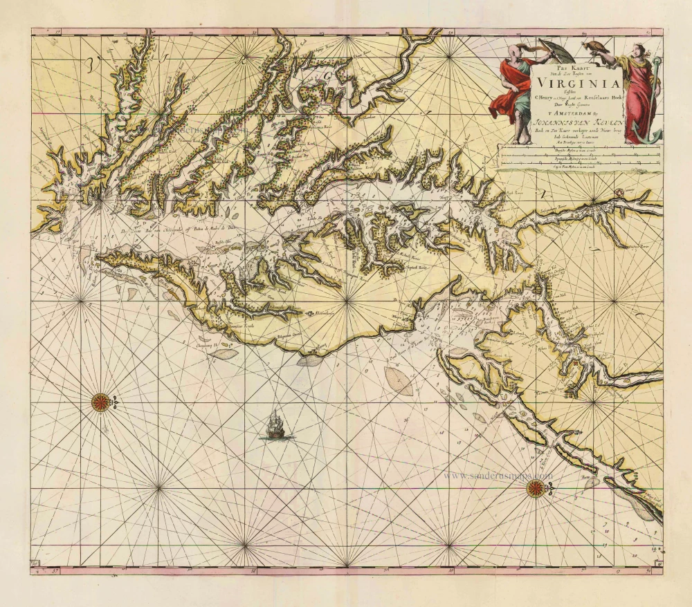
Pas Kaart van de Zee Kusten van Virginia tusschen C. Henry en t Hooge Land van Renselaars Hoek. 1702
Virginia by Johannes van Keulen
[Item number: 1332]
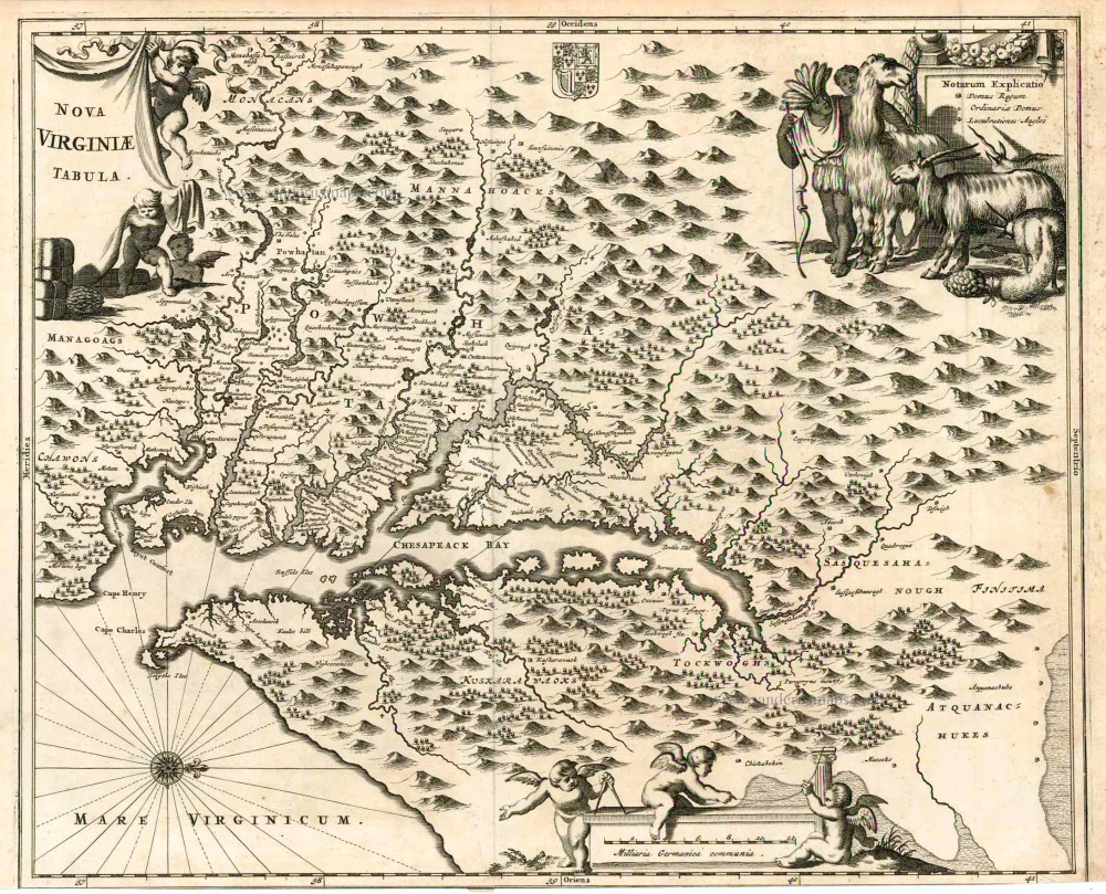
Nova Virginiae Tabula. 1671
Virginia, by A. Montanus.
[Item number: 25613]
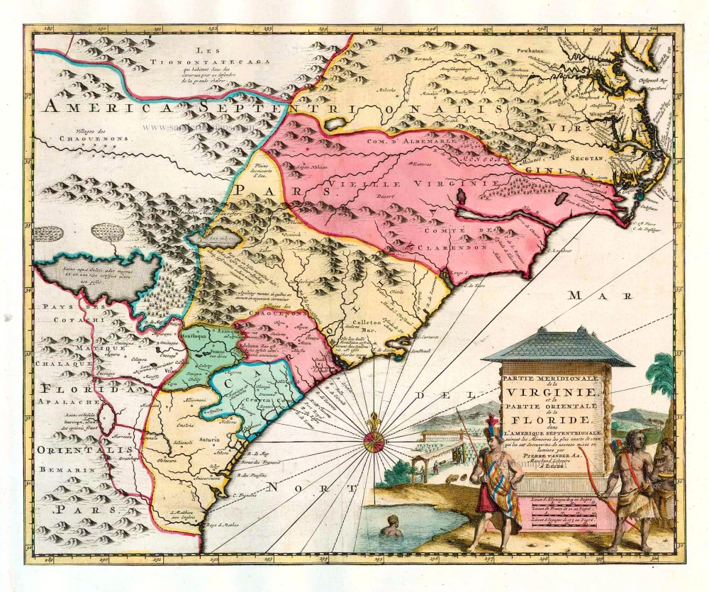
Partie Meridionale de la Virginie, et la Partie Orientale de la Floride dans l'Amerique Septentrionale. 1713
Carolina by Pieter van der Aa.
[Item number: 26137]
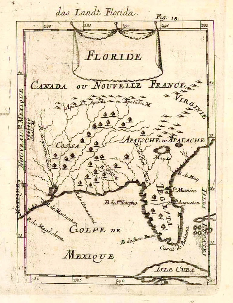
Floride. 1685
Florida, Virginia and Louisiana, by A.M. Mallet.
[Item number: 26599]
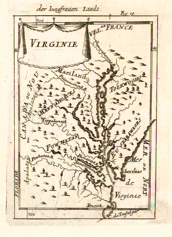
Virginie. 1685
Virginia and Maryland, by A.M. Mallet.
[Item number: 26602]