
Sea chart of Newfoundland by Joseph-Bernard de Chabert, James Cook and Charles-Pierre Claret de Fleurieu, published for Thomas Jefferys, by Robert Sayer and John Bennett. 1775
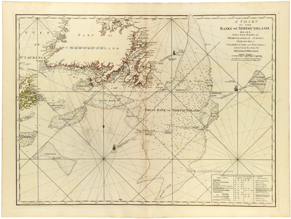
An important and highly detailed eighteenth-century nautical chart of the Grand Banks of Newfoundland, based on hydrographic surveys by the French and British navigators Chabert, James Cook and Charles-Pierre Claret de Fleurieu.
The chart depicts the southern coast of Newfoundland, from the Gulf of St. Lawrence and Cape Breton Island in the west to the eastern approaches of the Atlantic Ocean. Particular attention is devoted to the extensive submarine banks surrounding Newfoundland, including the Great Bank, Green Bank, Banquereau, Mizen Bank, Porpoise Bank and the Outer Bank.
The Grand Banks, among the richest fishing grounds in the North Atlantic, had been exploited by European fishermen since the early sixteenth century. Their shallow waters, unpredictable weather, dense fogs and numerous navigational hazards made accurate hydrographic charts indispensable to maritime navigation and the fishing industry.
The map is particularly remarkable for its detailed representation of the submarine banks, distinguished by fine stippling and numerous depth soundings. An intricate network of rhumb lines radiates from several compass centres, while coastal landmarks, islands, capes, harbours and offshore hazards are carefully identified. Small engraved ships enliven the otherwise technical composition.
In the lower right corner, a table of astronomical observations lists the geographical coordinates of important locations, along with the observers' names and references to the surveys on which the chart was based. This reflects the increasing importance of astronomical observations in establishing accurate geographical positions during the eighteenth century.
The chart draws upon the work of three distinguished hydrographers: Joseph-Bernard de Chabert (1724–1805), the French naval officer and astronomer who conducted important surveys of the North Atlantic; James Cook (1728–1779), whose pioneering surveys of Newfoundland between 1763 and 1767 established his reputation as an exceptionally skilled hydrographer; and Charles-Pierre Claret de Fleurieu (1738–1810), the French naval officer, hydrographer and scientific navigator.
The combination of British and French survey material is particularly significant, demonstrating the international exchange of hydrographic knowledge despite the intense political and maritime rivalry between the two nations.
The Grand Banks were of enormous economic and strategic importance throughout the eighteenth century. The Newfoundland fisheries supplied European markets with vast quantities of cod, while the surrounding waters formed part of the principal transatlantic shipping routes between Europe and North America. Accurate charts of these dangerous waters were consequently essential to both commercial and naval navigation.
A fine example of eighteenth-century hydrographic cartography, combining the pioneering surveys of James Cook with contemporary French scientific observations, and documenting one of the most economically important maritime regions of the North Atlantic.
Thomas Jefferys (c. 1719-1771)
Thomas Jefferys was an outstanding English cartographer who was the leading map supplier of his day. He engraved and printed maps for government and other official bodies and produced a wide range of commercial maps and atlases. He made some of the finest maps of the time of North America and the West Indies.
He was appointed Geographer to the Prince of Wales and George II. However, in 1766, he became bankrupt and subsequently, the publication of his maps was managed by Robert Sayer, who in 1774 was joined in partnership by John Bennett and William Faden.
A Chart of the Banks of Newfoundland Drawn from a Great Number of Hydrographical Surveys, Chiefly from those of Chabert, Cook and Fleurieu, Corrected and Ascertained Astronomical Observations.
Item Number: 33365 new Authenticity Guarantee
Category: Antique maps > America > North America
Sea chart of Newfoundland by Joseph-Bernard de Chabert, James Cook and Charles-Pierre Claret de Fleurieu, published for Thomas Jefferys, by Robert Sayer and John Bennett.
Title: A Chart of the Banks of Newfoundland Drawn from a Great Number of Hydrographical Surveys, Chiefly from those of Chabert, Cook and Fleurieu, Corrected and Ascertained Astronomical Observations.
London. Printed for & Sold by R. Sayer & J Bennett. N° 53 in Fleet Street, as the Act directs 25th March 1775.
Date: 1775.
Date on map: 1775.
Copper engraving, printed on paper.
Image size: 470 x 615mm (18½ x 24¼ inches).
Sheet size: 555 x 745mm (21¾ x 29¼ inches).
Verso: Blank.
Condition: Original coloured in outline, excellent.
Condition Rating: A+.
From: Jefferys Thomas, The American Atlas. London, 1775. (Tooley (Brit.Lib.), T.JEF-2b).
An important and highly detailed eighteenth-century nautical chart of the Grand Banks of Newfoundland, based on hydrographic surveys by the French and British navigators Chabert, James Cook and Charles-Pierre Claret de Fleurieu.
The chart depicts the southern coast of Newfoundland, from the Gulf of St. Lawrence and Cape Breton Island in the west to the eastern approaches of the Atlantic Ocean. Particular attention is devoted to the extensive submarine banks surrounding Newfoundland, including the Great Bank, Green Bank, Banquereau, Mizen Bank, Porpoise Bank and the Outer Bank.
The Grand Banks, among the richest fishing grounds in the North Atlantic, had been exploited by European fishermen since the early sixteenth century. Their shallow waters, unpredictable weather, dense fogs and numerous navigational hazards made accurate hydrographic charts indispensable to maritime navigation and the fishing industry.
The map is particularly remarkable for its detailed representation of the submarine banks, distinguished by fine stippling and numerous depth soundings. An intricate network of rhumb lines radiates from several compass centres, while coastal landmarks, islands, capes, harbours and offshore hazards are carefully identified. Small engraved ships enliven the otherwise technical composition.
In the lower right corner, a table of astronomical observations lists the geographical coordinates of important locations, along with the observers' names and references to the surveys on which the chart was based. This reflects the increasing importance of astronomical observations in establishing accurate geographical positions during the eighteenth century.
The chart draws upon the work of three distinguished hydrographers: Joseph-Bernard de Chabert (1724–1805), the French naval officer and astronomer who conducted important surveys of the North Atlantic; James Cook (1728–1779), whose pioneering surveys of Newfoundland between 1763 and 1767 established his reputation as an exceptionally skilled hydrographer; and Charles-Pierre Claret de Fleurieu (1738–1810), the French naval officer, hydrographer and scientific navigator.
The combination of British and French survey material is particularly significant, demonstrating the international exchange of hydrographic knowledge despite the intense political and maritime rivalry between the two nations.
The Grand Banks were of enormous economic and strategic importance throughout the eighteenth century. The Newfoundland fisheries supplied European markets with vast quantities of cod, while the surrounding waters formed part of the principal transatlantic shipping routes between Europe and North America. Accurate charts of these dangerous waters were consequently essential to both commercial and naval navigation.
A fine example of eighteenth-century hydrographic cartography, combining the pioneering surveys of James Cook with contemporary French scientific observations, and documenting one of the most economically important maritime regions of the North Atlantic.
Thomas Jefferys (c. 1719-1771)
Thomas Jefferys was an outstanding English cartographer who was the leading map supplier of his day. He engraved and printed maps for government and other official bodies and produced a wide range of commercial maps and atlases. He made some of the finest maps of the time of North America and the West Indies.
He was appointed Geographer to the Prince of Wales and George II. However, in 1766, he became bankrupt and subsequently, the publication of his maps was managed by Robert Sayer, who in 1774 was joined in partnership by John Bennett and William Faden.
Related items
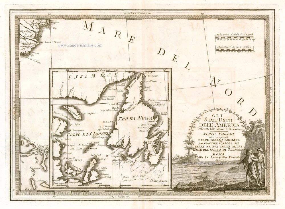
Gli Stati Uniti dell'America Delineati sulle Ultime Osservazioni. Sesto Foglio che Comprende Parte della Carolina ed Inoltre l'Isola di Terra Nuova colle altre Isole del Golfo do S. Lorenzo 1797
Antique map of the Carolinas - Newfoundland, by Cassini, G.M.
[Item number: 23477]
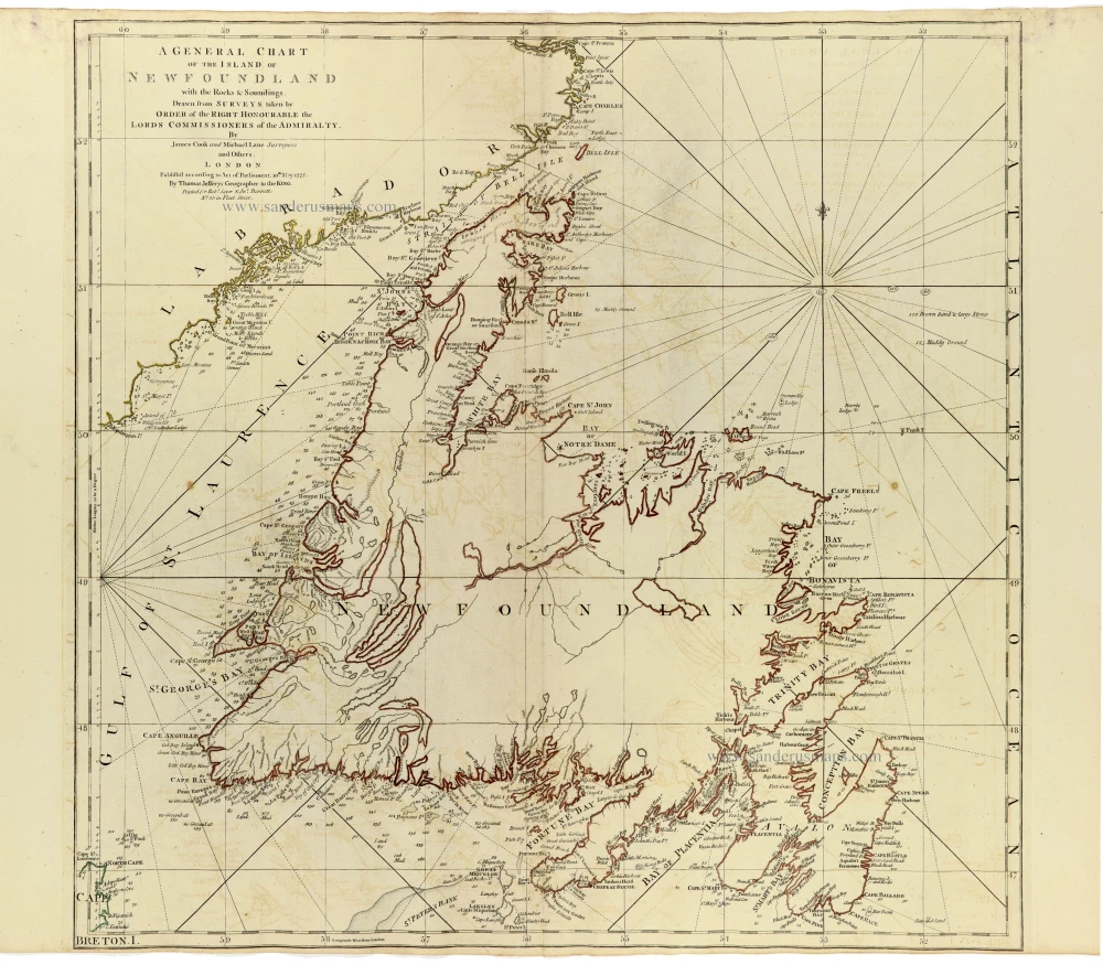
A General Chart of the Island of Newfoundland with the Rocks & Soundings. 1775
Newfoundland by James Cook and Michael Lane, published by Thomas Jefferys.
[Item number: 33364]
new