
Nova Scotia by Thomas Jefferys, published by Robert Sayer and John Bennett 1775
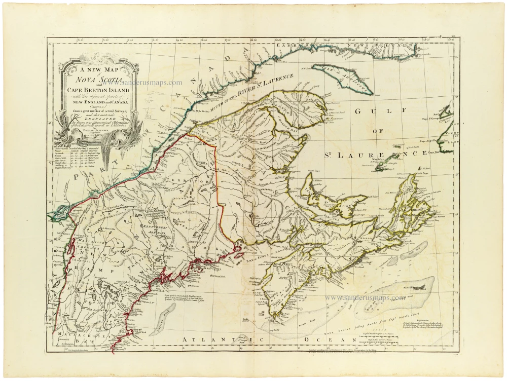
A highly detailed and finely engraved eighteenth-century map of Nova Scotia, Cape Breton Island, New Brunswick and the adjoining territories of northeastern North America, published in London by Robert Sayer and John Bennett in 1775.
The map extends from the St. Lawrence River and the Gaspé Peninsula in the north to the Atlantic coast of Maine and Nova Scotia in the south, encompassing the Bay of Fundy, the Gulf of St. Lawrence, Prince Edward Island (then known as St. John's Island), and Cape Breton Island.
Based on numerous surveys and other geographical materials, the map provides an exceptionally detailed representation of the region's coastlines, rivers, lakes, settlements, roads and territorial boundaries. Particular attention is devoted to the complex river systems and coastal geography of Nova Scotia and the Bay of Fundy, including the important harbours and settlements associated with British colonial expansion.
The map is also notable for its depiction of the extensive territories inhabited by Indigenous peoples, including the Mi'kmaq and other First Nations, whose traditional lands extended across much of the region long before European colonisation.
The map also depicts the disputed boundary between the British colonies and former French territories. The map reflects the changing political geography of northeastern North America following the British conquest of New France and the Treaty of Paris in 1763.
The offshore waters are carefully delineated, including the principal fishing banks along the Atlantic coast of Nova Scotia. These fishing grounds were of considerable commercial importance, particularly for the cod fisheries that formed a major part of the region's economy.
The map features an elaborate rococo title cartouche in the upper left corner, decorated with ornamental scrollwork and foliage. The original outline colouring distinguishes the coastlines and territorial boundaries, while fine engraving provides extensive topographical detail.
Published shortly before the outbreak of the American Revolutionary War, the map represents an important document of British colonial geography at a time of considerable political and territorial change.
An attractive and historically significant map of northeastern British North America, combining detailed geographical information with fine decorative engraving and original outline colouring.
Thomas Jefferys (c. 1719-1771)
Thomas Jefferys was an outstanding English cartographer who was the leading map supplier of his day. He engraved and printed maps for government and other official bodies and produced a wide range of commercial maps and atlases. He made some of the finest maps of the time of North America and the West Indies.
He was appointed Geographer to the Prince of Wales and George II. However, in 1766, he became bankrupt and subsequently, the publication of his maps was managed by Robert Sayer, who in 1774 was joined in partnership by John Bennett and William Faden.
A new map of Nova Scotia, and Cape Breton Island with the adjacent parts of New England and Canada,
Item Number: 33366 new Authenticity Guarantee
Category: Antique maps > America > North America
Nova Scotia by Thomas Jefferys, published by Robert Sayer and John Bennett.
Title: A new map of Nova Scotia, and Cape Breton Island with the adjacent parts of New England and Canada,
Composed from a great number of actual surveys; and other materials regulated by many new Astronomical Observations of the Longitude aswell as Latitude;
by Thomas Jefferys, Geographer to the King.
London. Printed for & Sold by R. Sayer & J Bennett. N° 53 in Fleet Street, 15 June 1775.
Date of the first edition: 1755.
Date of this map: 1775.
Date on map: 1775.
Copper engraving, printed on paper.
Image size: 470 x 615mm (18½ x 24¼ inches).
Sheet size: 555 x 745mm (21¾ x 29¼ inches).
Verso: Blank.
Condition: Original coloured in outline, excellent.
Condition Rating: A+.
From: Jefferys Thomas, The American Atlas. London, 1775. (Tooley (Brit.Lib.), T.JEF-2b).
A highly detailed and finely engraved eighteenth-century map of Nova Scotia, Cape Breton Island, New Brunswick and the adjoining territories of northeastern North America, published in London by Robert Sayer and John Bennett in 1775.
The map extends from the St. Lawrence River and the Gaspé Peninsula in the north to the Atlantic coast of Maine and Nova Scotia in the south, encompassing the Bay of Fundy, the Gulf of St. Lawrence, Prince Edward Island (then known as St. John's Island), and Cape Breton Island.
Based on numerous surveys and other geographical materials, the map provides an exceptionally detailed representation of the region's coastlines, rivers, lakes, settlements, roads and territorial boundaries. Particular attention is devoted to the complex river systems and coastal geography of Nova Scotia and the Bay of Fundy, including the important harbours and settlements associated with British colonial expansion.
The map is also notable for its depiction of the extensive territories inhabited by Indigenous peoples, including the Mi'kmaq and other First Nations, whose traditional lands extended across much of the region long before European colonisation.
The map also depicts the disputed boundary between the British colonies and former French territories. The map reflects the changing political geography of northeastern North America following the British conquest of New France and the Treaty of Paris in 1763.
The offshore waters are carefully delineated, including the principal fishing banks along the Atlantic coast of Nova Scotia. These fishing grounds were of considerable commercial importance, particularly for the cod fisheries that formed a major part of the region's economy.
The map features an elaborate rococo title cartouche in the upper left corner, decorated with ornamental scrollwork and foliage. The original outline colouring distinguishes the coastlines and territorial boundaries, while fine engraving provides extensive topographical detail.
Published shortly before the outbreak of the American Revolutionary War, the map represents an important document of British colonial geography at a time of considerable political and territorial change.
An attractive and historically significant map of northeastern British North America, combining detailed geographical information with fine decorative engraving and original outline colouring.
Thomas Jefferys (c. 1719-1771)
Thomas Jefferys was an outstanding English cartographer who was the leading map supplier of his day. He engraved and printed maps for government and other official bodies and produced a wide range of commercial maps and atlases. He made some of the finest maps of the time of North America and the West Indies.
He was appointed Geographer to the Prince of Wales and George II. However, in 1766, he became bankrupt and subsequently, the publication of his maps was managed by Robert Sayer, who in 1774 was joined in partnership by John Bennett and William Faden.
Related items
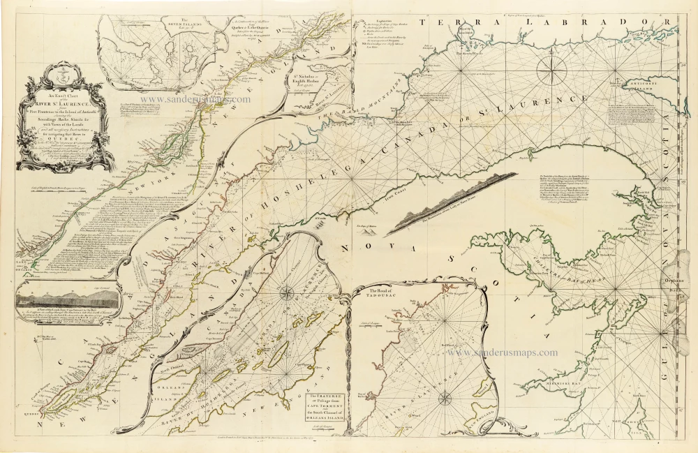
An Exact Chart of the River St. Laurence, from Fort Frontenac to the Island of Anticosti shewing the Soundings, Rocks, Shoals &c with Views of the Lands and all necessary Instructions for navigating that River to Quebec. 1775
Canada - St. Laurence River by Thomas Jeffery, published by Robert Sayer,
[Item number: 33362]
new
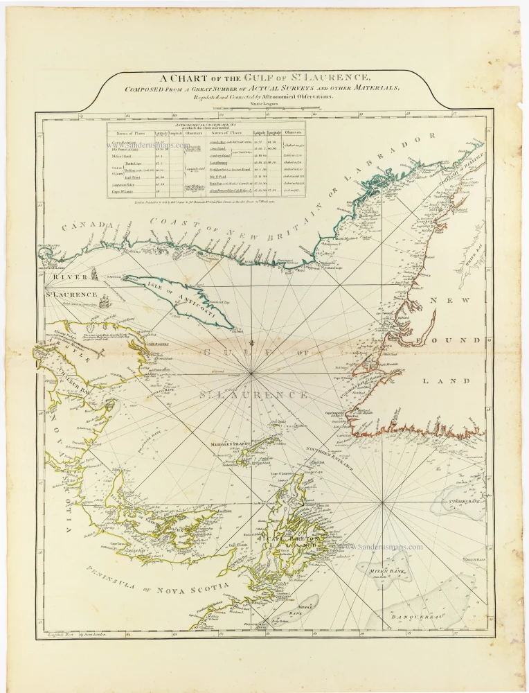
A Chart of the Gulf of St. Laurence, Composed From A Great Number of Actual Surveys and other Materials, Regulated by Astronomical Observations, 1775
Gulf of St. Laurence by Thomas Jeffery, published by Robert Sayer,
[Item number: 33363]
new
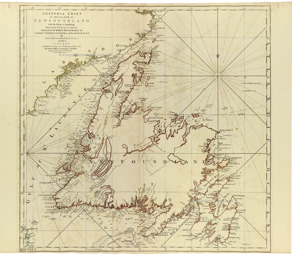
A General Chart of the Island of Newfoundland with the Rocks & Soundings. 1775
Newfoundland by James Cook and Michael Lane, published by Thomas Jefferys.
[Item number: 33364]
new
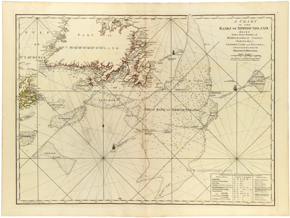
A Chart of the Banks of Newfoundland Drawn from a Great Number of Hydrographical Surveys, Chiefly from those of Chabert, Cook and Fleurieu, Corrected and Ascertained Astronomical Observations. 1775
Sea chart of Newfoundland by Joseph-Bernard de Chabert, James Cook and Charles-Pierre Claret de Fleurieu, published for Thomas Jefferys, by Robert Sayer and John Bennett.
[Item number: 33365]
new