
Canada - St. Laurence River by Thomas Jeffery, published by Robert Sayer, 1775
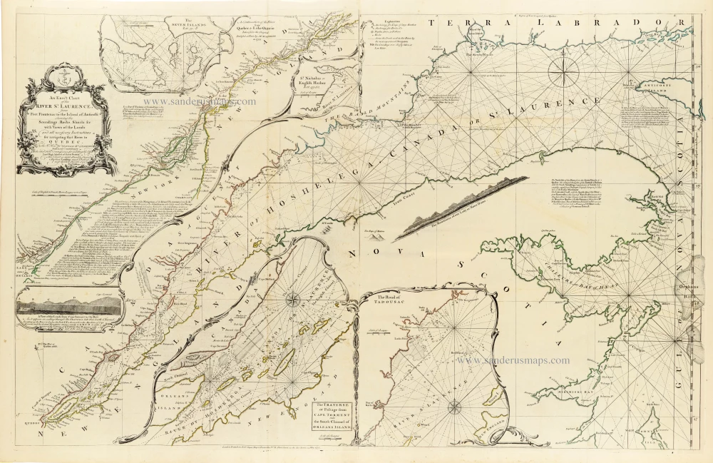
A magnificent and highly detailed eighteenth-century navigational chart of the St. Lawrence River, extending from Lake Ontario to the Gulf of St. Lawrence, published by Robert Sayer in London.
This impressive chart by Thomas Jefferys (c. 1719–1771), one of the leading British cartographers of the eighteenth century, depicts the St. Lawrence River from Fort Frontenac (present-day Kingston, Ontario), at the eastern end of Lake Ontario, to the Island of Anticosti in the Gulf of St. Lawrence.
Designed primarily for maritime navigation, the chart provides exceptionally detailed hydrographic information, including soundings, shoals, rocks, channels, anchorages, currents, and coastal landmarks. Numerous compass roses and an intricate network of rhumb lines cover the river and its approaches, reflecting the chart's practical importance for vessels navigating the difficult waters of the St. Lawrence.
The chart includes Quebec, Montreal, the Saguenay River, the Gaspé Peninsula, the northern coast of New Brunswick, and parts of Nova Scotia and Newfoundland. The geographical detail is particularly extensive along the shores of the St. Lawrence, where numerous settlements, islands, bays, and navigational hazards are carefully identified.
Several decorative inset charts provide additional information essential to navigation, including the Seven Islands, St. Nicholas or English Harbour, the Traverse near Cape Torment, and the Road of Tadoussac. A finely engraved coastal profile shows the land as seen from the river, helping navigators identify key landmarks.
The elaborate rococo title cartouche, decorated with maritime motifs, contrasts with the chart's technical precision. The original outline colouring distinguishes coastlines, islands, and geographical features.
The St. Lawrence River was of enormous strategic and commercial importance during the eighteenth century, providing the principal maritime route into the interior of Canada. Following the British conquest of Quebec in 1759 and the Treaty of Paris in 1763, accurate charts of the river became particularly valuable for British naval, military, and commercial activities.
Thomas Jefferys, who held the title of Geographer to King George III, was responsible for some of the most important maps of British North America published during the colonial period. His work combined existing French cartographic knowledge with British hydrographic surveys and geographical observations.
The chart was published by Robert Sayer, who acquired much of Jefferys' cartographic material following the latter's death in 1771. It was included in The American Atlas, one of the most important collections of maps of North America published during the period of the American Revolutionary War.
An outstanding example of eighteenth-century British hydrographic cartography, combining exceptional geographical detail, practical navigational information, and fine decorative engraving.
Thomas Jefferys (c. 1719-1771)
Thomas Jefferys was an outstanding English cartographer who was the leading map supplier of his day. He engraved and printed maps for government and other official bodies and produced a wide range of commercial maps and atlases. He made some of the finest maps of the time of North America and the West Indies.
He was appointed Geographer to the Prince of Wales and George II. However, in 1766, he became bankrupt and subsequently, the publication of his maps was managed by Robert Sayer, who in 1774 was joined in partnership by John Bennett and William Faden.
An Exact Chart of the River St. Laurence, from Fort Frontenac to the Island of Anticosti shewing the Soundings, Rocks, Shoals &c with Views of the Lands and all necessary Instructions for navigating that River to Quebec.
Item Number: 33362 new Authenticity Guarantee
Category: Antique maps > America > North America
St. Laurence River by Thomas Jeffery, published by Robert Sayer,.
Title: An Exact Chart of the River St. Laurence, from Fort Frontenac to the Island of Anticosti shewing the Soundings, Rocks, Shoals &c with Views of the Lands and all necessary Instructions for navigating that River to Quebec.
London Printed for Rob.t Sayer Map & Printseller, N° 53 Fleet Street, as the Act directs, 25 May, 1775.
Date of the first edition: 1757.
Date of this map: 1775.
Date on map: 1775.
Copper engraving, printed on paper.
Image size: 605 x 950mm (23¾ x 37½ inches).
Sheet size: 640 x 990mm (25¼ x 39 inches).
Verso: Blank.
Condition: Original coloured in outline; folds as issued, excellent.
Condition Rating: A+.
From: Jefferys Thomas, The American Atlas. London, 1775. (Tooley (Brit.Lib.), T.JEF-2b).
A magnificent and highly detailed eighteenth-century navigational chart of the St. Lawrence River, extending from Lake Ontario to the Gulf of St. Lawrence, published by Robert Sayer in London.
This impressive chart by Thomas Jefferys (c. 1719–1771), one of the leading British cartographers of the eighteenth century, depicts the St. Lawrence River from Fort Frontenac (present-day Kingston, Ontario), at the eastern end of Lake Ontario, to the Island of Anticosti in the Gulf of St. Lawrence.
Designed primarily for maritime navigation, the chart provides exceptionally detailed hydrographic information, including soundings, shoals, rocks, channels, anchorages, currents, and coastal landmarks. Numerous compass roses and an intricate network of rhumb lines cover the river and its approaches, reflecting the chart's practical importance for vessels navigating the difficult waters of the St. Lawrence.
The chart includes Quebec, Montreal, the Saguenay River, the Gaspé Peninsula, the northern coast of New Brunswick, and parts of Nova Scotia and Newfoundland. The geographical detail is particularly extensive along the shores of the St. Lawrence, where numerous settlements, islands, bays, and navigational hazards are carefully identified.
Several decorative inset charts provide additional information essential to navigation, including the Seven Islands, St. Nicholas or English Harbour, the Traverse near Cape Torment, and the Road of Tadoussac. A finely engraved coastal profile shows the land as seen from the river, helping navigators identify key landmarks.
The elaborate rococo title cartouche, decorated with maritime motifs, contrasts with the chart's technical precision. The original outline colouring distinguishes coastlines, islands, and geographical features.
The St. Lawrence River was of enormous strategic and commercial importance during the eighteenth century, providing the principal maritime route into the interior of Canada. Following the British conquest of Quebec in 1759 and the Treaty of Paris in 1763, accurate charts of the river became particularly valuable for British naval, military, and commercial activities.
Thomas Jefferys, who held the title of Geographer to King George III, was responsible for some of the most important maps of British North America published during the colonial period. His work combined existing French cartographic knowledge with British hydrographic surveys and geographical observations.
The chart was published by Robert Sayer, who acquired much of Jefferys' cartographic material following the latter's death in 1771. It was included in The American Atlas, one of the most important collections of maps of North America published during the period of the American Revolutionary War.
An outstanding example of eighteenth-century British hydrographic cartography, combining exceptional geographical detail, practical navigational information, and fine decorative engraving.
Thomas Jefferys (c. 1719-1771)
Thomas Jefferys was an outstanding English cartographer who was the leading map supplier of his day. He engraved and printed maps for government and other official bodies and produced a wide range of commercial maps and atlases. He made some of the finest maps of the time of North America and the West Indies.
He was appointed Geographer to the Prince of Wales and George II. However, in 1766, he became bankrupt and subsequently, the publication of his maps was managed by Robert Sayer, who in 1774 was joined in partnership by John Bennett and William Faden.
Related items
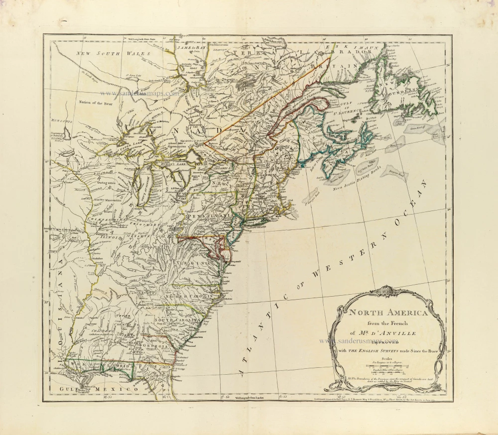
North America from the French of Mr. d'Anville improved with The English Surveys made Since the Peace. 1775
Eastern North America by J.B. Bourguignon d'Anville, published by Robert Sayer and John Bennett.
[Item number: 33360]
new
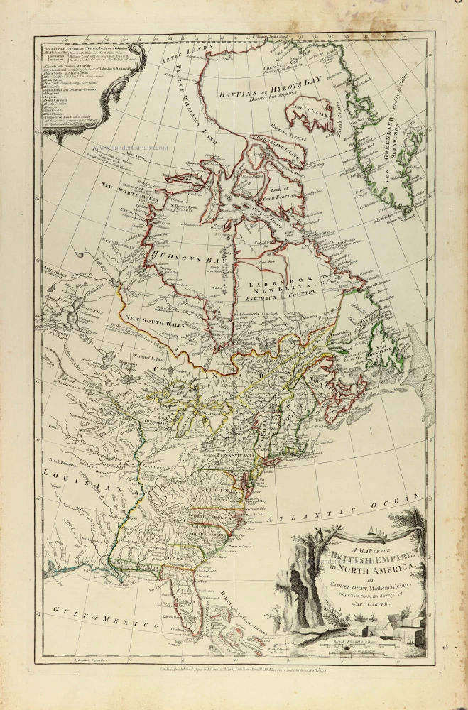
A map of the British Empire, in North America 1776
Eastern North America by Samuel Dunn, published by Robert Sayer and John Bennett.
[Item number: 33361]
new