
Gulf of St. Laurence by Thomas Jeffery, published by Robert Sayer, 1775
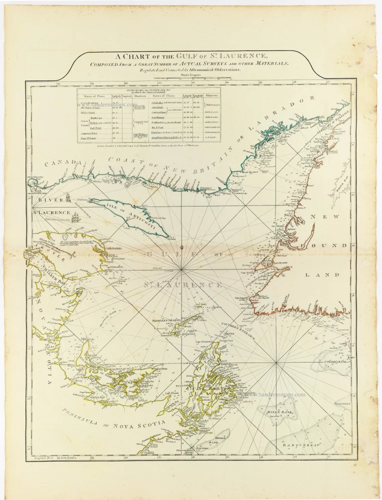
A Chart of the Gulf of St. Laurence – Thomas Jefferys
A highly detailed eighteenth-century nautical chart of the Gulf of St. Lawrence, illustrating the maritime approaches to Canada, with extensive hydrographic information and original outline colouring.
This finely engraved chart depicts the Gulf of St. Lawrence and its surrounding coastlines, extending from the mouth of the St. Lawrence River and the Gaspé Peninsula to Newfoundland, and southwards to Nova Scotia and Cape Breton Island. It includes Anticosti Island, Prince Edward Island (here named St. John's Island), the Magdalen Islands, the Strait of Belle Isle, and the principal maritime passages connecting the Gulf with the Atlantic Ocean.
The chart is particularly remarkable for its detailed representation of the coastlines, islands, bays, harbours, shoals, and fishing banks. An elaborate network of rhumb lines radiates from compass centres across the Gulf, reflecting its primary purpose as a practical navigational aid. Numerous soundings, coastal place names, and navigational observations provide valuable information for ships approaching the St. Lawrence River.
Of particular interest is the table of astronomical observations in the upper-left portion of the map, listing the latitudes and longitudes of important geographical locations, along with the observers' names. This feature illustrates the increasing importance of astronomical measurements in improving the geographical accuracy of eighteenth-century maritime charts.
The map also identifies the principal fishing grounds off Newfoundland and Nova Scotia, including the extensive banks southeast of Cape Breton. These waters were of considerable economic importance to European fishing fleets, particularly those of Britain and France.
The chart reflects the growing British interest in the Gulf of St. Lawrence following the conquest of New France in 1760 and the Treaty of Paris in 1763. Control of the Gulf and its navigable approaches was essential for trade, fishing, naval operations, and communication with the newly acquired British territories in Canada.
The map is associated with the cartographic work of Thomas Jefferys (c. 1719–1771), Geographer to King George III, whose maps of North America were among the most authoritative British publications of the period. His geographical materials were subsequently published and reissued by Robert Sayer and John Bennett, notably in The American Atlas, first published in London in 1775.
The restrained neoclassical title, engraved above the map within an elegant curved border, contrasts with the dense hydrographic detail below. The original outline colouring delicately distinguishes the principal coastlines and islands.
A fine example of British eighteenth-century maritime cartography, documenting the strategically important Gulf of St. Lawrence at a period of expanding British naval and commercial activity in North America.
Thomas Jefferys (c. 1719-1771)
Thomas Jefferys was an outstanding English cartographer who was the leading map supplier of his day. He engraved and printed maps for government and other official bodies and produced a wide range of commercial maps and atlases. He made some of the finest maps of the time of North America and the West Indies.
He was appointed Geographer to the Prince of Wales and George II. However, in 1766, he became bankrupt and subsequently, the publication of his maps was managed by Robert Sayer, who in 1774 was joined in partnership by John Bennett and William Faden.
A Chart of the Gulf of St. Laurence, Composed From A Great Number of Actual Surveys and other Materials, Regulated by Astronomical Observations,
Item Number: 33363 new Authenticity Guarantee
Category: Antique maps > America > North America
Gulf of St. Laurence by Thomas Jeffery, published by Robert Sayer,.
Title: A Chart of the Gulf of St. Laurence, Composed From A Great Number of Actual Surveys and other Materials, Regulated by Astronomical Observations,
London Printed for & Sold by Rob.t Sayer & Jn. Bennett, N° 53 Fleet Street, as the Act directs, 25th March 1775.
Date of the first edition: 1775.
Date of this map: 1775.
Date on map: 1775.
Copper engraving, printed on paper.
Image size: 610 x 495mm (24 x 19½ inches).
Sheet size: 745 x 555mm (29¼ x 21¾ inches).
Verso: Blank.
Condition: Original coloured in outline; excellent.
Condition Rating: A+.
From: Jefferys Thomas, The American Atlas. London, 1775. (Tooley (Brit.Lib.), T.JEF-2b).
A Chart of the Gulf of St. Laurence – Thomas Jefferys
A highly detailed eighteenth-century nautical chart of the Gulf of St. Lawrence, illustrating the maritime approaches to Canada, with extensive hydrographic information and original outline colouring.
This finely engraved chart depicts the Gulf of St. Lawrence and its surrounding coastlines, extending from the mouth of the St. Lawrence River and the Gaspé Peninsula to Newfoundland, and southwards to Nova Scotia and Cape Breton Island. It includes Anticosti Island, Prince Edward Island (here named St. John's Island), the Magdalen Islands, the Strait of Belle Isle, and the principal maritime passages connecting the Gulf with the Atlantic Ocean.
The chart is particularly remarkable for its detailed representation of the coastlines, islands, bays, harbours, shoals, and fishing banks. An elaborate network of rhumb lines radiates from compass centres across the Gulf, reflecting its primary purpose as a practical navigational aid. Numerous soundings, coastal place names, and navigational observations provide valuable information for ships approaching the St. Lawrence River.
Of particular interest is the table of astronomical observations in the upper-left portion of the map, listing the latitudes and longitudes of important geographical locations, along with the observers' names. This feature illustrates the increasing importance of astronomical measurements in improving the geographical accuracy of eighteenth-century maritime charts.
The map also identifies the principal fishing grounds off Newfoundland and Nova Scotia, including the extensive banks southeast of Cape Breton. These waters were of considerable economic importance to European fishing fleets, particularly those of Britain and France.
The chart reflects the growing British interest in the Gulf of St. Lawrence following the conquest of New France in 1760 and the Treaty of Paris in 1763. Control of the Gulf and its navigable approaches was essential for trade, fishing, naval operations, and communication with the newly acquired British territories in Canada.
The map is associated with the cartographic work of Thomas Jefferys (c. 1719–1771), Geographer to King George III, whose maps of North America were among the most authoritative British publications of the period. His geographical materials were subsequently published and reissued by Robert Sayer and John Bennett, notably in The American Atlas, first published in London in 1775.
The restrained neoclassical title, engraved above the map within an elegant curved border, contrasts with the dense hydrographic detail below. The original outline colouring delicately distinguishes the principal coastlines and islands.
A fine example of British eighteenth-century maritime cartography, documenting the strategically important Gulf of St. Lawrence at a period of expanding British naval and commercial activity in North America.
Thomas Jefferys (c. 1719-1771)
Thomas Jefferys was an outstanding English cartographer who was the leading map supplier of his day. He engraved and printed maps for government and other official bodies and produced a wide range of commercial maps and atlases. He made some of the finest maps of the time of North America and the West Indies.
He was appointed Geographer to the Prince of Wales and George II. However, in 1766, he became bankrupt and subsequently, the publication of his maps was managed by Robert Sayer, who in 1774 was joined in partnership by John Bennett and William Faden.
Related items
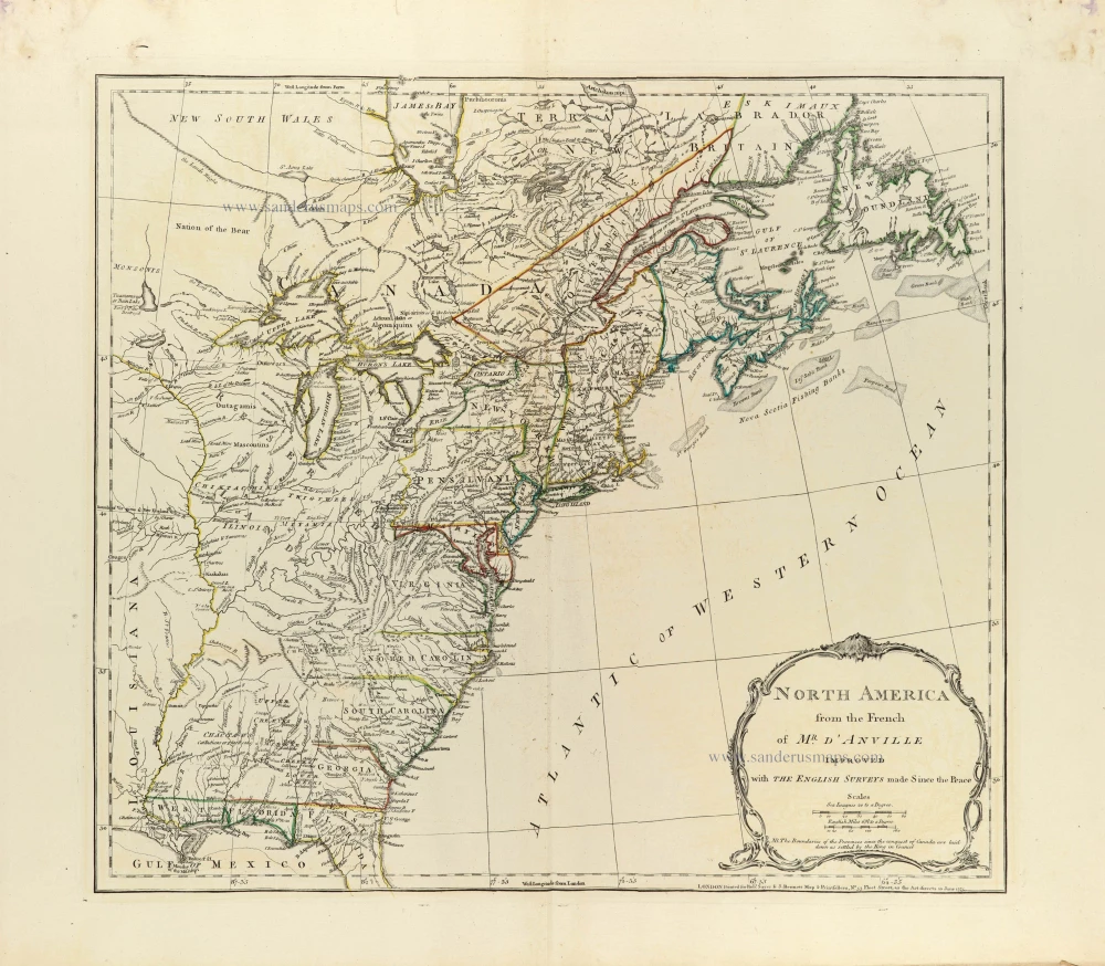
North America from the French of Mr. d'Anville improved with The English Surveys made Since the Peace. 1775
Eastern North America by J.B. Bourguignon d'Anville, published by Robert Sayer and John Bennett.
[Item number: 33360]
new
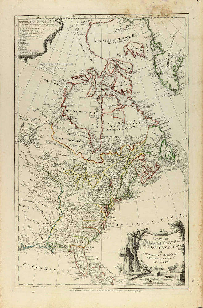
A map of the British Empire, in North America 1776
Eastern North America by Samuel Dunn, published by Robert Sayer and John Bennett.
[Item number: 33361]
new
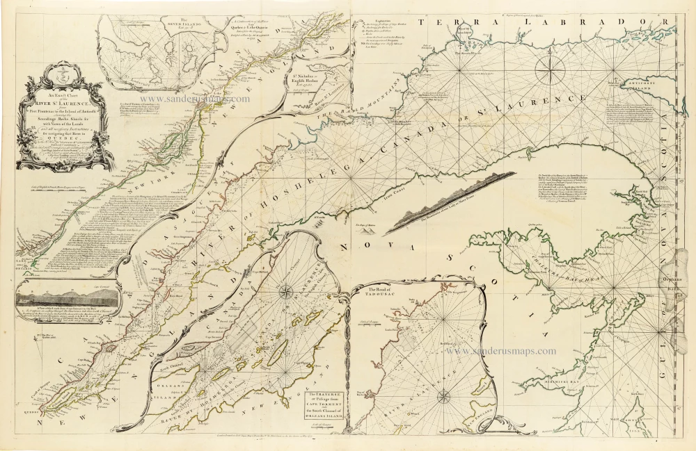
An Exact Chart of the River St. Laurence, from Fort Frontenac to the Island of Anticosti shewing the Soundings, Rocks, Shoals &c with Views of the Lands and all necessary Instructions for navigating that River to Quebec. 1775
Canada - St. Laurence River by Thomas Jeffery, published by Robert Sayer,
[Item number: 33362]
new