
Eastern North America by Samuel Dunn, published by Robert Sayer and John Bennett. 1776
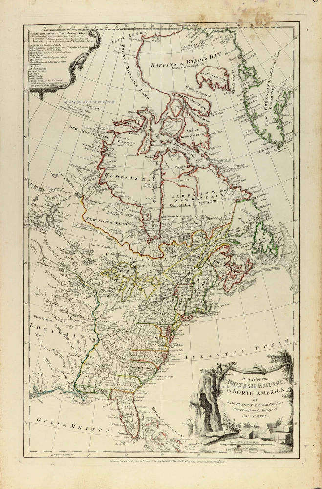
An impressive and finely engraved map of British North America by the English mathematician and cartographer Samuel Dunn, incorporating geographical information derived from the surveys of Captain Jonathan Carver (1710–1780).
The map extends from the Gulf of Mexico and Florida in the south to Greenland, Baffin Bay, and the Arctic regions in the north, encompassing the thirteen British colonies, Canada, Labrador, Newfoundland, Hudson Bay, and the vast territories surrounding the Great Lakes and the Mississippi Valley.
Published during the American Revolutionary War, the map provides a fascinating representation of the British Empire in North America at a time when its political and territorial integrity was being fundamentally challenged.
The eastern seaboard is shown in considerable detail, with the thirteen American colonies identified and their boundaries delineated in contemporary outline colour. The map also illustrates the extensive British possessions acquired from France following the Treaty of Paris in 1763, including Canada and the territories east of the Mississippi River.
Particularly noteworthy is the treatment of the northern regions. Hudson Bay occupies a prominent central position, surrounded by the territories of New North Wales, New South Wales, Labrador, and the Arctic Lands. Baffin Bay, Davis Strait, Cumberland Island, and the southern coast of Greenland are depicted, reflecting contemporary geographical knowledge and the continuing uncertainty surrounding the Arctic coastline.
The map records numerous rivers, lakes, trading posts, settlements, and Indigenous territories throughout the interior. The Great Lakes are carefully delineated, while the Mississippi and its tributaries provide the principal geographical framework for the western regions. The names and approximate territories of numerous Native American peoples are included, offering valuable evidence of eighteenth-century European geographical knowledge of the continent.
Of particular historical interest are the colonial boundaries and territorial divisions, many of which reflect British administrative arrangements following the Seven Years' War. An explanatory cartouche in the upper left corner lists the principal British territories and colonies, distinguishing between the northern possessions and the established colonies along the Atlantic coast.
The map is embellished with an attractive pictorial title cartouche in the lower right corner, featuring a rugged rocky landscape, trees, vegetation, and a small settlement. The upper left corner contains an elaborate decorative cartouche enclosing a geographical and administrative explanation of the British Empire in North America.
The finely engraved coastline, extensive river systems, carefully rendered topography, and delicate original outline colouring make this an attractive example of late eighteenth-century British cartography.
An important historical map illustrating the geographical extent of British claims in North America during the American Revolutionary War, and a valuable document of the continent's political geography in the final years of British colonial rule over the thirteen American colonies.
Jean-Baptiste Bourguignon d'Anville (1697 -1782)
French geographer and cartographer to the king. He made more than 200 maps during his life. His maps remained the reference point in cartography throughout the 19th century.
A map of the British Empire, in North America
Item Number: 33361 new Authenticity Guarantee
Category: Antique maps > America > North America
Eastern North America by Samuel Dunn, published by Robert Sayer and John Bennett.
Title: A map of the British Empire, in North America
London Printed for R. Sayer & J. Bennett, Map & Sea Chartsellers, N° 53 Fleet Street, as the Act directs Aug. 17.1776.
Date of the first edition: 1755.
Date of this map: 1776.
Date on map: 1776.
Copper engraving, printed on paper.
Image size: 480 x 305mm (19 x 12 inches).
Sheet size: 550 x 370mm (21¾ x 14½ inches).
Verso: Blank.
Condition: Original coloured in outline; some soiling in the right upper margin.
Condition Rating: A+.
From: Jefferys Thomas, The American Atlas. London, 1775. (Tooley (Brit.Lib.), T.JEF-2b).
An impressive and finely engraved map of British North America by the English mathematician and cartographer Samuel Dunn, incorporating geographical information derived from the surveys of Captain Jonathan Carver (1710–1780).
The map extends from the Gulf of Mexico and Florida in the south to Greenland, Baffin Bay, and the Arctic regions in the north, encompassing the thirteen British colonies, Canada, Labrador, Newfoundland, Hudson Bay, and the vast territories surrounding the Great Lakes and the Mississippi Valley.
Published during the American Revolutionary War, the map provides a fascinating representation of the British Empire in North America at a time when its political and territorial integrity was being fundamentally challenged.
The eastern seaboard is shown in considerable detail, with the thirteen American colonies identified and their boundaries delineated in contemporary outline colour. The map also illustrates the extensive British possessions acquired from France following the Treaty of Paris in 1763, including Canada and the territories east of the Mississippi River.
Particularly noteworthy is the treatment of the northern regions. Hudson Bay occupies a prominent central position, surrounded by the territories of New North Wales, New South Wales, Labrador, and the Arctic Lands. Baffin Bay, Davis Strait, Cumberland Island, and the southern coast of Greenland are depicted, reflecting contemporary geographical knowledge and the continuing uncertainty surrounding the Arctic coastline.
The map records numerous rivers, lakes, trading posts, settlements, and Indigenous territories throughout the interior. The Great Lakes are carefully delineated, while the Mississippi and its tributaries provide the principal geographical framework for the western regions. The names and approximate territories of numerous Native American peoples are included, offering valuable evidence of eighteenth-century European geographical knowledge of the continent.
Of particular historical interest are the colonial boundaries and territorial divisions, many of which reflect British administrative arrangements following the Seven Years' War. An explanatory cartouche in the upper left corner lists the principal British territories and colonies, distinguishing between the northern possessions and the established colonies along the Atlantic coast.
The map is embellished with an attractive pictorial title cartouche in the lower right corner, featuring a rugged rocky landscape, trees, vegetation, and a small settlement. The upper left corner contains an elaborate decorative cartouche enclosing a geographical and administrative explanation of the British Empire in North America.
The finely engraved coastline, extensive river systems, carefully rendered topography, and delicate original outline colouring make this an attractive example of late eighteenth-century British cartography.
An important historical map illustrating the geographical extent of British claims in North America during the American Revolutionary War, and a valuable document of the continent's political geography in the final years of British colonial rule over the thirteen American colonies.
Jean-Baptiste Bourguignon d'Anville (1697 -1782)
French geographer and cartographer to the king. He made more than 200 maps during his life. His maps remained the reference point in cartography throughout the 19th century.
Related items

Canada ou Nouvelle France. 1685
North America (Northeast), by A.M. Mallet.
[Item number: 26601]
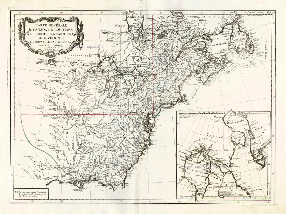
Carte Générale du Canada, de la Louisiane, de la Floride, de la Caroline, de la Virginie, de la Nouvelle Angleterre etc. 1776-79
North America (East), by Paolo Santini.
[Item number: 26980]

Amerique Septentrionale. 1748
North America by Robert de Vaugondy.
[Item number: 28157]
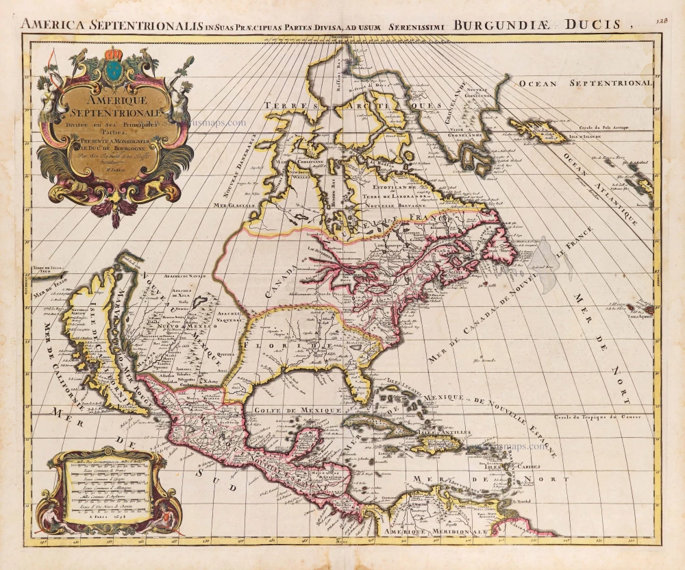
Amerique Septentrionale, Divisee en ses Principales Parties. 1694
North America, by Nicolas Sanson, published by Pierre Mortier after A.H. Jaillot.
[Item number: 29125]

Carte de la Nouvelle France, ou se Voit le Cours des Grandes Rivieres de S. Laurens & de Mississipi Aujourd'hui S. Louis, Aux environs des quelles se trouvent les Etats, Païs, Nations, Peuples &c. de la Floride, de la Louisiane, de la Virginie, de la Marie-Lande, de la Pensilvanie, du Nouveau Jersay, de la Nouvelle Yorck, de la Nouv. Angleterre, de l'Acadie, du Canada, des Esquimaux, des Hurons, des Iroquois, des Ilinois &c. Et de la Grande Ile de Terre Neuve:. 1719
Eastern North America (U.S.), by Zacharias Châtelain.
[Item number: 29365]

Nouvelle carte de l'Amérique Septentrionale dressée sur les plus nouvelles observations de Messieurs de l'Académie des Sciences et des meilleurs Géographes avec des tables très Instructives et Curieuses de la Division de tous les Etats et les différents souverains qui en sont possesseur. 1713
North America, by Zacharias Châtelain.
[Item number: 29445]

L'Amerique Septentrionale. 1708
North America by G. de L'Isle, published by Pierre Mortier.
[Item number: 29510]

Big and spectacular map, heightened in gold.
Amerique Septentrionale, divisée en ses principales parties, ou sont distingués les uns des autres Les Estats suivant qu'ils appartiennet Presentemet aux Francois, Castillans, Anglois, Suedois, Danois, Hollandois. 1692
North America by N. Sanson, so-called published by Hubert Jaillot. (Pirated edition by Pierre Mortier).
[Item number: 29895]

California as an island.
Americque Septentrionale. 1715
North America by Nicolas Sanson, published by Nicolas Chemereau.
[Item number: 30086]

Carte de la Partie de l'Amérique Septentrionale, comprenant les Possessions Espagnoles. 1788
North America by Louis Brion de la Tour.
[Item number: 30144]

Carte d'Assemblage de l'Amérique Septen-le 1827
North America by Philippe Vandermaelen.
[Item number: 31099]

Amerique Septentrionale, Divisee en ses Principales Parties, ou sont Distingues les Uns des Autres les Estats Suivant qu'ils Appartiennent Presentemet aux Francois, Castillans, Anglois, Suedois, Danois, Hollandois. 1692
North America by N. Sanson, so-called published by Hubert Jaillot. (Pirated edition by Pierre Mortier).
[Item number: 31142]

Scarce
Virginia et Nova Francia. 1618
East Coast by Bertius Petrus.
[Item number: 32328]

L' America Settentrionale. 1677
North America by Giovanni De Rossi, after Nicolas Sanson.
[Item number: 32889]

Amerique Septentrionale. 1659
Nicolas Sanson's landmark map of North America, scarce second state.
[Item number: 33218]
new
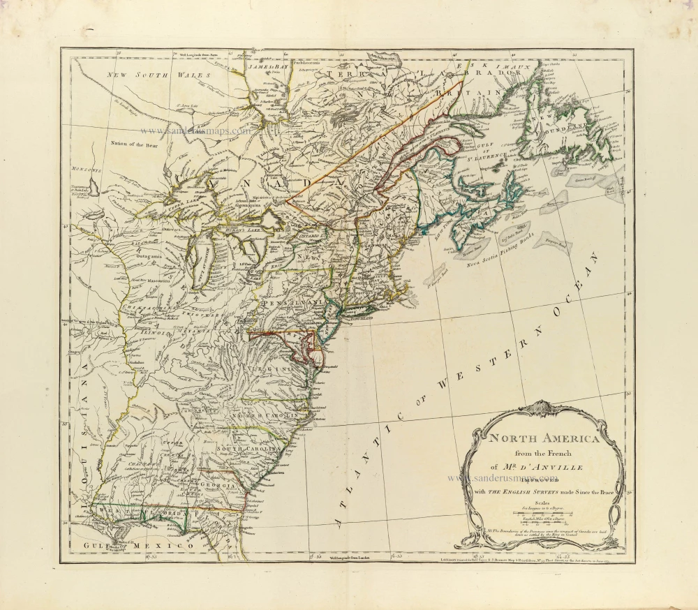
North America from the French of Mr. d'Anville improved with The English Surveys made Since the Peace. 1775
Eastern North America by J.B. Bourguignon d'Anville, published by Robert Sayer and John Bennett.
[Item number: 33360]
new