
United States, Central America, and the West Indies, by Zacharias Châtelain. 1719
The Châtelain Family
Zacharias Châtelain (1684-1743) was a bookseller and publisher of Amsterdam. He was succeeded by his sons Zacharias jr and Henry Abraham. The Châtelain family was best known for the historical atlas Atlas Historique, ou nouvelle introduction à l’histoire…, a major work of its time. It was an encyclopaedia in seven volumes, including geography as one of its main subjects. The atlas was published in Amsterdam in seven volumes in various editions with different imprints from 1705 to 1739. An anonym person (Mr. C***) compiled the work with compositions of text, maps, plates and chronological and genealogical tables by Gueudeville, except volume 7, where H.P. Limiers took over this task. The maps were made mainly after the work of Guillaume de l'Isle.
The 1705 edition was published with the imprint “L’Honoré & Châtelain”. Later editions had the imprint: “les Frères Châtelain Libraires” or “L’Honoré & Châtelain Libraires”.
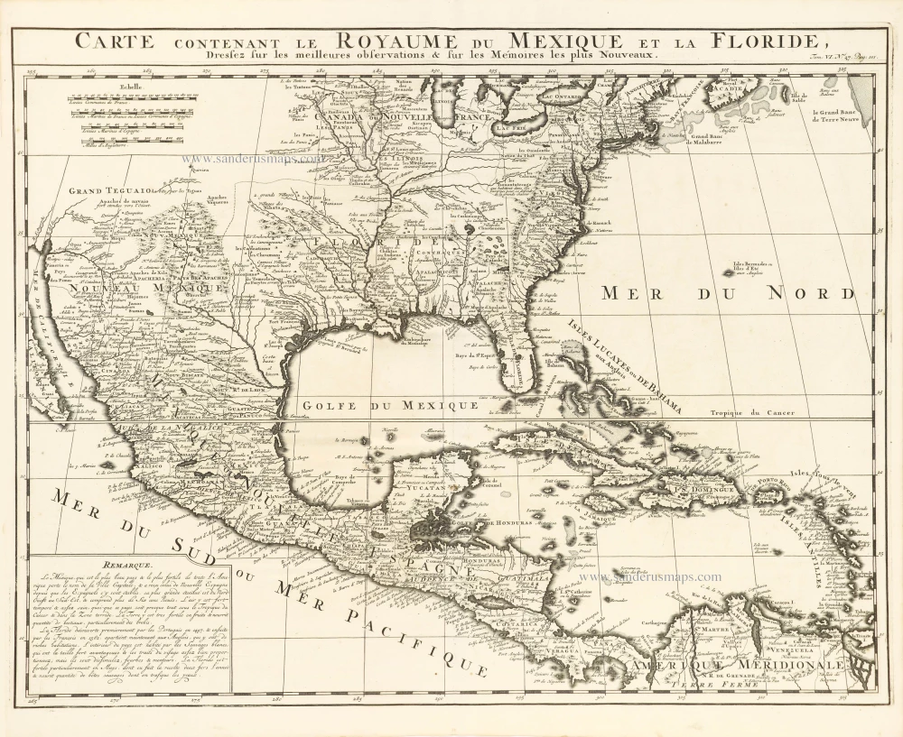
Carte Contenant le Royaume du Mexique et la Floride,
Item Number: 29409 Authenticity Guarantee
Category: Antique maps > America > North America
Old, antique map of the United States, Central America, and the West Indies, by Zacharias Châtelain.
Title: Carte Contenant le Royaume du Mexique et la Floride,
Dressez sur les meilleures observations sur les Mémoires les plus Nouveaux.
Tom: VI. N° 27. Pag.: 101.
Date of the first edition: 1719.
Date of this map: 1719.
Copper engraving, printed on paper.
Map size: 405 x 520mm (15.94 x 20.47 inches).
Sheet size: 440 x 535mm (17.32 x 21.06 inches).
Verso: Blank.
Condition: Excellent.
Condition Rating: A+.
From: Châtelain Z. Atlas Historique, ou Nouvelle Introduction A l'Histoire, à la Chronologie & à la Geographie Ancienne & Moderne; ... Tome VI. Qui comprend l'Afrique & l'Amerique Septentrionale & Meridionale, ... A Amsterdam, Chez L'Honoré & Châtelain Libraires, M.DCC.XIX. (1719). (Koeman II, p. 37, Cha7)
The Châtelain Family
Zacharias Châtelain (1684-1743) was a bookseller and publisher of Amsterdam. He was succeeded by his sons Zacharias jr and Henry Abraham. The Châtelain family was best known for the historical atlas Atlas Historique, ou nouvelle introduction à l’histoire…, a major work of its time. It was an encyclopaedia in seven volumes, including geography as one of its main subjects. The atlas was published in Amsterdam in seven volumes in various editions with different imprints from 1705 to 1739. An anonym person (Mr. C***) compiled the work with compositions of text, maps, plates and chronological and genealogical tables by Gueudeville, except volume 7, where H.P. Limiers took over this task. The maps were made mainly after the work of Guillaume de l'Isle.
The 1705 edition was published with the imprint “L’Honoré & Châtelain”. Later editions had the imprint: “les Frères Châtelain Libraires” or “L’Honoré & Châtelain Libraires”.
Related items
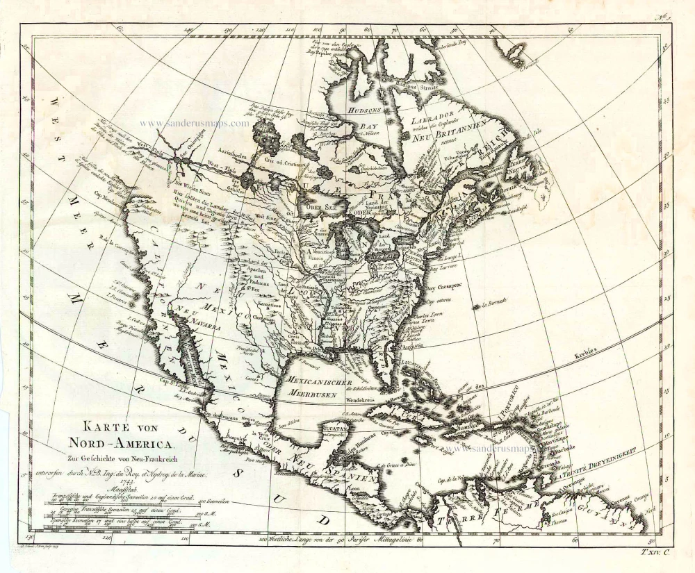
Karte von Nord-America, zur Geschichte von Neu-Frankreich. 1747-74
North America, by Jacques Nicolas Bellin.
[Item number: 26799]
Earliest obtainable map of North America
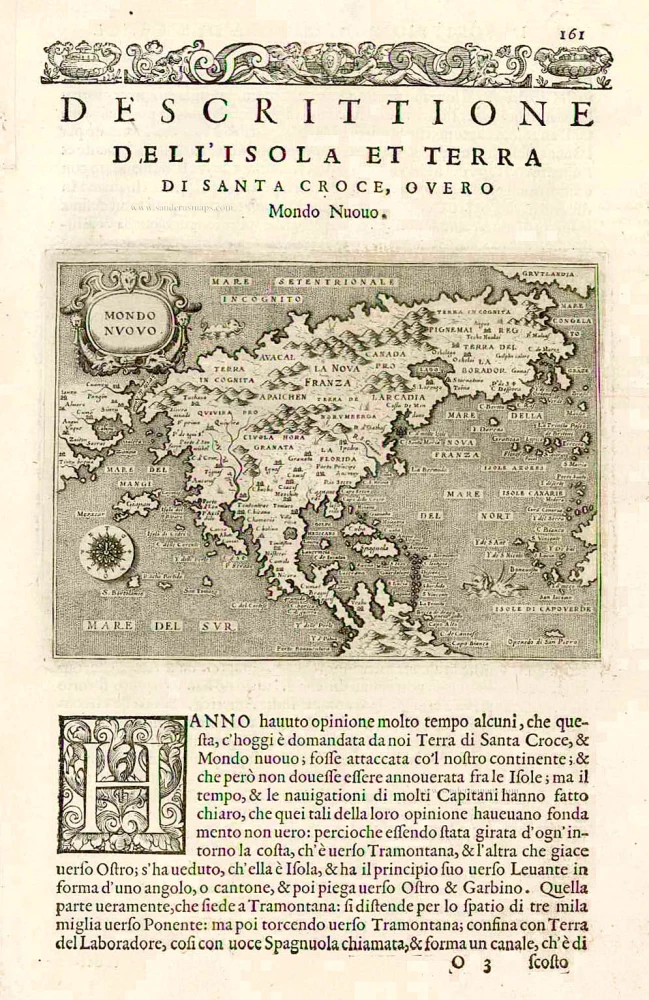
Mondo Nuovo - Descrittione del l'Isola et Terra di Sancta Croce, overo Mondo Nuovo. 1576
Tomaso Porcacchi., North America
[Item number: 27651]
Important map.
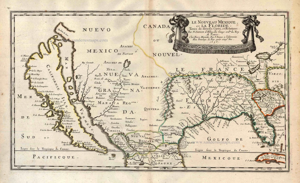
Le Nouveau Mexique, et la Floride: 1658
Southern North America, by Nicolas Sanson.
[Item number: 27917]
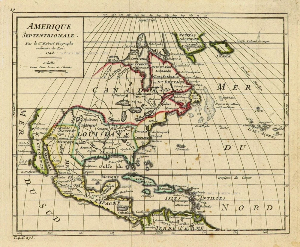
Amerique Septentrionale. 1748
North America by Robert de Vaugondy.
[Item number: 28157]

Amerique Septentrionale, Divisee en ses Principales Parties. 1694
North America, by Nicolas Sanson, published by Pierre Mortier after A.H. Jaillot.
[Item number: 29125]
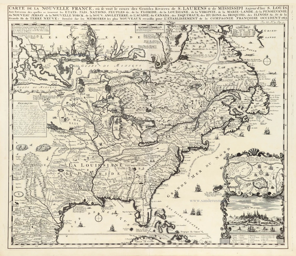
Carte de la Nouvelle France, ou se Voit le Cours des Grandes Rivieres de S. Laurens & de Mississipi Aujourd'hui S. Louis, Aux environs des quelles se trouvent les Etats, Païs, Nations, Peuples &c. de la Floride, de la Louisiane, de la Virginie, de la Marie-Lande, de la Pensilvanie, du Nouveau Jersay, de la Nouvelle Yorck, de la Nouv. Angleterre, de l'Acadie, du Canada, des Esquimaux, des Hurons, des Iroquois, des Ilinois &c. Et de la Grande Ile de Terre Neuve:. 1719
Eastern North America (U.S.), by Zacharias Châtelain.
[Item number: 29365]
With luxury colour
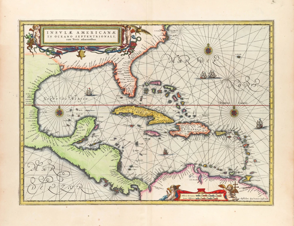
Insulae Americanae in Oceano Septentrionali, cum Terris adiacentibus. 1666
West Indies, by Johannes Janssonius.
[Item number: 29806]
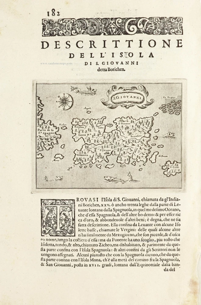
S.Giovanni. - [Above map :] Descrittione del l'Isola di S. Giovanni detta Borichen. 1590
Puerto Rico by Tommaso Porcacchi.
[Item number: 29810]
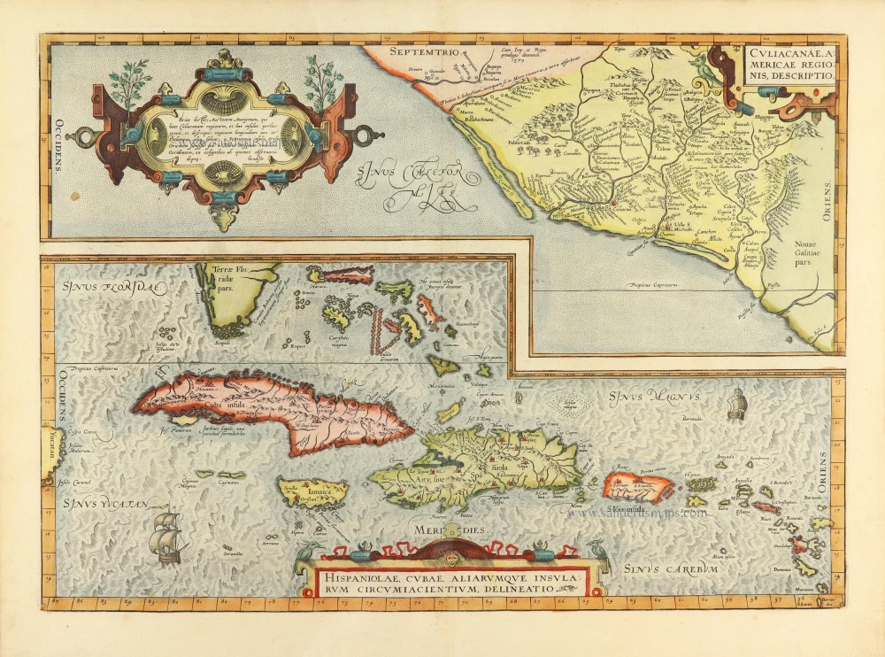
Culiacanae Americae Regionis Descriptio. - Hispaniolae, Cubae, Aliarumquae Insularum Circumiacentium, delineatio. 1584
Antilles by Abraham Ortelius.
[Item number: 30904]