
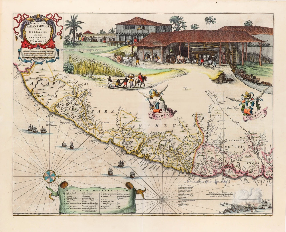
Unrecorded view of Pernambuco (Brazil) by Carel Allard
View of Pernambuco (Brazil) by Carel Allard. 1673

The Allard Family
The founder of this family of map-makers, publishers and print-sellers was Huych (Hugo) Allard (1625-1691). He worked in Amsterdam in 1684 and is supposed to have begun his business as early as 1645. He died in 1691, leaving his shop to his son, Carel Allard (1648-c. 1706). Carel brought out many maps and some atlases. His atlases are mainly composed of maps from the stock of other publishers like Janssonius and De Wit. However, some maps were his original creations. The States of Holland granted him a privilege for these maps in 1683.
One of the sons of Carel, Abraham Allard (1676-c.1730), joined his father in the map trade and was accepted as a member of the ‘Constvercoopers gilde’ (Art dealer’s Guild) in 1708.
The original geographical maps by Allard, designed and cut between 1680 and 1700, are very decorative, well-composed and up-to-date.
Paranbuca.
Item Number: 30558 Authenticity Guarantee
Category: Antique maps > America > South America
View of Pernambuco (Brazil) by Carel Allard.
Title: Paranbuca.
Date: 1673.
Copper engraving, printed on paper.
Image size: 210 x 270mm (8.27 x 10.63 inches).
Sheet size: 315 x 400mm (12.4 x 15.75 inches).
Verso: Blank.
Condition: Excellent.
Condition Rating: A+.
Added in: Allard Carolus, De Voornaemste Steden des Werelts. - The Principall Citties of the World. t' Amsterdam by Gerrit Van Schagen, by de Nieuwe Haerlemmer Sluys inde Stuerman. 1673.
Not recorded by Van der Krogt.
The Allard Family
The founder of this family of map-makers, publishers and print-sellers was Huych (Hugo) Allard (1625-1691). He worked in Amsterdam in 1684 and is supposed to have begun his business as early as 1645. He died in 1691, leaving his shop to his son, Carel Allard (1648-c. 1706). Carel brought out many maps and some atlases. His atlases are mainly composed of maps from the stock of other publishers like Janssonius and De Wit. However, some maps were his original creations. The States of Holland granted him a privilege for these maps in 1683.
One of the sons of Carel, Abraham Allard (1676-c.1730), joined his father in the map trade and was accepted as a member of the ‘Constvercoopers gilde’ (Art dealer’s Guild) in 1708.
The original geographical maps by Allard, designed and cut between 1680 and 1700, are very decorative, well-composed and up-to-date.
Related items
Important map in excellent condition
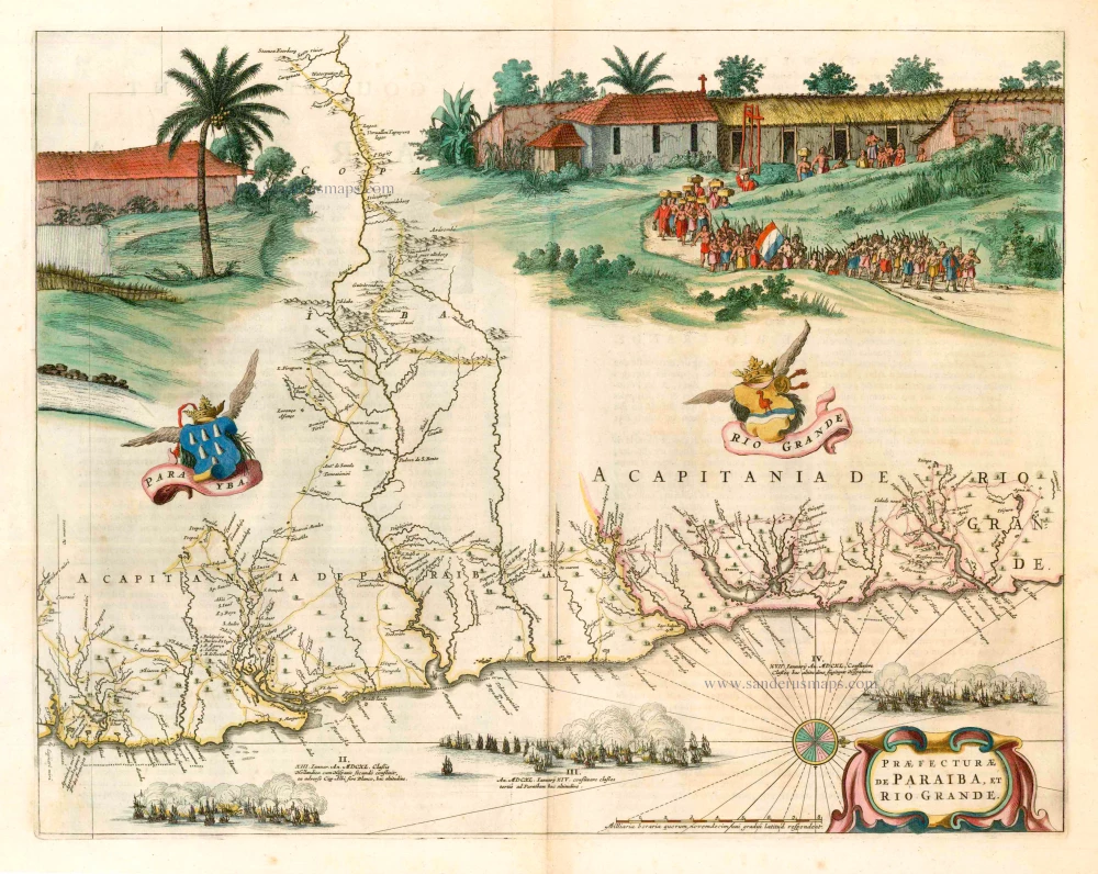
Praefecturae de Paraiba, et Rio Grande. 1663
Brazil - Paraiba, by Joan Blaeu.
[Item number: 25258]

Provincia de Brasil cum Adiacentibus Provinciis. 1630
Brazil, by Johannes de Laet.
[Item number: 25390]

Brasil. 1563
Brazil, by Ramusio G.B.
[Item number: 26186]
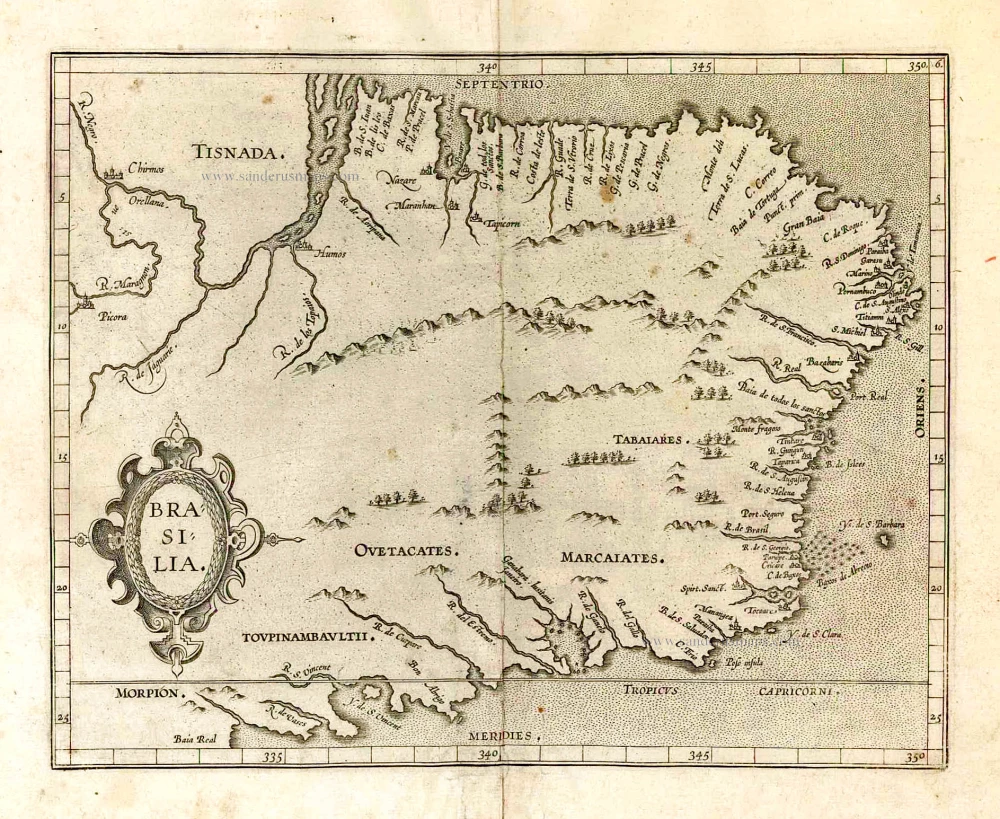
Brasilia. 1607
Brazil, by C. van Wytfliet.
[Item number: 26509]

With cannibals
Brasilia. 1602
Brazil by Langenes, published by Bertius P.
[Item number: 26537]

Brasil Nuova Tavola. 1598
Brazil by Girolamo Ruscelli.
[Item number: 28430]

Brasilia. 1645
Brazil, by Joan Blaeu.
[Item number: 29707]
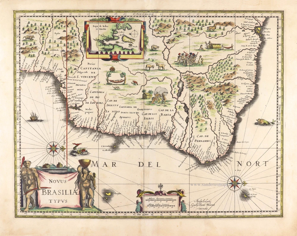
Novus Brasiliae Typus. c. 1640
Brazil, by Willem Blaeu.
[Item number: 29848]
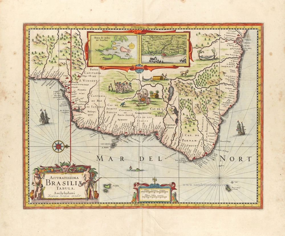
Accuratissima Brasiliae Tabula. 1638
Brazil by Henricus Hondius.
[Item number: 29851]
Praefecturae Paranambucae, pars Borealis, una cum Praefectura de Itâmarcâ. 1663
Brazil - Pernambuco (North) by Joan Blaeu.
[Item number: 30149]

SCARCE !
Serinhaim. 1685/90
View of Serinhaem (Pernambuco - Brazil), by Carel Allard.
[Item number: 30588]

Rio Iavero 1631
Rio De Janeiro by de Bry Theodore, published by J.L. Gottfried.
[Item number: 32443]
Brasilia. 1618
Brazil by Petrus Bertius.
[Item number: 33184]
new