
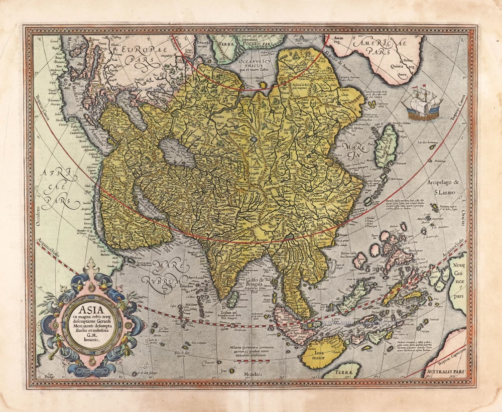
Asia, by Abraham Ortelius. 1612


Abraham Ortelius (1527-1598)
The maker of the 'first atlas', the Theatrum Orbis Terrarum (1570), was born on 4 April 1527 into an old Antwerp family. He learned Latin and studied Greek and mathematics.
Abraham and his sisters Anne and Elizabeth took up map colouring. Ortelius was admitted to the Guild of St. Luke as an "illuminator of maps." In addition to colouring maps, Ortelius was a dealer in antiques, coins, maps, and books, and the book and map trade gradually became his primary occupation.
Business went well because his means permitted him to start an extensive collection of medals, coins, antiques, and a library of many volumes. In addition, he travelled a lot, visited Italy and France, made contacts everywhere with scholars and editors, and maintained extensive correspondence with them.
In 1564, he published his first map, a large and ambitious world wall map. The inspiration for this map may well have been Gastaldi's large world map. In 1565, he published a map of Egypt and a map of the Holy Land; a large map of Asia followed.
In 1568, the production of individual maps for his atlas Theatrum Orbis Terrarum was already in full swing. He completed the atlas in 1569, and in May 1570, it was available for sale. It was one of the most expensive books ever published.
This first edition contained seventy maps on fifty-three sheets. Franciscus Hogenberg engraved the maps.
Later editions included Additamenta (additions), resulting in Ortelius' historical atlas, the Parergon, which is mainly bound together with the atlas. The Parergon can be considered a truly original work by Ortelius, who drew the maps based on his research.
The importance of the Theatrum Orbis Terrarum for geographical knowledge in the last quarter of the sixteenth century is difficult to overemphasize. Nothing was like it until Mercator's atlas appeared twenty-five years later. Demand for the Theatrum was remarkable. Some 24 editions appeared during Ortelius's lifetime and another 10 after he died in 1598. Editions were published in Dutch, German, French, Spanish, English, and Italian. The number of map sheets grew from 53 in 1570 to 167 in 1612 in the last edition.
In 1577, engraver Philip Galle and poet-translator Pieter Heyns published the first pocket-sized edition of the Theatrum, the Epitome. The work was trendy. Over thirty editions of this Epitome were published in different languages.
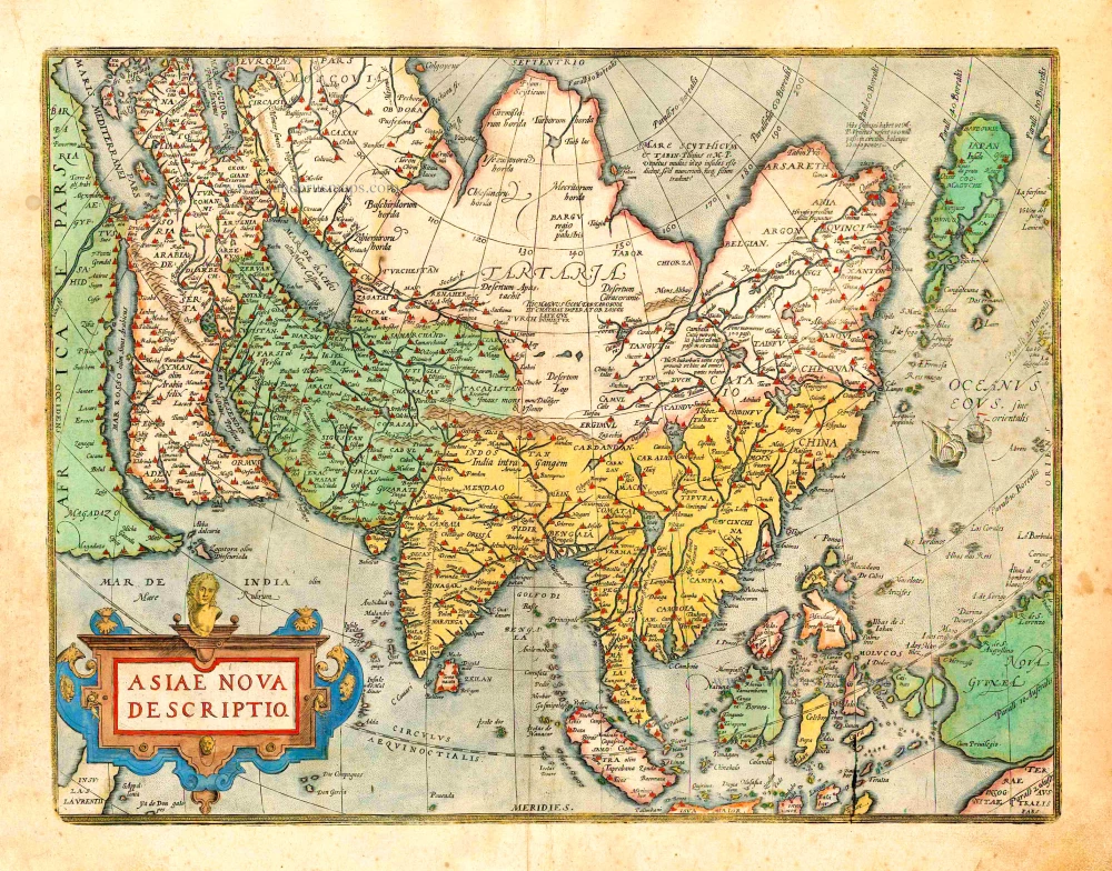
Asiae Nova Descriptio.
Item Number: 22925 Authenticity Guarantee
Category: Antique maps > Asia > Asia
Old, antique map of Asia, by Abraham Ortelius.
Title: Asiae Nova Descriptio.
Date of the first edition: 1570.
Date of this map: 1612.
Copper engraving, printed on paper.
Size (not including margins): 377 x 503mm (14.84 x 19.8 inches).
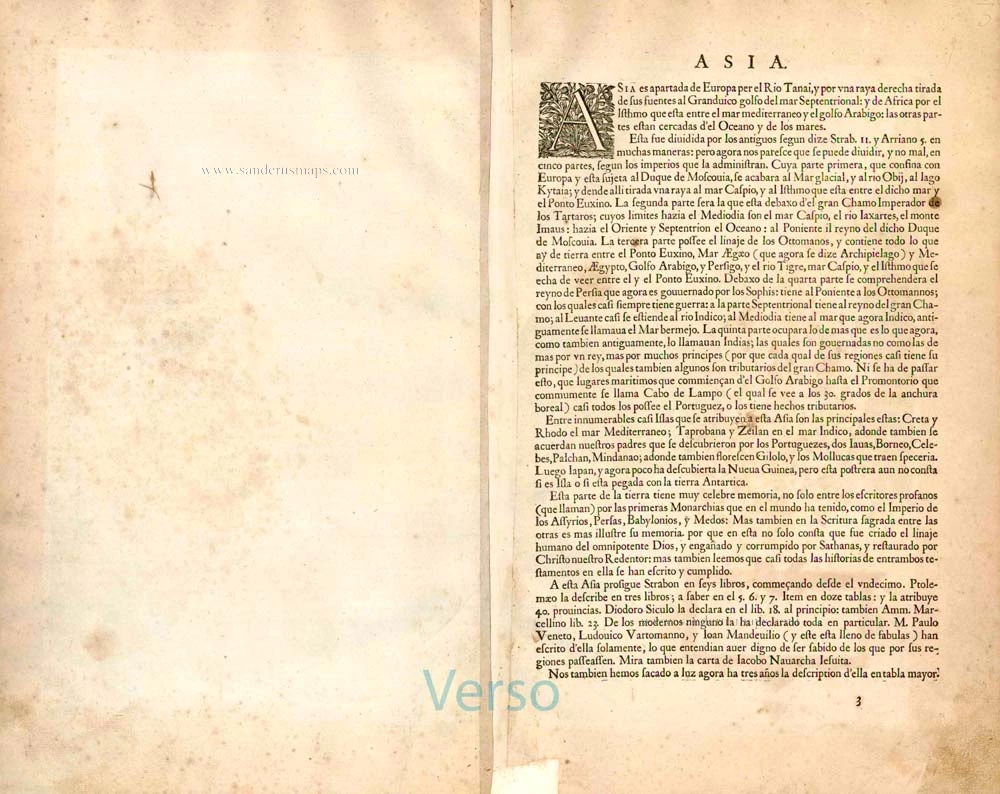
Verso: Spanish text.
Condition: Original coloured, excellent.
Condition Rating: A+.
From: Ortelius A. Theatro d'el Orbe de la Tierra. Antwerp. Plantin Press, 1612. (Van der Krogt 3, 1:453)
Abraham Ortelius (1527-1598)
The maker of the 'first atlas', the Theatrum Orbis Terrarum (1570), was born on 4 April 1527 into an old Antwerp family. He learned Latin and studied Greek and mathematics.
Abraham and his sisters Anne and Elizabeth took up map colouring. Ortelius was admitted to the Guild of St. Luke as an "illuminator of maps." In addition to colouring maps, Ortelius was a dealer in antiques, coins, maps, and books, and the book and map trade gradually became his primary occupation.
Business went well because his means permitted him to start an extensive collection of medals, coins, antiques, and a library of many volumes. In addition, he travelled a lot, visited Italy and France, made contacts everywhere with scholars and editors, and maintained extensive correspondence with them.
In 1564, he published his first map, a large and ambitious world wall map. The inspiration for this map may well have been Gastaldi's large world map. In 1565, he published a map of Egypt and a map of the Holy Land; a large map of Asia followed.
In 1568, the production of individual maps for his atlas Theatrum Orbis Terrarum was already in full swing. He completed the atlas in 1569, and in May 1570, it was available for sale. It was one of the most expensive books ever published.
This first edition contained seventy maps on fifty-three sheets. Franciscus Hogenberg engraved the maps.
Later editions included Additamenta (additions), resulting in Ortelius' historical atlas, the Parergon, which is mainly bound together with the atlas. The Parergon can be considered a truly original work by Ortelius, who drew the maps based on his research.
The importance of the Theatrum Orbis Terrarum for geographical knowledge in the last quarter of the sixteenth century is difficult to overemphasize. Nothing was like it until Mercator's atlas appeared twenty-five years later. Demand for the Theatrum was remarkable. Some 24 editions appeared during Ortelius's lifetime and another 10 after he died in 1598. Editions were published in Dutch, German, French, Spanish, English, and Italian. The number of map sheets grew from 53 in 1570 to 167 in 1612 in the last edition.
In 1577, engraver Philip Galle and poet-translator Pieter Heyns published the first pocket-sized edition of the Theatrum, the Epitome. The work was trendy. Over thirty editions of this Epitome were published in different languages.
Related items

Accuratissima totius Asiae Tabula. c. 1691-96
Asia, by F. De Wit.
[Item number: 10960]
Exactissima Asiae Delineatio in praecipuas regiones Caeterasq Partes divisa. c. 1700
Asia by Th. Danckerts.
[Item number: 11298]
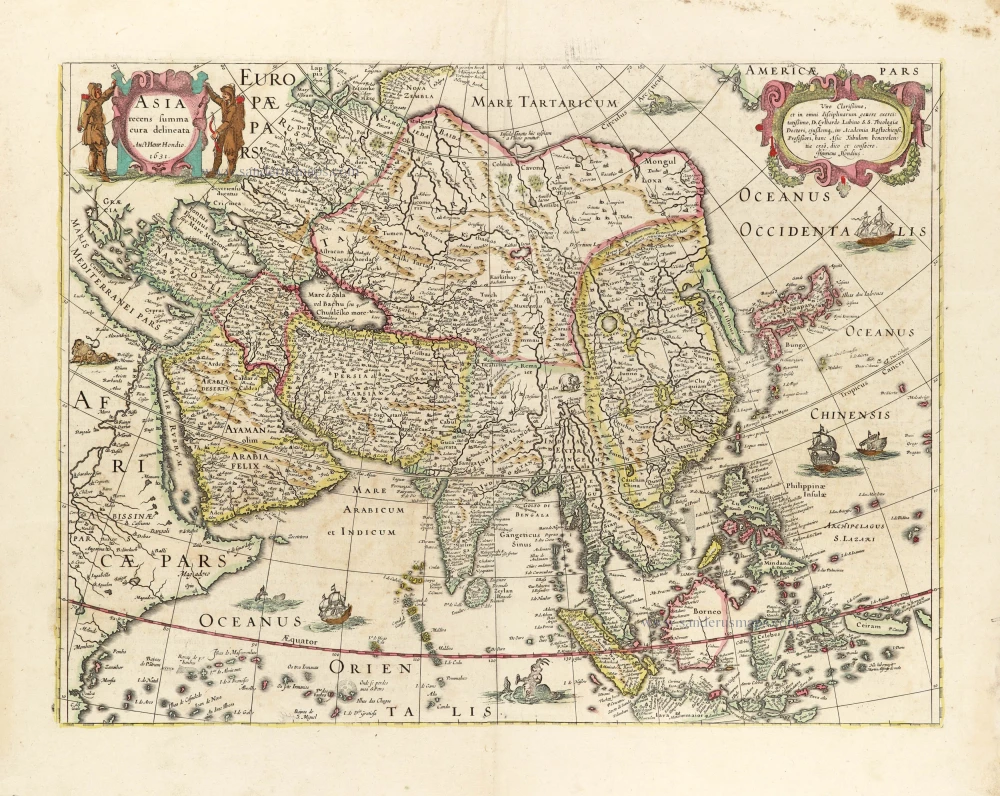
Asia Recens Summa Cura Delineata. 1639
ASIA by Hondius H.
[Item number: 24473]
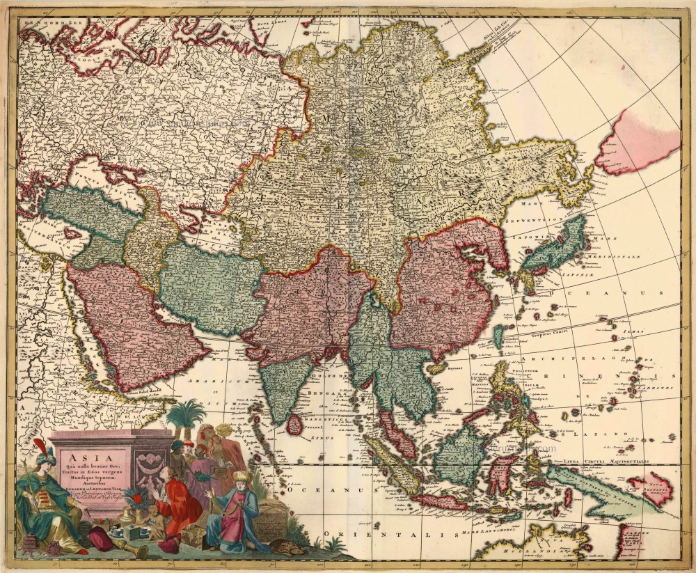
Asia qua Nulla Beatior Ora; Tractus in Eoos Vergens Mundique Teporem. c. 1730.
Asia, by G.& L. Valk.
[Item number: 24538]
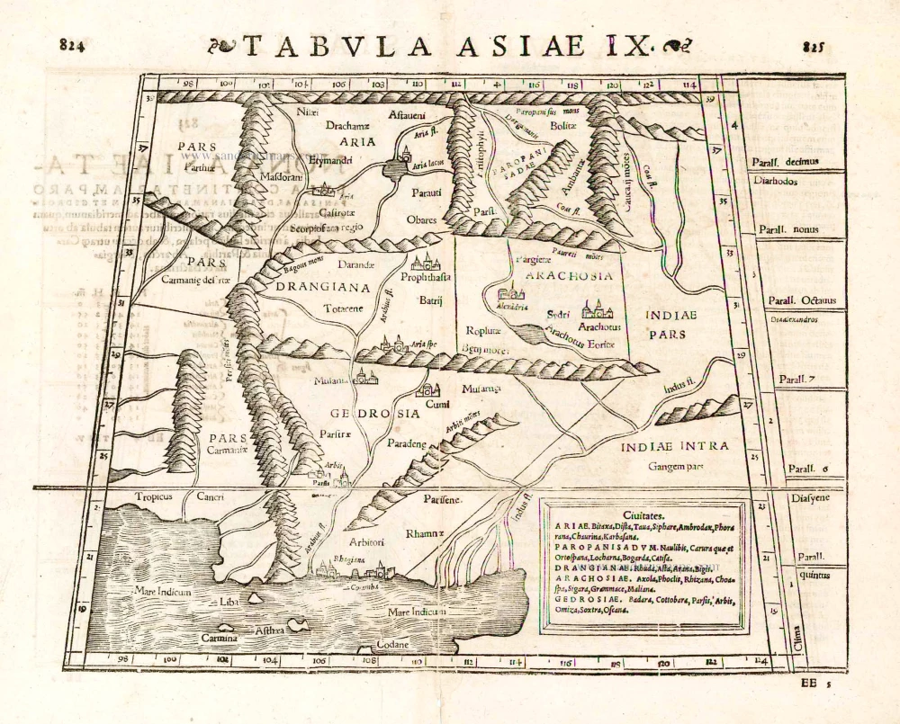
Tabula Asiae IX. 1571
Pakistan, by Sebastian Münster.
[Item number: 25641]
Asia. 1597
Asia, by Giovanni Magini.
[Item number: 26548]
Spectacular map
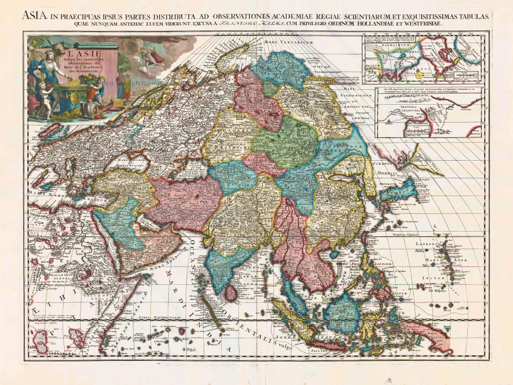
L'Asie Selon les Nouvelles Observations de Messrs. de l'Academie des Sciences, etc. Before 1713
Asia, by François Halma.
[Item number: 27851]
Spectacular map
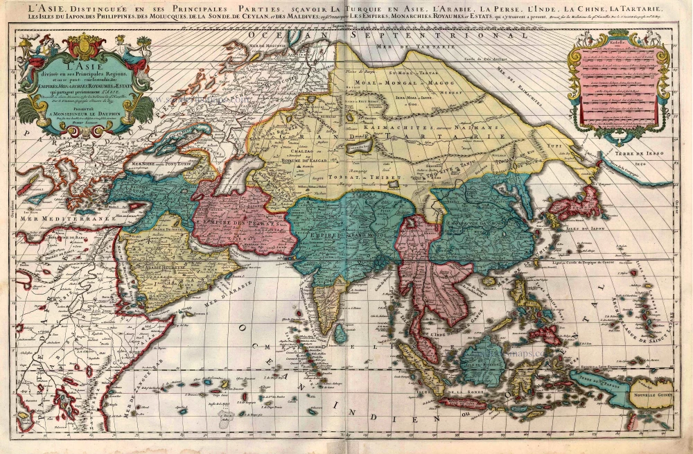
L'Asie divisée en ses Principales Regions, et ou se peut voir l'estendue Des Empites, Monarchies, Royaumes, et Estats qui partagent présentement L'Asie. c. 1705
Asia, by H. Jaillot, published by P. Mortier.
[Item number: 27858]
Asia ex magna orbis terre descriptione Gerardi Mercatoris desumpta studio et industria G.M. Iunioris. 1613
Asia, by Gerard Mercator.
[Item number: 28072]
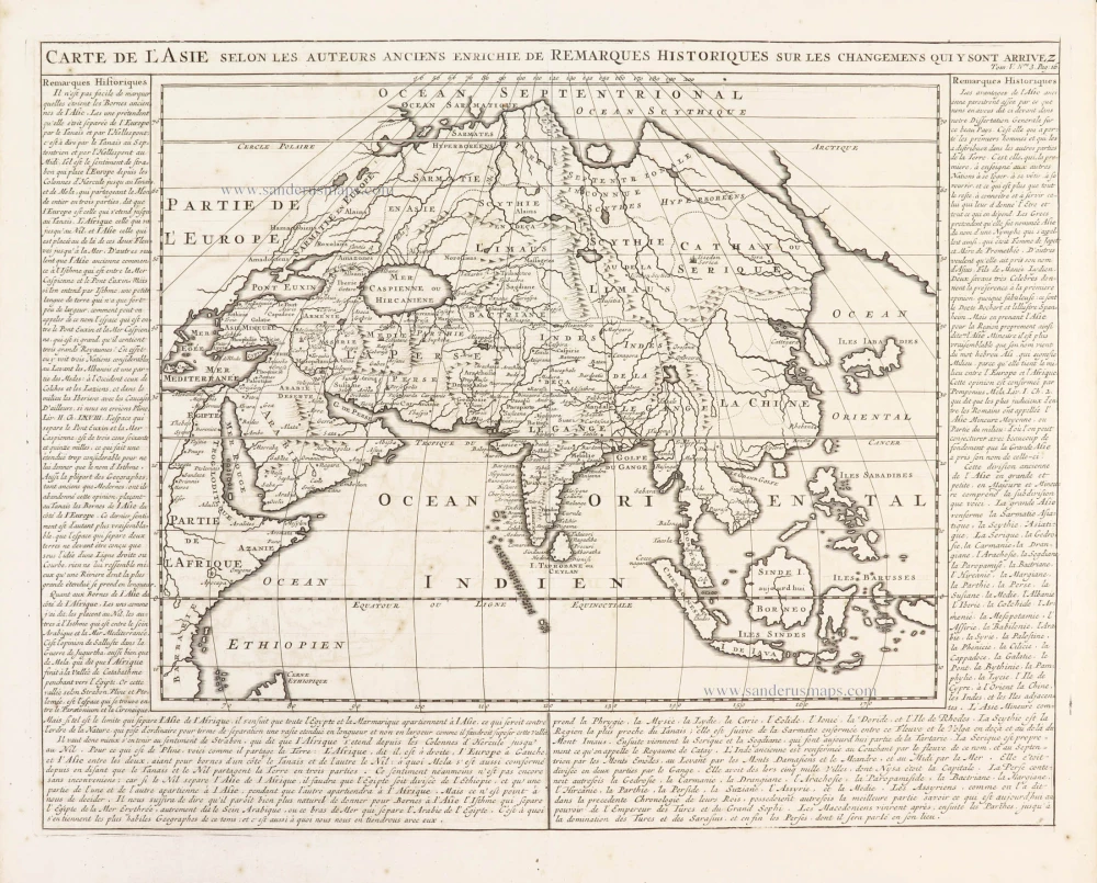
Carte de l'Asie selon les auteurs anciens enrichie de remarques historiques sur les changemens qui y sont arrivez. 1719
Asia, by Zacharias Châtelain.
[Item number: 29387]
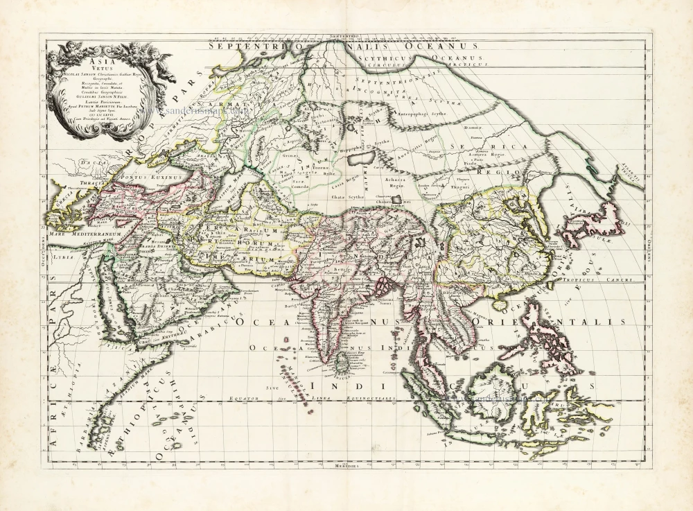
Asia Vetus. 1667-69
Ancient Asia by Nicolas & Guillaume Sanson.
[Item number: 30002]
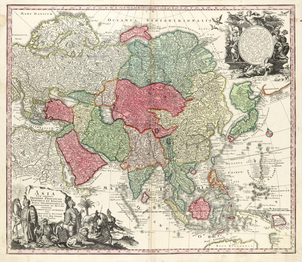
Asia Cum omnibus Imperiis Provinciis, Statibus et Insulis Iuxta Observationes receentissimas et Accuratissimas Correcta et Adornata. 1728
Asia by Matthäus Seutter.
[Item number: 30201]

Asia Antiqua cum finitimis Africae et Europae Regionibus. 1675
Antique map of Asia by Janssonius à Waesberghe -
[Item number: 30385]
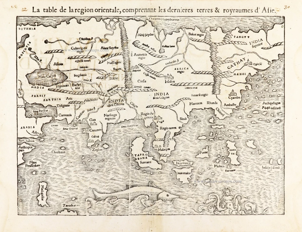
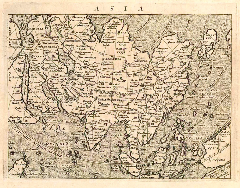
La table de la region orientale, comprenant les derniered terres & royraumes d'Asie. 1568
Asia by Sebastian Munster.
[Item number: 30528]

L'Asie divisée en ses Principales Regions, et ou se peut voir l'estendue Des Empites, Monarchies, Royaumes, et Estats qui partagent présentement L'Asie. 1692
Asia, by N. Sanson, so-called published by Hubert Jaillot. (Pirated edition by Pierre Mortier).
[Item number: 31140]

Accuratissima totius Asiae Tabula Recens Emendata. c. 1688
Asia by Justus Danckerts after F. de Wit.
[Item number: 31792]

Asiae Recentissima Delineatio, Qua Status et Imperia Totius Orientis unacum Orientalibus Indiis exhibentur. c. 1720
Asia by J.B. Homann.
[Item number: 32096]
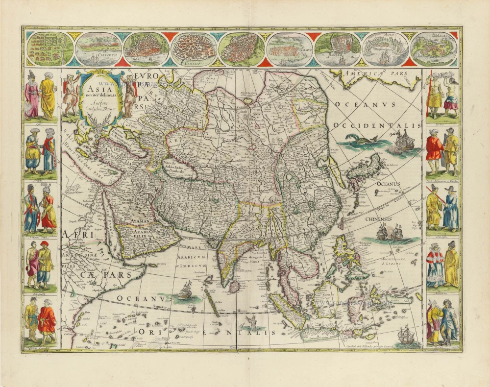
Asia Noviter Delineata. 1640
Asia, by Willem Blaeu.
[Item number: 32292]
new
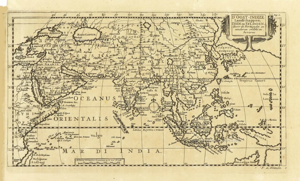
D'Oost-Indize Landschappen, Zeen en YEylanden, Door de Portugysen en anderen ondekt en bevaren. 1706
Asia by Pieter Van der Aa.
[Item number: 32319]
new