
Scarce
Russia by Justus Danckerts c. 1680


The Danckerts Family.
The Danckerts family of Amsterdam was one of the best-known print and map sellers in 17th century Amsterdam. Their business activity covered a vast period, from ca. 1633. From 1669 until 1701, father Justus and his sons had their shop in the ‘Calverstraet in de Danckbaerheyt’.
Cornelis Danckerts (1561-1631) was a printseller born in Amsterdam and active in Antwerp.
Cornelis Danckerts, the elder (1603-1656) was an engraver and publisher in Amsterdam and Nieuwendijk. Son of Cornelis (above), whom he succeeded in 1631.
The house of Danckerts gained its greatest fame from Justus Danckerts (1635-1701 - son of Cornelis the elder) and his two sons, Theodorus and Cornelis. Dancker Danckerts (1634-1666), the elder brother of Justus, was known for his etchings of paintings, maps, and publications.
The grandfather, father, and sons were highly skilled and excellent artistic drafters and engravers. They are famous for the edition of their Atlas, which appeared from ca. 1686, and for several monumental and beautiful wall maps and views. However, compared with that published by the Blaeu's or Janssonius's, their cartographic work has attracted little attention and has never received proper recognition.
On 14 August 1684, Justus and his sons obtained the privilege from the States of Holland for their publications. In 1713, twelve years after Justus Danckerts, the heirs decided to sell part of the stock of maps and atlases and many copperplates. In 1727, after the death of the last surviving brother Theodorus, a final sale took place.
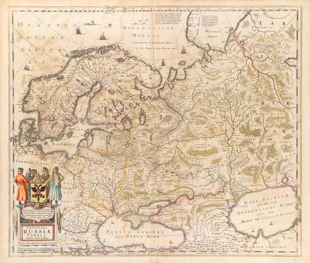
Novissima et Accuratissima Totius Russiae Vulgo Moscoviae Tabula.
Item Number: 32515 new Authenticity Guarantee
Category: Antique maps > Europe > Eastern Europe
Western Russia and Ukraine by Justus Danckerts.
Title: Novissima et Accuratissima Totius Russiae Vulgo Moscoviae Tabula.
a Iusto Danckerts Amstelodami
cum Privilegio Ordinum Holland: et West-vrisiae.
Date of the first edition: c. 1680.
Date of this map: c. 1680.
Copper engraving, printed on paper.
Image size: 495 x 580mm (19½ x 22¾ inches).
Sheet size: 530 x 615mm (20¾ x 24¼ inches).
Verso: Blank.
Condition: Original coloured, excellent.
Condition Rating: A+.
From: Atlas. Amsterdam, c. 1680. (Koeman II, p. 91, Dan1)
The Danckerts Family.
The Danckerts family of Amsterdam was one of the best-known print and map sellers in 17th century Amsterdam. Their business activity covered a vast period, from ca. 1633. From 1669 until 1701, father Justus and his sons had their shop in the ‘Calverstraet in de Danckbaerheyt’.
Cornelis Danckerts (1561-1631) was a printseller born in Amsterdam and active in Antwerp.
Cornelis Danckerts, the elder (1603-1656) was an engraver and publisher in Amsterdam and Nieuwendijk. Son of Cornelis (above), whom he succeeded in 1631.
The house of Danckerts gained its greatest fame from Justus Danckerts (1635-1701 - son of Cornelis the elder) and his two sons, Theodorus and Cornelis. Dancker Danckerts (1634-1666), the elder brother of Justus, was known for his etchings of paintings, maps, and publications.
The grandfather, father, and sons were highly skilled and excellent artistic drafters and engravers. They are famous for the edition of their Atlas, which appeared from ca. 1686, and for several monumental and beautiful wall maps and views. However, compared with that published by the Blaeu's or Janssonius's, their cartographic work has attracted little attention and has never received proper recognition.
On 14 August 1684, Justus and his sons obtained the privilege from the States of Holland for their publications. In 1713, twelve years after Justus Danckerts, the heirs decided to sell part of the stock of maps and atlases and many copperplates. In 1727, after the death of the last surviving brother Theodorus, a final sale took place.
Related items
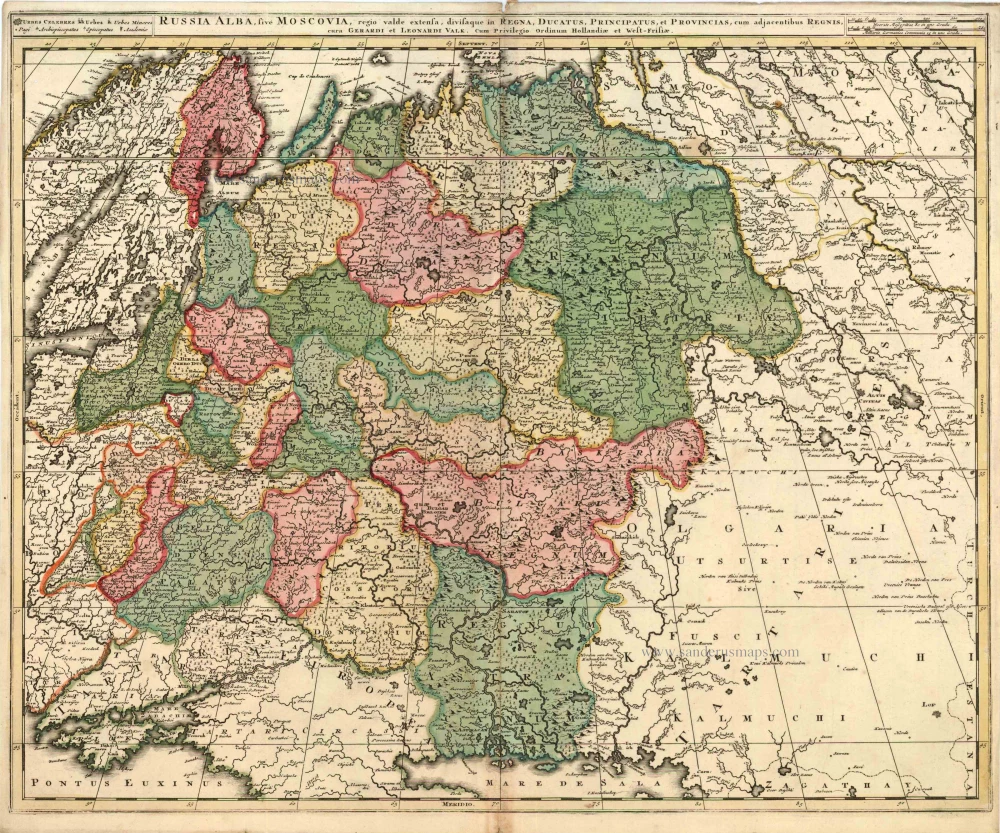
Russia Alba, sive Moscoviae, Regio Valde Extensa, Divisaque in Regna, Ducatus, Principatus, et Provincias, cum Adjacentibus Regnis c. 1702
Russia, by Valk & Schenk.
[Item number: 5099]
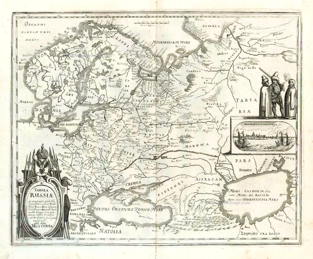
Tabula Russiae ... alias dicta Moscovia. 1638
Russia, by M. Merian.
[Item number: 25918]
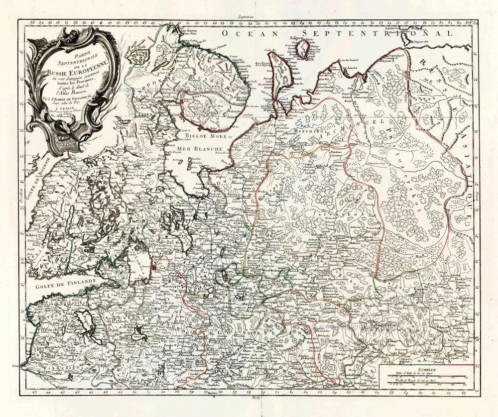
Partie Septentrionale de la Russie Européenne où sont distingées exactement toutes les Provinces, d'après le détail de l'Atlas Russien. 1776-79
Northern European Russia, by Francesco Santini.
[Item number: 26970]

Partie Méridionale de la Russie Européenne où sont distingées exactement toutes les Provinces, d'après le détail de l'Atlas Russien. 1776-79
Southern European Russia, by Francesco Santini.
[Item number: 26971]
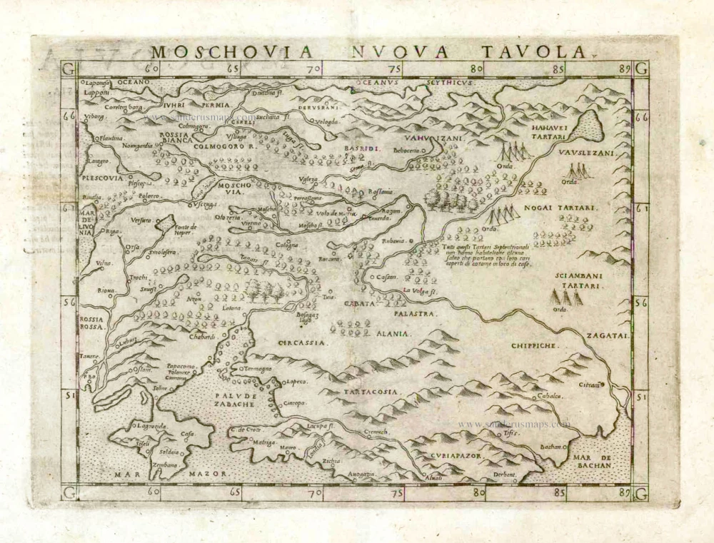
Moschovia Nuova Tavola. 1561
Russia, by Girolamo Ruscelli.
[Item number: 27072]
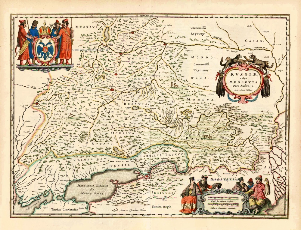
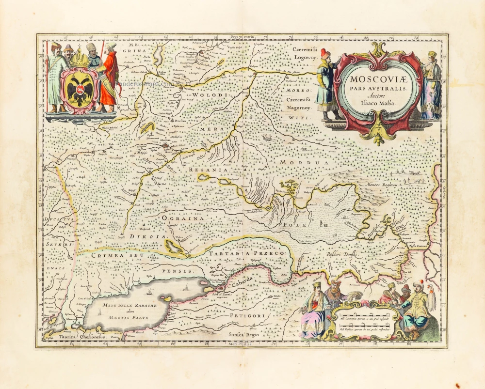
Russiae, Vulgo Moscovia Pars Australis. Auctore Isaaco Massa. 1643
Southern Russia, by Joan Blaeu.
[Item number: 27663]
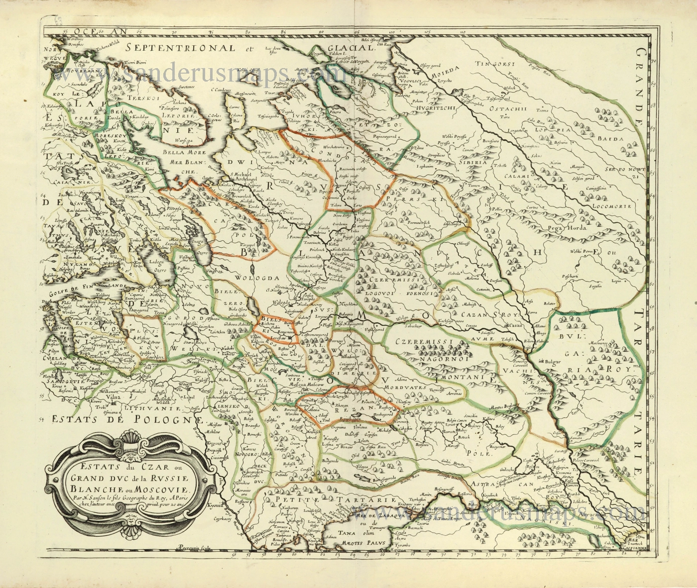
Estats du Czar ou Grand Duc de la Russie Blanche ou Moscovie. 1658
Russia by Nicolas Sanson.
[Item number: 28499]
Tabula Russiae. c. 1678
Russia by Claes Jansz Visscher.
[Item number: 28516]
Novissima Russiae Tabula. 1639
Russia, by Henricus Hondius.
[Item number: 28811]
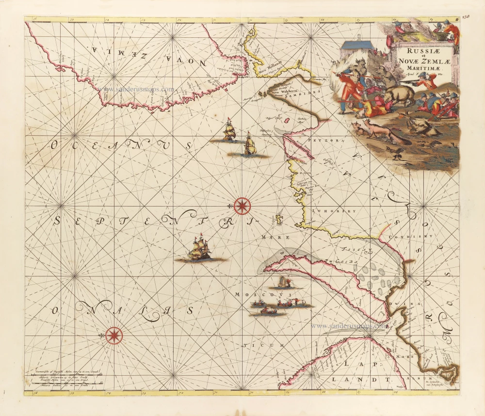
Russiae et Novae Zemlae Maritimae. c. 1680
Northern Coast of Russia, by Frederick de Wit.
[Item number: 29178]
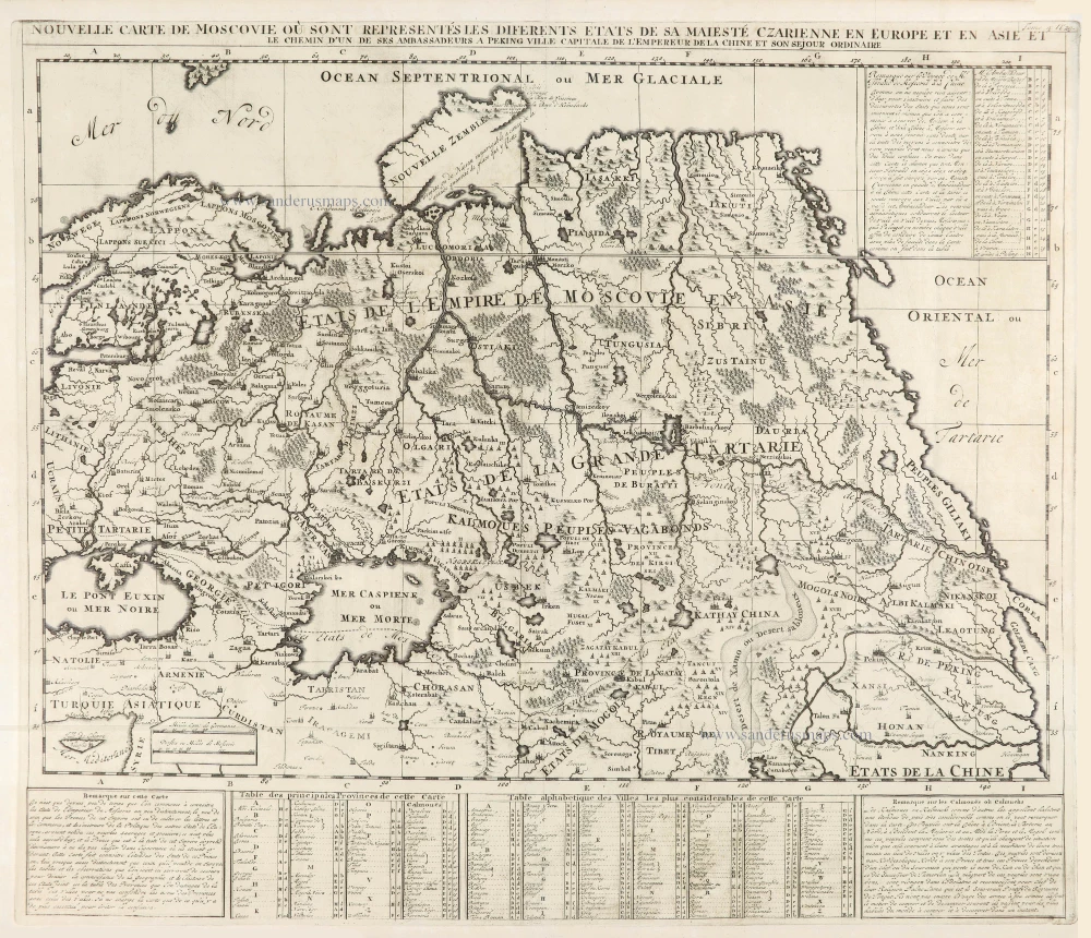
Nouvelle Carte de Moscovie où sont representés diferents Etats de sa Maiesté Czarienne en Europe et en Asie 1714
Russia, by Zacharias Châtelain.
[Item number: 29400]
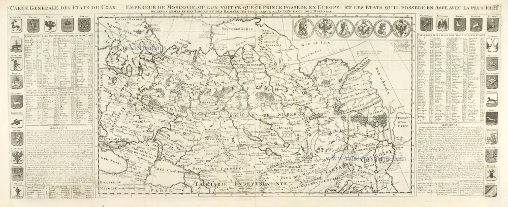
Carte Générale des Etats du Czar Empereur de Moscovie, ou l'on voit ce que ce Prince possède en Europe et les Etats qu'il possède en Asie 1714
Russia, by Zacharias Châtelain.
[Item number: 29401]

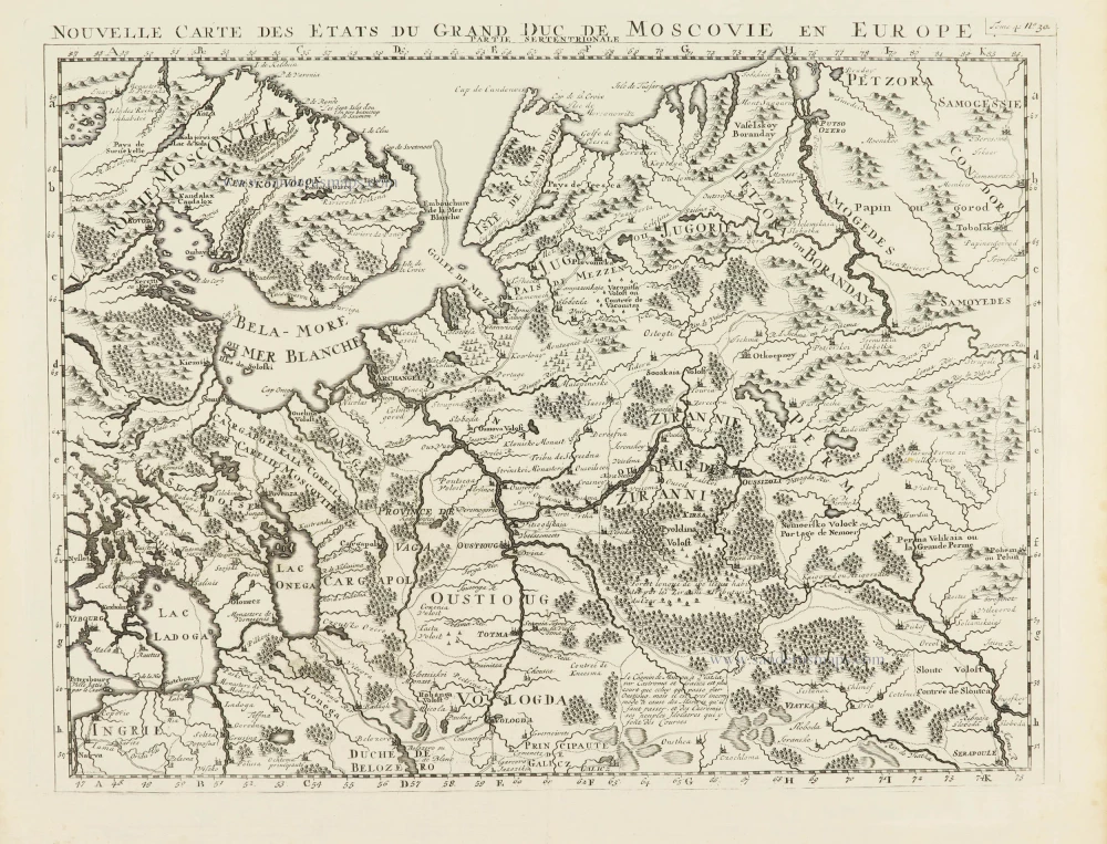
Nouvelle Carte des Etats du Grand Duc de Moscovie en Europe. Partie Meridionale. 1714
Southern European Russia, by Zacharias Châtelain.
[Item number: 29403]
Nouvelle Carte des Etats du Grand Duc de Moscovie en Europe. Partie Meridionale. 1714
Northern European Russia, by Zacharias Châtelain.
[Item number: 29404]
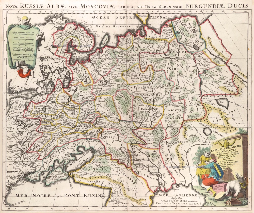
La Russie Blanche ou Moscovie. c. 1709
Russia by Hubert Jaillot, published by Pierre Mortier.
[Item number: 29615]
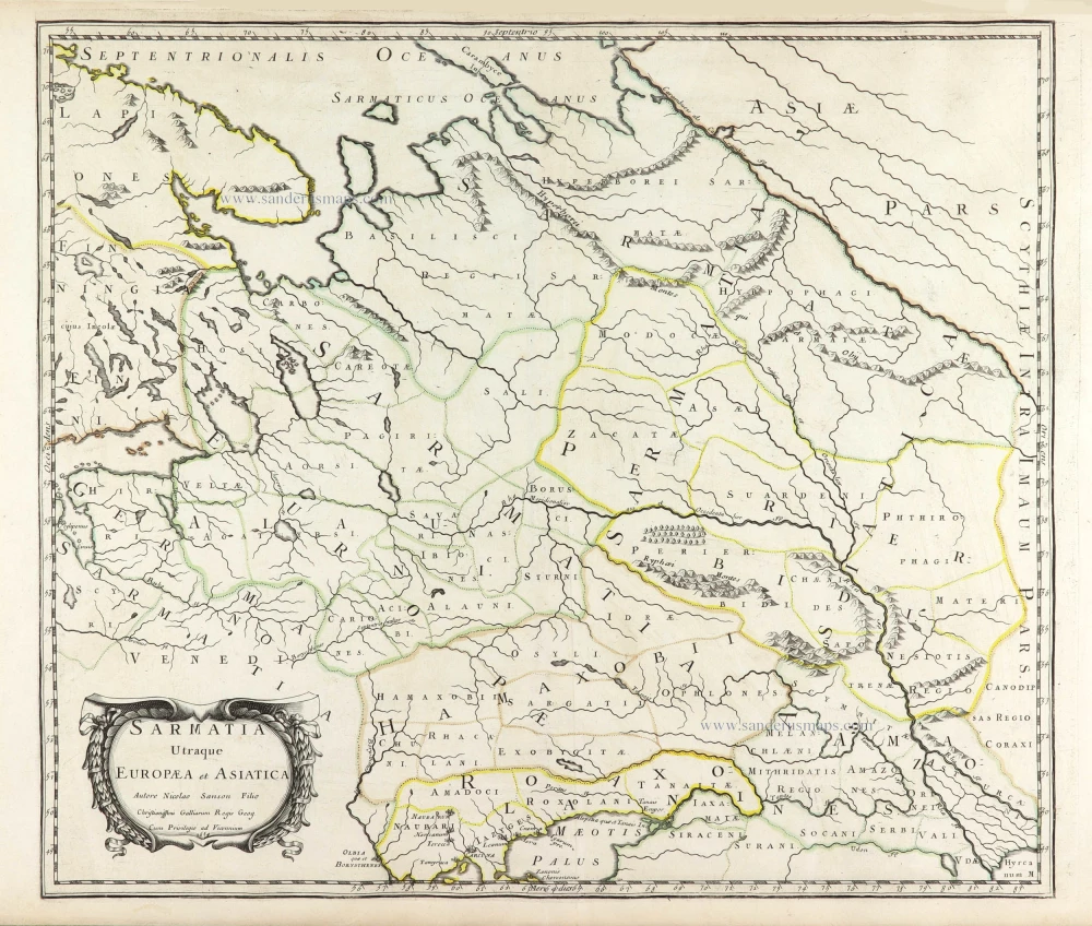
Sarmatia Utraque Europaea et Asiatica. 1659
European Russia and Ukraine by Nicolas Sanson.
[Item number: 29717]
![Atlas Russicus [Atlas Rossiiskoi.] by Joseph-Nicolas De L'Isle. <Strong><i> The first atlas devoted solely to Russia.</i></Strong>](https://sanderusmaps.com/assets/WEBP/m29938.webp)
Atlas Russicus, Mappa una Generali et Undeviginti Specialibus Vastissimum Imperium Russicum ... - contenant une carte générale et dixneuf cartes particulières de tout l'empire de Russie et des Pays Limitrophes. [Atlas Rossiiskoi.]
Atlas Russicus [Atlas Rossiiskoi.] by Joseph-Nicolas De L'Isle. The first atlas devoted solely to Russia.
[Item number: 29938]
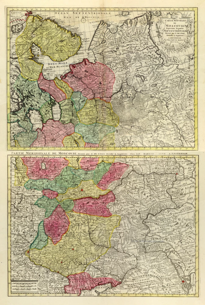
Carte Nouvelle de Moscovie Represente la partie Septentrionale. [In set with:] Partie Meridionale de Moscovie. 1792
Russia by G. Delisle, published by J.B. Elwe.
[Item number: 30173]
Moscoviae pars Australis. 1653
Southern Russia by Johannes Janssonius.
[Item number: 30342]
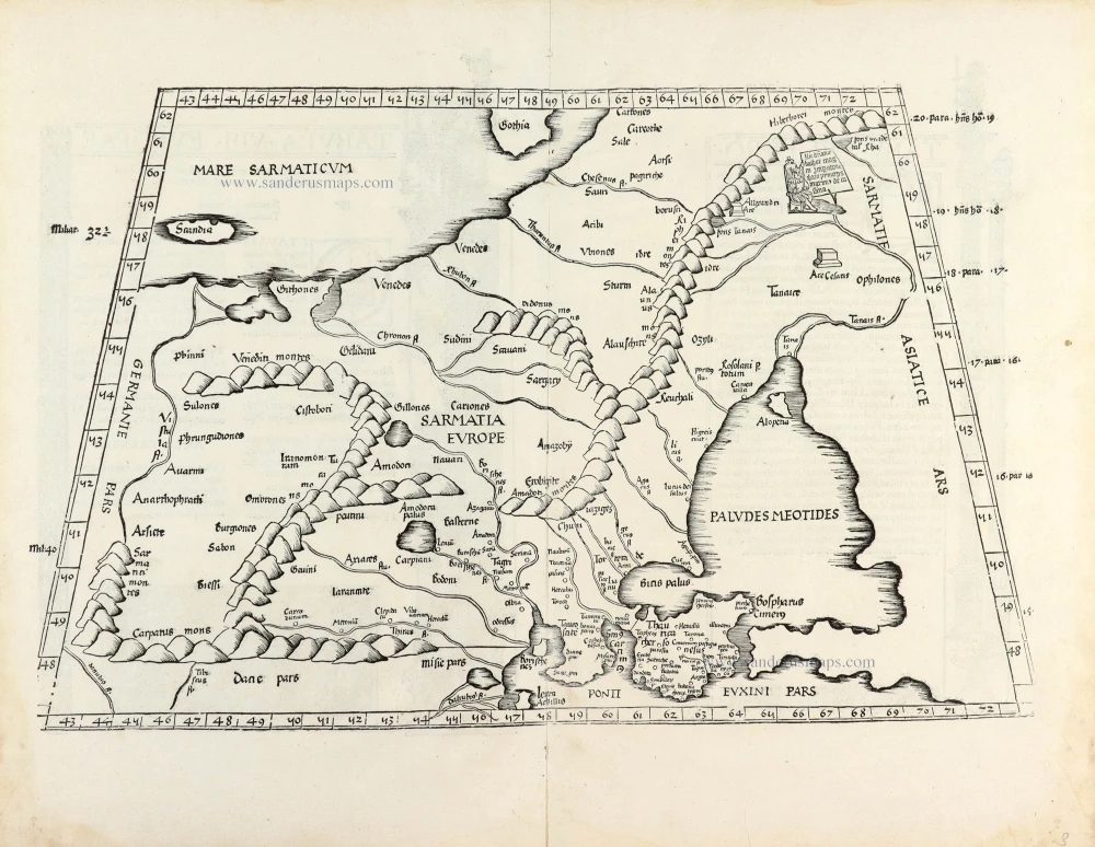
[Title on verso:] Tabula .VIII. Europae. 1525
Ptolemy map of Eastern Europe, Ukraine - Russia by Lorenz Fries, after Martin Waldseemüller.
[Item number: 30369]

La Russie Blanche ou Moscovie Divisee Suivant l'Estendue des Royaumes, Duchés, Principautes, Provinces et Peuples qui sont Presentement sous la Domination du Czar de la Russe Cognu sous le Nom de Grand Duc de Moscovie. 1692
Russia by N. Sanson, so-called published by Hubert Jaillot. (Pirated edition by Pierre Mortier).
[Item number: 31176]

A view of the Exchange at Petersburg in Russia. - Vue de la Bourse & du Port de Petersbourg en Russie. c. 1750
Exchange at Petersburg in Russia, by Martin Engelbrecht.
[Item number: 31984]

The Buiheigs of the Imperial Colleges in St. Petersburg on the Leftside and the Warehouses for Merchants on ye right. - Vue des Colleges Imperiaux et du Magazin des Marchandises de l'Orient a Peterbourg. c. 1750
The Imperial Colleges and warehouses at St. Petersburg in Russia, by Martin Engelbrecht.
[Item number: 31987]
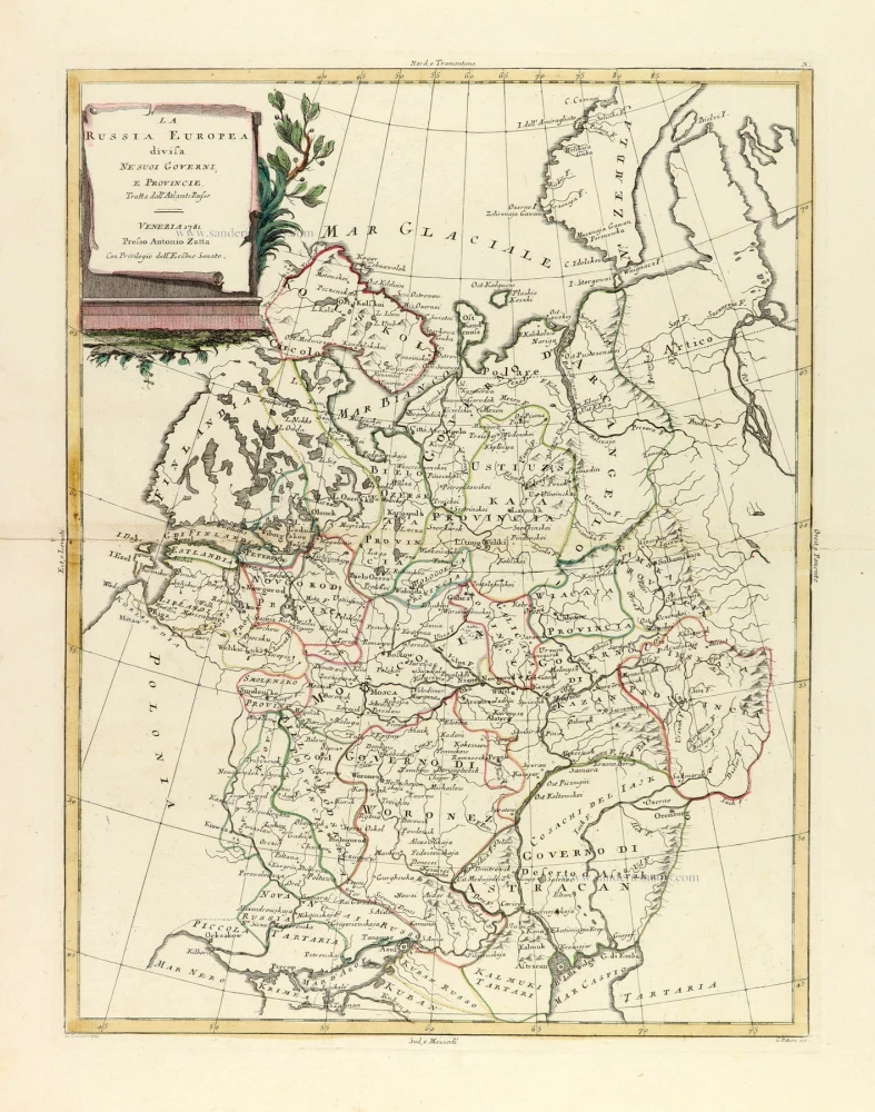
La Russia Europea divisa ne' suoi Governi, e Provincie. 1779-1785
Russia (European), by Antonio Zatta.
[Item number: 32136]

Governi di Moscovia e Woronez colle loro Provincie nella Russia Europea. 1779-1785
Russia: Moscow - Voronezh, by Antonio Zatta.
[Item number: 32167]

Generalis totius Imperii Moscovitici Novissima Tabula Magnam Orbis terrarum pertem à Polo Articousq ad mare Iaponicum, et Chinae Septentrionalis confinia exhibens cum via Czaricae nuper legationis ex urbe Moscua per universam Tartariam ad magnu[m] Chinae Imperatorem. c. 1720
Russia, by J.B. Homann.
[Item number: 32194]

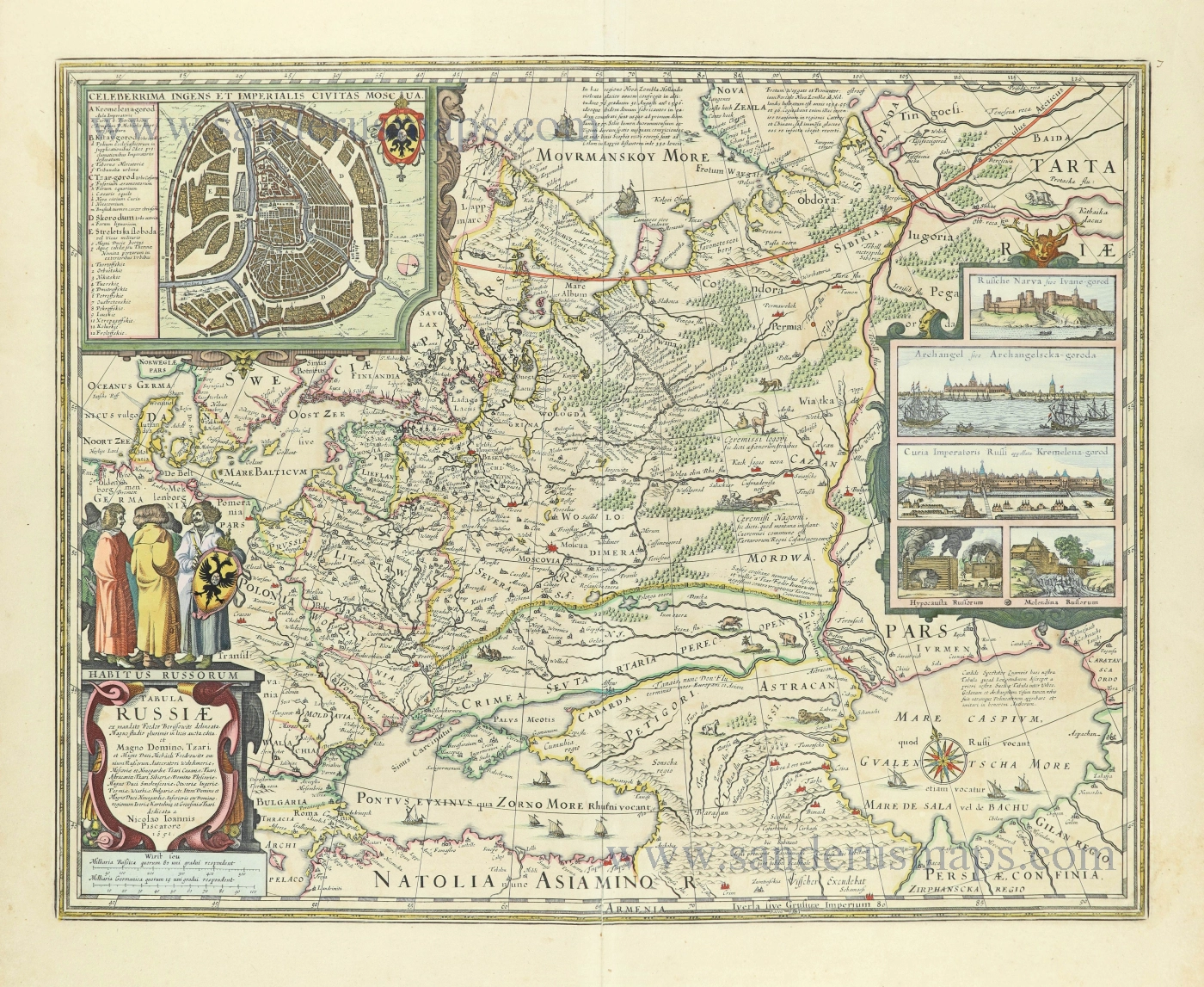
Tabula Russiae ex autographo, quod delineandum curavit Foedor filius Tzaris Boris desumta; . . . 1643
Russia by Willem & Joan Blaeu.
[Item number: 32266]