
Palma Nova by Braun & Hogenberg c. 1610
The item displayed on this page has been sold. However, we have a similar map in stock:
Palma Nova by Braun & Hogenberg, published by J. Janssonius. 1657
Palma - Nova Palmae civitas in patria ...
[Item number: 31048]


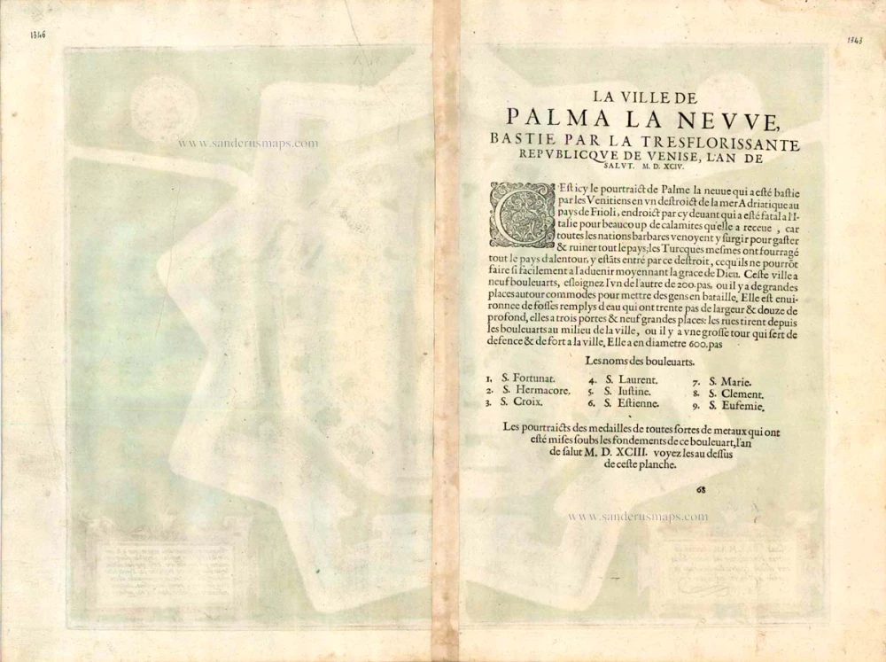


TRANSLATION OF CARTOUCHE TEXT BOTTOM LEFT: The new city of Palma, built by Venice in Friuli at the mouth of the Adriatic Sea as protection against attacks by barbarians.
CARTOUCHE BOTTOM RIGHT: The city has nine bulwarks, each 200 paces apart. Streets run around them to reinforce the front line. The moats encircling these are 30 paces wide and 12 deep. There are 3 gates and nine squares. From the bulwarks, streets lead into the centre, where a heavily fortified tower stands as a place of refuge. The whole site has a diameter of 600 paces.
COMMENTARY BY BRAUN: "Outline of the city of Palmanova, built by the Venetians in Friuli at the mouth of the sea. Previously the Italians suffered great harm, for the barbarian peoples ravaged this province, and the Turks also threatened the surrounding towns with daily rape and pillage, something that would not be so easy for them in future. The city has nine new bulwarks, each 200 paces apart; the streets are round and wide, and the walls can today be well defended. The streets lead directly from the bulwarks to a centre, where there is a mighty tower, from where the whole city can be defended."
The bird's-eye view is the optimum perspective to present the fortified city of Palmanova to the viewer. Designed by Vincenzo Scamozzi, the star-shaped fort on the Venetian border was laid out as late as 1593 and is one of the few Renaissance examples of an ideal city. The primary goal of the Venetian government was to create a bulwark against the Turks, who had raided Friuli seven times between 1470 and 1499. The fortifications were extended in the 17th century when Palmanova lay on the border with the Habsburg Empire and again in the 19th century by Napoleon. The city's star-shaped plan is visible even today. The draughtsman has introduced several figures into the town to "soften" its strict geometric shape. (Taschen)
Braun G. & Hogenberg F. and the Civitates Orbis Terrarum.
The Civitates Orbis Terrarum, also known as the 'Braun & Hogenberg', is a six-volume town atlas and the most excellent book of town views and plans ever published: 363 engravings, sometimes beautifully coloured. It was one of the best-selling works in the last quarter of the 16th century. Georg Braun, a skilled writer, wrote the text accompanying the plans and views on the verso. Many plates were engraved after the original drawings of a professional artist, Joris Hoefnagel (1542-1600). The first volume was published in Latin in 1572 and the sixth in 1617. Frans Hogenberg, a talented engraver, created the tables for volumes I through IV, and Simon van den Neuwel made those for volumes V and VI. Other contributors were cartographers Daniel Freese and Heinrich Rantzau, who provided valuable geographical information. Works by Jacob van Deventer, Sebastian Münster, and Johannes Stumpf were also used as references. Translations appeared in German and French, making the atlas accessible to a wider audience.
Since its original publication of volume 1 in 1572, the Civitates Orbis Terrarum has left an indelible mark on the history of cartography. The first volume was followed by seven more editions in 1575, 1577, 1582, 1588, 1593, 1599, and 1612. Vol.2, initially released in 1575, saw subsequent editions in 1597 and 1612. The subsequent volumes, each a treasure trove of historical insights, graced the world in 1581, 1588, 1593, 1599, and 1606. The German translation of the first volume, a testament to its widespread appeal, debuted in 1574, followed by the French edition in 1575.
Several printers were involved: Theodor Graminaeus, Heinrich von Aich, Gottfried von Kempen, Johannis Sinniger, Bertram Buchholtz, and Peter von Brachel, all of whom worked in Cologne.
Georg Braun (1541-1622)
Georg Braun, the author of the text accompanying the plans and views in the Civitates Orbis Terrarum, was born in Cologne in 1541. After his studies in Cologne, he entered the Jesuit Order as a novice, indicating his commitment to learning and intellectual pursuits. In 1561, he obtained his bachelor's degree; in 1562, he received his Magister Artium, further demonstrating his academic achievements. Although he left the Jesuit Order, he continued his studies in theology, gaining a licentiate in theology. His theological background likely influenced the content and tone of the text in the Civitates Orbis Terrarum, adding a unique perspective to the work.
Frans Hogenberg (1535-1590)
Frans Hogenberg was a Flemish and German painter, engraver, and mapmaker. He was born in Mechelen as the son of Nicolaas Hogenberg.
By the end of the 1560s, Frans Hogenberg was employed upon Abraham Ortelius's Theatrum Orbis Terrarum, published in 1570; he is named an engraver of numerous maps. In 1568, he was banned from Antwerp by the Duke of Alva and travelled to London, where he stayed a few years before emigrating to Cologne. He immediately embarked on his two most important works, the Civitates, published in 1572 and the Geschichtsblätter, which appeared in several series from 1569 until about 1587.
Thanks to large-scale projects like the Geschichtsblätter and the Civitates, Hogenberg's social circumstances improved with each passing year. He died as a wealthy man in Cologne in 1590.
Nova Palmae civitas in patria Foroiuliensi ad maris Adriatici ostium contra Barbarorum incursum à Venetis aedificata.
Item Number: 16672 Authenticity Guarantee
Category: Antique maps > Europe > Italy - Cities
Palma Nova by Braun & Hogenberg.
Title: Nova Palmae civitas in patria Foroiuliensi ad maris Adriatici ostium contra Barbarorum incursum à Venetis aedificata.
Date of the first edition: 1596.
Date of this map: c. 1610.
Copper engraving, printed on paper.
Size (not including margins): 360 x 475mm (14.17 x 18.7 inches).
Verso: French text.
Condition: Contemporary old coloured, excellent.
Condition Rating: A+.
From: Théâtre des Principales Villes de tout l'Univers. Tome 5. c. 1610.
TRANSLATION OF CARTOUCHE TEXT BOTTOM LEFT: The new city of Palma, built by Venice in Friuli at the mouth of the Adriatic Sea as protection against attacks by barbarians.
CARTOUCHE BOTTOM RIGHT: The city has nine bulwarks, each 200 paces apart. Streets run around them to reinforce the front line. The moats encircling these are 30 paces wide and 12 deep. There are 3 gates and nine squares. From the bulwarks, streets lead into the centre, where a heavily fortified tower stands as a place of refuge. The whole site has a diameter of 600 paces.
COMMENTARY BY BRAUN: "Outline of the city of Palmanova, built by the Venetians in Friuli at the mouth of the sea. Previously the Italians suffered great harm, for the barbarian peoples ravaged this province, and the Turks also threatened the surrounding towns with daily rape and pillage, something that would not be so easy for them in future. The city has nine new bulwarks, each 200 paces apart; the streets are round and wide, and the walls can today be well defended. The streets lead directly from the bulwarks to a centre, where there is a mighty tower, from where the whole city can be defended."
The bird's-eye view is the optimum perspective to present the fortified city of Palmanova to the viewer. Designed by Vincenzo Scamozzi, the star-shaped fort on the Venetian border was laid out as late as 1593 and is one of the few Renaissance examples of an ideal city. The primary goal of the Venetian government was to create a bulwark against the Turks, who had raided Friuli seven times between 1470 and 1499. The fortifications were extended in the 17th century when Palmanova lay on the border with the Habsburg Empire and again in the 19th century by Napoleon. The city's star-shaped plan is visible even today. The draughtsman has introduced several figures into the town to "soften" its strict geometric shape. (Taschen)
Braun G. & Hogenberg F. and the Civitates Orbis Terrarum.
The Civitates Orbis Terrarum, also known as the 'Braun & Hogenberg', is a six-volume town atlas and the most excellent book of town views and plans ever published: 363 engravings, sometimes beautifully coloured. It was one of the best-selling works in the last quarter of the 16th century. Georg Braun, a skilled writer, wrote the text accompanying the plans and views on the verso. Many plates were engraved after the original drawings of a professional artist, Joris Hoefnagel (1542-1600). The first volume was published in Latin in 1572 and the sixth in 1617. Frans Hogenberg, a talented engraver, created the tables for volumes I through IV, and Simon van den Neuwel made those for volumes V and VI. Other contributors were cartographers Daniel Freese and Heinrich Rantzau, who provided valuable geographical information. Works by Jacob van Deventer, Sebastian Münster, and Johannes Stumpf were also used as references. Translations appeared in German and French, making the atlas accessible to a wider audience.
Since its original publication of volume 1 in 1572, the Civitates Orbis Terrarum has left an indelible mark on the history of cartography. The first volume was followed by seven more editions in 1575, 1577, 1582, 1588, 1593, 1599, and 1612. Vol.2, initially released in 1575, saw subsequent editions in 1597 and 1612. The subsequent volumes, each a treasure trove of historical insights, graced the world in 1581, 1588, 1593, 1599, and 1606. The German translation of the first volume, a testament to its widespread appeal, debuted in 1574, followed by the French edition in 1575.
Several printers were involved: Theodor Graminaeus, Heinrich von Aich, Gottfried von Kempen, Johannis Sinniger, Bertram Buchholtz, and Peter von Brachel, all of whom worked in Cologne.
Georg Braun (1541-1622)
Georg Braun, the author of the text accompanying the plans and views in the Civitates Orbis Terrarum, was born in Cologne in 1541. After his studies in Cologne, he entered the Jesuit Order as a novice, indicating his commitment to learning and intellectual pursuits. In 1561, he obtained his bachelor's degree; in 1562, he received his Magister Artium, further demonstrating his academic achievements. Although he left the Jesuit Order, he continued his studies in theology, gaining a licentiate in theology. His theological background likely influenced the content and tone of the text in the Civitates Orbis Terrarum, adding a unique perspective to the work.
Frans Hogenberg (1535-1590)
Frans Hogenberg was a Flemish and German painter, engraver, and mapmaker. He was born in Mechelen as the son of Nicolaas Hogenberg.
By the end of the 1560s, Frans Hogenberg was employed upon Abraham Ortelius's Theatrum Orbis Terrarum, published in 1570; he is named an engraver of numerous maps. In 1568, he was banned from Antwerp by the Duke of Alva and travelled to London, where he stayed a few years before emigrating to Cologne. He immediately embarked on his two most important works, the Civitates, published in 1572 and the Geschichtsblätter, which appeared in several series from 1569 until about 1587.
Thanks to large-scale projects like the Geschichtsblätter and the Civitates, Hogenberg's social circumstances improved with each passing year. He died as a wealthy man in Cologne in 1590.
Related items
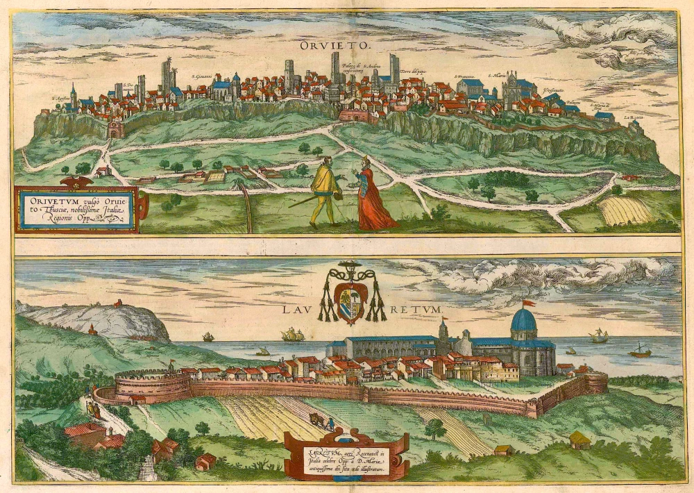
Orvieto [on sheet with] with Lauretum 1581-88
Orvieto - Lauretum, by Braun & Hogenberg.
[Item number: 2673]
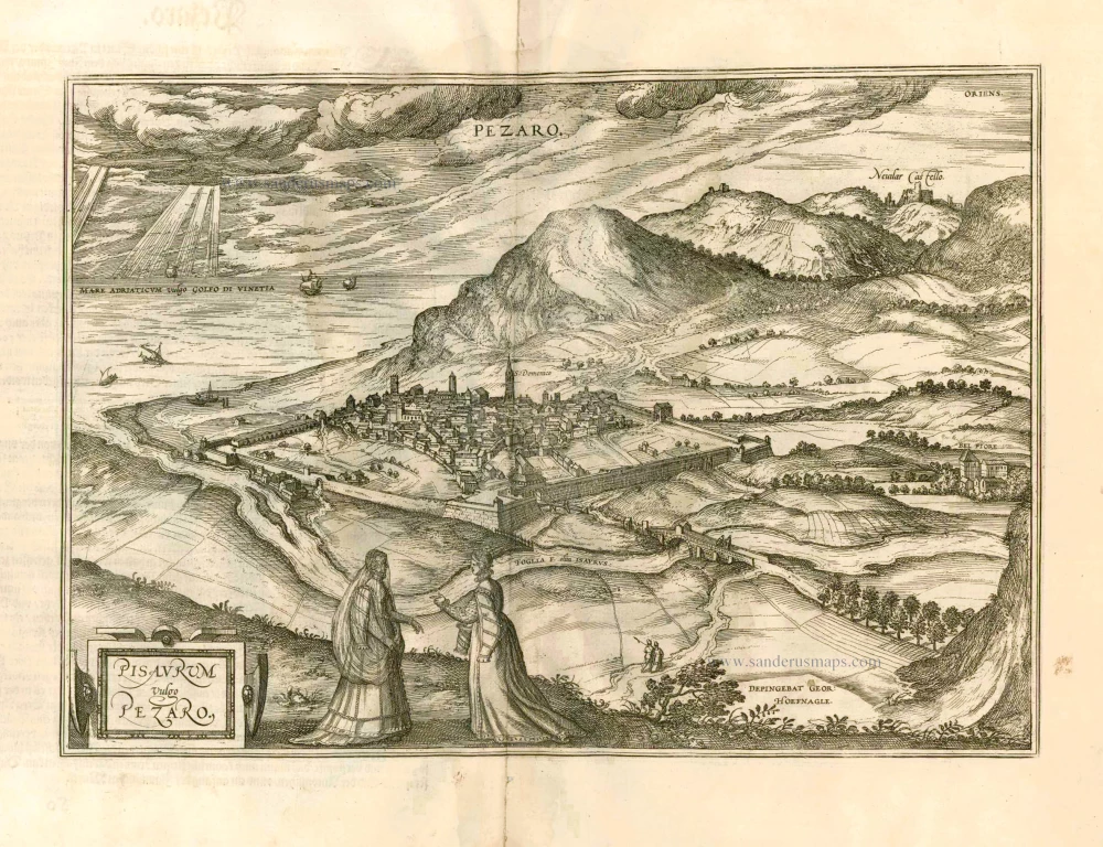
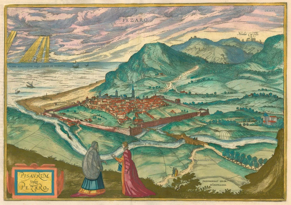
Pisaurum Vulgo Pezaro. 1582
Pesaro by Braun & Hogenberg.
[Item number: 14164]
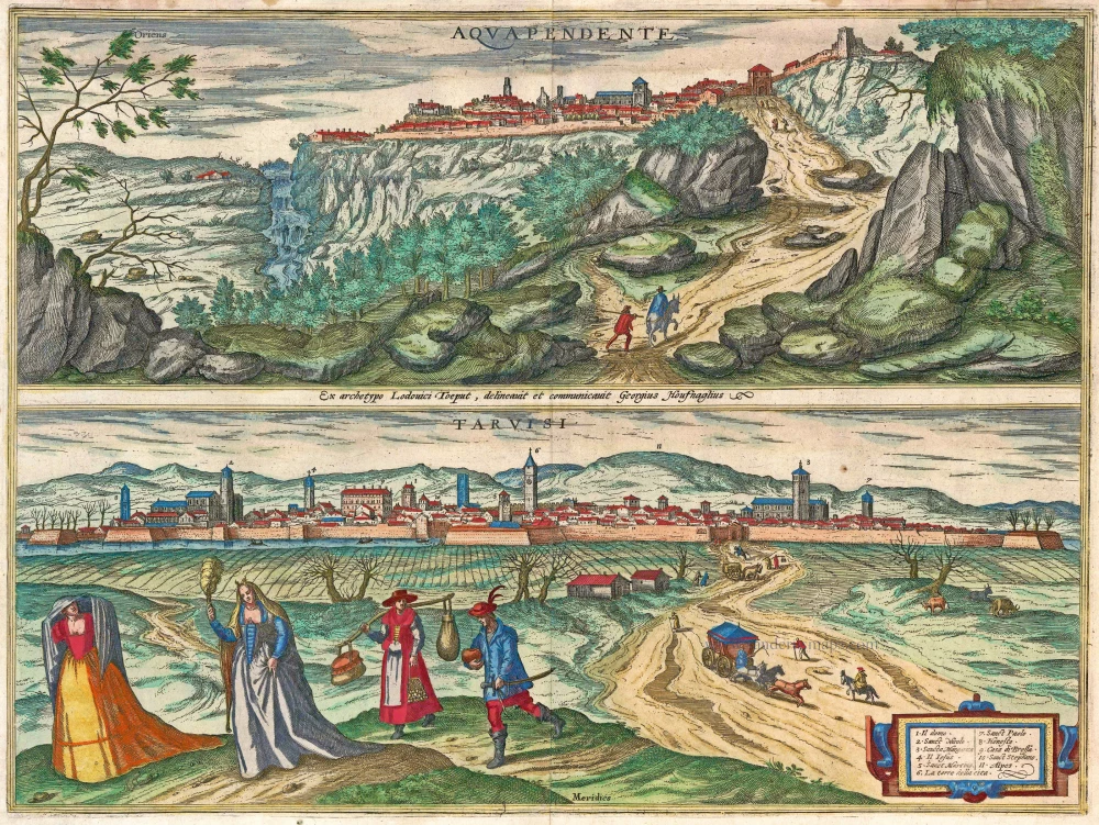
Aquapendente [on sheet with] Tarvisi c. 1610
Acquapendente and Tarvisio by Braun and Hogenberg.
[Item number: 14608]
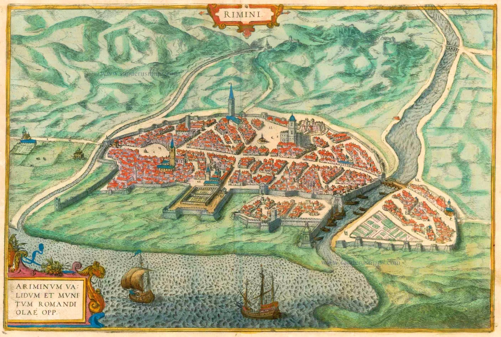
Rimini - Ariminum validum et munitum romandi olae opp. 1612
Rimini, by Braun & Hogenberg.
[Item number: 16426]
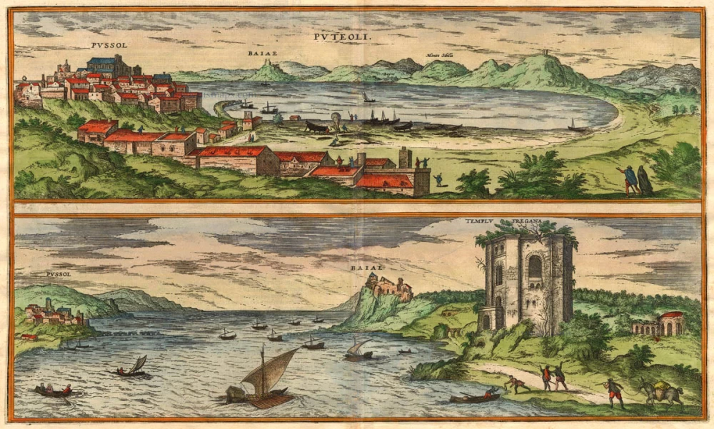
Puteoli - Baiae 1575
Pozzuoli - Baia, by Braun & Hogenberg.
[Item number: 17963]
Pisaurum Vulgo Pezaro. 1588
Pesaro, by Braun & Hogenberg.
[Item number: 21465]
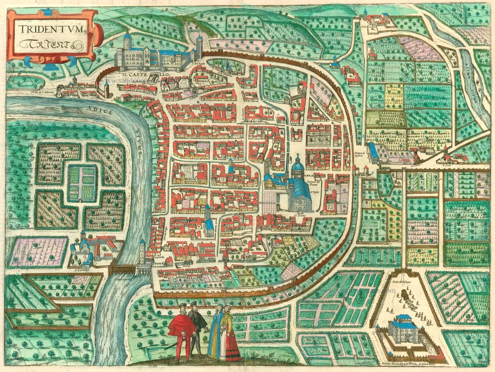
Tridentum. Trient. 1599
Trente (Trento) by Georg Braun & Frans Hogenberg
[Item number: 24063]