
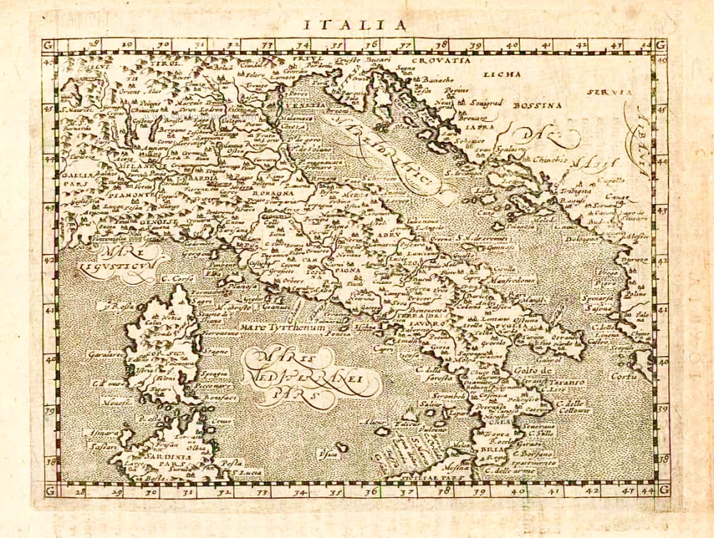
Italy by Joannes Janssonius. 1666

The Janssonius Family
Joannes Janssonius (Arnhem, 1588-1664), son of the Arnhem publisher Jan Janssen, married Elisabeth Hondius, daughter of Jodocus Hondius, in Amsterdam in 1612. After his marriage, he settled down in this town as a bookseller and publisher of cartographic material. In 1618 he established himself in Amsterdam next door to Blaeu’s book shop. He entered into serious competition with Willem Jansz. Blaeu when copying Blaeu’s Licht der Zeevaert after the expiration of the privilege in 1620. His activities not only concerned the publication of atlases and books, but also of single maps and an extensive book trade with branches in Frankfurt, Danzig, Stockholm, Copenhagen, Berlin, Koningsbergen, Geneva, and Lyon. In 1631 he began publishing atlases together with Henricus Hondius.
In the early 1640s Henricus Hondius left the atlas publishing business completely to Janssonius. Competition with Joan Blaeu, Willem’s son and successor, in atlas production prompted Janssonius to enlarge his Atlas Novus finally into a work of six volumes, into which a sea atlas and an atlas of the Old World were inserted. Other atlases published by Janssonius are Mercator’s Atlas Minor, Hornius’s historical atlas (1652), the townbooks in eight volumes (1657), Cellarius’s Atlas Coelestis and several sea atlases and pilot guides.
After the death of Joannes Janssonius, the shop and publishing firm were continued by the heirs under the direction of Johannes van Waesbergen (c. 1616-1681), son-in-law of Joannes Janssonius. Van Waesbergen added the name of Janssonius to his own.
In 1676, Joannes Janssonius’s heirs sold by auction “all the remaining Atlases in Latin, French, High and Low German, as well as the Stedeboecken in Latin, in 8 volumes, bound and unbound, maps, plates belonging to the Atlas and Stedeboecken.” The copperplates from Janssonius’s atlases were afterwards sold to Schenk and Valck.
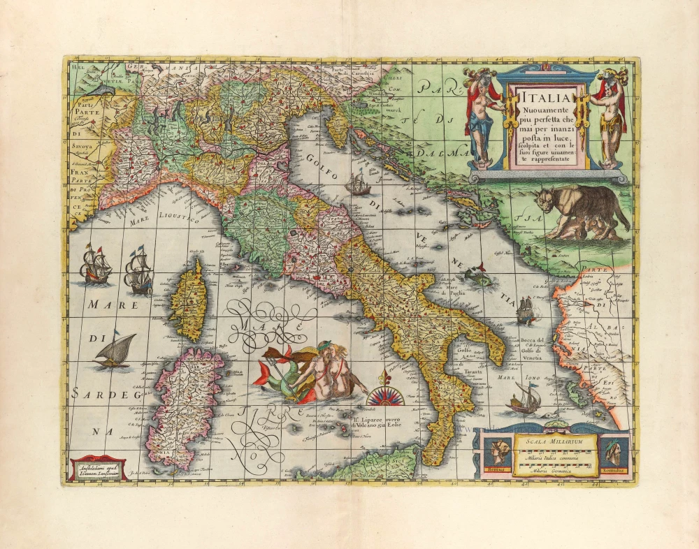
Italia Nuovamente piu perfetta che mai per inanzi posta im luce, scolpita et con le suoi figure uiuamente rappresentate.
Item Number: 29804 Authenticity Guarantee
Category: Antique maps > Europe > Italy
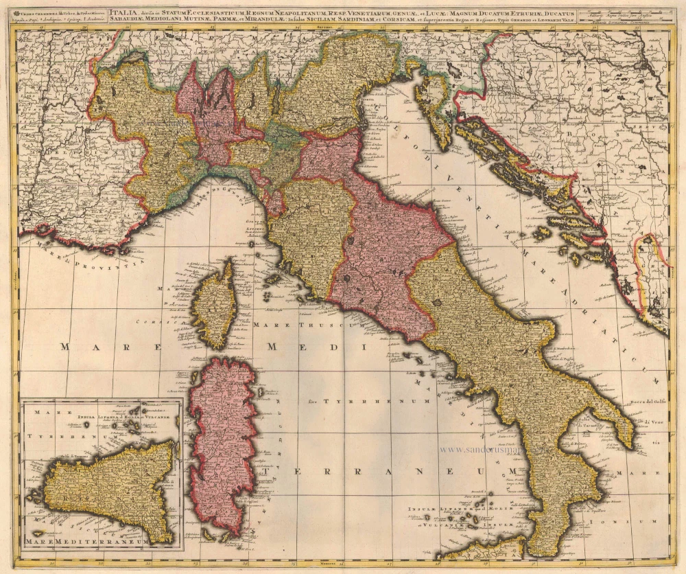
Old, antique map of Italy by Joannes Janssonius.
Title: Italia Nuovamente piu perfetta che mai per inanzi posta im luce, scolpita et con le suoi figure uiuamente rappresentate.
Amstelodami apud Ioannem Ianßonium.
Date of the first edition: 1617 (J. Hondius).
Date of this map: 1666.
Copper engraving, printed on paper.
Image size: 375 x 500mm (14.76 x 19.69 inches).
Sheet size: 520 x 610mm (20.47 x 24.02 inches).
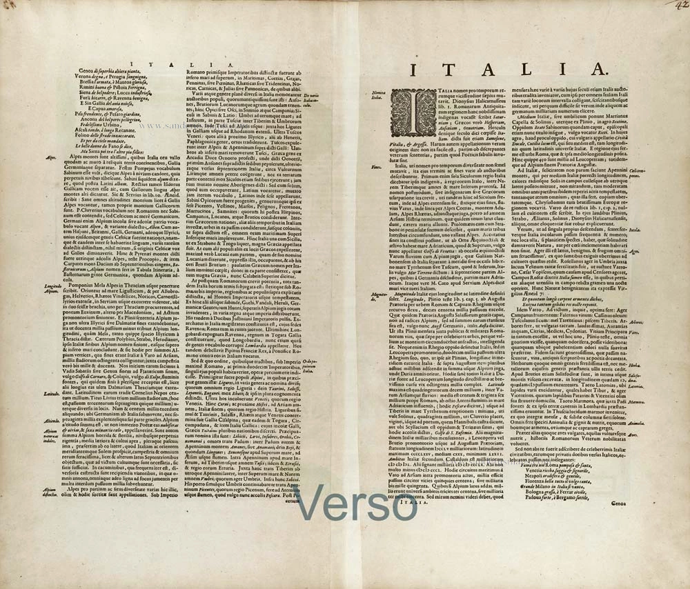
Verso: Latin text.
Condition: Original coloured, excellent.
Condition Rating: A+.
From: Joannis Janssonii Atlas Contractus, sive Atlantis Majoris Compendium, . . . Amsterdam, Janssonius Heirs, 1666. (Van der Krogt, 1:407)
The Janssonius Family
Joannes Janssonius (Arnhem, 1588-1664), son of the Arnhem publisher Jan Janssen, married Elisabeth Hondius, daughter of Jodocus Hondius, in Amsterdam in 1612. After his marriage, he settled down in this town as a bookseller and publisher of cartographic material. In 1618 he established himself in Amsterdam next door to Blaeu’s book shop. He entered into serious competition with Willem Jansz. Blaeu when copying Blaeu’s Licht der Zeevaert after the expiration of the privilege in 1620. His activities not only concerned the publication of atlases and books, but also of single maps and an extensive book trade with branches in Frankfurt, Danzig, Stockholm, Copenhagen, Berlin, Koningsbergen, Geneva, and Lyon. In 1631 he began publishing atlases together with Henricus Hondius.
In the early 1640s Henricus Hondius left the atlas publishing business completely to Janssonius. Competition with Joan Blaeu, Willem’s son and successor, in atlas production prompted Janssonius to enlarge his Atlas Novus finally into a work of six volumes, into which a sea atlas and an atlas of the Old World were inserted. Other atlases published by Janssonius are Mercator’s Atlas Minor, Hornius’s historical atlas (1652), the townbooks in eight volumes (1657), Cellarius’s Atlas Coelestis and several sea atlases and pilot guides.
After the death of Joannes Janssonius, the shop and publishing firm were continued by the heirs under the direction of Johannes van Waesbergen (c. 1616-1681), son-in-law of Joannes Janssonius. Van Waesbergen added the name of Janssonius to his own.
In 1676, Joannes Janssonius’s heirs sold by auction “all the remaining Atlases in Latin, French, High and Low German, as well as the Stedeboecken in Latin, in 8 volumes, bound and unbound, maps, plates belonging to the Atlas and Stedeboecken.” The copperplates from Janssonius’s atlases were afterwards sold to Schenk and Valck.
Related items
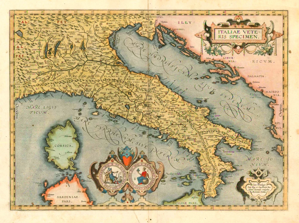
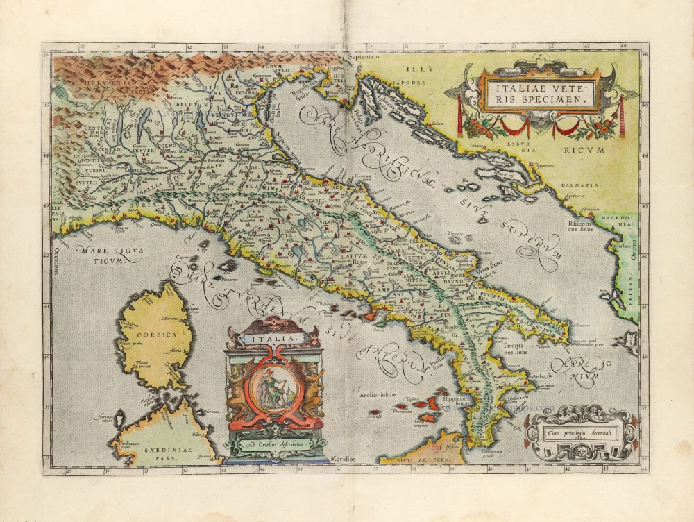
Italiae Veteris Specimen 1601
ITALY by Abraham Ortelius
[Item number: 12412]
Italia, Divisa in Statum Ecclesiasticum, Regnum Neapolitanum, Resp. Venetiarum, Genuae, et Lucae: Magnum Ducatum Etruriae, Ducatus Sabaudiae, Mediolani, Mutinae, Parmae et Mirandulae: Insulas Siliciam, Sardiniam, et Superjacentia Regna et Regiones c. 1730.
Italy, by Valk G.& L.
[Item number: 14145]
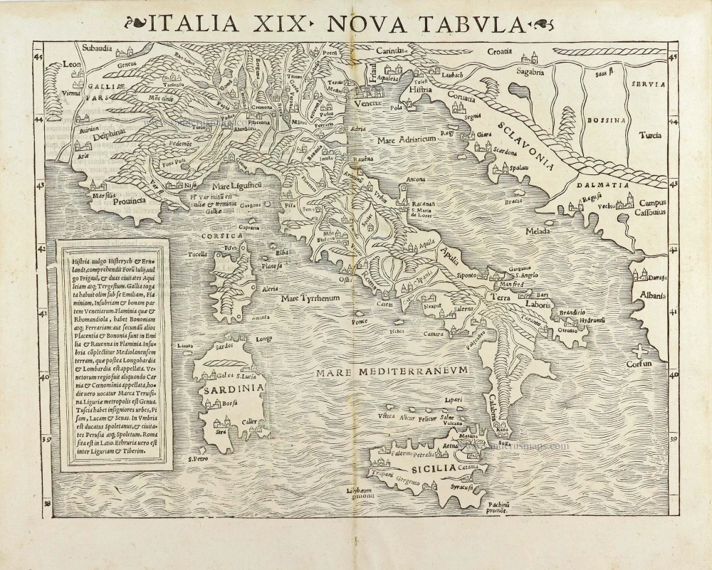
Italia XIX Nova Tabula. 1545
ITALY by Münster S.
[Item number: 17073]

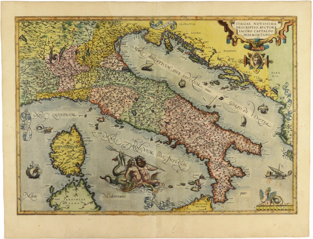
Italiae Novissima Descriptio Auctore Iacobo Castaldo Pedemontano. 1612
Italy by Abraham Ortelius
[Item number: 22982]
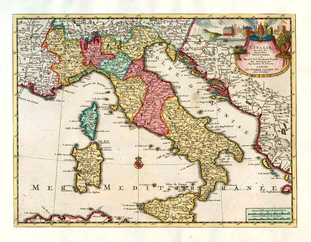
L'Italie. 1713
Italy, by Pieter Van der Aa.
[Item number: 26083]
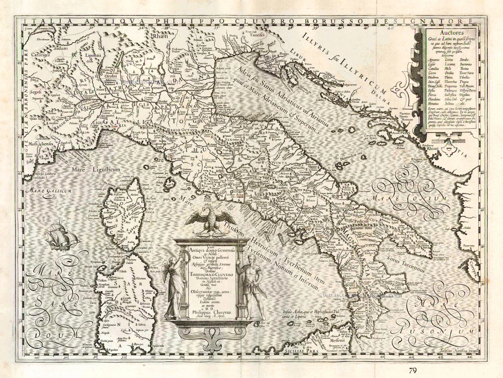
Italia Antiqua Philippo Cluvero Borusso Designatore. / Iodocus Hondius excud. 1630
Ancient Italy, by J. Janssonius - J. Hondius.
[Item number: 26223]
Italia. 1597
Italy, by Giovanni Magini.
[Item number: 26517]
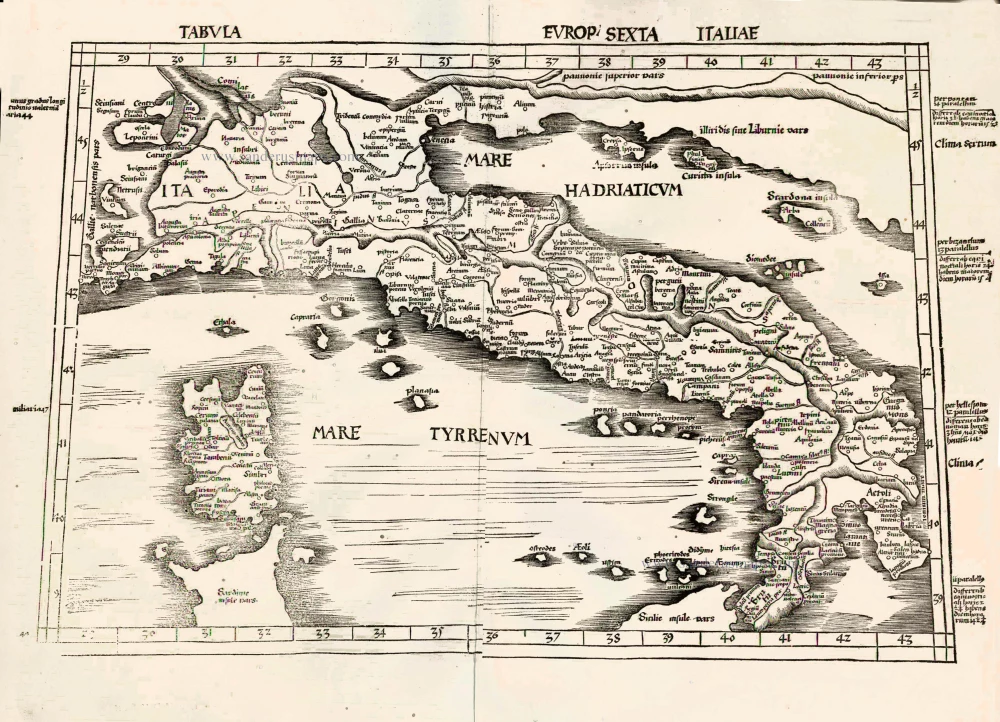
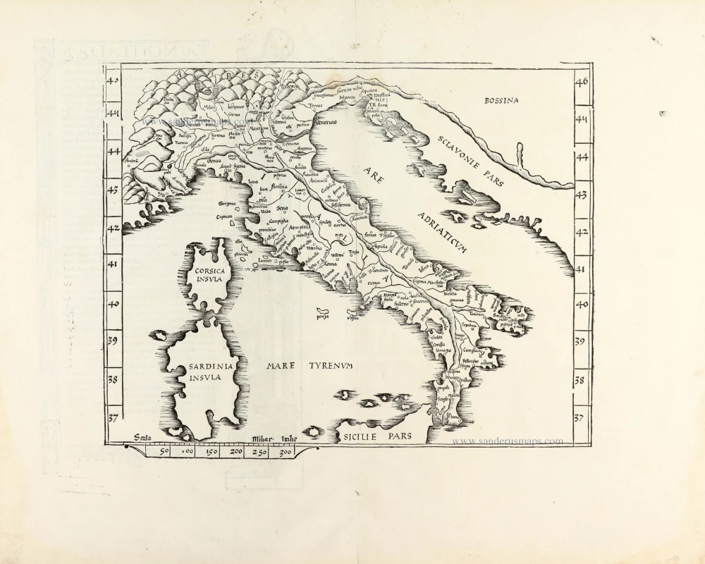
Important Ptolemy map
Tabula Europ. Sexta Italiae. 1513
Italy by Waldseemüller Martin
[Item number: 27588]
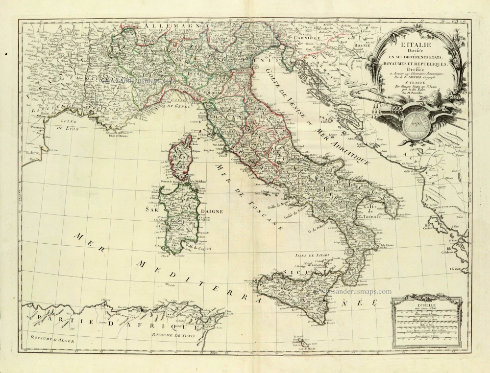
L'Italie Divisée en ses différents Etats, Royaumes et Républiques. 1776-79
Italy, by Sr. Janvier Jean Denis.
[Item number: 28076]
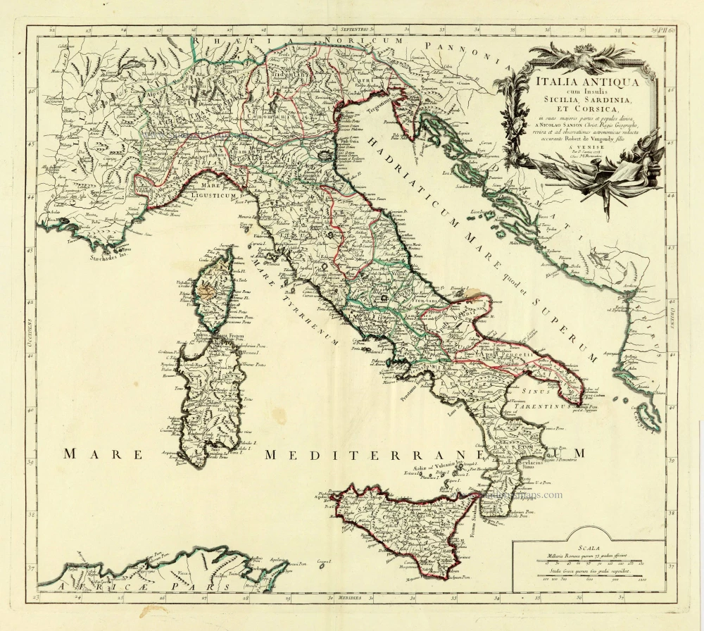
Italia Antiqua cum Insulis Sicilia, Sardinia, et Corsica, 1776-79
Ancient Italy, by Paolo Santini, after Nicolas Sanson & Sr. Robert de Vaugondy.
[Item number: 28107]
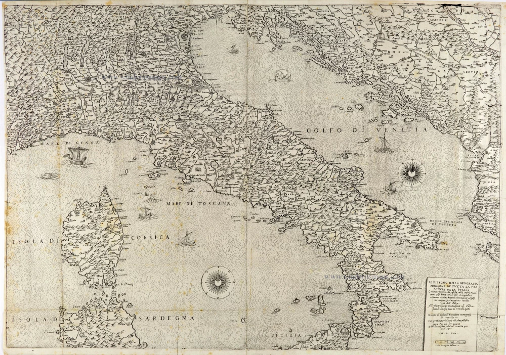
The most important Italy map of the 16th century
Il Disegno della Geografia Moderna de Tutta la Provincia de la Italia. 1561
Italy by Giacomo Gastaldi. (Italia)
[Item number: 28121]
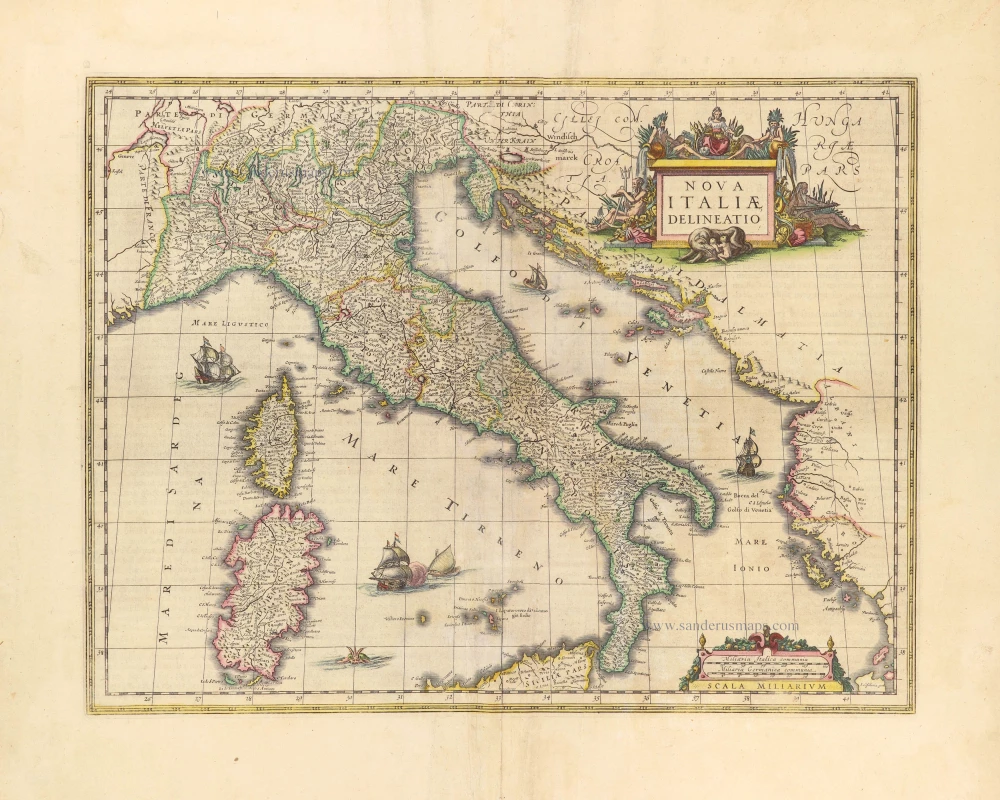
Nova Italiae Delineatio. 1642-43
Italy by Willem Blaeu.
[Item number: 28676]
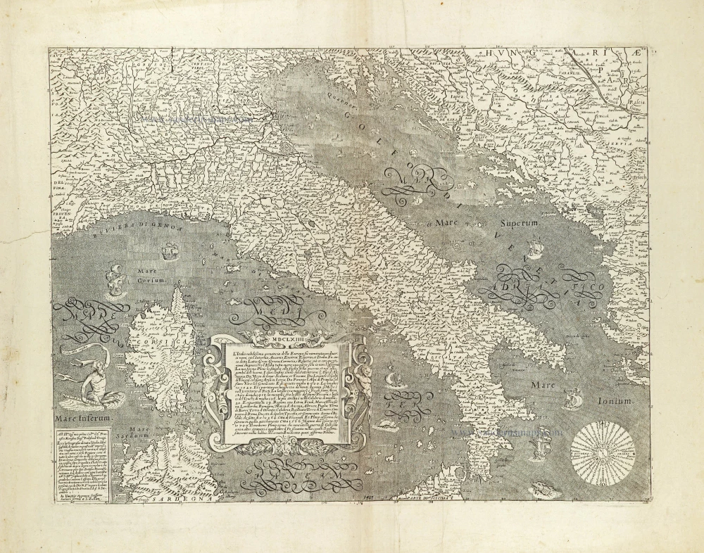
Rare
L'Italia nobilissima provincia della Europa su nominata con diversi nomi, ... 1664
Italy by Donato Rascicotti, published in Venice by Steffano Scolari.
[Item number: 28782]
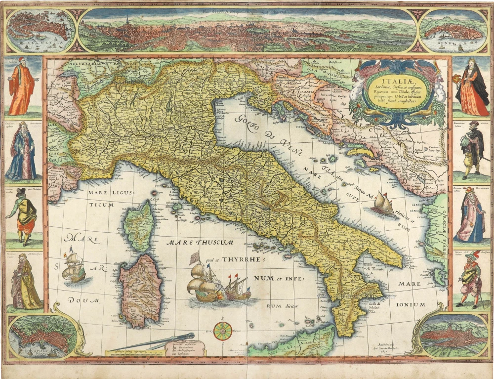
Rare
Italiae, Sardiniae, Corsicae, et confinium Regionum nova Tabula, effigies praecipuarum Urbiu[m] et habituum inibi simul complectens. 1640
Italy, by Willem Blaeu, published by Cornelis Danckerts.
[Item number: 29405]
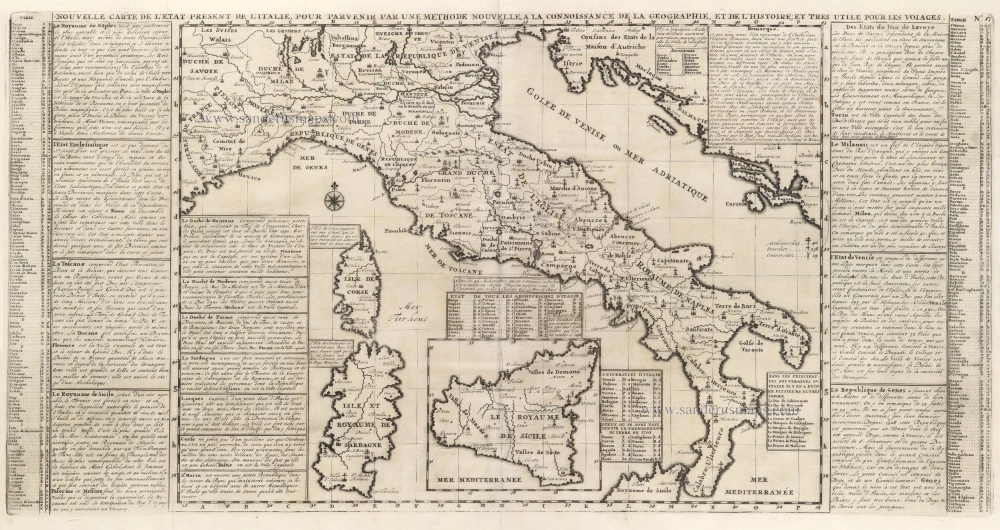
Nouvelle Carte de L'Etat present de l'Italie pour parvenir par une Methode nouvelle, a la connoissance de la Geographie, et de l'Histoire; et tres utile pour les voiages. 1713
Map of Italy by Zacharias Châtelain.
[Item number: 29641]
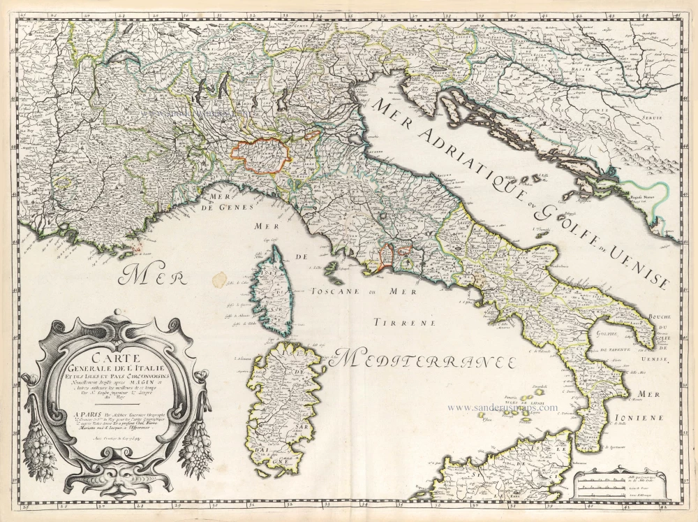
Carte Generale de l'Italie et des Isles et Pays Circonvoisins. 1652
Italy by Nicolas Sanson.
[Item number: 29672]
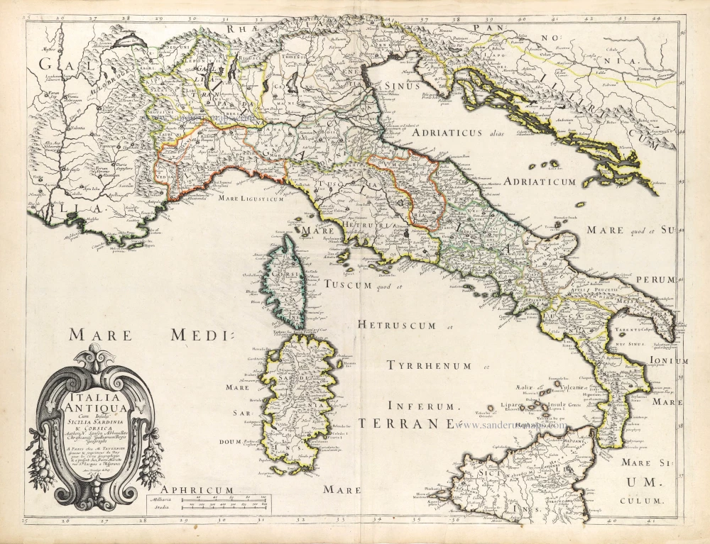
Italia Antiqua Cum Insulis Sicilia Sardinia & Corsica. 1652
Ancient Italy (Italia) by Nicolas Sanson.
[Item number: 29692]
new
Ta .NO. Italiae. 1525
Italy, by Lorenz Fries.
[Item number: 30321]
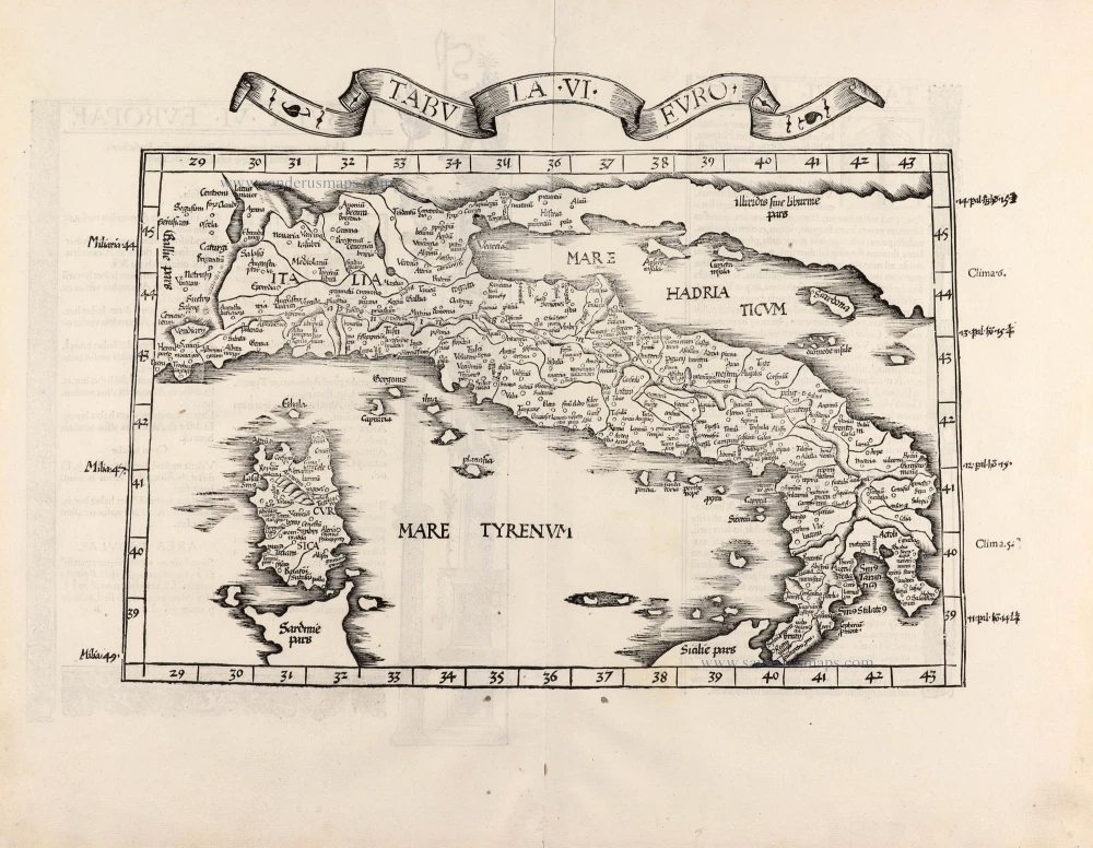
Tabula .VI. Euro. 1525
Ptolemy map of Italy by Lorenz Fries, after Martin Waldseemüller.
[Item number: 30370]
Italiae Veteris Specimen. 1595
Ancient Italy, by Abraham Ortelius
[Item number: 30532]
Italiae Novissima Descriptio Auctore Iacobo Castaldo Pedemontano. 1584
Italy by Abraham Ortelius.
[Item number: 30985]