
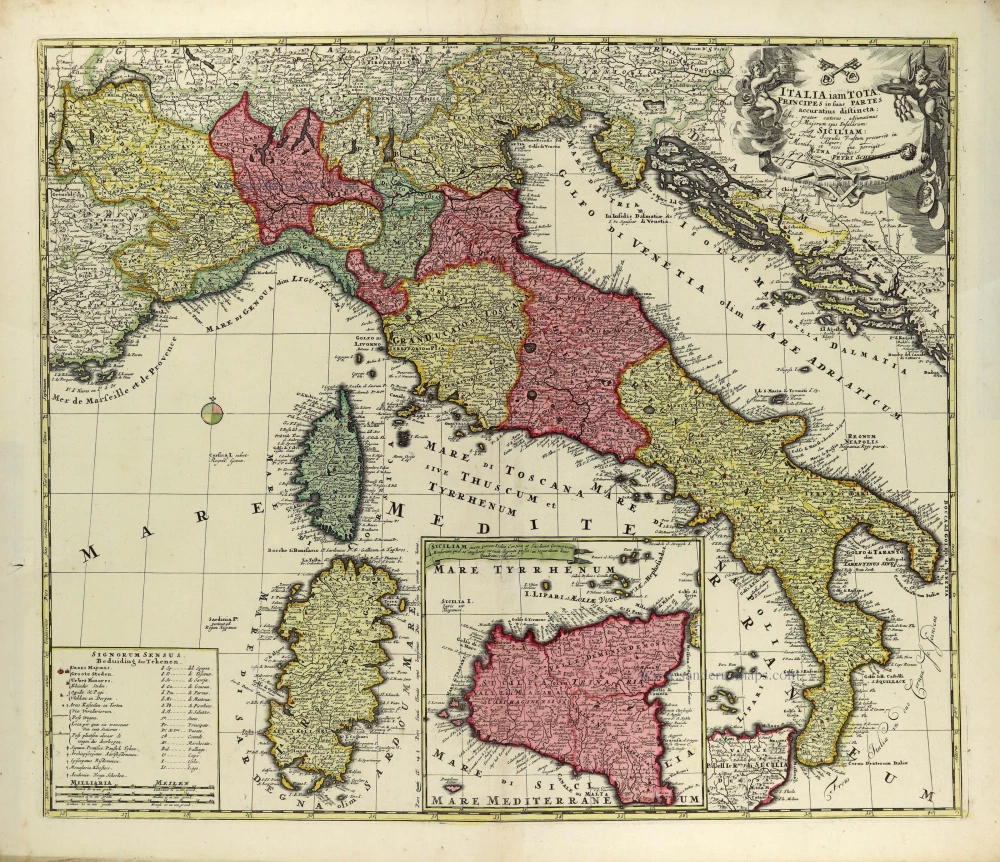
Italy by Petrus Schenk. c. 1700
The Schenk Family
Petrus Schenk (1660-1718), the founder of one of the best-known publishing firms of Amsterdam in the 18th century, was born in Elberfeld, Germany, in 1660. He went to Amsterdam where he became a pupil of the engraver Gerard Valck. On 19 Nov. 1686, a privilegio was granted to Petrus Schenk and Gerard Valk for the manufacturing and selling of their prints. Schenk’s contribution to cartography dates from c. 1695. In 1706 he moved to the Vijgendam in Amsterdam, ‘in Sanson’s Atlas’. After he died in 1718 his son, Leonardus Schenk, continued the art and print shop. The second son, Petrus II, settled in another famous house: ‘in Visscher’s Atlas’ where he continued the association with Gerard and Leonarus Valck.
The Schenk family produced general geographical atlases and special atlases. Apart from seventy original maps, several hundred are known with the name of Schenk, which were printed from plates obtained from Janssonius and Visscher. Schenk and Valck acquired all the plates of the Janssonius Heir’s Novus Atlas, Celestial atlas included. Many of Janssonius’ plates were reworked and amended.
The republishing of the maps from Janssonius’ Novus Atlas since c. 1680 was followed by the engraving of new maps, copied from Sanson’s better and more modern maps. Petrus Schenk published these maps in his Atlas Contractus sive mapparum geographicarum Sansoniarum auctarum et correctum Nova Congeries, also called Atlas Minor. After 1719, Petrus Schenk II continued the Atlas Contractus.
Petrus Schenk, the elder, enjoyed great fame as a print-seller and artist among art-and print-dealers in the whole of Europe. The great activity in map publishing, displayed by Petrus Schenk, the elder, was continued by his son and grandson. But the number of original atlas-maps is small. Like his father, who bought the copperplates of Janssonius’ atlas, Petrus Schenk II bought many of the plates formerly owned by Nicolaas Visscher.
Apart from the globes, maps and atlases, Petrus Schenk II published many books. He was older men of the booksellers guild in 1733.
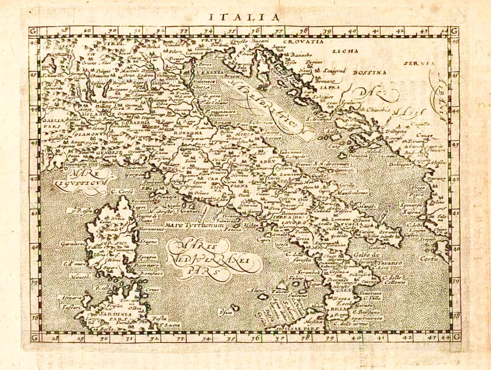
Italia iam tota Principes in suas Partes accuratius distincta;
Item Number: 28323 Authenticity Guarantee
Category: Antique maps > Europe > Italy
Italy by Petrus Schenk.
Title: Italia iam tota Principes in suas Partes accuratius distincta;
Cartographer: Carolus Allard.
Date: c. 1700.
Copper engraving, printed on paper.
Size (not including margins): 490 x 570mm (19.29 x 22.44 inches).
Verso: Blank.
Condition: Original coloured, excellent.
Condition Rating: A+.
From: Atlas Contractus sive Mapparum Geographicarum Sansoniarum auctarum et correctarum Nova Congeries. Amsterdam, Petrus Schenk, c. 1700. (Koeman, Sche 1)
The Schenk Family
Petrus Schenk (1660-1718), the founder of one of the best-known publishing firms of Amsterdam in the 18th century, was born in Elberfeld, Germany, in 1660. He went to Amsterdam where he became a pupil of the engraver Gerard Valck. On 19 Nov. 1686, a privilegio was granted to Petrus Schenk and Gerard Valk for the manufacturing and selling of their prints. Schenk’s contribution to cartography dates from c. 1695. In 1706 he moved to the Vijgendam in Amsterdam, ‘in Sanson’s Atlas’. After he died in 1718 his son, Leonardus Schenk, continued the art and print shop. The second son, Petrus II, settled in another famous house: ‘in Visscher’s Atlas’ where he continued the association with Gerard and Leonarus Valck.
The Schenk family produced general geographical atlases and special atlases. Apart from seventy original maps, several hundred are known with the name of Schenk, which were printed from plates obtained from Janssonius and Visscher. Schenk and Valck acquired all the plates of the Janssonius Heir’s Novus Atlas, Celestial atlas included. Many of Janssonius’ plates were reworked and amended.
The republishing of the maps from Janssonius’ Novus Atlas since c. 1680 was followed by the engraving of new maps, copied from Sanson’s better and more modern maps. Petrus Schenk published these maps in his Atlas Contractus sive mapparum geographicarum Sansoniarum auctarum et correctum Nova Congeries, also called Atlas Minor. After 1719, Petrus Schenk II continued the Atlas Contractus.
Petrus Schenk, the elder, enjoyed great fame as a print-seller and artist among art-and print-dealers in the whole of Europe. The great activity in map publishing, displayed by Petrus Schenk, the elder, was continued by his son and grandson. But the number of original atlas-maps is small. Like his father, who bought the copperplates of Janssonius’ atlas, Petrus Schenk II bought many of the plates formerly owned by Nicolaas Visscher.
Apart from the globes, maps and atlases, Petrus Schenk II published many books. He was older men of the booksellers guild in 1733.
Related items
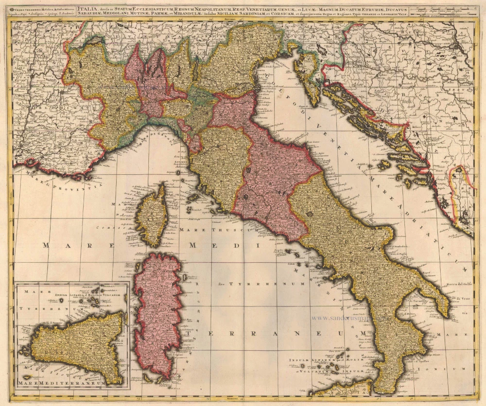
Italia, Divisa in Statum Ecclesiasticum, Regnum Neapolitanum, Resp. Venetiarum, Genuae, et Lucae: Magnum Ducatum Etruriae, Ducatus Sabaudiae, Mediolani, Mutinae, Parmae et Mirandulae: Insulas Siliciam, Sardiniam, et Superjacentia Regna et Regiones c. 1730.
Italy, by Valk G.& L.
[Item number: 14145]

Italiae Novissima Descriptio Auctore Iacobo Castaldo Pedemontano. 1612
Italy by Abraham Ortelius
[Item number: 22982]
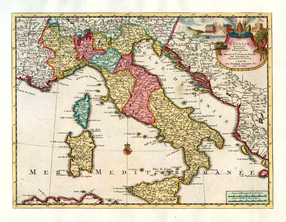
L'Italie. 1713
Italy, by Pieter Van der Aa.
[Item number: 26083]
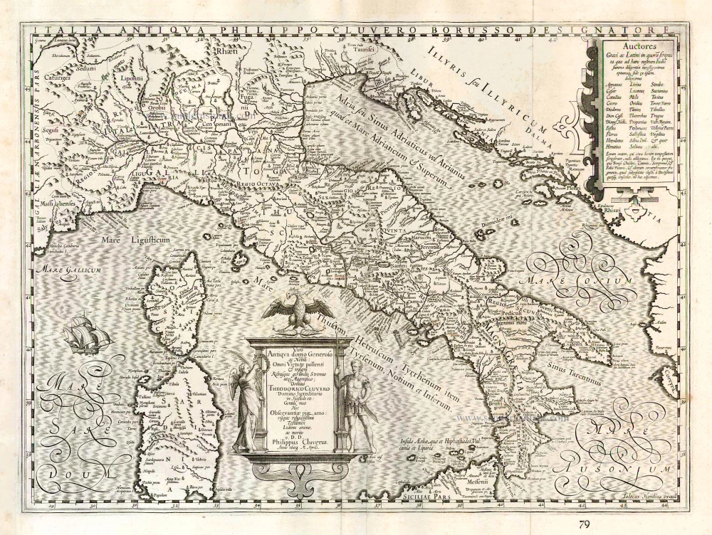
Italia Antiqua Philippo Cluvero Borusso Designatore. / Iodocus Hondius excud. 1630
Ancient Italy, by J. Janssonius - J. Hondius.
[Item number: 26223]
Italia. 1597
Italy, by Giovanni Magini.
[Item number: 26517]
Important Ptolemy map
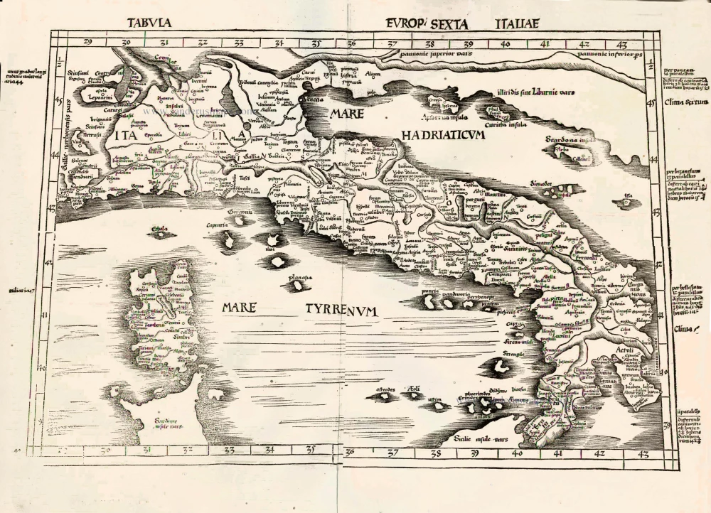
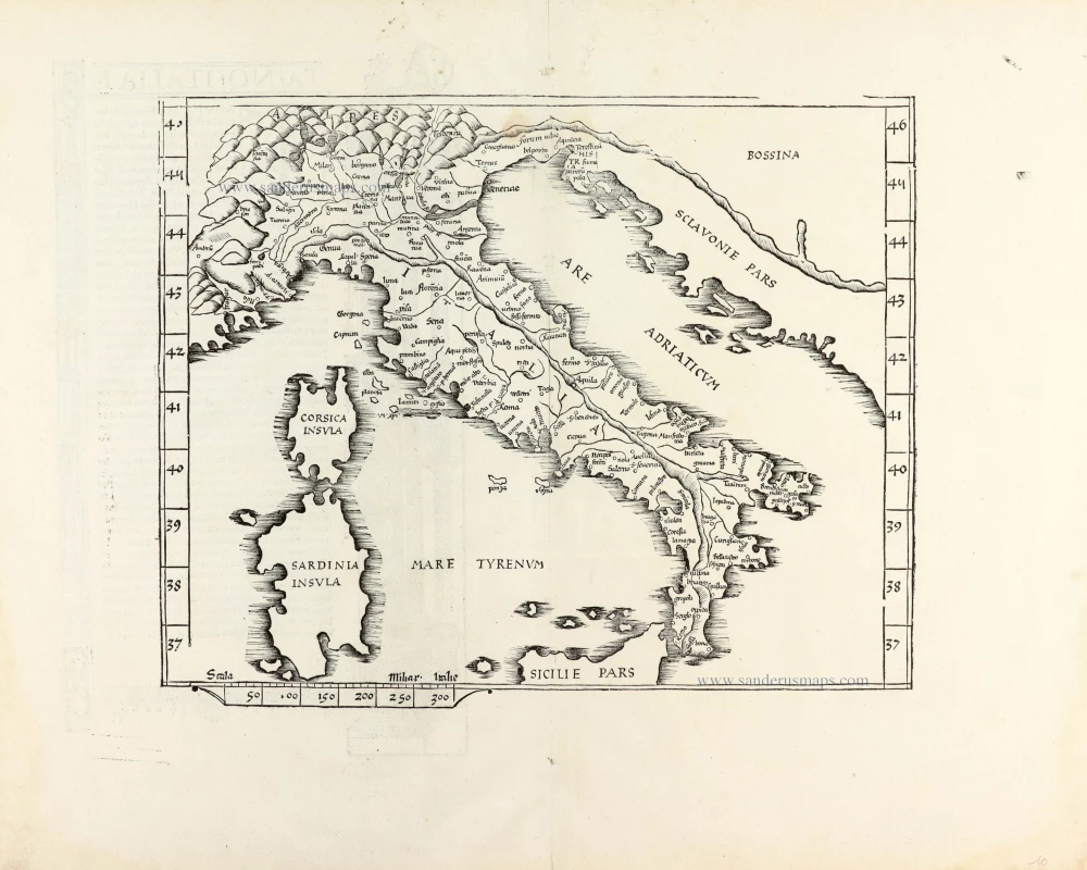
Tabula Europ. Sexta Italiae. 1513
Italy by Waldseemüller Martin
[Item number: 27588]
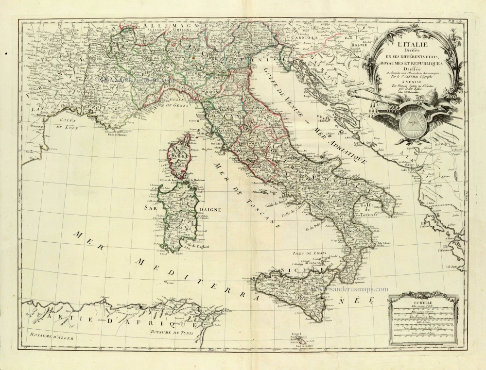
L'Italie Divisée en ses différents Etats, Royaumes et Républiques. 1776-79
Italy, by Sr. Janvier Jean Denis.
[Item number: 28076]
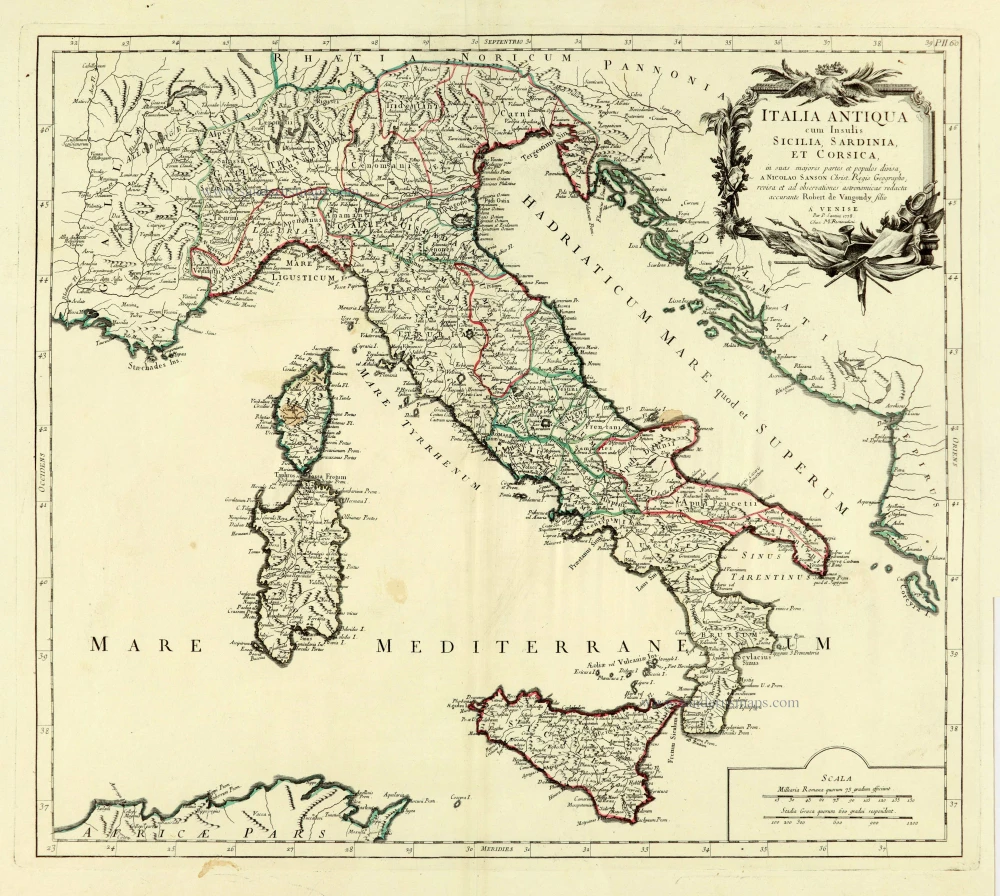
Italia Antiqua cum Insulis Sicilia, Sardinia, et Corsica, 1776-79
Ancient Italy, by Paolo Santini, after Nicolas Sanson & Sr. Robert de Vaugondy.
[Item number: 28107]
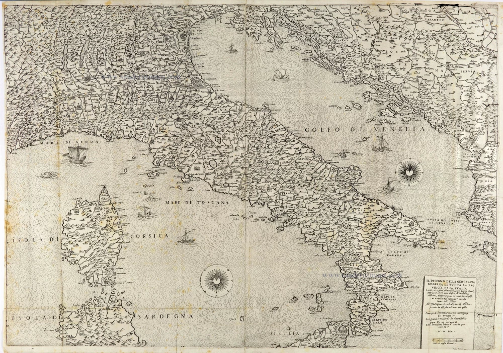
The most important Italy map of the 16th century
Il Disegno della Geografia Moderna de Tutta la Provincia de la Italia. 1561
Italy by Giacomo Gastaldi. (Italia)
[Item number: 28121]
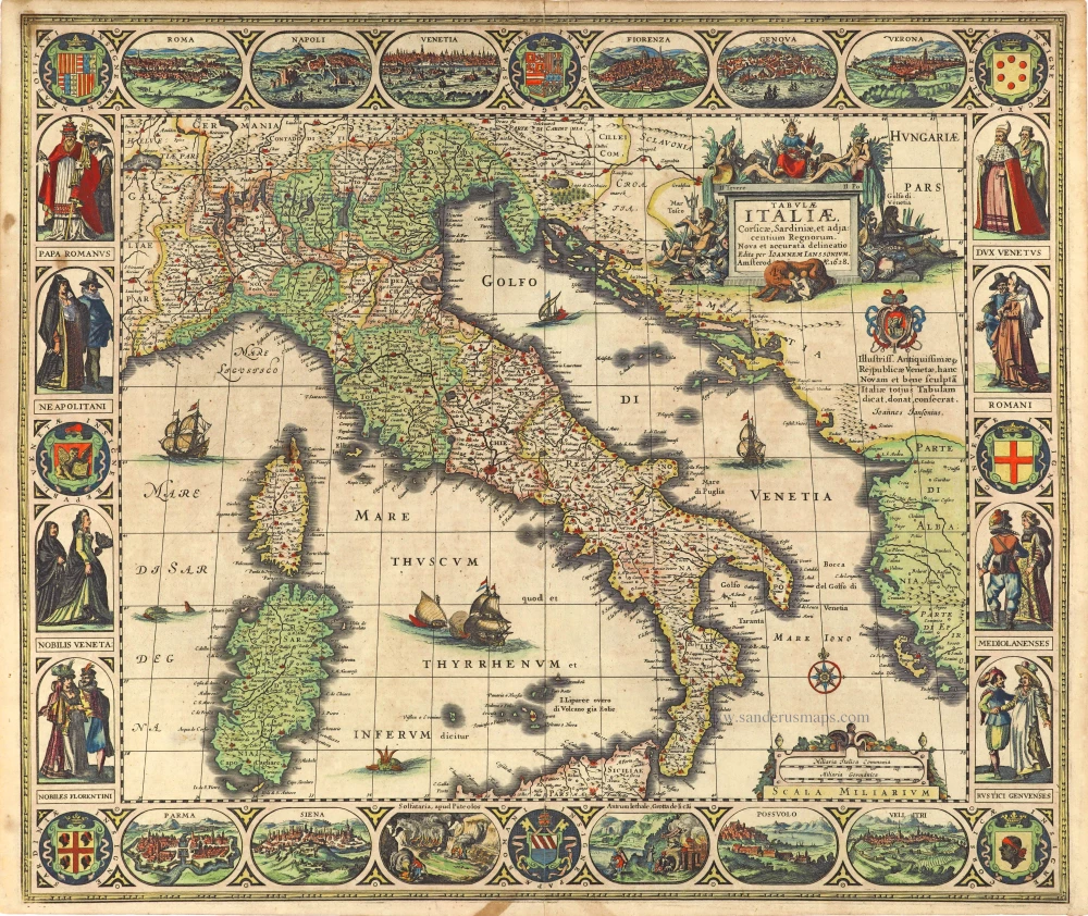
Tabula Italiae, Corsicae, Sardiniae, et adjacentium Regnorum. 1628
Italy by Joannes Janssonius.
[Item number: 28449]
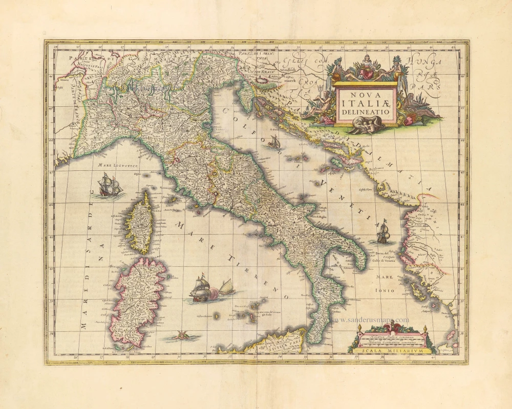
Nova Italiae Delineatio. 1642-43
Italy by Willem Blaeu.
[Item number: 28676]
Rare
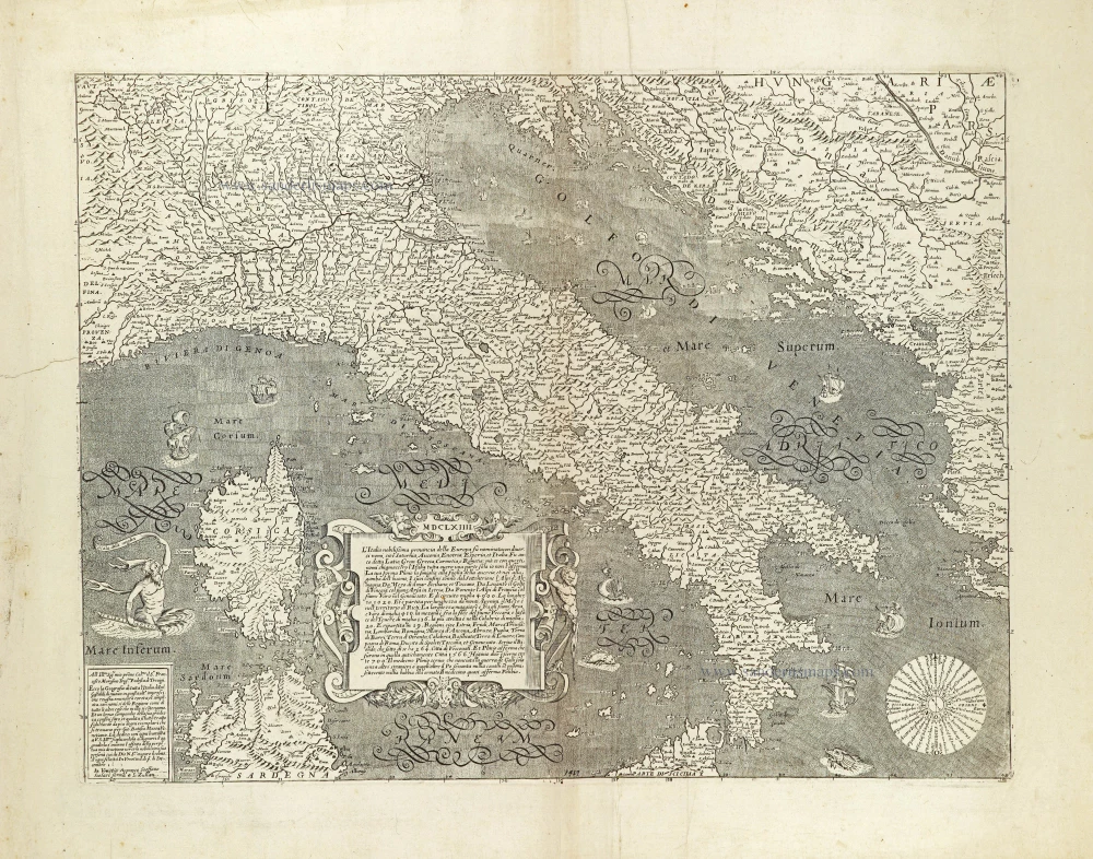
L'Italia nobilissima provincia della Europa su nominata con diversi nomi, ... 1664
Italy by Donato Rascicotti, published in Venice by Steffano Scolari.
[Item number: 28782]
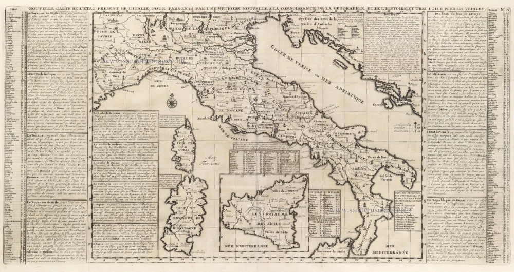
Nouvelle Carte de L'Etat present de l'Italie pour parvenir par une Methode nouvelle, a la connoissance de la Geographie, et de l'Histoire; et tres utile pour les voiages. 1713
Map of Italy by Zacharias Châtelain.
[Item number: 29641]
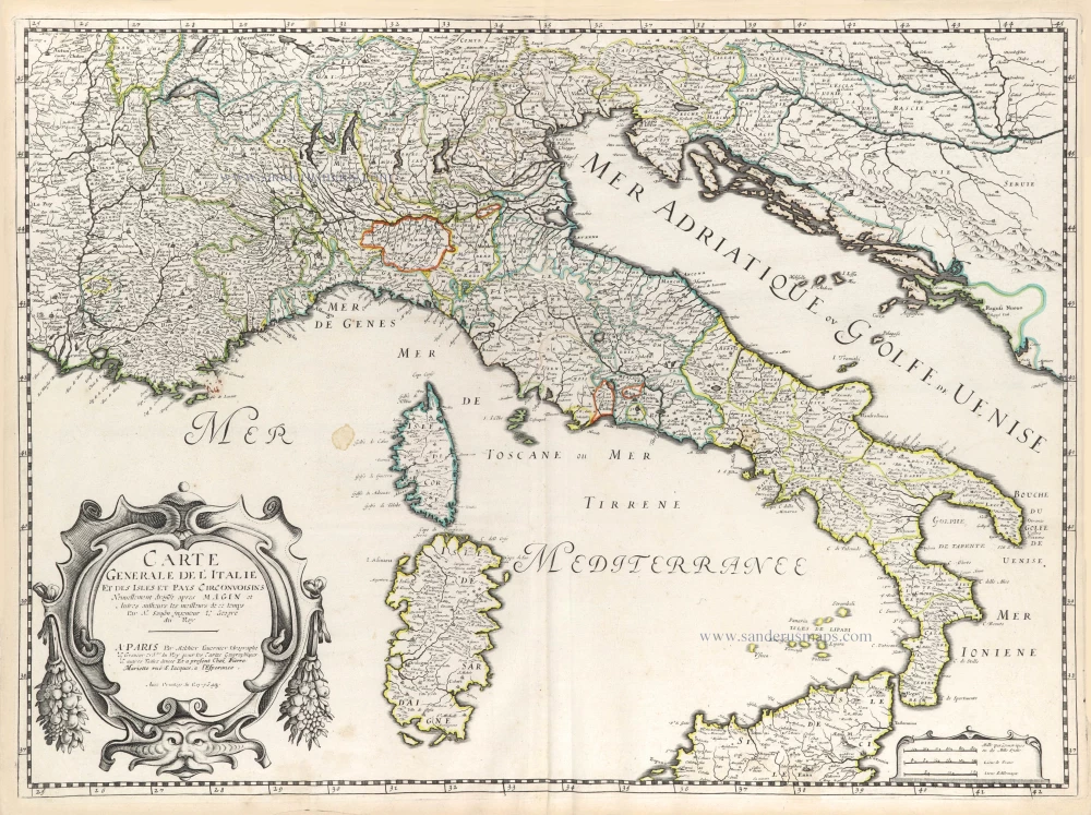
Carte Generale de l'Italie et des Isles et Pays Circonvoisins. 1652
Italy by Nicolas Sanson.
[Item number: 29672]
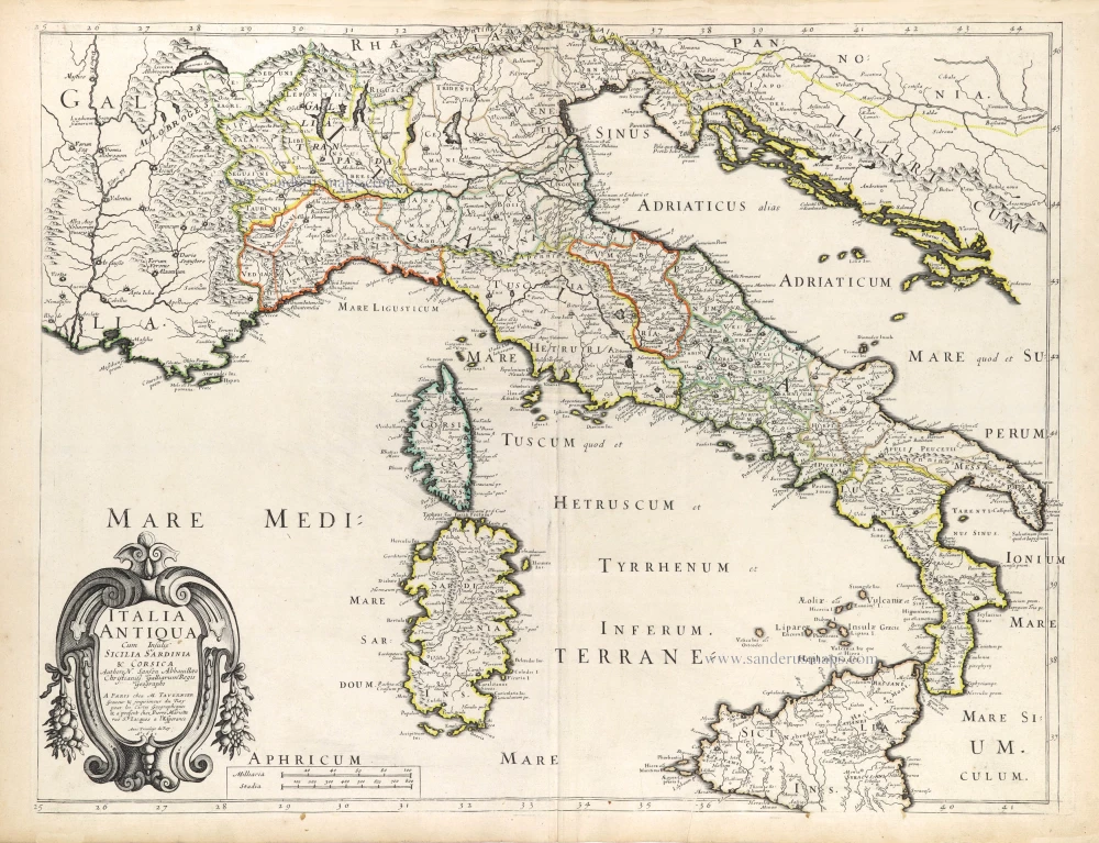
Italia Antiqua Cum Insulis Sicilia Sardinia & Corsica. 1652
Ancient Italy (Italia) by Nicolas Sanson.
[Item number: 29692]
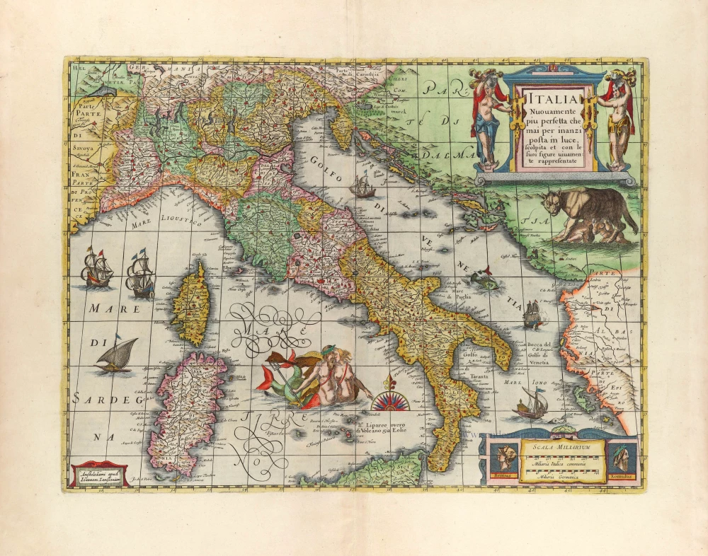
Italia Nuovamente piu perfetta che mai per inanzi posta im luce, scolpita et con le suoi figure uiuamente rappresentate. 1666
Italy by Joannes Janssonius.
[Item number: 29804]
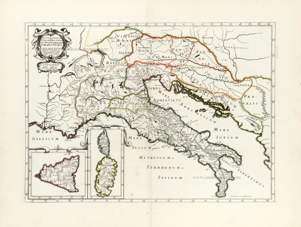
Antiquorum Italiae & Illyrici Occidentalis Episcopatuu Geographica descriptio. 1641 or later
Ancient Italy (Italia) & Dalmatia by Melchior Tavernier.
[Item number: 30035]
Ta .NO. Italiae. 1525
Italy, by Lorenz Fries.
[Item number: 30321]
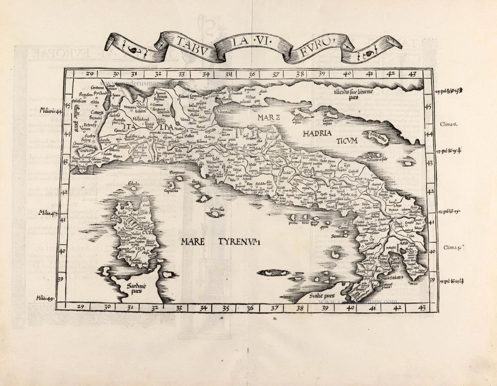
Tabula .VI. Euro. 1525
Ptolemy map of Italy by Lorenz Fries, after Martin Waldseemüller.
[Item number: 30370]