
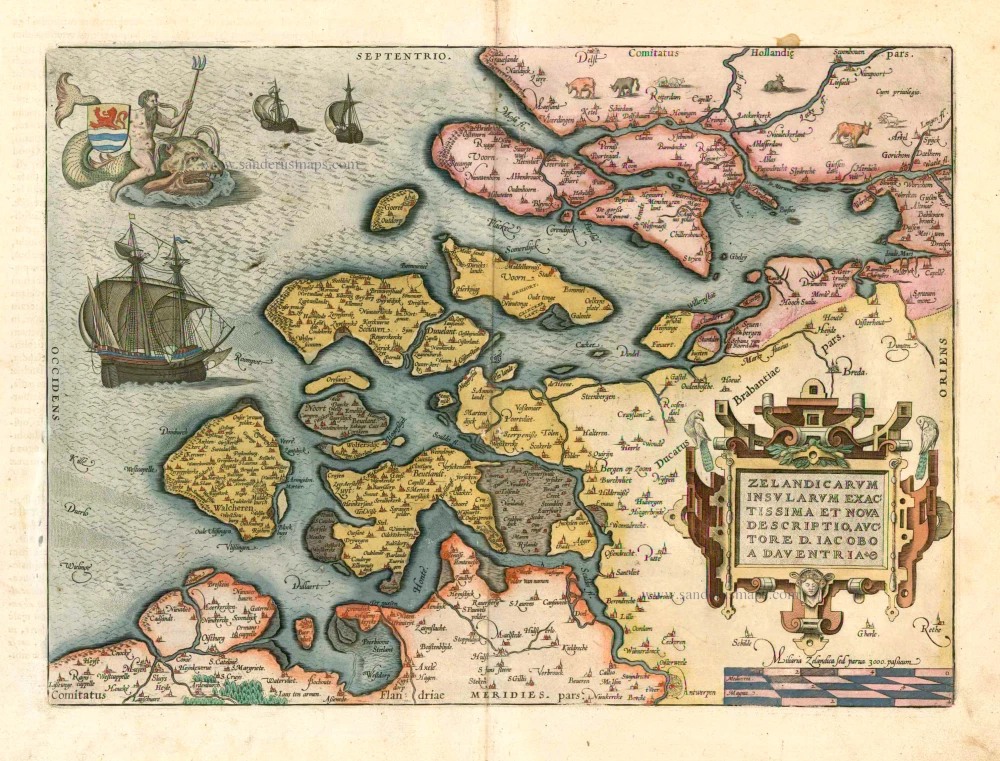
Zeeland, by A. Ortelius. 1601


Abraham Ortelius (1527-1598)
The maker of the 'first atlas', the Theatrum Orbis Terrarum (1570), was born on 4 April 1527 into an old Antwerp family. He learned Latin and studied Greek and mathematics.
Abraham and his sisters Anne and Elizabeth took up map colouring. Ortelius was admitted to the Guild of St. Luke as an "illuminator of maps." In addition to colouring maps, Ortelius was a dealer in antiques, coins, maps, and books, and the book and map trade gradually became his primary occupation.
Business went well because his means permitted him to start an extensive collection of medals, coins, antiques, and a library of many volumes. In addition, he travelled a lot, visited Italy and France, made contacts everywhere with scholars and editors, and maintained extensive correspondence with them.
In 1564, he published his first map, a large and ambitious world wall map. The inspiration for this map may well have been Gastaldi's large world map. In 1565, he published a map of Egypt and a map of the Holy Land; a large map of Asia followed.
In 1568, the production of individual maps for his atlas Theatrum Orbis Terrarum was already in full swing. He completed the atlas in 1569, and in May 1570, it was available for sale. It was one of the most expensive books ever published.
This first edition contained seventy maps on fifty-three sheets. Franciscus Hogenberg engraved the maps.
Later editions included Additamenta (additions), resulting in Ortelius' historical atlas, the Parergon, which is mainly bound together with the atlas. The Parergon can be considered a truly original work by Ortelius, who drew the maps based on his research.
The importance of the Theatrum Orbis Terrarum for geographical knowledge in the last quarter of the sixteenth century is difficult to overemphasize. Nothing was like it until Mercator's atlas appeared twenty-five years later. Demand for the Theatrum was remarkable. Some 24 editions appeared during Ortelius's lifetime and another 10 after he died in 1598. Editions were published in Dutch, German, French, Spanish, English, and Italian. The number of map sheets grew from 53 in 1570 to 167 in 1612 in the last edition.
In 1577, engraver Philip Galle and poet-translator Pieter Heyns published the first pocket-sized edition of the Theatrum, the Epitome. The work was trendy. Over thirty editions of this Epitome were published in different languages.
Zelandicarum Insularum exactissima et nova descriptio, Auctore D. Iacobbo a Deventria
Item Number: 5769 Authenticity Guarantee
Category: Antique maps > Europe > The Netherlands
Old, antique map of Zeeland, by Abraham Ortelius.
Title: Zelandicarum Insularum exactissima et nova descriptio, Auctore D. Iacobbo a Deventria
Cartographer: Jacob van Deventer.
Date of the first edition: 1570.
Date of this map: 1601.
Copper engraving, printed on paper.
Size (not including margins): 333 x 462mm (13.11 x 18.19 inches).
Verso: Latin text.
Condition: Contemporary old coloured, excellent.
Condition Rating: A
From: Ortelius A.,Theatrum Orbis Terrarum Abrahami Ortelii Antverp. Geographi Regii. Antwerpen, Plantin Press, 1601. (Van der Krogt 3, 1:052)
Abraham Ortelius (1527-1598)
The maker of the 'first atlas', the Theatrum Orbis Terrarum (1570), was born on 4 April 1527 into an old Antwerp family. He learned Latin and studied Greek and mathematics.
Abraham and his sisters Anne and Elizabeth took up map colouring. Ortelius was admitted to the Guild of St. Luke as an "illuminator of maps." In addition to colouring maps, Ortelius was a dealer in antiques, coins, maps, and books, and the book and map trade gradually became his primary occupation.
Business went well because his means permitted him to start an extensive collection of medals, coins, antiques, and a library of many volumes. In addition, he travelled a lot, visited Italy and France, made contacts everywhere with scholars and editors, and maintained extensive correspondence with them.
In 1564, he published his first map, a large and ambitious world wall map. The inspiration for this map may well have been Gastaldi's large world map. In 1565, he published a map of Egypt and a map of the Holy Land; a large map of Asia followed.
In 1568, the production of individual maps for his atlas Theatrum Orbis Terrarum was already in full swing. He completed the atlas in 1569, and in May 1570, it was available for sale. It was one of the most expensive books ever published.
This first edition contained seventy maps on fifty-three sheets. Franciscus Hogenberg engraved the maps.
Later editions included Additamenta (additions), resulting in Ortelius' historical atlas, the Parergon, which is mainly bound together with the atlas. The Parergon can be considered a truly original work by Ortelius, who drew the maps based on his research.
The importance of the Theatrum Orbis Terrarum for geographical knowledge in the last quarter of the sixteenth century is difficult to overemphasize. Nothing was like it until Mercator's atlas appeared twenty-five years later. Demand for the Theatrum was remarkable. Some 24 editions appeared during Ortelius's lifetime and another 10 after he died in 1598. Editions were published in Dutch, German, French, Spanish, English, and Italian. The number of map sheets grew from 53 in 1570 to 167 in 1612 in the last edition.
In 1577, engraver Philip Galle and poet-translator Pieter Heyns published the first pocket-sized edition of the Theatrum, the Epitome. The work was trendy. Over thirty editions of this Epitome were published in different languages.
Related items
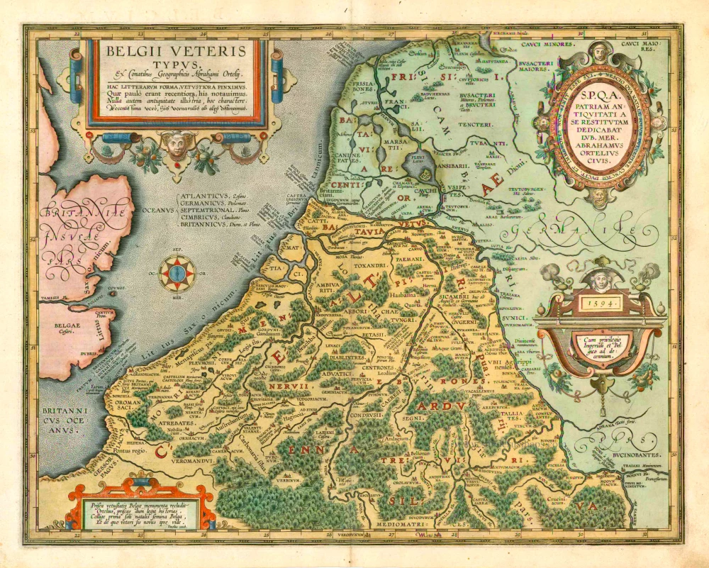
Belgii Veteris Typus. 1601
The ancient Low Countries, by Abraham Ortelius.
[Item number: 12355]
First Christoffel Pantin edition
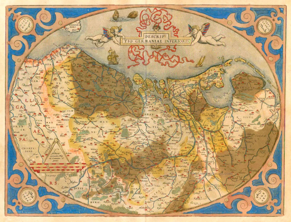
Descriptio Germaniae Inferioris. 1579
XVII Provinces by Abraham Ortelius.
[Item number: 21663]
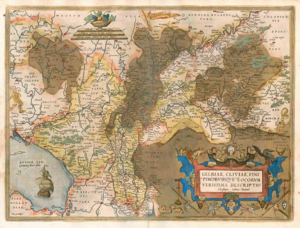
Gelriae, Cliviae, Finitimorumque Locorum Verissima Descriptio / Christiano Schrot Auctore 1579
Gelderland, by Ortelius A,
[Item number: 21729]
Scarce map by Vrients
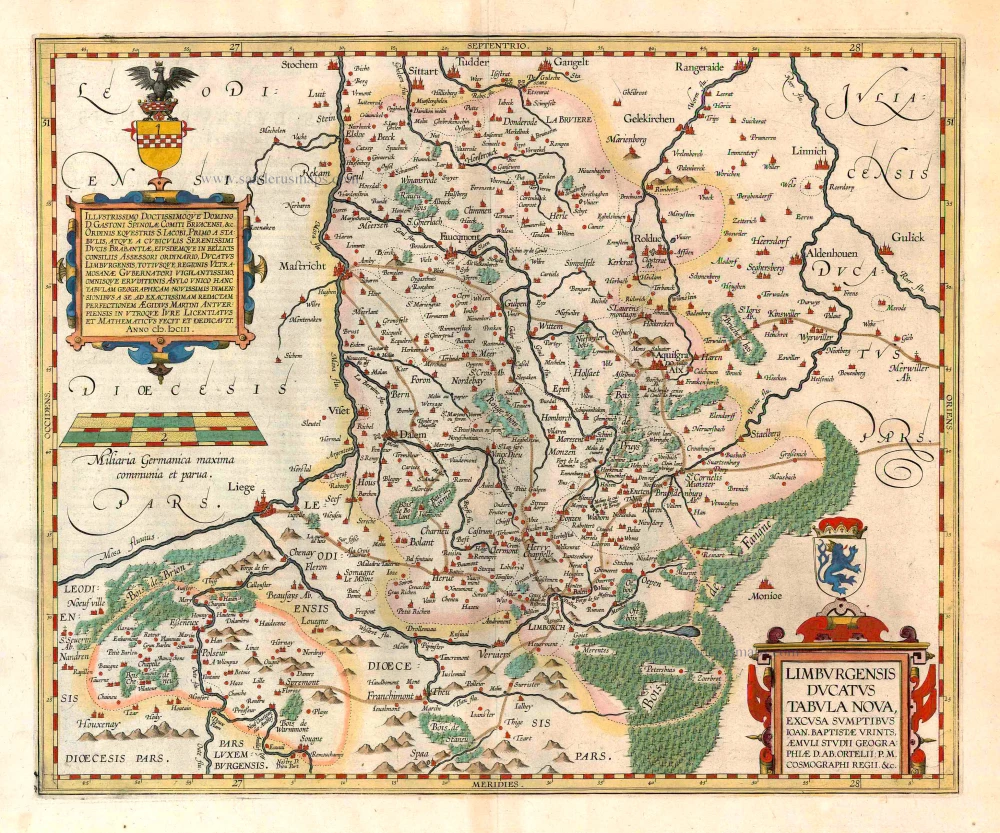
Limburgensis Ducatus Tabula Nova. 1612
Limburg, by Ortelius A.
[Item number: 22979]
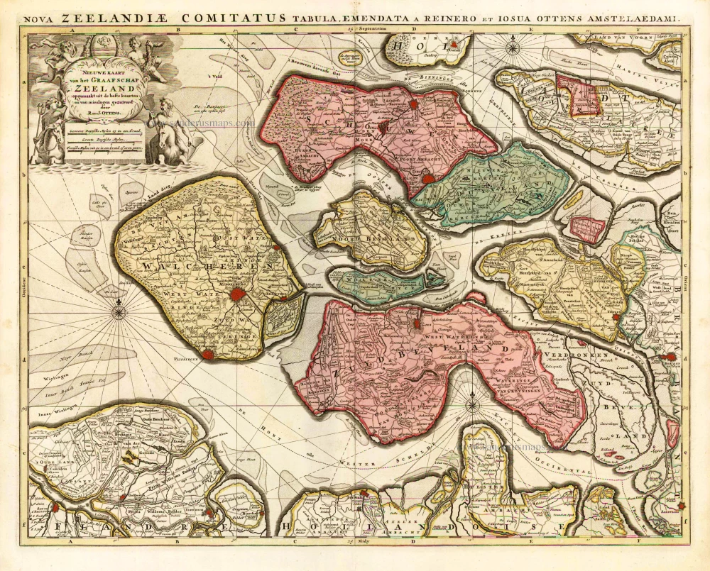
Nieuwe Kaart van het Graafschap Zeeland. 1730-45
Zeeland, by Ottens R. & I.
[Item number: 25736]
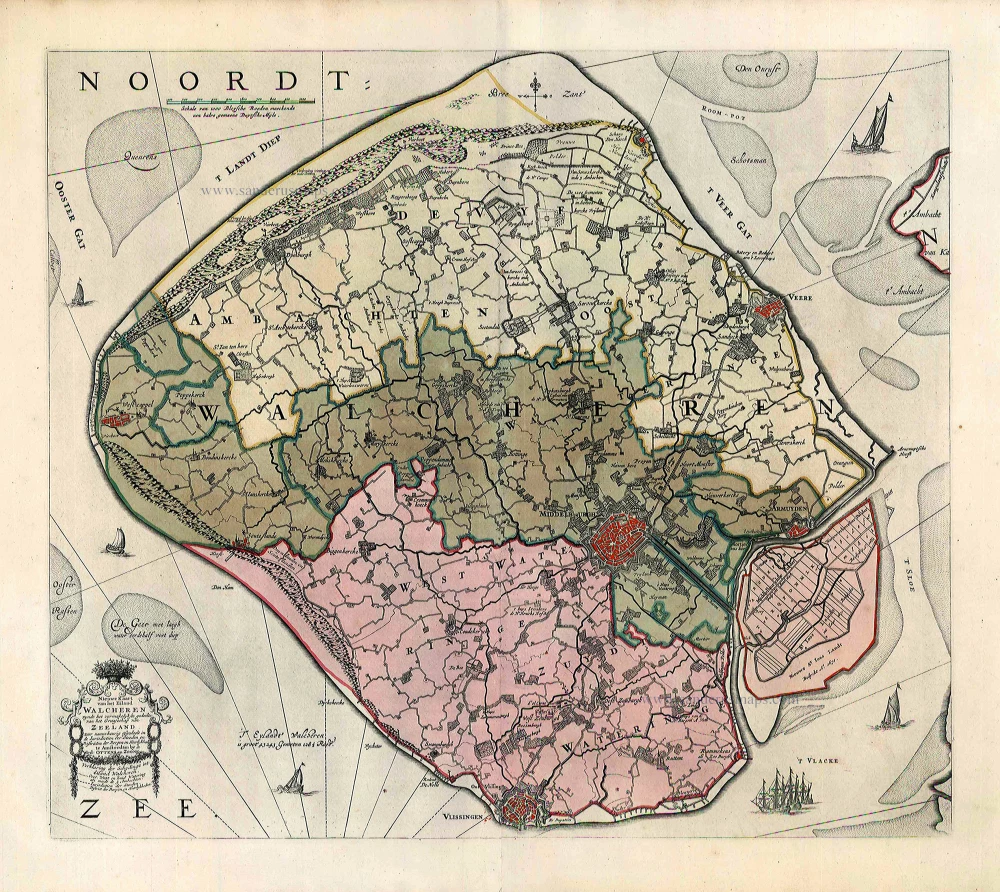
Nieuwe Kaart van het Eiland Walcheren zynde het vermakelykste gedeelte van het Graafschap van Zeeland ... 1765-70
Walcheren, by Widow J. Ottens & Son.
[Item number: 25773]
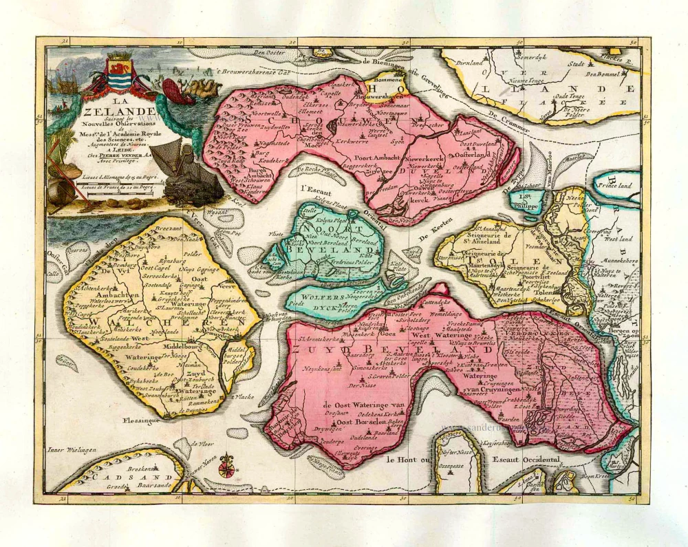
La Zelande. 1713
Zeeland, by Pieter Van der Aa.
[Item number: 26058]
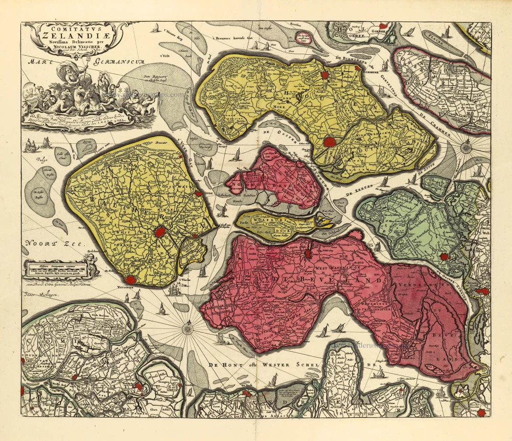
Comitatus Zelandiae. c. 1715
Zeeland by Nicolaas Visscher I, published by Petrus Schenk II.
[Item number: 28275]
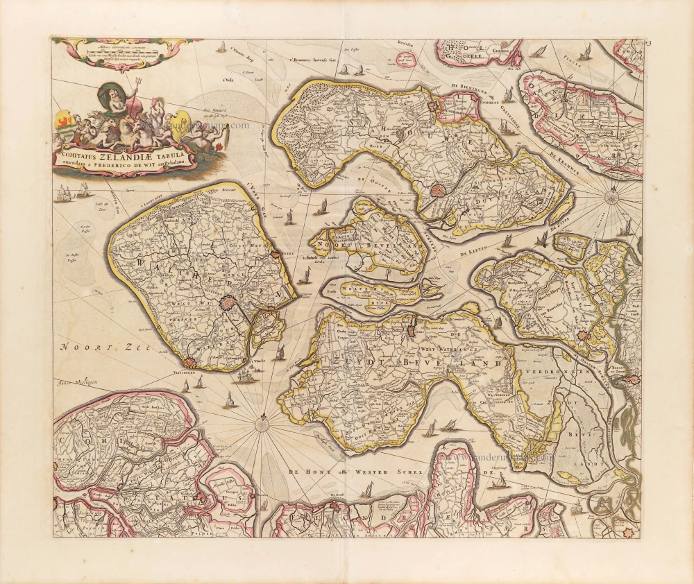
Comitatus Zelandiae Tabula. ca. 1705
Zeeland by Frederick de Wit.
[Item number: 29008]