
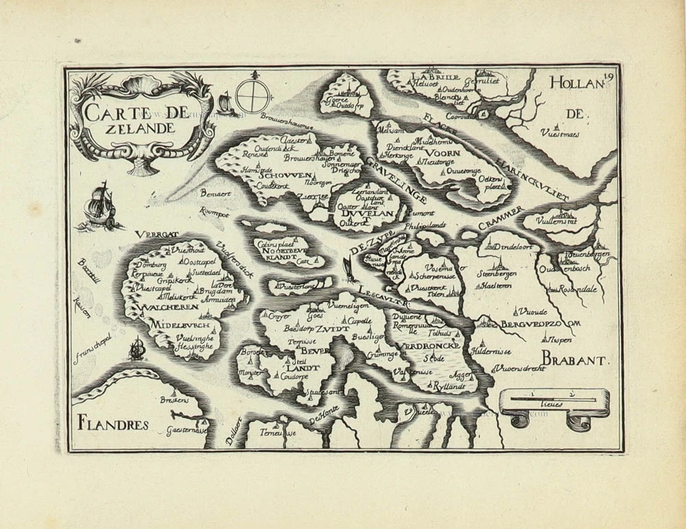
Zeeland by Christophe Tassin. 1633
Tassin Christophe Nicolas. (? - 1660)
Christophe Tassin was a French cartographer known for his atlases of France, Spain, Germany, and Switzerland.
He was 'Ingenieur-géographe du roi'. He used this title only between 1633 and 1638. In 1633 Tassin published an atlas of France and Spain, Cartes générales des provinces de France et d’ Espagne; one of Germany, Cartes généralis des royaumes et provinces de la haute et basse Allemagna; and one of the Low Countries, Plans et profils des principales villes du duché de Lorraine, avec les cartes generale et particulieres de chacun gouvernement d’iucelles.
In 1644, Tassin ended his work and sold his copper plates of maps to Antoine de Fer, who published them in many subsequent editions.
Carte de Zeland.
Item Number: 31929 Authenticity Guarantee
Category: Antique maps > Europe > The Netherlands
Zeeland by C. Tassin. RARE.
Title: Carte de Zeland.
Date of the first edition: 1633.
Date of this map: 1633.
Copper engraving, printed on paper.
Image size: 105 x 150mm (4¼ x 6 inches).
Sheet size: 155 x 195mm (6 x 7¾ inches).
Verso: Blank.
Condition: Excellent.
Condition Rating: A+.
From: Tassin C. Cartes Generales des Royaumes et Provinces de la Haute et Basse Allemagne. Reveues, corrigées & augmentées par le sieur Tassin Geographe ordinaire de sa Majesté. A Paris, Chez Martin Gobert au Palais en la gallerie des prisonniers. M.DC.XXXIII. (1633). (Pastoureau, p. 445, Tassin IV Aa 1633)
Tassin Christophe Nicolas. (? - 1660)
Christophe Tassin was a French cartographer known for his atlases of France, Spain, Germany, and Switzerland.
He was 'Ingenieur-géographe du roi'. He used this title only between 1633 and 1638. In 1633 Tassin published an atlas of France and Spain, Cartes générales des provinces de France et d’ Espagne; one of Germany, Cartes généralis des royaumes et provinces de la haute et basse Allemagna; and one of the Low Countries, Plans et profils des principales villes du duché de Lorraine, avec les cartes generale et particulieres de chacun gouvernement d’iucelles.
In 1644, Tassin ended his work and sold his copper plates of maps to Antoine de Fer, who published them in many subsequent editions.
Related items

Paskaert van de Zeeusche en Vlaemsche Kusten, tonende Alle Drooghten, Diepten, en Ondiepten, tusschen t'Eylandt Schouwen en de Hoofden, Curieuselyck Beschreven door Dirck Davidsz 1667
Sea chart of Flanders (Vlaanderen) & Zeeland, by Pieter Goos.
[Item number: 19054]

Spectacular 'Romain de Hooghe' map
Carte Nouvelle des Costes de Hollande, Zeelande, Flandre, Picardie, & Normandie ... Chez Pierre Mortier, 1693. 1700
Sea chart of the Channel - Flanders (Vlaanderen) - Zeeland, by Pieter Mortier.
[Item number: 27176]

Flandria et Zeelandia Comitatus. 1640-43
Flanders (Vlaanderen) and Zeeland, by Willem Blaeu.
[Item number: 27409]

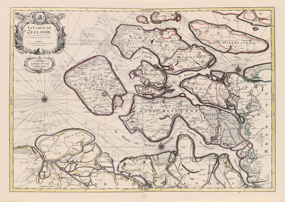
Le Comté de Zeelande. c. 1705
Zeeland, by Pieter Mortier.
[Item number: 27806]
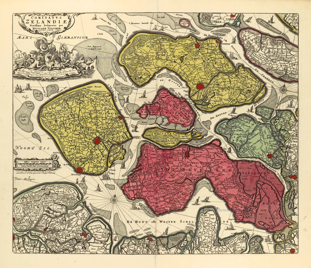
Comitatus Zelandiae. c. 1715
Zeeland by Nicolaas Visscher I, published by Petrus Schenk II.
[Item number: 28275]

Comitatus Zelandiae Tabula. ca. 1705
Zeeland by Frederick de Wit.
[Item number: 29008]

Isole Selandia - [Above map :] Descrittione dell'Isole Selandie. 1590
Zeeland, by Thomaso Porcacchi.
[Item number: 29759]
[No title - With inset view of the town of Middelburg:] Middelburgum. [Costumed figures:] Seelandi c. 1630-1650
Zeeland by Petrus Kaerius, published by C.J. Visscher.
[Item number: 30935]

Early edition
Zelandicarum Insularum exactissima et nova descriptio, 1573
Zeeland by Abraham Ortelius.
[Item number: 30967]
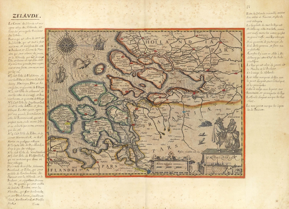
Le Comté de Zeelande. 1692
Zeeland by N. Sanson, so-called published by Hubert Jaillot. (Pirated edition by Pierre Mortier).
[Item number: 31343]

Zeelandia. 1618
Zeeland by Petrus Bertius, published by Jodocus Hondius II.
[Item number: 31590]

Naeukeurige Nieuwe Land-Caert des Graefschaps Zeeland. 1728
Zeeland by M. Smallegange, published by P. van der Aa.
[Item number: 33042]
new