
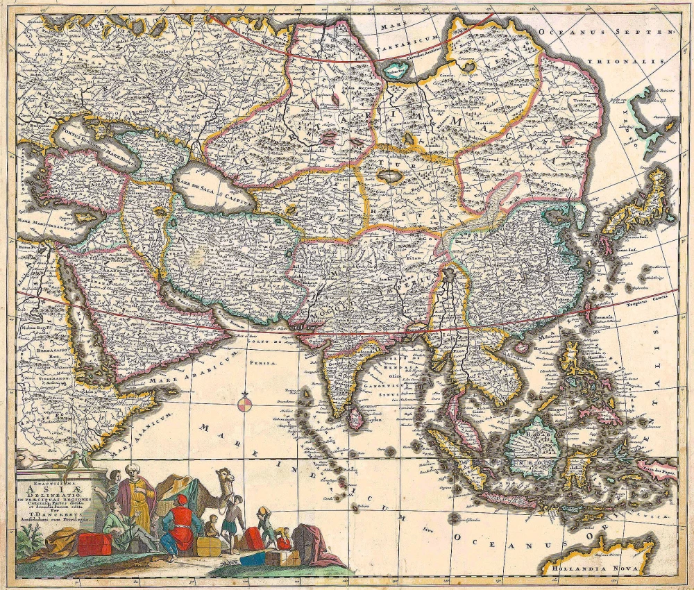
Asia by Th. Danckerts. c. 1700
The Danckerts Family.
The Danckerts family of Amsterdam was one of the best-known print and map sellers in 17th century Amsterdam. Their business activity covered a vast period, from ca. 1633. From 1669 until 1701, father Justus and his sons had their shop in the ‘Calverstraet in de Danckbaerheyt’.
Cornelis Danckerts (1561-1631) was a printseller born in Amsterdam and active in Antwerp.
Cornelis Danckerts, the elder (1603-1656) was an engraver and publisher in Amsterdam and Nieuwendijk. Son of Cornelis (above), whom he succeeded in 1631.
The house of Danckerts gained its greatest fame from Justus Danckerts (1635-1701 - son of Cornelis the elder) and his two sons, Theodorus and Cornelis. Dancker Danckerts (1634-1666), the elder brother of Justus, was known for his etchings of paintings, maps, and publications.
The grandfather, father, and sons were highly skilled and excellent artistic drafters and engravers. They are famous for the edition of their Atlas, which appeared from ca. 1686, and for several monumental and beautiful wall maps and views. However, compared with that published by the Blaeu's or Janssonius's, their cartographic work has attracted little attention and has never received proper recognition.
On 14 August 1684, Justus and his sons obtained the privilege from the States of Holland for their publications. In 1713, twelve years after Justus Danckerts, the heirs decided to sell part of the stock of maps and atlases and many copperplates. In 1727, after the death of the last surviving brother Theodorus, a final sale took place.
Exactissima Asiae Delineatio in praecipuas regiones Caeterasq Partes divisa.
Item Number: 11298 Authenticity Guarantee
Category: Antique maps > Asia > Asia
Old, antique map of Asia by Th. Danckerts.
Title: Exactissima Asiae Delineatio in praecipuas regiones Caeterasq Partes divisa.
et denuo in lucem edita
Per | I. Danckaerts | Amstelodami cum Privilegio.
Date: c. 1700.
Copper engraving, printed on paper.
Size (not including margins): 494 x 574mm (19.45 x 22.6 inches).
Verso: Blank.
Condition: Original coloured, excellent.
Condition Rating: A+.
From: Atlas. (after 1696).
The Danckerts Family.
The Danckerts family of Amsterdam was one of the best-known print and map sellers in 17th century Amsterdam. Their business activity covered a vast period, from ca. 1633. From 1669 until 1701, father Justus and his sons had their shop in the ‘Calverstraet in de Danckbaerheyt’.
Cornelis Danckerts (1561-1631) was a printseller born in Amsterdam and active in Antwerp.
Cornelis Danckerts, the elder (1603-1656) was an engraver and publisher in Amsterdam and Nieuwendijk. Son of Cornelis (above), whom he succeeded in 1631.
The house of Danckerts gained its greatest fame from Justus Danckerts (1635-1701 - son of Cornelis the elder) and his two sons, Theodorus and Cornelis. Dancker Danckerts (1634-1666), the elder brother of Justus, was known for his etchings of paintings, maps, and publications.
The grandfather, father, and sons were highly skilled and excellent artistic drafters and engravers. They are famous for the edition of their Atlas, which appeared from ca. 1686, and for several monumental and beautiful wall maps and views. However, compared with that published by the Blaeu's or Janssonius's, their cartographic work has attracted little attention and has never received proper recognition.
On 14 August 1684, Justus and his sons obtained the privilege from the States of Holland for their publications. In 1713, twelve years after Justus Danckerts, the heirs decided to sell part of the stock of maps and atlases and many copperplates. In 1727, after the death of the last surviving brother Theodorus, a final sale took place.
Related items
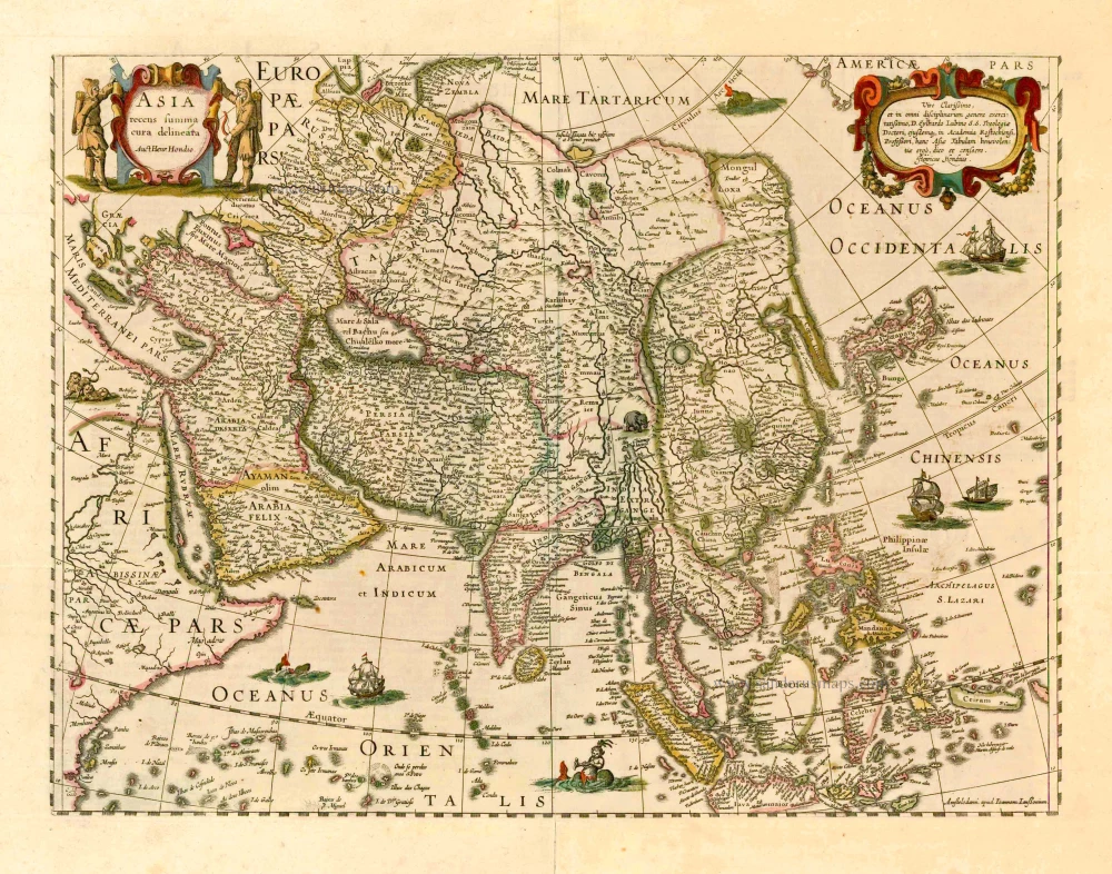
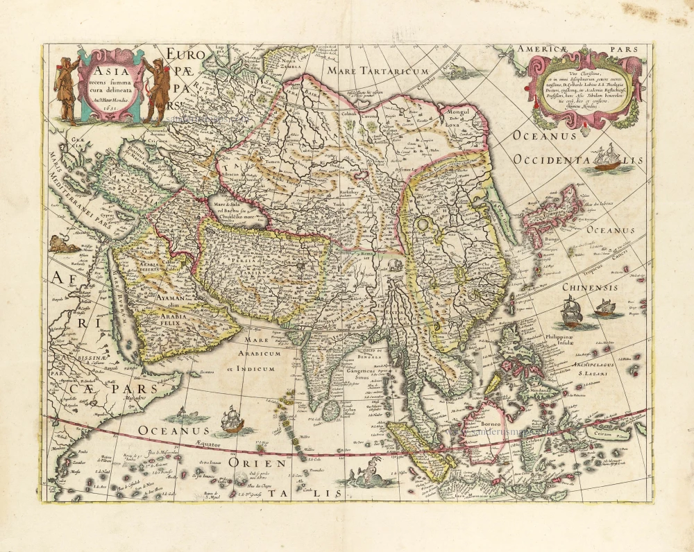
Asia Recens Summa Cura Delineata. 1644-58
Asia, by J. Janssonius
[Item number: 7508]

Accuratissima totius Asiae Tabula. c. 1691-96
Asia, by F. De Wit.
[Item number: 10960]
Exactissima Asiae Delineatio in praecipuas regiones Caeterasq Partes divisa. c. 1700
Asia by Th. Danckerts.
[Item number: 11298]
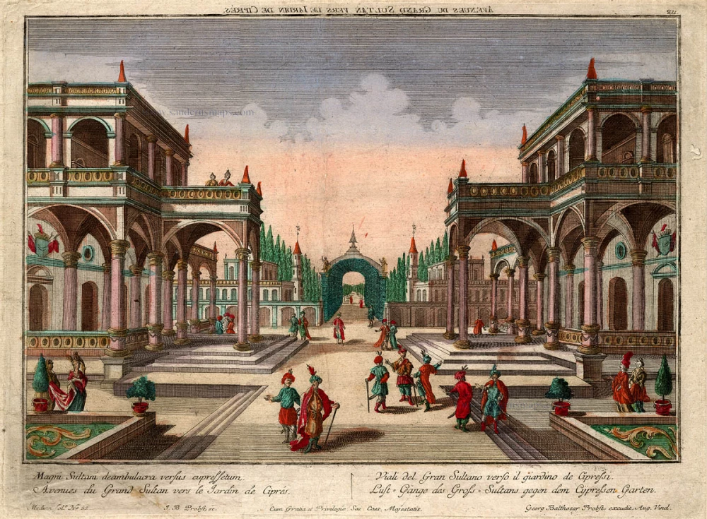
Avenues du Grand Sultan vers le Jardin de Cipres 18e eeuw
Avenues du Grand Sultan, Optica.
[Item number: 17523]
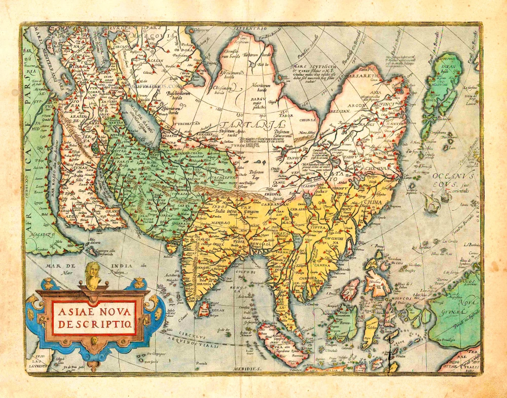
Asiae Nova Descriptio. 1612
Asia, by Abraham Ortelius.
[Item number: 22925]
Asia Recens Summa Cura Delineata. 1639
ASIA by Hondius H.
[Item number: 24473]

Asiae in Tabula Geographica Delineatio. c. 1700
Asia by A.F. Zürner, published by Petrus Schenk.
[Item number: 25842]
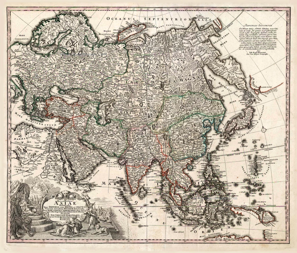
Recentissima Asiae Delineatio qua Imperia, ejus Regna et Status ... 1730-37
Asia, by Homann Johann Christoph.
[Item number: 26733]
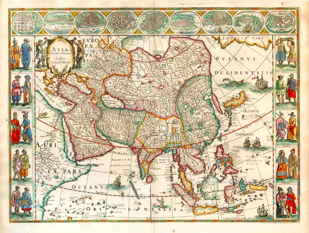
Asia Noviter Delineata. 1641-42
Asia, by Willem Blaeu.
[Item number: 27041]
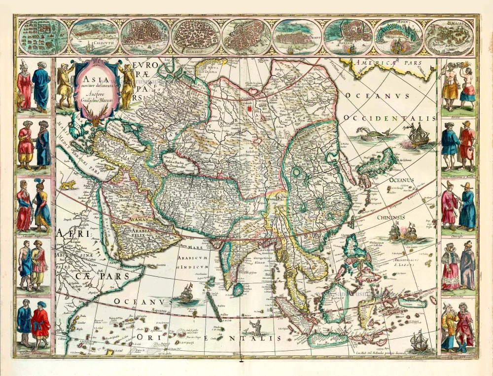
Asia Noviter Delineata. 1640
Old antique map of Asia, by Willem Blaeu.
[Item number: 27151]
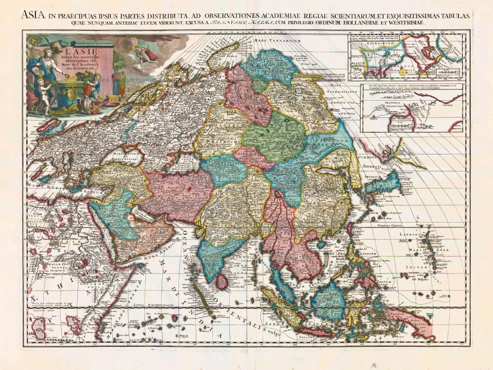
L'Asie Selon les Nouvelles Observations de Messrs. de l'Academie des Sciences, etc. Before 1713
Asia, by François Halma.
[Item number: 27851]
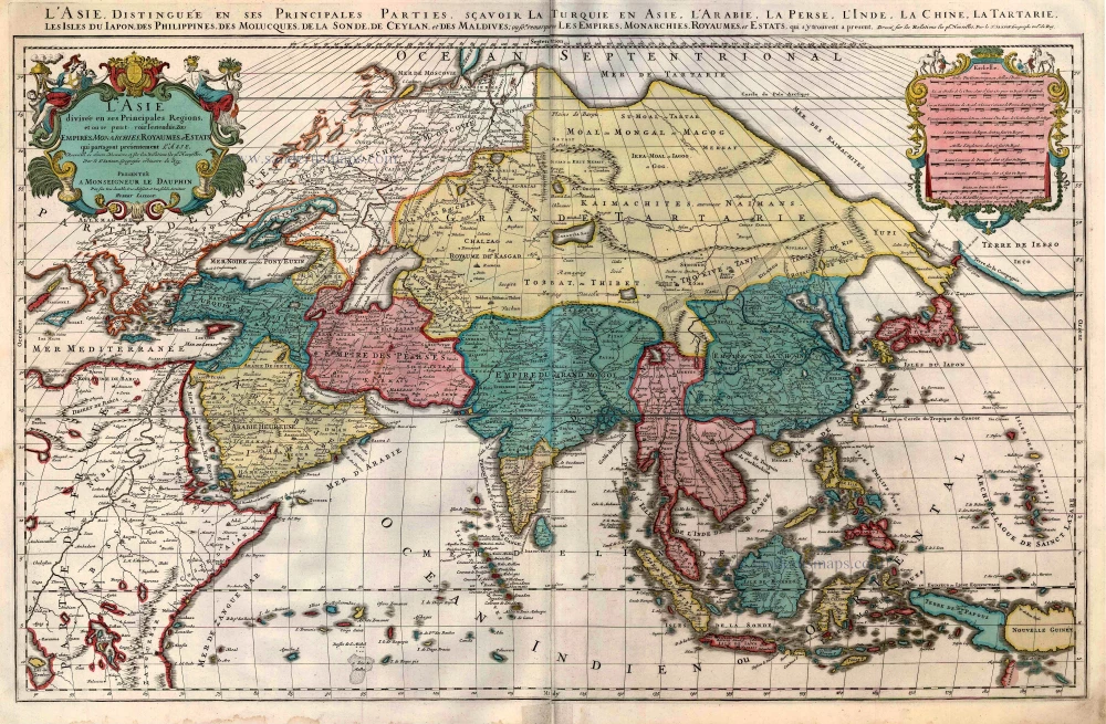
L'Asie divisée en ses Principales Regions, et ou se peut voir l'estendue Des Empites, Monarchies, Royaumes, et Estats qui partagent présentement L'Asie. c. 1705
Asia, by H. Jaillot, published by P. Mortier.
[Item number: 27858]
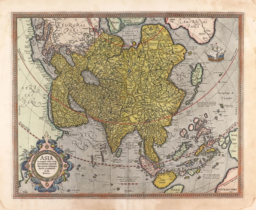
Asia ex magna orbis terre descriptione Gerardi Mercatoris desumpta studio et industria G.M. Iunioris. 1613
Asia, by Gerard Mercator.
[Item number: 28072]
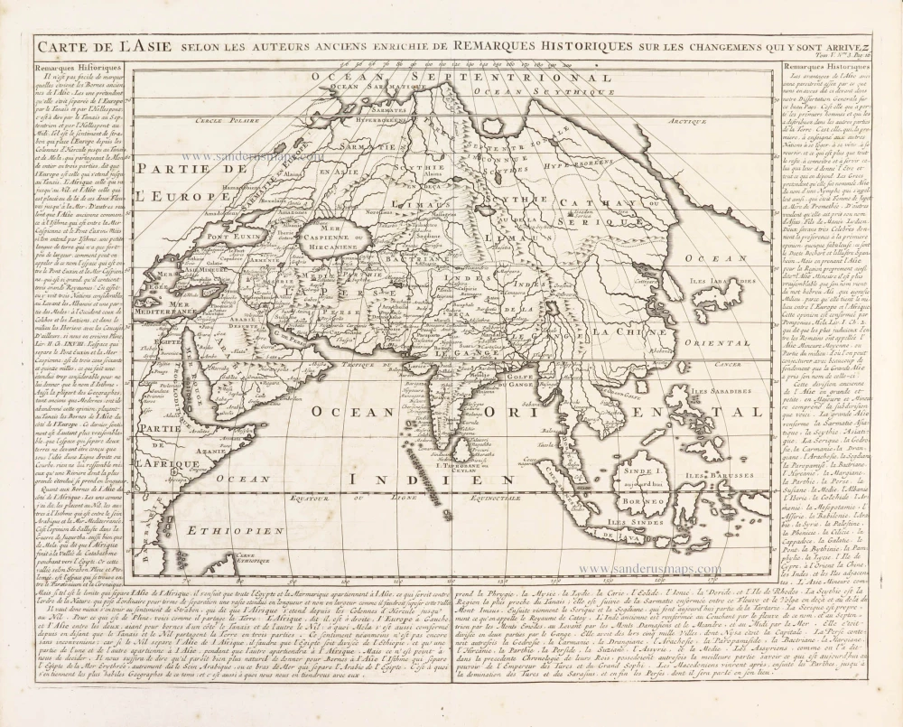
Carte de l'Asie selon les auteurs anciens enrichie de remarques historiques sur les changemens qui y sont arrivez. 1719
Asia, by Zacharias Châtelain.
[Item number: 29387]
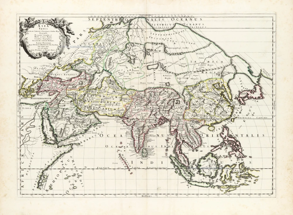
Asia Vetus. 1667-69
Ancient Asia by Nicolas & Guillaume Sanson.
[Item number: 30002]
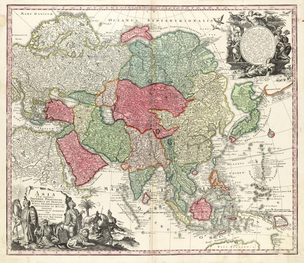
Asia Cum omnibus Imperiis Provinciis, Statibus et Insulis Iuxta Observationes receentissimas et Accuratissimas Correcta et Adornata. 1728
Asia by Matthäus Seutter.
[Item number: 30201]

Asia Antiqua cum finitimis Africae et Europae Regionibus. 1675
Antique map of Asia by Janssonius à Waesberghe -
[Item number: 30385]
new
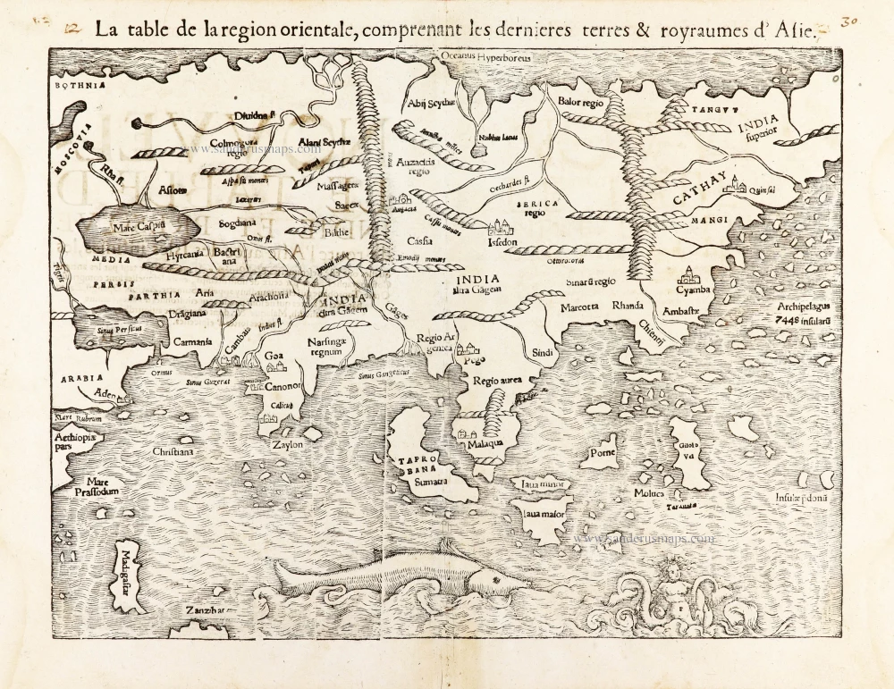
La table de la region orientale, comprenant les derniered terres & royraumes d'Asie. 1568
Asia by Sebastian Munster.
[Item number: 30528]
new