
Holy Land, by Adrichomius C. 1590
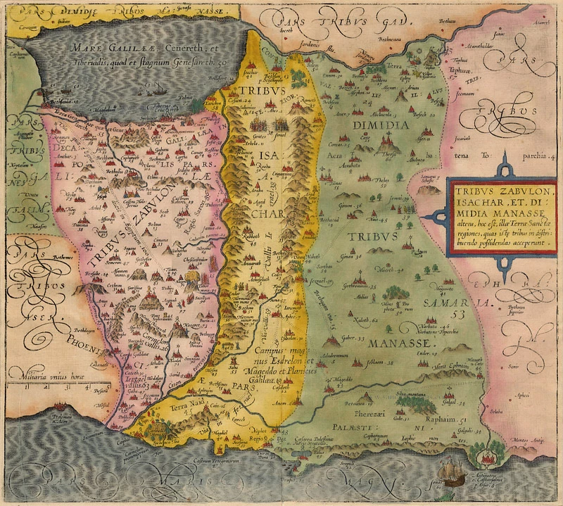
Tribus Zabulon, Isachar, Et, Dimidia Manasse ...
Item Number: 1902 Authenticity Guarantee
Category: Antique maps > Asia > Holy Land
Old, antique map of the Holy Land, by C. Adrichomius.
Title: Tribus Zabulon, Isachar, Et, Dimidia Manasse ...
Copper engraving, printed on paper.
Size (not including margins): 363 x 402mm (14.29 x 15.83 inches).
Verso: Blank.
Condition: Old coloured.
Condition Rating: A+.
From: Adrichom, Christian vanTheatrum Terrae Sanctae Cologne, Officina Birckmannica, 1590.
Related items
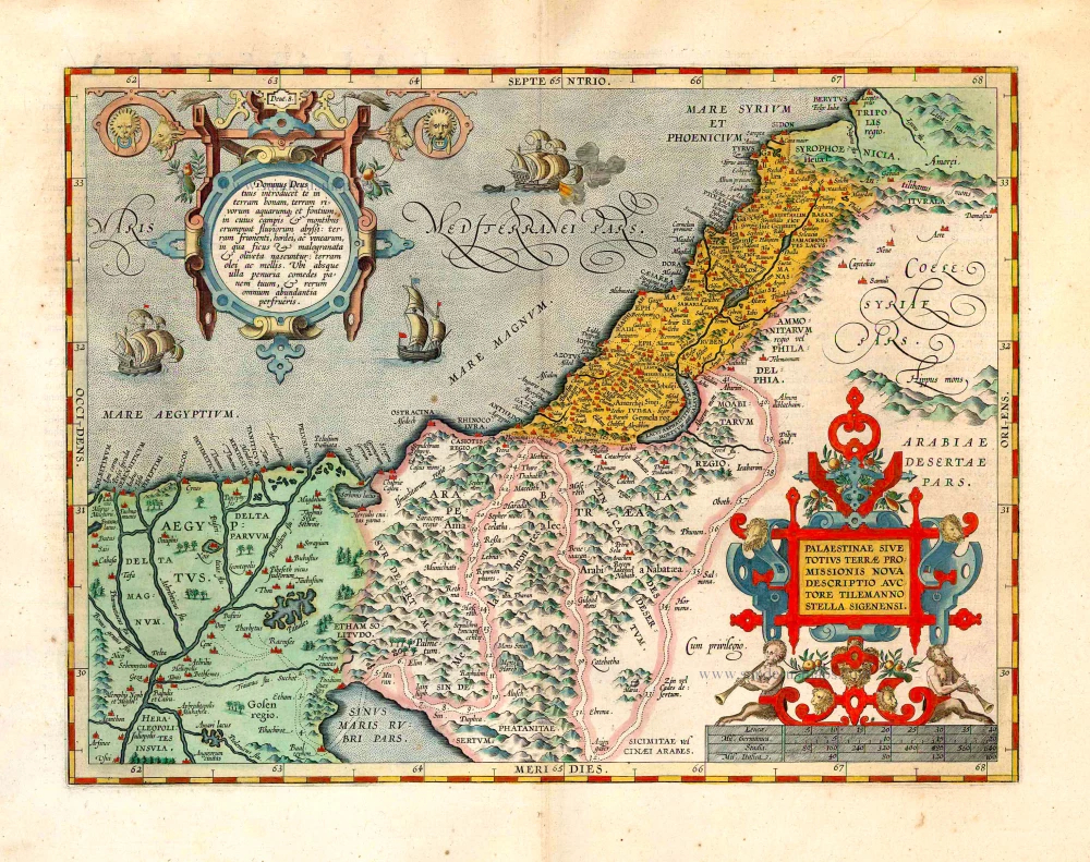
Palaestinae sive totius Terrae Promissionis nova descriptio Auctore Tilemanno Stella Sigenensi. 1624
Holy Land, by Abraham Ortelius.
[Item number: 1583]
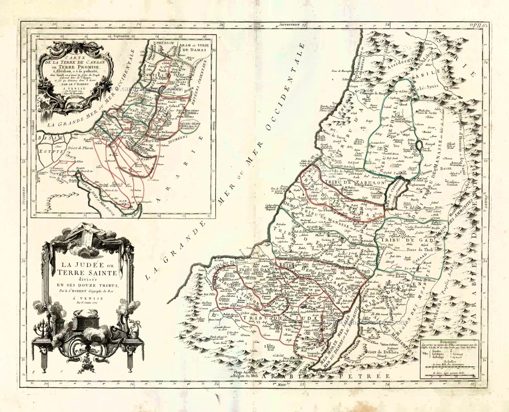
La Judée ou Terre Sainte divisée en ses Douze Tribus. 1776-79
Holy Land, by Paolo Santini.
[Item number: 27015]
Parergon map
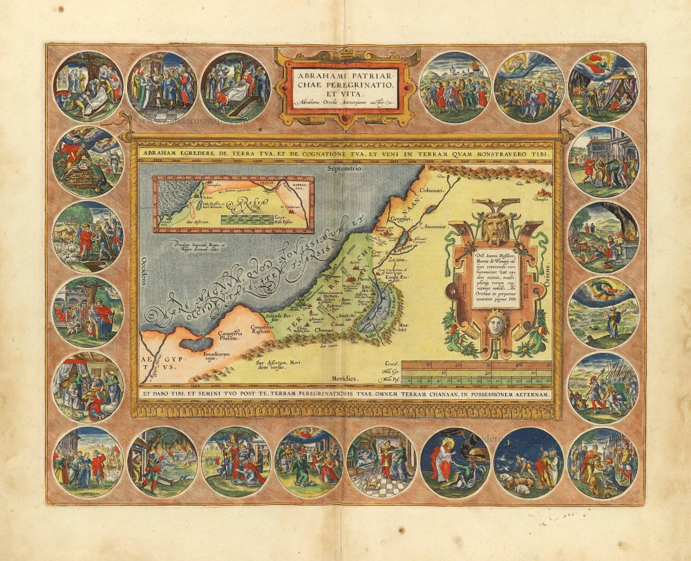
Abrahami Patriarchae Peregrinatio, et Vita. 1612
The Holy Land by Abraham Ortelius.
[Item number: 28921]
Luxury colour
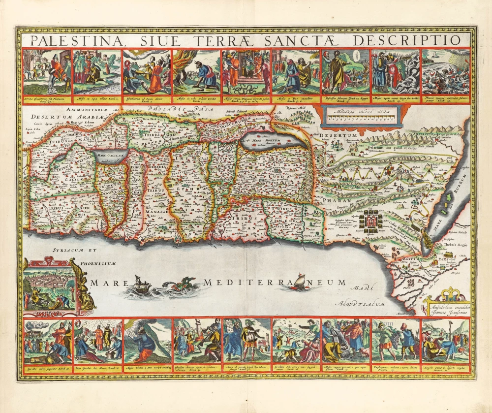
Palestina, sive Terrae Sanctae Descriptio. 1666
The Holy Land by Joannes Janssonius.
[Item number: 29972]
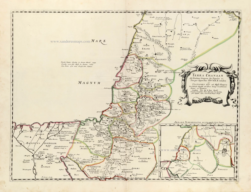
Terra Chanaan Ad Abrahami tempora, per populos XI Item per toparchias Idumeae Totidem et Stationes XLV. ad Mosis Tempora Seu Tabula digesta ad libros Genes. Exodi. Levit. Numer. et Deuteron. 1651
Historic map of the Land of Canaan from the time of Abraham up to the time of Moses, by Philippe de la Rue, published by Pierre Mariette.
[Item number: 30053]
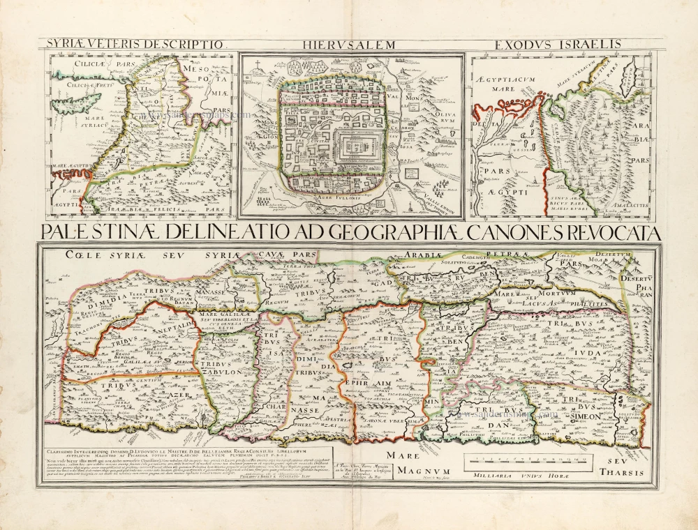
Palestinae Delineatio Ad Geographiae Canones Revocata. 1641
Holy Land - Jerusalem by Philippe Briet, published by Pierre Mariette.
[Item number: 30056]
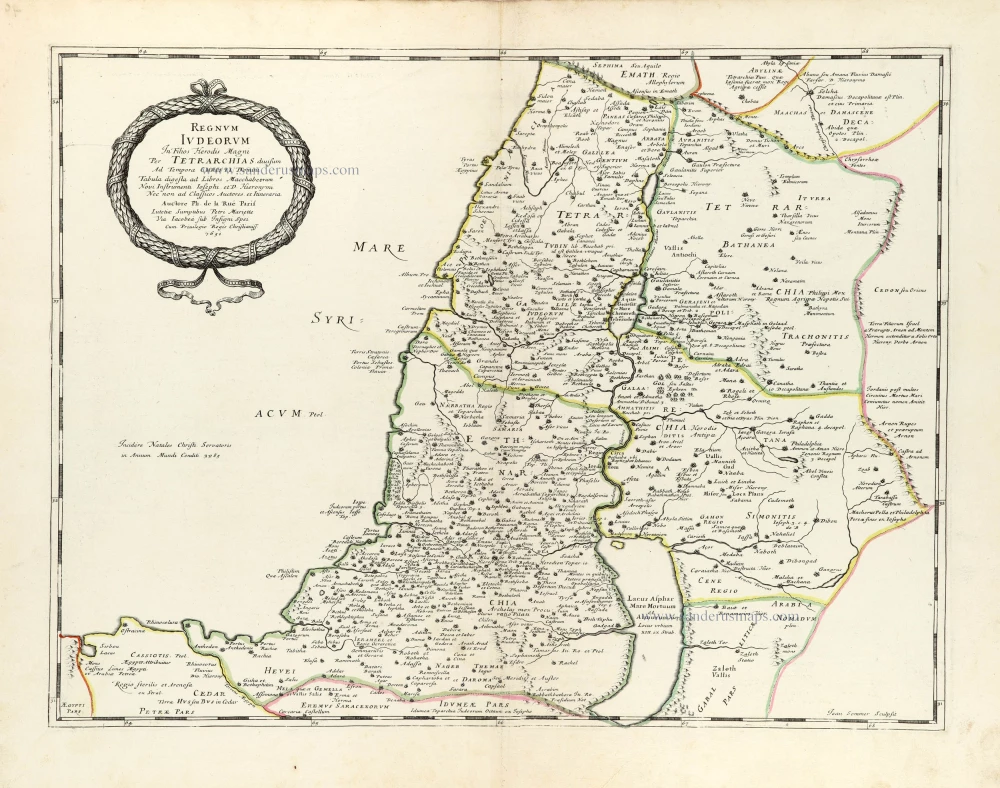
Regnum Iudeorum In Filios Herodis Magni. 1651
Historic map of the Kingdom of Judea in the time of Christ, by Philippe de la Rue, published by Pierre Mariette.
[Item number: 30060]
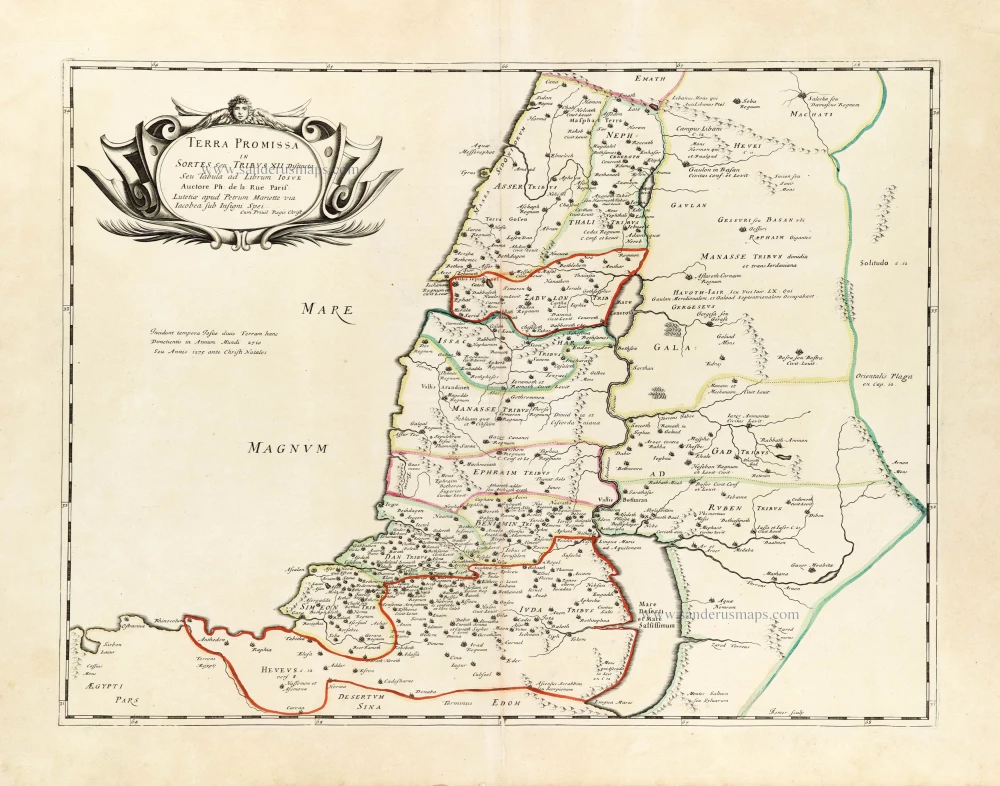
Terra Promissa in Sortes seu Tribus XII Distincta. 1651
The Promised Land divided among the 12 Tribes, by Philippe de la Rue, published by Pierre Mariette.
[Item number: 30061]
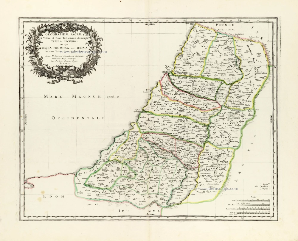
Geographiae Sacrae ex Veteri et Novo Testamento desumptae Tabula Secunda: in qua Terra Promissa, sive Iudaea in suas Tribus Partesq, distincta. 1665
Holy Land by Nicolas Sanson.
[Item number: 30105]
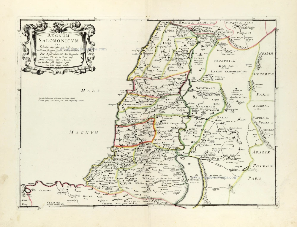
Regnum Salomonicum Seu Tabula digesta ad Libros Judicum, Regum, Paral. et Prophetarum. 1651
Historic map of the Kingdom of Solomon divided into 12 provinces, by Philippe de la Rue, published by Pierre Mariette.
[Item number: 30106]
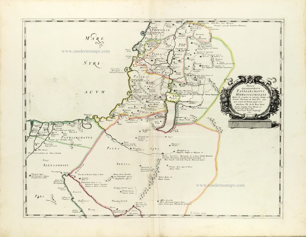
Pinax Geogpaphicus [sic] Patriarchatus Hierosolymitani [...] 1651
The Patriarchate of Jerusalem, by Philippe de la Rue, published by Pierre Mariette.
[Item number: 30120]