
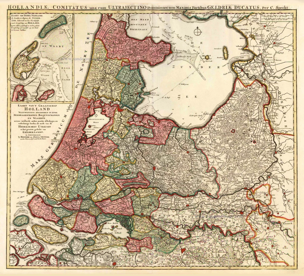
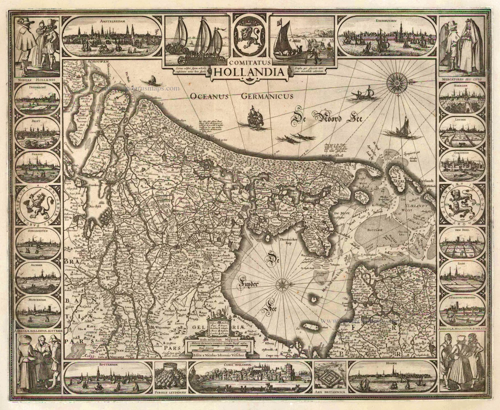
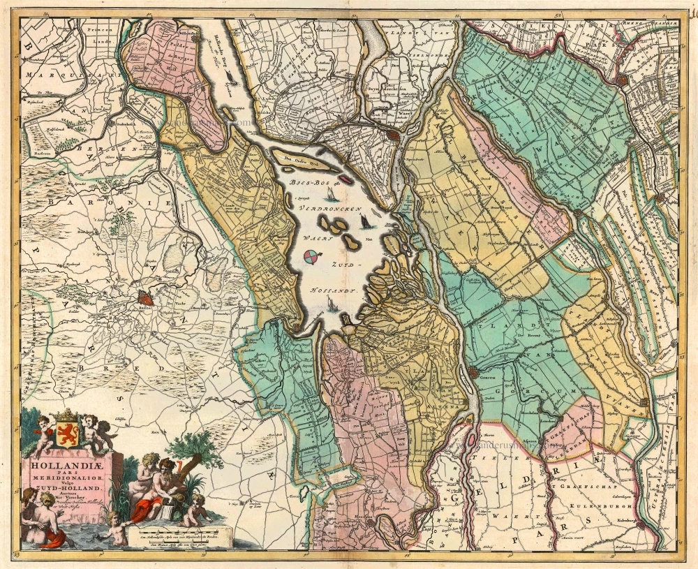
Holland by C. Specht, published by R. & J. Ottens. 1730-45

The Ottens Family
Joachim Ottens (1663-1719), was a copper-engraver and the founder of the print- and mapsellers’ firm in Amsterdam. In 1710 he became a member of the art- and printsellers guild. After he died in 1719, his widow and the sons continued the business under the name “In de Wereldcaert” (In the world map). On the whole, the Ottens’s financial position was rather weak, and the stock was not very large.
In a notary contract dated 20 October 1726, the partnership between the two brothers, Reinier and Josua, was stipulated. Despite separate shops, the brothers’ partnership continued until the death of Renier in 1750.
After Joshua died in 1765, his widow continued the firm, together with her son, Renier II, until c. 1780.
The firm flourished mainly between 1719 and c. 1750. In that period, they advertised at various times the publication of new maps.
Ottens’s greatest fame comes from the voluminous atlases assembled to order. A small number of these so-called ‘Atlas factice’, splendid copies with gorgeous illumination, have survived. These collector’s copies are known to exist in 2, 6, 8, 11, and even 15 volumes. Ottens also published atlases in one volume, with a varying number of maps, pocket atlases, collections of military plans, and Renard’s atlas de la navigation.
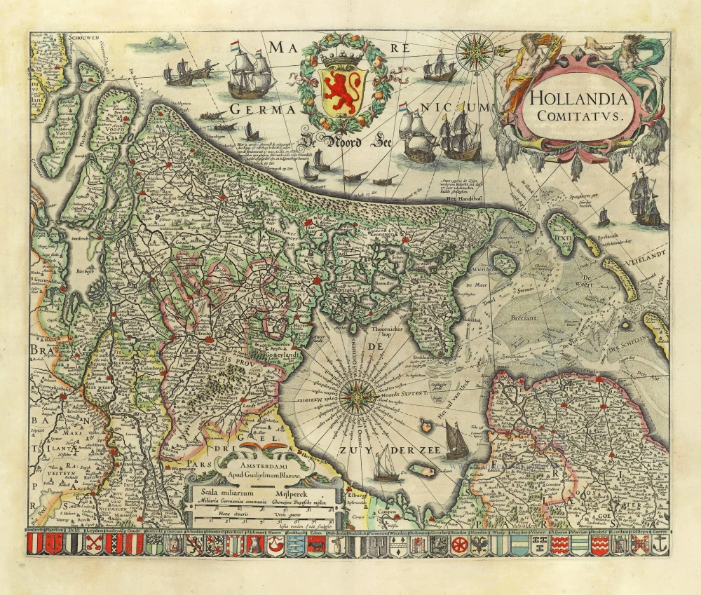
Kaart van 't Graafschap Holland Naauwkeurig Afgedeelt in zyne Heemraadschappen, Baljuwschappen en Waarden,
Item Number: 25706 Authenticity Guarantee
Category: Antique maps > Europe > The Netherlands
Old, antique map of Holland by Caspar Specht, published by R. & J. Ottens.
With inset map: the North of Holland with Den Helder, Wieringen and the Isles of Texel and Vlieland.
Title: Kaart van 't Graafschap Holland Naauwkeurig Afgedeelt in zyne Heemraadschappen, Baljuwschappen en Waarden,
nevens verscheide andere minder afdeelingen en onderhorige landen als mede van de Heerlykheit Utrecht en het grootste gedeelte van Gelderlandt.
te Amstersdam by Reinier en Josua Ottens op den Nieuwen Dijk in de Werelt Kaart.
[Title above map:] Hollandiae Comitatus una cum Ultraiectino Dominio nec non Maximis Partibus Geldriae Ducatus, per C. Specht.
Cartographer: C. Specht.
Date of the first edition: 1702.
Date of this map: 1730-45.
Copper engraving, printed on paper.
Size (not including margins): 520 x 570mm (20.47 x 22.44 inches).
Verso: Blank.
Condition: Original coloured, excellent.
Condition Rating: A+.
From: Atlas sive Geographia compendiosa in qua Orbis Terrarum pacis attamen novissimis Tabulis Ostenditur. - Atlas Nouveau, contenant toutes les partis du monde ... R. & I. Ottens, 1730-45. (Composite Atlas).
The Ottens Family
Joachim Ottens (1663-1719), was a copper-engraver and the founder of the print- and mapsellers’ firm in Amsterdam. In 1710 he became a member of the art- and printsellers guild. After he died in 1719, his widow and the sons continued the business under the name “In de Wereldcaert” (In the world map). On the whole, the Ottens’s financial position was rather weak, and the stock was not very large.
In a notary contract dated 20 October 1726, the partnership between the two brothers, Reinier and Josua, was stipulated. Despite separate shops, the brothers’ partnership continued until the death of Renier in 1750.
After Joshua died in 1765, his widow continued the firm, together with her son, Renier II, until c. 1780.
The firm flourished mainly between 1719 and c. 1750. In that period, they advertised at various times the publication of new maps.
Ottens’s greatest fame comes from the voluminous atlases assembled to order. A small number of these so-called ‘Atlas factice’, splendid copies with gorgeous illumination, have survived. These collector’s copies are known to exist in 2, 6, 8, 11, and even 15 volumes. Ottens also published atlases in one volume, with a varying number of maps, pocket atlases, collections of military plans, and Renard’s atlas de la navigation.
Related items
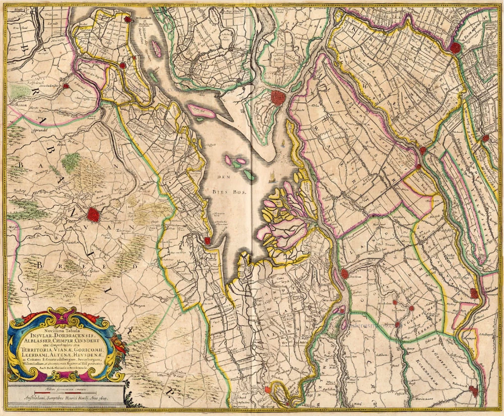
Novissima Tabula Insular. Dordracensis, Ablasser, ... 1636
Holland (Southeast), by Hondius H.
[Item number: 1235]
Strong impression. Important map.
Comitatus Hollandia 1633
Holland by C.J. Visscher.
[Item number: 2748]
Novissima Delflandiae, Schielandiae et circumiacentium insularum ... 1644-58
Holland, by J. Janssonius
[Item number: 2848]
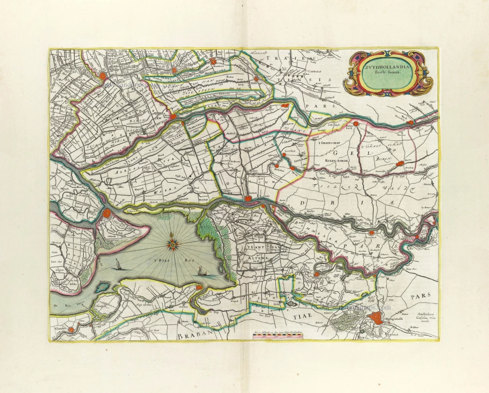
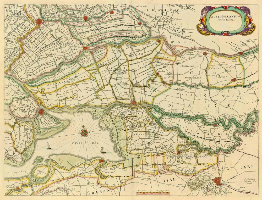
Zuydhollandia stricte sumta. 1662
Southern Holland by Willem Blaeu.
[Item number: 5358]

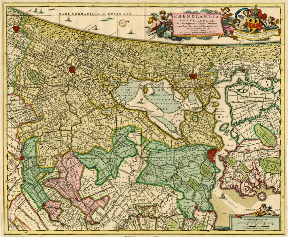
Rhenolandiae et Amstellandiae exactißima Tabula. 1662
Central Holland by Willem Blaeu.
[Item number: 5359]
Rare and important map!
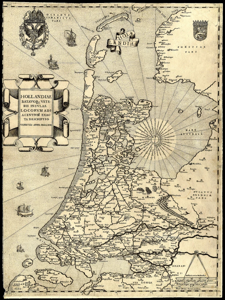
Hollandiae Batavor Veteris Insulae Locorum Adiacentium Exacta Descriptio. 1563
Holland, by Camocio G.F. - Forlani P.
[Item number: 9232]
Hollandiae pars Meridionalis, vulgo Zuyd-Holland 1683-1696
Holland (South), by N. Visscher.
[Item number: 10962]
[No title] c. 1670
Holland (North), by Frederick de Wit.
[Item number: 12547]
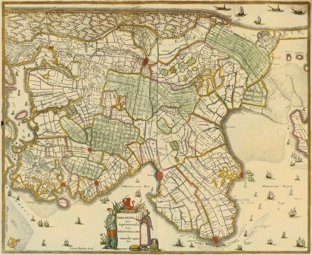
Hollandiae pars Septentrionalis, vulgo Westvriesland en 'tnoorder Quartier 1652-53
Holland (North) by Janssonius J. - Hondius H.
[Item number: 13205]
Rhenolandia, Amstelandia et Circumjacentia aliquot Territoria, ... 1680-1710
Central Holland by N. Visscher
[Item number: 15634]
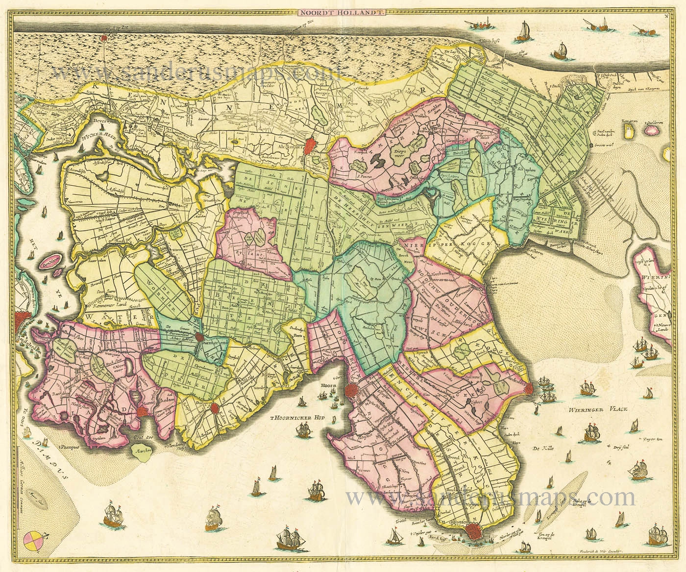
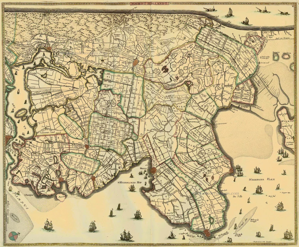
Noordt Hollandt c. 1680
Noord Holland by Frederick de Wit.
[Item number: 15663]
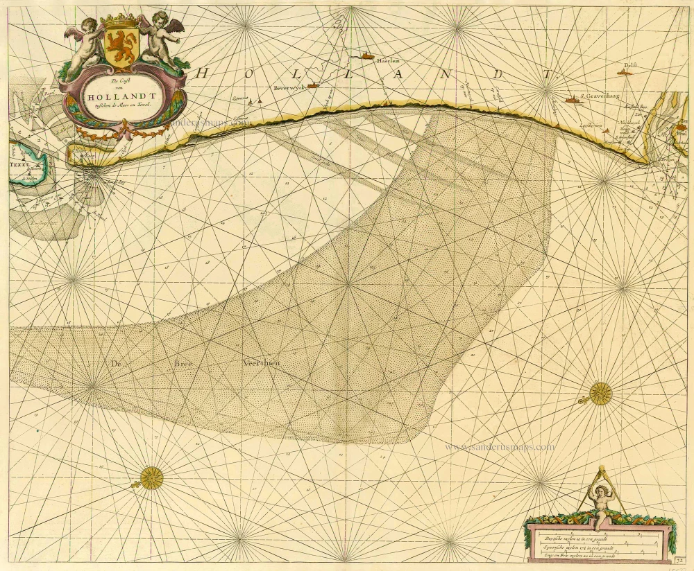
De Cust van Hollandt Tusschen de Maes en Texel. 1686
Holland by Hendrick Doncker.
[Item number: 15677]
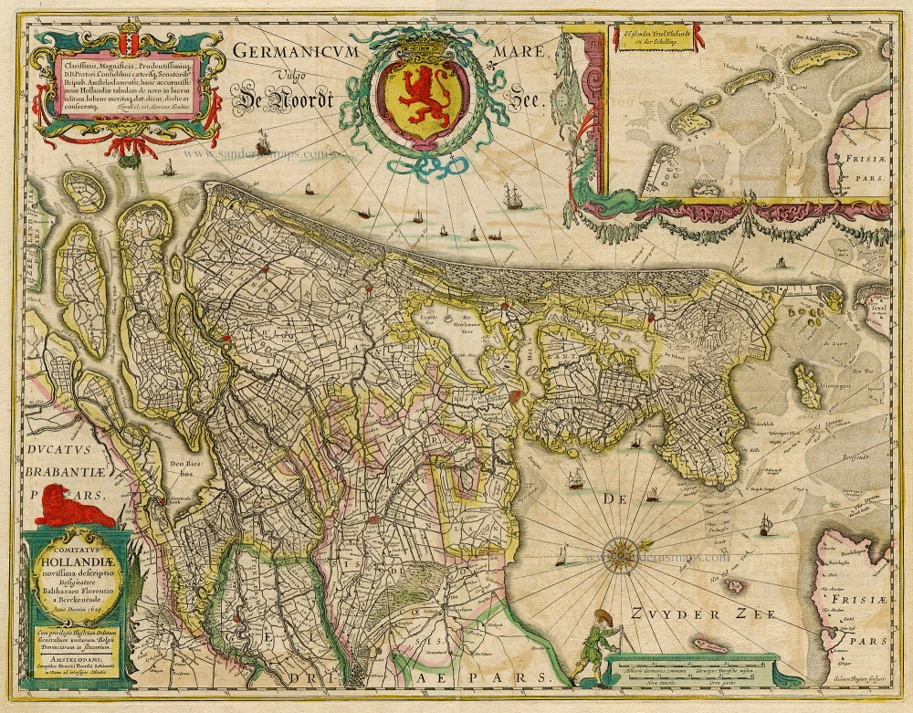
Comitatus Hollandiae novissima descriptio. 1638
Holland, by Janssonius J.
[Item number: 19020]
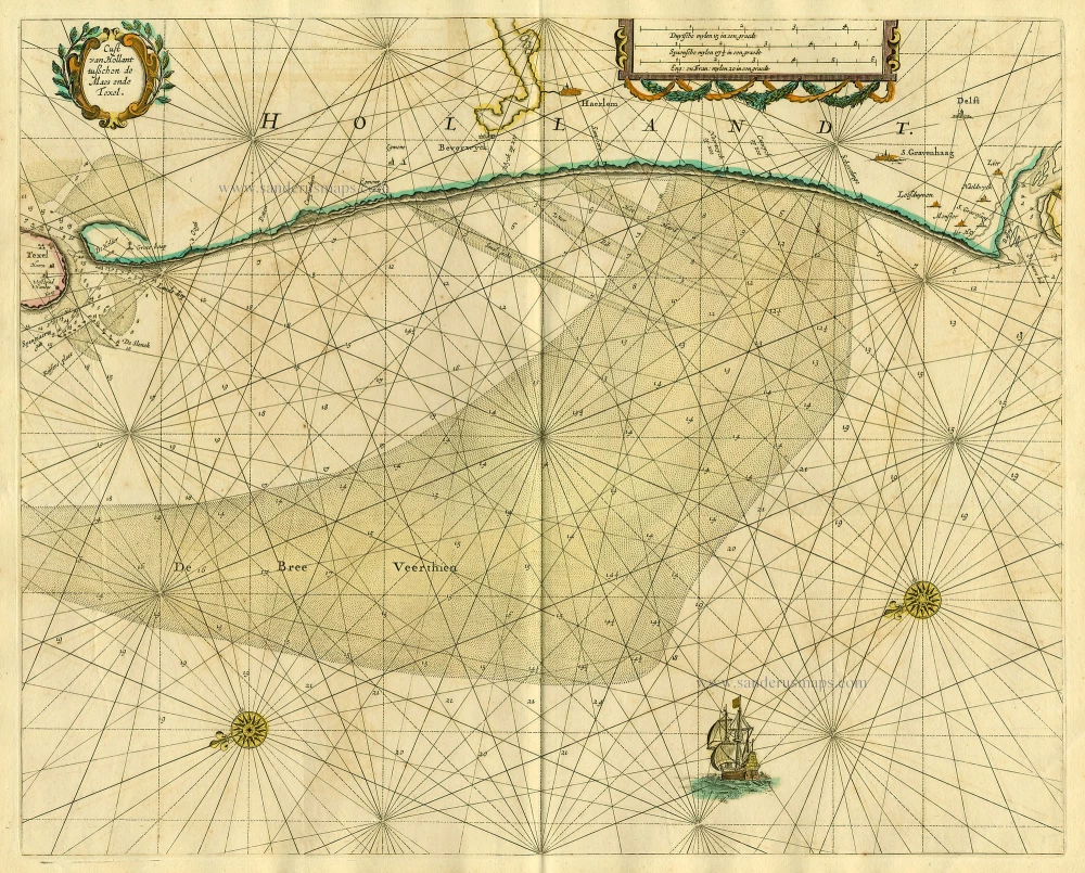
Cust van Hollant tusschen de Maes ende Texel 1667
Sea chart of Holland, by Pieter Goos.
[Item number: 19040]
Zuydhollandia stricte sumta. 1643-50
Holland (South), by Willem & Joan Blaeu.
[Item number: 21071]
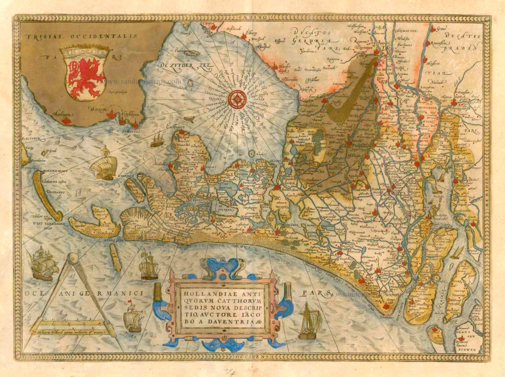
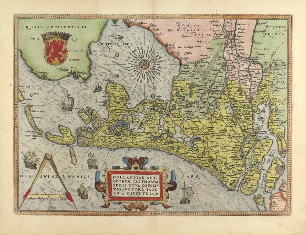
Hollandiae Antiquorum Catthorum Sedis Nova Descriptio. 1579
Holland by Ortelius A
[Item number: 22594]
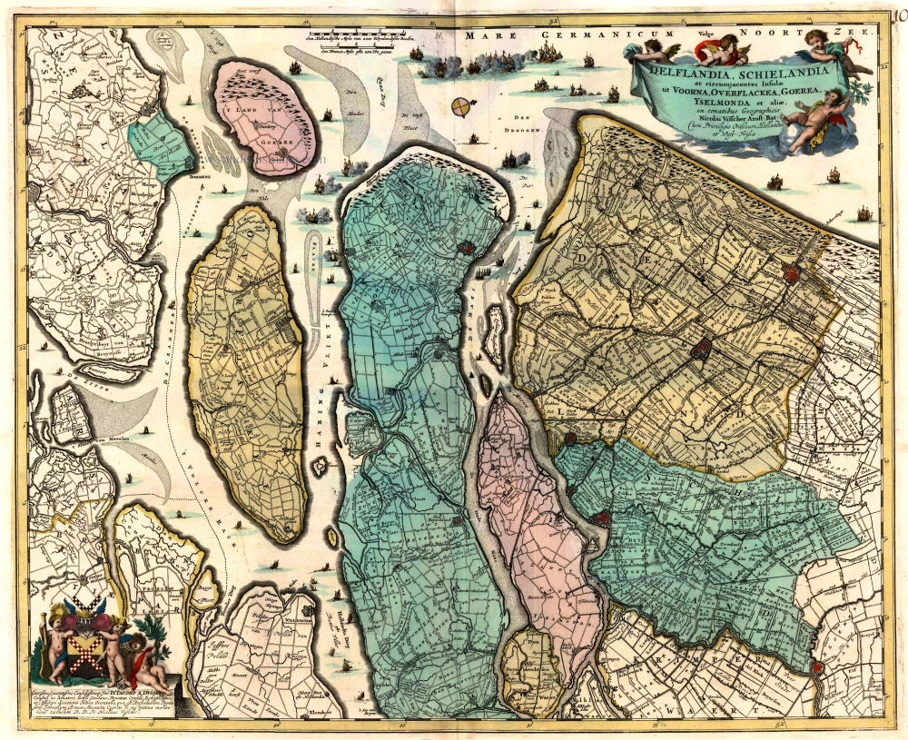
Delflandia, Schielandia et circumjacentes Insulae ... 1680-1710
Holland, by N. Visscher
[Item number: 24417]
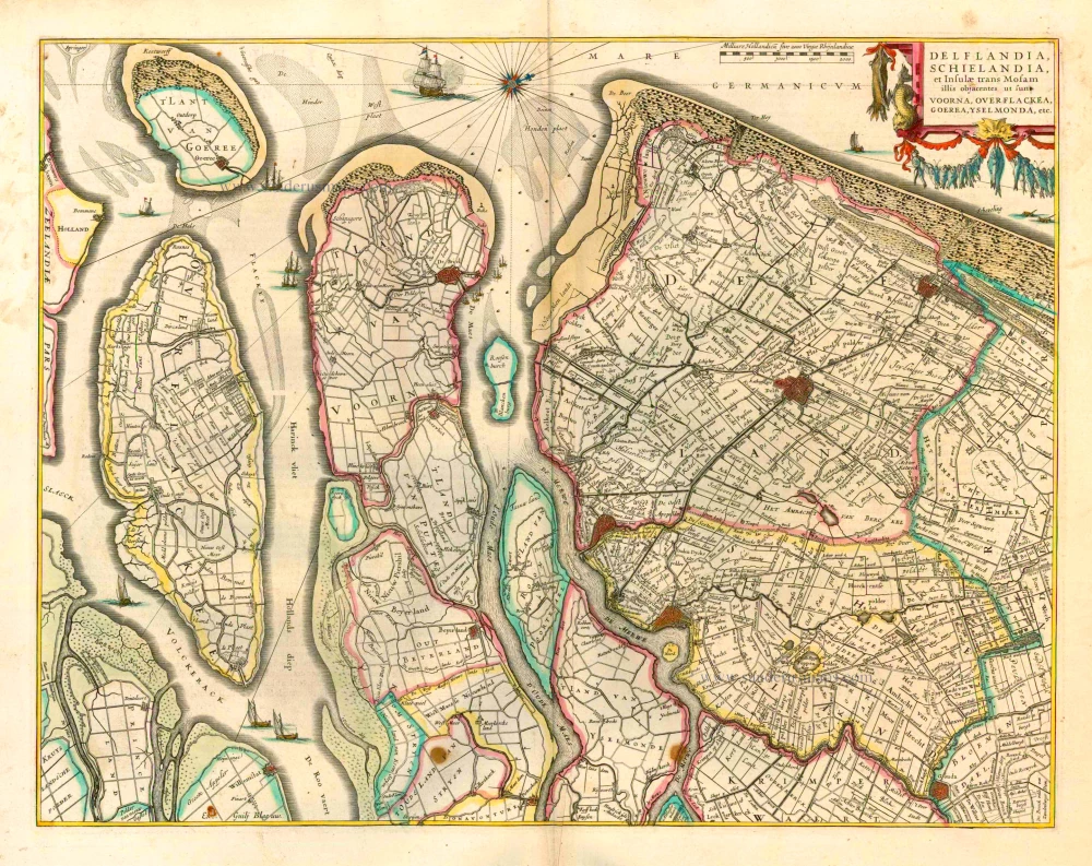
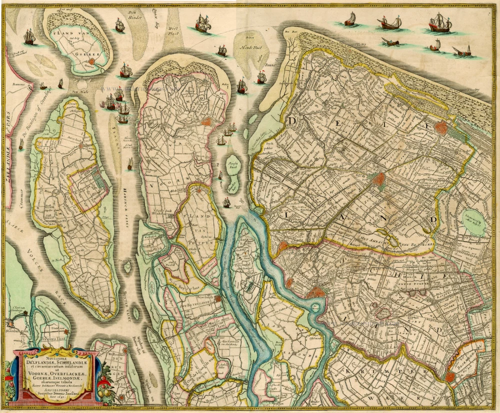
Delflandia, Schielandia et Insulae trans Mosam et Insulae trans Mosam illis objacentes ut sunt Voorna, Overflackea, Goerea, Yselmonda, etc. 1635
Holland (Southwest), by Willem Blaeu.
[Item number: 25352]
Kaart van 't Graafschap Holland Naauwkeurig Afgedeelt in zyne Heemraadschappen, Baljuwschappen en Waarden, 1730-45
Holland by C. Specht, published by R. & J. Ottens.
[Item number: 25706]
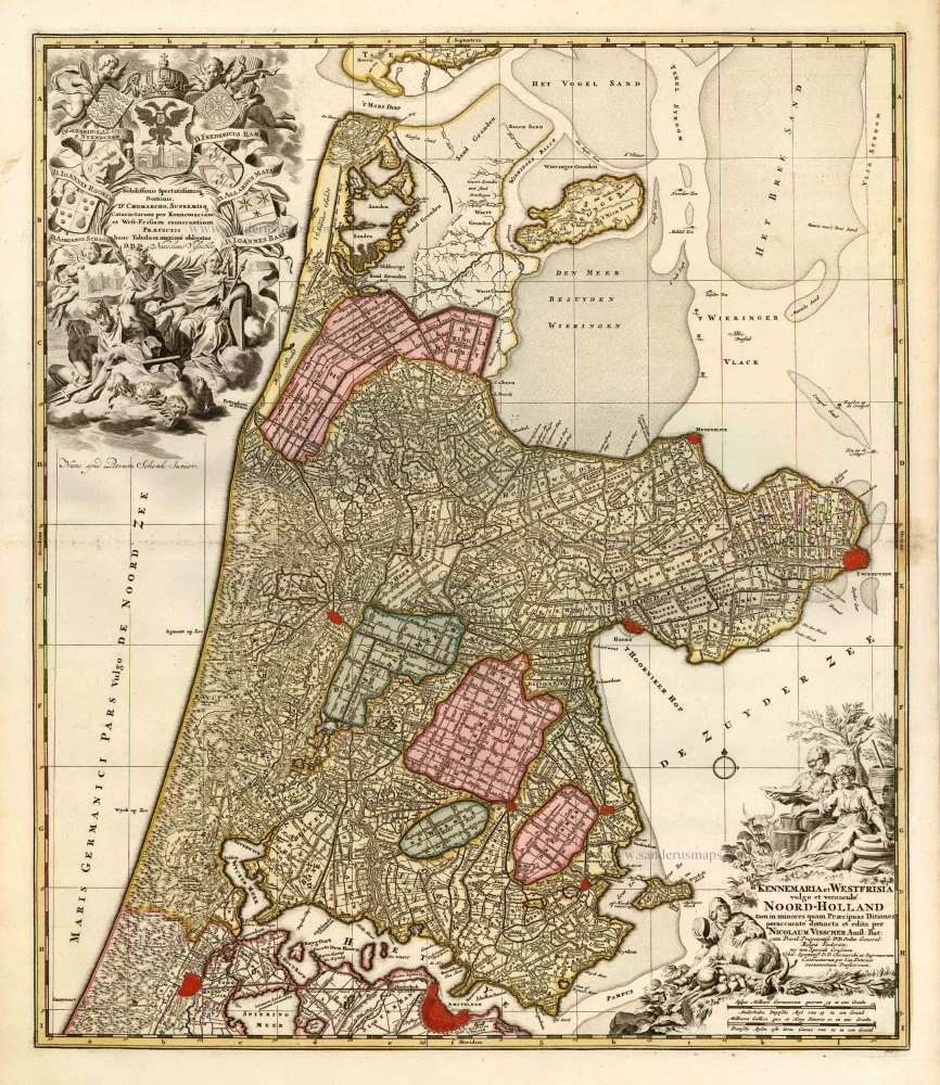
Kennemaria et Westfrisia vulgo et vernaculé Noord-Holland. c. 1700
Noord Holland by Nicolaas Visscher I, published by Petrus Schenk.
[Item number: 25707]
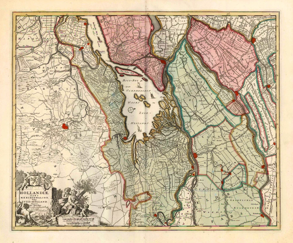
Hollandiae Pars Meridionalior, Vulgo Zuyd-Holland. c. 1740
Southern Holland by Nicolaas Visscher II, published by Petrus Schenk.
[Item number: 25721]
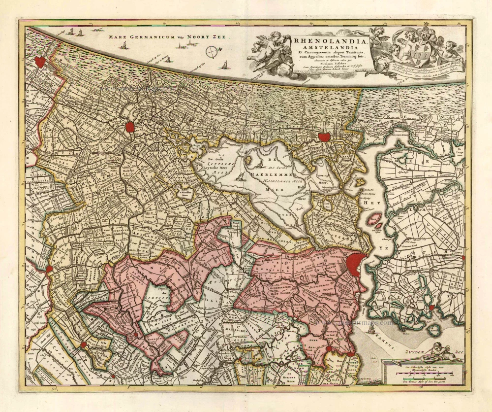
Rhenolandia, Amstelandia et Circumjacentia aliquot Territoria, cum Aggeribus omnibus, Terminiqz fuis. c. 1740
Central Holland by Nicolaas Visscher II, published by Petrus Schenk.
[Item number: 25722]
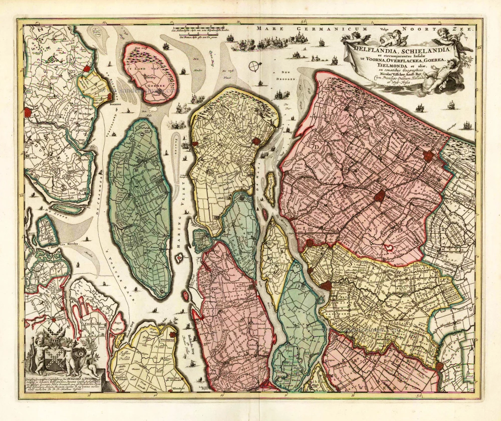
Delflandia, Schielandia et circumjacentes Insulae et circumjacentes Insulae ut Voorna, Overflackea, Goerea, Yselmonda et aliae, 1683-1696
Southwest Holland by Nicolaas Visscher II.
[Item number: 25729]
Big and spectacular map
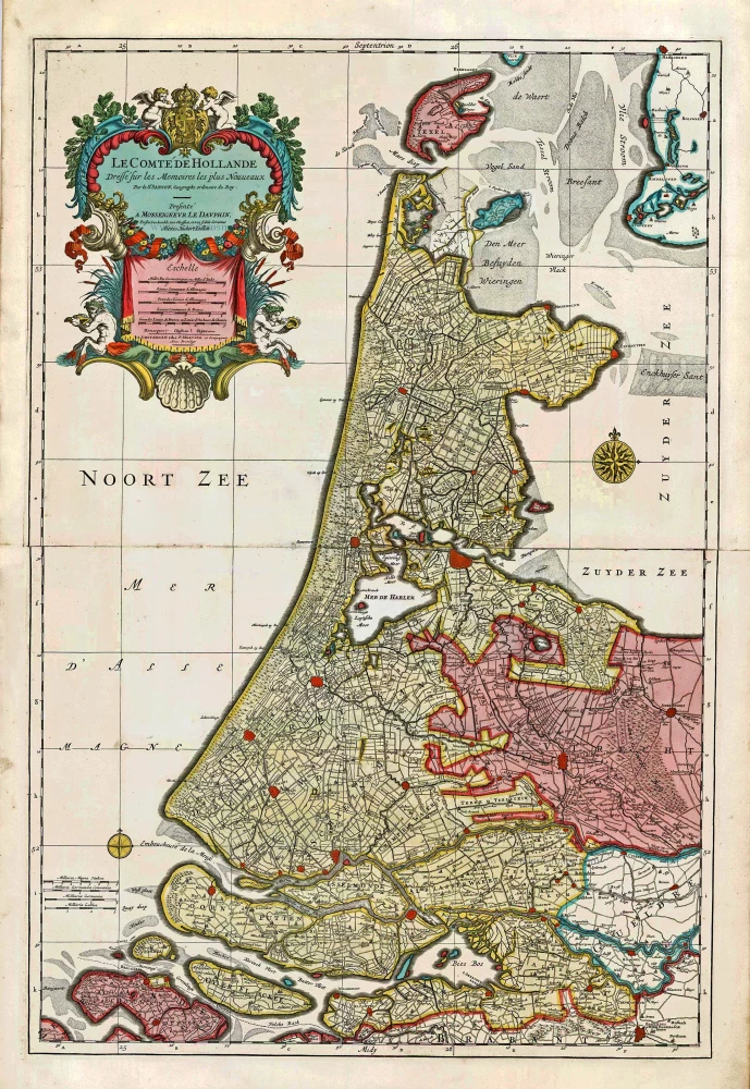
Le Comté de Hollande. c. 1705
Holland, by Pieter Mortier.
[Item number: 27807]
Rare
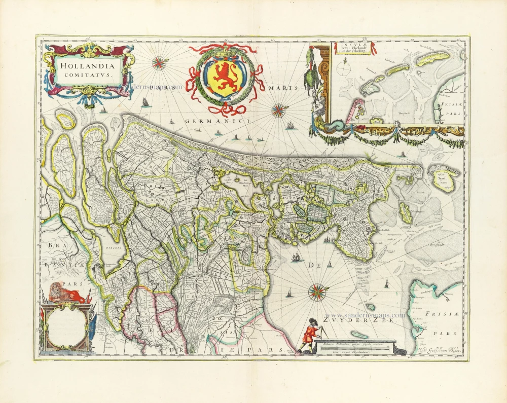
Hollandia Comitatus. 1631
Holland by Willem Blaeu.
[Item number: 28471]
Scarce map
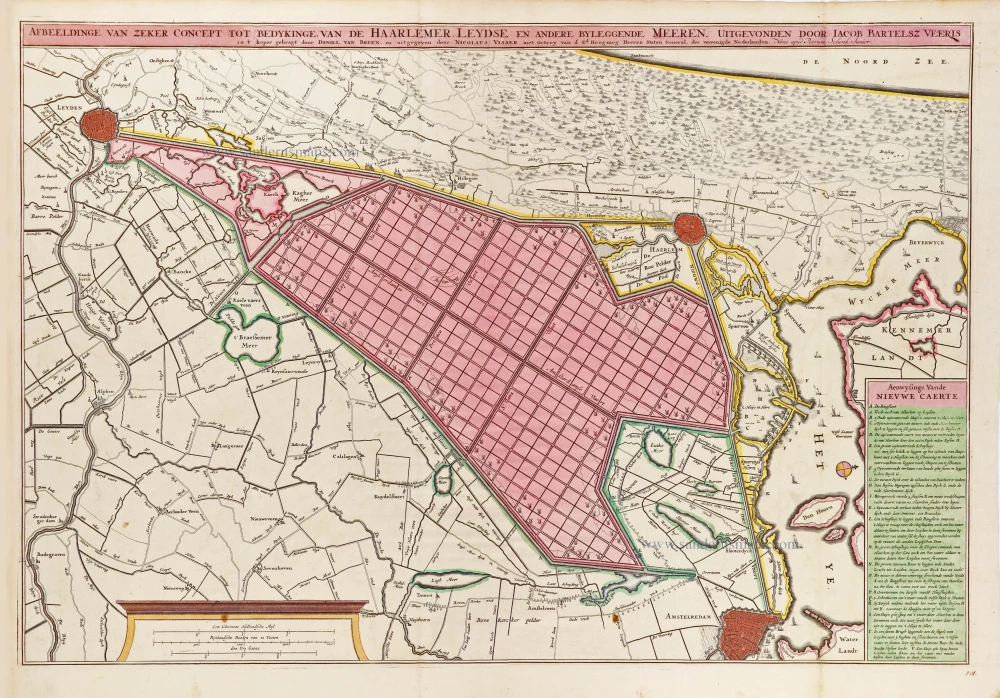
Afbeeldinge van zeker concept tot bedykinge van de Haarlemer, Leydse en andere byleggende Meeren. c. 1750
Polder map of Holland, by Nicolaas Visscher, published by Petrus Schenk Jr.
[Item number: 28918]
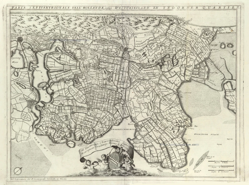
Parte Septentrionale del'Hollanda, vulgo Westuriesland en Tnoorder Quartier. 1696
Northern Holland, by Vincenzo Coronelli.
[Item number: 29432]
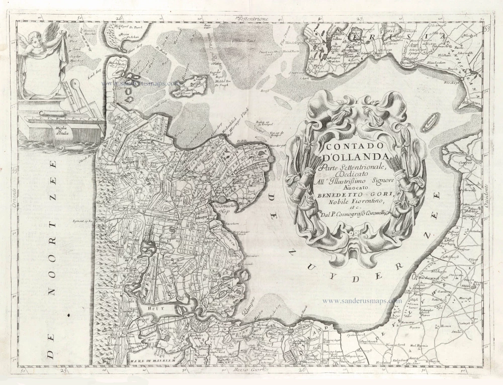
Contado d'Hollanda, Parte Settentrionale, 1696
Northern Holland, by Vincenzo Coronelli.
[Item number: 29433]
Hollandiae Antiquorum Catthorum Sedis Nova Descriptio. 1584
Holland, by Abraham Ortelius.
[Item number: 29547]
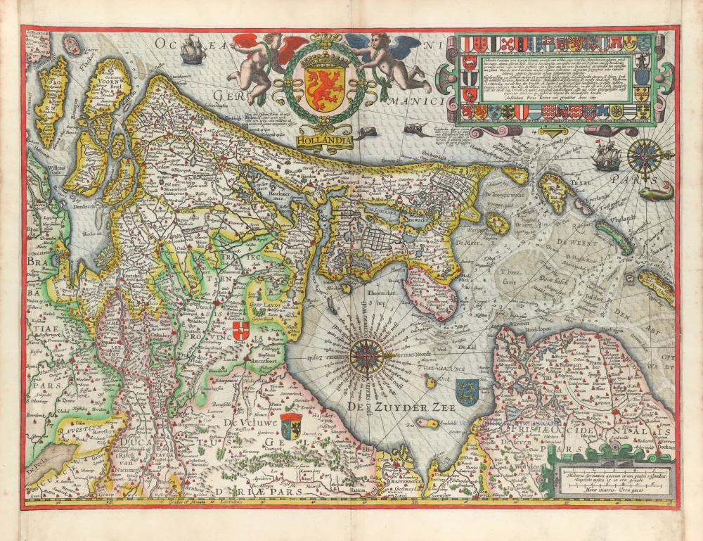
Hollandia Comitatus. 1643
Holland by Willem Blaeu
[Item number: 30182]
Hollandia. 1617
Holland by Petrus Kaerius (Pieter Van den Keere).
[Item number: 30257]