
North-Eastern Coasts of North America (Canada), by Frederick de Wit. c. 1690

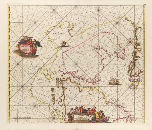

This chart originates in Joannes van Loon's similar chart of 1666; there are no differences between them. One of its more distinguishing features is that it bears not one but two title cartouches, one in Latin and the other in Dutch.
Frederick de Wit (1630-1706)
The engraver and map-seller, Frederick de Wit, was born in Gouda (Netherlands) in 1630 as a son of Hendrick Fredericksz de Wit. Through his marriage with Maria van der Waag of Amsterdam in 1661, he obtained citizenship of the city where he had been working since 1648 and where he became one of the most famous engravers of maps of the second half of the 17th century. Although De Wit was a Catholic, which meant that he was not favoured at the time by the city council, he was awarded the honour of being listed as one of the "excellent citizens" on the roll of the city council in the years 1694-1704. However, his name was not written in the Guild of St. Luke book before 1664. At that time, he lived on the Kalverstraat "in de Witte Pascaert", where he stayed until his death in 1706. His earliest dates on maps engraved are 1659 (Regni Daniae) and 1660 (World map).
Frederick de Wit published several world atlases, a sea atlas, and an atlas of the Netherlands.
The dating of the maps is difficult. However, as a privilege was granted in 1689, the annotation 'cum privilegio' marks an edition after 1688.
Around 1700, Frederick de Wit entered the market with a town atlas. He produced two volumes with a total of 260 plans and views. Most were printed from plates used for Janssonius and Blaeu town atlases.
After he died in 1706, his widow continued the shop until 1709. The plates and stock of De Wit's atlas were sold to Covens & Mortier in 1710, who sold the atlas for an extended period.
Septemtrionaliora Americae à Groenlandia, per Freta Davidis et Hudson, ad Terram Novam = De Noordelyckste Zee kusten van America van Goenland door de Straet Davis ende Straet Hudson tot Terra Neuf.
Item Number: 29242 Authenticity Guarantee
Category: Antique maps > America > North America
Old, antique sea chart of North-Eastern Coasts of North America (Canada), by Frederick de Wit.
Title: Septemtrionaliora Americae à Groenlandia, per Freta Davidis et Hudson, ad Terram Novam = De Noordelyckste Zee kusten van America van Goenland door de Straet Davis ende Straet Hudson tot Terra Neuf.
Engraver: Romeyn de Hooghe.
Date of the first edition: c. 1671-76.
Date of this map: c. 1690.
Copper engraving, printed on paper.
Map size: 485 x 560mm (19.09 x 22.05 inches).
Sheet size: 540 x 640mm (21.26 x 25.2 inches).
Verso: Blank.
Condition: Original coloured, partially backed with archival paper, minor repair at the bottom cartouche.
Condition Rating: B+.
From: Orbis Maritimus ofte Zee Atlas. Amsterdam, F. de Wit, c. 1680.
This chart originates in Joannes van Loon's similar chart of 1666; there are no differences between them. One of its more distinguishing features is that it bears not one but two title cartouches, one in Latin and the other in Dutch.
Frederick de Wit (1630-1706)
The engraver and map-seller, Frederick de Wit, was born in Gouda (Netherlands) in 1630 as a son of Hendrick Fredericksz de Wit. Through his marriage with Maria van der Waag of Amsterdam in 1661, he obtained citizenship of the city where he had been working since 1648 and where he became one of the most famous engravers of maps of the second half of the 17th century. Although De Wit was a Catholic, which meant that he was not favoured at the time by the city council, he was awarded the honour of being listed as one of the "excellent citizens" on the roll of the city council in the years 1694-1704. However, his name was not written in the Guild of St. Luke book before 1664. At that time, he lived on the Kalverstraat "in de Witte Pascaert", where he stayed until his death in 1706. His earliest dates on maps engraved are 1659 (Regni Daniae) and 1660 (World map).
Frederick de Wit published several world atlases, a sea atlas, and an atlas of the Netherlands.
The dating of the maps is difficult. However, as a privilege was granted in 1689, the annotation 'cum privilegio' marks an edition after 1688.
Around 1700, Frederick de Wit entered the market with a town atlas. He produced two volumes with a total of 260 plans and views. Most were printed from plates used for Janssonius and Blaeu town atlases.
After he died in 1706, his widow continued the shop until 1709. The plates and stock of De Wit's atlas were sold to Covens & Mortier in 1710, who sold the atlas for an extended period.
Related items
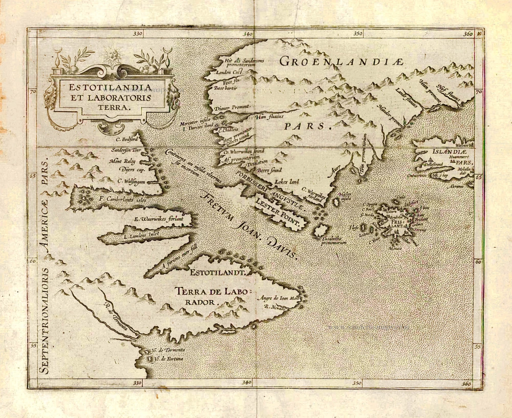
Estotilandia et Laboratoris Terra. 1607
Greenland and Northeast Canada, by C. van Wytfliet.
[Item number: 26499]
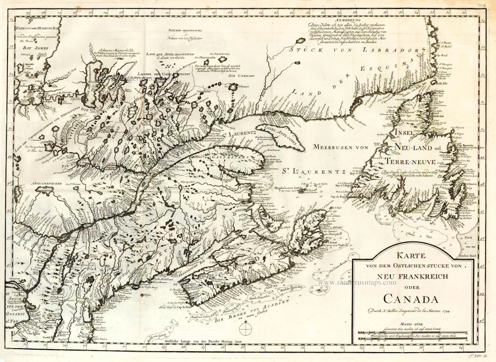
Karte von dem Ostlichen-Stucke von Neu Frankreich oder Canada. 1747-74
Eastern Canada, by Jacques Nicolas Bellin.
[Item number: 26796]
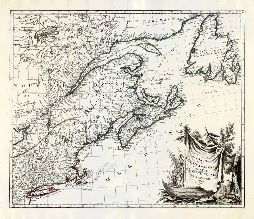
Partie Orientale du Canada, avec la Nouvelle Angleterre, l'Acadie, et la Terre-Neuve. 1776-79
New England and Northeastern Canada, by Paolo Santini.
[Item number: 26982]
Rare.
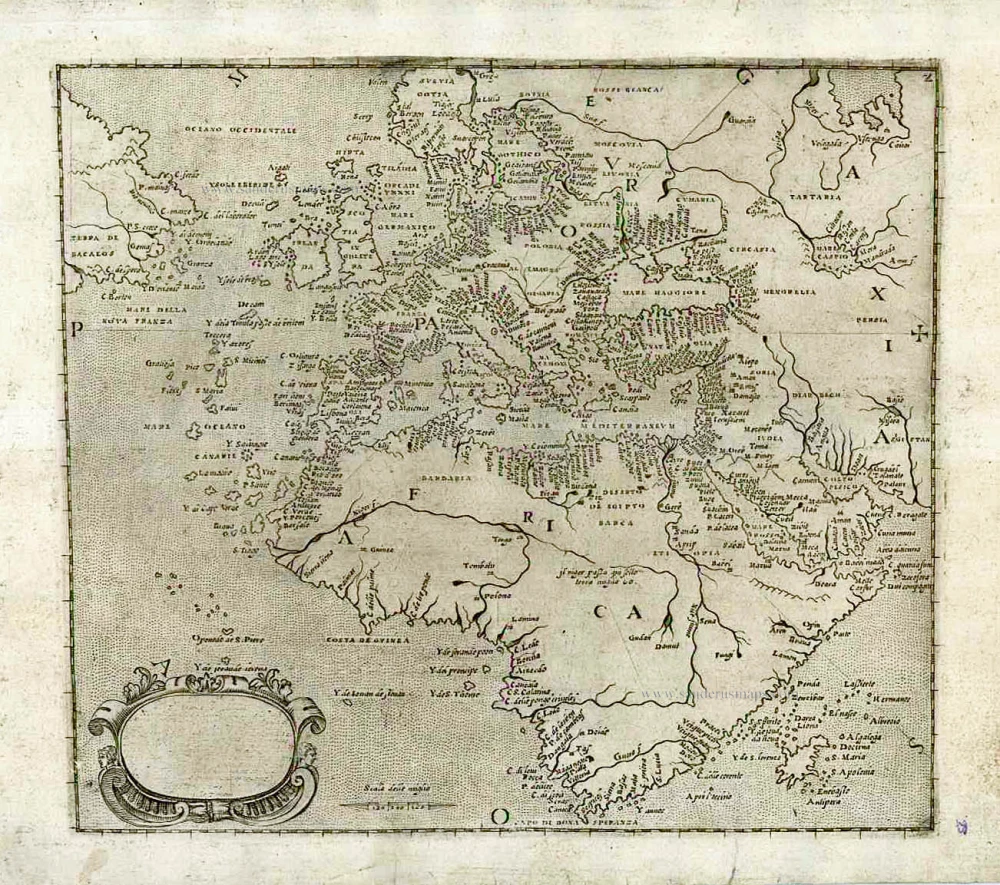
[No title] c. 1575
Atlantic Ocean - Europe, Africa & Eastern Canada by Giovanni Francesco Camocio
[Item number: 27086]
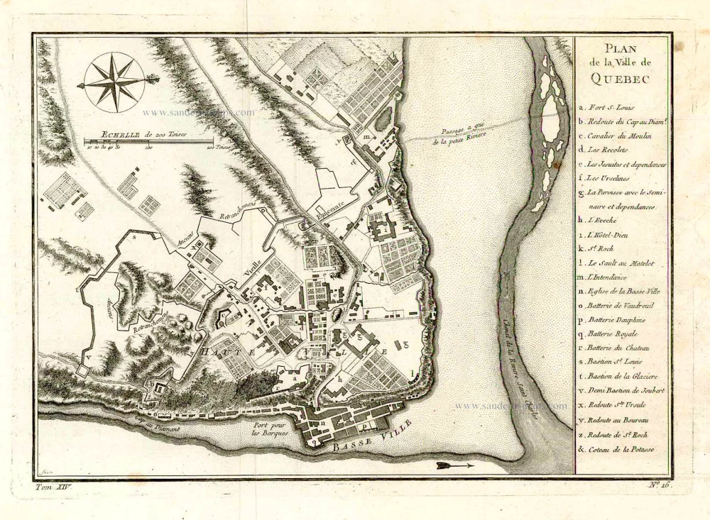
Plan de la Ville de Quebec. 1757
Quebec (Canada), by Jacques-Nicolas Bellin.
[Item number: 27568]

Carte du Canada ou de la Nouvelle France, & des découvertes qui y ont été faites, 1719
Canada by Zacharias Châtelain.
[Item number: 28328]
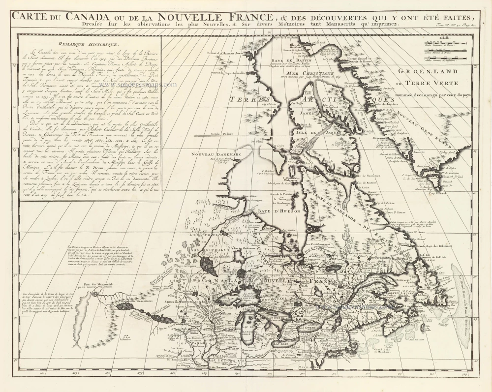
Carte du Canada ou de la Nouvelle France, & des découvertes qui y ont été faites, 1719
Canada, by Zacharias Châtelain.
[Item number: 29367]
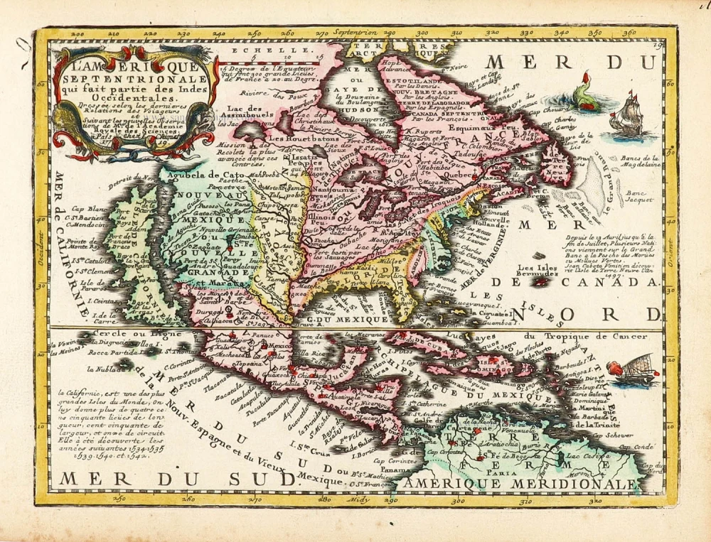
California as an island.
L'Amerique Septentrionale qui fait partie des Indes Occidentales. 1719
North America by Chiquet Jacques.
[Item number: 30085]
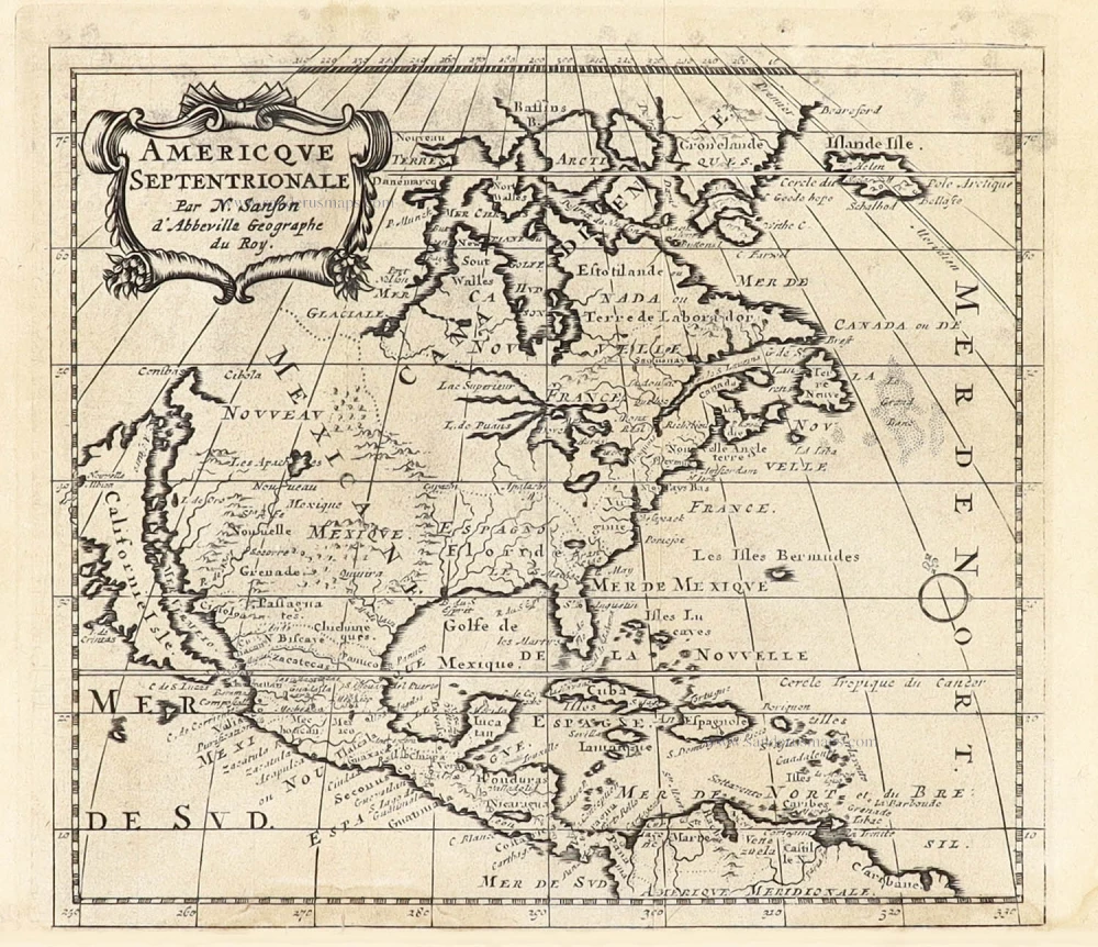
California as an island.
Americque Septentrionale. 1715
North America by Nicolas Sanson, published by Nicolas Chemereau.
[Item number: 30086]

California as an island.
L'America Settentrionale. 1677
North America by Giovanni Giacomo de Rossi.
[Item number: 30088]

Carte de la Partie de l'Amérique Septentrionale, comprenant les Possessions Espagnoles. 1788
North America by Louis Brion de la Tour.
[Item number: 30144]