
Northern Africa, by Abraham Ortelius. 1584

Abraham Ortelius (1527-1598)
The maker of the 'first atlas', the Theatrum Orbis Terrarum (1570), was born on 4 April 1527 into an old Antwerp family. He learned Latin and studied Greek and mathematics.
Abraham and his sisters, Anne and Elizabeth, took up map colouring. Ortelius was admitted to the Guild of St. Luke as an "illuminator of maps." In addition to colouring maps, Ortelius was a dealer in antiques, coins, maps, and books, and the book and map trade gradually became his primary occupation.
Business went well because his means allowed him to amass an extensive collection of medals, coins, and antiques, as well as a library of many volumes. In addition, he travelled extensively, visited Italy and France, made contacts with scholars and editors everywhere, and maintained extensive correspondence with them.
In 1564, he published his first map, a large and ambitious world wall map. The inspiration for this map may well have been Gastaldi's large world map. In 1565, he published a map of Egypt and a map of the Holy Land; a large map of Asia followed.
In 1568, the production of individual maps for his atlas Theatrum Orbis Terrarum was already in full swing. He completed the atlas in 1569, and in May 1570, it was available for sale. It was one of the most expensive books ever published.
This first edition contained seventy maps on fifty-three sheets. Franciscus Hogenberg engraved the maps.
Later editions included Additamenta (additions), resulting in Ortelius' historical atlas, the Parergon, which is mainly bound together with the atlas. The Parergon can be considered a truly original work by Ortelius, who drew the maps based on his research.
The importance of the Theatrum Orbis Terrarum for geographical knowledge in the last quarter of the sixteenth century is difficult to overemphasise. Nothing was like it until Mercator's atlas appeared twenty-five years later. Demand for the Theatrum was remarkable. Some 24 editions appeared during Ortelius's lifetime, and another 10 after he died in 1598. Editions were published in Dutch, German, French, Spanish, English, and Italian. The number of map sheets grew from 53 in 1570 to 167 in the last edition in 1612.
In 1577, engraver Philip Galle and poet-translator Pieter Heyns published the first pocket-sized edition of the Theatrum, the Epitome. The work was trendy. Over thirty editions of this Epitome were published in different languages.
Ortelius is also remembered for an early idea resembling continental drift: he suggested that the Americas, Europe, and Africa may once have been joined together before separating over time. His work helped shape the development of modern geography and mapmaking.
Barbariae et Biledulgerid, Nova Descriptio.
Item Number: 29356 Authenticity Guarantee
Category: Antique maps > Africa
Old, antique map of Northern Africa, by Abraham Ortelius.
Title: Barbariae et Biledulgerid, Nova Descriptio.
Cum Privilegio.
Date of the first edition: 1570.
Date of this map: 1584.
Copper engraving, printed on paper.
Map size: 332 x 504mm (13.07 x 19.84 inches).
Sheet size: 420 x 550mm (16.54 x 21.65 inches).
Verso: Latin text.
Condition: Original coloured, excellent.
Condition Rating: A+.
From: Theatrum Orbis Terrarum. Antwerp, Christoffel Plantin, 1584. (Van der Krogt, 31:031)
Abraham Ortelius (1527-1598)
The maker of the 'first atlas', the Theatrum Orbis Terrarum (1570), was born on 4 April 1527 into an old Antwerp family. He learned Latin and studied Greek and mathematics.
Abraham and his sisters, Anne and Elizabeth, took up map colouring. Ortelius was admitted to the Guild of St. Luke as an "illuminator of maps." In addition to colouring maps, Ortelius was a dealer in antiques, coins, maps, and books, and the book and map trade gradually became his primary occupation.
Business went well because his means allowed him to amass an extensive collection of medals, coins, and antiques, as well as a library of many volumes. In addition, he travelled extensively, visited Italy and France, made contacts with scholars and editors everywhere, and maintained extensive correspondence with them.
In 1564, he published his first map, a large and ambitious world wall map. The inspiration for this map may well have been Gastaldi's large world map. In 1565, he published a map of Egypt and a map of the Holy Land; a large map of Asia followed.
In 1568, the production of individual maps for his atlas Theatrum Orbis Terrarum was already in full swing. He completed the atlas in 1569, and in May 1570, it was available for sale. It was one of the most expensive books ever published.
This first edition contained seventy maps on fifty-three sheets. Franciscus Hogenberg engraved the maps.
Later editions included Additamenta (additions), resulting in Ortelius' historical atlas, the Parergon, which is mainly bound together with the atlas. The Parergon can be considered a truly original work by Ortelius, who drew the maps based on his research.
The importance of the Theatrum Orbis Terrarum for geographical knowledge in the last quarter of the sixteenth century is difficult to overemphasise. Nothing was like it until Mercator's atlas appeared twenty-five years later. Demand for the Theatrum was remarkable. Some 24 editions appeared during Ortelius's lifetime, and another 10 after he died in 1598. Editions were published in Dutch, German, French, Spanish, English, and Italian. The number of map sheets grew from 53 in 1570 to 167 in the last edition in 1612.
In 1577, engraver Philip Galle and poet-translator Pieter Heyns published the first pocket-sized edition of the Theatrum, the Epitome. The work was trendy. Over thirty editions of this Epitome were published in different languages.
Ortelius is also remembered for an early idea resembling continental drift: he suggested that the Americas, Europe, and Africa may once have been joined together before separating over time. His work helped shape the development of modern geography and mapmaking.
Related items

Africae Propriae Tabula. 1624
Ancient Northern Africa, by Ortelius A.
[Item number: 2053]

Barbaria 1613-16
Northern Africa by J. Hondius
[Item number: 13746]

Africae Propriae Tabula .. 1645-58
Northern Africa, by Janssonius J.
[Item number: 19443]

Barbarien tusschen C. de Tenes en C. de Rosa. t' Amsterdam, By Hendrick Doncker. 1664
Northern Africa, by Doncker H.
[Item number: 21375]

Barbariae et Biledulgerid, Nova Descriptio. 1601
Northern Africa, by A. Ortelius.
[Item number: 22524]

Barbaria 1662
Northern Africa, by Blaeu J.
[Item number: 22814]

Nouvelle Carte du Roiaume d'Alger, divisée en toutes ses provinces, avec une partie du Côtes d'Espagne &c. 1756
Northern Africa - Algeria (Algiers) by Ottens R. & J.
[Item number: 23495]

Barbaria c. 1680
Northern Africa, by F. de Wit.
[Item number: 24490]

Barbarie, Biledulgerid, (autrefois Libye) et une partie du Pays des Negres. 1713
Northern Africa (Barbary), by Pieter van der Aa.
[Item number: 26154]

Tabula nova partis Africae. 1525
Northern Africa by Lorenz Fries
[Item number: 27946]

Ptolemaic map of the African continent
[Title on verso:] Tabula .IIII. Aphricae. 1525
Africa, by Lorenz Fries,
[Item number: 27976]
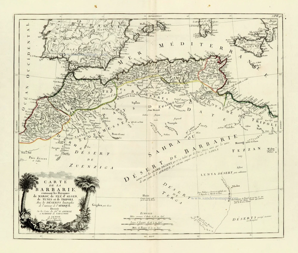
Carte de la Barbarie, contenant les Royaumes de Maroc, de Fez, d'Alger, de Tunis et de Tripoli, Avec les Déserts limitrophes de l'intérieur de l'Afrique. 1776-79
Northern Africa, by Francesco Santini.
[Item number: 28098]

Nova Barbariae Descriptio. 1657
Northern Africa by Joannes Janssonius.
[Item number: 28219]

AFR. II. TAB. 1605
Northern Africa by Claudius Ptolemy, published by Jodocus Hondius.
[Item number: 28884]

Parergon map
Africae Propriae Tabula, In qua, Punica regna vides; Tyrios, et Agenoris urbem. 1609
Abraham Ortelius, Ancient Northern Africa.
[Item number: 29348]

Carte Particuliere de l'Egypte, de la Nubie et de l'Abyssinie. 1719
Northeast Africa & Arabia, by Z. Châtelain.
[Item number: 29371]

Antiquorum Africae Episcopatuum Geographice Descriptio. 1640
Northern Africa by Melchior Tavernier, published for Nicolas Sanson.
[Item number: 30001]

Tabula Aphricae III. 1545
Northern Africa by Sebastian Münster.
[Item number: 30293]

Barbaria. 1618
Northern Africa by Petrus Bertius, published by Jodocus Hondius II.
[Item number: 32067]