
Canada: Gulf of St. Lawrence - New Foundland - Nova Scotia by John Gibson. c. 1762
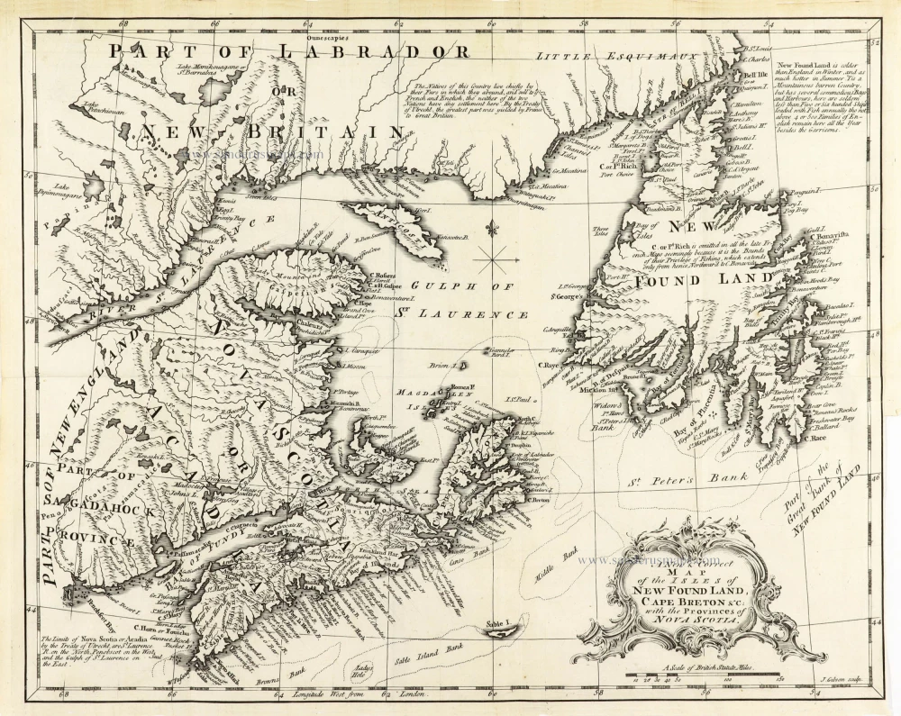
John Gibson (flourished in London 1750-1792)
Cartographer, engraver and draughtsman who spent most of his life in prison because of several debts. He produced thousands of maps. In 1758, he published a pocket atlas, The Atlas Minimus.
A New & Correct Map of the Isles of New Found Land, Cape Breton &c: with the Provinces of Nova Scotia.
Item Number: 30405 Authenticity Guarantee
Category: Antique maps > America > North America
Canada: Gulf of St. Lawrence - New Foundland - Nova Scotia by John Gibson.
Title: A New & Correct Map of the Isles of New Found Land, Cape Breton &c: with the Provinces of Nova Scotia.
J. Gibson sculp.
Engraver: John Gibson.
Date: c. 1762.
Copper engraving, printed on paper.
Image size: 280 x 345mm (11.02 x 13.58 inches).
Sheet size: 290 x 360mm (11.42 x 14.17 inches).
Verso: Blank.
Condition: Folds as issued, excellent.
Condition Rating: A+.
John Gibson (flourished in London 1750-1792)
Cartographer, engraver and draughtsman who spent most of his life in prison because of several debts. He produced thousands of maps. In 1758, he published a pocket atlas, The Atlas Minimus.
Related items
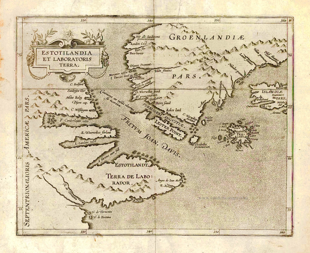
Estotilandia et Laboratoris Terra. 1607
Greenland and Northeast Canada, by C. van Wytfliet.
[Item number: 26499]
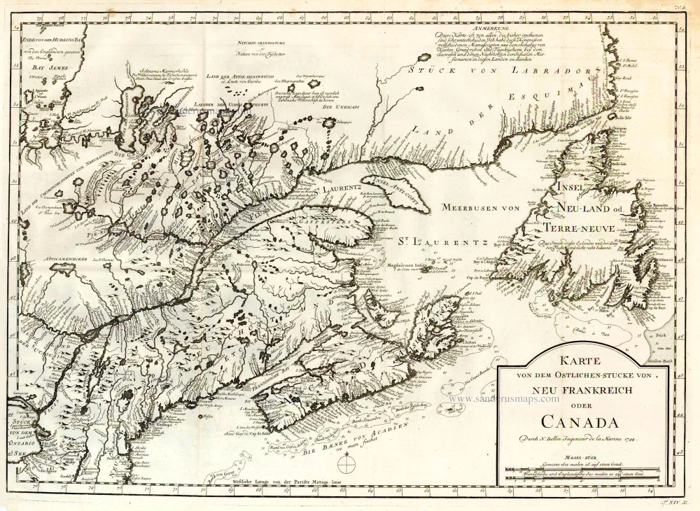
Karte von dem Ostlichen-Stucke von Neu Frankreich oder Canada. 1747-74
Eastern Canada, by Jacques Nicolas Bellin.
[Item number: 26796]
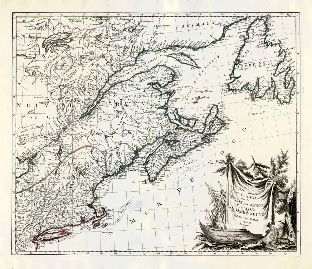
Partie Orientale du Canada, avec la Nouvelle Angleterre, l'Acadie, et la Terre-Neuve. 1776-79
New England and Northeastern Canada, by Paolo Santini.
[Item number: 26982]
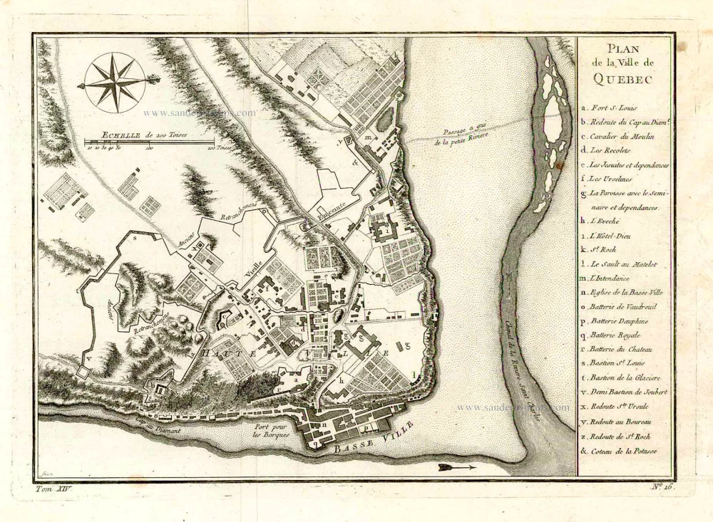
Plan de la Ville de Quebec. 1757
Quebec (Canada), by Jacques-Nicolas Bellin.
[Item number: 27568]

Carte du Canada ou de la Nouvelle France, & des découvertes qui y ont été faites, 1719
Canada by Zacharias Châtelain.
[Item number: 28328]

Septemtrionaliora Americae à Groenlandia, per Freta Davidis et Hudson, ad Terram Novam = De Noordelyckste Zee kusten van America van Goenland door de Straet Davis ende Straet Hudson tot Terra Neuf. c. 1690
North-Eastern Coasts of North America (Canada), by Frederick de Wit.
[Item number: 29242]