
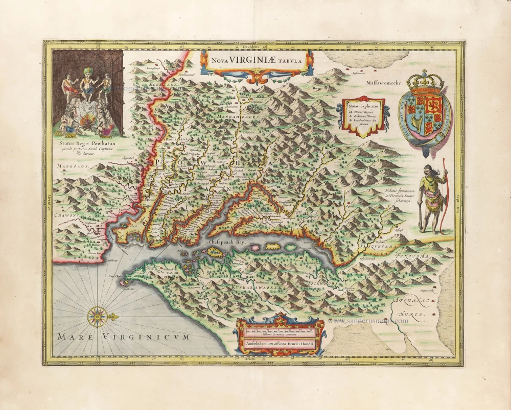
Virginia by Willem Blaeu. 1647
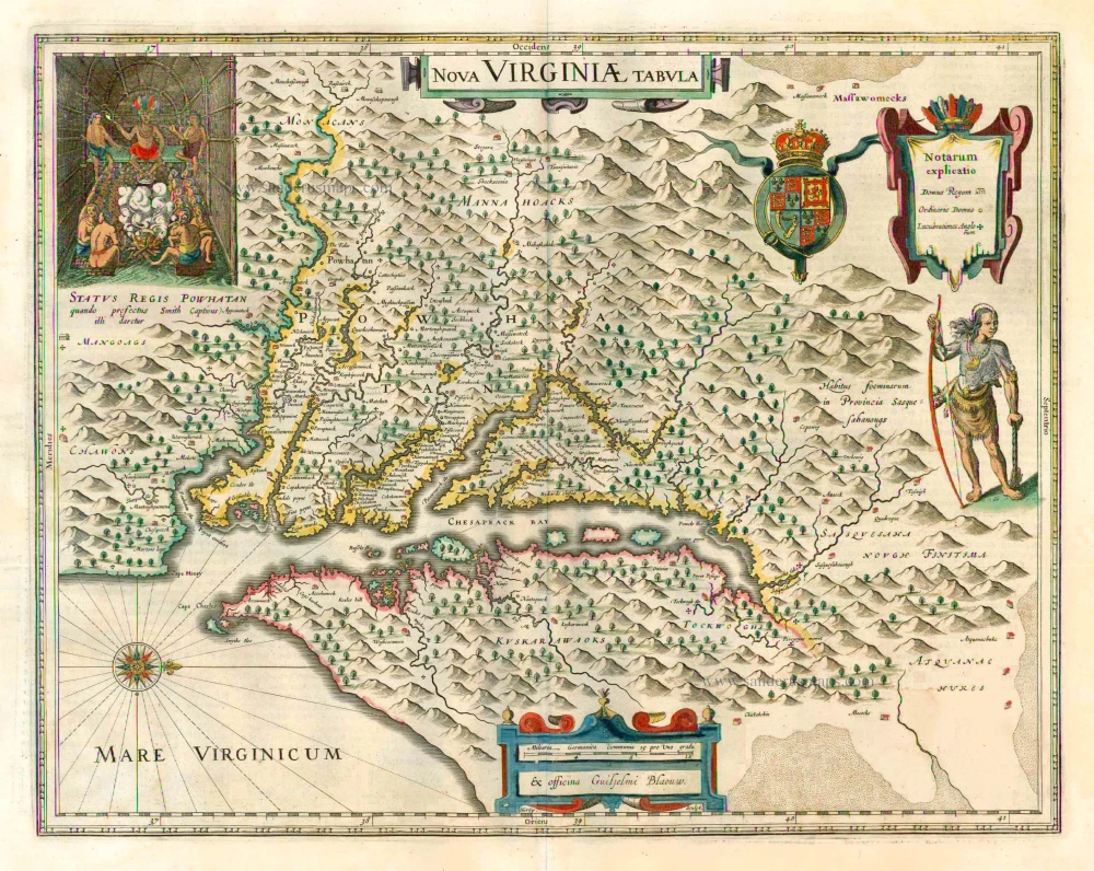
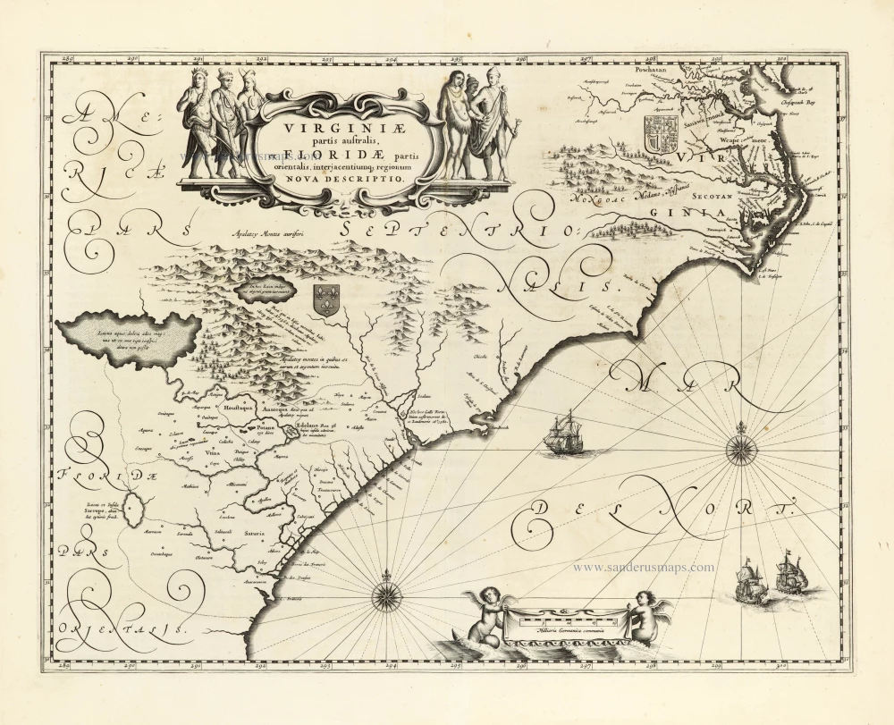
This is Jodocus Hondius' Jr derivative of John Smith's highly important map of Virginia, 1612. After the death of Jodocus, Willem Blaeu acquired a number of plates from the estate. About thirty of these formed the nucleus of Blaeu's Atlantis Appendix of 1630. This challenge to the atlas of Henricus Hondius, which was now quite dated, stimulated fierce competition between the two houses. Taken from the first state of the Smith, it continues the coastlines where the former had left them vague. The royal arms at the top lack the motto and a third cartouche is introduced to contain the Notarum explicatio.
The Blaeus: Willem Janszoon, Cornelis & Joan
Willem Jansz. Blaeu and his son Joan Blaeu are the seventeenth century's most widely known cartographic publishers.
Willem Jansz. (also written Guilielmus Janssonius) = Willem Janszoon Blaeu was born in Uitgeest (Netherlands), near Alkmaar, in 1571. He studied mathematics under Tycho Brahe and learned the theory and practice of astronomical observations and the art of instrument- and globe-making.
In 1596, he came to Amsterdam, where he settled down as a globe-, instrument- and mapmaker. He published his first cartographic work (a globe) in 1599 and probably published his first printed map (a map of the Netherlands) in 1604. He specialised in maritime cartography, published the first edition of the pilot guide Het Licht der Zeevaert in 1608, and was appointed Hydrographer of the V.O.C. (United East India Company) in 1633. After publishing books, wall maps, globes, charts and pilot guides for thirty years, he brought out his first atlas, Atlas Appendix (1630). This was the beginning of the great tradition of atlas-making by the Blaeus.
In 1618, another mapmaker, bookseller and publisher, Johannes Janssonius, established himself in Amsterdam next door to Blaeu's shop. No wonder these two neighbours began accusing each other of copying and stealing their information and became fierce competitors who did not have a good word to say about each other. In about 1621 Willem Jansz. decided to end the confusion between his name and his competitor's and assumed his grandfather's nickname, 'blauwe Willem' ('blue Willem'), as the family name; after that, he called himself Willem Jansz. Blaeu.
Willem Janszoon Blaeu died in 1638, leaving his prospering business to his sons, Cornelis and Joan. We only know that Cornelis's name occurs in the prefaces of books and atlases until c. 1645.
Joan Blaeu, born in Amsterdam in 1596, became a partner in his father's book trade and printing business. 1638, he was appointed his father's successor in the Hydrographic Office of the V.O.C. His efforts culminated in the magnificent Atlas Major and the town books of the Netherlands and Italy – works unsurpassed in history and modern times, giving eternal fame to the name of the Blaeu's.
A fire ruined the business on February 23, 1672, and one year later, Dr. Joan Blaeu died. The fire and the director's passing caused the complete sale of the Blaeu House's stock. Five public auctions dispersed the remaining books, atlases, copperplates, globes, etc., among many other map dealers and publishers in Amsterdam. The majority was acquired by several booksellers acting in partnership.
In the succeeding years, the remaining printing department remained in the hands of the Blaeu family until 1695, when the printing house's inventory was sold at a public auction. That meant the end of the Blaeu family as a printing house of world renown.
The Hondius Family
Jodocus Hondius the Elder (1563-1612)
Joost d’Hondt was born at Wakken (Flanders) in 1563. Two years later, his family settled in Ghent, where young Joost displayed an excellent gift for drawing and calligraphy. Through study and lessons, he developed his talents and became an engraver with a good reputation.
Due to the circumstances of the war, he moved to London in 1584, where he settled down as an engraver, instrument-maker, and map-maker. In 1587, he married Coletta van den Keere, sister of the well-known engraver Pieter van den Keere (Petrus Kaerius); some years earlier, his sister, Jacomina, had married Pieter van den Berghe (Petrus Montanus). Joost, who had Latinized his name to Jodocus Hondius, closely co-operated with his two brothers-in-law.
The political situation in the Northern Netherlands in 1593 was such that Jodocus seemed justified in establishing himself in Amsterdam, where many Antwerp printers, publishers, and engravers had gone. In this new centre of cartography, Jodocus Hondius set up his business “In de Wackere Hondt” (in the vigilant dog), this name being an allusion to his birthplace and name. He engraved many maps and published atlases and many other works, such as his continuation of Gerard Mercator’s Atlas.
He suddenly passed away in February 1612. The publishing firm of Jodocus Hondius was continued by his widow, later on, by his two sons, Jodocus Jr. and Henricus, and by his son-in-law, J. Janssonius.
Jodocus Hondius II (1594-1629) & Henricus Hondius (1597-1651)
After the father’s death, the widow and her seven children continued publishing the atlases under the name of Jodocus Hondius till 1620. The firm was reinforced by the very welcome help of Joannes Janssonius (1588-1664), who married 24-year-old Elisabeth Hondius in 1612. After 1619, Mercator’s Atlas was published under the name of Henricus Hondius.
One of the most dramatic events in the early history of commercial cartography in Amsterdam was the sale of Jodocus Hondius Jr.’s copper plates to Willem Jansz. Blaeu in 1629, the year of his death. At least 34 plates, from which Jodocus II had printed single-sheet maps for his benefit, passed into the hands of his great competitor. Immediately after that, his brother, Henricus, and Joannes Janssonius ordered the engraving of identical plates.
Henricus devoted all his energy to publishing the Atlas for an extended period. He saw its growth up to and including the fourth part in 1646; after that, his name no longer figures on the title pages. After 1638, the title of the Atlas was changed to Atlas Novus; Joannes Janssonius mainly carried it on.
The competition with the Blaeu's dates from 1630. In 1630, Willem Janszoon (=Blaeu) first attacked with his Atlantis Appendix. In 1635, Blaeu completed his Theatrum Orbis Terrarum in two volumes with French, Latin, Dutch, and German texts, prompting Henricus Hondius to speed up the enlargement of his Atlas.
Nova Virginiae Tabula
Item Number: 25096 Authenticity Guarantee
Category: Antique maps > America > North America
Old, antique map of Virginia by Willem Blaeu.
Title: Nova Virginiae Tabula
Oriented to the west.
Date of the first edition: 1630.
Date of this map: 1647.
Copper engraving, printed on paper.
Size (not including margins): 375 x 480mm (14.76 x 18.9 inches).
Verso: German text.
Condition: Original coloured, excellent.
Condition Rating: A+.
From: Novus Atlas, Das ist, Weltbeschreibung, Mit schönen newen aussführlichen Land-Taffeln in Kupfer gestochen, und ab den Tag gegeben. Durch Guil. und Johannem Blaeu. Ander Theil. Amsterdam, 1647. (Van der Krogt 2, 232.2J)
This is Jodocus Hondius' Jr derivative of John Smith's highly important map of Virginia, 1612. After the death of Jodocus, Willem Blaeu acquired a number of plates from the estate. About thirty of these formed the nucleus of Blaeu's Atlantis Appendix of 1630. This challenge to the atlas of Henricus Hondius, which was now quite dated, stimulated fierce competition between the two houses. Taken from the first state of the Smith, it continues the coastlines where the former had left them vague. The royal arms at the top lack the motto and a third cartouche is introduced to contain the Notarum explicatio.
The Blaeus: Willem Janszoon, Cornelis & Joan
Willem Jansz. Blaeu and his son Joan Blaeu are the seventeenth century's most widely known cartographic publishers.
Willem Jansz. (also written Guilielmus Janssonius) = Willem Janszoon Blaeu was born in Uitgeest (Netherlands), near Alkmaar, in 1571. He studied mathematics under Tycho Brahe and learned the theory and practice of astronomical observations and the art of instrument- and globe-making.
In 1596, he came to Amsterdam, where he settled down as a globe-, instrument- and mapmaker. He published his first cartographic work (a globe) in 1599 and probably published his first printed map (a map of the Netherlands) in 1604. He specialised in maritime cartography, published the first edition of the pilot guide Het Licht der Zeevaert in 1608, and was appointed Hydrographer of the V.O.C. (United East India Company) in 1633. After publishing books, wall maps, globes, charts and pilot guides for thirty years, he brought out his first atlas, Atlas Appendix (1630). This was the beginning of the great tradition of atlas-making by the Blaeus.
In 1618, another mapmaker, bookseller and publisher, Johannes Janssonius, established himself in Amsterdam next door to Blaeu's shop. No wonder these two neighbours began accusing each other of copying and stealing their information and became fierce competitors who did not have a good word to say about each other. In about 1621 Willem Jansz. decided to end the confusion between his name and his competitor's and assumed his grandfather's nickname, 'blauwe Willem' ('blue Willem'), as the family name; after that, he called himself Willem Jansz. Blaeu.
Willem Janszoon Blaeu died in 1638, leaving his prospering business to his sons, Cornelis and Joan. We only know that Cornelis's name occurs in the prefaces of books and atlases until c. 1645.
Joan Blaeu, born in Amsterdam in 1596, became a partner in his father's book trade and printing business. 1638, he was appointed his father's successor in the Hydrographic Office of the V.O.C. His efforts culminated in the magnificent Atlas Major and the town books of the Netherlands and Italy – works unsurpassed in history and modern times, giving eternal fame to the name of the Blaeu's.
A fire ruined the business on February 23, 1672, and one year later, Dr. Joan Blaeu died. The fire and the director's passing caused the complete sale of the Blaeu House's stock. Five public auctions dispersed the remaining books, atlases, copperplates, globes, etc., among many other map dealers and publishers in Amsterdam. The majority was acquired by several booksellers acting in partnership.
In the succeeding years, the remaining printing department remained in the hands of the Blaeu family until 1695, when the printing house's inventory was sold at a public auction. That meant the end of the Blaeu family as a printing house of world renown.
The Hondius Family
Jodocus Hondius the Elder (1563-1612)
Joost d’Hondt was born at Wakken (Flanders) in 1563. Two years later, his family settled in Ghent, where young Joost displayed an excellent gift for drawing and calligraphy. Through study and lessons, he developed his talents and became an engraver with a good reputation.
Due to the circumstances of the war, he moved to London in 1584, where he settled down as an engraver, instrument-maker, and map-maker. In 1587, he married Coletta van den Keere, sister of the well-known engraver Pieter van den Keere (Petrus Kaerius); some years earlier, his sister, Jacomina, had married Pieter van den Berghe (Petrus Montanus). Joost, who had Latinized his name to Jodocus Hondius, closely co-operated with his two brothers-in-law.
The political situation in the Northern Netherlands in 1593 was such that Jodocus seemed justified in establishing himself in Amsterdam, where many Antwerp printers, publishers, and engravers had gone. In this new centre of cartography, Jodocus Hondius set up his business “In de Wackere Hondt” (in the vigilant dog), this name being an allusion to his birthplace and name. He engraved many maps and published atlases and many other works, such as his continuation of Gerard Mercator’s Atlas.
He suddenly passed away in February 1612. The publishing firm of Jodocus Hondius was continued by his widow, later on, by his two sons, Jodocus Jr. and Henricus, and by his son-in-law, J. Janssonius.
Jodocus Hondius II (1594-1629) & Henricus Hondius (1597-1651)
After the father’s death, the widow and her seven children continued publishing the atlases under the name of Jodocus Hondius till 1620. The firm was reinforced by the very welcome help of Joannes Janssonius (1588-1664), who married 24-year-old Elisabeth Hondius in 1612. After 1619, Mercator’s Atlas was published under the name of Henricus Hondius.
One of the most dramatic events in the early history of commercial cartography in Amsterdam was the sale of Jodocus Hondius Jr.’s copper plates to Willem Jansz. Blaeu in 1629, the year of his death. At least 34 plates, from which Jodocus II had printed single-sheet maps for his benefit, passed into the hands of his great competitor. Immediately after that, his brother, Henricus, and Joannes Janssonius ordered the engraving of identical plates.
Henricus devoted all his energy to publishing the Atlas for an extended period. He saw its growth up to and including the fourth part in 1646; after that, his name no longer figures on the title pages. After 1638, the title of the Atlas was changed to Atlas Novus; Joannes Janssonius mainly carried it on.
The competition with the Blaeu's dates from 1630. In 1630, Willem Janszoon (=Blaeu) first attacked with his Atlantis Appendix. In 1635, Blaeu completed his Theatrum Orbis Terrarum in two volumes with French, Latin, Dutch, and German texts, prompting Henricus Hondius to speed up the enlargement of his Atlas.
Related items
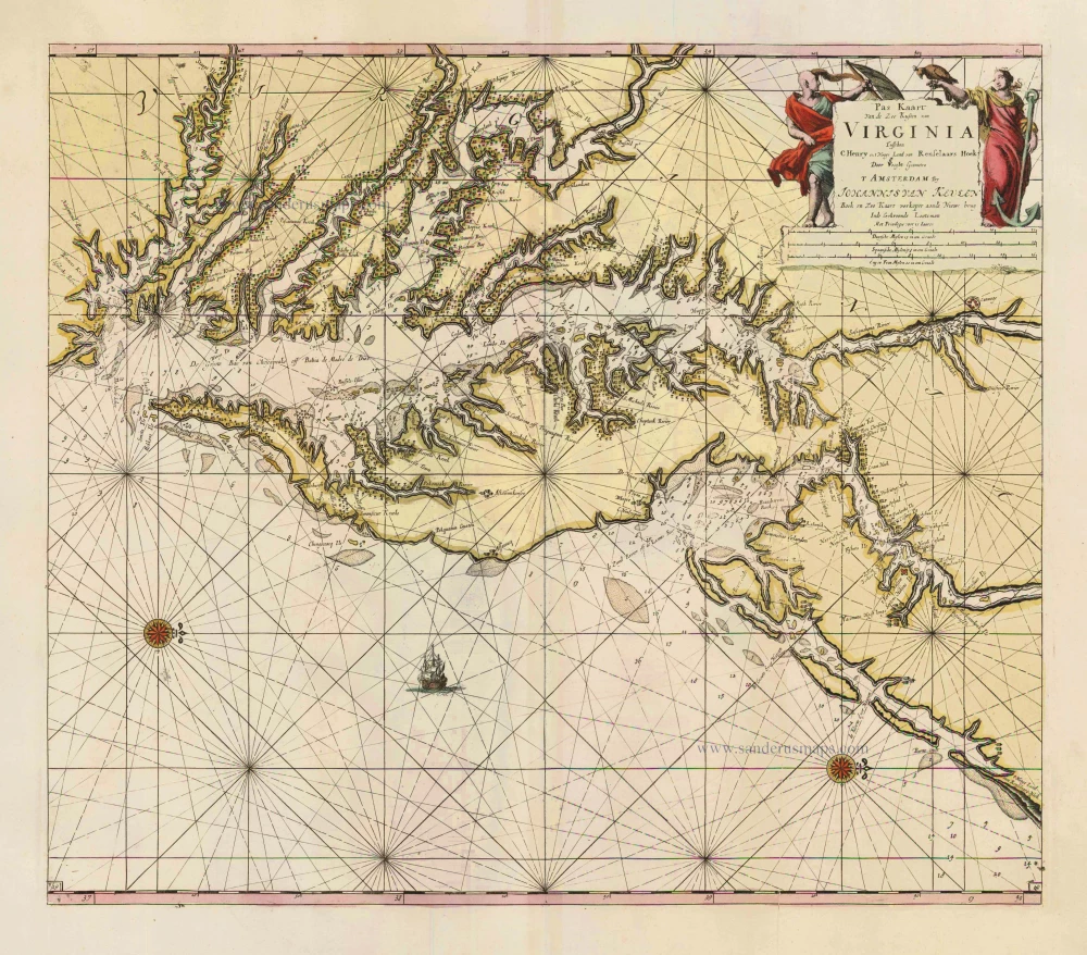
Pas Kaart van de Zee Kusten van Virginia tusschen C. Henry en t Hooge Land van Renselaars Hoek. 1702
Virginia by Johannes van Keulen
[Item number: 1332]
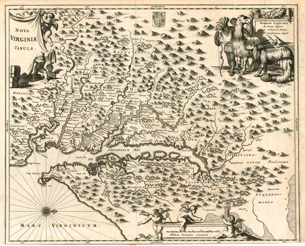
Nova Virginiae Tabula. 1671
Virginia, by A. Montanus.
[Item number: 25613]
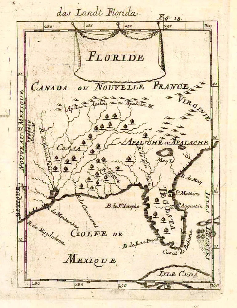
Floride. 1685
Florida, Virginia and Louisiana, by A.M. Mallet.
[Item number: 26599]
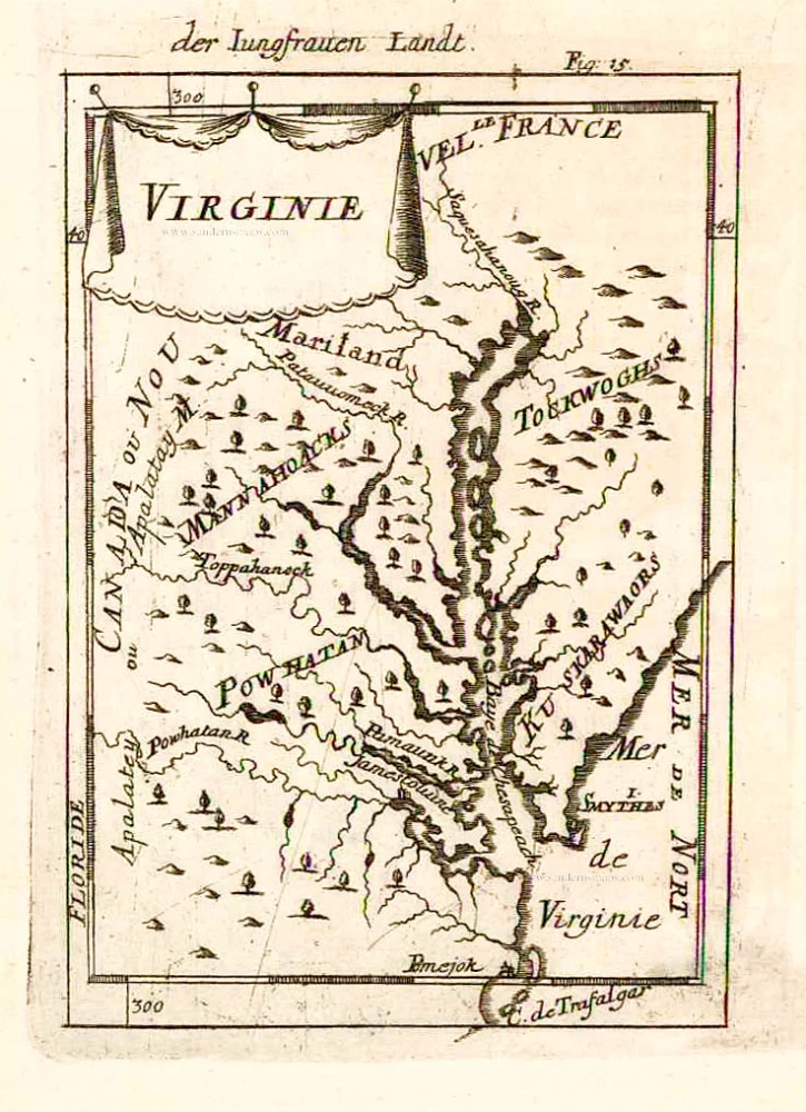
Virginie. 1685
Virginia and Maryland, by A.M. Mallet.
[Item number: 26602]
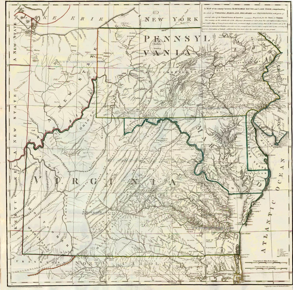
A Map of the country between Albemarle Sound, and Lake Erie, comprehending the whole of Virginia, Maryland, Delaware and Pensylvania, with parts of several other of the United States of America. 1787
Virginia by Thomas Jefferson
[Item number: 27301]
Nova Virginiae Tabula. 1666
Virginia by Henricus Hondius.
[Item number: 29956]
Luxury colouring
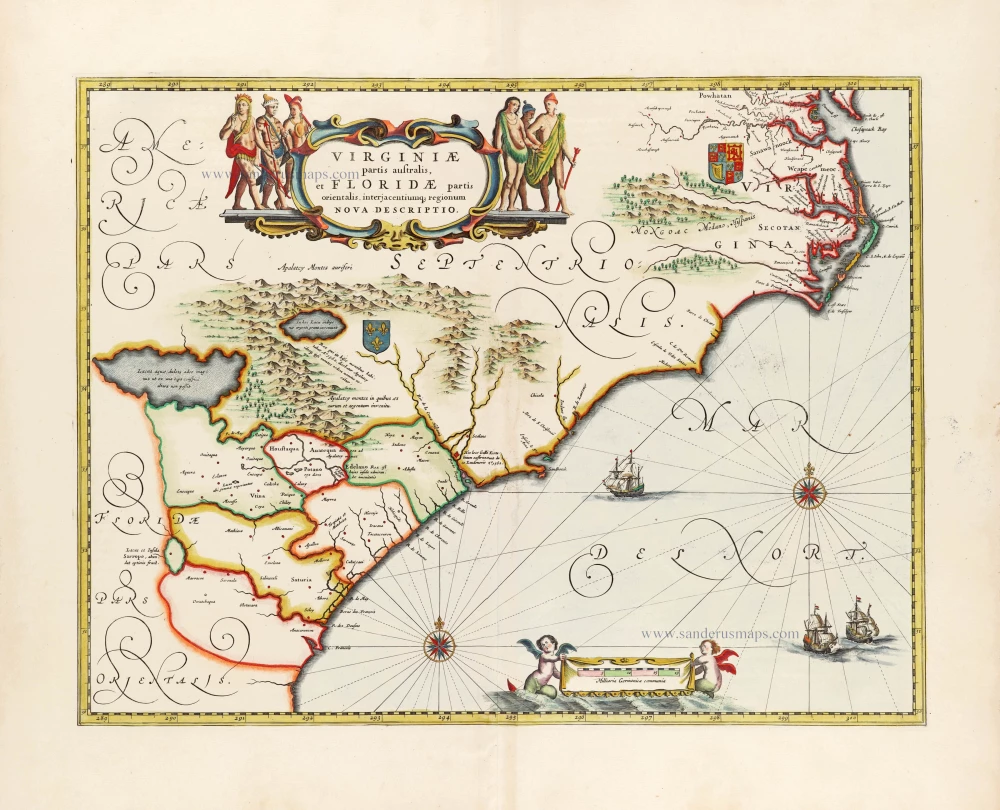
Virginiae partis australis et Floridae partis orientalis, interjacentiumq; regionum Nova Descriptio. 1666
Carolinas and Georgia by Johannes Janssonius
[Item number: 30020]
Virginiae Partis Australis, Et Floridae Partis Orientalis, interjacentiumq regionum Nova Descriptio. 1641
Carolinas and Georgia by Johannes Janssonius.
[Item number: 30319]

D' Engelze Volkplanting in Virginie door Iohan Smith Bezogt en Verder Uytgeset 1707
Virginia, by Pieter Van der Aa.
[Item number: 32400]