
South America by Coronelli V.M. 1691
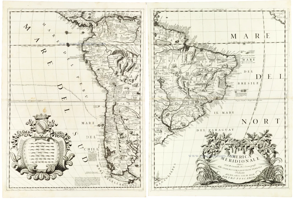
A magnificent and highly detailed two-sheet map of South America by Vincenzo Maria Coronelli, one of the foremost Italian cartographers of the late seventeenth century. Published in Venice in 1691, this impressive map combines extensive geographical information with the elegant Baroque decoration characteristic of Coronelli's cartographic work.
The map depicts the entire South American continent on two separate, unjoined sheets, extending from the Caribbean coast and the Isthmus of Panama in the north to Tierra del Fuego and the Strait of Magellan in the south. The western sheet principally covers the Pacific coast, including present-day Colombia, Ecuador, Peru, Chile, and the western regions of Argentina and Bolivia. The eastern sheet encompasses Venezuela, the Guianas, Brazil, Paraguay, Uruguay, and the Atlantic coast.
Of particular interest is Coronelli's representation of the Amazon basin and the interior of Brazil. The Amazon and its tributaries are depicted in considerable detail, together with numerous indigenous settlements, regional names, and geographical annotations. The interior is filled with mountain ranges, rivers, lakes, and extensive explanatory texts, reflecting the geographical knowledge available to European cartographers at the end of the seventeenth century. The map also records the territorial divisions and colonial settlements established by the Spanish and Portuguese.
Along the western coast, the imposing Andes chain is prominently represented by densely engraved mountain ranges that extend almost the entire length of the continent. Numerous coastal towns, ports, rivers, and geographical features are identified, illustrating the importance of the Pacific coastline to Spanish colonial administration and maritime trade. The southern regions include Patagonia, Tierra del Fuego, and the Strait of Magellan, while the surrounding oceans contain navigational and geographical annotations.
The map is particularly noteworthy for its treatment of the interior of South America, where Coronelli combines information derived from European exploration, missionary accounts, and earlier cartographic traditions. Although the coastlines were relatively well established by this period, the geography of the interior remained imperfectly understood, and the map preserves several geographical interpretations characteristic of seventeenth-century cartography.
The decorative elements are exceptionally fine. The eastern sheet features a large, elaborate title cartouche in the lower right corner, with a draped banner surrounded by luxuriant foliage and ornamental plants. It bears the dedication to Pietro Foscarini, a member of the Venetian patriciate. On the western sheet, a magnificent ornamental cartouche in the lower left corner encloses several scales of distance, surmounted by a crowned coat of arms and surrounded by richly engraved scrollwork and botanical decoration.
Coronelli's distinctive engraving style is evident throughout the map, particularly in the detailed representation of mountain ranges, intricate river systems, extensive geographical nomenclature, and carefully engraved coastal outlines. The large format allows extraordinary information density without sacrificing the composition's overall elegance.
An outstanding example of late seventeenth-century Venetian cartography, distinguished by its remarkable geographical detail, impressive representation of the Andes and Amazon basin, and magnificent Baroque ornamentation.
Vincenzo Coronelli (1650-1718)
Vincenzo Coronelli was born in Venice on 16 August 1650 and primarily brought up in Ravenna. He returned to Venice in 1665 and joined the convent of the Minor Conventuals. Five years later, he was sent to Rome to study, and by 1673, he was already a doctor of theology.
Having achieved fame by constructing two globes for the Duke of Parma, he was invited to Paris for three years in 1681 and made two enormous examples for Louis XIV. On his return to Venice, he assiduously collected cartographic material and founded the Academy of the Argonauts. In 1685, he was appointed Cosmographer to the Republic of Venice and authorised to publish a large atlas. He became a geography lecturer at the University of Venice and brought out an Atlante Veneto the following year.
In 1696, he visited Germany, Holland and southern England. During intervals in compiling his vast encyclopaedia, he continued with cartographic projects up to 1709. He died in his native Venice on 9 December 1718.
Coronelli became famous for his globes. In addition, he was a renowned encyclopaedist, mapmaker and geographer. Most of his maps and other material are gathered in his Atlante Veneto (13 vols, 1690-1705). The first volume, subtitled Descrizione generale istorica geografica, was his masterpiece, planned as an extension of Blaeu’s atlas.
Other volumes of the atlas which contain maps are Isolario, two parts (1696-8), with detailed maps and plans, mostly of islands; Corso geografico, two parts based on the edition 1694-7; Libro de’ globi (1697); and Lo Specchio del Mare, a reprint of Levanto's Lo Specchio del Mare Mediterraneo of 1664.
The other vital aspects of his mapping are those arising from the Venetian conquest and his travels. His most extensive military compilation was the Teatro della Guerra, in more than 30 volumes.
America Meridionale
Item Number: 33309 new Authenticity Guarantee
Category: Antique maps > America > South America
South America by Coronelli V.M.
Title: America Meridionale
Auttore H.P.M. Coronelli M.C. Cosmografo della Serenissima Repub. di Venetia Dedicata all'Ill, et Ecc. Sig. Il Sign. Pietro Foscarini.
Date of the first edition: 1691.
Date of this map: 1691.
Copper engravings, printed on paper, two double sheets, unjoined.
Image size each: 605 x 455mm (23¾ x 18 inches).
Sheet size each: 645 x 475mm (25½ x 18¾ inches).
Verso: Blank.
Condition: Excellent.
Condition Rating: A.
From: Atlante Veneto, nel quale si contiene la descrittione... degl' Imperii, Regni, Provincie, e Stati dell' Universo. Venice: Girolamo Albrizzi, 1691. Shirley (Brit.Lib.), T.CORO-7a
A magnificent and highly detailed two-sheet map of South America by Vincenzo Maria Coronelli, one of the foremost Italian cartographers of the late seventeenth century. Published in Venice in 1691, this impressive map combines extensive geographical information with the elegant Baroque decoration characteristic of Coronelli's cartographic work.
The map depicts the entire South American continent on two separate, unjoined sheets, extending from the Caribbean coast and the Isthmus of Panama in the north to Tierra del Fuego and the Strait of Magellan in the south. The western sheet principally covers the Pacific coast, including present-day Colombia, Ecuador, Peru, Chile, and the western regions of Argentina and Bolivia. The eastern sheet encompasses Venezuela, the Guianas, Brazil, Paraguay, Uruguay, and the Atlantic coast.
Of particular interest is Coronelli's representation of the Amazon basin and the interior of Brazil. The Amazon and its tributaries are depicted in considerable detail, together with numerous indigenous settlements, regional names, and geographical annotations. The interior is filled with mountain ranges, rivers, lakes, and extensive explanatory texts, reflecting the geographical knowledge available to European cartographers at the end of the seventeenth century. The map also records the territorial divisions and colonial settlements established by the Spanish and Portuguese.
Along the western coast, the imposing Andes chain is prominently represented by densely engraved mountain ranges that extend almost the entire length of the continent. Numerous coastal towns, ports, rivers, and geographical features are identified, illustrating the importance of the Pacific coastline to Spanish colonial administration and maritime trade. The southern regions include Patagonia, Tierra del Fuego, and the Strait of Magellan, while the surrounding oceans contain navigational and geographical annotations.
The map is particularly noteworthy for its treatment of the interior of South America, where Coronelli combines information derived from European exploration, missionary accounts, and earlier cartographic traditions. Although the coastlines were relatively well established by this period, the geography of the interior remained imperfectly understood, and the map preserves several geographical interpretations characteristic of seventeenth-century cartography.
The decorative elements are exceptionally fine. The eastern sheet features a large, elaborate title cartouche in the lower right corner, with a draped banner surrounded by luxuriant foliage and ornamental plants. It bears the dedication to Pietro Foscarini, a member of the Venetian patriciate. On the western sheet, a magnificent ornamental cartouche in the lower left corner encloses several scales of distance, surmounted by a crowned coat of arms and surrounded by richly engraved scrollwork and botanical decoration.
Coronelli's distinctive engraving style is evident throughout the map, particularly in the detailed representation of mountain ranges, intricate river systems, extensive geographical nomenclature, and carefully engraved coastal outlines. The large format allows extraordinary information density without sacrificing the composition's overall elegance.
An outstanding example of late seventeenth-century Venetian cartography, distinguished by its remarkable geographical detail, impressive representation of the Andes and Amazon basin, and magnificent Baroque ornamentation.
Vincenzo Coronelli (1650-1718)
Vincenzo Coronelli was born in Venice on 16 August 1650 and primarily brought up in Ravenna. He returned to Venice in 1665 and joined the convent of the Minor Conventuals. Five years later, he was sent to Rome to study, and by 1673, he was already a doctor of theology.
Having achieved fame by constructing two globes for the Duke of Parma, he was invited to Paris for three years in 1681 and made two enormous examples for Louis XIV. On his return to Venice, he assiduously collected cartographic material and founded the Academy of the Argonauts. In 1685, he was appointed Cosmographer to the Republic of Venice and authorised to publish a large atlas. He became a geography lecturer at the University of Venice and brought out an Atlante Veneto the following year.
In 1696, he visited Germany, Holland and southern England. During intervals in compiling his vast encyclopaedia, he continued with cartographic projects up to 1709. He died in his native Venice on 9 December 1718.
Coronelli became famous for his globes. In addition, he was a renowned encyclopaedist, mapmaker and geographer. Most of his maps and other material are gathered in his Atlante Veneto (13 vols, 1690-1705). The first volume, subtitled Descrizione generale istorica geografica, was his masterpiece, planned as an extension of Blaeu’s atlas.
Other volumes of the atlas which contain maps are Isolario, two parts (1696-8), with detailed maps and plans, mostly of islands; Corso geografico, two parts based on the edition 1694-7; Libro de’ globi (1697); and Lo Specchio del Mare, a reprint of Levanto's Lo Specchio del Mare Mediterraneo of 1664.
The other vital aspects of his mapping are those arising from the Venetian conquest and his travels. His most extensive military compilation was the Teatro della Guerra, in more than 30 volumes.
Related items

Carte Particuliere du Perou, de la Ville de Lima. 1713-1719
South America (Northwest), by Zacharias Châtelain.
[Item number: 16838]

Important and rare map
Brasilia et Peruvia ... 1593
South America, by Cornelis de Jode.
[Item number: 25240]

Very rare first state
Neuwe Landtaffel, in welcher eigentlich, und warhafftiglich furgestelt wird, das gewaltige und goldtreiche Kunigreich Guiana : so daligt under der aequinoctial Linien zwischer Brasilien und Peru / observiert und abgerisen von ein emschiffman so selbst mit her Ralegh der fahrt gewessen. 1599
Guyana by Theodor de Bry.
[Item number: 27037]

La Partie Méridionale De L'Amérique Appeéee Terre Ferme ou se trouve Les Provinces ou Grand Gouvernemens de La Guiane et de La Nouvelle Grenade . . . 1709-28
Northern South America, by Nicolas de Fer.
[Item number: 27572]

Le Paraguayr, Le Chili, la Terre, et les Isles Magellanicques. 1692
Southern South America by Nicolas Sanson.
[Item number: 28502]

Partie de Terre Ferme ou sont Guiane et Caribane. 1658
Guiana by Nicolas Sanson.
[Item number: 28504]
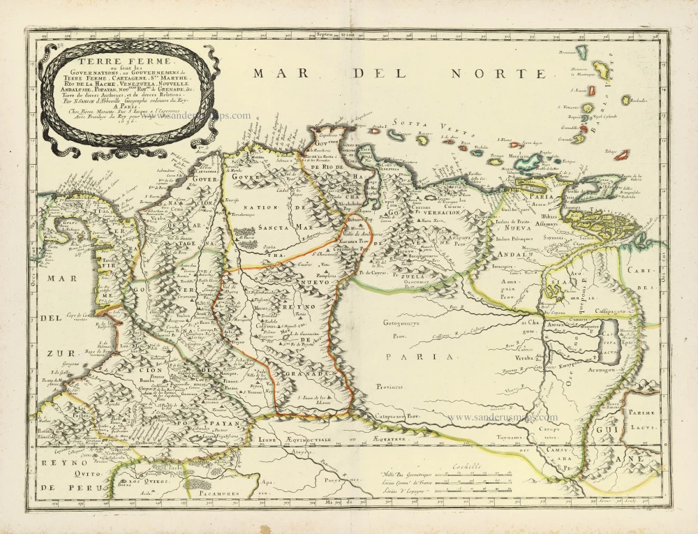
Terre Ferme ou sont les Governations, ou Gouvernemens de Terre Ferme, Cartagene, Ste. Marthe, Rio de la Hache, Venezuela, Nouvelle Andalusie, Popayan, Nouveau Roy[au]me de Grenade, &c. 1658
Northern South America by Nicolas Sanson.
[Item number: 28505]

La Terre et les Isles Magellaniques. 1670
Southern South America with the Straits of Magellan, by Guillaume Sanson.
[Item number: 28510]

L'Amerique Meridionale Divisee en ses Principales Parties. [Above map:] America Meridionalis in suas Praecipuas Partes Accurate Divisa, ad Usum Serenissimi Burgundiae Ducis. c. 1691-97
South America, by Hubert Jaillot.
[Item number: 29153]

Tractus Australior Americae Meridionalis, a Rio del a Plata per Fretum Magellanicum ad Toraltum. = Nieuwe Perfecte Pascaert van 't Suyderlyckste deel van Suyt America. van Rio de la Plata door de straet Magellaen tot Toral. c. 1690-91
Sea chart of the Southern Coasts of South America, by Frederick de Wit.
[Item number: 29239]

Carte du Paraguai, du Chili, du Detroit de Magellan &c. 1719
Southern South America, by Zacharias Châtelain.
[Item number: 29361]
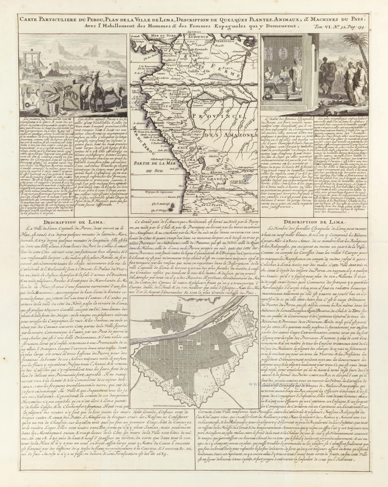
Carte Particuliere du Perou, Plan de la Ville de Lima, Description de quelques plantes, animaux, & Machines du Pays. 1719
Northwest South America, by Zacharias Châtelain.
[Item number: 29363]

Amerique Meridionale Divisée en ses Principales Parties ou sont Distingués les uns des Autres les Estats Suivant qu'ils appartienent présentement, aux François, Castillans, Portugais, Hollandois, &c. 1692
South America by N. Sanson, so-called published by Hubert Jaillot. (Pirated edition by Pierre Mortier).
[Item number: 31143]
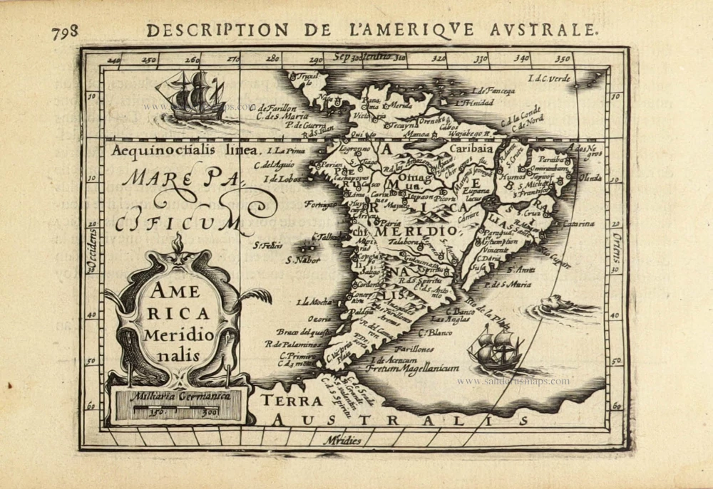
America Meridionalis. 1618
South America, by Petrus Bertius.
[Item number: 32335]

L' America Meridionale. 1677
South America by Nicolas Sanson, published by Giovanni de Rossi.
[Item number: 32897]

Amerique Meridionale. 1659
South America by Nicolas Sanson.
[Item number: 33219]
new