
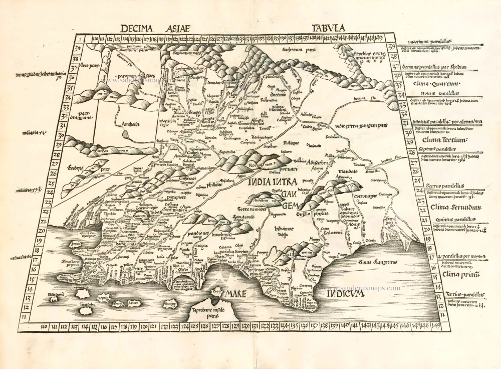
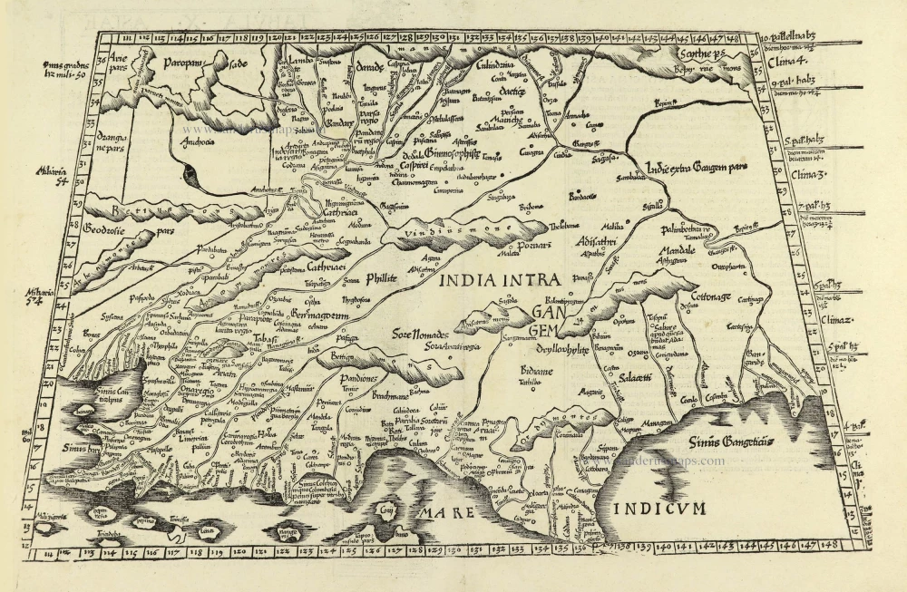
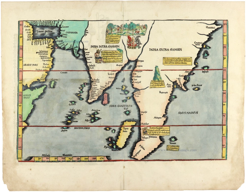
India by Martin Waldseemüller 1513
The Strasbourg Ptolemy is the most important edition of the Geographia. Preparatory work was begun in about 1505 by Martin Waldseemüller, scholar-geographer of the small town of St. Dié in Lorraine, together with his associate Mathias Ringmann. Waldseemüller is believed to have incised many maps himself; all are firm, distinctive woodcuts. By 1507, much progress had been made, but the project was delayed and was not completed until 1513 under the editorship of Jacob Eszler and Georg Ubelin. The printer was Johann Schott, and the work, the first modern atlas, bears a dedication to Emperor Maximilian.
Martin Waldseemüller (Ilacomilus) (c. 1473-1519)
Martin Walseemüller and his collaborator, Matthias Ringmann, are credited with the first recorded usage of the word America to name the New World in honour of the Italian explorer Amerigo Vespucci.
He was born about 1475, most probably in the village of Wolfenweiler near Freiburg in Breisgau (southern Germany). He studied at the University of Freiburg, where he met Johann Scott, the future printer of Waldseemüller’s edition of Ptolemy and Matthias Ringman, a poet who wrote Waldseemüller’s texts. Gregor Reisch was their tutor. He was noted for his philosophical work, Margaretha Philosophica (1503), a widely read book that included a world map in Ptolemaic form. He undoubtedly aroused the students’ interest in cosmography.
At the beginning of the 16th century, Walseemüller moved to St.Dié in the Vosges. He Hellenized his name to Ilacomilus and worked on an edition of Ptolemy. He learned the printing trade in Basle and became a professor of cosmography under the patronage of René II, Duke of Lorraine.
Together with a group of scholars, among them were Nicholas Lud and Matthias Ringmann, they installed a printing press in St. Dié. The first book appeared in 1507: Cosmographiae Introductio… Few books have generated as much interest and speculation as this book because it suggested that the new continent is named America in honour of Amerigo Vespucci, whose letters about his American “discoveries” form a large part of the book. Great interest was also attached to the two maps on the title page constituting part of the Cosmographiae Introductio: a large 12-panel wall map of the world and a set of globe gores. The map and globe were notable for showing the New World as a continent separate from Asia and naming the southern landmass America.
Ringmann wrote the Cosmographiae Introductio's text, using the name ‘America’. He died in 1511, and by then, Waldseemüller was having doubts about the name they had coined.
In 1511, Walseemüller published the Carta Itineraria Europae, a road map of Europe that showed essential trade routes and pilgrim routes from central Europe to Santiago de Compostela, Spain. It was the first printed wall map of Europe.
After Ringmann’s death, Waldseemüller concentrated on the new version of Ptolemy’s Geographia. Johannes Scott finally printed the new edition in 1513 in Strasbourg, and it is now regarded as the most important. Waldseemüller included twenty modern maps in the new Geographia as a separate appendix.
The 1507 wall map was lost for a long time, but Joseph Fischer found a copy in Schloss Wolfegg in southern Germany in 1901. It is the only known copy purchased by the United States Library of Congress in May 2003.
Decima Asiae Tabula.
Item Number: 16495 Authenticity Guarantee
Category: Antique maps > Asia > India - Ceylon
India by Martin Waldseemüller.
Title: Decima Asiae Tabula.
Date of the first edition: 1513.
Date of this map: 1513.
Woodcut, printed on paper.
Size (not including margins): 370 x 520mm (14.57 x 20.47 inches).
Verso: Blank.
Condition: Several filled wormholes, centrefold split in upper margin closed.
Condition Rating: A.
From: Claudii Ptolemei viri Alexandrini Mathematice discipline Philosophi dictissimi Geographiae opus novissima . . . Strassburg, J. Schott, 1513.
The Strasbourg Ptolemy is the most important edition of the Geographia. Preparatory work was begun in about 1505 by Martin Waldseemüller, scholar-geographer of the small town of St. Dié in Lorraine, together with his associate Mathias Ringmann. Waldseemüller is believed to have incised many maps himself; all are firm, distinctive woodcuts. By 1507, much progress had been made, but the project was delayed and was not completed until 1513 under the editorship of Jacob Eszler and Georg Ubelin. The printer was Johann Schott, and the work, the first modern atlas, bears a dedication to Emperor Maximilian.
Martin Waldseemüller (Ilacomilus) (c. 1473-1519)
Martin Walseemüller and his collaborator, Matthias Ringmann, are credited with the first recorded usage of the word America to name the New World in honour of the Italian explorer Amerigo Vespucci.
He was born about 1475, most probably in the village of Wolfenweiler near Freiburg in Breisgau (southern Germany). He studied at the University of Freiburg, where he met Johann Scott, the future printer of Waldseemüller’s edition of Ptolemy and Matthias Ringman, a poet who wrote Waldseemüller’s texts. Gregor Reisch was their tutor. He was noted for his philosophical work, Margaretha Philosophica (1503), a widely read book that included a world map in Ptolemaic form. He undoubtedly aroused the students’ interest in cosmography.
At the beginning of the 16th century, Walseemüller moved to St.Dié in the Vosges. He Hellenized his name to Ilacomilus and worked on an edition of Ptolemy. He learned the printing trade in Basle and became a professor of cosmography under the patronage of René II, Duke of Lorraine.
Together with a group of scholars, among them were Nicholas Lud and Matthias Ringmann, they installed a printing press in St. Dié. The first book appeared in 1507: Cosmographiae Introductio… Few books have generated as much interest and speculation as this book because it suggested that the new continent is named America in honour of Amerigo Vespucci, whose letters about his American “discoveries” form a large part of the book. Great interest was also attached to the two maps on the title page constituting part of the Cosmographiae Introductio: a large 12-panel wall map of the world and a set of globe gores. The map and globe were notable for showing the New World as a continent separate from Asia and naming the southern landmass America.
Ringmann wrote the Cosmographiae Introductio's text, using the name ‘America’. He died in 1511, and by then, Waldseemüller was having doubts about the name they had coined.
In 1511, Walseemüller published the Carta Itineraria Europae, a road map of Europe that showed essential trade routes and pilgrim routes from central Europe to Santiago de Compostela, Spain. It was the first printed wall map of Europe.
After Ringmann’s death, Waldseemüller concentrated on the new version of Ptolemy’s Geographia. Johannes Scott finally printed the new edition in 1513 in Strasbourg, and it is now regarded as the most important. Waldseemüller included twenty modern maps in the new Geographia as a separate appendix.
The 1507 wall map was lost for a long time, but Joseph Fischer found a copy in Schloss Wolfegg in southern Germany in 1901. It is the only known copy purchased by the United States Library of Congress in May 2003.
Related items
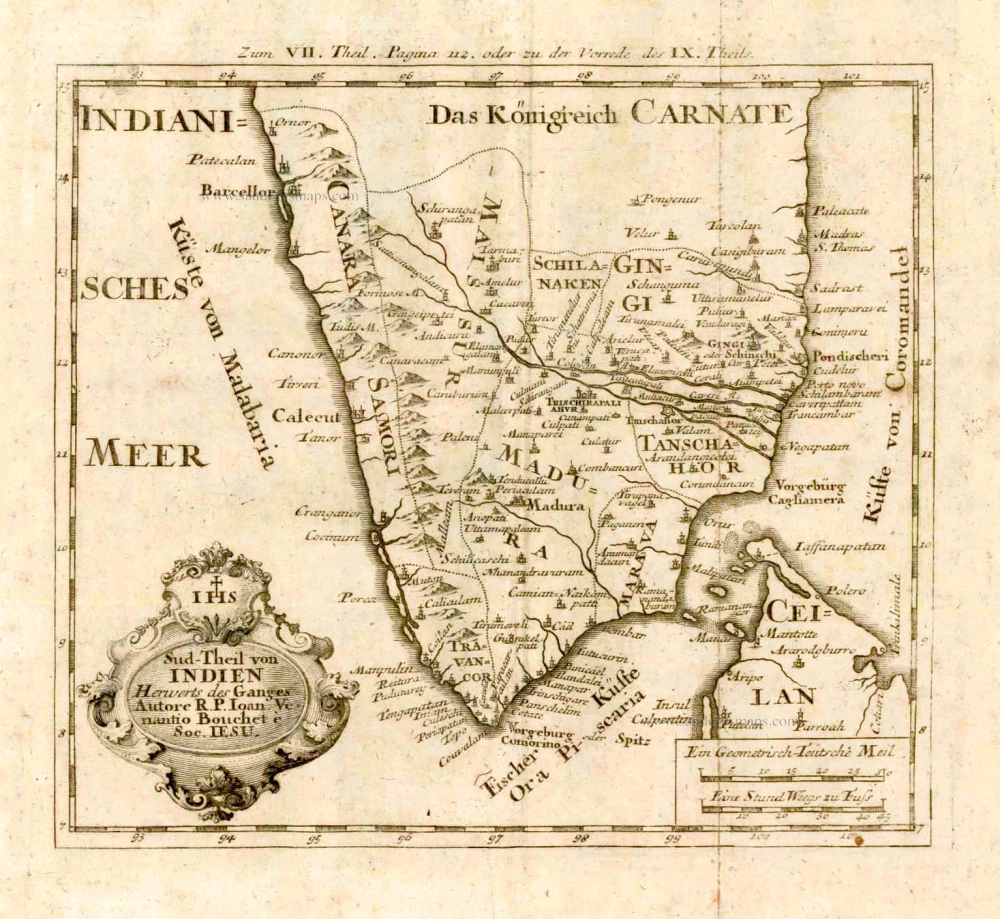
Sud-Theil von Indien Herwerts des Ganges. 1726
Southern India, by J.V. Bouchet.
[Item number: 4184]
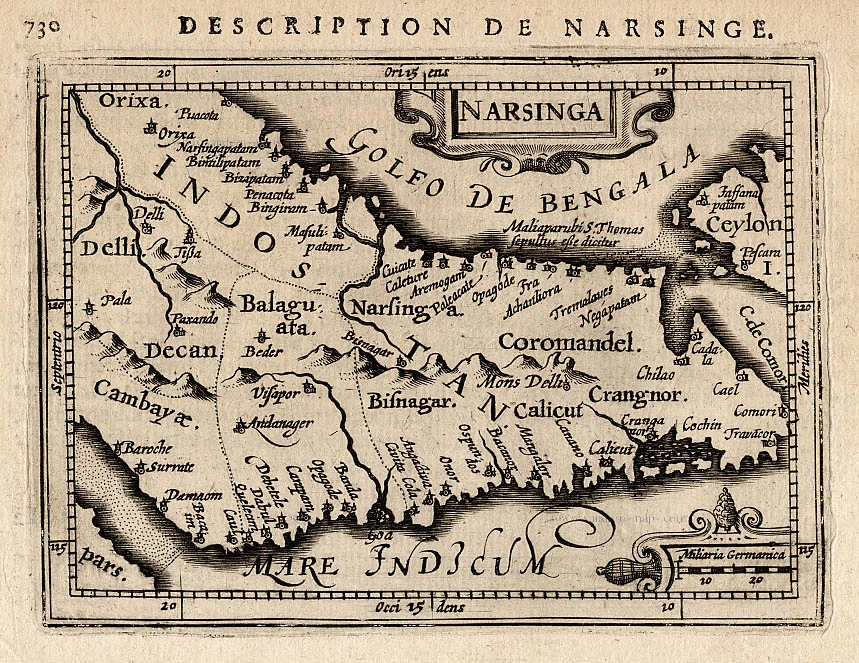
Narsinga. 1618
Narsinga, by P. Bertius.
[Item number: 18299]
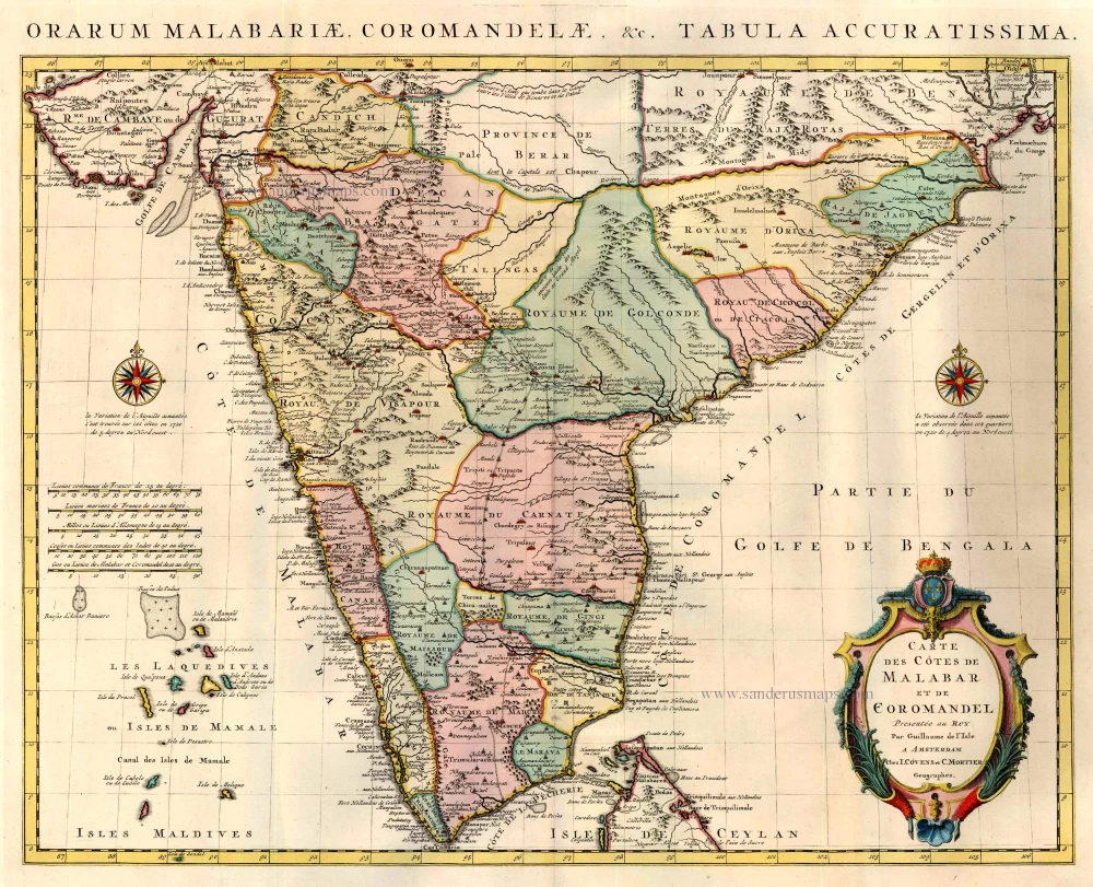
Carte des Cotes de Malabar et de Coromandel. 1721-41
India by Guillaume Delisle, published by Covens & Mortier.
[Item number: 23609]
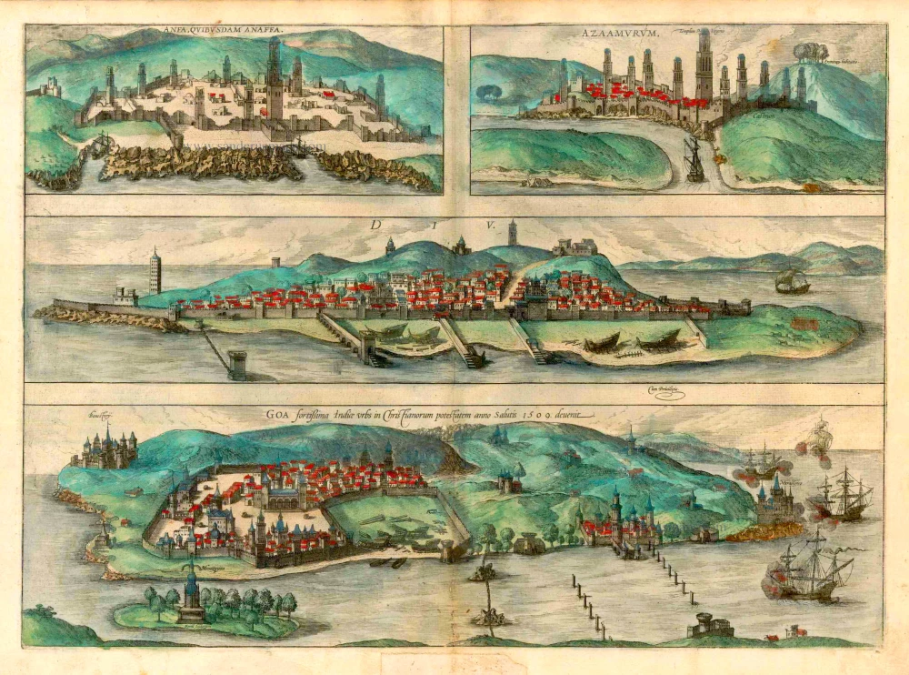
Anfa, quibusdam Anaffa [on sheet with] Azaamurum [and] Diu [and] Goa. 1582
Casablanca (Anfa) - Azemmour (Azamor) - Diu - Old Goa (Velha Goa), by Braun & Hogenberg.
[Item number: 25333]
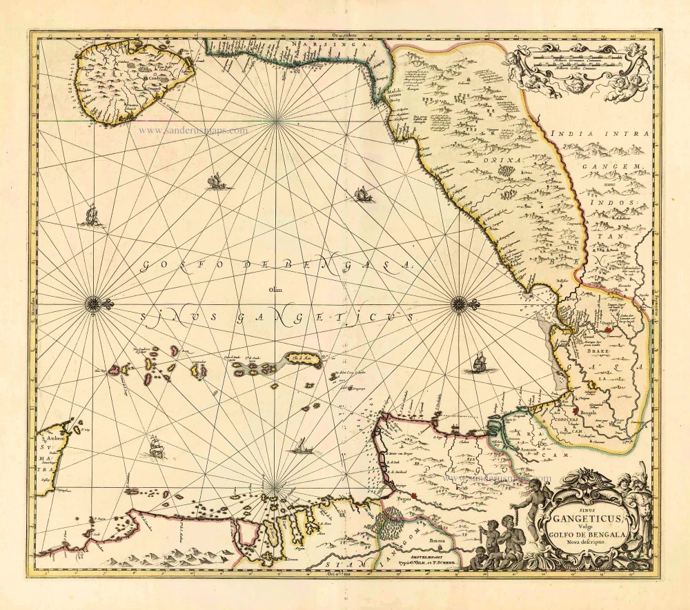
Sinus Gangeticus Vulgo Golfo de Bengala Nova Descriptio. c. 1700
Gulf of Bengal, by G. Valk & P. Schenk.
[Item number: 25835]
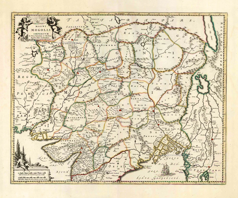
Magni Mogolis Imperium. After 1721
Mongol Empire, by Frederick de Wit - Covens & Mortier.
[Item number: 25838]

Goa. 1638
Goa, by M. Merian.
[Item number: 25903]
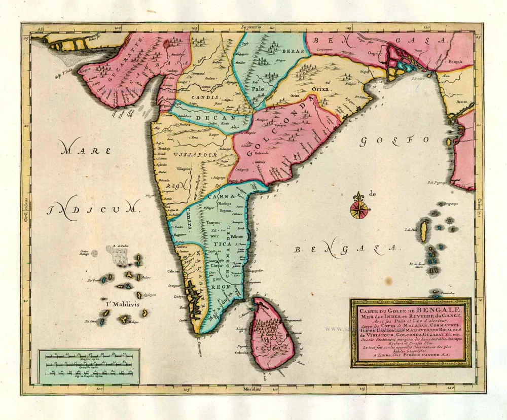
Carte du Golfe de Bengale, Mer des Indes, et Riviere du Gange, Avec les Païs et Iles d'alentour, Savoir les Côtes de Malabar, Cormandel, Ile de Ceylon, les Maldives, les Rolaumes de Visiapour, Golconda, Guzaratte, etc. 1713
India and Ceylon (Sri Lanka), by Pieter van der Aa.
[Item number: 26095]
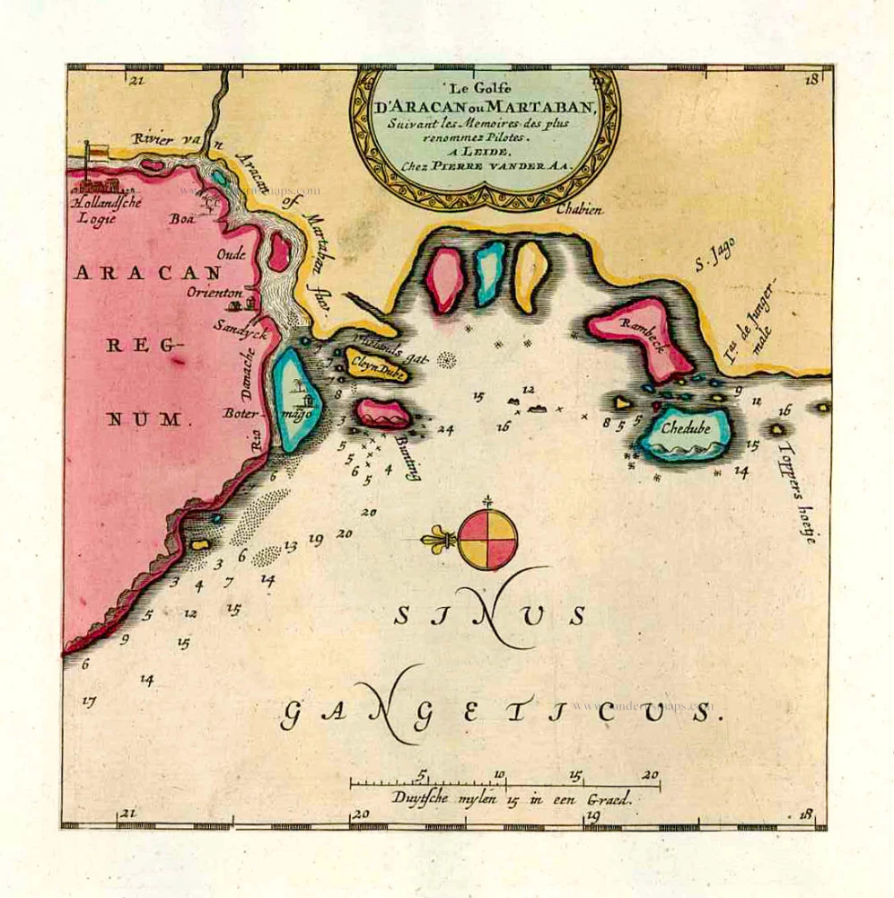
Le Golfe D'Aracan ou Martaban. 1713
The Gulf of Martaban, by Pieter van der Aa.
[Item number: 26106]
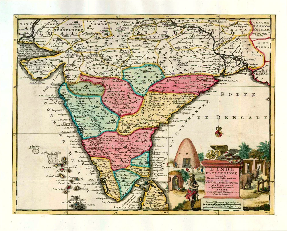
L'Inde de ça le Gange. 1713
India, by Pieter van der Aa.
[Item number: 26107]
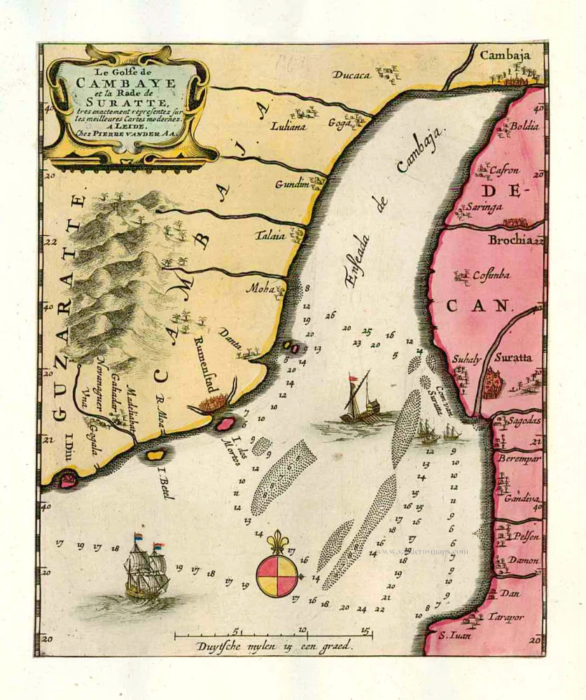
Le Golfe de Cambaye et la Rade de Suratte, tres exactement representez sur les meilleures Cartes modernes. 1713
The gulf of Cambay and the coast of Surat. by P. Van der Aa
[Item number: 26113]
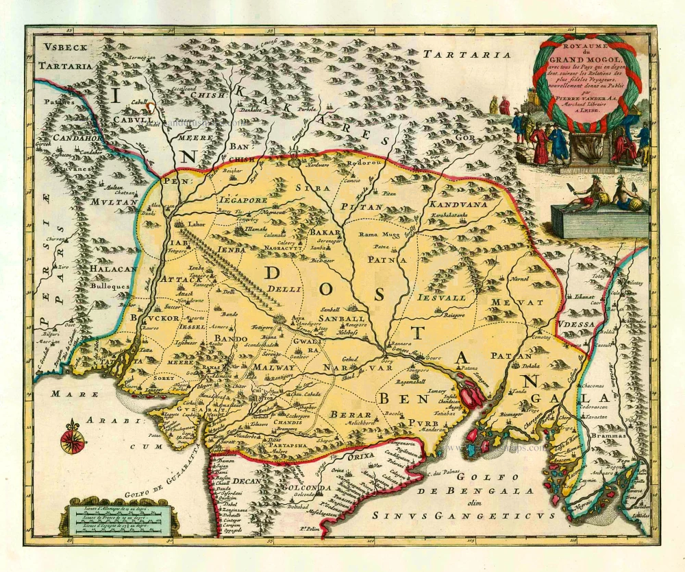
Royaume du Grand Mogol, avec tous les Pays qui en dépendent, suivant les Relations des fideles Voyageurs. 1713
India by Pieter van de Aa
[Item number: 26117]
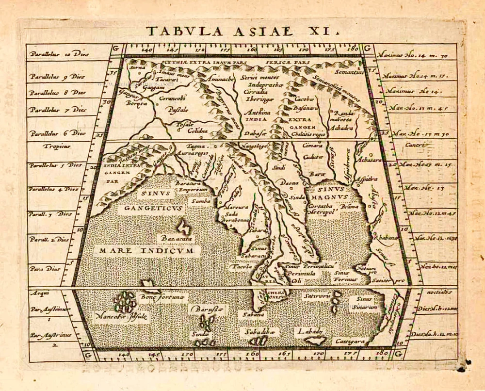
Tabula Asiae XI. 1597
India, by Giovanni Magini
[Item number: 26522]

Peninsula Indiae citra Gangem, hoc est Orae Celeberrimae Malabar & Coromandel. Cum Adjacente Insula non Minus Celebratissima Ceylon. c. 1737
India & Ceylon, by Homann Heirs.
[Item number: 26752]
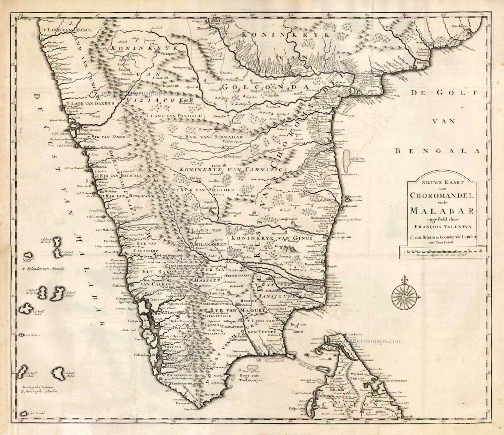
Nieuwe kaart van Choromandel ende Malabar. 1724-26
Southern India, by François Valentyn (Valentijn).
[Item number: 26896]

Fries 1525 edition of the first modern map of Southeast Asia
Tab. Moderna Indiae. 1525
South Asia by Lorenz Fries.
[Item number: 27929]
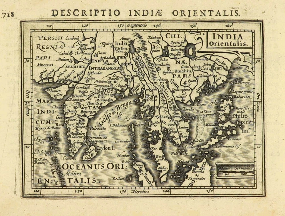
India Orientalis. 1616
East Indies by Petrus Bertius.
[Item number: 28162]
Tabula .X. Asiae. [On verso] 1525
Ptolemy map of India by Lorenz Fries, after Martin Waldseemüller.
[Item number: 28198]
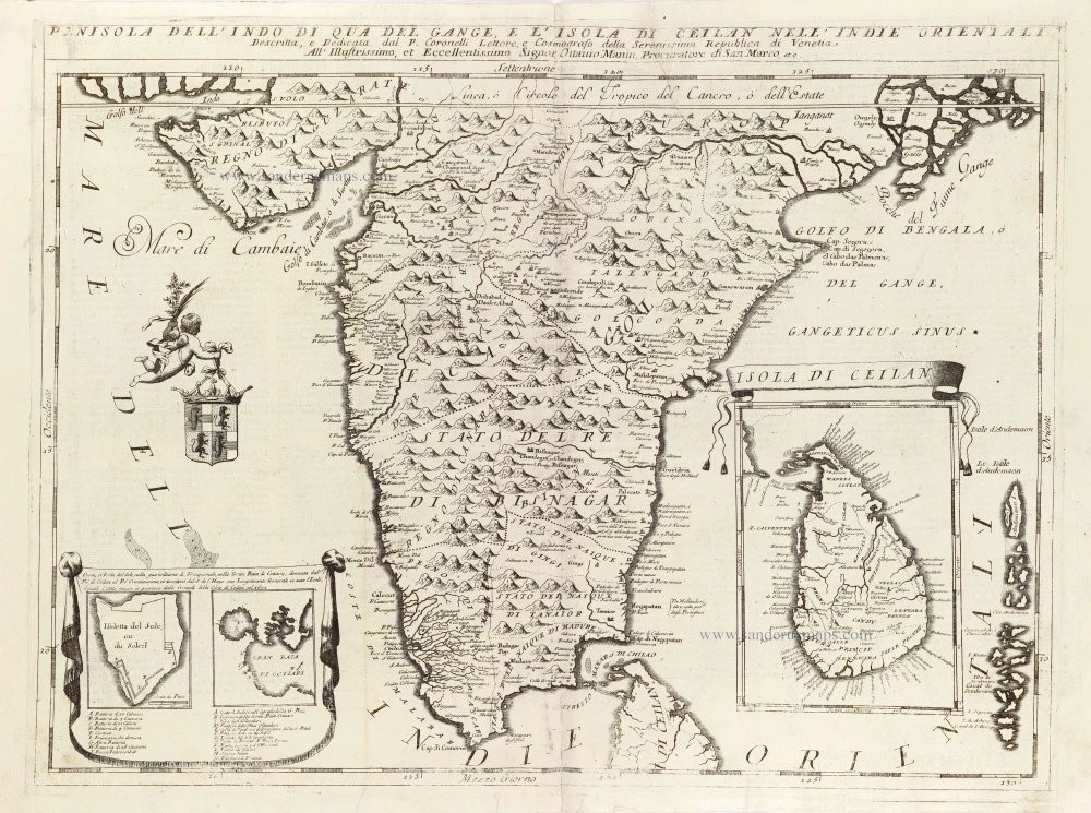
Penisola dell'Indo di qua del Gange, e l'Isola di Ceilan nell'Indie Orientali. 1696
India - Ceylon (Sri Lanka) by Vincenzo Coronelli.
[Item number: 28674]
Rare 1525 edition in nice old colour.
[No titel - from verso:] Tab. Moderna Indiae. 1525
Ptolemy map of southern Asia by Lorenz Fries, after Martin Waldseemüller.
[Item number: 30650]