
Manilla Bay, par Pieter van der Aa. 1719

Pieter van der Aa (Leiden, 1659-1733)
Pieter van der Aa was already in 1682 owner of a bookshop and auction house. During his life, he has published an enormous amount of printed material.
After 1700, van der Aa increasingly specialised in books on geography and travel.
He published composite atlases, a series of geographical descriptions of European countries, and some very spectacular works. Between 1706 and 1708 he published the Naauweurige versameling der gedenkwaardigste zee- en land-reysen, in 28 volumes.
Many of Van der Aa’s publications are richly illustrated with maps and plates. He took over many copperplates and prints from other publishers such as Carel Allard and Frederik De Wit. The composite atlases that appeared from his workshop contain a curious mixture of his own material, copies of maps from other publishers, and reprints made from old copper plates, now with his own imprint.
The Galérie agréable du monde, was completed in 1729, and comprised 66 parts, bound in 27 volumes. Van der Aa presented it as a good investment; after publication, the antiquarian value of the work would double, the more so since it was printed in a limited edition of only one hundred copies.
La Baie de Manille.
Item Number: 28115 Authenticity Guarantee
Category: Antique maps > Asia > Southeast Asia
Old, antique map of Manilla Bay, by Pieter Van der Aa.
Title: La Baie de Manille.
Selon les Observations les plus récentes.
A Leide, Chez Pierre Bander Aa.
Oriented to the southwest.
Date of the first edition: 1713.
Date of this map: 1719.
Copper engraving, printed on paper.
Size (not including margins): 182 x 170mm (7.17 x 6.69 inches).
Verso: Blank
Condition: Excellent.
Condition Rating: A+.
References: Van der Krogt A, 55:21; Quirino, p.126 & 132
From: J.A. von Mandelslo, Voyages celebres & remarquables, faits de Perse aux Indes Orientales. Leiden, P. van der Aa, 1719.
Pieter van der Aa (Leiden, 1659-1733)
Pieter van der Aa was already in 1682 owner of a bookshop and auction house. During his life, he has published an enormous amount of printed material.
After 1700, van der Aa increasingly specialised in books on geography and travel.
He published composite atlases, a series of geographical descriptions of European countries, and some very spectacular works. Between 1706 and 1708 he published the Naauweurige versameling der gedenkwaardigste zee- en land-reysen, in 28 volumes.
Many of Van der Aa’s publications are richly illustrated with maps and plates. He took over many copperplates and prints from other publishers such as Carel Allard and Frederik De Wit. The composite atlases that appeared from his workshop contain a curious mixture of his own material, copies of maps from other publishers, and reprints made from old copper plates, now with his own imprint.
The Galérie agréable du monde, was completed in 1729, and comprised 66 parts, bound in 27 volumes. Van der Aa presented it as a good investment; after publication, the antiquarian value of the work would double, the more so since it was printed in a limited edition of only one hundred copies.
Related items

Carte du Canal des Iles Philippines par lequel Passe le Galion de Manille et les Iles Voisines de ce Canal. 1749
Philippines by Bonne Rigobert
[Item number: 26611]
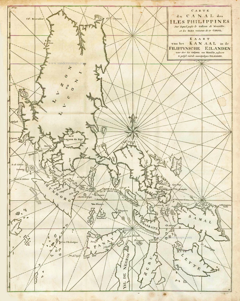
Carte du Canal des Iles Philippines par lequel Passe le Galion de Manille et les Iles Voisines de ce Canal. - Kaart van het Kanaal in de Filippynsche Eilanden waar door het Galjoen van Manilla passeert, tegelijk met de naast gelegen Eilanden. 1748
The Philippines, by George Anson.
[Item number: 27036]
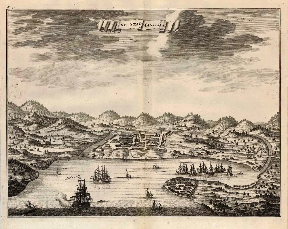
De Stad Manilha. 1726
Philippines - Manilla by François Valentyn (Valentijn)
[Item number: 27894]

Lucon of Luconia. 1726
Philippines, by Valentyn François
[Item number: 27895]

Manilhas Bay. 1724-26
Philippine Islands - Manila Bay by François Valentyn (Valentijn)
[Item number: 27904]

Typus Freti Manilensis. - Détroit de Manilles. 1725
Philippines - Manila Strait by René Augustin Constantin de Renneville.
[Item number: 28370]
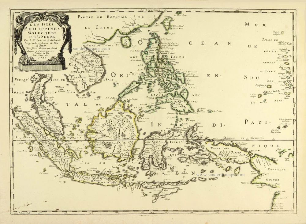
Les Isles Philippines Molucques et de la Sonde. 1658
Southeast Asia par Nicolas Sanson.
[Item number: 28378]
Scarce and important map
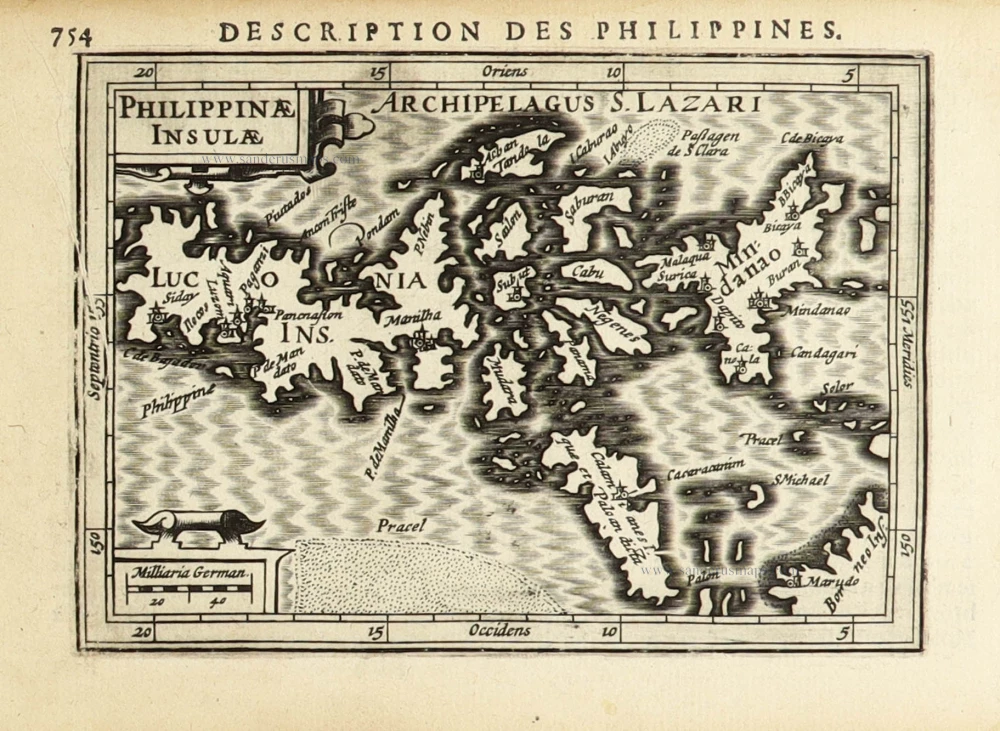
Philippinae Insulae. 1618
Philippines by Petrus Bertius.
[Item number: 32158]