
First edition
Philippines by Petrus Bertius. 1616
Petrus Bertius (1565-1629)
Petrus Bertius, born at Beveren, Flanders, in 1565, was related to Pieter van den Keere (Kaerius) and Jodocus Hondius. Both famous cartographers were brothers-in-law of Petrus Bertius. As a refugee, he settled in Amsterdam, and after finishing his studies, he became a professor of mathematics and librarian at the University of Leiden. In 1618, he became a cosmographer and historiographer for Louis XIII of France. He lived in Paris, where he died in 1629.
Petrus Bertius's remarkable work ethic is evident in the numerous geographical and theological works he produced. His contributions to the works of Clüver and Herrera further solidified his reputation in geography.
His fame among geographers was established by his text in the pocket atlas Tabularum Geographicarum and by his edition of Ptolemy’s Geographia.
The origin of the Tabularum Geographicum lies in the well-known miniature atlas Caert thresoor, published by Barent Langenes in 1598 in Middelburg. Bertius engraved 169 maps for this small but attractive atlas, sold for the first time in 1599 by Cornelis Claesz in Amsterdam. In 1600, Claesz published the pocket atlas with a Latin text composed by Petrus Bertius. From then on, new editions, often enlarged with new maps, regularly appeared, subsequently published by Cornelis Claesz, Jodocus Hondius, Johannes Janssonius and ultimately, in 1649, by Claes Jansz. Visscher.
Koeman divides this series of pocketbooks into two atlases: The Caert-thresoor, published by Langenes and Claesz., with five editions between 1598 and 1609, and the Tabularum Geographicarum Contractarum by Petrus Bertius with ten editions between 1600 and 1650.
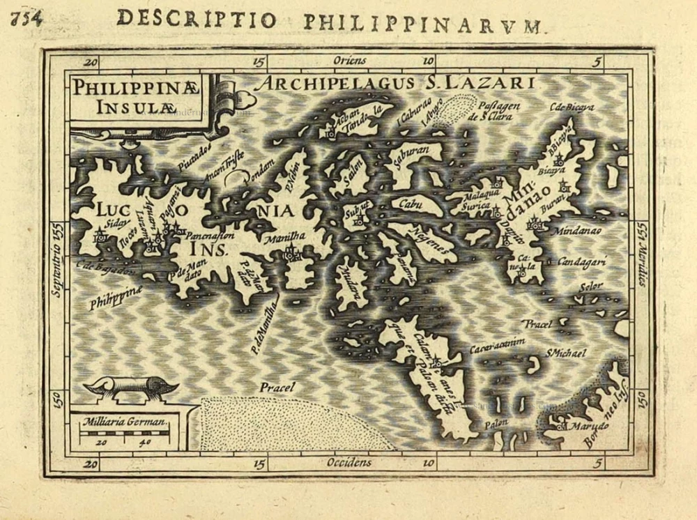
Philippinae Insulae.
Item Number: 28166 Authenticity Guarantee
Category: Antique maps > Asia > Southeast Asia
Old, antique map of the Philippines, by Petrus Bertius.
Title: Philippinae Insulae.
Date of the first edition: 1616.
Date of this map: 1616.
Copper engraving, printed on paper.
Size (not including margins): 95 x 135mm (3.74 x 5.31 inches).
Verso: Latin text.
Condition: Excellent.
Condition Rating: A+.
References: Van der Krogt 3, 9200:342
From: Petrus Bertius, Tabulae Geographicae Contractae. Amsterdam, Jodocus Hondius Jr., 1616. First edition. (Van der Krogt 3, 342:01)
Petrus Bertius (1565-1629)
Petrus Bertius, born at Beveren, Flanders, in 1565, was related to Pieter van den Keere (Kaerius) and Jodocus Hondius. Both famous cartographers were brothers-in-law of Petrus Bertius. As a refugee, he settled in Amsterdam, and after finishing his studies, he became a professor of mathematics and librarian at the University of Leiden. In 1618, he became a cosmographer and historiographer for Louis XIII of France. He lived in Paris, where he died in 1629.
Petrus Bertius's remarkable work ethic is evident in the numerous geographical and theological works he produced. His contributions to the works of Clüver and Herrera further solidified his reputation in geography.
His fame among geographers was established by his text in the pocket atlas Tabularum Geographicarum and by his edition of Ptolemy’s Geographia.
The origin of the Tabularum Geographicum lies in the well-known miniature atlas Caert thresoor, published by Barent Langenes in 1598 in Middelburg. Bertius engraved 169 maps for this small but attractive atlas, sold for the first time in 1599 by Cornelis Claesz in Amsterdam. In 1600, Claesz published the pocket atlas with a Latin text composed by Petrus Bertius. From then on, new editions, often enlarged with new maps, regularly appeared, subsequently published by Cornelis Claesz, Jodocus Hondius, Johannes Janssonius and ultimately, in 1649, by Claes Jansz. Visscher.
Koeman divides this series of pocketbooks into two atlases: The Caert-thresoor, published by Langenes and Claesz., with five editions between 1598 and 1609, and the Tabularum Geographicarum Contractarum by Petrus Bertius with ten editions between 1600 and 1650.
Related items
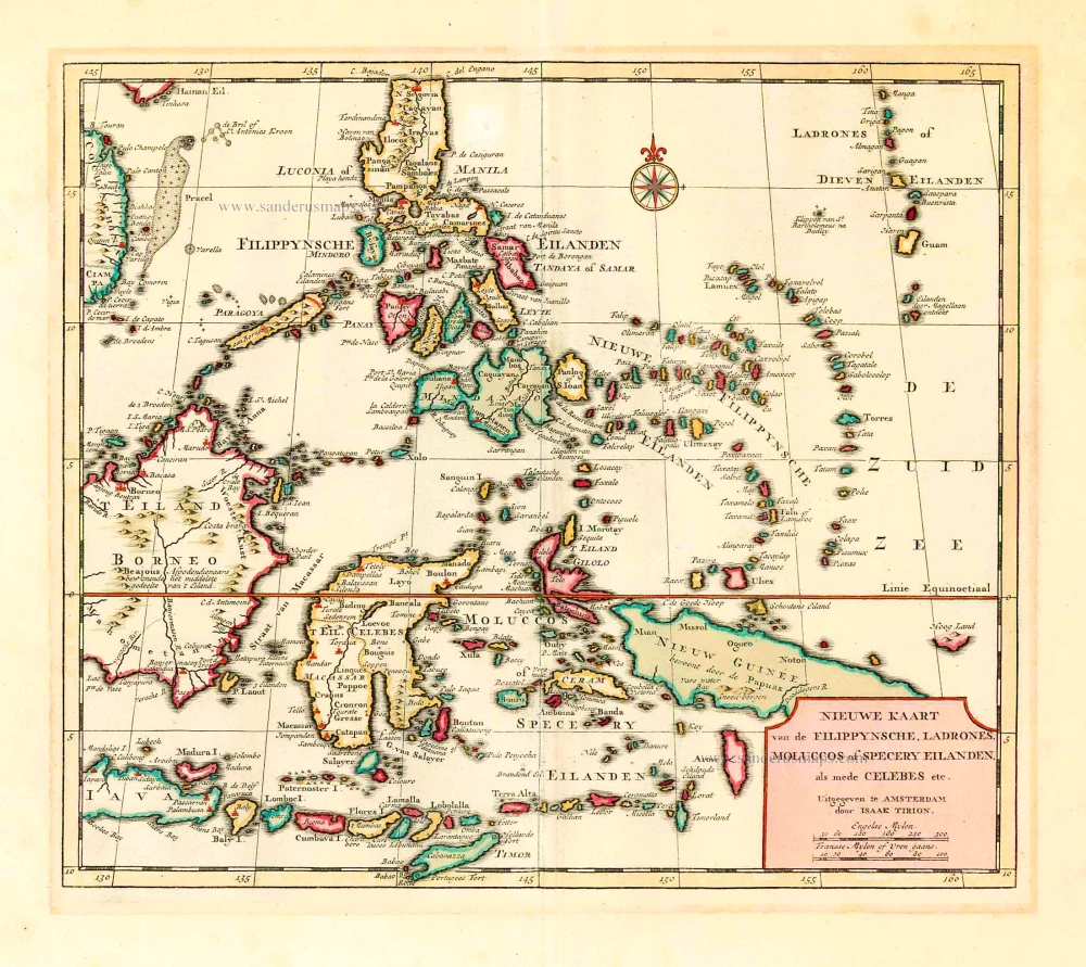
Nieuwe Kaart van de Filippynsche, Ladrones, Moluccos of Specery Eilanden als mede Celebes, etc. 1744
Philippines - Indonesia by Tirion I.
[Item number: 26584]
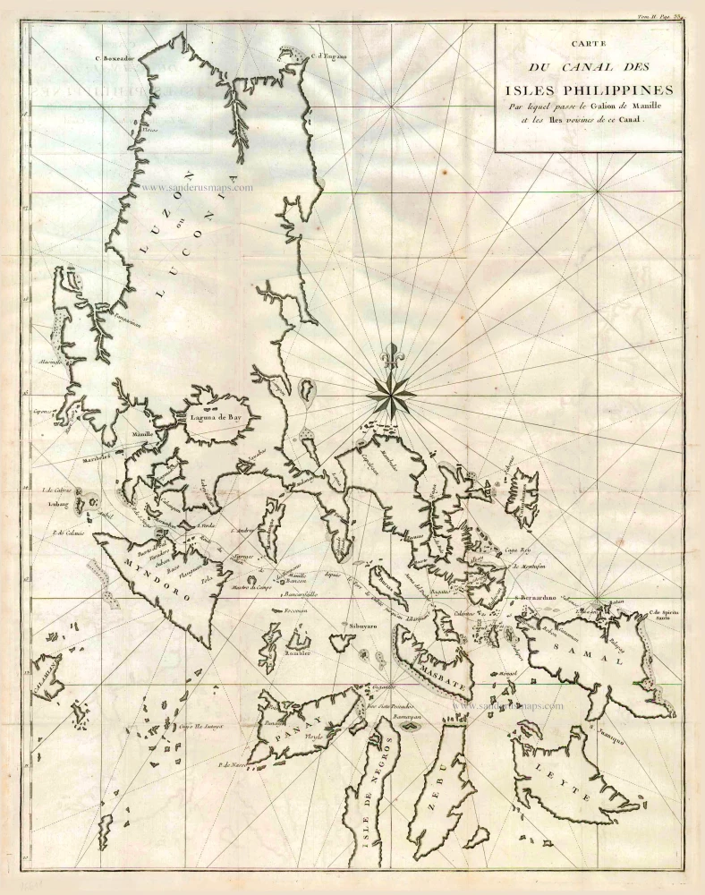
Carte du Canal des Iles Philippines par lequel Passe le Galion de Manille et les Iles Voisines de ce Canal. 1749
Philippines by Bonne Rigobert
[Item number: 26611]
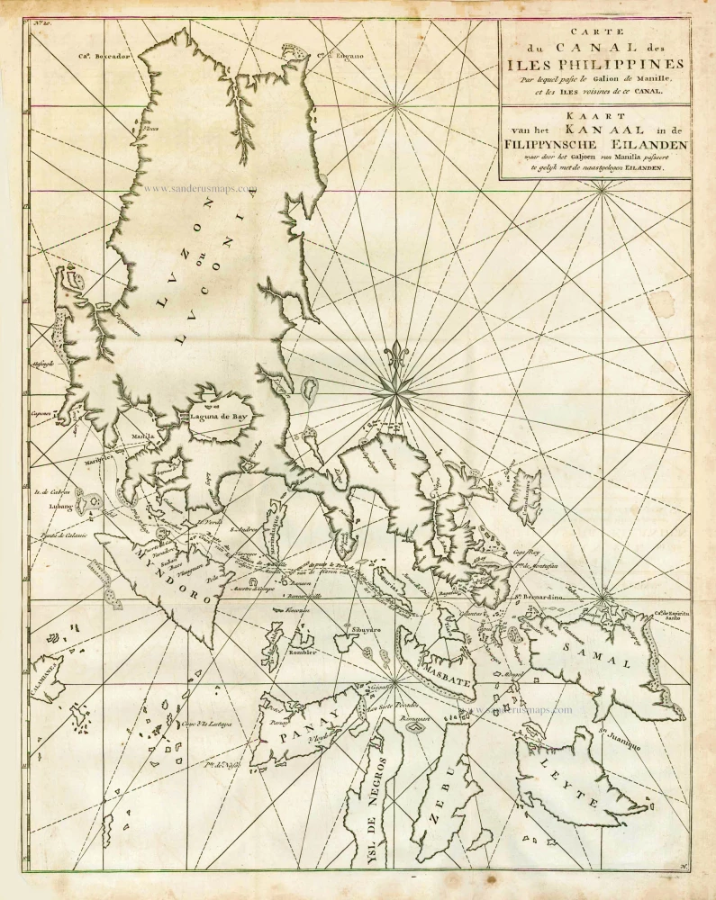
Carte du Canal des Iles Philippines par lequel Passe le Galion de Manille et les Iles Voisines de ce Canal. - Kaart van het Kanaal in de Filippynsche Eilanden waar door het Galjoen van Manilla passeert, tegelijk met de naast gelegen Eilanden. 1748
The Philippines, by George Anson.
[Item number: 27036]
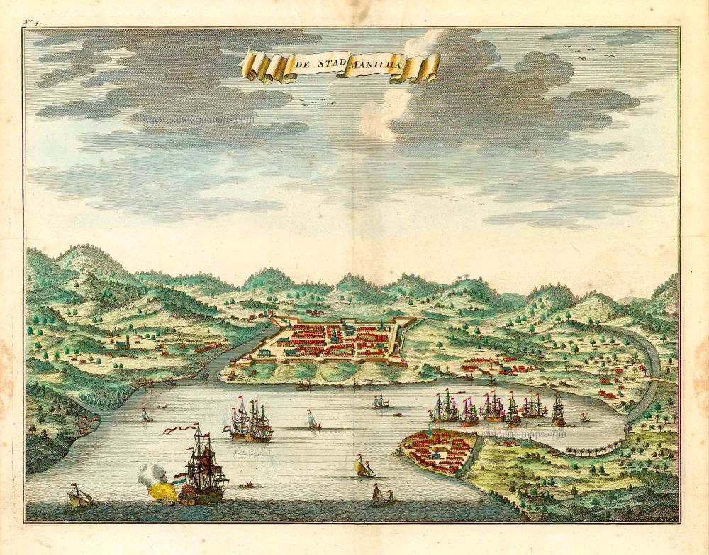
De Stad Manilha. 1724-26
Philippines - Manilla by François Valentyn (Valentijn)
[Item number: 27064]
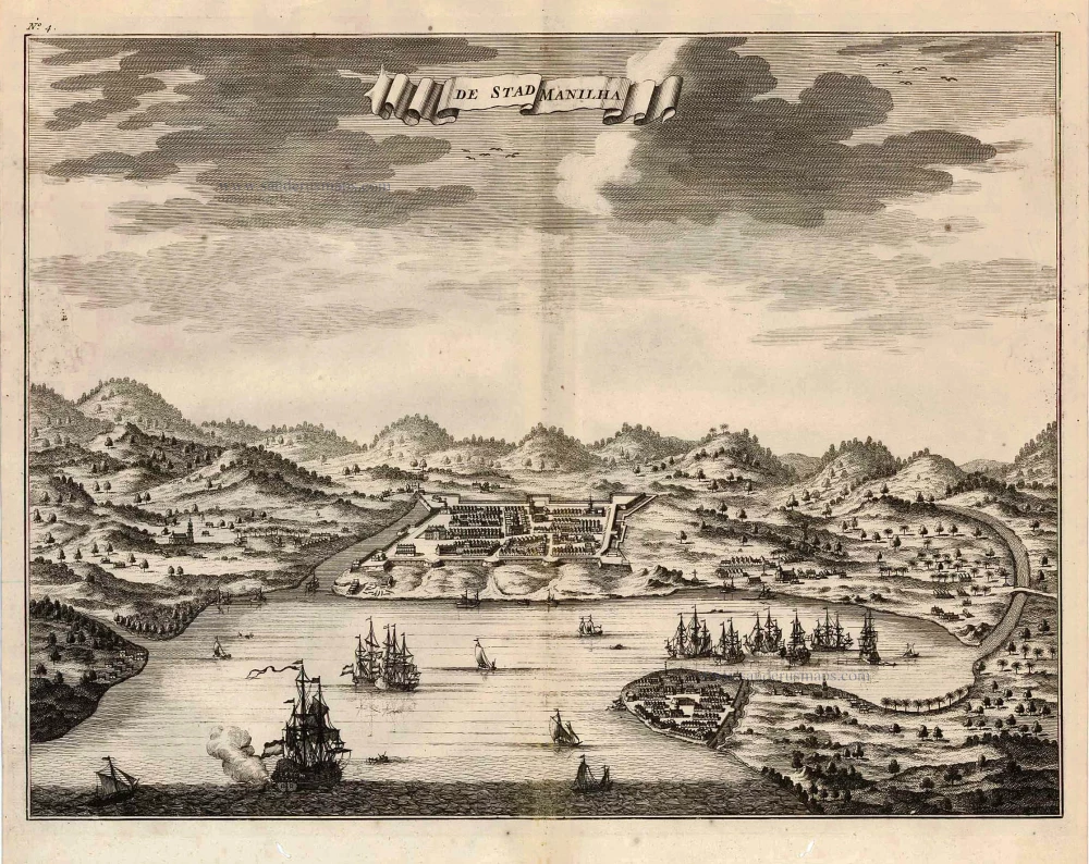
De Stad Manilha. 1726
Philippines - Manilla by François Valentyn (Valentijn)
[Item number: 27894]
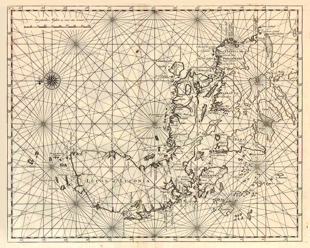
Lucon of Luconia. 1726
Philippines, by François Valentyn.
[Item number: 27895]
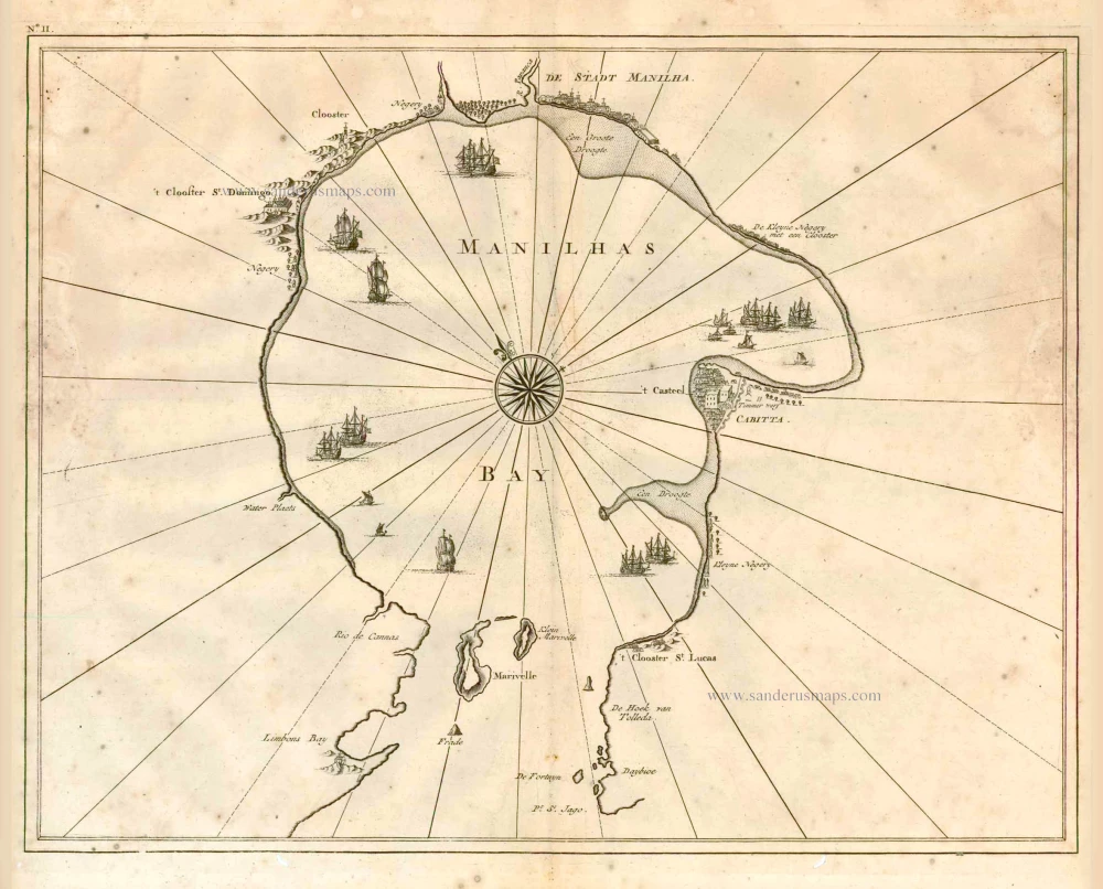
Manilhas Bay. 1724-26
Philippine Islands - Manila Bay by François Valentyn (Valentijn)
[Item number: 27904]
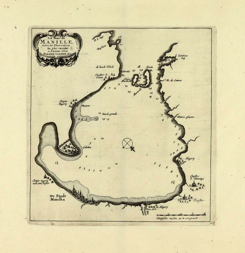
La Baie de Manille. 1719
Manilla Bay, par Pieter van der Aa.
[Item number: 28115]
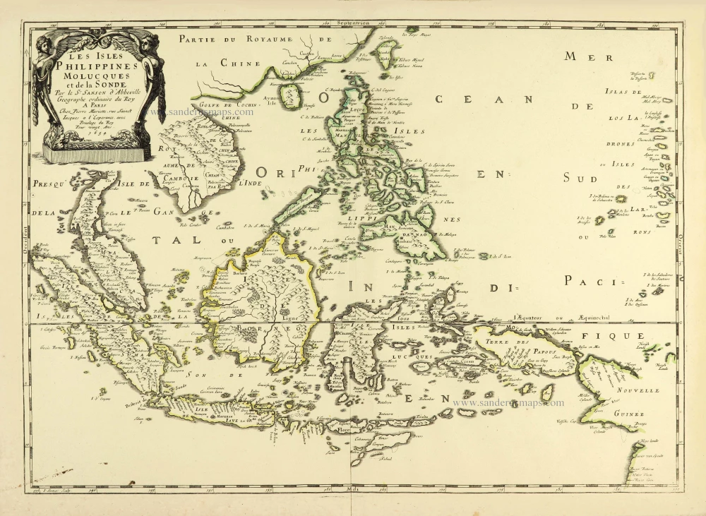
Les Isles Philippines Molucques et de la Sonde. 1658
Philippines par Nicolas Sanson.
[Item number: 28378]
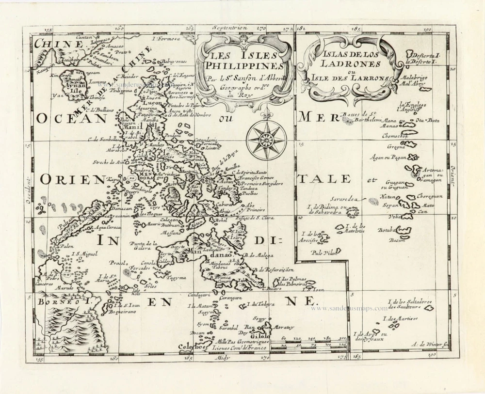
Les Isles Philippines [on sheet with] Islas de los Ladrones ou Isle des Larrons. 1747-74
Philippines, by Nicolas Sanson, published by Prevost d'Exiles.
[Item number: 30304]