
Philippines by Jean Mallat.
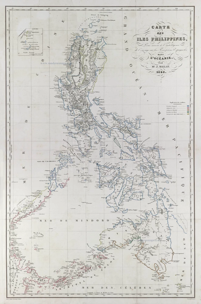
Carte des Iles Philippines,
Item Number: 29503 Authenticity Guarantee
Category: Antique maps > Asia > Southeast Asia
Old, antique map of the Philippines by Jean Mallat.
Title: Carte des Iles Philippines,
Pour servirà l'intelligence de l'ouvrage sur les Possessions Espagnoles dans l'Océanie,
par Mr. J. Mallat. 1846.
Paris, Arthus Bertrand, Editeur. - Gravé par Hip.te Bonvalet.
Date of the first edition: 1846.
Date of this map: 1846.
Map size: 755 x 490mm (29.72 x 19.29 inches).
Sheet size: 825 x 535mm (32.48 x 21.06 inches).
Condition: Original coloured in outline, tear closed, running 20 cm into the image.
Condition Rating: A.
From: Les Philippines. Atlas. Paris, A. Bertrand, 1846.
Related items
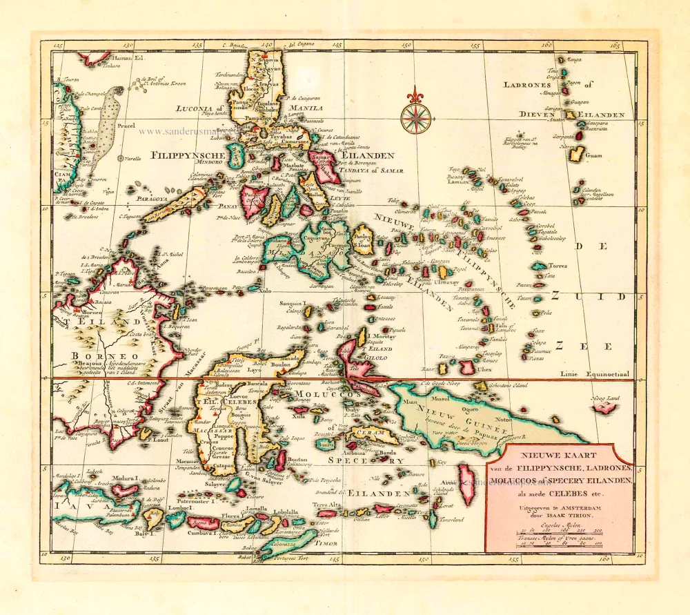
Nieuwe Kaart van de Filippynsche, Ladrones, Moluccos of Specery Eilanden als mede Celebes, etc. 1744
Philippines - Indonesia by Tirion I.
[Item number: 26584]
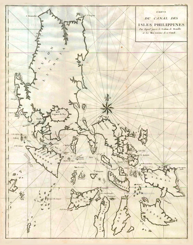
Carte du Canal des Iles Philippines par lequel Passe le Galion de Manille et les Iles Voisines de ce Canal. 1749
Philippines by Bonne Rigobert
[Item number: 26611]
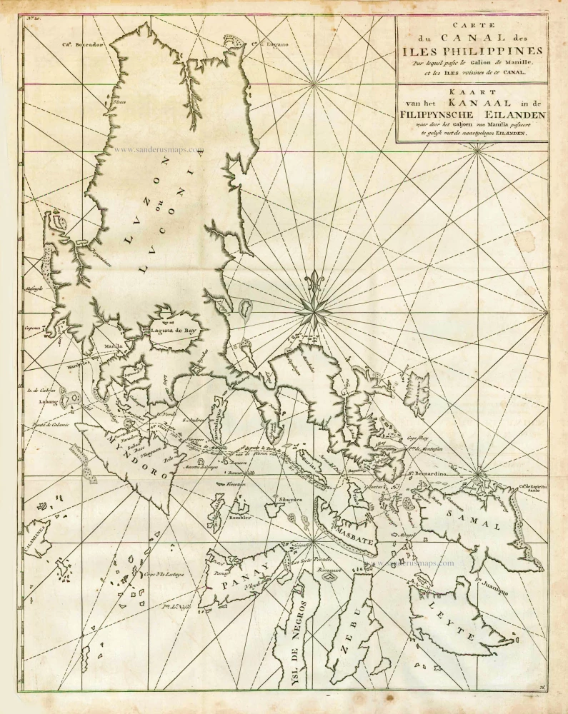
Carte du Canal des Iles Philippines par lequel Passe le Galion de Manille et les Iles Voisines de ce Canal. - Kaart van het Kanaal in de Filippynsche Eilanden waar door het Galjoen van Manilla passeert, tegelijk met de naast gelegen Eilanden. 1748
The Philippines, by George Anson.
[Item number: 27036]
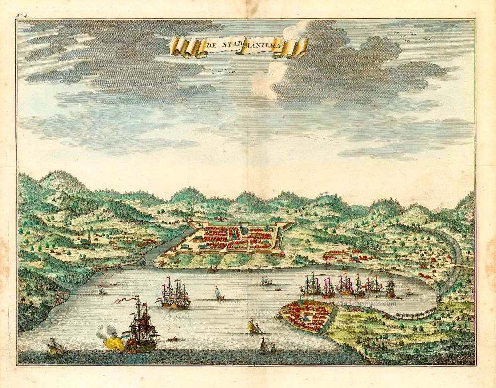
De Stad Manilha. 1724-26
Philippines - Manilla by François Valentyn (Valentijn)
[Item number: 27064]
Including the first map of the Philippines.
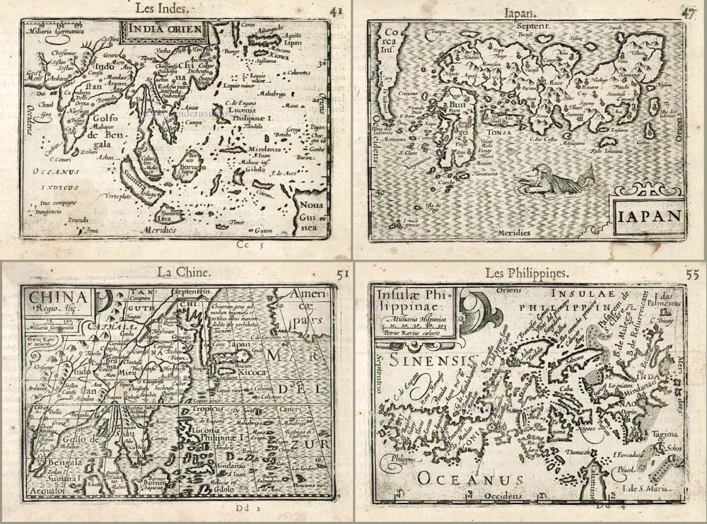
India Orien. - Iapan. - China. - Insulae Philippinae. 1602
Barent Langenes & Cornelis Claesz.: Southeast Asia, Japan, China, and the Philippines.
[Item number: 27705]
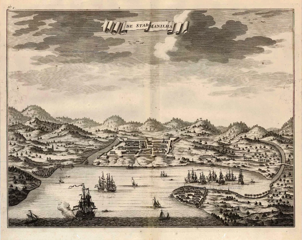
De Stad Manilha. 1726
Philippines - Manilla by François Valentyn (Valentijn)
[Item number: 27894]
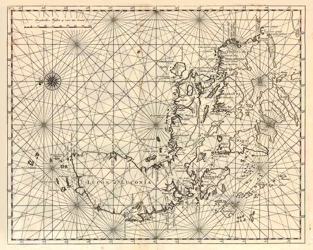
Lucon of Luconia. 1726
Philippines, by François Valentyn.
[Item number: 27895]
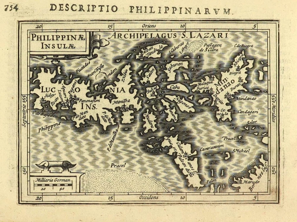
First edition
Philippinae Insulae. 1616
Philippines by Petrus Bertius.
[Item number: 28166]
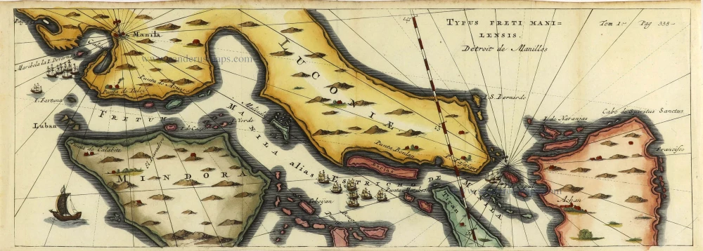
Typus Freti Manilensis. - Détroit de Manilles. 1725
Philippines - Manila Strait by René Augustin Constantin de Renneville.
[Item number: 28370]
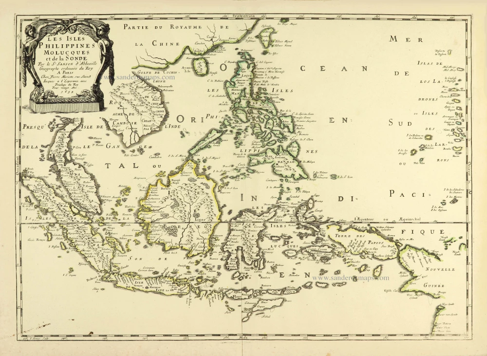
Les Isles Philippines Molucques et de la Sonde. 1658
Philippines par Nicolas Sanson.
[Item number: 28378]