
Southeast Asia and Australia, by Pieter Van der Aa. 1707
Pieter van der Aa (Leiden, 1659-1733)
Pieter van der Aa was already in 1682 owner of a bookshop and auction house. During his life, he has published an enormous amount of printed material.
After 1700, van der Aa increasingly specialised in books on geography and travel.
He published composite atlases, a series of geographical descriptions of European countries, and some very spectacular works. Between 1706 and 1708 he published the Naauweurige versameling der gedenkwaardigste zee- en land-reysen, in 28 volumes.
Many of Van der Aa’s publications are richly illustrated with maps and plates. He took over many copperplates and prints from other publishers such as Carel Allard and Frederik De Wit. The composite atlases that appeared from his workshop contain a curious mixture of his own material, copies of maps from other publishers, and reprints made from old copper plates, now with his own imprint.
The Galérie agréable du monde, was completed in 1729, and comprised 66 parts, bound in 27 volumes. Van der Aa presented it as a good investment; after publication, the antiquarian value of the work would double, the more so since it was printed in a limited edition of only one hundred copies.
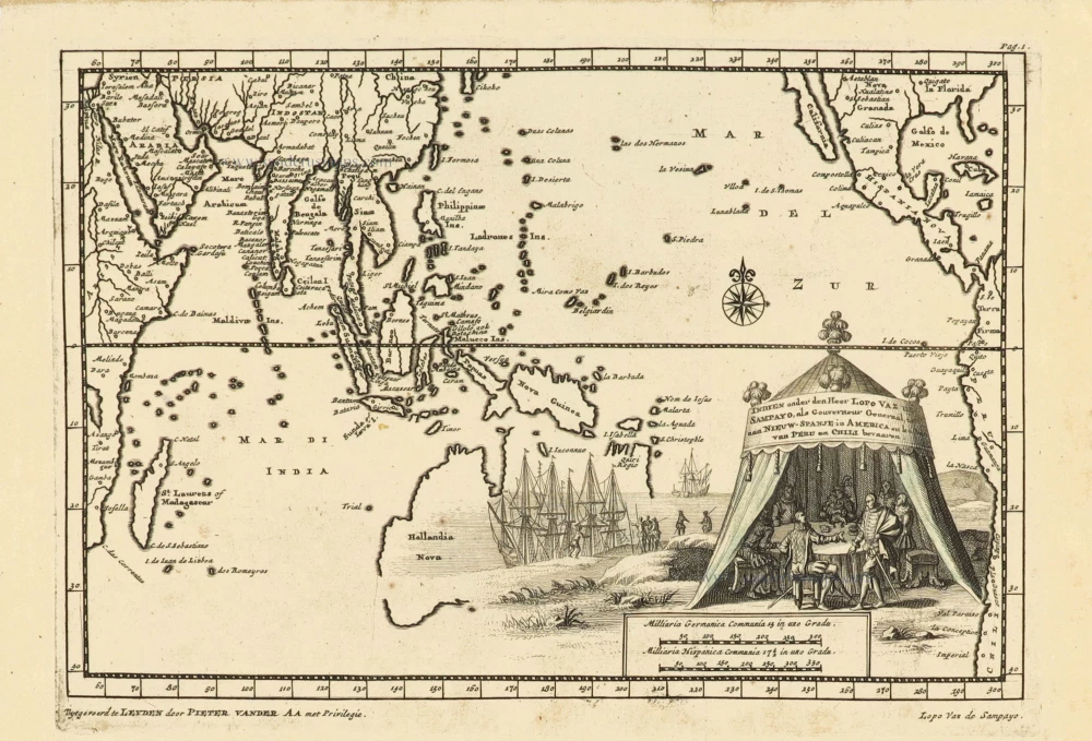
Indien onder den Heer Lopo Vaz de Sampayo, als Gouverneur Generaal tot aan Nieuw-Spanje in Amrica en kusten van Peru en Chili bevaaren.
Item Number: 32359 Authenticity Guarantee
Category: Antique maps > Asia > Southeast Asia
Southeast Asia and Australia, by Pieter Van der Aa. RARE
Title: Indien onder den Heer Lopo Vaz de Sampayo, als Gouverneur Generaal tot aan Nieuw-Spanje in Amrica en kusten van Peru en Chili bevaaren.
Uytgevoerd te Leyden door Pieter Vander Aa met Privilegie. - Lopo Van de Sampayo.
Date of the first edition: 1707.
Date of this map: 1707.
Copper engraving, printed on paper.
Image size: 155 x 220mm (6 x 8¾ inches).
Sheet size: 175 x 275mm (7 x 10¾ inches).
Verso: Blank.
Condition: Excellent.
Condition Rating: A+.
From: Naaukeurige Versameling der gedenk-waardigste Zee- en landreysen na Oost en West-Indien. Leiden, Pieter Van der Aa, 1707.
Map extending from Africa to the Americas, showing the Indian Ocean, Southeast Asia, Australia, and the Southern Atlantic Ocean.
Pieter van der Aa (Leiden, 1659-1733)
Pieter van der Aa was already in 1682 owner of a bookshop and auction house. During his life, he has published an enormous amount of printed material.
After 1700, van der Aa increasingly specialised in books on geography and travel.
He published composite atlases, a series of geographical descriptions of European countries, and some very spectacular works. Between 1706 and 1708 he published the Naauweurige versameling der gedenkwaardigste zee- en land-reysen, in 28 volumes.
Many of Van der Aa’s publications are richly illustrated with maps and plates. He took over many copperplates and prints from other publishers such as Carel Allard and Frederik De Wit. The composite atlases that appeared from his workshop contain a curious mixture of his own material, copies of maps from other publishers, and reprints made from old copper plates, now with his own imprint.
The Galérie agréable du monde, was completed in 1729, and comprised 66 parts, bound in 27 volumes. Van der Aa presented it as a good investment; after publication, the antiquarian value of the work would double, the more so since it was printed in a limited edition of only one hundred copies.
Related items
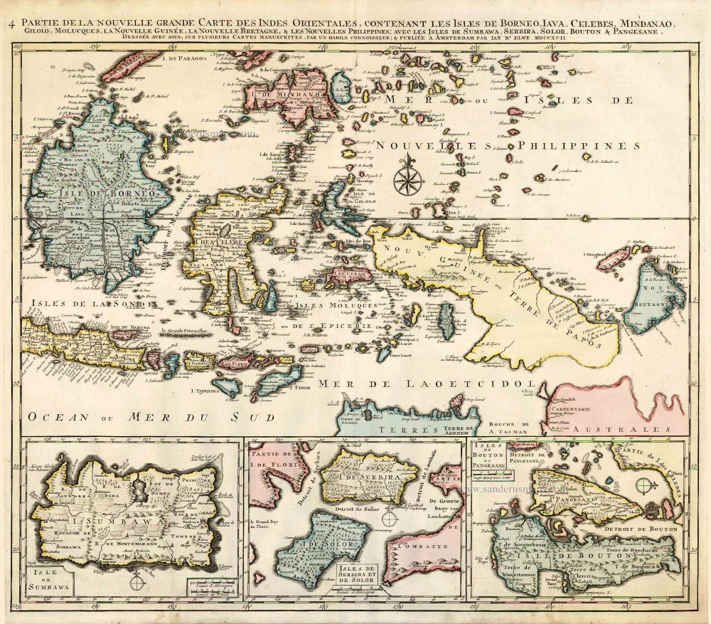
Partie de la Nouvelle Grande Carte des Indes Orientales, Contenant les Isles de Borneo, Iava, Celebes, Mindanao ... 1792
Indonesia - New Guinea - Australia by J.B. Elwe.
[Item number: 2293]
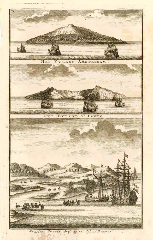
Swarte Swaane drift op het Eyland Rottenest. 1726
View of Australia, by François Valentyn.
[Item number: 27920]

Isole dell'Indie, Divise in Filippine, Molucche, e della Sonda. 1696
Southeast Asia and Northwest Australia by Vincenzo Coronelli.
[Item number: 28670]

Indiae Orientalis nec non Insularum Adiacentium. c. 1691-97
Southeast Asia - Australia by Frederick de Wit.
[Item number: 29091]

Nuova Guinea. 1696
Globe gore with Northern Australia and the East Indies, by V.M. Coronelli.
[Item number: 30785]
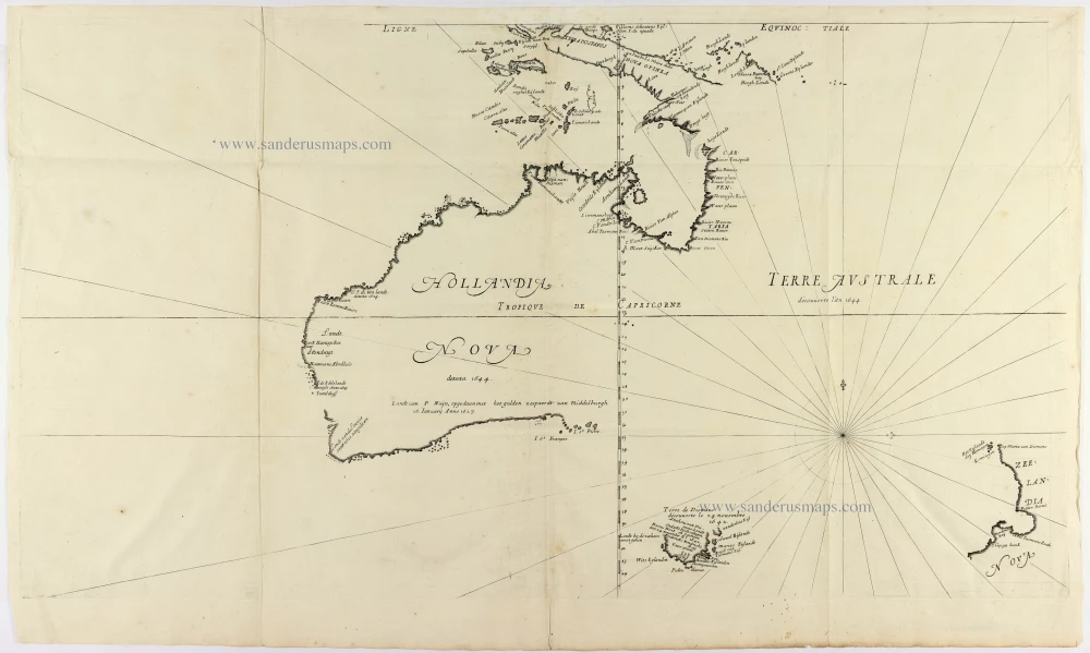
Cornerstone map of Australia
Hollandia Nova detecta 1644. - Terre Australe decouuerte l'an 1644. 1663-72.
Thevenot Melchisedech, Australia
[Item number: 31818]

A Rare Pre-Cook Map Focusing on Australia
Carte Réduite des Terres Australes. 1758
Australia by Jacques-Nicolas Bellin, published by A.F. Prévost.
[Item number: 31885]

An extremely decorative sea chart (Norwhich)
Nieuwe Pascaert van Oost Indien Verthoonende hen van C. De Bona Esperanca tot aen het Landt van Eso. 1683
Indian Ocean - Southeast Asia - Australia by Johannes Van Keulen
[Item number: 33150]
new