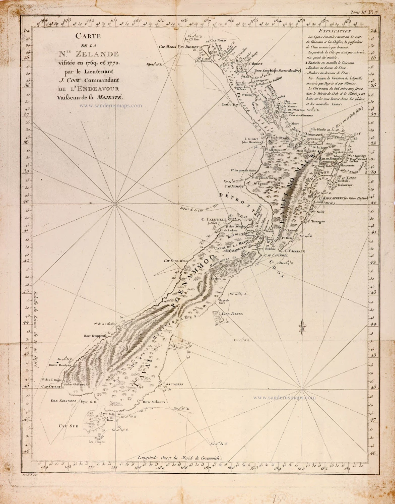
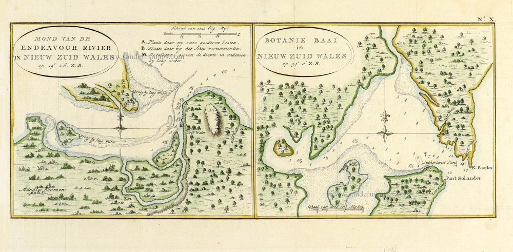
Map of New Zealand by James Cook. 1774
James Cook (1728 – 1779)
Captain James Cook, a British explorer, cartographer, and captain in the British Royal Navy, was born of poor parentage in 1728. Yet, he became the most excellent navigator of his day. More than any other man, Cook contributed to the mapping of Australia and the Pacific. He was famous for his three voyages between 1768 and 1779. In these voyages, Cook sailed thousands of miles across largely uncharted areas of the globe. He mapped lands from New Zealand to Hawaii in the Pacific Ocean in greater detail and on a scale not previously charted by Western explorers. He surveyed and named features and recorded islands and coastlines on European maps for the first time.
In his first voyage 1768-71 in the Endeavour, he charted the whole of New Zealand and the east coast of Australia.
In his second voyage, 1772-75, in the Resolution and Adventure, he dispelled the myth of an immense southern landmass and reduced the Antarctic to its proper proportions.
In his third voyage, 1776-79 in the Resolution and Discovery, he completed the charting of the coasts between America and Asia. Unfortunately, in 1779 he was attacked and killed by natives on the island of Hawaii.
Carte de la Nlle-Zelande visitée en 1769 et 1770 par le Lieutenant J. Cook.
Item Number: 31053 Authenticity Guarantee
Category: Antique maps > Australia
Map of New Zealand by James Cook.
Title: Carte de la Nlle-Zelande visitée en 1769 et 1770 par le Lieutenant J. Cook.
Renard Dir.
Date of the first edition: 1773.
Date of this map: 1774.
Steel engraving, printed on paper.
Image size: 480 x 375mm (18.9 x 14.76 inches).
Sheet size: 540 x 420mm (21.26 x 16.54 inches).
Verso: Blank.
Condition: Folds as issued, some toning along folds and margins.
Condition Rating: A.
From: Relation des voyages entrepris par ordre de Sa Majesté britannique actuellement regnante; pour faire des découvertes dans l'hémisphère méridional, et successivement exécutés par le Commodore Byron, le Capitaine Carteret, le Capitaine Wallis & le Capitaine Cook, dans les vaiseaux le Dauphin, le Swallow, & l'Endeavour. Rédigée d'après les journeaux tenus par les différens commandans, & les papiers de M. Banks, par J. Hawkesworth ... Traduite de l'anglois [par J.B.A. Suard]. Paris, Saillant et Nyon, 1774.
James Cook (1728 – 1779)
Captain James Cook, a British explorer, cartographer, and captain in the British Royal Navy, was born of poor parentage in 1728. Yet, he became the most excellent navigator of his day. More than any other man, Cook contributed to the mapping of Australia and the Pacific. He was famous for his three voyages between 1768 and 1779. In these voyages, Cook sailed thousands of miles across largely uncharted areas of the globe. He mapped lands from New Zealand to Hawaii in the Pacific Ocean in greater detail and on a scale not previously charted by Western explorers. He surveyed and named features and recorded islands and coastlines on European maps for the first time.
In his first voyage 1768-71 in the Endeavour, he charted the whole of New Zealand and the east coast of Australia.
In his second voyage, 1772-75, in the Resolution and Adventure, he dispelled the myth of an immense southern landmass and reduced the Antarctic to its proper proportions.
In his third voyage, 1776-79 in the Resolution and Discovery, he completed the charting of the coasts between America and Asia. Unfortunately, in 1779 he was attacked and killed by natives on the island of Hawaii.

