
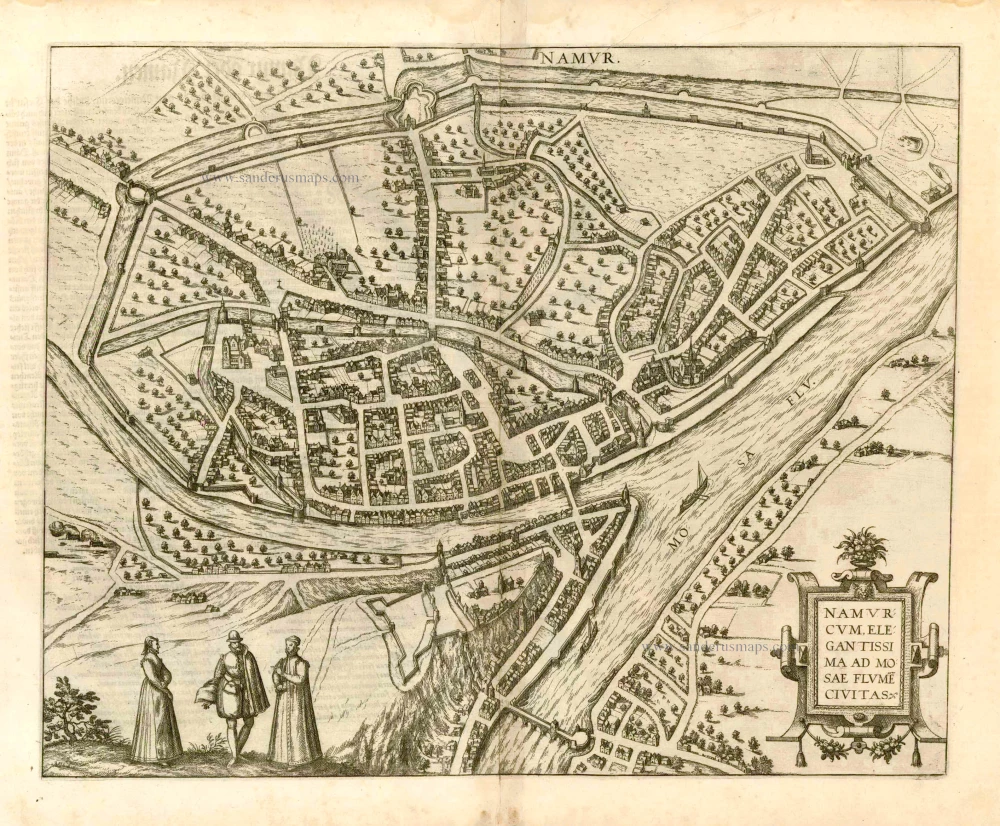
Namur, by Georg Braun and Frans Hogenberg. 1581


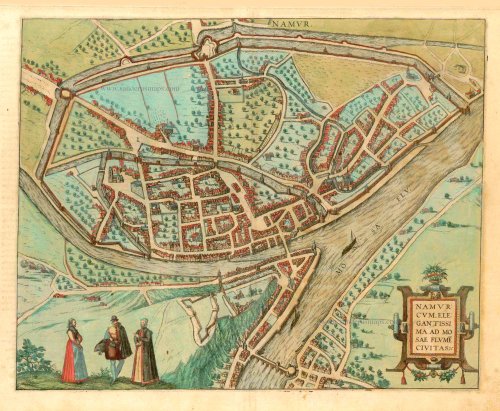
CARTOUCHE: Namur, a very fair city on the River Meuse.
COMMENTARY BY BRAUN: "The county council is held here. The people of this city are very experienced in warfare. The princes greatly like this city and French is spoken here, albeit in a rather garbled fashion."
This engraving of Namur shows a bird's-eye view of the city from the south. It offers a clear overview of the topographical setting of the hilly city, which in the 16th century belonged to the House of Habsburg. Modest fortifications lie on the rocky spur high above the Meuse. In the 17th century, these were expanded into a mighty citadel. Nevertheless, in 1692, the French, under Sébastien Le Prestre Marquis de Vauban's command, captured the city, fortress and citadel after a siege lasting just a few weeks. (Taschen)
Braun G. & Hogenberg F. and the Civitates Orbis Terrarum.
The Civitates Orbis Terrarum, also known as the 'Braun & Hogenberg', is a six-volume town atlas and the most excellent book of town views and plans ever published: 363 engravings, sometimes beautifully coloured. It was one of the best-selling works in the last quarter of the 16th century. Georg Braun, a skilled writer, wrote the text accompanying the plans and views on the verso. Many plates were engraved after the original drawings of a professional artist, Joris Hoefnagel (1542-1600). The first volume was published in Latin in 1572 and the sixth in 1617. Frans Hogenberg, a talented engraver, created the tables for volumes I through IV, and Simon van den Neuwel made those for volumes V and VI. Other contributors were cartographers Daniel Freese and Heinrich Rantzau, who provided valuable geographical information. Works by Jacob van Deventer, Sebastian Münster, and Johannes Stumpf were also used as references. Translations appeared in German and French, making the atlas accessible to a broader audience.
Since its original publication of volume 1 in 1572, the Civitates Orbis Terrarum has left an indelible mark on the history of cartography. Seven more editions followed the first volume in 1575, 1577, 1582, 1588, 1593, 1599, and 1612. Vol.2, initially released in 1575, saw subsequent editions in 1597 and 1612. The subsequent volumes, each a treasure trove of historical insights, graced the world in 1581, 1588, 1593, 1599, and 1606. The German translation of the first volume, a testament to its widespread appeal, debuted in 1574, followed by the French edition in 1575.
Several printers were involved: Theodor Graminaeus, Heinrich von Aich, Gottfried von Kempen, Johannis Sinniger, Bertram Buchholtz, and Peter von Brachel, all of whom worked in Cologne.
Georg Braun (1541-1622)
Georg Braun, the author of the text accompanying the plans and views in the Civitates Orbis Terrarum, was born in Cologne in 1541. After his studies in Cologne, he entered the Jesuit Order as a novice, indicating his commitment to learning and intellectual pursuits. In 1561, he obtained his bachelor's degree; in 1562, he received his Magister Artium, further demonstrating his academic achievements. Although he left the Jesuit Order, he continued his studies in theology, gaining a licentiate in theology. His theological background likely influenced the content and tone of the text in the Civitates Orbis Terrarum, adding a unique perspective to the work.
Frans Hogenberg (1535-1590)
Frans Hogenberg was a Flemish and German painter, engraver, and mapmaker. He was born in Mechelen as the son of Nicolaas Hogenberg.
By the end of the 1560s, Frans Hogenberg was employed upon Abraham Ortelius's Theatrum Orbis Terrarum, published in 1570; he is named an engraver of numerous maps. In 1568, he was banned from Antwerp by the Duke of Alva and travelled to London, where he stayed a few years before emigrating to Cologne. He immediately embarked on his two most important works, the Civitates, published in 1572 and the Geschichtsblätter, which appeared in several series from 1569 until about 1587.
Thanks to large-scale projects like the Geschichtsblätter and the Civitates, Hogenberg's social circumstances improved with each passing year. He died as a wealthy man in Cologne in 1590.
Namurcum, Elegantissima ad Mosae Flume Civitas.
Item Number: 25415 Authenticity Guarantee
Category: Antique maps > Europe > Belgium - Cities
Namur, by Georg Braun and Frans Hogenberg.
Title: Namurcum, Elegantissima ad Mosae Flume Civitas.
Date of the first edition: 1581.
Date of this map: 1581.
Copper engraving, printed on paper.
Size (not including margins): 350 x 440mm (13.78 x 17.32 inches).
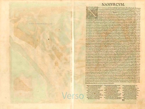
Verso: Latin text.
Condition: Contemporary old coloured, excellent.
Condition Rating: A+.
From: Civitates Orbis Terrarum. . Liber tertius. Cologne, Gottfried von Kempen, 1581. (Van der Krogt 4, 41:1.3)
CARTOUCHE: Namur, a very fair city on the River Meuse.
COMMENTARY BY BRAUN: "The county council is held here. The people of this city are very experienced in warfare. The princes greatly like this city and French is spoken here, albeit in a rather garbled fashion."
This engraving of Namur shows a bird's-eye view of the city from the south. It offers a clear overview of the topographical setting of the hilly city, which in the 16th century belonged to the House of Habsburg. Modest fortifications lie on the rocky spur high above the Meuse. In the 17th century, these were expanded into a mighty citadel. Nevertheless, in 1692, the French, under Sébastien Le Prestre Marquis de Vauban's command, captured the city, fortress and citadel after a siege lasting just a few weeks. (Taschen)
Braun G. & Hogenberg F. and the Civitates Orbis Terrarum.
The Civitates Orbis Terrarum, also known as the 'Braun & Hogenberg', is a six-volume town atlas and the most excellent book of town views and plans ever published: 363 engravings, sometimes beautifully coloured. It was one of the best-selling works in the last quarter of the 16th century. Georg Braun, a skilled writer, wrote the text accompanying the plans and views on the verso. Many plates were engraved after the original drawings of a professional artist, Joris Hoefnagel (1542-1600). The first volume was published in Latin in 1572 and the sixth in 1617. Frans Hogenberg, a talented engraver, created the tables for volumes I through IV, and Simon van den Neuwel made those for volumes V and VI. Other contributors were cartographers Daniel Freese and Heinrich Rantzau, who provided valuable geographical information. Works by Jacob van Deventer, Sebastian Münster, and Johannes Stumpf were also used as references. Translations appeared in German and French, making the atlas accessible to a broader audience.
Since its original publication of volume 1 in 1572, the Civitates Orbis Terrarum has left an indelible mark on the history of cartography. Seven more editions followed the first volume in 1575, 1577, 1582, 1588, 1593, 1599, and 1612. Vol.2, initially released in 1575, saw subsequent editions in 1597 and 1612. The subsequent volumes, each a treasure trove of historical insights, graced the world in 1581, 1588, 1593, 1599, and 1606. The German translation of the first volume, a testament to its widespread appeal, debuted in 1574, followed by the French edition in 1575.
Several printers were involved: Theodor Graminaeus, Heinrich von Aich, Gottfried von Kempen, Johannis Sinniger, Bertram Buchholtz, and Peter von Brachel, all of whom worked in Cologne.
Georg Braun (1541-1622)
Georg Braun, the author of the text accompanying the plans and views in the Civitates Orbis Terrarum, was born in Cologne in 1541. After his studies in Cologne, he entered the Jesuit Order as a novice, indicating his commitment to learning and intellectual pursuits. In 1561, he obtained his bachelor's degree; in 1562, he received his Magister Artium, further demonstrating his academic achievements. Although he left the Jesuit Order, he continued his studies in theology, gaining a licentiate in theology. His theological background likely influenced the content and tone of the text in the Civitates Orbis Terrarum, adding a unique perspective to the work.
Frans Hogenberg (1535-1590)
Frans Hogenberg was a Flemish and German painter, engraver, and mapmaker. He was born in Mechelen as the son of Nicolaas Hogenberg.
By the end of the 1560s, Frans Hogenberg was employed upon Abraham Ortelius's Theatrum Orbis Terrarum, published in 1570; he is named an engraver of numerous maps. In 1568, he was banned from Antwerp by the Duke of Alva and travelled to London, where he stayed a few years before emigrating to Cologne. He immediately embarked on his two most important works, the Civitates, published in 1572 and the Geschichtsblätter, which appeared in several series from 1569 until about 1587.
Thanks to large-scale projects like the Geschichtsblätter and the Civitates, Hogenberg's social circumstances improved with each passing year. He died as a wealthy man in Cologne in 1590.
Related items

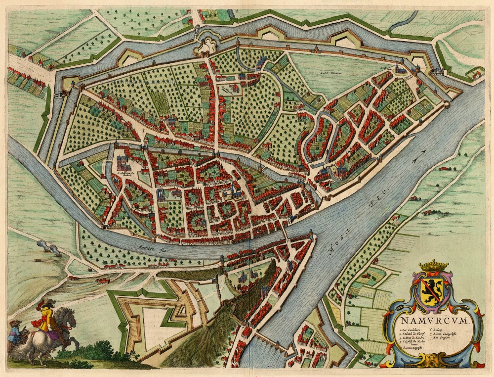
Hannonia Namurcum Comitatus. 1619
Hainaut - Namur, by G. Mercator
[Item number: 12182]
Namurcum, Elegantissima ad Mosae Flume Civitas. 1582
Namur, by Georg Braun and Frans Hogenberg.
[Item number: 14168]

Namurcum Comitatus. 1659-72
Antique map of Namur by J. Blaeu
[Item number: 14785]

Namurcum Comitatus. Na 1612.
Namur, by Ortelius A. - Galle Th.
[Item number: 15490]
Namurcum 1649
Namur by Blaeu J.
[Item number: 18149]

Namurcum, Comitatus 1612
Namur by Abraham Ortelius.
[Item number: 22940]

Comitatus Namurci 1683-1696
Namur, by N. Visscher
[Item number: 24453]

Tractus Inter Sabim Et Mosam 1683-1696
Namur by Visscher N. II.
[Item number: 24460]

Plan qui représente les Environs et la Circonvallation de Namur, du 4. Septembre au 6. Octobre. Avec les differentes positions de l'Armée du Roy et de celle des Alliés, depuis le 30. Juillet jusqu'au 19. Aoust 1746. Levé Geometriquement. 1746
Military manuscript map of the western vicinity of Namur.
[Item number: 24865]

Plan des Attaques des villes, ports et Chateaux de Namur, 1746. [Title from label on the back.] 1746
Namur, military manuscript map
[Item number: 24870]

Hannonia. Namurcum Comitatus 1623
Hainaut and Namur, by G. Mercator.
[Item number: 24919]

Nieuwe Kaart van 't Graafschap Namen, met een groot gedeelte van 't Hertogdom Brabant, ... 1720-30
Namur by N. Visscher II, published by P. Schenk.
[Item number: 25921]

Namurcum, preclara ad Mosae flumen civitas, ... 1576
Namur, by Georg Braun & Frans Hogenberg.
[Item number: 26786]

In luxury colouring.
La Ville de Namur avec son Chateau et autres Fortifications. - De sterke Stadt Namen met syn Casteel en andere Fortificatien. 1721-41
Namur by Covens & Mortier.
[Item number: 29495]

Namurcum. 1617
Namur by Pieter Van den Keere (Petrus Kaerius).
[Item number: 30654]