
Military manuscript map of the western vicinity of Namur. 1746

Plan qui représente les Environs et la Circonvallation de Namur, du 4. Septembre au 6. Octobre. Avec les differentes positions de l'Armée du Roy et de celle des Alliés, depuis le 30. Juillet jusqu'au 19. Aoust 1746. Levé Geometriquement.
Item Number: 24865 Authenticity Guarantee
Category: Antique maps > Europe > Belgium
Antique military manuscript map of the western vicinity of Namur, with key to locations.
Ink and wash colour on paper, dissected in 16 sections, on original linnen backing.
Cartographer: Gayet
Date on map: 1746
Size: 122 x 105 cm (47.6 x 41 inches)
Condition: Excellent.
Condition Rating: A
Related items

Namurcum, Comitatus 1612
Namur by Abraham Ortelius.
[Item number: 22940]

Namurcum, Elegantissima ad Mosae Flume Civitas. 1581
Namur, by Georg Braun and Frans Hogenberg.
[Item number: 25415]

Nieuwe Kaart van 't Graafschap Namen, met een groot gedeelte van 't Hertogdom Brabant, ... 1720-30
Namur by N. Visscher II, published by P. Schenk.
[Item number: 25921]

Namurcum, preclara ad Mosae flumen civitas, ... 1576
Namur, by Georg Braun & Frans Hogenberg.
[Item number: 26786]

In luxury colouring.
La Ville de Namur avec son Chateau et autres Fortifications. - De sterke Stadt Namen met syn Casteel en andere Fortificatien. 1721-41
Namur by Covens & Mortier.
[Item number: 29495]

Namurcum. 1617
Namur by Pieter Van den Keere (Petrus Kaerius).
[Item number: 30654]
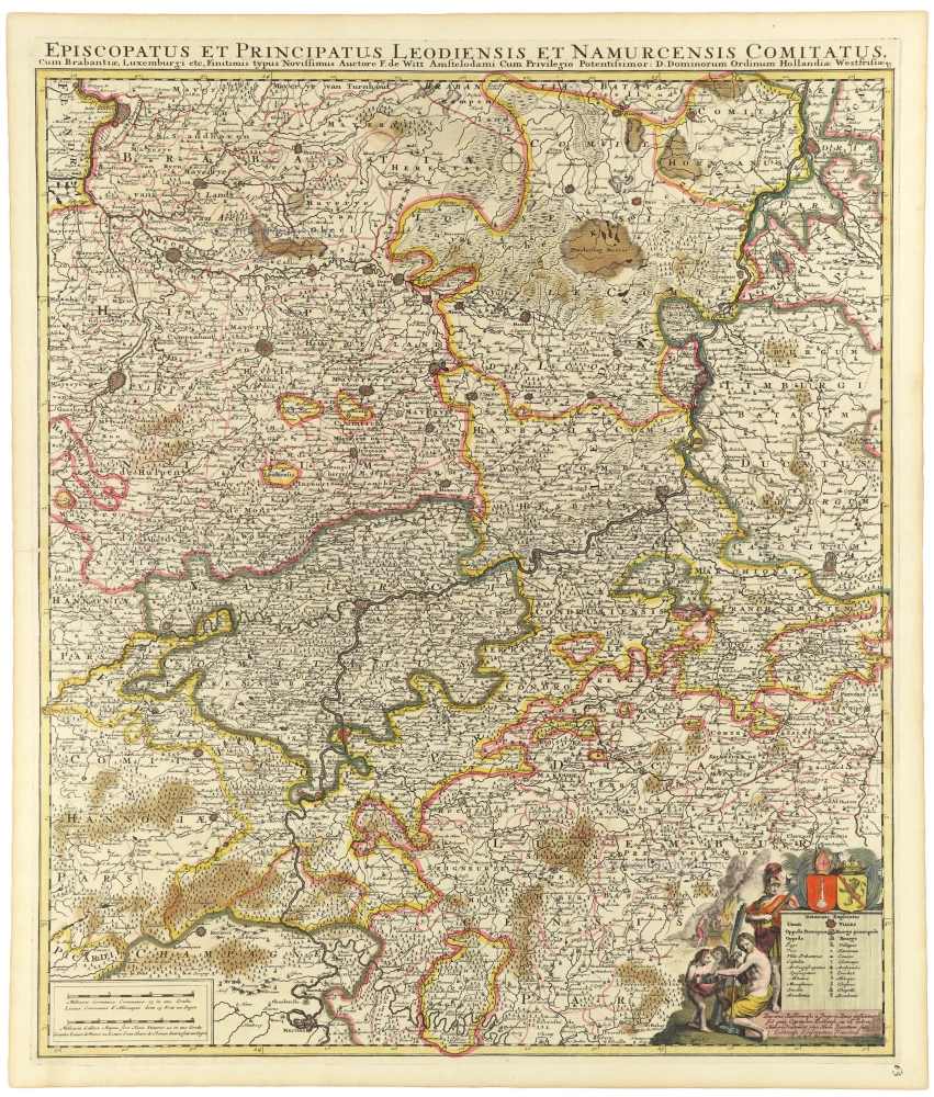
Episcopatus et Principatus Leodiensis et Namurcensis Comitatus, Cum Brabantiae, Luxemburgi etc. c. 1705-06
Liège - Namur, by Frederick de Wit.
[Item number: 33158]