
Sea chart of England - Thames River - London, by Pieter Goos. 1667
"Pieter Goos' marine atlases were held to be among the finest printed at the time and were often added tot the nine or twelve volumes of Blaeu's Atlas Maior." (Shirley)
Pieter Goos (1615-1675)
Pieter Goos, son of the engraver Abraham Goos, was one of the best known maritime booksellers of Amsterdam. He was not only a bookseller but also a copper-engraver and even a book printer.
His first pilot book, the Lichtende Columne ofte Zee-Spiegel appeared in 1650. The well-made pilot guides and the beautiful sea-atlas reflect a high professional standard. The many editions published over 28 years is an indication of the customers’ appreciation. The Zeespiegel was printed in Dutch, French (1662), and English (1658). Goos printed all the time from the same 60 plates. For his Straetsboeck, being the third part of the Zeespiegel, Pieter Goos copied the text from Lootsman’s Straetboeck and copied also the plates. This atlas of the Mediterranean appeared in 1662.
Pieter Goos also published a fourth and fifth part of his Zeespiegel. For the fourth part, he used the second part of Het Brandende Veen by Arent Roggeveen, which dealt with the coasts of West-Africa (No copy with Goos’s imprint is known). For the fifth part, he used the first part of Het Brandende Veen, which appeared in 1675. It contains the charts and sailing directions for the West Indies.
The first edition of his sea-atlas, the Zee-Atlas ofte Water-Wereld, came out in 1666. For the design of the charts, Goos copied nearly all the charts from Hendrik Doncker’s sea-atlas. All the years through, till 1675 (the year of his death), the number of 40 or 41 maps remained the same.
When Pieter Goos died in March 1675, his widow continued the shop. She brought out a few new editions of the Zee-Atlas with 44 charts. Part of the atlases was sold then by the famous Amsterdam bookbinder Albert Magnus. These copies are renowned for their outstanding colouring. She died in 1677; their son, Hendrik Goos, born in 1641, took over and sold his father’s pilot books until 1680.
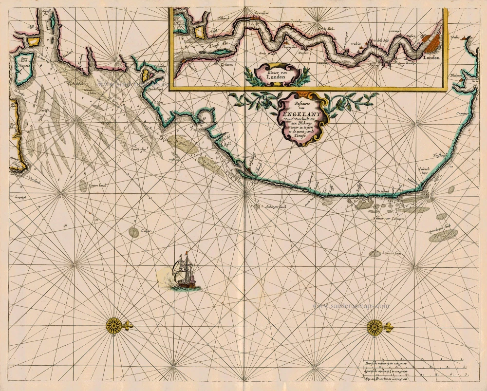
Pascaarte van Engelant van t' Voorlandt tot aen Blakeney waer in te Sien is de Mont vande Teemse.
Item Number: 19032 Authenticity Guarantee
Category: Antique maps > Europe > British Isles
Sea chart of England - Thames River - London, by Pieter Goos.
Title: Pascaarte van Engelant van t' Voorlandt tot aen Blakeney waer in te Sien is de Mont vande Teemse.
Date: 1667.
Copper engraving, printed on paper.
Image size: 430 x 537mm (16.93 x 21.14 inches).
Sheet size: 450 x 560mm (17.72 x 22.05 inches).
Verso: Blank.
Condition: Original coloured, on heavy paper, excellent.
Condition Rating: A+.
From: De Zee-Atlas, Ofte Water-Weereld, Waer in vertoont werden alle de Zee-Kusten Van het bekende des Aerd-Bodems. P. Goos, 1667. (Koeman, Goos1B)
"Pieter Goos' marine atlases were held to be among the finest printed at the time and were often added tot the nine or twelve volumes of Blaeu's Atlas Maior." (Shirley)
Pieter Goos (1615-1675)
Pieter Goos, son of the engraver Abraham Goos, was one of the best known maritime booksellers of Amsterdam. He was not only a bookseller but also a copper-engraver and even a book printer.
His first pilot book, the Lichtende Columne ofte Zee-Spiegel appeared in 1650. The well-made pilot guides and the beautiful sea-atlas reflect a high professional standard. The many editions published over 28 years is an indication of the customers’ appreciation. The Zeespiegel was printed in Dutch, French (1662), and English (1658). Goos printed all the time from the same 60 plates. For his Straetsboeck, being the third part of the Zeespiegel, Pieter Goos copied the text from Lootsman’s Straetboeck and copied also the plates. This atlas of the Mediterranean appeared in 1662.
Pieter Goos also published a fourth and fifth part of his Zeespiegel. For the fourth part, he used the second part of Het Brandende Veen by Arent Roggeveen, which dealt with the coasts of West-Africa (No copy with Goos’s imprint is known). For the fifth part, he used the first part of Het Brandende Veen, which appeared in 1675. It contains the charts and sailing directions for the West Indies.
The first edition of his sea-atlas, the Zee-Atlas ofte Water-Wereld, came out in 1666. For the design of the charts, Goos copied nearly all the charts from Hendrik Doncker’s sea-atlas. All the years through, till 1675 (the year of his death), the number of 40 or 41 maps remained the same.
When Pieter Goos died in March 1675, his widow continued the shop. She brought out a few new editions of the Zee-Atlas with 44 charts. Part of the atlases was sold then by the famous Amsterdam bookbinder Albert Magnus. These copies are renowned for their outstanding colouring. She died in 1677; their son, Hendrik Goos, born in 1641, took over and sold his father’s pilot books until 1680.
Related items
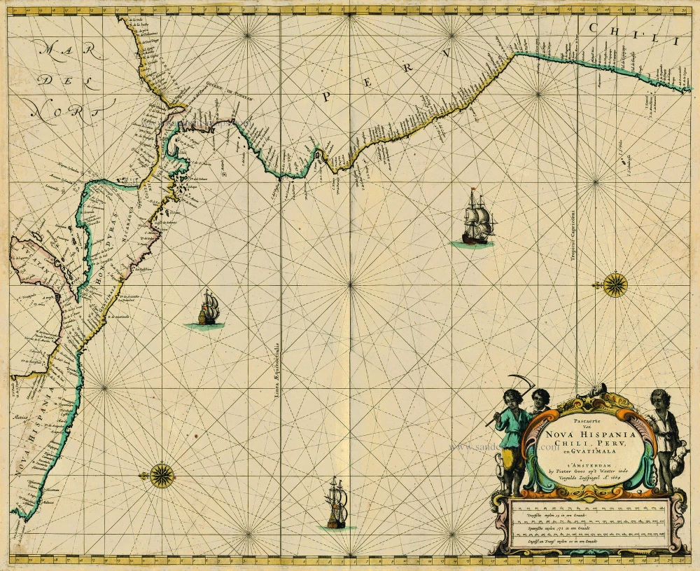
Pascaerte van Nova Hispania Chili, Peru, en Guatimala 1667
Central America, by Pieter Goos.
[Item number: 19031]
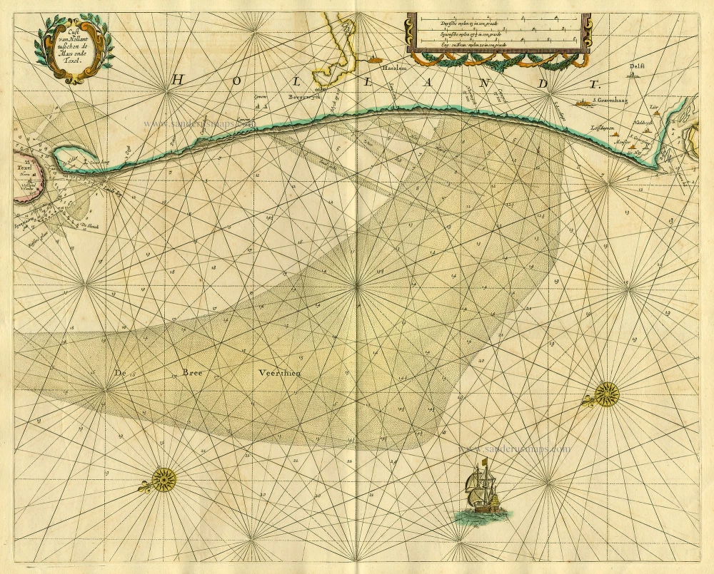
Cust van Hollant tusschen de Maes ende Texel 1667
Sea chart of Holland, by Pieter Goos.
[Item number: 19040]

Paskaarte om Achter Yrlandt om te Zeylen van Hitlant tot aen Heyssat Nieuwlycx Uytgegeven 1667
The British Isles, by Pieter Goos.
[Item number: 19046]
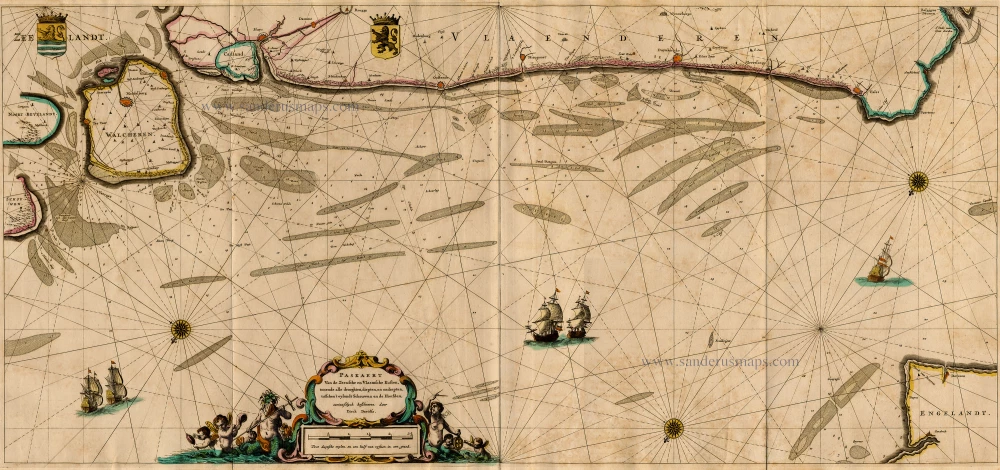
Paskaert van de Zeeusche en Vlaemsche Kusten, tonende Alle Drooghten, Diepten, en Ondiepten, tusschen t'Eylandt Schouwen en de Hoofden, Curieuselyck Beschreven door Dirck Davidsz 1667
Sea chart of Flanders (Vlaanderen) & Zeeland, by Pieter Goos.
[Item number: 19054]
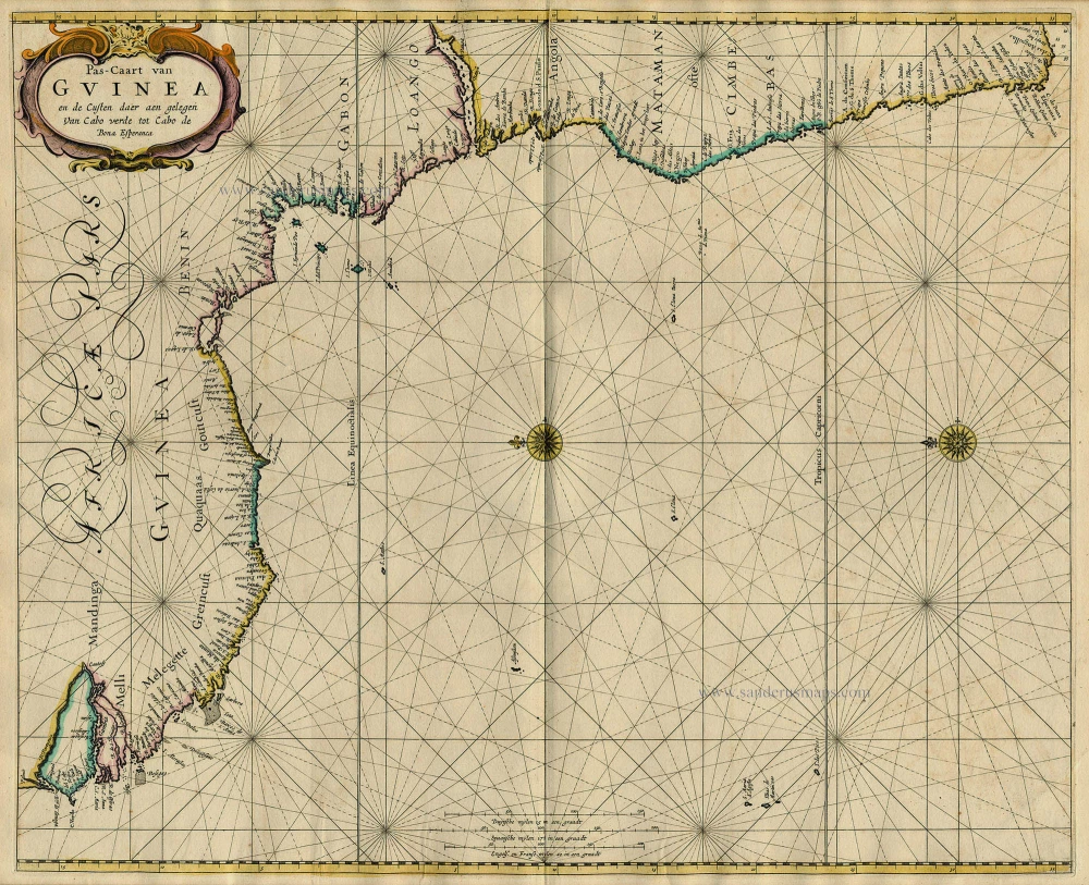
Pas-Caart van Guinea en de Custen daer aen Gelegen van Cabo Verde tot Cabo de Bona Esperanca 1667
Sea chart of Guinea, by Pieter Goos.
[Item number: 19060]
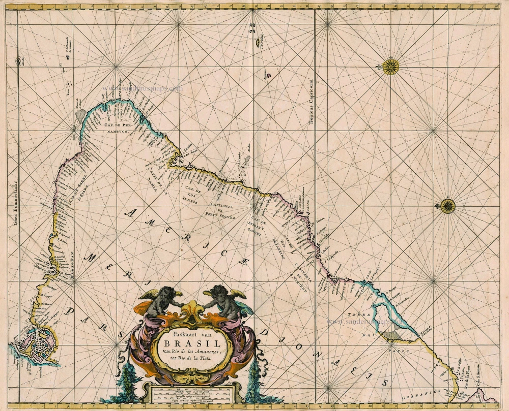
Paskaart van Brasil van Rio de los Amazones, tot Rio de la Plata 1667
Sea chart of Brazil, by Pieter Goos.
[Item number: 19066]
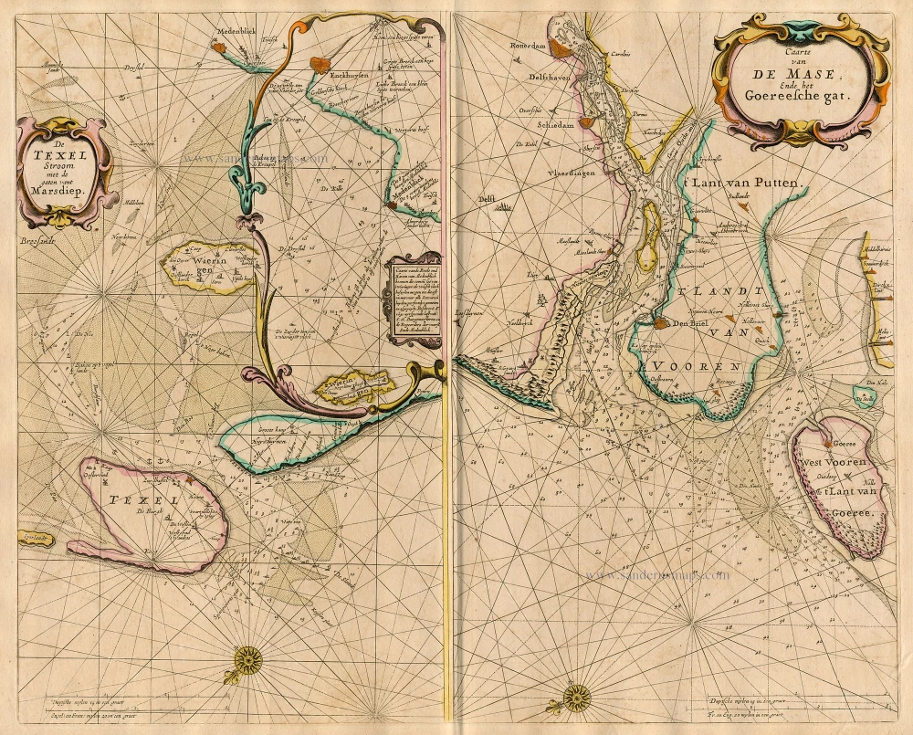
De Texel Stroom met de gaten vant Marsdiep. [On sheet with:] Caarte van De Mase ende het Goereesche Gat 1667
Sea chart of Texel & Maas, by Pieter Goos.
[Item number: 19068]
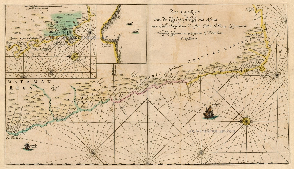
Pas-Kaarte van de Zuyd-West-Kust van Afrika; van Cabo Negro tot Beoosten Cabo de Bona Esperanca 1667
Sea chart of South African Coast, by Pieter Goos.
[Item number: 19073]
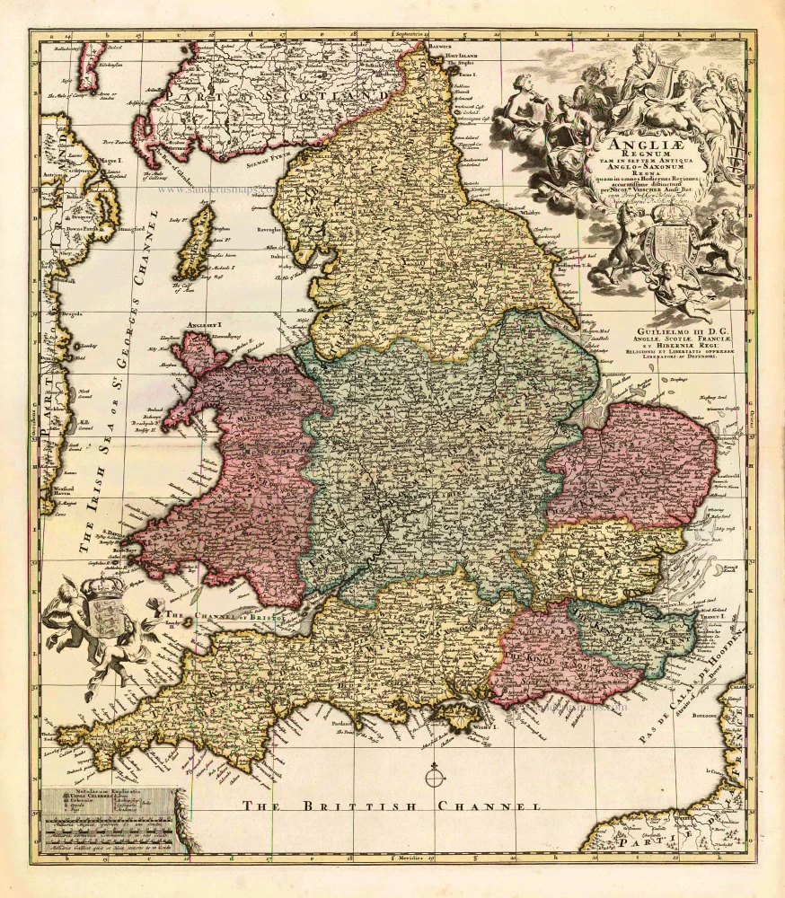
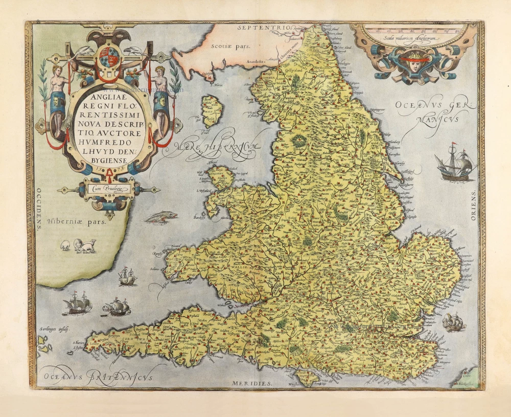
Angliae Regnum tam in septem Antiqua Anglo-Saxonum Regna ... c. 1740
England, by N. Visscher II, published by P. Schenk.
[Item number: 25720]
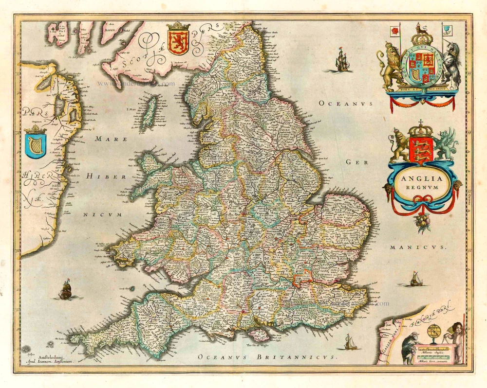
Anglia Regnum. 1641
England, by Henricus Hondius.
[Item number: 26242]
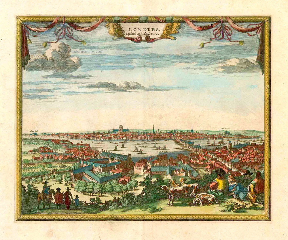
Londres Capitale de l'Angleterre. c. 1715
London, by Pieter van der Aa.
[Item number: 26854]
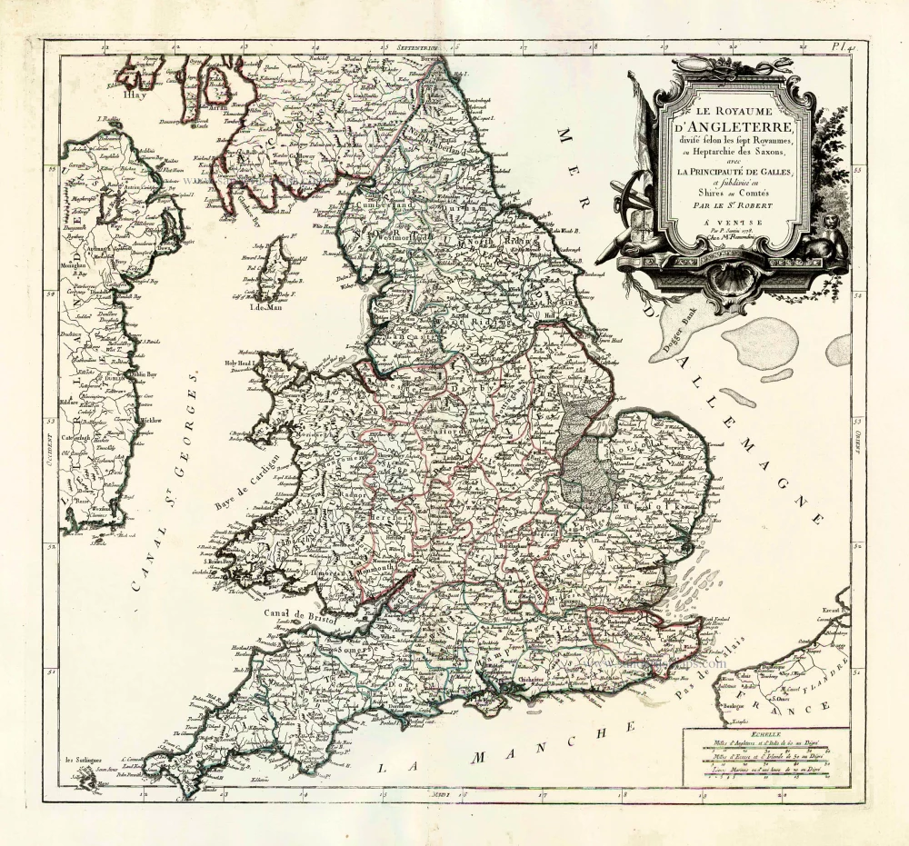
Le Royaume d'Angleterre, Divisé Selon les Sept Royaumes, ou Heptarchie des Saxons, avec la Principauté de Galles et Subdivisé en Shires ou Comtés. 1776-79
England, by Francesco Santini.
[Item number: 26960]

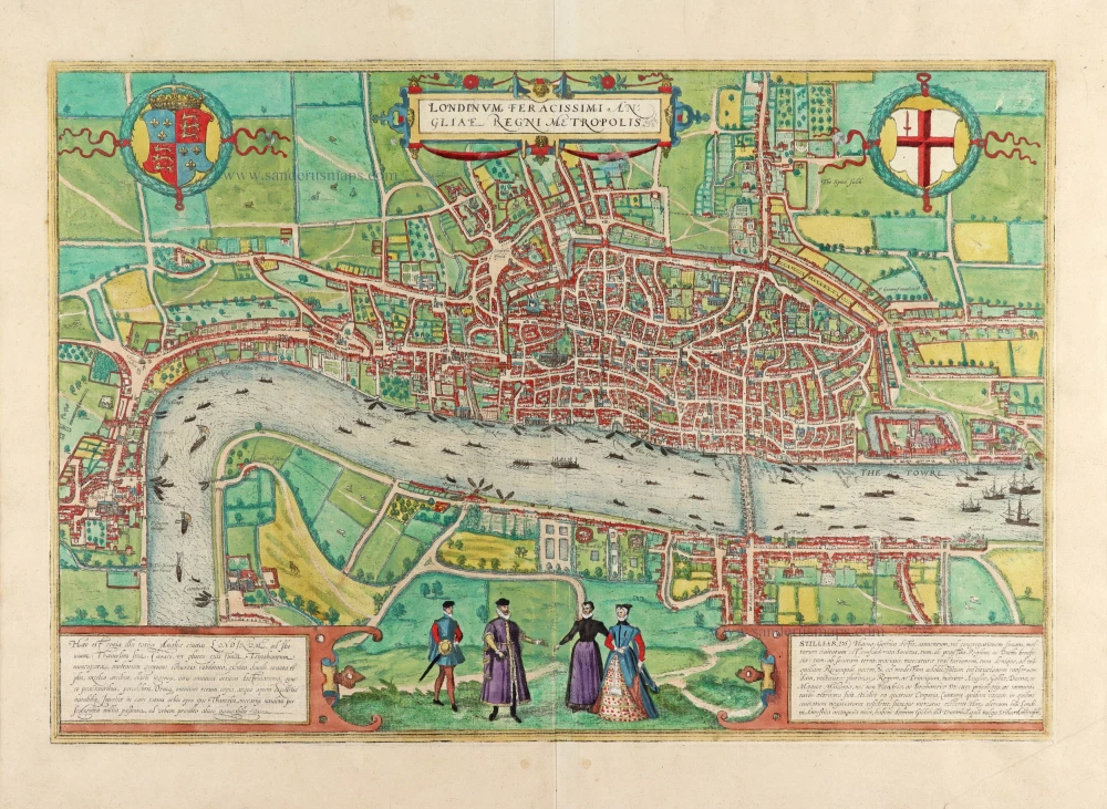
Londinum, Feracissimi Agliae Regni Metropolis. [French title above map:] La Ville de Londres. 1575
London, by François de Belleforest.
[Item number: 27163]
Anglia Regnum. 1623
England, by Gerard Mercator.
[Item number: 28132]
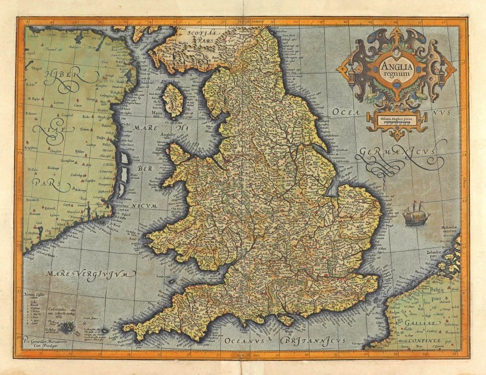
Angliae Regni Florentissimi nova descriptio. 1584
England by A. Ortelius.
[Item number: 30145]
Londinum Feracissimi Angliae Regni Metropolis. 1593
London by Georg Braun & Frans Hogenberg
[Item number: 30542]