
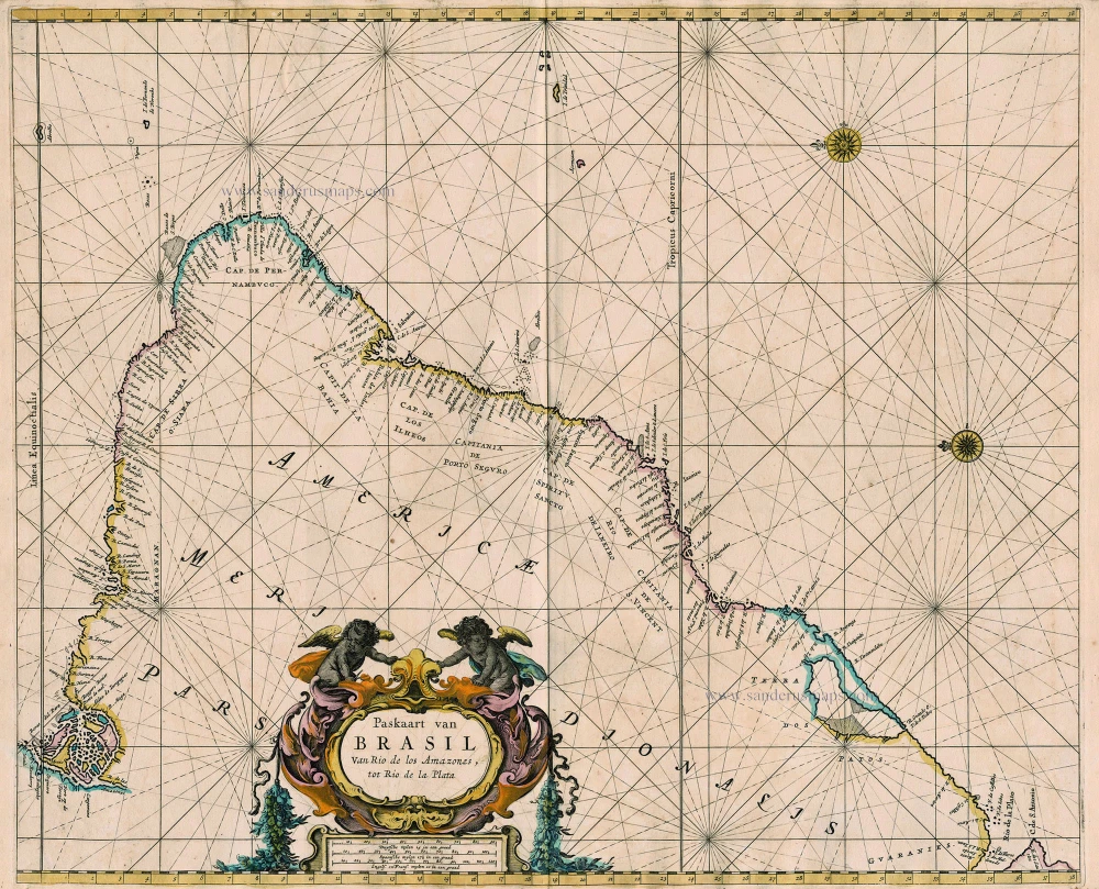
Sea chart of Brazil, by Pieter Goos. 1667
"Pieter Goos' marine atlases were held to be among the finest printed at the time and were often added tot the nine or twelve volumes of Blaeu's Atlas Maior." (Shirley)
Paskaart van Brasil van Rio de los Amazones, tot Rio de la Plata
Currently not available
Item Number: 19066 Authenticity Guarantee
Category: Antique maps > America > South America
Old, antique sea chart of Brazil, by Pieter Goos.
Title: Paskaart van Brasil van Rio de los Amazones, tot Rio de la Plata
Date: 1667.
Copper engraving, printed on paper.
Size (not including margins): 445 x 540mm (17.52 x 21.26 inches).
Verso: Blank.
Condition: Old coloured, some offsetting, on heavy paper.
Condition Rating: B.
From: De Zee-Atlas, Ofte Water-Weereld, Waer in vertoont werden alle de Zee-Kusten Van het bekende des Aerd-Bodems. P. Goos, 1667. (Koeman, Goos1B)
"Pieter Goos' marine atlases were held to be among the finest printed at the time and were often added tot the nine or twelve volumes of Blaeu's Atlas Maior." (Shirley)
Related items
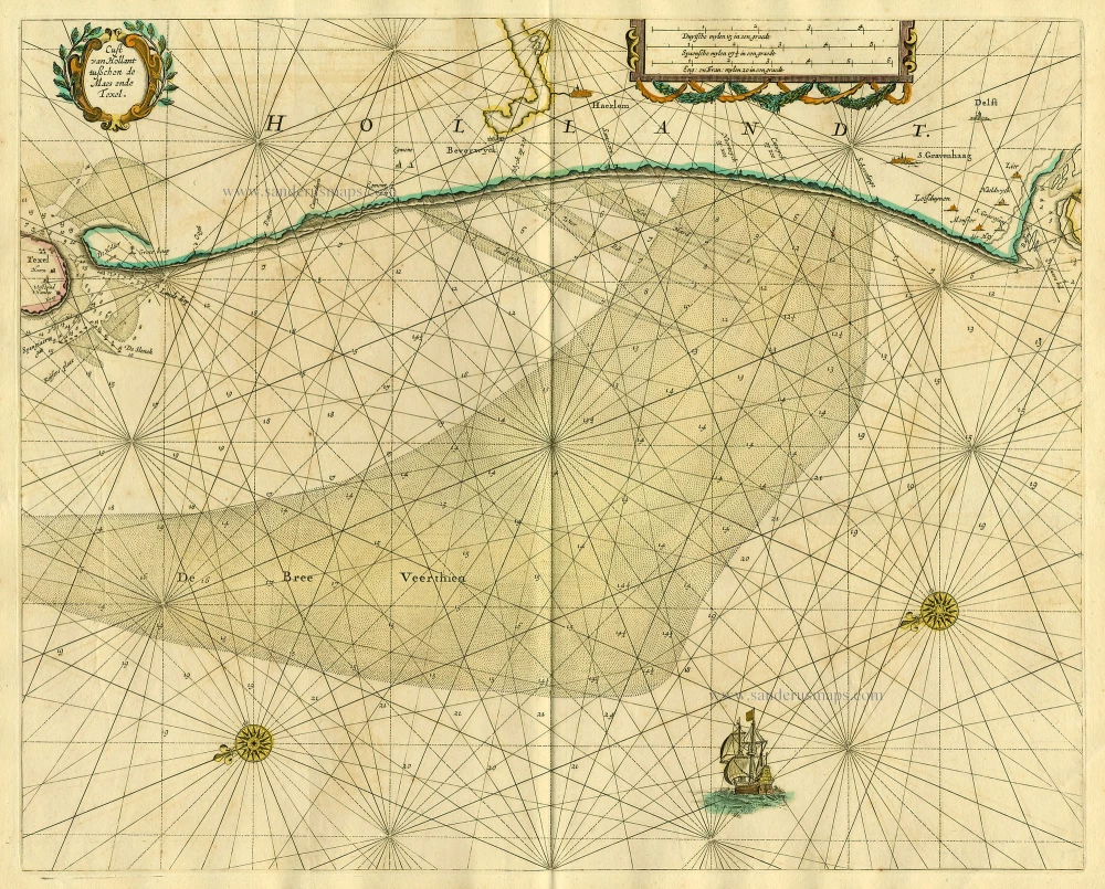
Cust van Hollant tusschen de Maes ende Texel 1667
Sea chart of Holland, by Pieter Goos.
[Item number: 19040]

Paskaarte om Achter Yrlandt om te Zeylen van Hitlant tot aen Heyssat Nieuwlycx Uytgegeven 1667
The British Isles, by Pieter Goos.
[Item number: 19046]
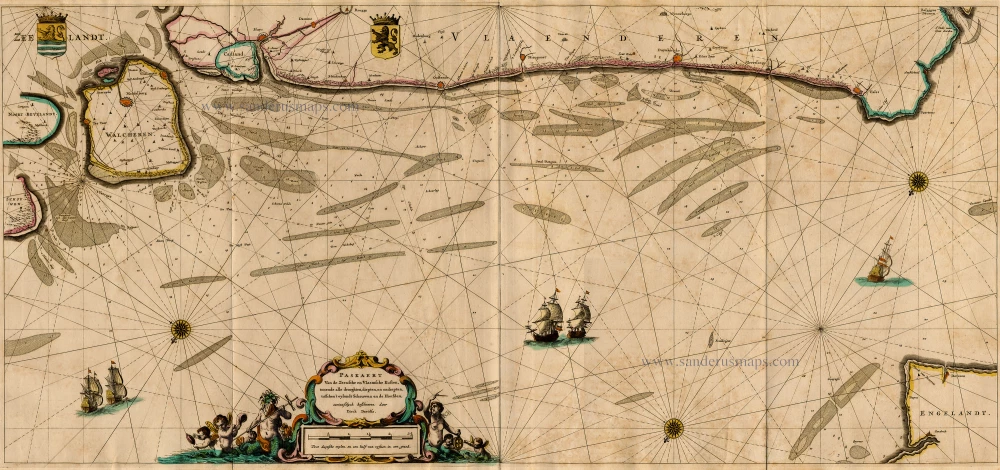
Paskaert van de Zeeusche en Vlaemsche Kusten, tonende Alle Drooghten, Diepten, en Ondiepten, tusschen t'Eylandt Schouwen en de Hoofden, Curieuselyck Beschreven door Dirck Davidsz 1667
Sea chart of Flanders (Vlaanderen) & Zeeland, by Pieter Goos.
[Item number: 19054]
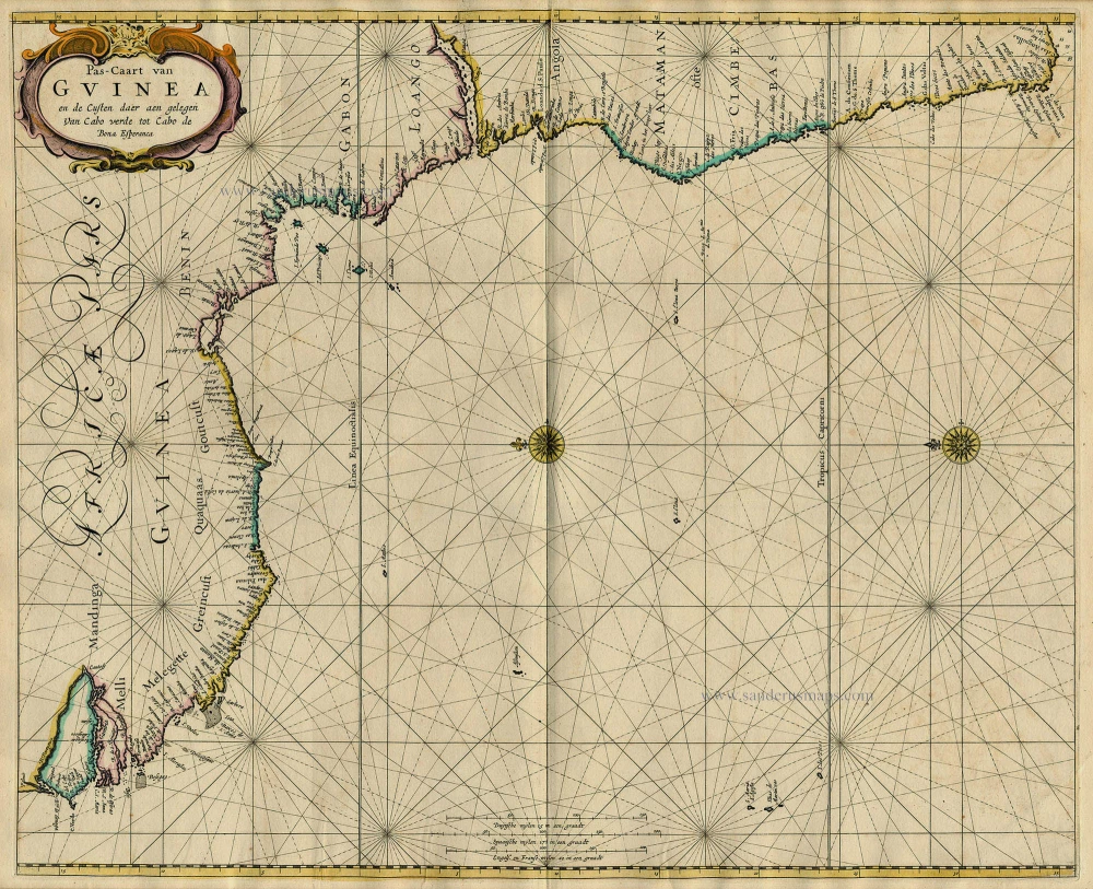
Pas-Caart van Guinea en de Custen daer aen Gelegen van Cabo Verde tot Cabo de Bona Esperanca 1667
Sea chart of Guinea, by Pieter Goos.
[Item number: 19060]
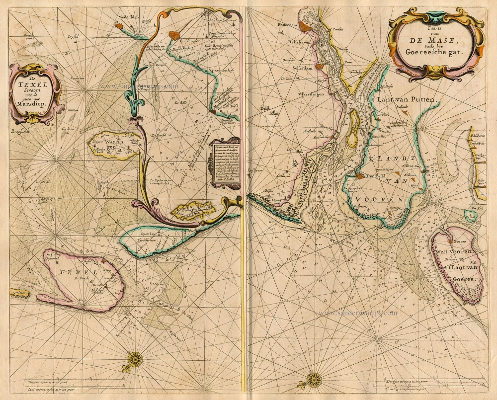
De Texel Stroom met de gaten vant Marsdiep. [On sheet with:] Caarte van De Mase ende het Goereesche Gat 1667
Sea chart of Texel & Maas, by Pieter Goos.
[Item number: 19068]
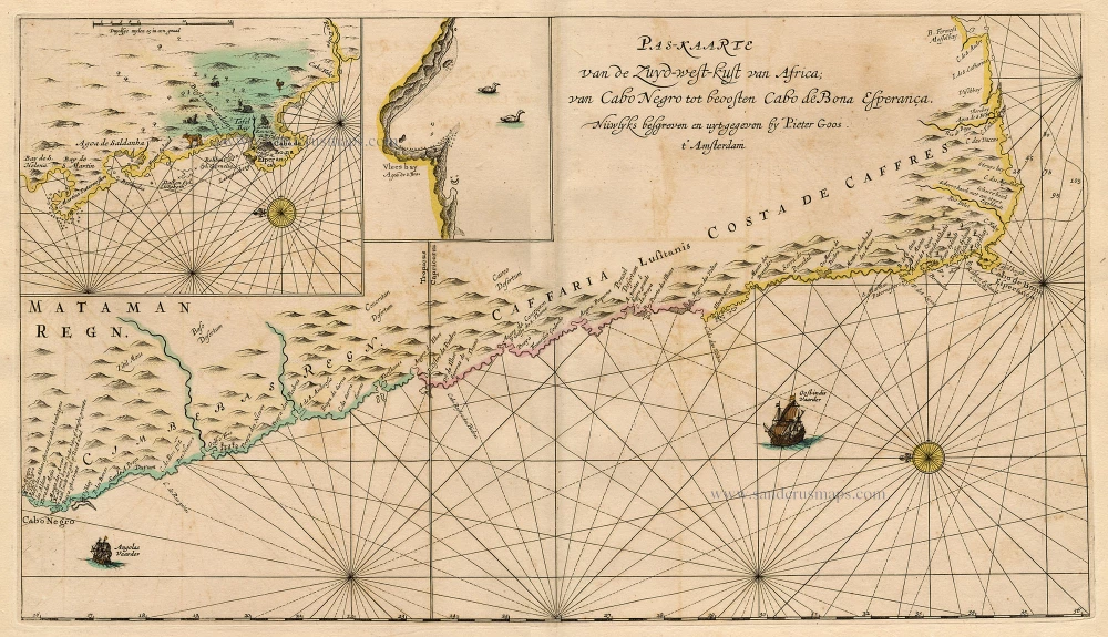
Pas-Kaarte van de Zuyd-West-Kust van Afrika; van Cabo Negro tot Beoosten Cabo de Bona Esperanca 1667
Sea chart of South African Coast, by Pieter Goos.
[Item number: 19073]
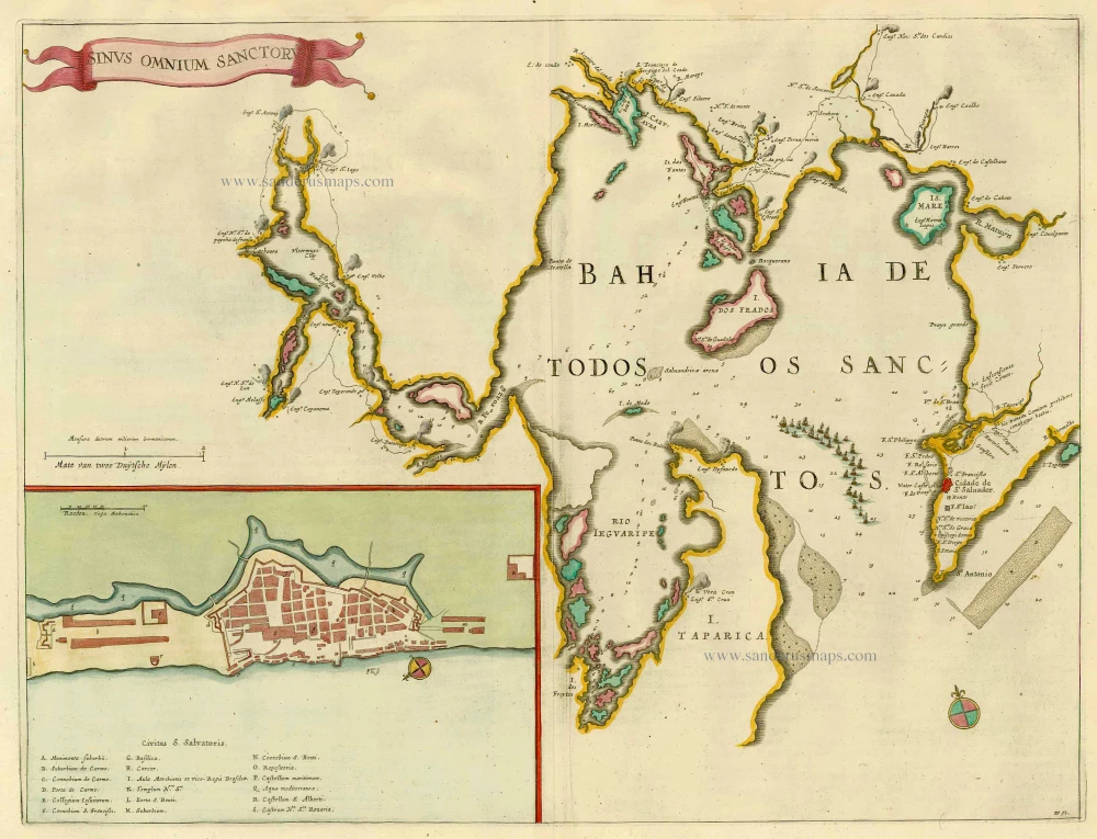
Sinus Omnium Sanctoru. 1664-65
Bahia de Todos los Sanctos, by J. Blaeu.
[Item number: 21226]
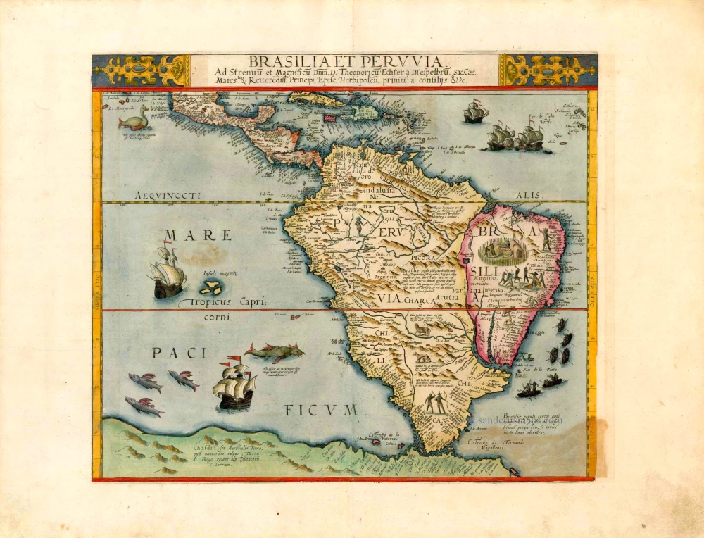
Important and rare map
Brasilia et Peruvia ... 1593
South America, by Cornelis de Jode.
[Item number: 25240]
Important map in excellent condition
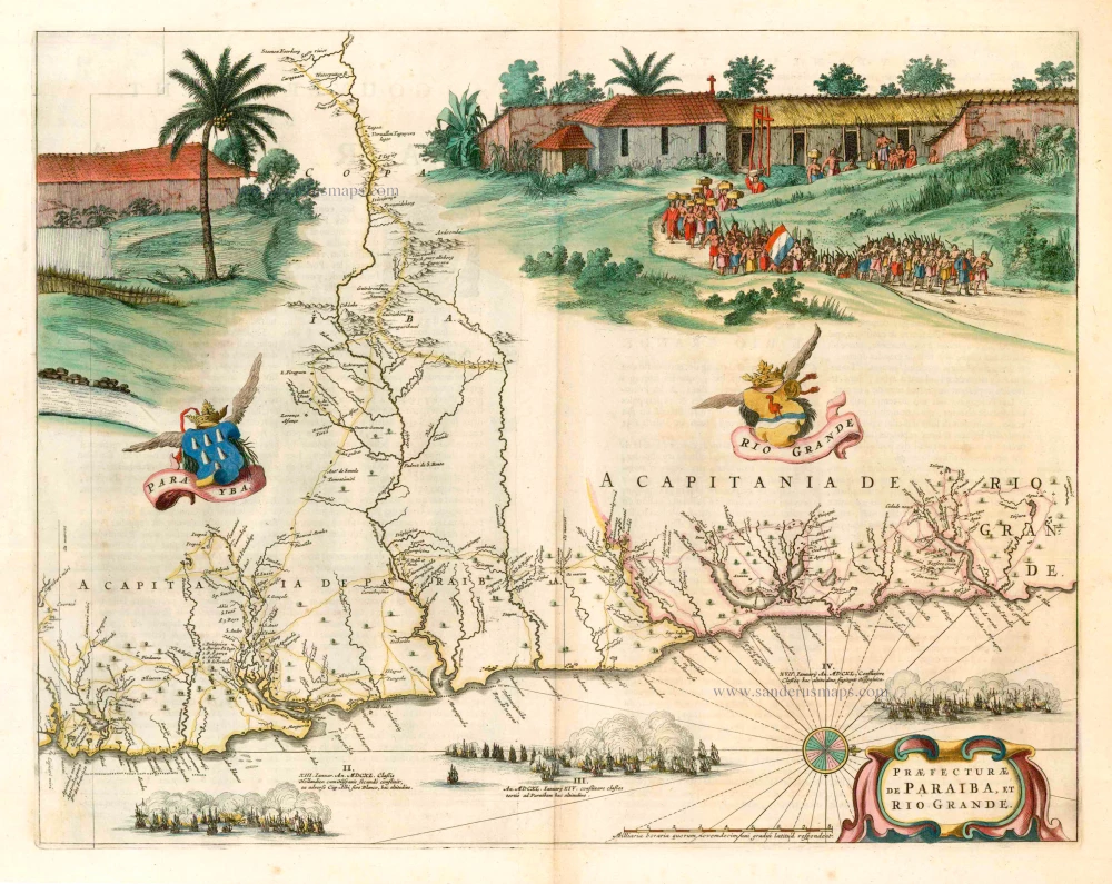
Praefecturae de Paraiba, et Rio Grande. 1663
Brazil - Paraiba, by Joan Blaeu.
[Item number: 25258]

Provincia de Brasil cum Adiacentibus Provinciis. 1630
Brazil, by Johannes de Laet.
[Item number: 25390]
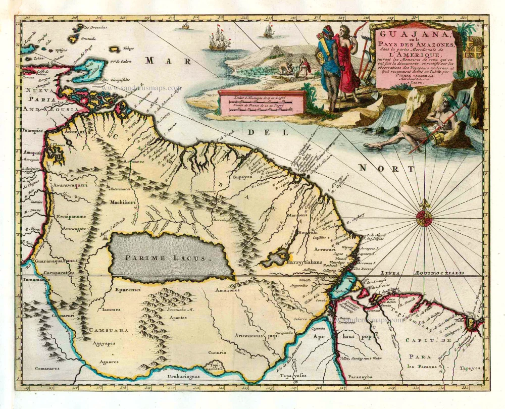
Guajana, ou le Pays des Amazones, dans la partie Meridionale de l'Amerique. 1713
Guyana, by Pieter van der Aa.
[Item number: 26149]

Brasil. 1563
Brazil, by Ramusio G.B.
[Item number: 26186]
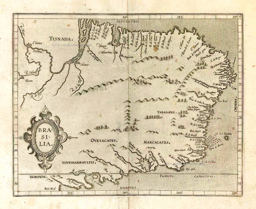
Brasilia. 1607
Brazil, by C. van Wytfliet.
[Item number: 26509]
With cannibals
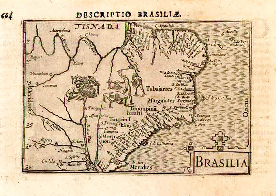
Brasilia. 1602
Brazil by Langenes, published by Bertius P.
[Item number: 26537]
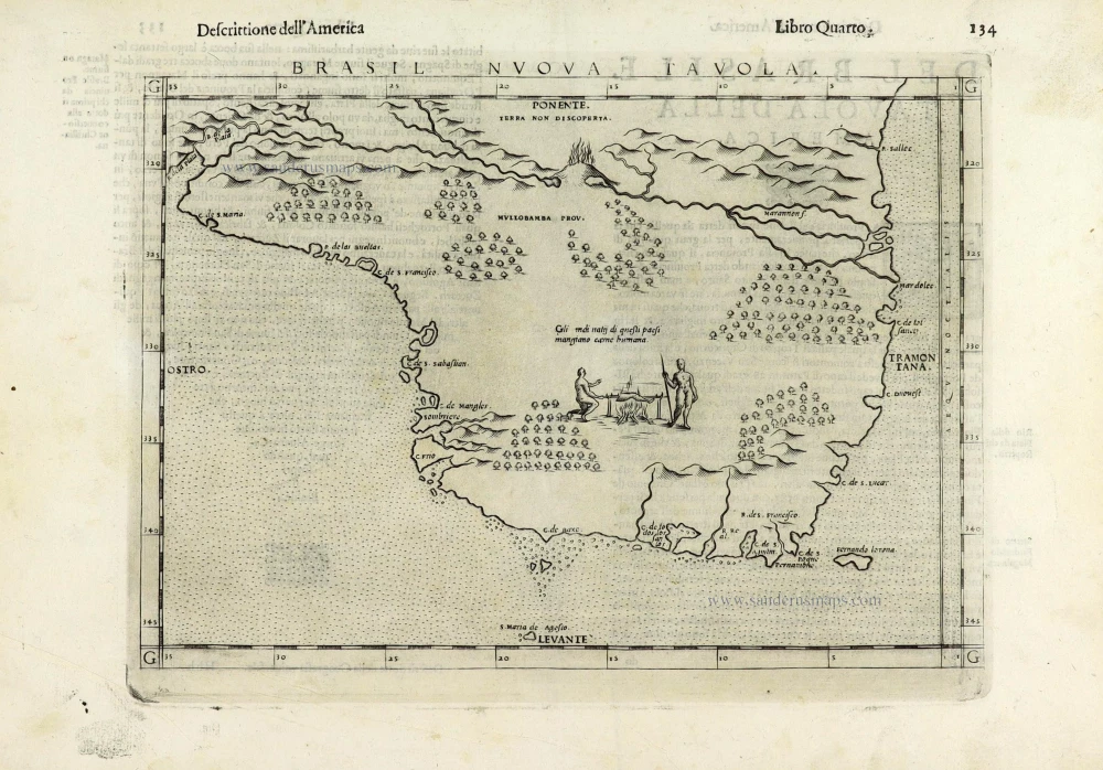
Brasil Nuova Tavola. 1598
Brazil by Girolamo Ruscelli.
[Item number: 28430]
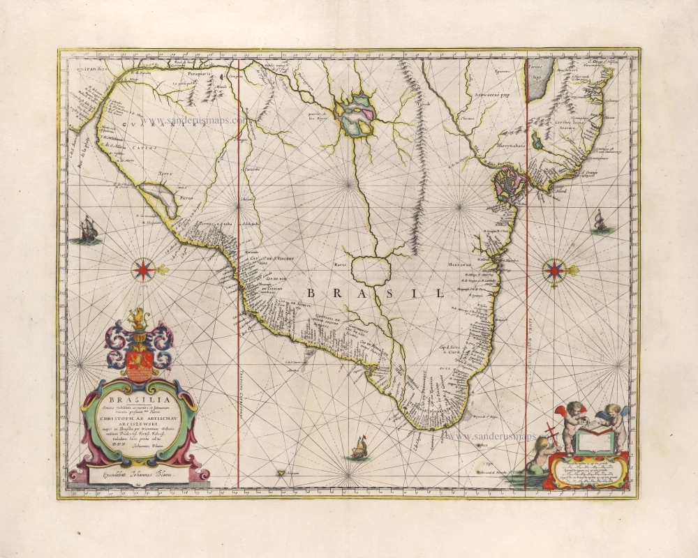
Brasilia. 1645
Brazil, by Joan Blaeu.
[Item number: 29707]
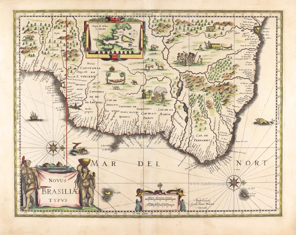
Novus Brasiliae Typus. c. 1640
Brazil, by Willem Blaeu.
[Item number: 29848]
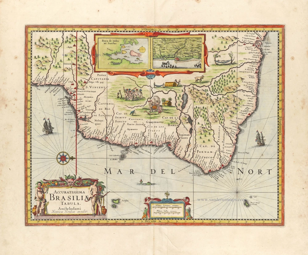
Accuratissima Brasiliae Tabula. 1638
Brazil by Henricus Hondius.
[Item number: 29851]
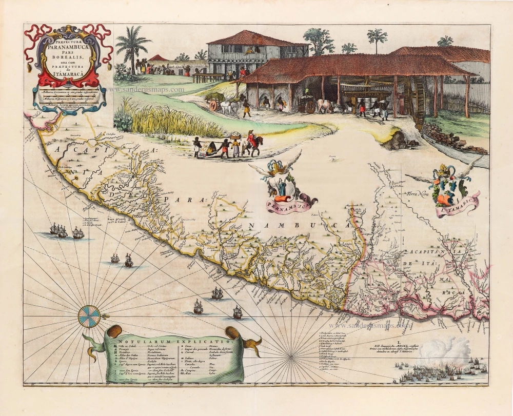
Praefecturae Paranambucae, pars Borealis, una cum Praefectura de Itâmarcâ. 1663
Brazil - Pernambuco (North) by Joan Blaeu.
[Item number: 30149]
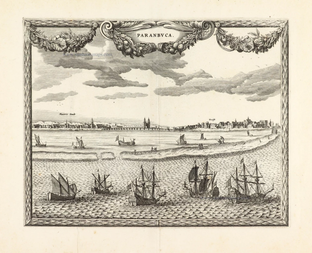
Unrecorded view of Pernambuco (Brazil) by Carel Allard
Paranbuca. 1673
View of Pernambuco (Brazil) by Carel Allard.
[Item number: 30558]